
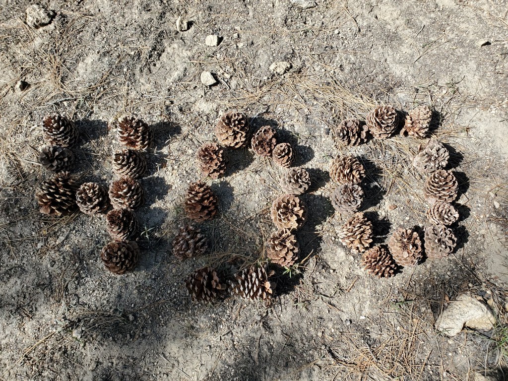
Day 26 – 21 miles/362
Waking up in the hotel, we enjoyed a fairly slow start, checking out around 8:30. A quick walk back to McDonald’s for breakfast again, where we ran into many of the hikers from the days before. They too had themselves some fun at the Joshua Inn. One girl that was at the Inn with us turned around and went back for another night there!
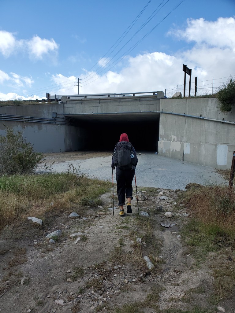
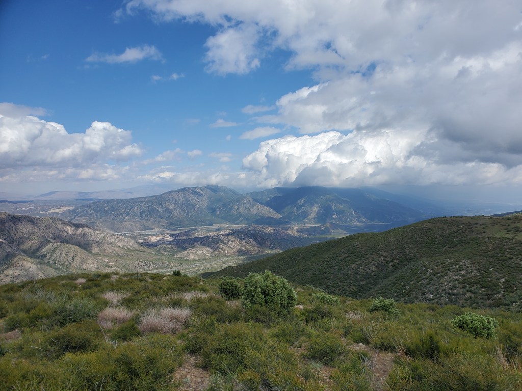
We got back on trail at 9:30, certainly a late start for us. We weren’t sure if we were going to hike 15 or 20 miles. A bit tired from a night of shenanigans, ahead of us lie a 5,000 foot climb out of Cajon Pass, and no water sources meant we would be carrying 4.5 L. Twenty miles seemed out of the question. We passed under I-15 and escaped the noise.
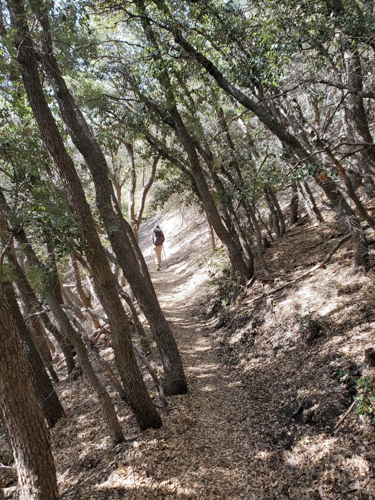
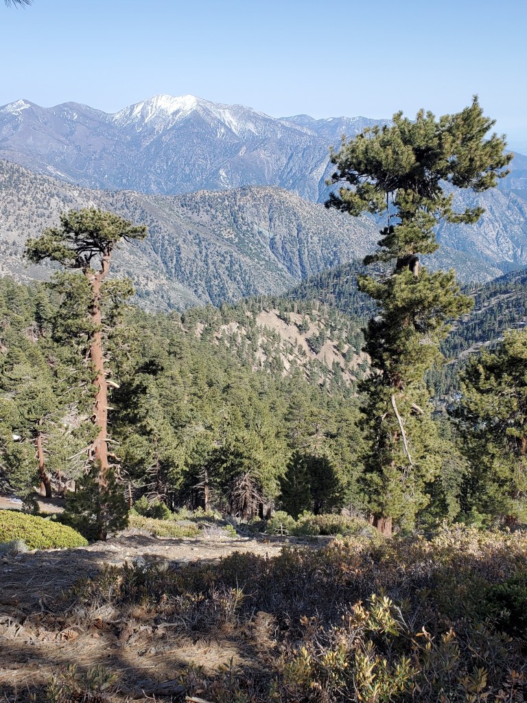
Climbing over and down the first small ridge, we were graced by a golden eagle, soaring 15 feet away from the trail. A good omen for our bird watching that day. Later we saw a California thrasher, a hummingbird feeding on paintbrushes, and mountain quail up high! We topped off our water at a cache and began the long climb up. The PCT is generally built very well for backpacking. The slope is rarely greater than 400 feet per mile, which makes covering long distance very doable. We stopped for lunch at 1pm 1,000 feet up our climb, having mostly digested breakfast, taking in the view back down to Cajon Pass.
We decided to listen to podcasts and music for a little while as we continued uphill. It was a nice way to zone out and get our minds off the arduous hiking for a little while. After the crazy noise around the interstate, I listened to a podcast on noise pollution. Turns out noise can quite literally shorten your life! It made me glad to be out in the quiet outdoors.
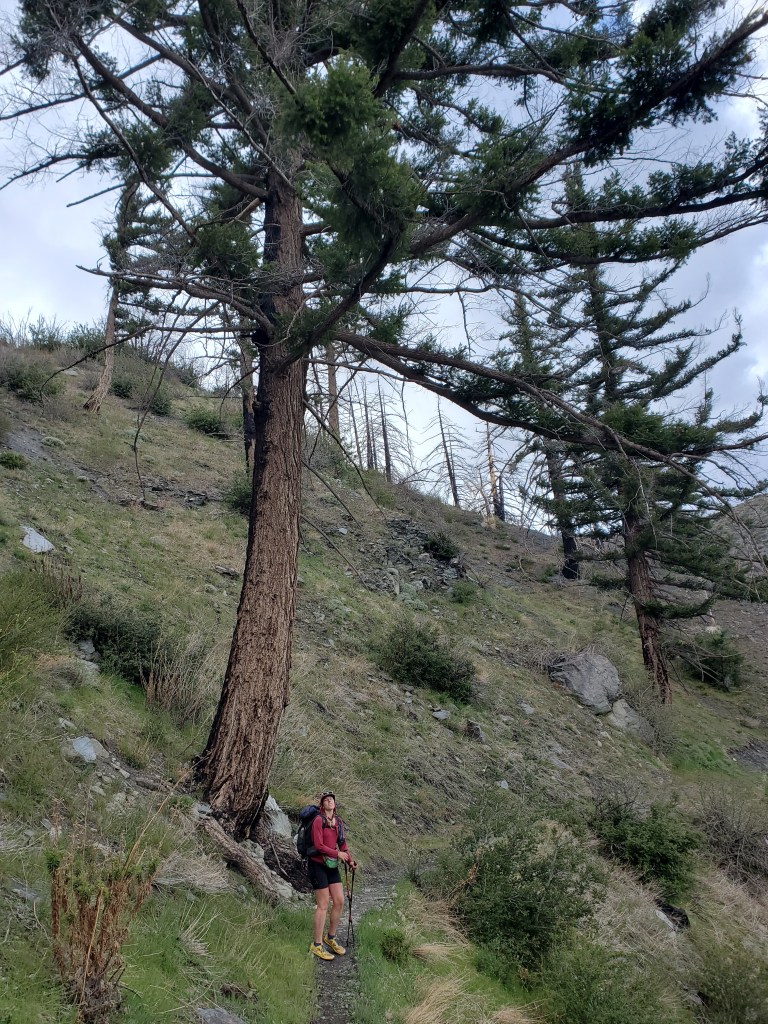
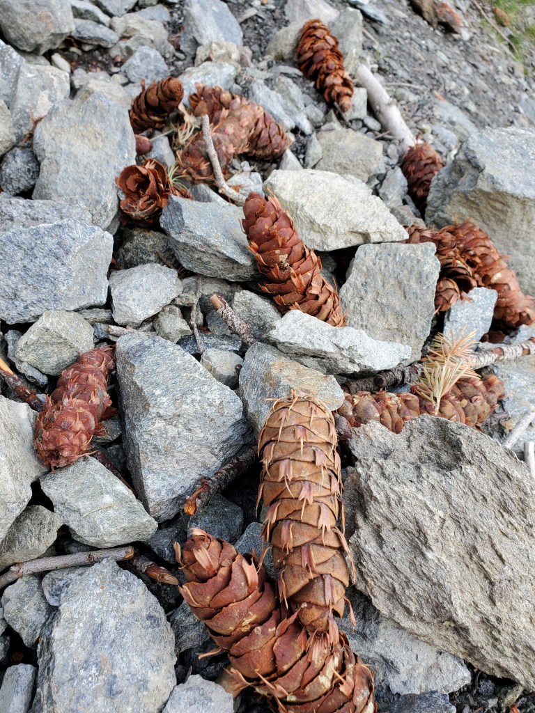
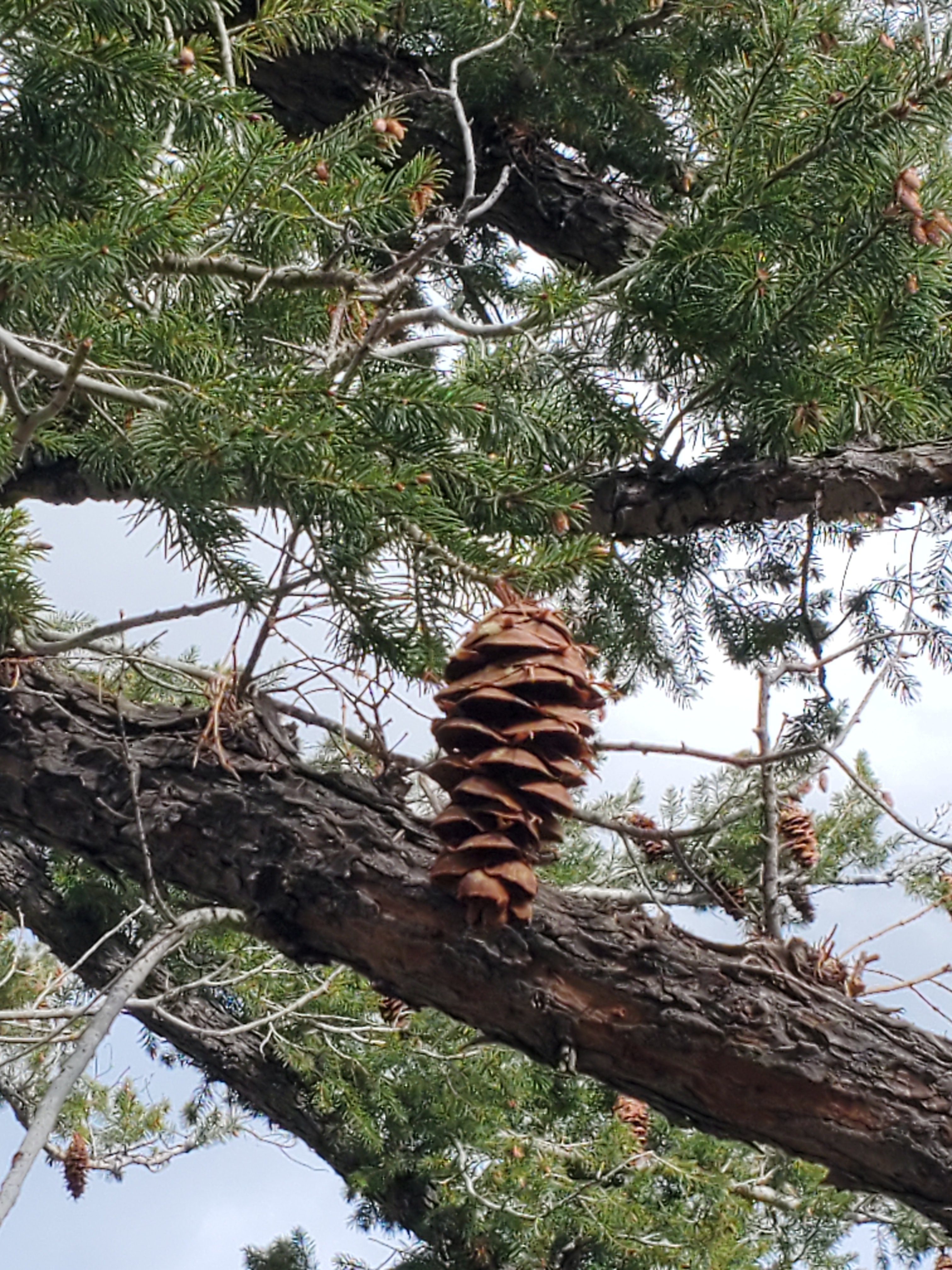
The chaparral shrubland at last gave way to the first small groves of conifers. From a distance I didn’t recognize these trees. Upon closer inspection I said, “Is that Doug-fir?” But upon much closer inspection, I realized it wasn’t just Douglas-fir, but Big Cone Douglas-fir (Pseudotsuga macrocarpa). Just a few days earlier I had mentioned this species to Maggie. I knew it was in Southern California, but not exactly sure where to find it. The Big Cone species produces fruits 4-6 inches long, roughly twice the size of the species found in the Rockies and Cascades. At a glance, the cones looked like big dog turds, especially after the recent rains. This was a fun, unexpected find for me.
We kept heading up, winding our way through the switchbacks. We came to the camp at 15 miles, and few hikers already set up there at 4:50pm. We felt pretty good at this point, the blood flowing from a good day of hiking so far. A brief snack break gave us the energy we needed to carry on to the 20 mile mark. We passed another campsite, which was available and very tempting, but pushing to 20 would set us up only 7 miles from Wrightwood, our next resupply stop.
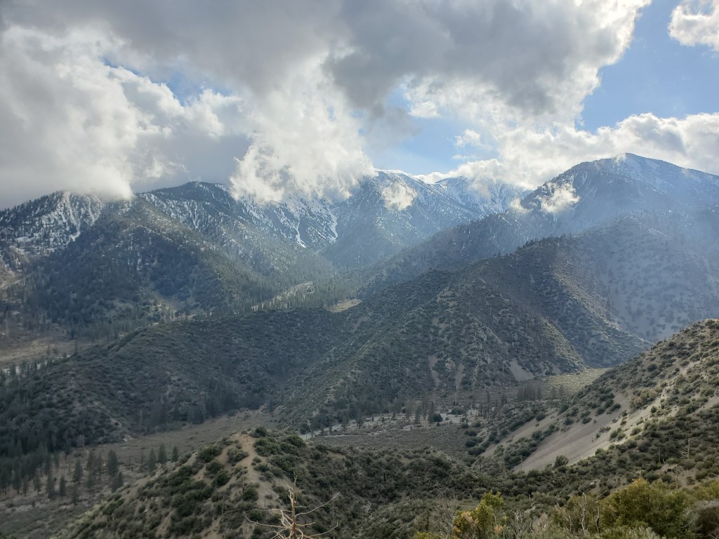
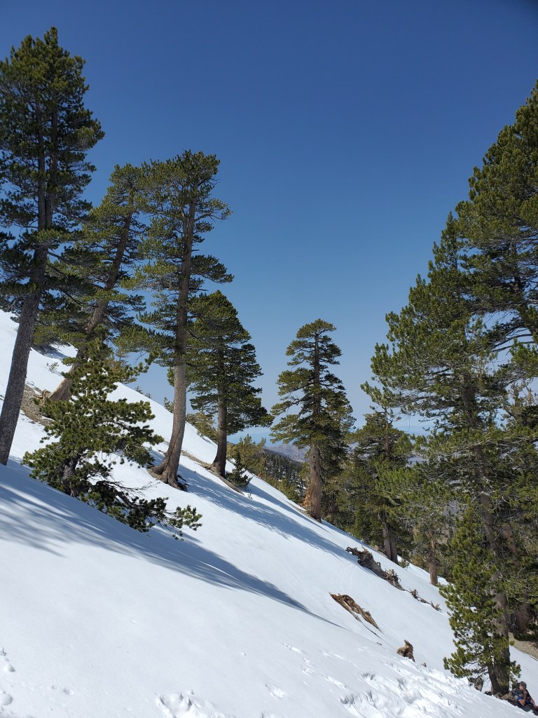
Onward and upward. At 8,000 feet, the precipitation from the night before showed itself as snow, patchy and less than an inch, but only increasing as we got higher. We arrived at our campsite just after 7, only 3 others already set up. It was cooling off quickly at 8,100 feet, so we pitched the tent swiftly and got in our sleeping bags. It was a chilly night, but the clouds abated and we stayed dry.
Day 27 – 7 miles/369
Getting moving on a cold morning is hard. The warmth of our sleeping bags is simply too heavenly to abandon. Hot drinks and a light breakfast were had while we sat in our downy cocoons. Again, we were last to leave, with other hikers camped lower down the trail passing by as we packed up.
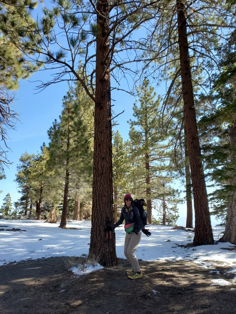
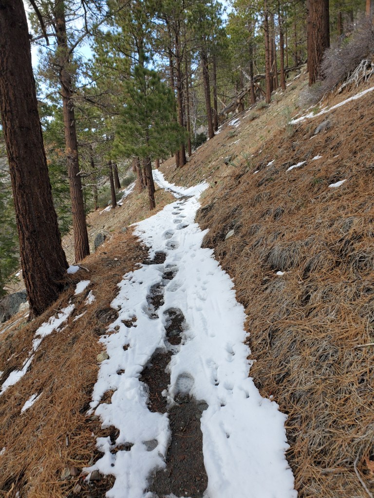
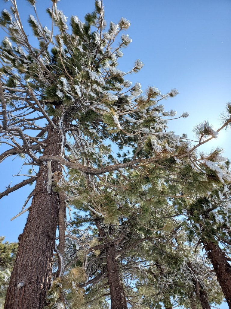
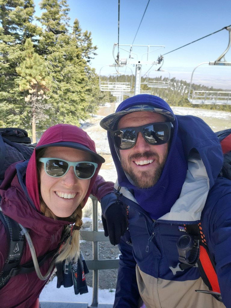
Our effort the day before paid off, though, and the hike to Highway 2 only has some small ups and downs. The snow was pretty consistent, however, and we occasionally walked on a forest road that parallels the trail. Rime ice was encrusted on the trees, occasionally melting and sprinkling down like small shards of glass. An unexpected sight for Southern California in late April. We came upon a small ski resort, Mountain High. Despite the fresh snow, the resort was long closed for the season. We took pictures on the chairlifts and had a snack.
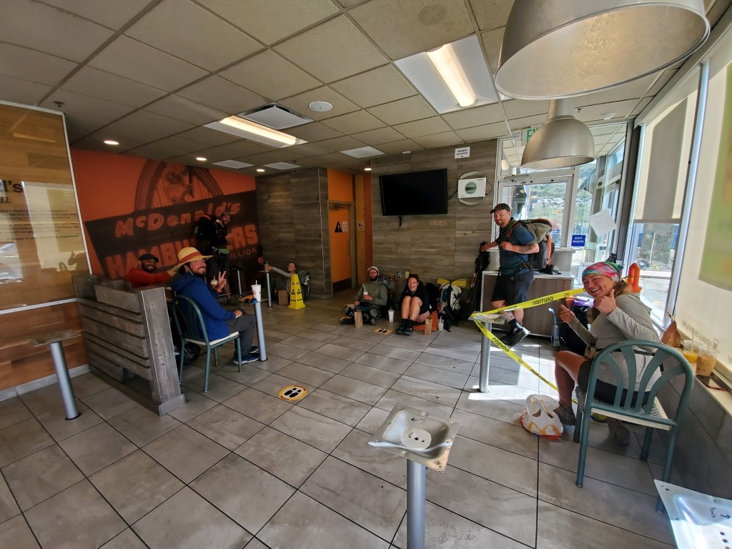
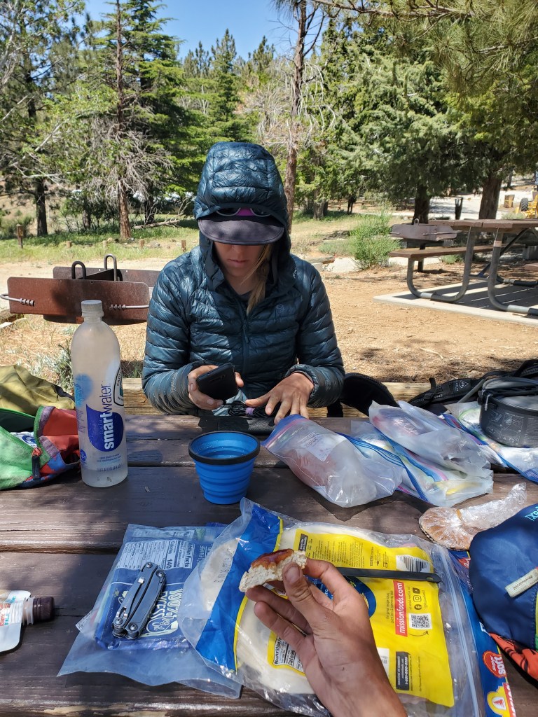
We dropped down to Hwy 2 to get a ride into Wrightwood for our next resupply. This is a winding, scenic road without much traffic, so it was out longest wait yet. The crowd of thru hikers slowly grew as we waited. A day hiker coming off of Mt. Baden-Powell saw the mob and offered a ride to four of us. Maggie and I hopped in with an older British couple we have been seeing periodically, and we got to town. First stop: the brewery. Somehow the Wolf Pack beat us there, despite getting a hitch after us. We enjoyed a couple local brews and sandwiches for lunch. We all made way to the hardware/gear store. I was in need of new socks, and a couple other hiker odds and ends. Groceries next. Our friends have been jealous of the produce, cream cheese, and bagels we pack out, so they were watching our cart closely for inspiration. We took some burritos to go from the local Mexican restaurant, then went to top off our water. It was getting late, almost 6pm, and we intended to hike a little more that evening. Sitting in the convenience store parking lot, s nice old woman named Joy approached us and asked if we needed a ride. Good luck strikes again! We got back to the trail and considered our options. The trail crosses the highway at a view point with benches and bathrooms. Our burritos weren’t exactly backpack friendly, and the sun was going getting low. Hiking some more was quickly ruled out, and instead we camped a few hundred feet from the road, eating dinner while the sun set over L.A. Our tent site was a bit slopey and the wind picked up over night, but it was entirely adequate, and we slept well after reading our books.
Day 28 – 15 miles/384
We tried to wake up a little early, but again the cold and our tortoise like morning pace got us going at 8:10. I’ve decided our new motto is “You snooze, you cruise!” The day ahead of us would not be easy though. Mt. Baden-Powell was the next obstacle, standing at 9,407 feet. We knew from the views we got earlier of Mt. B-P that it had snow on it. Foolishly, Maggie and I mailed out our microspikes to Kennedy Meadows when we stopped in Big Bear Lake. We thought we were done with snow and there was no need to carry the extra weight. Well, we thought wrong…
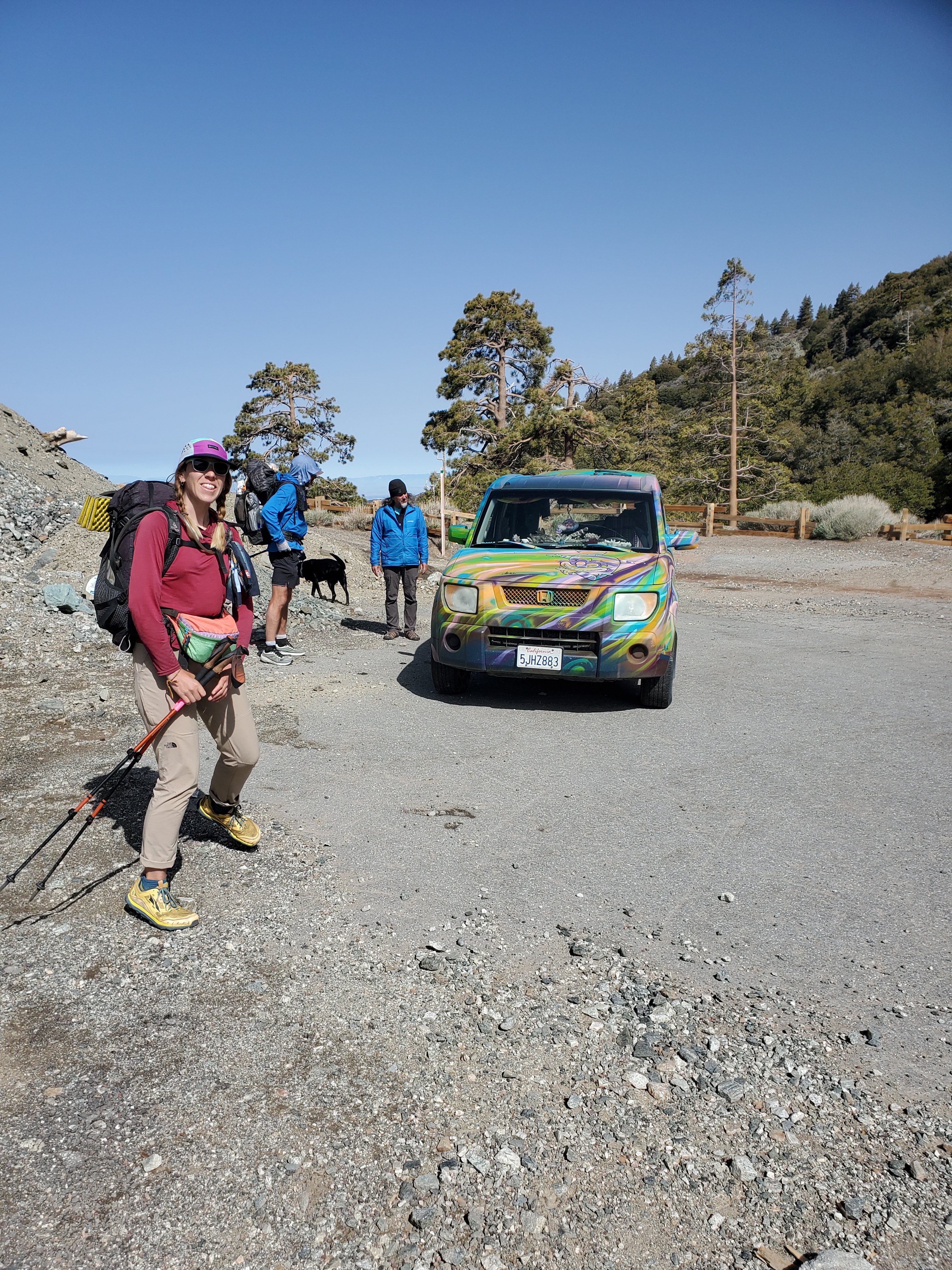
It was a breezy and cool morning. After a few easy miles, we dropped down 1,000 feet to the B-P trailhead. Waiting for us in the parking lot was a fabled trail angel, Cheshire Cat. He has a Honda Element custom painted with the Cheshire Cat from Alice in Wonderland on a bright rainbow background. He was offering up fresh fruit! I got a banana and Maggie got a quarter pineapple- perfectly ripe! We had 2,800 feet to climb over 4 miles, so we ate quickly and started our way up the mountain. This was noticeably steeper than most of the trail before, so we kept our pace slow and steady. There were a couple small snow patches on the trail, a warning of what was to come. We took a water and snack break with the Wolf Pack half way up.
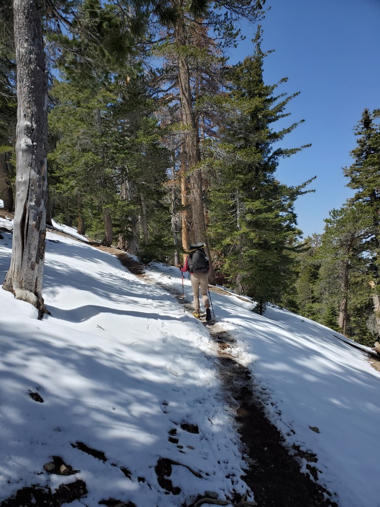

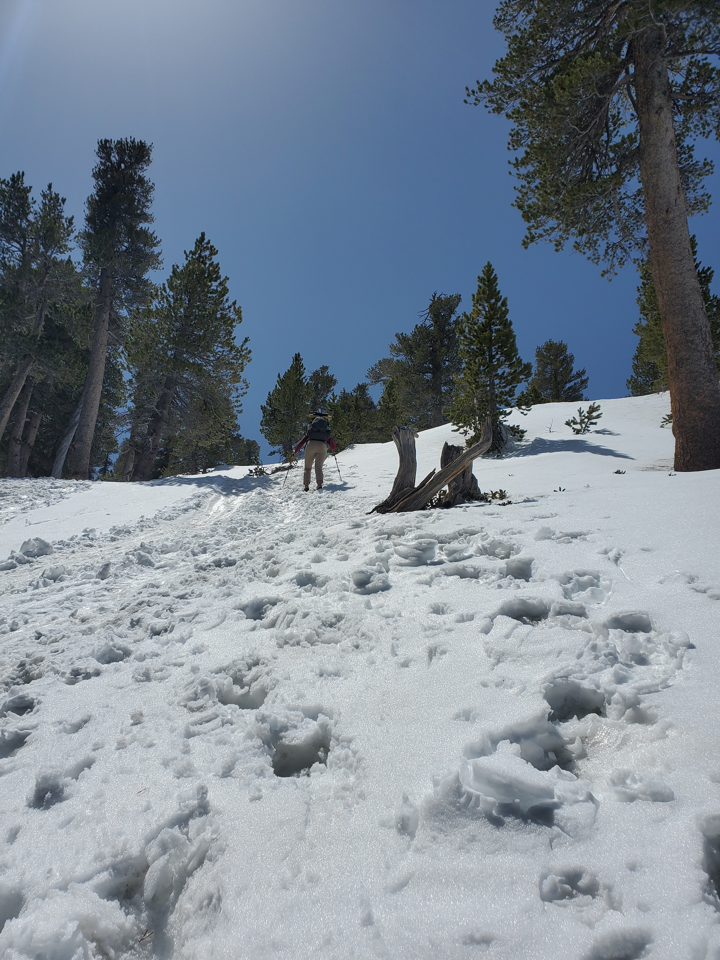
The snow became more or less continuous above 8,500 feet. It didn’t help that the trail approaches the summit on a north east aspect, protected from direct sun. The snow was mostly ok for waking across in our trail runners. It was about noon, and the snow was softening up, which made kicking in steps a little easier. The slope angle picked up and we were wishing we had our spikes. We both had a few small slips where we briefly lost footing, but we never fell down, thank goodness.
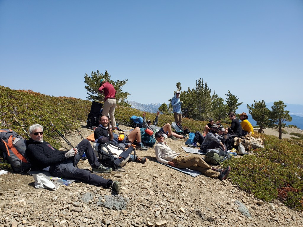
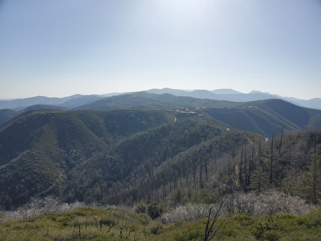
We slowly worked our way up the last few spicy sections, and the mountain finally relented on the slope. We made it to the summit just in time for lunch. The wind had died down throughout the day, and we found a place to sit and soak up some sun. Thru hikers trickled in behind us, and we all sat around for lunch time chit chat. The view was spectacular. Despite some haze and smog over L.A., we could see the Pacific Ocean, Catalina Island, the skyscrapers of downtown, and of course all the mountains we had hiked in the weeks before, all the way to San Jacinto 60 miles away!

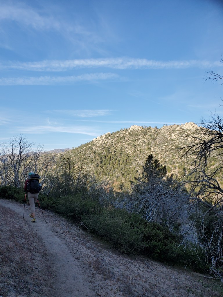
Maggie and I sat up top for almost 2 hours. It was time to get moving again. The low mileage days, while nice in their own way, had been hampering our pace. We continued west on the high ridge from Baden-Powell, managing to avoid most snow. We did a little bonus mountain, Throop Peak, dropping our packs and quickly jaunting to another summit.
Onward and downward, we continued to Little Jimmy campground. Probably 20 or so hikers had the same idea, but thankfully it was a large campground and everyone was in bed by dark, beat from a day on the mountain.
Day 29 – 20 miles/404
Started at 8am on the dot, third to last party to leave camp. We soon entered a burn scar and the trail took us down 900 feet to the side of Mt. Williamson. We were one again graced with some fresh fruit trail magic. The trail angel had seen someone posting online and met them at a road crossing.
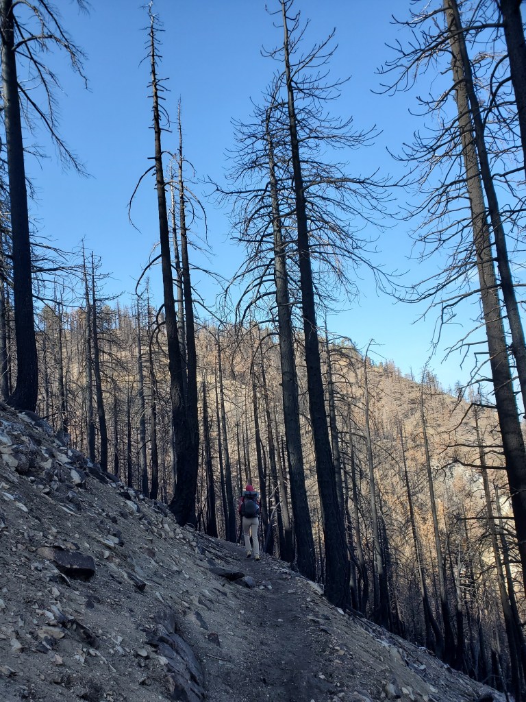
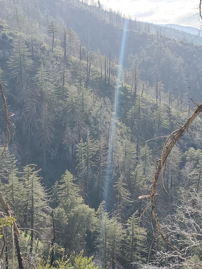
A few berries later, we were trudging up the mountain, 1,200 feet up over 1.7 miles, just like skinning up our beloved Ski Santa Fe. The trail doesn’t go to the summit, and we passed on peak bagging this day since we were aiming to go at least 20 miles total. The forest was very thin and open much of the day, ground cover clear, lots of blackened skeletons still standing, but plenty of big trees still kicking despite large burns around their trunks.

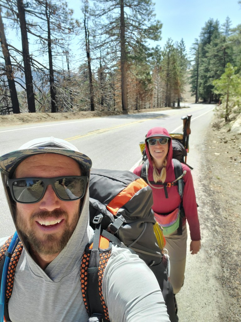
The trail generally followed Highway 2, Angeles Crest Highway, from there, crossing the road every so often. One section of trail is closed for protection of the endangered Mountain Yellow Frog, and the alternate route involves a 2.7 mile road walk. We were thankful there wasn’t much traffic, for the road has frequent blind corners and a narrow shoulder at times. Maggie enjoys the occasional road walk, you get to see everything you would otherwise miss while driving and appreciate the scale of things.
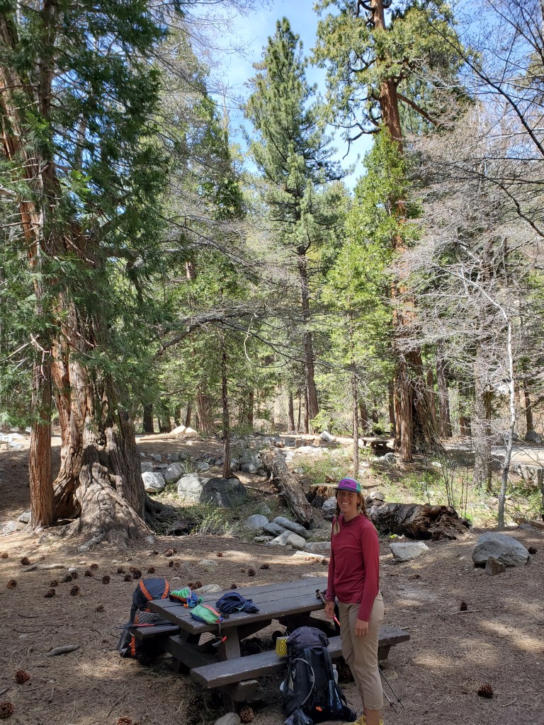
We cruised down the road to Buckhorn Campground where we ate lunch at a picnic table shaded by tall pines and incensce-cedars. The thin canopy earlier and clear skies was letting the sun fry us and we weren’t quite half way done yet. Stellar’s jays, robins, and a green tailed towhee made appearances while we carried about our lunch.
Not wanting to leave this beautiful campground, we threw our packs on and proceeded down to Little Rock Creek and Cooper Canyon. Our time on the creek was short, and we were thrust back up on the the ridge with another decent climb. The remainder of the day was much the same, semi-burnt conifer forest and lots of sun. Somewhere in there, we passed the 400 mile mark!
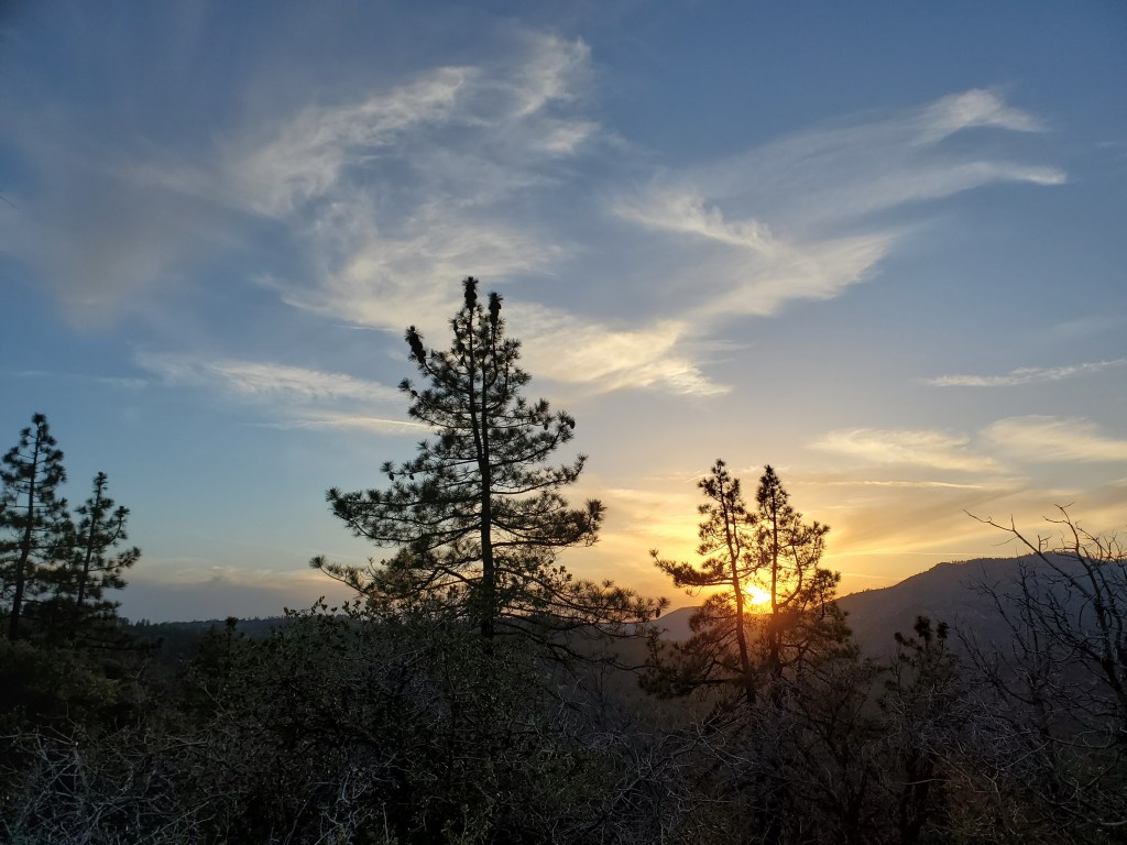
As great as this was, I was losing steam quickly around 4pm. We stopped for water at 5pm, having hiked 18 miles, and we weighed our options. Another campground with water lay 5 miles away, or a dry tent site just 2 miles away. Maggie was very understanding of the state I was in – achey, tired, and in need of food soon. I was willing to push the extra 5, knowing it would be a slog past 7pm, but looking ahead, we realized few water sources were available. Ending sooner would split up the mileage more evenly the next day, so we finished our day at an even 20 miles. A nice sunset provided some brief entertainment before having dinner and crawling into bed about 12 hours after we started our day.
Day 30 – 21 miles/425
We got going at 7:45, but the minute I put my pack on, I realized I was feeling terrible. Not achey, but groggy and light headed. I’m not sure if it was from the heat the day before, or perhaps dehydration and too much salt with dinner. At any rate, I didn’t believe I could walk 20 miles, but there wasn’t much choice but to keep moving. Thankfully, a small shift in the weather brought in some decent cloud cover, keeping temperatures down, a godsend for how I was feeling. Maggie was feeling physically good, but my morose state brought down her mood, and she was feeling a bit sad in the morning.
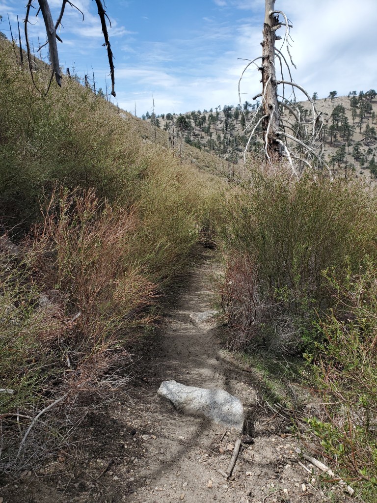
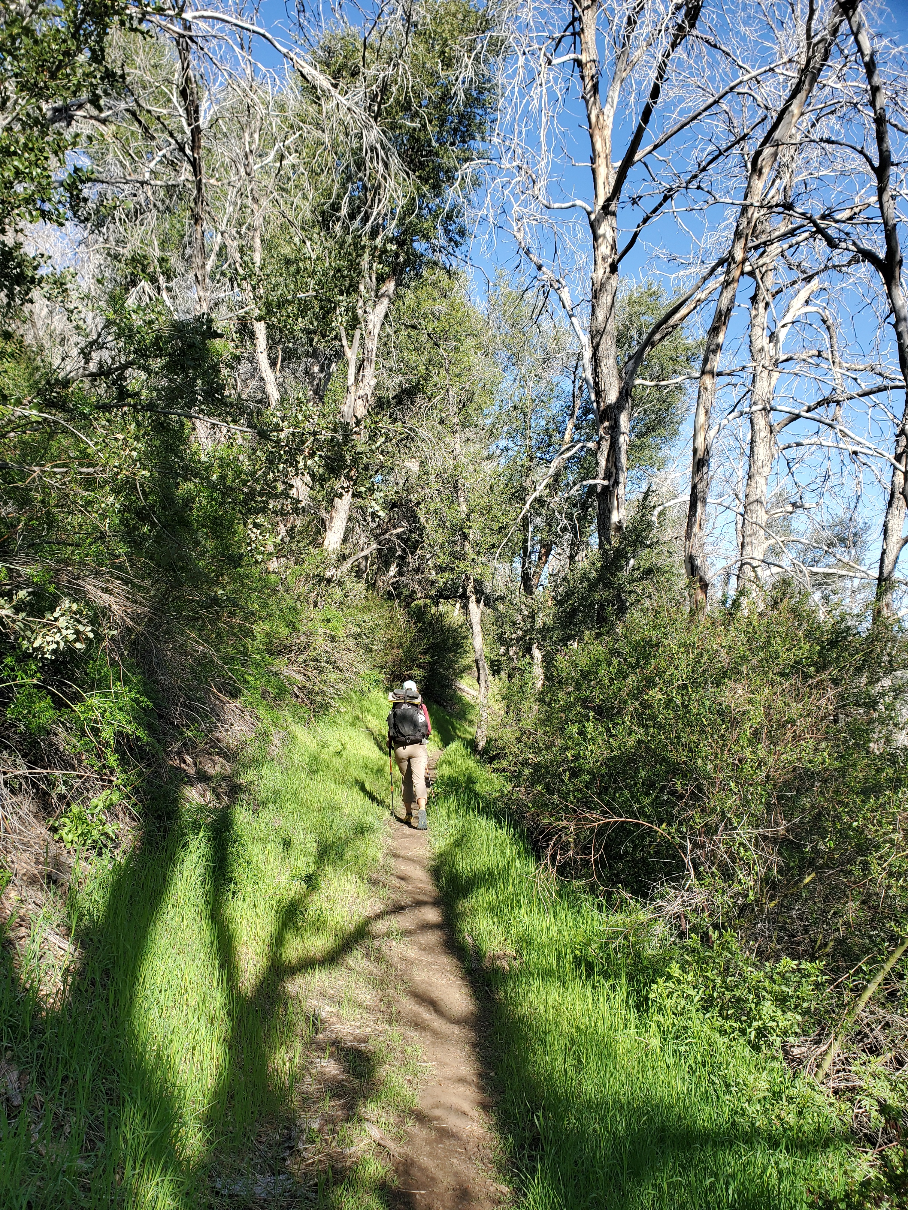
The scenery was nothing special, back in the desert scrub with the occasional pine tree. We got water at a small stream, and as we talked, it was feeling like a bad day lay ahead of us. If we couldn’t hike 20 miles, it would throw off our plan to get to Acton the next day. There was minimal water on this stretch, complicating things a little more. We walked, mostly in silence. At times, the thorny shrubs on the side of the trail were overgrown, but we were prepared for this with long sleeves and pants.
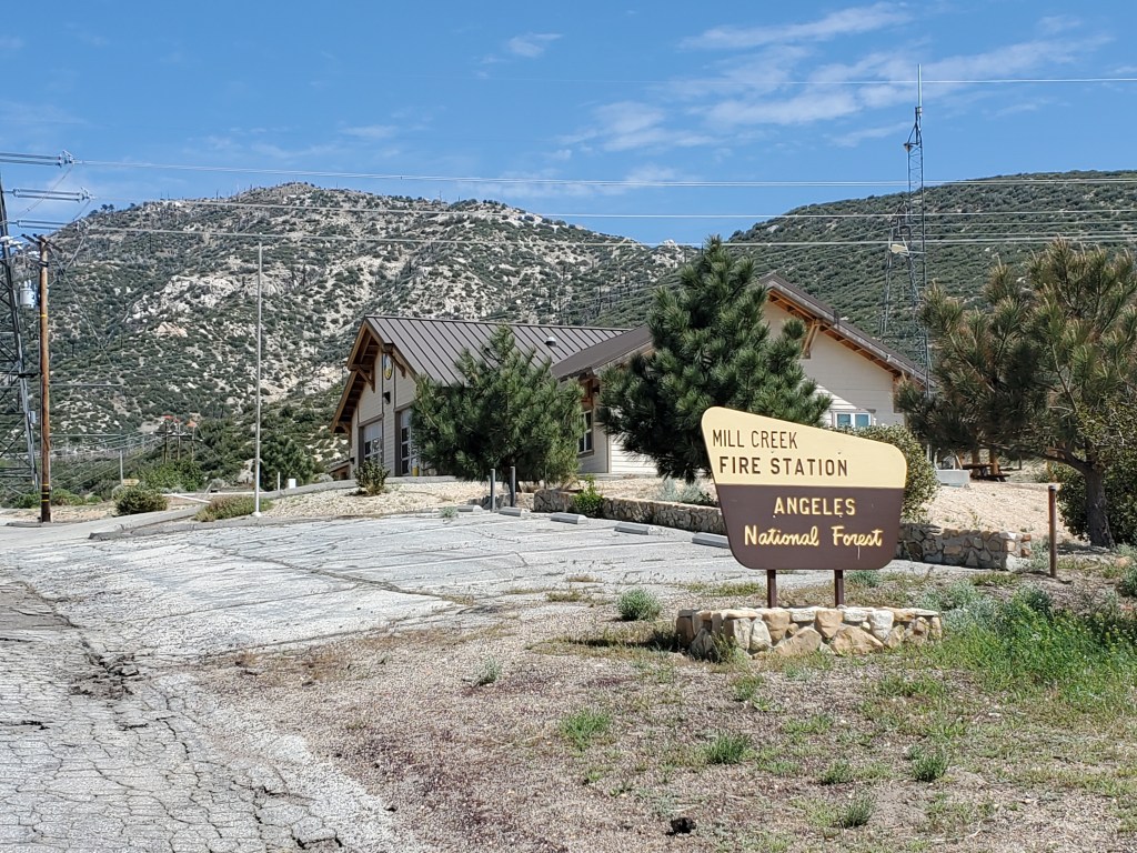
A long, easy climb brought us back into conifer country near the mountain tops. It felt like we were moving slow, taking lots of breaks, but we had covered 9 miles by lunch time. We ate on a small flat spot on top of a boulder embedded in an otherwise steep, sketchy slope. I was slowly feeling better as the day progressed, especially after lunch. We meandered off of the high sides of the mountains to Mill Creek Fire Station, our next water stop. There is a faucet where hikers can fill up, and thank goodness, otherwise we would have had 27 mile water carry.
We climbed back up on one last ridge for the day. More uninspiring shrubland and rolling hills for a while. We put on podcasts to break up the monotony. As we got a little higher and turned on to the north side of Little Mount Gleason, we were greeted again by Big Cone Doug Fir and some larger oak trees. They looked beautiful, back lit by the evening sun. Bright green grass grew in the damp drainages beneath the trees.
The cool, shady air and lush bits of forest were very refreshing, a much needed boost near the end of the day. We said farewell to these idyllic nooks and dropped down a little bit to camp near a dirt road. Only one hiker was there. The big group from two days earlier seemed to have thinned out, and we were somewhere in the middle. It was nice to get some solitude again. Whatever funk I was feeling in the morning had largely subsided. We ate dinner in the tent and read our books till dark.
Day 31 – 19 miles/444
It was time to get off the mountain. A resupply box was waiting for us near Acton. The day ahead involved a few small climbs, but mostly descent, over 5,000 feet, as we returned to the valley bottom at 2,200 feet of elevation. We climbed up the side of Mount Gleason, again through mostly burned conifer forest. The views weren’t anything special, but we could see much of the ridgeline we had been traversing the last few days.
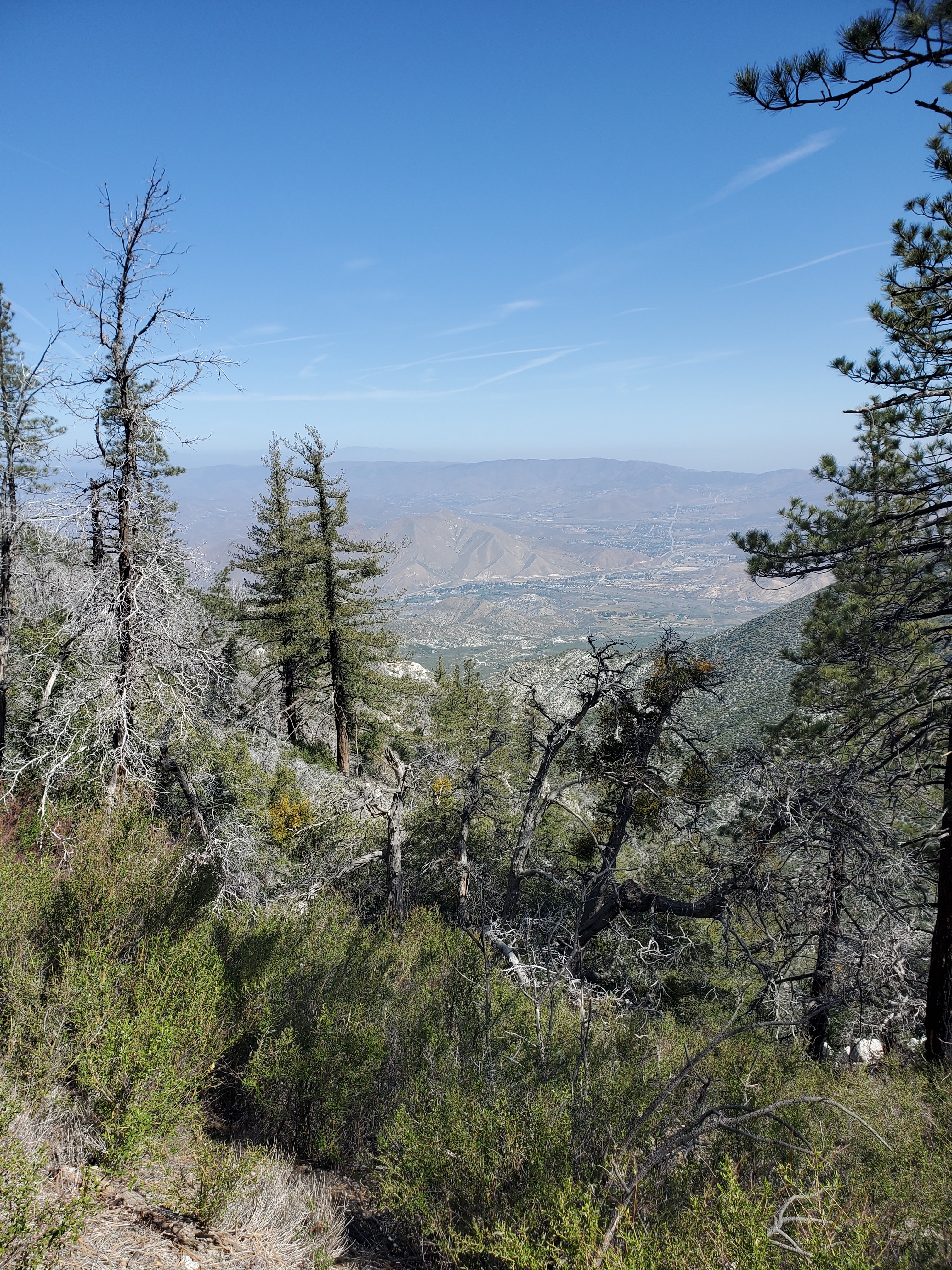
At last on the shoulder of the mountain, we could look down and know most of our day would be easy going. With blue above and brown below, it appeared we were just above the smog line of L.A., just a few 10s of miles away. We romped down the trail and reached North Fork Saddle picnic site for lunch, a respectable 11 miles by noon. We ate well, eager to empty our food bags before the resupply. We got water there, ending the 18 mile water carry. A Forest Service employee fills 5 gallon jugs and brings them out for hikers. Without this water, this section of trail would be nearly impossible. I saw him bring a jug out and we chatted briefly about the exotic trees the Forest Service had planted at the picnic site back in the ’60s.
Down, down, down we went, back to the desert proper. The only clouds were thin srips left by planes, which inexplicably ended straight overhead. At least cool, humid seabreeze blew in at times, moderating the temperature. We only stopped for the briefest of shade breaks on the final 8 miles, finishing the 19 at 4pm.
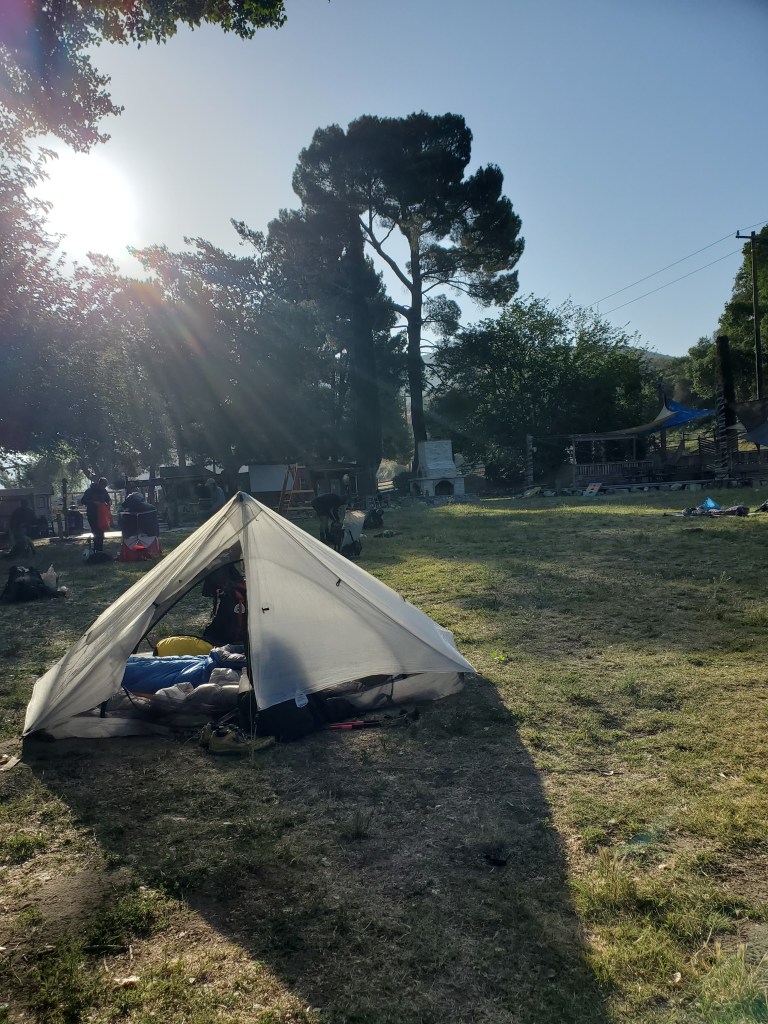
It was a quick road walk to LA RV Resort where we checked in to camp for the evening and pick up our resupply package. We went out to set up camp and found… the bubble. Close to 50 hikers were milling about, tents with laundry hanging on top to dry. We were lucky enough to grab a washing machine without too much of a wait, and we showered up. We ordered pizza, caesar salad, and a bottle of chardonnay. Tired from three 20-ish mile days, we decided to retire rather than socialize. The chatter died down a little after 9 as everyone crawled into their tents, synthetic materials swishing and crinkling all around as the hikers got comfortable.