Day 32 – 10 miles/454
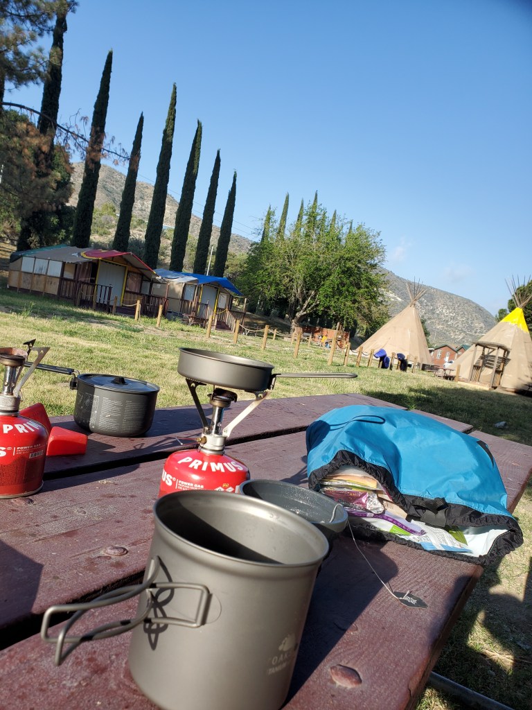
A slow morning was on deck. We planned on hiking 14 easy miles after doing 60 in the last three days. We ate well at our picnic table, watching the other hikers pack up and clear out of the RV resort.
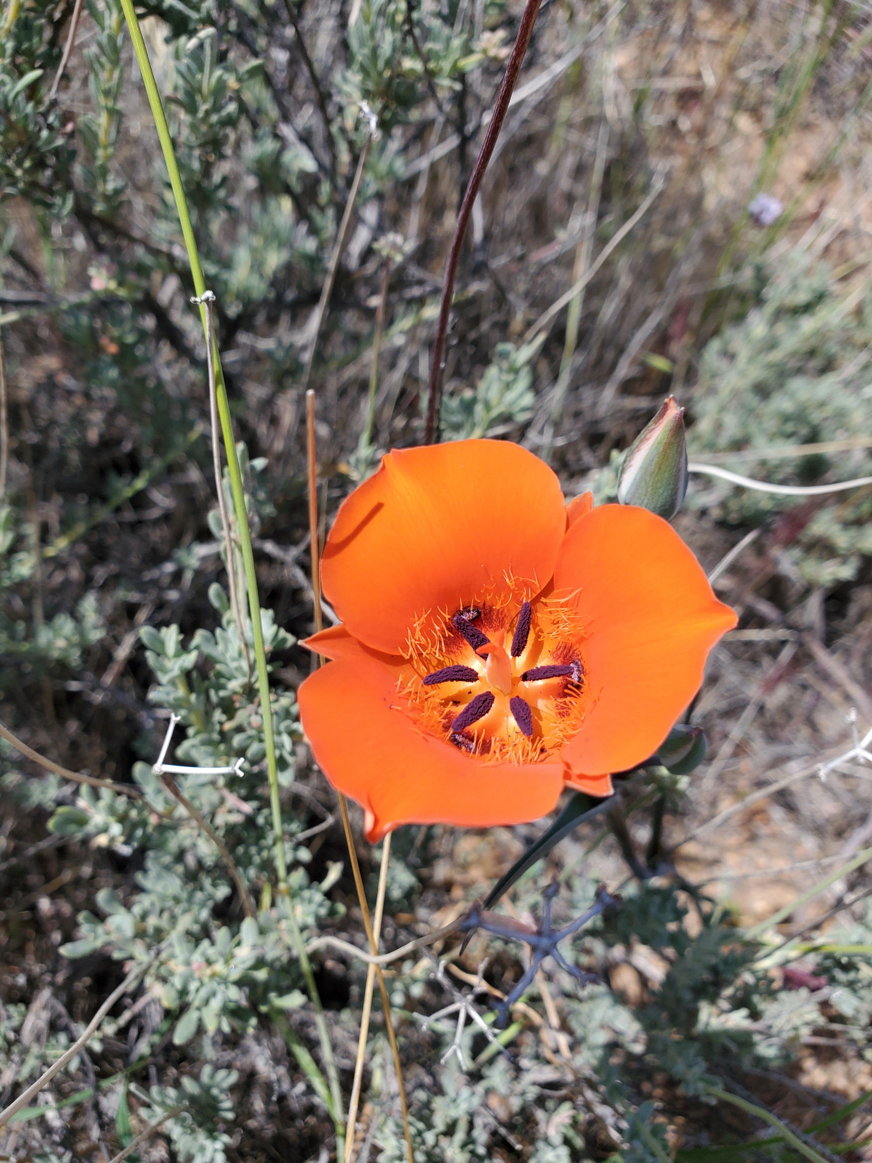
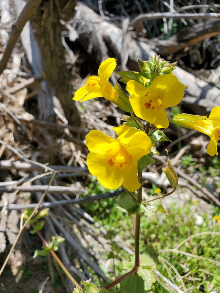
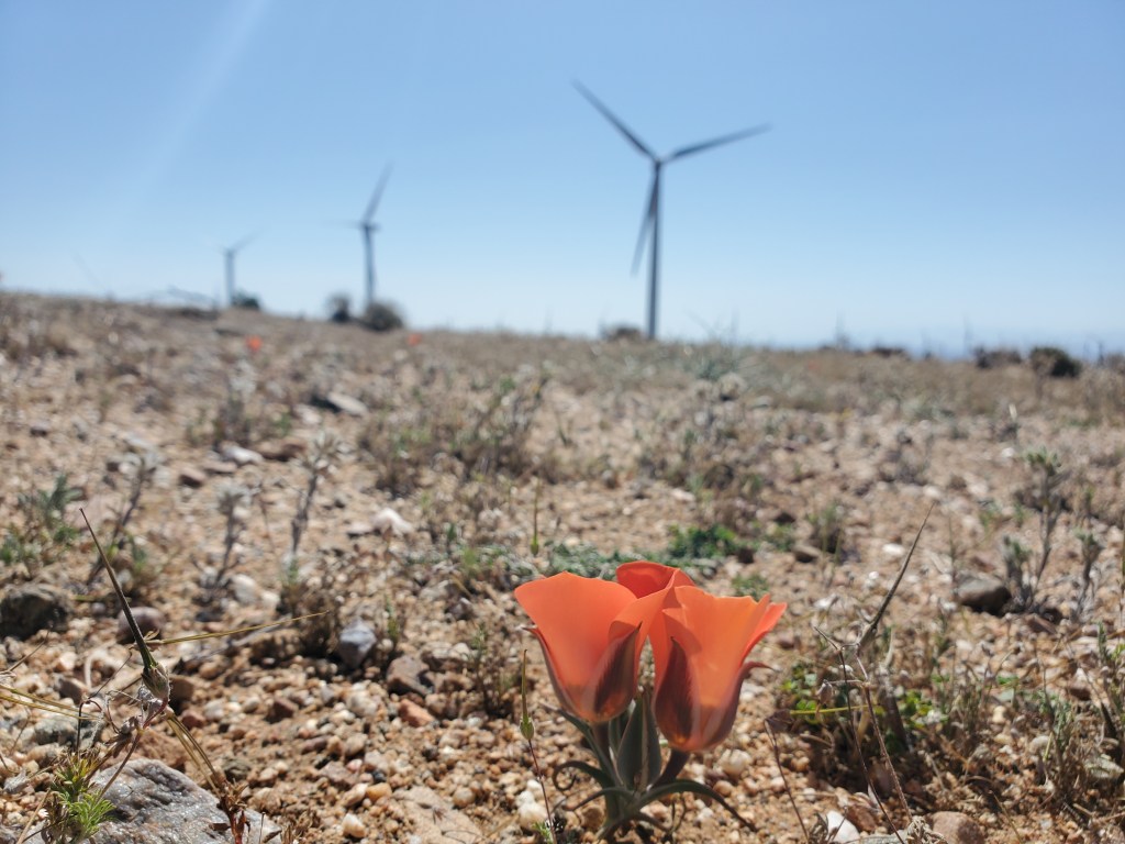
We got back on trail a little after 10am and entered a whole new geological area. Massive gum drops of brown conglomerate dotted the hills, a marked difference from the granite mountains we had been in for so long. Low, dry grasses waved in the wind with a smattering of wildflowers. Most notable were the mariposa lillies (Calichortus sp.), one orange, one yellow. A beautiful little find in this seemingly barren landscape.
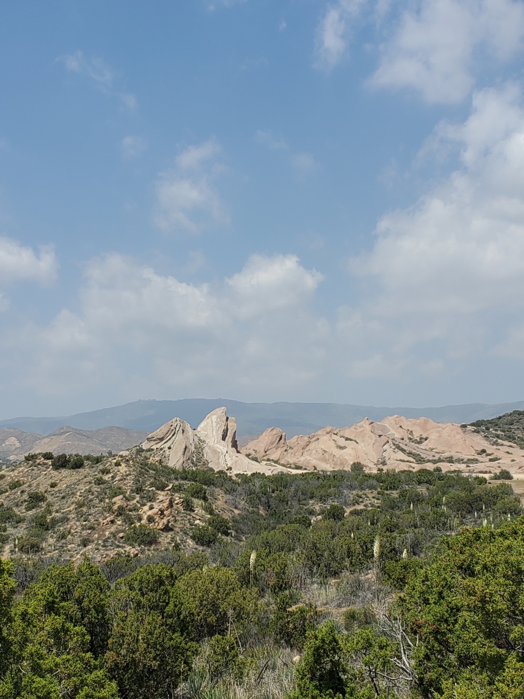
Over the hills lie the town of Agua Dulce where we could get a burger, fries and beer, so we hiked fast to get there for lunch. A quick snack break at the top of our climb where we got our first view of Vasquez Rocks. This formation of sandstone and conglomerate has been uplifted by the San Andreas fault, making for some striking fins and small canyons. The unique geology for SoCal has attracted film makers for a long time – Star Trek, Blazing Saddles, Bonanza, and many more have shot scenes there. We carried on, down to the 500 foot tunnel under Highway 14, a fun little echo chamber to sing in.
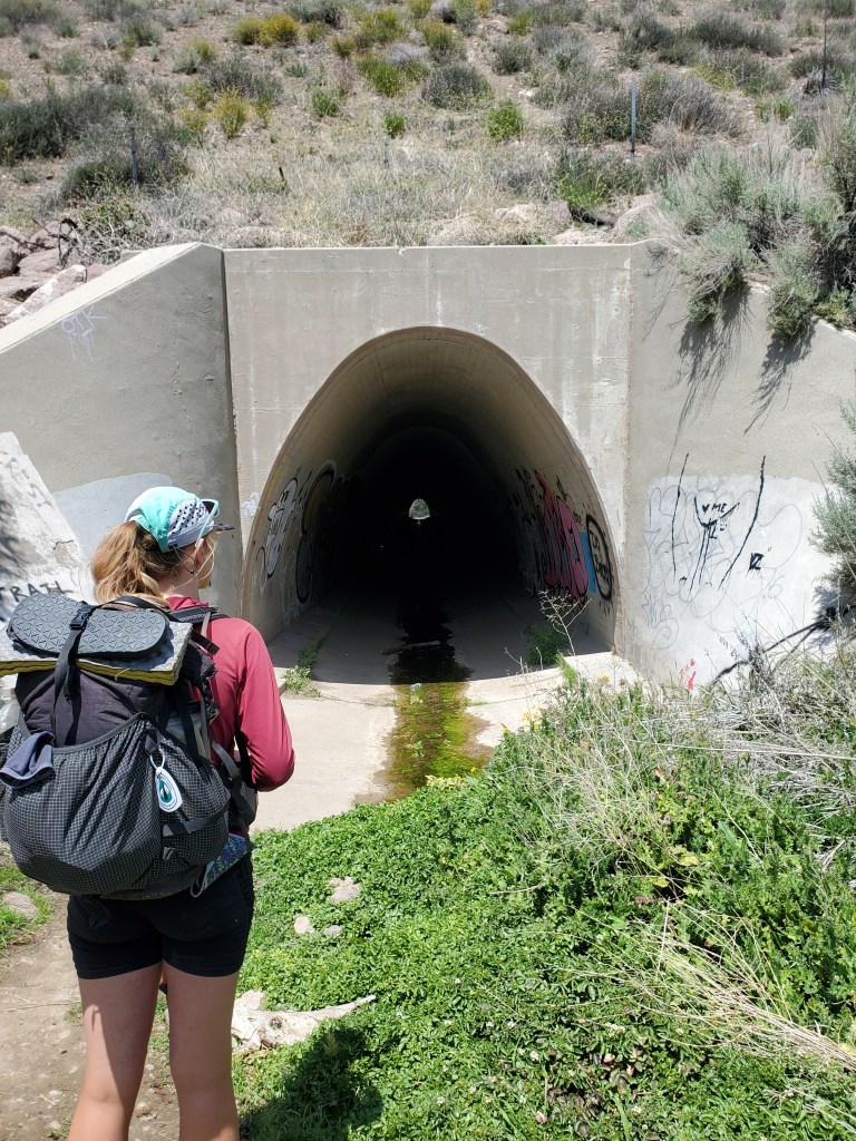
Walking towards the light, we emerged in a lush canyon nestled between the textured sandstone cliffs. Sycamores, willows, and so many more botanical friends greeted us. We forgot about the french fries for a minute and stopped to take lots of pictures.
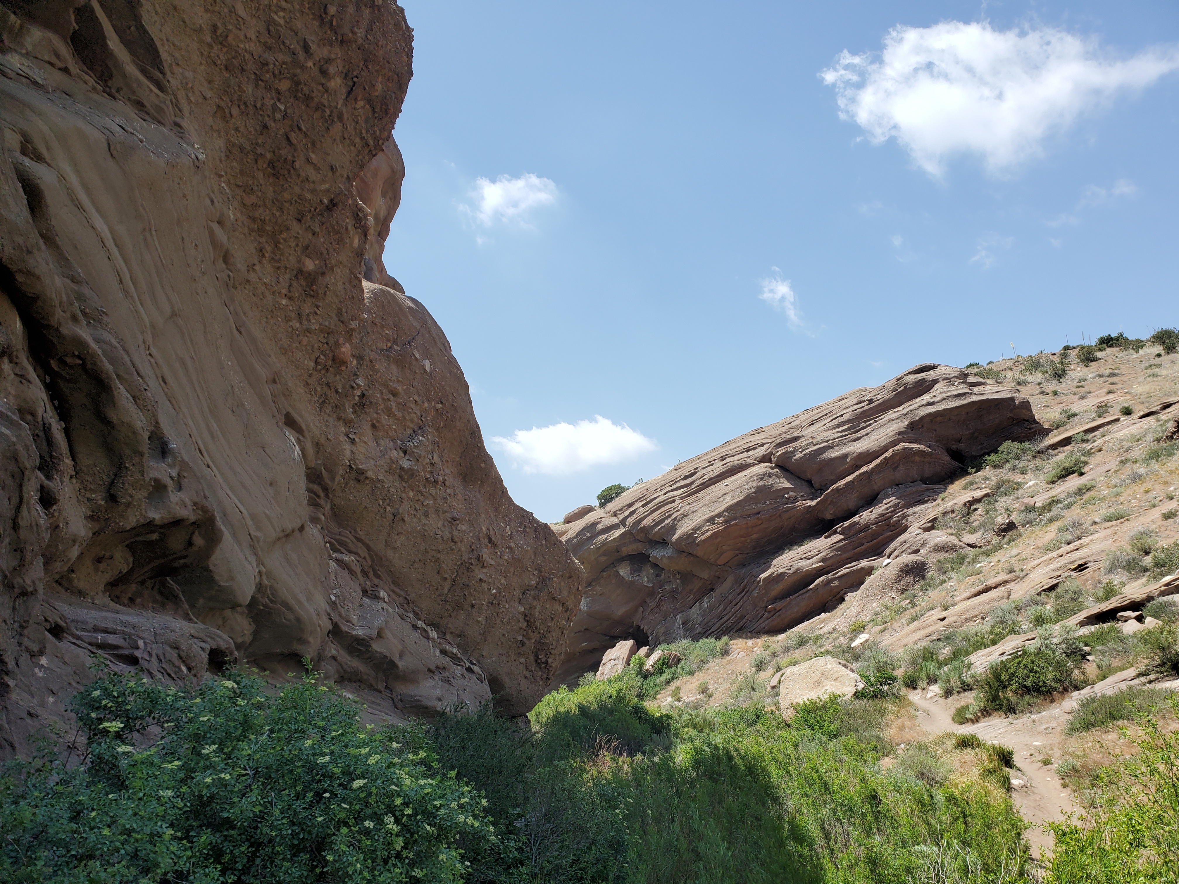

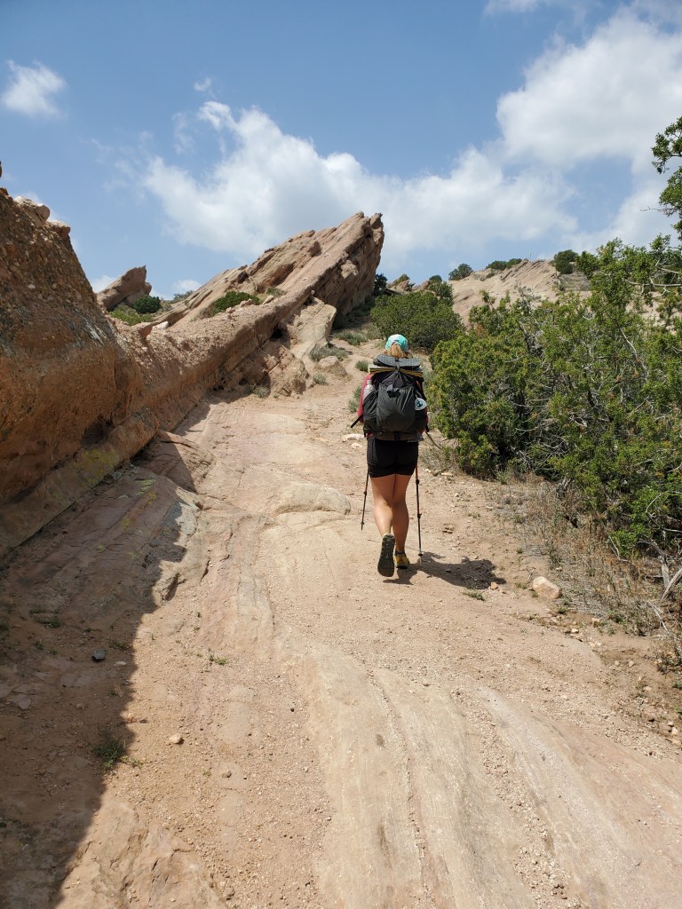
The trail took us up above the canyons where we could see the larger formations beyond. We took a few more nature breaks, watching a coyote stalk prarie dogs, then made our way into Agua Dulce. The trail actually goes right through the middle of town, so it’s only a 10 foot detour to stop in the Sweetwater Bar & Grill. A handful of hikers were there, our late start allowed the rest of the bubble to get ahead. We both opted for the burger with everything on it – pickle, onion, tomato, avocado, a fried egg (over easy), and bacon (for me). It was delicious.

One hiker, Squalo, who we had seen the last two days, sat with us for a beer. Two local girls took the table next to us, and after a while, they struck up a conversation with us. “You’re obviously PCT hikers, right?” They asked a lot of the usual questions about thru hiking life, mentioned that they enjoy riding horses on the PCT nearby. Maggie maintained the conversation, while I went back to talking with Squalo. Before I knew it, I overheard that one girl, Lexi, was offering to help us out and potentially host us for the night. “My mom has always wanted to have hikers over!”, she said. It sounded too good to be true, but the generosity of people out here has been truly amazing. We got her number before she left, and ordered one last beer. Behind me, I overheard another hiker talking, “Do you know Karate Man? He’s on the way right now…” Karate Man is in the Wolf Pack. I turned around to confirm what I heard. Sure enough those guys and gal showed up half an hour later, and they were thirsty. It didn’t take long for about a dozen hikers to commandeer two picnic tables out back of the bar & grill.
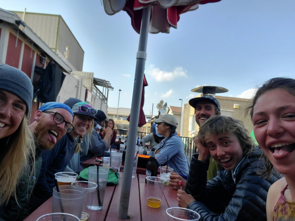
It became apparent after 2 or 3 more “last drinks” that we weren’t going to make it much further that night. We had ourselves a blast though, hootin’ and hollerin’ until the bar closed at 7:30pm, 5 hours after we arrived. The obvious choice from there was to stumble over to the Mexican restaurant across the street for dinner.
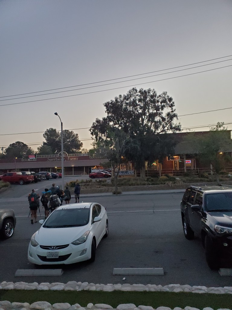
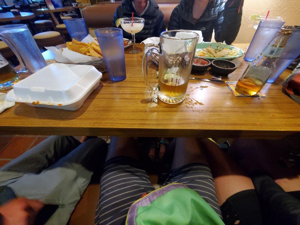
I got into a lengthy conversation with a guy in the bathroom. He was the most enthusiastic person I’ve talked to so far about thru hiking, and he wished he could give it a try someday. I returned him to his wife, impatiently waiting by the door and found Maggie and crew, wondering where I had been… A full 20 oz Modelo was waiting for me, which was definitely the last drink. Burritos and more laughs were had.
Maggie reached out to Lexi and she was still happy to host us for the night. We were stoked because the alternative was camping in the empty lot outside of the restaurant. Lexi and her partner picked us up in their truck at 9:30 and took us to the ranch a few miles out of town. We set up our tent in the front and went inside to meet the parents. We had some nice conversation, much of the usual “How did you decide to do this?” etc. They were genuinely interested and clearly happy to help us out for the night. Maggie took a shower (second day in a row!) and we went to bed, blown away by the how the day transpired.
Day 33 – 17 miles/471
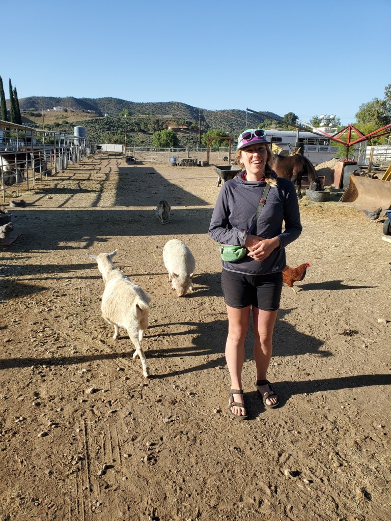
We were woken up by a surprising amount of traffic, surprisingly early in the moring. I think it started before 5am. A fresh dose of karma for the previous day’s debauchery. We were up and moving a little before 7, not quite miserable, but I’d say we weren’t happy campers. We found Lexi back behind the cabin feeding the horses. She is a horse trainer, willing to take on troublesome and unbroken horses. In between the stables were two goats, a pig, and a small flock of chickens running around with Lexi’s dog. We got to hold Wanda the cuddly chicken.
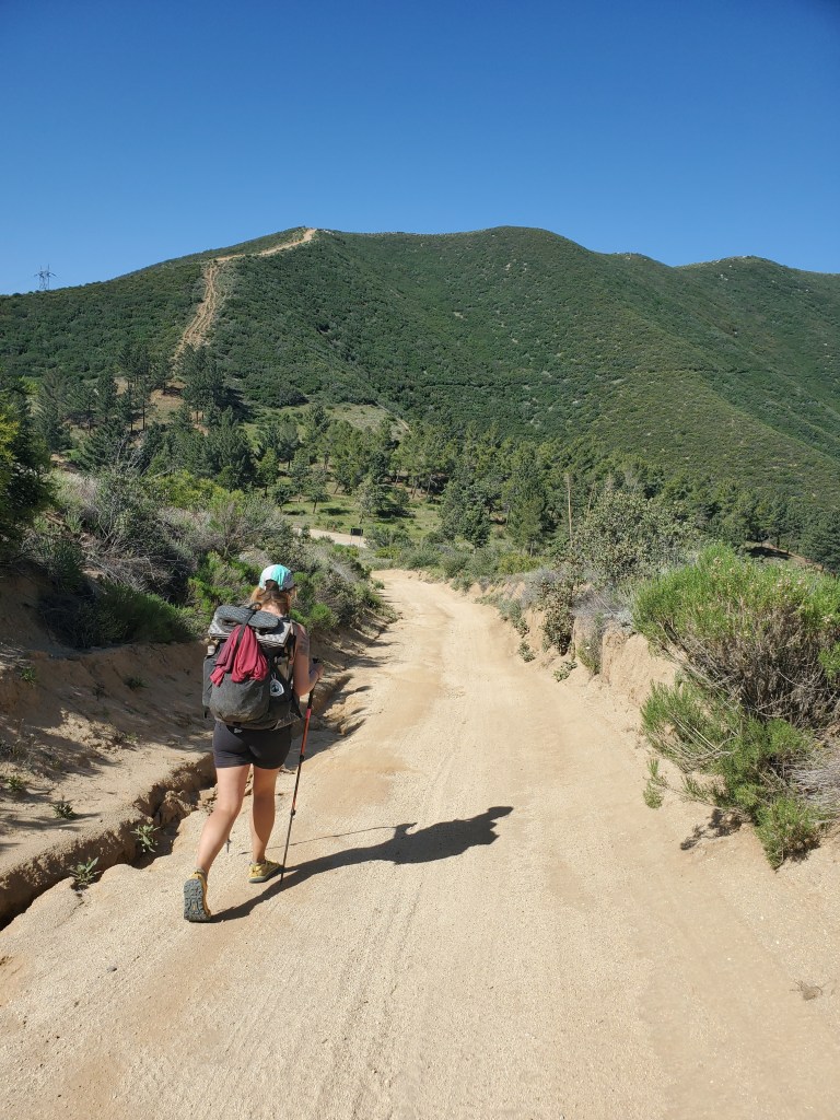
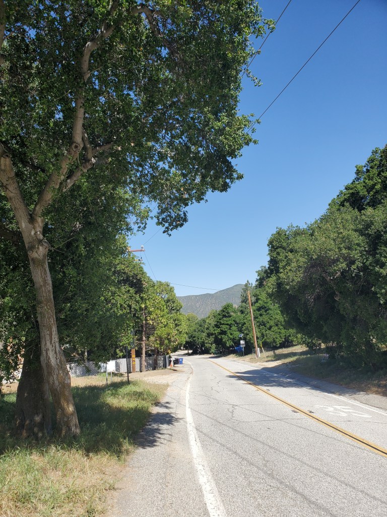
We filled up on water and Lexi drove us back to town, right where we left off. We saw our friends sitting at the diner for breakfast, sunglasses on and heads hanging low. We joined them and got giant plates of eggs, hash browns, and toast, much needed sustenance. The crowd thinned out, and we finally hit the trail at 9:50am. The trail continued through the town of Agua Dulce for 2 more miles. We were both pleasantly surprised by the community, beautiful homes, trees, and ranches lined the road. We got back to the desert scrubland where a break was in order. The sun was blazing, we were stuffed from breakfast, and a bit queasy. We hoped to hike 20 miles, but that seemed entirely out of the question. Just ahead of us was a 2,000 foot climb and another 1,000 foot climb a few miles later. Woof. It was podcast and music time.
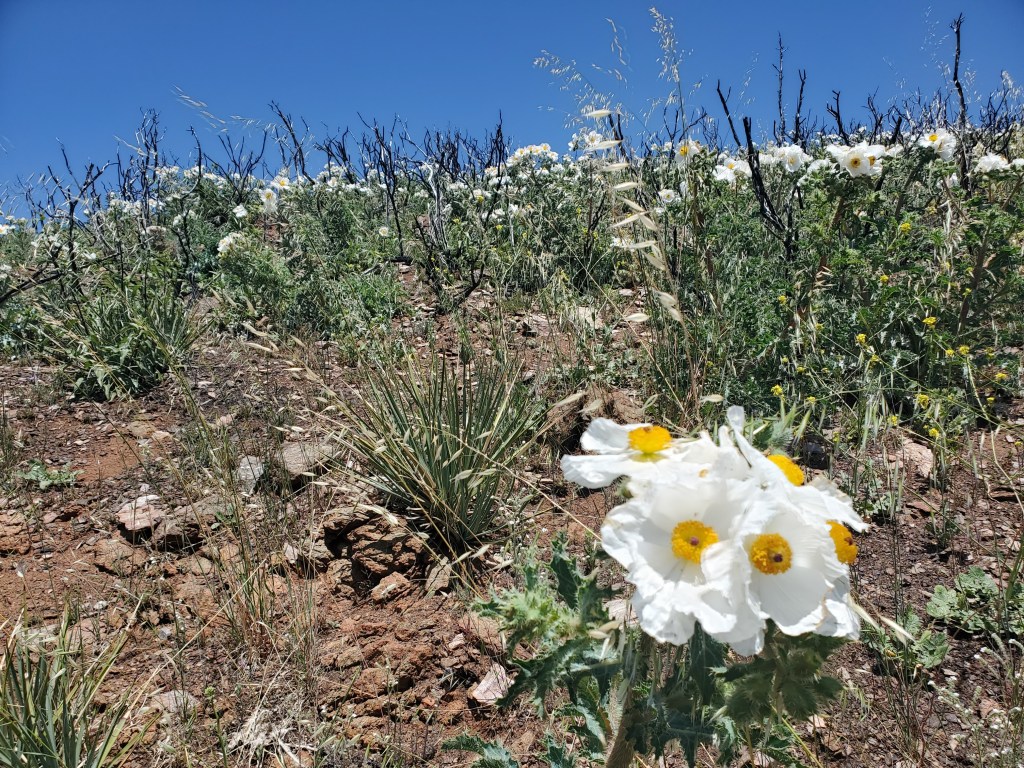
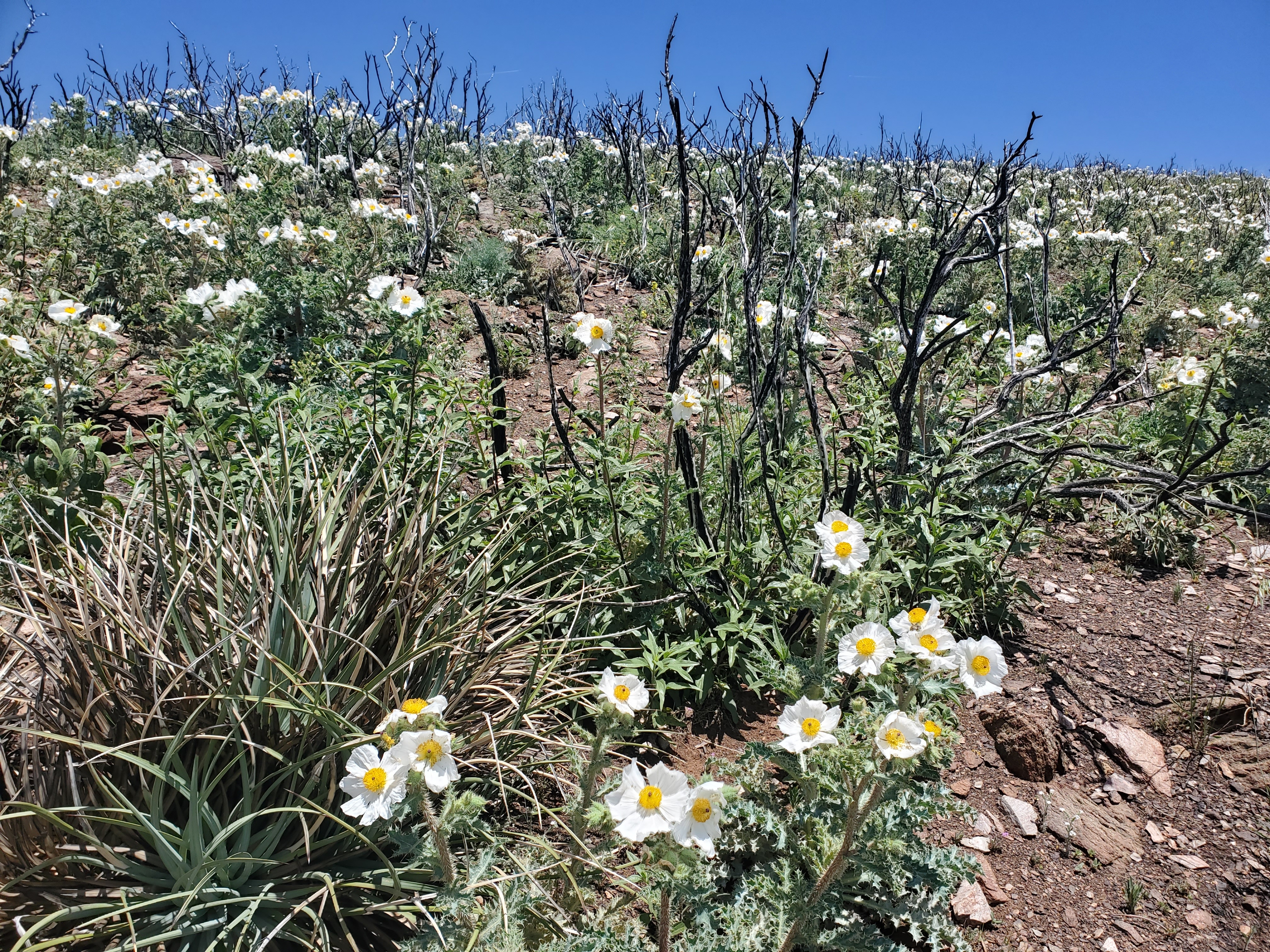
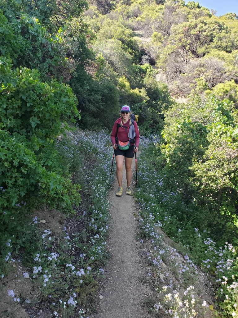
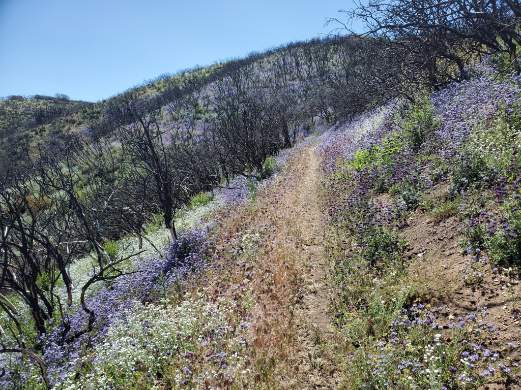
We climbed, slowly sweating out what was left of last night’s beer. For several miles there was nothing of much interest, just head down, pushing onward. As we got closer to the top of the hill, white California prickly poppys started appearing. A little higher yet and we were surrounded by a sea of white flowers fluttering in the breeze. This was one of those redeeming moments when everything else about the trail feels rather monotonous.
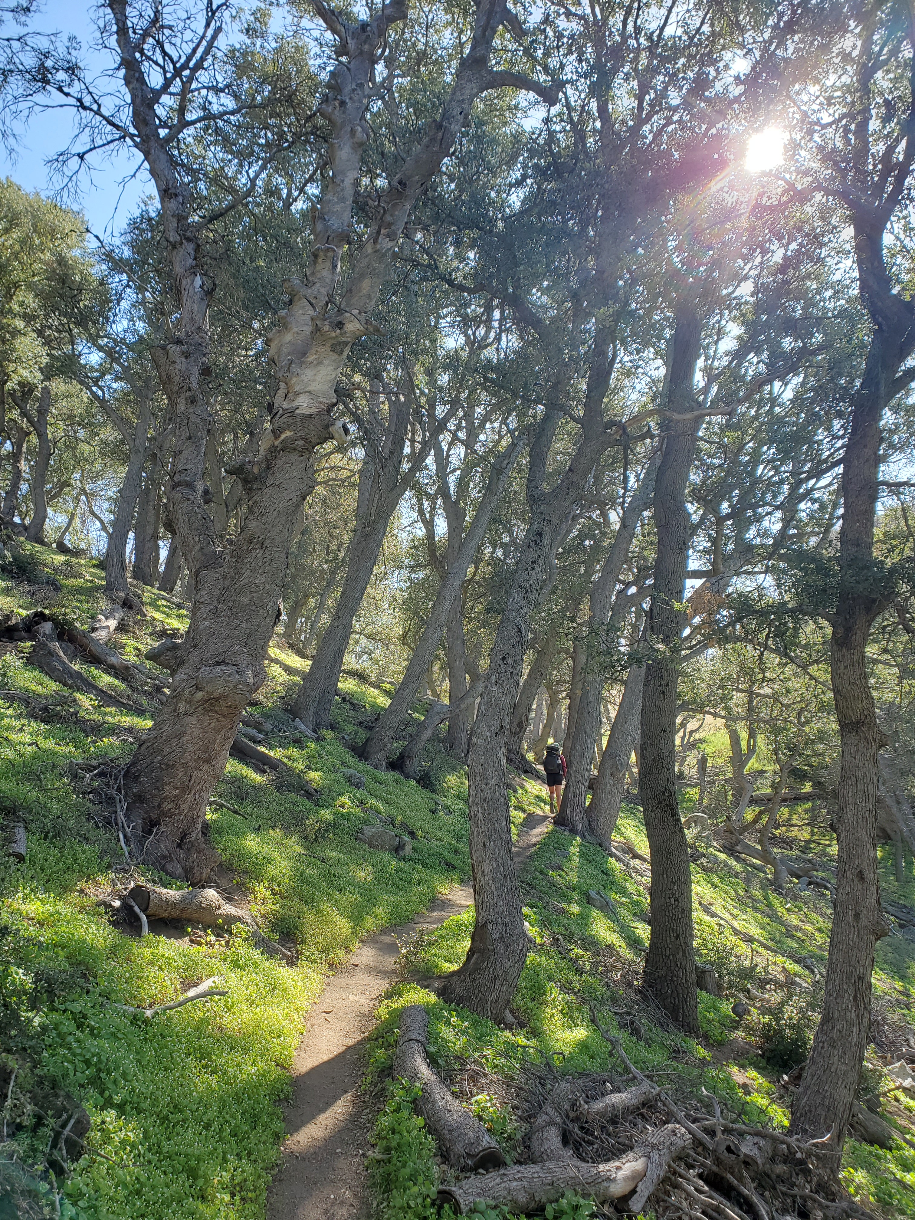
We powered through to the top where we were rewarded with a handful of oak trees providing much needed shade. We ate lunch and three hikers showed up who were out with us the night before. All we could do was laugh about our condition, perhaps complain a little too. Maggie and I continued down the back side of the mountain, where we got the occasional shady oak grove to cool down.
At the bottom, we caught up with the Wolf Pack. They had stopped for Nimbus, the girl who joined the pack around mile 100. She had shooting pain in her thigh and couldn’t go on. Maggie and I sat and talked with her for a bit, offering whatever advice we could and sharing some extra Ibuprofen. Needing to get to Green Valley the next day for resupply, we left Nimbus to heal. It was 4;30 we had 6 more miles to put us in range of town, and that 1,000 foot climb. Woof indeed. The sun was still blazing, just low enough and right in our eyes now. I can’t believe how hot it was that late in the day. We were dying.
Thankfully, the sun got low enough to take a shade break in a small drainage. At last we arrived at Spunky Canyon road, where we were able to set up in a small parking area. We ate and immediately went to sleep, exhausted from the last two days of having a little too much fun.
Day 34 – 17(-2) miles/488
We took it slow in the morning, having decided to walk down the forest road into Green Valley. This would save us a good bit of time getting to town. This did bypass 7 miles of the PCT, but we ended up hiking 5 miles through town so we felt ok about it. The rules are made up and the points don’t matter!
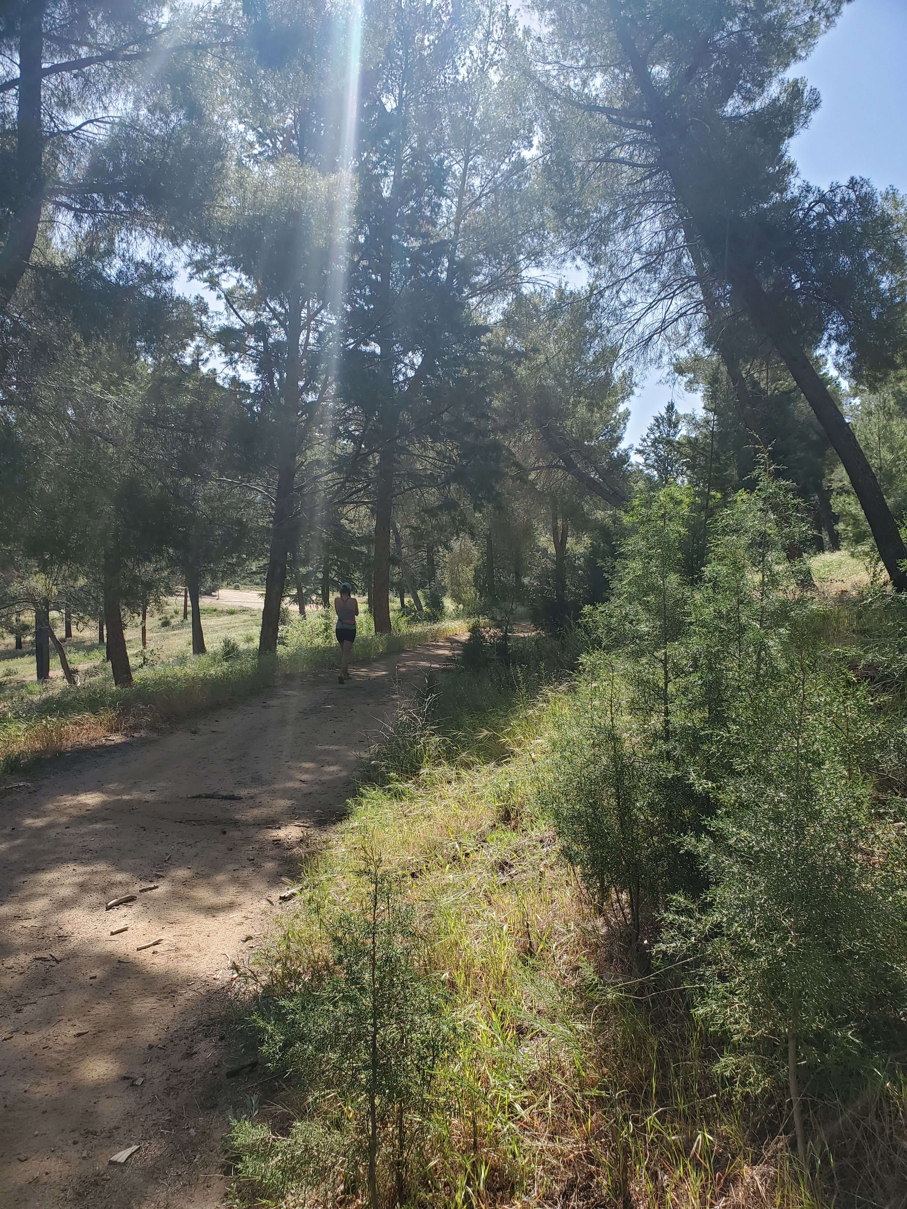
The road winded down the side of the hill and came to a junction with the paved road before long. There was a small “tree plantation” at this junction with a bunch of cypress, pines, and a Himalayan cedar (Cedrus deodara). We took off our packs to look around for a few minutes and cool off in the shade. On down the road, we made it to Green Valley, a sleepy little town nestled between the hills. Large oak trees dotted the road and the yards, inviting many birds to fly around overhead. We stopped in the Backroad Market, no bigger than a typical convenience store, but they had everything we needed for the next 4-5 days.
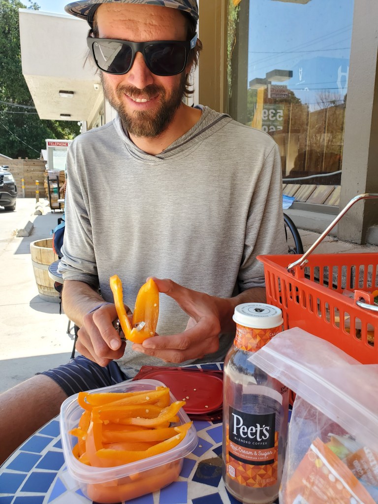
We had lunch out front and packed up our food. Strolling through the rest of the town was quite nice, some folks sitting out front of their homes waved and said hello as we passed by. We picked up a few more snacks at the other gas station in town then started the hot hike back up to the trail. It was mid-day and the road was especially toasty, minimal shade, and cars whizzing by at 50+mph. It was only 1.5 miles, but it was brutal. Near the PCT junction, we topped off our water then made a plan for how much further to go. That little road walk with full packs really took it out of us and the next few miles involved more uphill. We decided to push on 10 more miles to split up the next section more efficiently, but I think deep down, neither of us really wanted to walk that far on that afternoon. With the afternoon sun beating down on us, we made our way up the first climb. “I think I need a snack break at the top of this,” I said to Maggie, and she agreed. When we created the hill, we were greeted by the familiar sight of the rainbow Honda Element – Cheshire Cat was posted up doing trail magic! More fresh fruit under his makeshift shade tent, a tarp propped up with sticks and paracord. We chatted for awhile as we hastily ate pineapple and honeydew. We begrudgingly continued our hike, needing to beat the sunset. The trail started down the next valley, thank goodness, and with it came some shady oak groves.
We cruised through the next 6 miles. Near the road crossing at the bottom, we heard Nimbus call our for us. Her leg was feeling better and she hiked 20 miles that day. We were stoked for her! We took a little break before the last climb of the day. We were worn out and the heat was getting to us, but we carried on. Maggie was particularly not happy to keep hiking, but she was a trooper. We found a little tent site between the scrub oak bushes and got comfortable for the evening. It was windy most of the night, which certainly woke us up, but we did get some decent sleep.
Day 35 – 20 miles/508
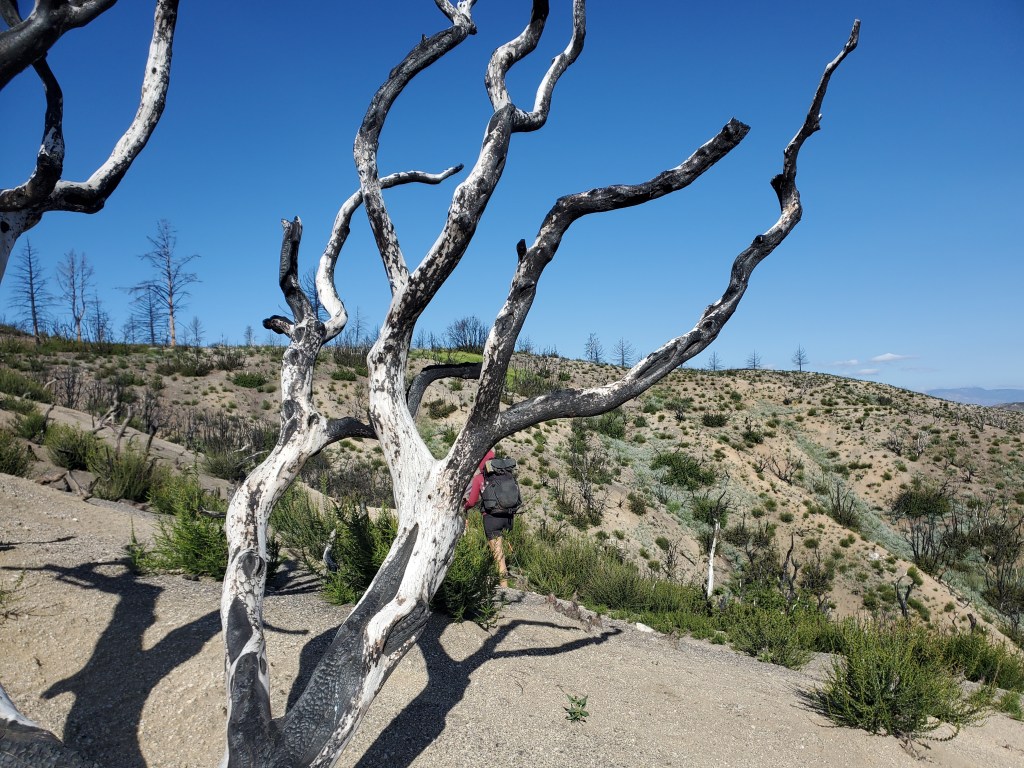
The day began in a barren burn scar. Only the smallest plants and seedlings grew to knee height in between scorched skeletons of past trees and shrubs. The wind was fierce and we felt its full force in this exposed landscape. “This sucks…”, Maggie said, and I agreed. If the whole day was going to be like this, I think we would have gone insane.
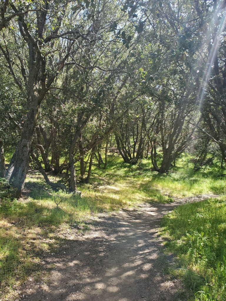
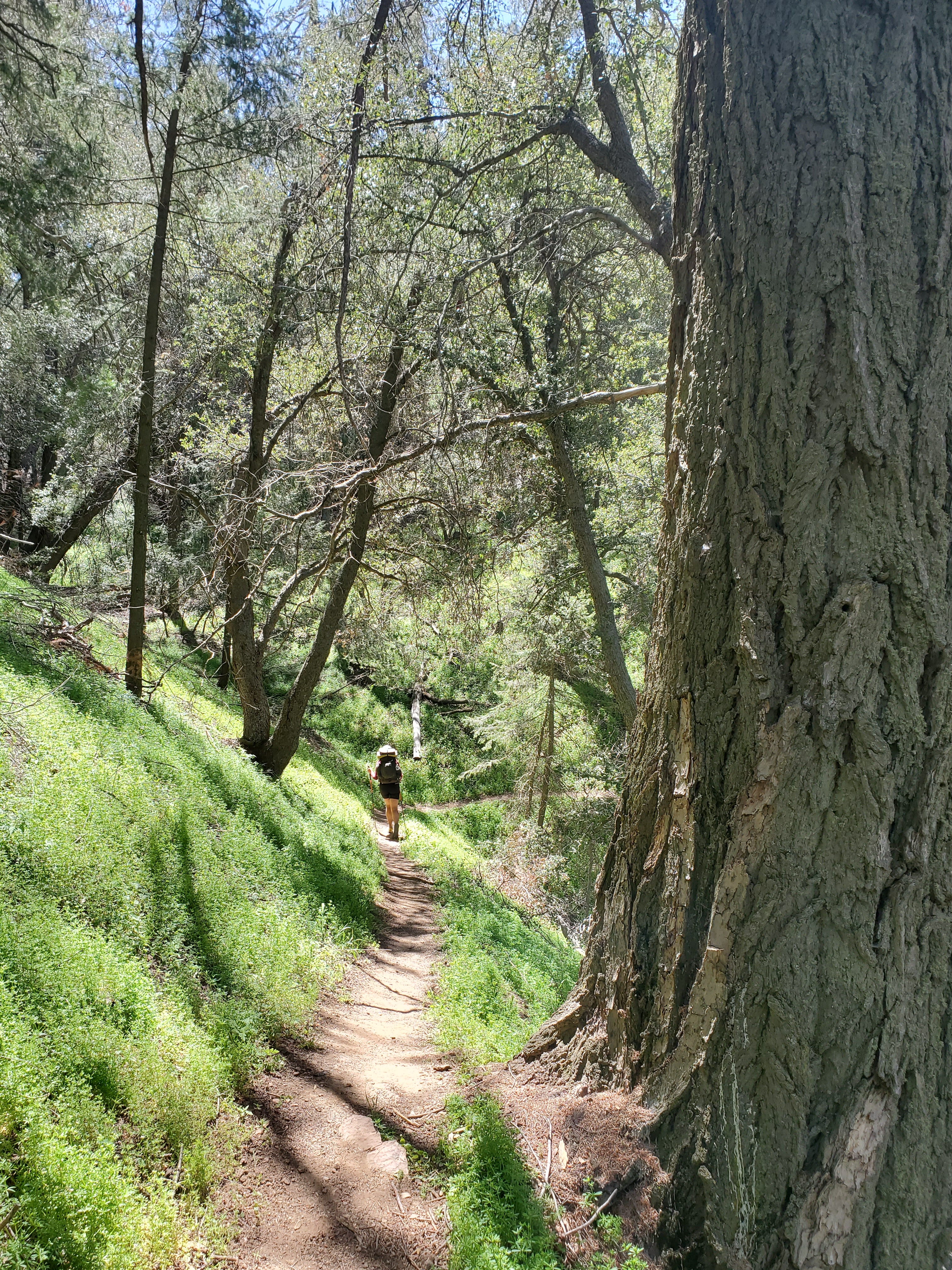
We weaved our way through the burn scar and finally we returned to the forest. Verdant oak groves with thick ground cover of miner’s lettuce were a huge relief. We relished the steady shade and cool, damp air blocked from the wind. We emerged from the forest at a dirt road with a water spigot. We ate lunch with a few other hikers, they always seem to congregate near water.
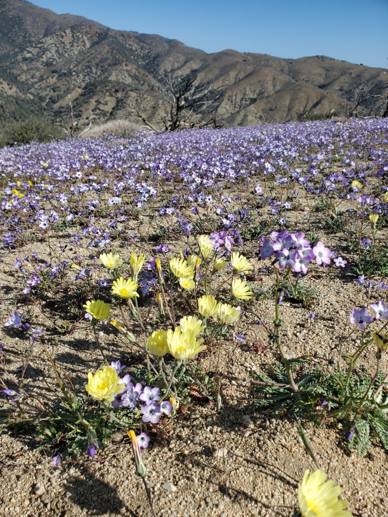
Back on the trail, we were back into a burn scar. Some patches of ground were blanketed with blue phacelias and the aroma was amazing! The cycle of life and death. Further on, we were back in the forest, a mix of oak and big cone Doug-fir. We were thankful again to be out of the burn. Somewhere in there, we passed 500 miles! Our fastest 100 yet, just 6 days. We didn’t see too many hikers throughout the day. Before long, the forest gave way to… another burn scar! We were sensing a pattern, and it kept true, because we finished the day in another oak, pine, and Doug-fir. The oak trees were larger now, and spaced out, making for a pleasant saunter into camp.
We were done hiking relatively early for a 20 mile day, a little before 6. The wind was back and forecast to be even stronger that night, so we cowboy camped. The night was clear and cool. It was hard to ignore the stars whenever I woke up to roll over.
Day 36 – 27 miles/535
The next stretch of the trail is a bit odd and infamous amongst thru hikers. The trail leaves the “crest” and drops down to the Mojave desert where it follows the Los Angeles aqueduct for several miles. I suppose the people who built the trail decided it was finally time to turn north after 250 miles of heading mostly westward and really mess with the hikers minds in the process.
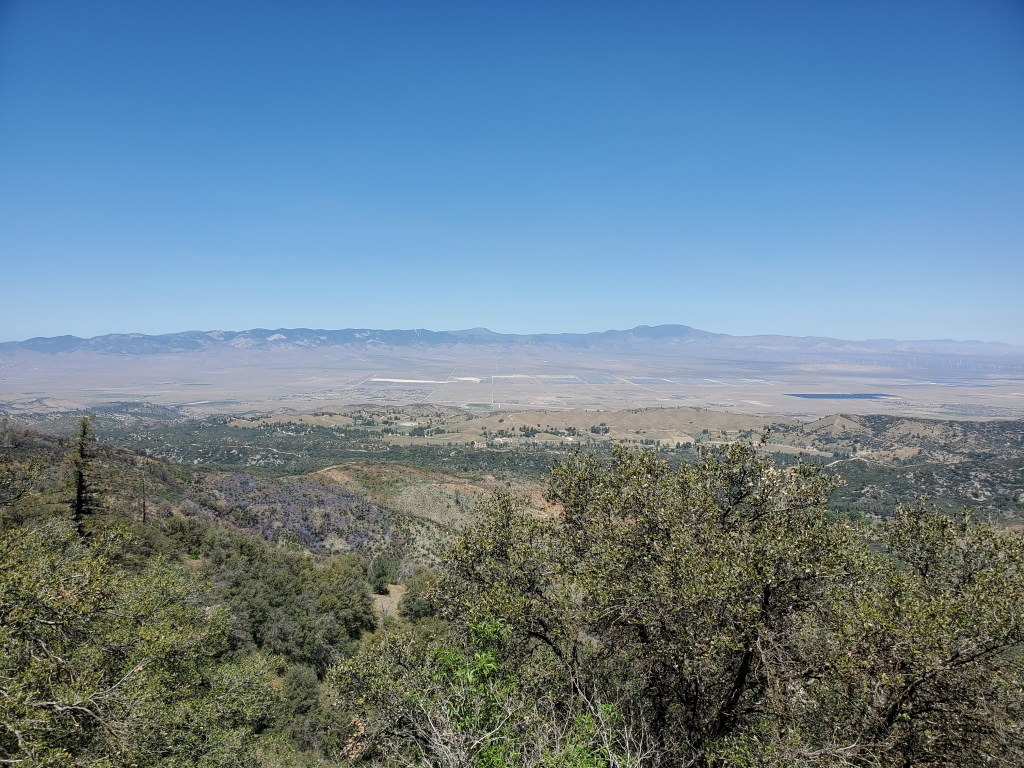
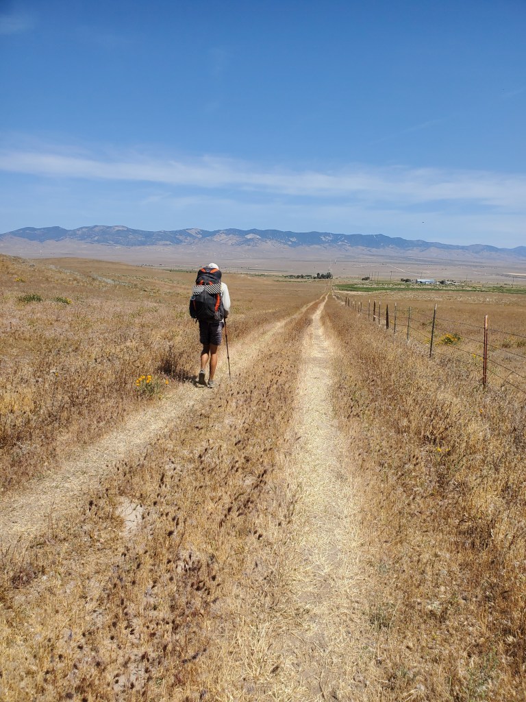
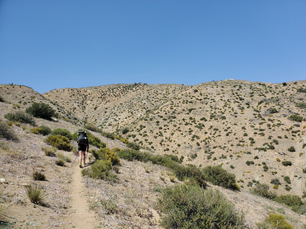
Maggie and I devised a plan the night before, and we think it worked out pretty well. Despite having a long day ahead of us, our longest day yet, we got going at the normal time of 8am. We had 9 miles in which we would descend about 2,000 feet down to the Mojave. The hiking was easy, but the overgrown shrubs scraping my legs and circuitous route of the PCT put me in a sour mood pretty quickly. We cruised down faster than normal to get it over with as soon as possible.
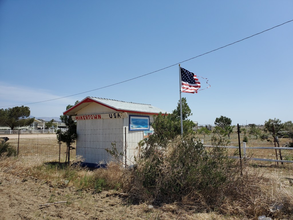
At the bottom of the hill was Hiker Town Hostel, perhaps the perfect pit stop before the aqueduct walk. Part trailer park, part cartoon western town, part Mexican restaurant, Hiker Town was the key to our plan. We arrived a little after 11am, signed the log book and took a look around. Plenty of hikers were hanging out under a shaded gazebo. “Well, well, well… Look who we have here,” I heard behind me. Rev, one of the guys in the Wolf Pack, poked his head out of a trailer window when he saw me. They had stayed there the night before. He invited us in to hang out and take a shower. What a nice surprise! I ate lunch while Maggie rinsed off, and I followed, frantically trying to get clean before the noon check out. We milled around for a bit when an old gold minivan pulled into the driveway. A load of hikers, more than there were seats, clambered out and a load of new hikers piled in, Maggie and I included. This was the shuttle to Neenach Market, a little convenience store and restaurant down the road. We got a few snacks, Maggie got a veggie burger for lunch, and I got some teriyaki noodles for later. The beer was very tempting, but we thought it wasn’t the best idea before hiking another 18 miles through the desert. Back into the golden shuttle and we were returned to Hiker Town for the rest of our siesta.
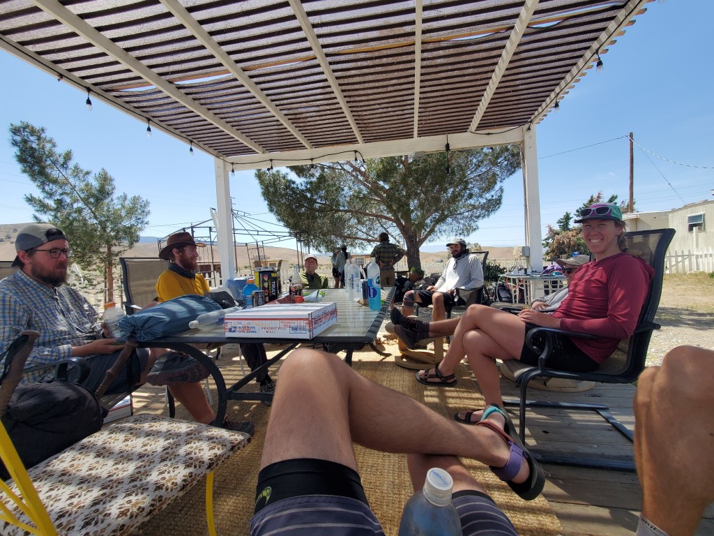
Everyone seems to agree that hiking the aqueduct in the middle of the day is not a good idea. No shade and low elevation makes for a hot walk. At least it’s fairly flat. Most folks traverse the Mojave very early in the morning, or at night. Maggie and I opted for the latter. We sat around the gazebo, talking with hikers from all over the country and the world, to rest up and let the sun get closer to the western horizon. It wasn’t terribly hot, upper 70s, with a steady breeze coming in off the Pacific. We filled up on water and got back on trail at 4pm. We were the first to leave for the evening.
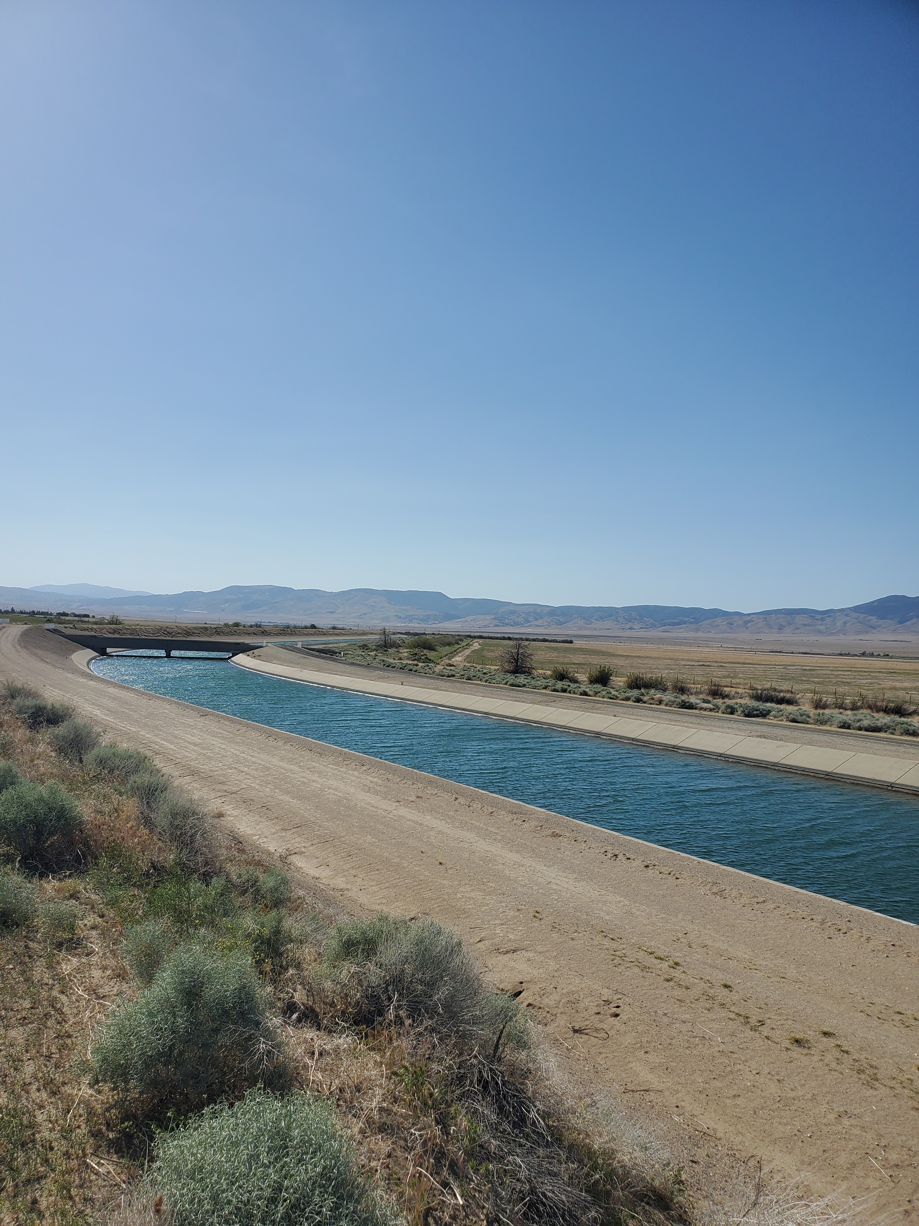
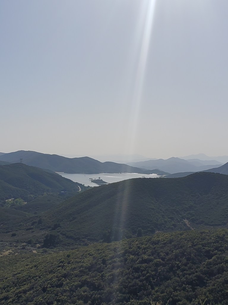
A few farms and fields later we came upon the first aqueduct, Governor Edmund G. Brown aqueduct to be precise, which is open to the air. A concrete lined river of blue in the most arid environment imaginable. It’s feels equally amazing and entirely out of place. Turns out this water feeds Silverwood Lake, where we hung out on the beach two weeks before. A short distance later and we were at the pipe. L.A. aqueduct.

Imagine you had a nice plot of land with a stream, a lake, and a humble farm. You have everything you need and the water is great for your crops. Now imagine that some folks upstream of you sell their land to a mysterious person from out of town. Soon after, this stranger sells his water rights to a developer building a water park 250 miles away. They build a pipe and take all the water, leaving you high and dry. Turns out that stranger upstream had worked for the water park before, and he profited nicely off the sneaky land grab. The water park gets built and they advertise for everyone to come, and they do. Even the president of the United States is on board with this fancy new water park!
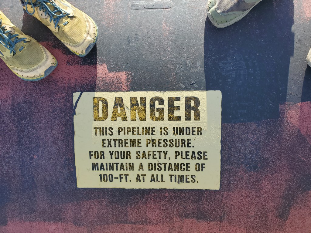
This is, in a nutshell, how the L.A. aqueduct got built, except instead of a small farm, it was the entire Owen’s Valley, east of the Sierra Nevada mountains, and rather than a water park, the city of Los Angeles grew from a scummy little desert town to the smoggy metropolis it is today. Needless to say, it made a lot of people very upset, and it has left the Owen’s Valley nearly uninhabitable. I was fun to walk on this not so little piece of history and to think about the residents of Owen’s Valley blowing up this very pipe with dynamite.
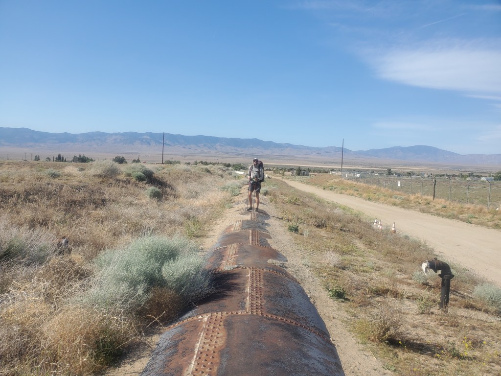
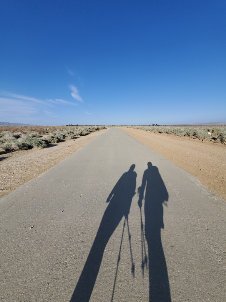
We put on podcasts and entered a trance of walking on the 8 foot wide pipe. Two steps per segment, welded and riveted together like a giant rusty snake scales as far as we would see. It only adds insult to injury knowing that thousands of gallons of water are flowing just inches below our feet while we carried 4 liters across this dry, 18 mile section of trail. California quail and ravens seemed to enjoy the view atop the pipe with us. Joshua trees, wind turbines, and solar farms were lit up by the low the evening sun. I lost all track of time, but my hour long podcast ended near the end of the pipe, meaning we had walked about 3 miles mostly on steel.
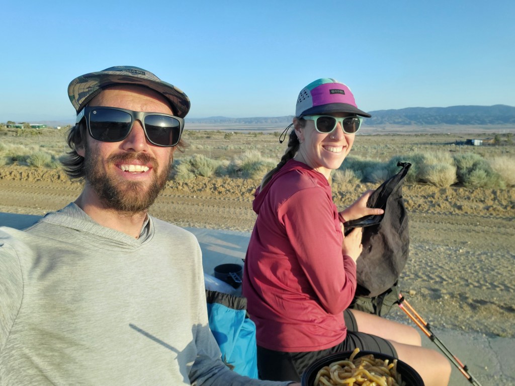
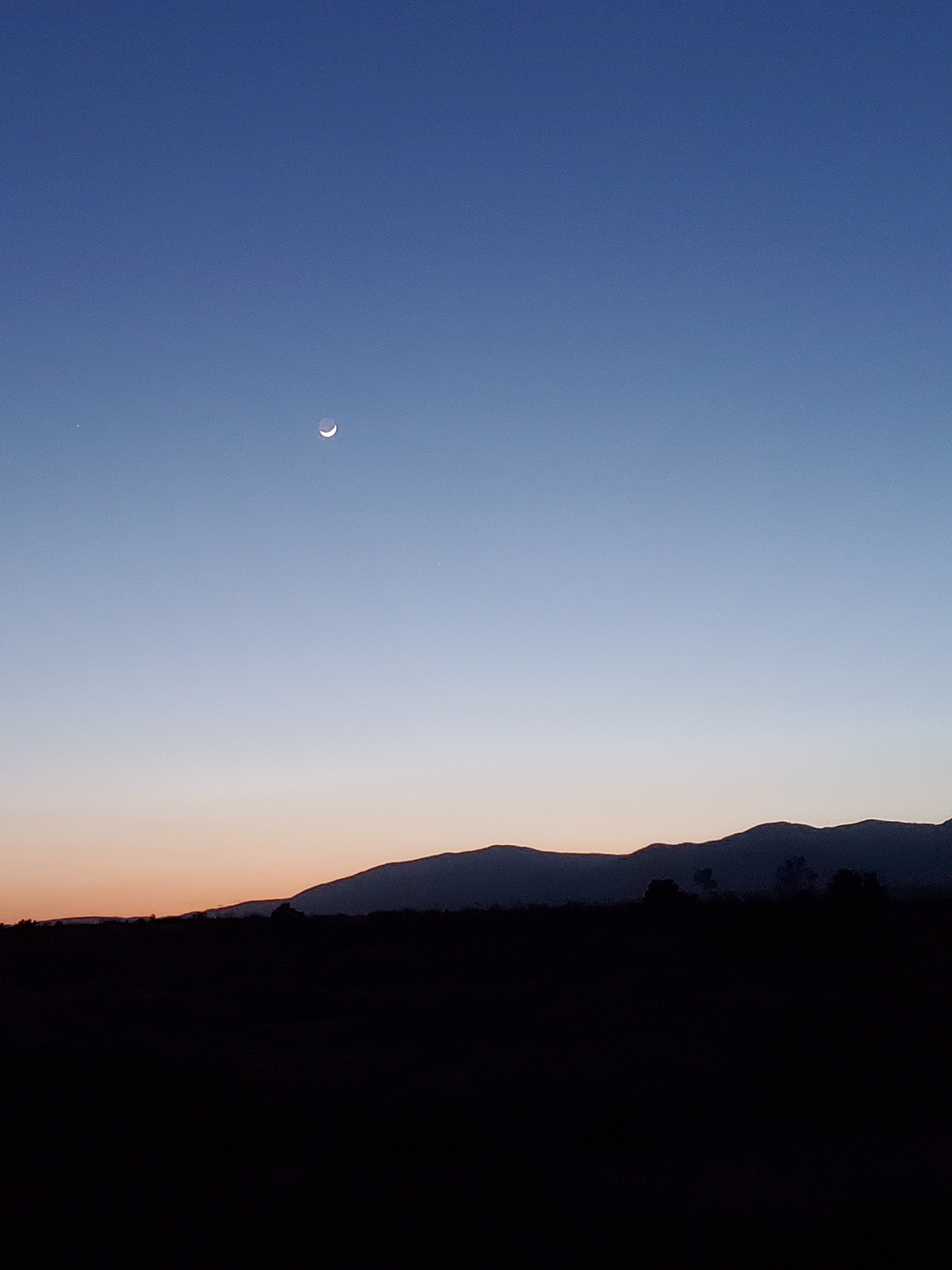
The pipe gave way to what resembled a paved concrete road, but this was just a continuation of the aqueduct. We walked a little while longer before stopping for a sunset dinner at 7pm having covered 9 miles since Hiker Town. We felt pretty good. Progress was fast on this level ground, but the concrete and steel definitely felt a bit harder on our feet compared to the dirt. The waxing cresent moon became apparent in the orange glow of where the sun once was. This sliver of light would dip below the horizon soon too, meaning we would be hiking with our headlamps for the rest of the night.
We got moving again at 8pm, full of food and a dash of caffeine to stave off tired eyelids. Obviously there’s not much to see in the dark. It was mostly heads down, walking as fast as we could to get to camp. Movement on the side of the road piqued our interest – a kangaroo rat! We must’ve seemed like aliens to them, towering dark figures with blinding lights, but they did not scurry away.

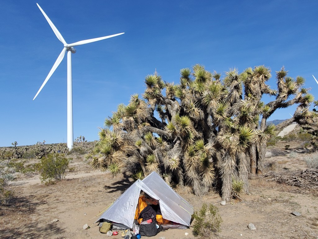
Silhouettes of large Joshua trees loomed overhead like fuzzy figures out of a Dr. Suess book. We crested a small climb and the wind turbines made themselves apparent with red lights blinking in unison 300 feet above ground, which looked like aliens to us. That’s where we were headed. We talked and walked into the night. The trail finally left the aqueduct and we were close to camp. We found a flat spot next to a large family of Joshua trees at 11pm. The wind was picking up again, and so were the turbines. It was loud, the say the least. Imagine a jet plane flying less than 1,000 feet overhead, add in a little electro-mechanical whirring, and the occasional dive bomb whistle sound and you get the lovely cacophony of wind turbines spinning at full speed. Thank goodness we had earplugs. Beat from our first marathon on trail, we slept.
Day 37 – 15 miles/550
We began stirring, the sun already high and shining brightly through the translucent white tent walls. A bit bleary eyed from the long day, we got going slowly. The wind turbines slowed down a little, giving us some relief from the noise.

On trail at 9:45, it was already quite warm. We weaved our way through the rest of the wind farm, slowly climbing into the Tehachapi mountains. I can’t say we were thrilled about our situation – sleep deprived, broiling, and hiking uphill. A few small mariposa lillies provided something pretty to look at rather than the towering wind turbines, but otherwise it was just slow going.

It was 6 miles to a small creek, salt caked on its dry banks. We got water and stopped for lunch. The Wolf Pack was already there, sprawled out under the only decent shade tree. They made room for us and we talked about our experiences on the aqueduct, as if we had just come from a foreign land. Most folks got going while Maggie and I extended our siesta. It was comfortably 2 days of hiking to get to the town of Tehachapi (te-HACH-a-pee), so we weren’t in a rush to cover lots of ground. While we were at least out of the wind farm, the scenery was nothing special. The usual lupines and phacelias dotted the ground, plenty of lizards scurrying away, but it felt like some of the most arid land we had been through yet.
We continued for a few miles before one last big climb. Part way up, we saw the Wolf Pack taking another siesta under a tree. I was surprised to see them since they planned to hike 17 miles after lunch to get to Tehachapi ASAP. They were spent, and so were we, but we pushed on. We took plenty of breaks on the way up the mountain, constantly checking our position and how far we had to go. It was getting close to 5pm, we were getting close to the top when we came upon the mile 549 water cache. Most water caches so far have just been piles of gallon jugs, which is fine, but a Tehachapi local maintains this cache and adds a bit of his own flair. The water was in two plastic 55 gallon drums, folding chairs and umbrellas were provided, and a handful of small metal boxes contained various snacks. While everything I’ve learned over the last three decades would suggest eating random food in the wilderness is a bad idea, I had a coconut macaroon and melted into a chair. This was an amazing and unexpected oasis after a tough day. The Wolf Pack caught up to us, and we all went another three quarters of a mile to camp in a lovely little spot between pinyon and Coulter pines. Tent, dinner, bundled up and we were dozing off by 8.
Day 38 – 9 miles/559
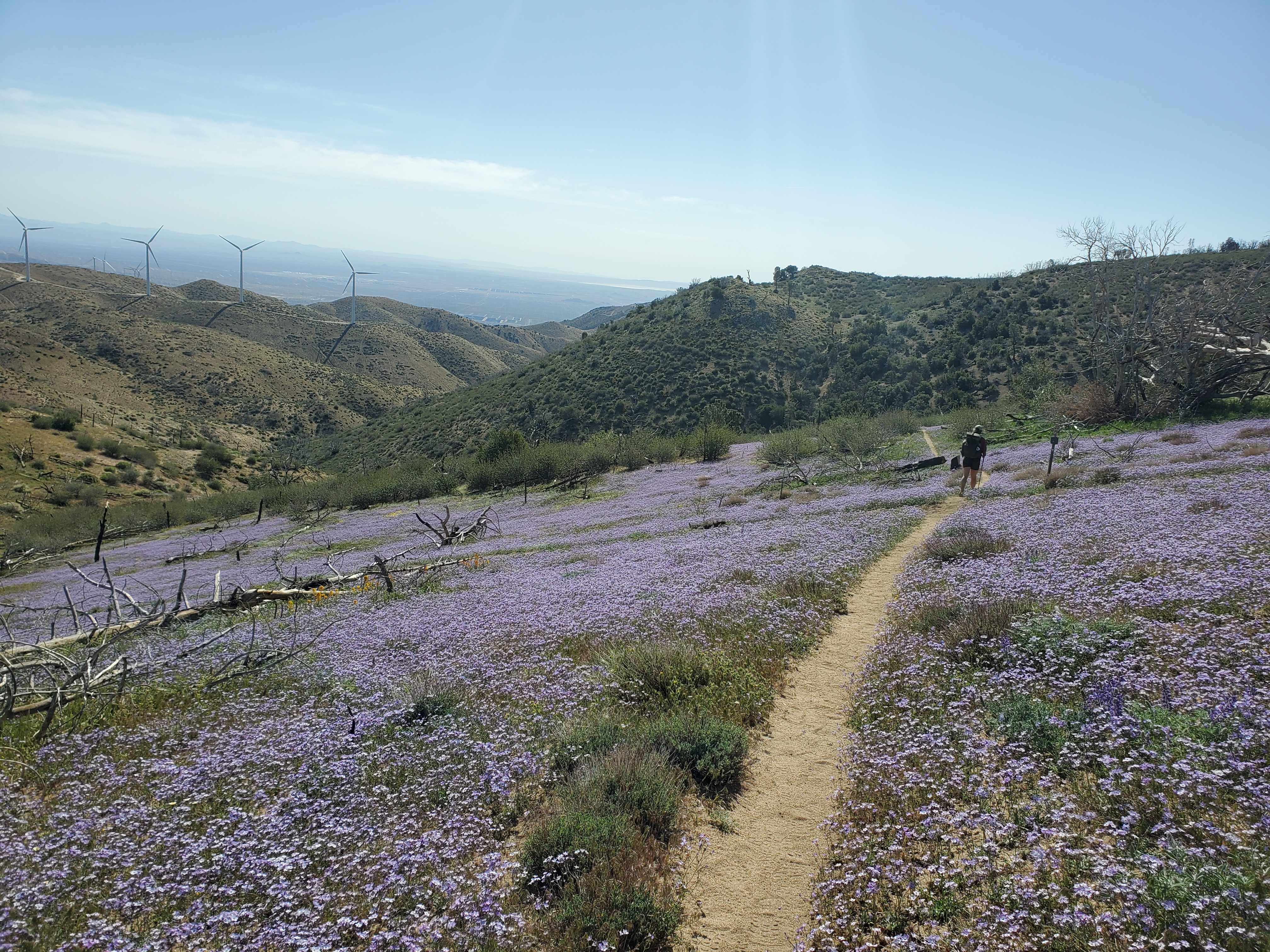
We originally thought we had to hike 15 miles to get to Tehachapi, but we learned it was better to hitch from a road only 9 miles from camp. With a short distance to cover, we were in no rush getting packed up, but we still managed to get going just after 8am. The trail took us down the north side of the mountain, back into the wind farms. The flowers were amazing!
We tried to move quickly, but I was worn down. We hadn’t taken a proper zero since Big Bear. The couple of nearos in Cajon and Wrightwood were nice, but they don’t really allow your body to recover from the endless miles and pack weight. Snaking down the hill, we finally got to the road. We saw a car in the lot and two hikers had just walked away. We approached, cautiously optimistic we could get a ride. “You two going to town?”, the old man asked. We happily confirmed and he said, “Great, I finally got some hikers! Everyone else already had rides.” JC, a retired local, likes to give rides to hikers, and we happened to be in the right place at the right time. On the way to town, he filled us in on all the restaurants we should check out and how to get around town. JC dropped us off at our motel. Lunch, showers, laundry, liquor store- the usual town routine.
We linked up with a couple we met on our first day and got sushi for dinner. Afterwards, we met up with an Austrian couple staying a few doors down at the motel. The four of us sat on our bed and talked late into the night, which is 11pm for us hikers. It was really nice to get some genuine social interaction with each of these couples, something we felt slightly deprived of in recent weeks. We slept on the firm springy bed, the freight trains across the street blasting their horns for us several times in the night.

One response to “Desert Haze – Acton to Tehachapi”
Very nice trip, descriptions, and photos. I enjoyed them!!
LikeLiked by 1 person