
Day 51 – 20 miles/722
We got an early start, awake at 5am, packed and ready to go at 7. We got a ride in the bed of a truck from a Grumpy’s employee and we were back at the PCT. We set off with the Austrians, a party of four.
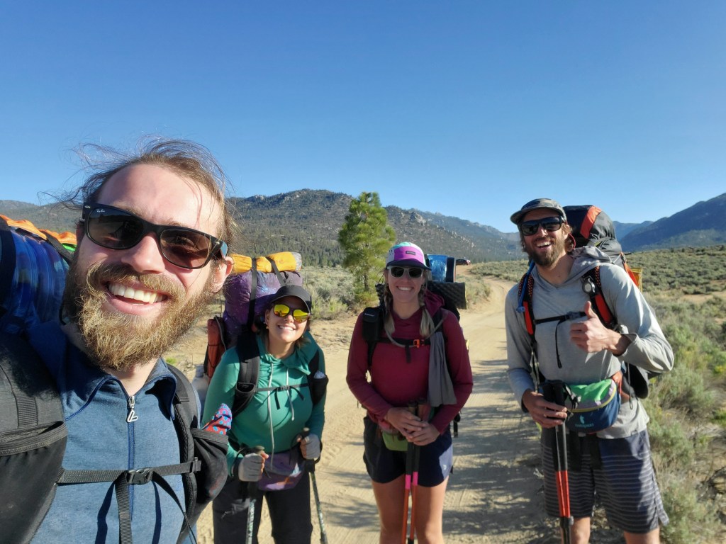
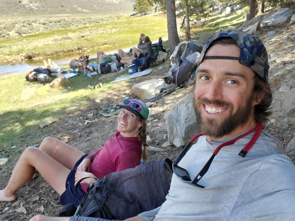
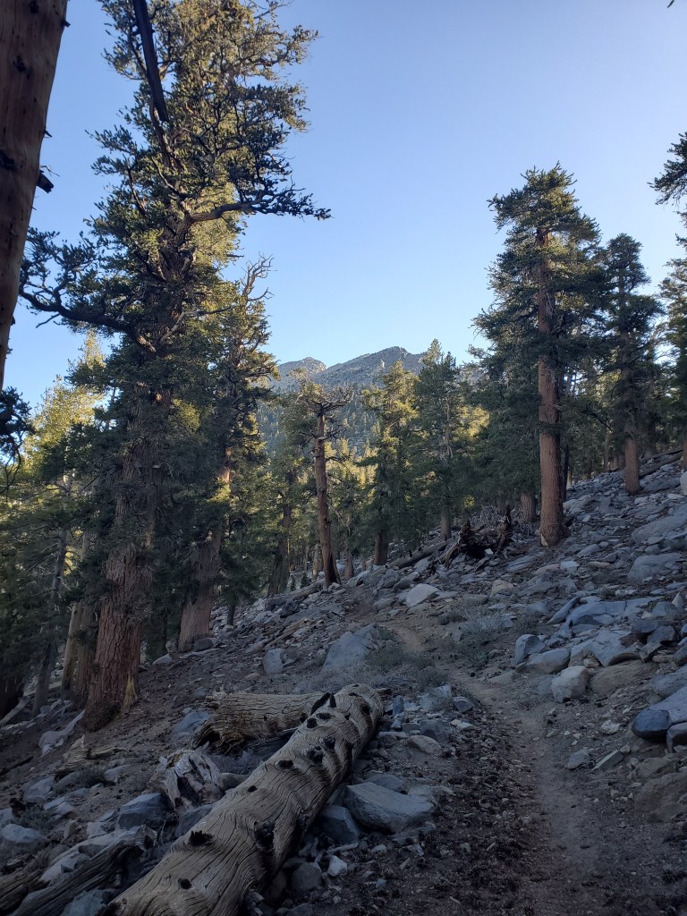
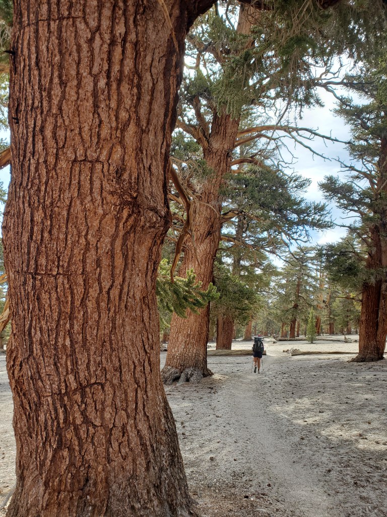
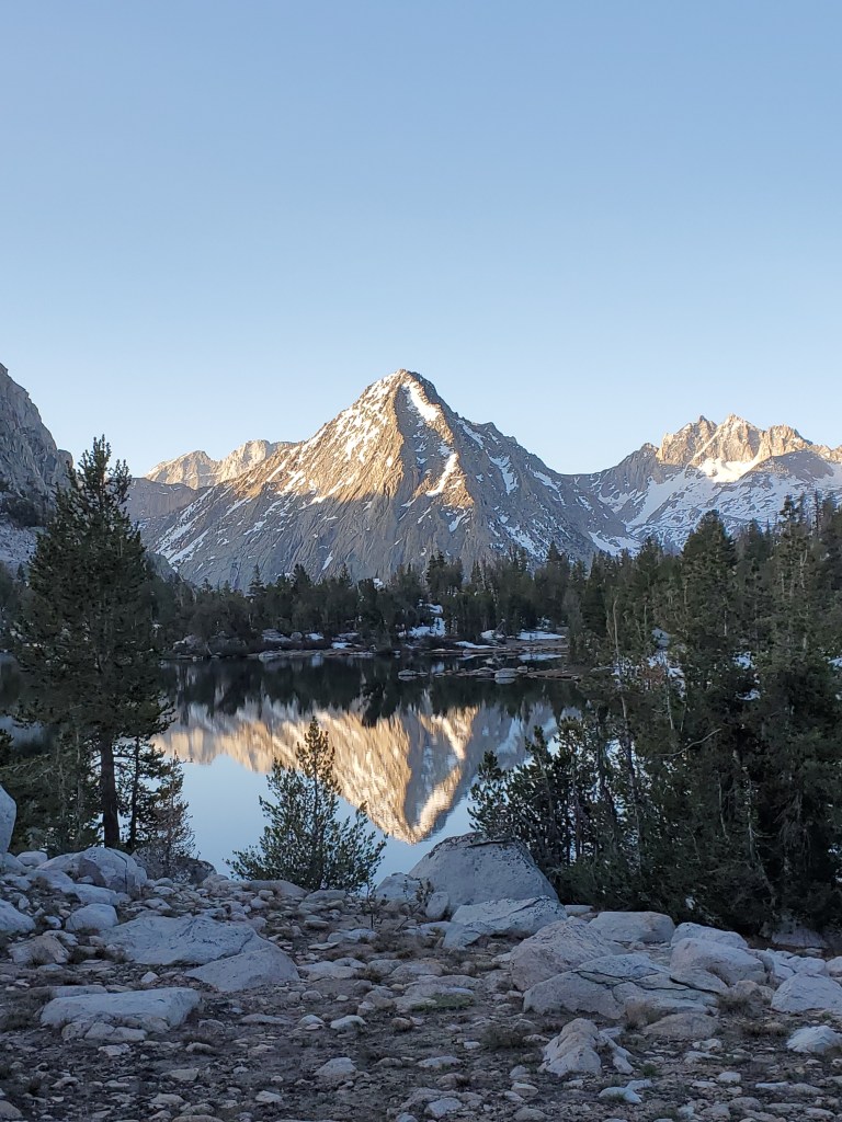
Spirits were high as we entered the Sierras, although it was definitely a couple miles of desert still with a sandy trail, pinyons, and cactus. Then began the long climb, it would be about 5,000 feet up over 20 miles. The grade was gentle, hardly steep enough to breathe heavily. The Austrians fell behind, feeling aches in their new boots, and discomfort with the stiff, heavy bear cans. We walked through an old burn scar before getting up to 8,000 feet where it finally felt like we were in the mountains. We had lunch under the shade of the first few lodge pole pines. We continued on through pine forest overlooking a grassy valley, which reminded us of Valles Caldera in NM. We made it to the bridge over south fork of Kern river. There were wonderful grassy banks, where we chilled for awhile with other hikers and dipped our feet in the water.
We gleefully snacked with our friends, but looking at our food we packed out for the week ahead, the realization was setting in that we didn’t pack enough snacks. We daydreamed of sending our moms a grocery list of food to mail us, signed “Hungrily yours, Russell & Maggie…” There was at least a trail we could exit early if things got dire. We hiked up the last 5 miles. I got hungry and my mood turned south. I hesitantly ate a cliff bar despite trying to ration. There were big ponderosas to admire along the drainage we followed on the final climb. The views were opening up as we approached 10,000 feet. Near the end of our hike, we eagerly searched for water, and it at last revealed itself as a very small trickling stream. The sun quickly fading, we set up camp not much further on a sandy spot. There was a great view to the south of the valley we just came from.
Day 52 – 21 miles/743
It was an unusually warm night and morning, can’t complain though. We got on trail at 7:20am, trying to stay on an early schedule. The trail took us over easy terrain on the side of Olancha Peak. Huge lodge pole pines, even bigger foxtail pines, and a few white bark pines surrounded us for much of the day.
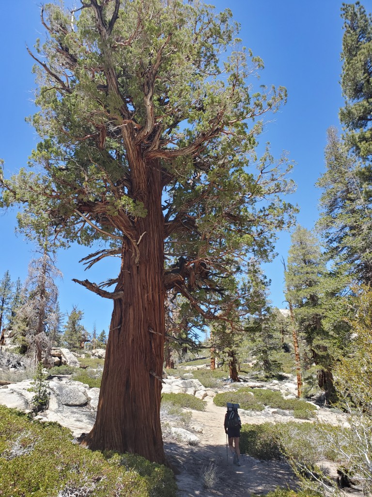
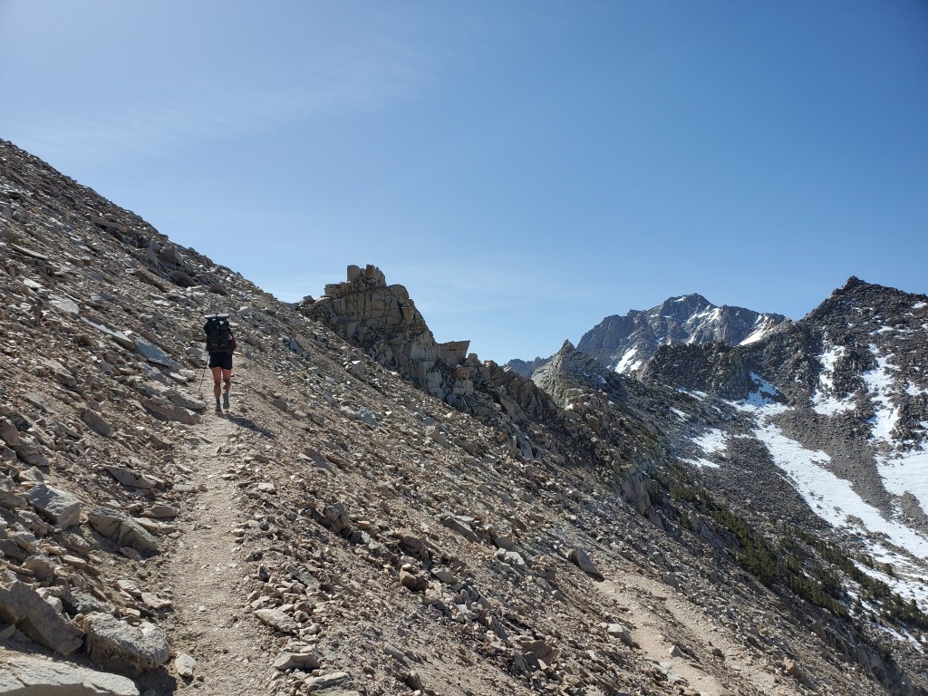
We took our morning snack break and realized that if we maintain ~20 mile days, we will get to our exit point, Kearsarge pass, a day early and we would have enough food. This was a relief in one sense, but it meant physically demanding days were ahead of us. We continued on a gentle downhill to Death Creek for water and lunch. The Austrians were moving slower, they arrived at the creek just before we were getting ready to move. We agreed to meet at a camp site about 12 miles ahead. Onward, we went up a long steady 1,600 foot climb. Big old western junipers dotted the sunny southern slope.
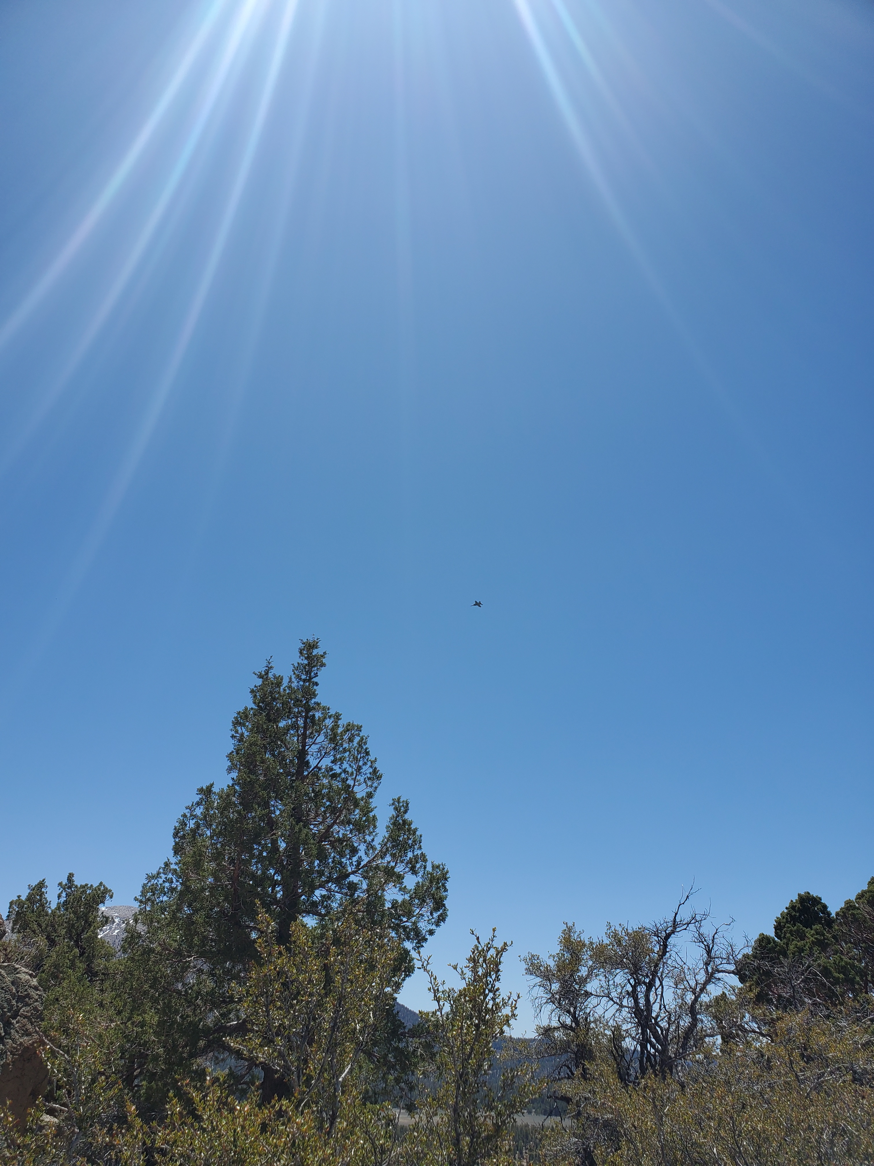
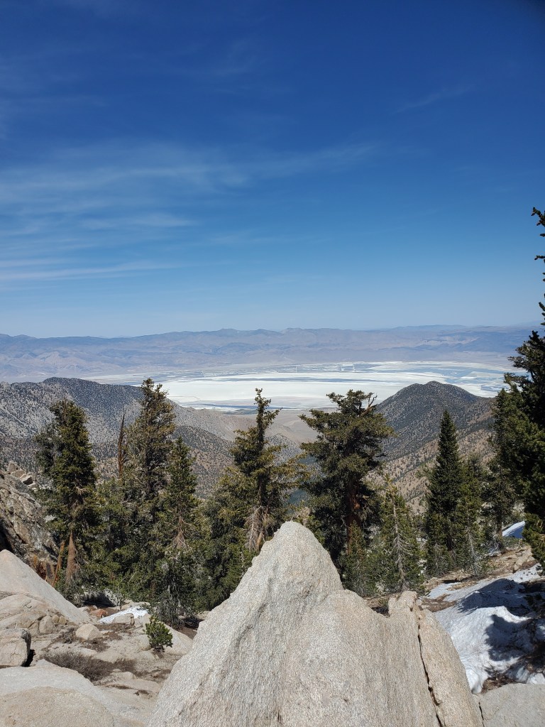
Lots of fighter jets flew in our wilderness airspace, some of them less than 100 feet overhead and doing banked turns and inverted flying. The deafening howl of the jets was somewhat cool for me, but it was very much out of place and a bit discomforting since we weren’t at some big sports event. At the top of the climb, we were rewarded with a view of Owen’s Valley and the former lake that Los Angeles has sucked dry with “the pipe.”
The trail relented on an easy downhill for the last 8 miles to camp. We sat on a large log making dinner, expecting to see the Austrians but they never showed up… We camped alone.

Day 53 – 23(+1) miles/766
We got on trail at 7:20am again. We couldn’t wait for the Austrians if we were to maintain our pace and get to town before our food ran out. It was a sad realization that we might not see them again without getting a proper goodbye… The first half of the day involved a long steady climb through forest dominated by foxtail pine groves. A short side trip took us up to Chicken Spring Lake, the first easily accessible alpine lake on the PCT. We sat and enjoyed the view, the water, and we took a nice hour long break.
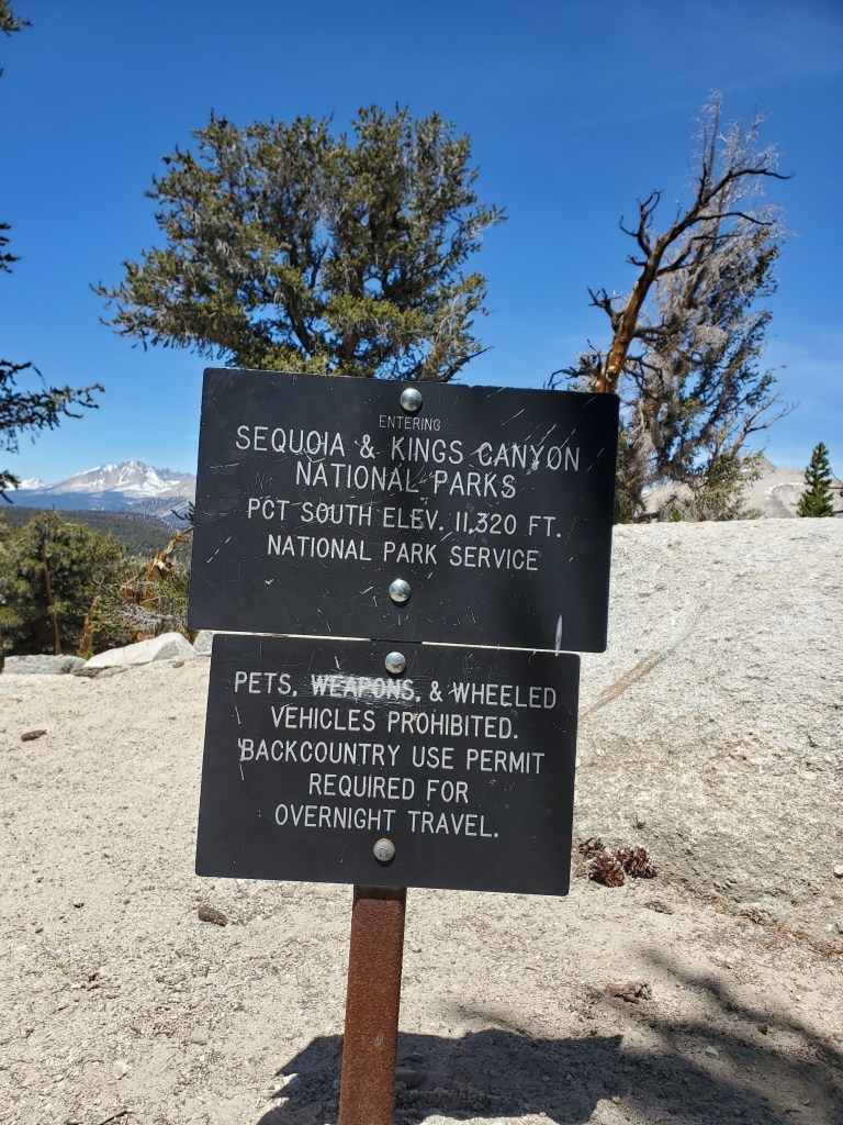
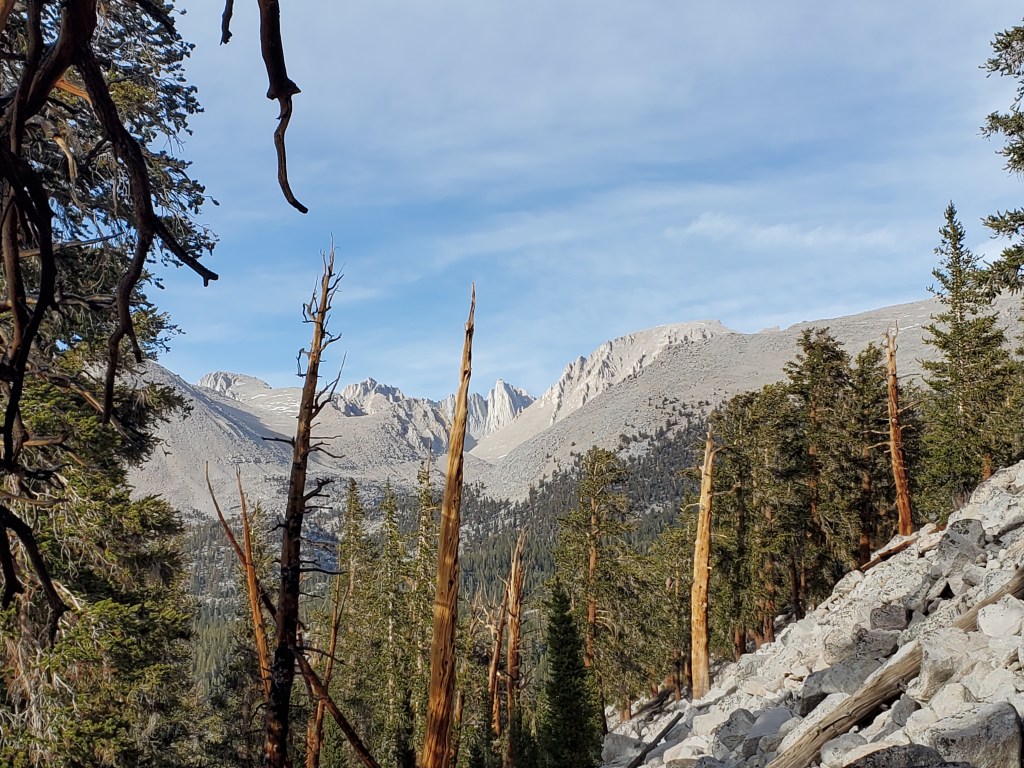
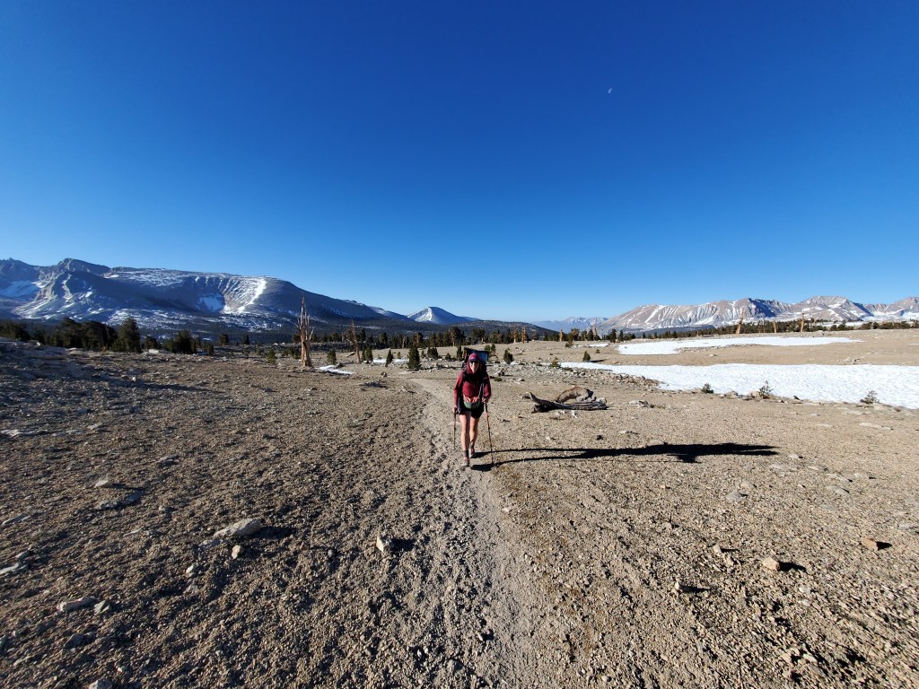
Easy terrain lay ahead, but for several miles, the trail was made of deep, fine sand, making progress feel slow. The views of high peaks in the distance were at least pleasant, enticing us to move north. At some point we entered Sequoia & Kings Canyon National Park. I’ve long dreamed of coming here, but alas, we would see no giant sequoias on our route.
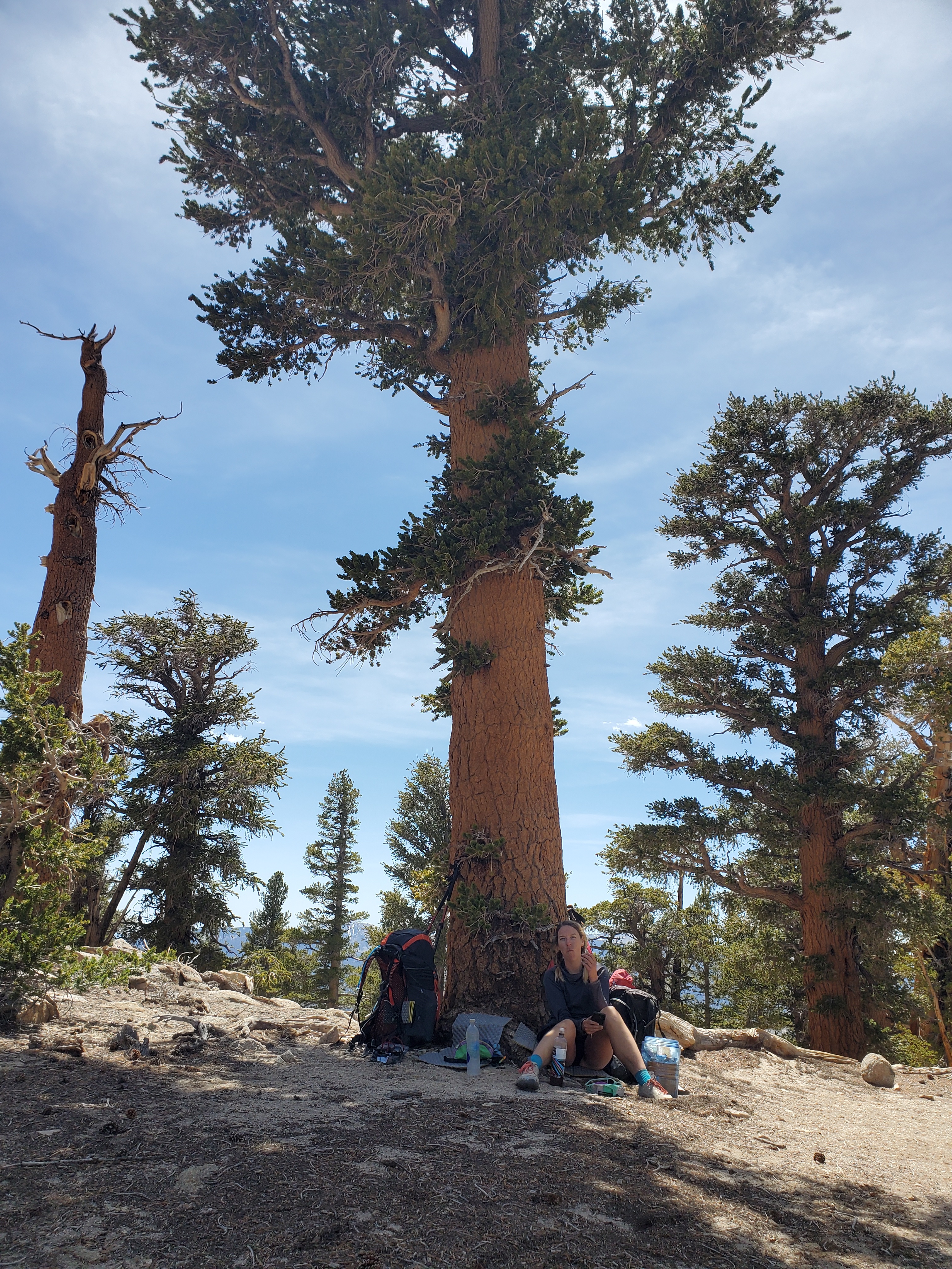
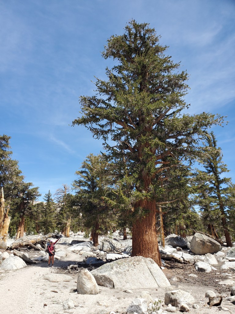
The trail continued down a long easy slope. Moving quickly now, we got to rock creek, the low point of our day. We got water and rested for a bit. We climbed up Guyot pass, which was steep but not as bad as we thought it would be. More giant foxtail pines, all spaced about 50 feet apart on bare granitic sand. Seems forest fires are rare here, allowing these foxtails to grow well into old age.
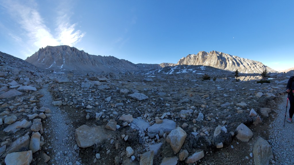
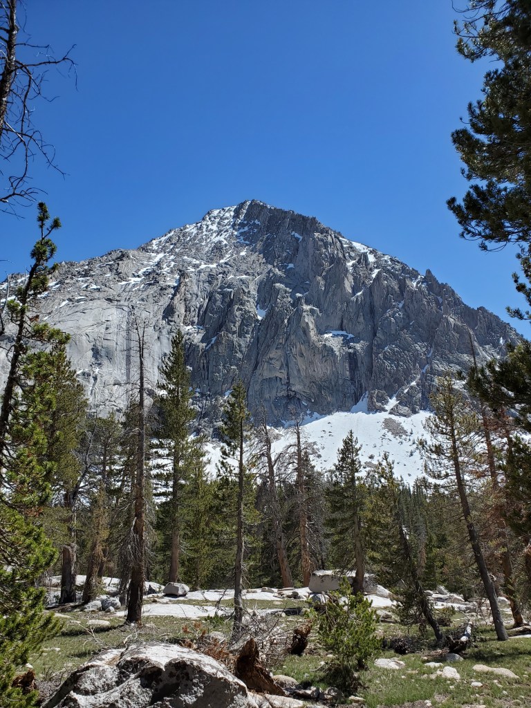
We cruised to the Whitney Creek trail and up to Crabtree Meadows for the preeminent side trip of the PCT – Mt. Whitney, the highest peak in the lower 48.
At the Crabtree Meadows campsite, a calm tension was in the air. Lots of hikers were already in camp but everyone was strangely quiet and in bed by 7:30pm. Most folks were going for sunrise on Mt. Whitney, waking up close to midnight. We stayed up later than most, aiming for a 6am start.
Day 54 – 4(+15) miles/770
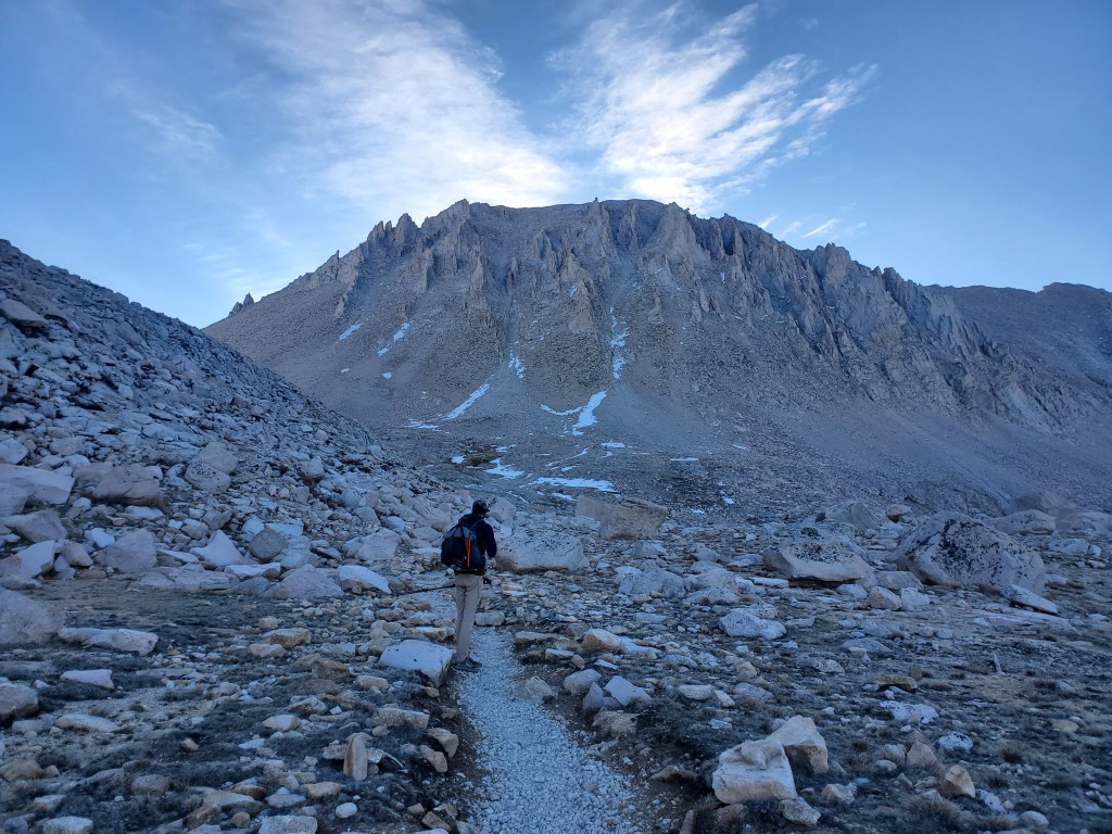
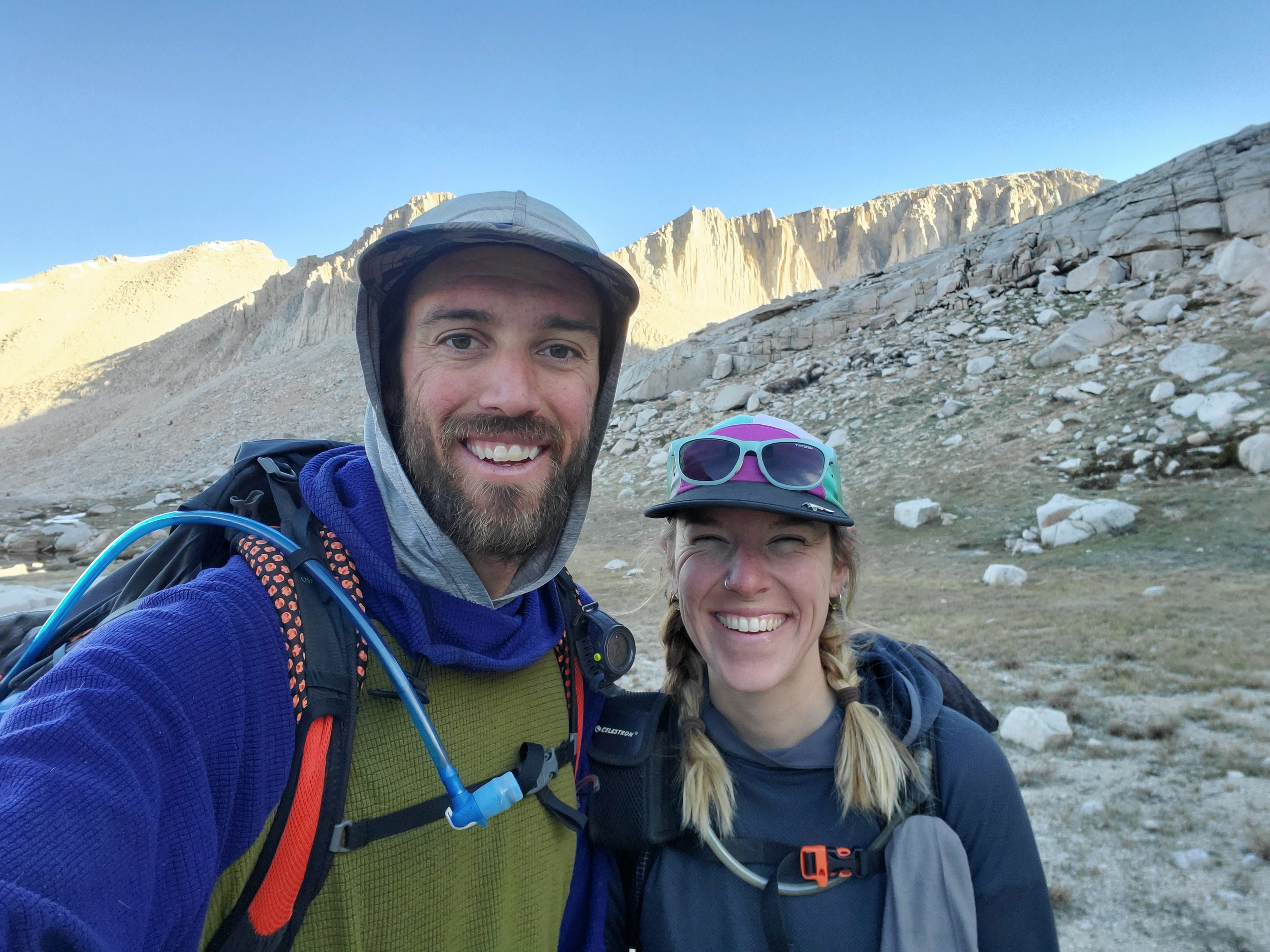
Summit day. We were awake at 4:15am, on trail at 6. As we hiked up, the sunlight brightened against the tall granite walls all around, while we remained in the shadows of Mt. Whitney’s western slopes. The scenery was awesome, to put it simply.
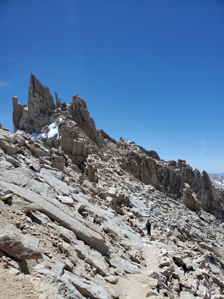
We got past Guitar Lake around 7:30 when we saw the first hikers coming down from the sunrise summit. They all sounded joyful to have experienced sunrise above 14,000 feet, but they looked haggard and frozen from their dark windy hike. The trail continued up gentle switchbacks. We made it to top of the ridge at 13,450 feet, 2 miles south and 1,055 feet shy of the summit. The trail was well built and maintained, even at this altitude. There were very few sections of talus, a bit of a surprise compared to our experience on Colorado 14ers.
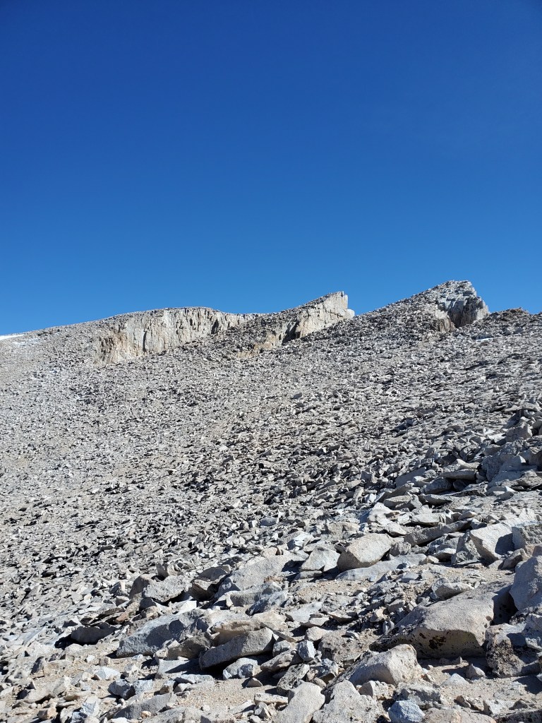

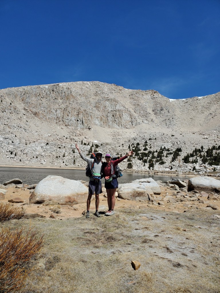
It was chilly and the wind was blowing steady 20 mph up top. We layered up for the final ascent. I got hot and hungry near the top, fearing altitude sickness might be setting in, but I cooled off and I was ok. For looking like such a fearsome peak from below, the summit is actually quite broad and flat. The highest point between Northern Canada and Southern Mexico, we found ourselves on top just after 11am. The view was spectacular, the vastness of the Sierra Nevada finally revealed.
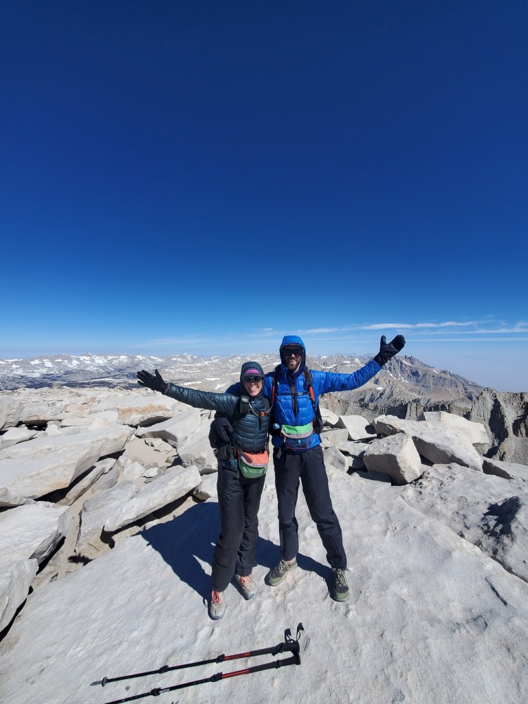
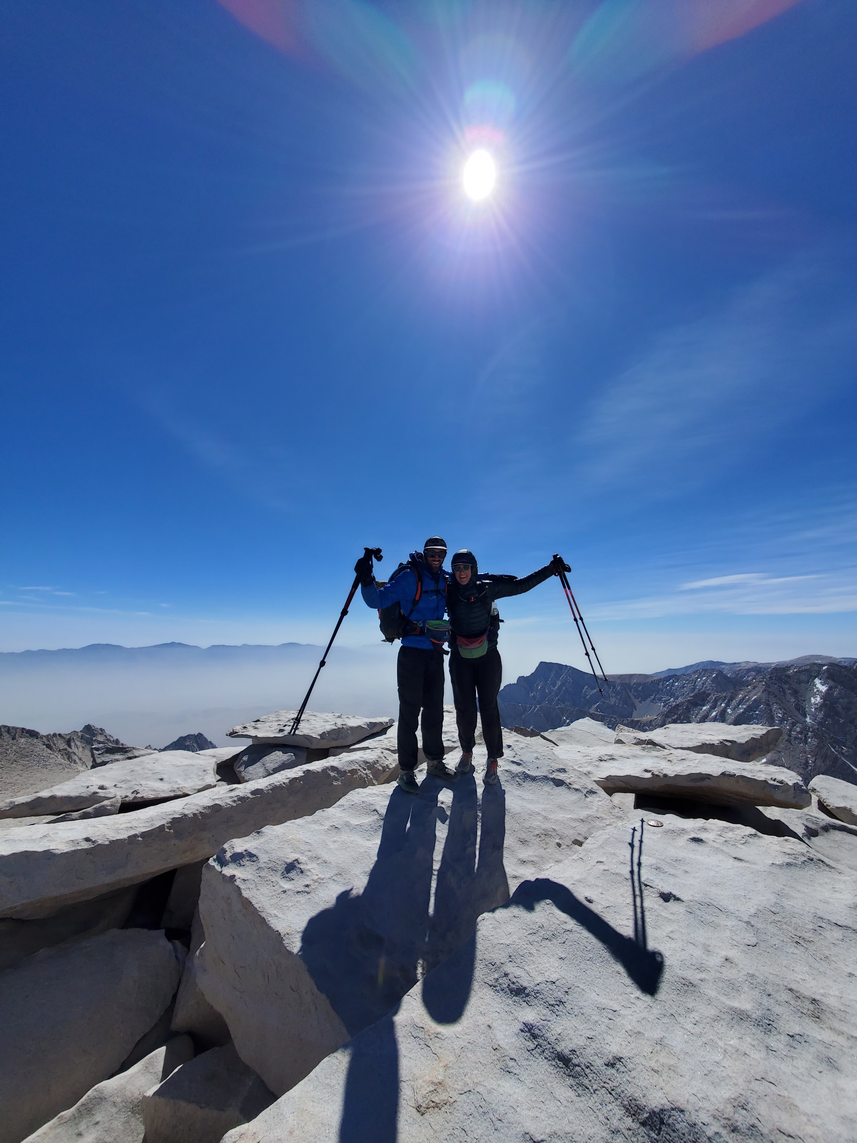
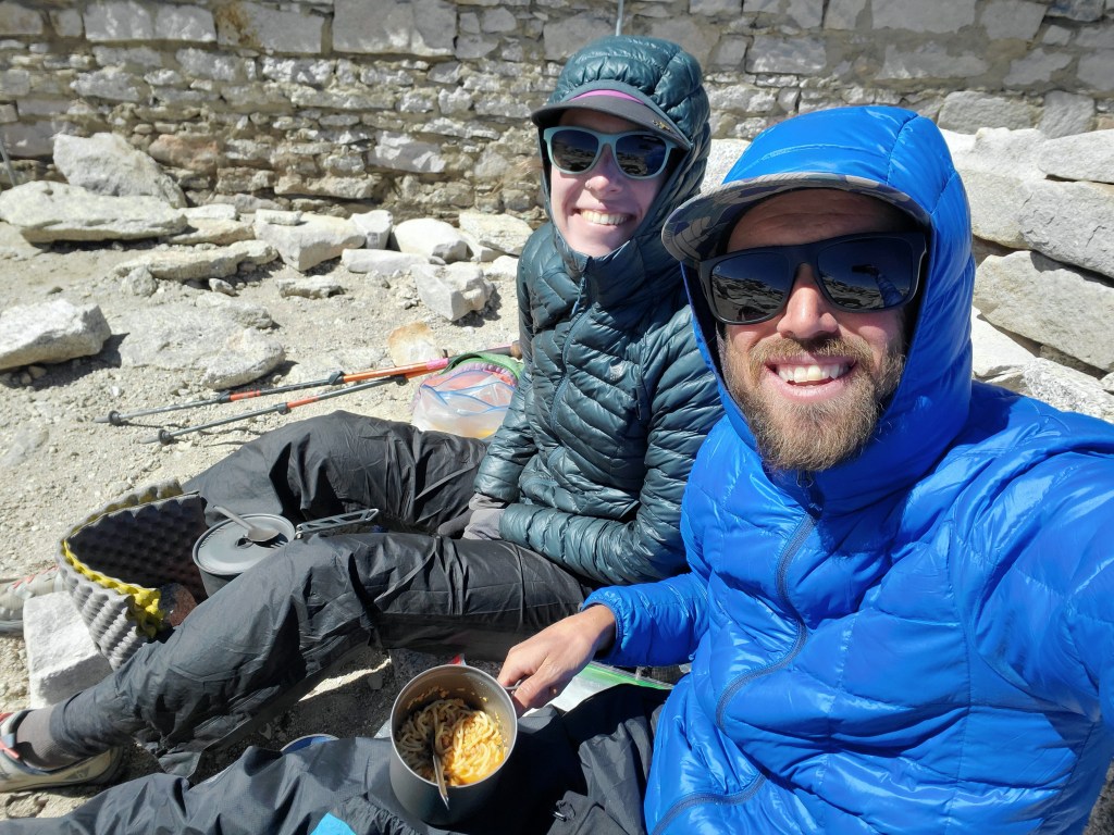
We got some quick pics at the summit then went to shelter behind a modest rock wall, protecting us from the worst of the wind’s icy bite. We made hot lunch, Thai noodles for me and ramen for Maggie. We took pics for others as they reached the summit, hanging out up top for just over an hour.
We cruised down, since the peak was only part of our hike for the day. I felt good until the last 3 miles. Sore ankles from 4,000 feet of vert and hungry from rationing food. That said, the west route up Mt. Whitney kind of felt too easy for a 14er, pretty much Class 1 hiking. Other hikers expressed similar feelings. Maggie and I agreed to come back and attempt the mountaineer’s route, as well as the east ridge of Mt. Russell, another CA 14er next to Whitney.

We got back to camp at 2:40pm and snacked and chilled for an hour. Packed up and got back on the PCT at 4:40pm. We hiked a few rolling miles to a stream to get us closer to Forester Pass. While cooking, I spilled about half my dinner… It was demoralizing after a challenging day and knowing that food was tight. I scooped up what I could from the ground, wondering what in the heck I was doing out here.
Day 55 – 18(+1) miles/788
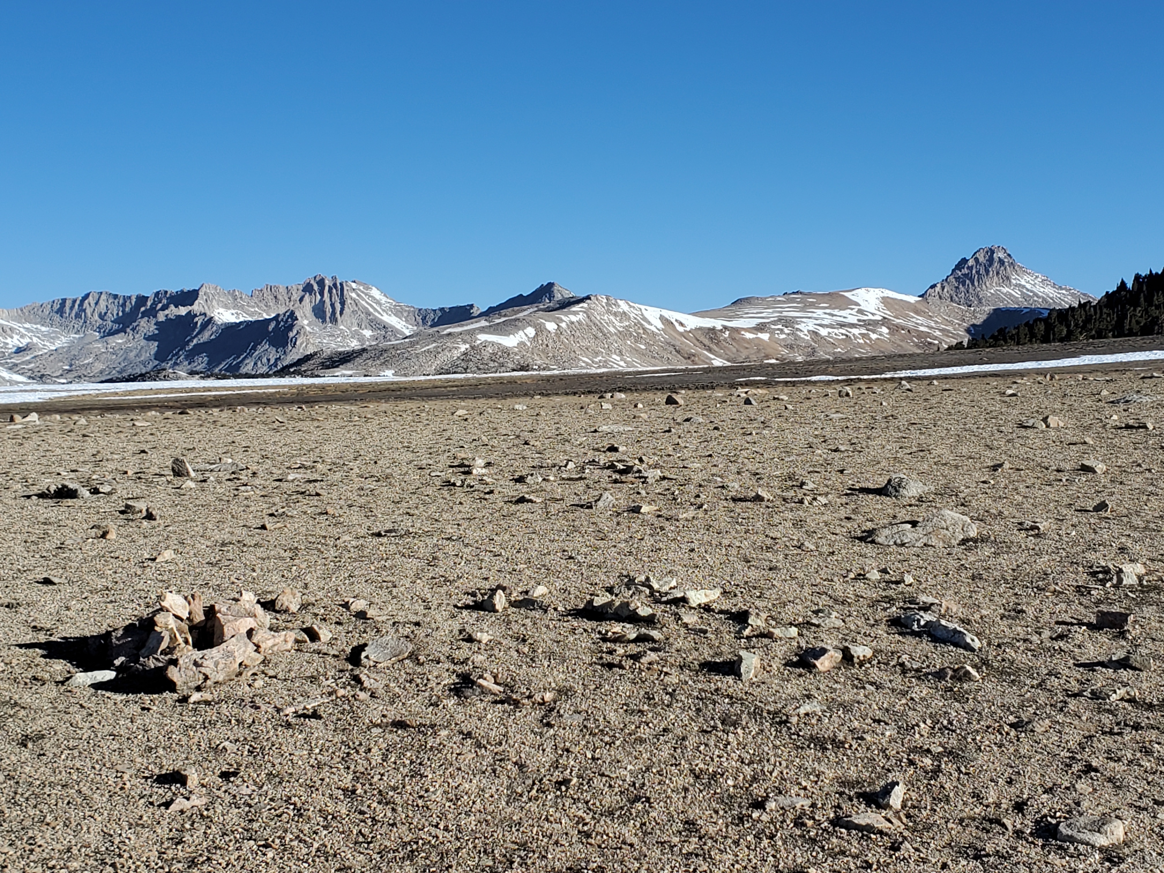
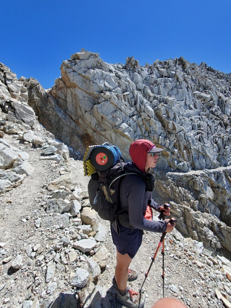
4:15 wake up again. We needed to get over Forester Pass while the snow was still frozen, which was 9 miles away. We were on trail at 6:15. The both of us got wet feet crossing icy streams within the first two miles. Being tired and worn out from the day before, wet cold feet put us in a sour mood to start. The trail took us over a few easy miles just below treeline, slowly climbing. We crossed Bighorn Plateau, which felt like the moon, barren and lifeless.
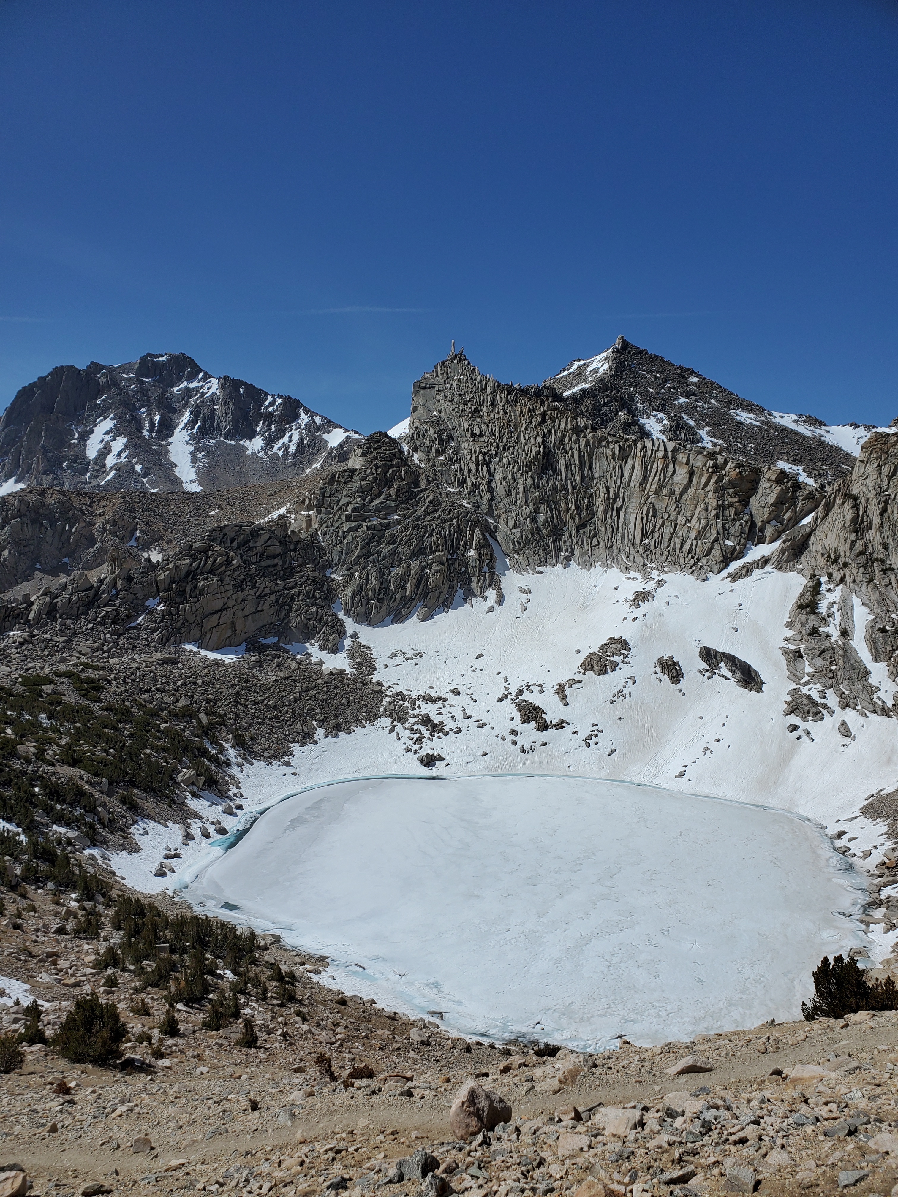
The trail dropped down to Tyndall Creek, for more wet feet, an unusual feeling after 7 weeks in the dry, hot desert. At last, a big climb began towards the pass. Gorgeous cliffs and peaks towered all around. We got a few snacks in us and water break amongst the last few trees. Onward, we traveled over our first snow patches since Mt. Baden-Powell. A handful of other hikers ahead of us showed the way.
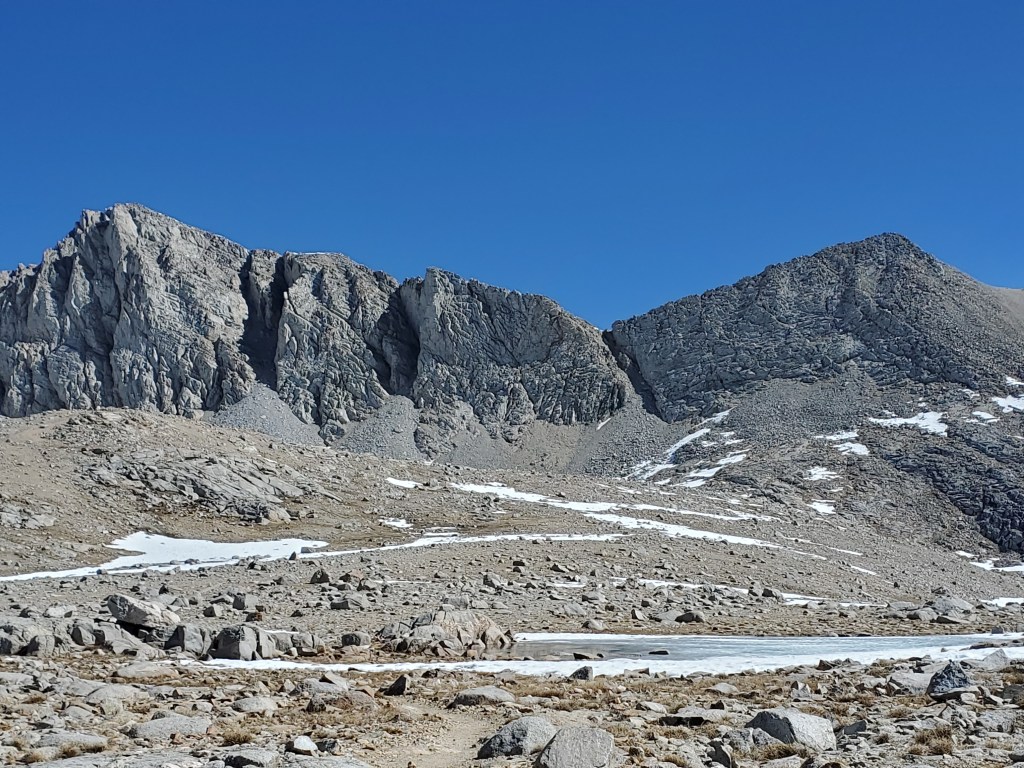
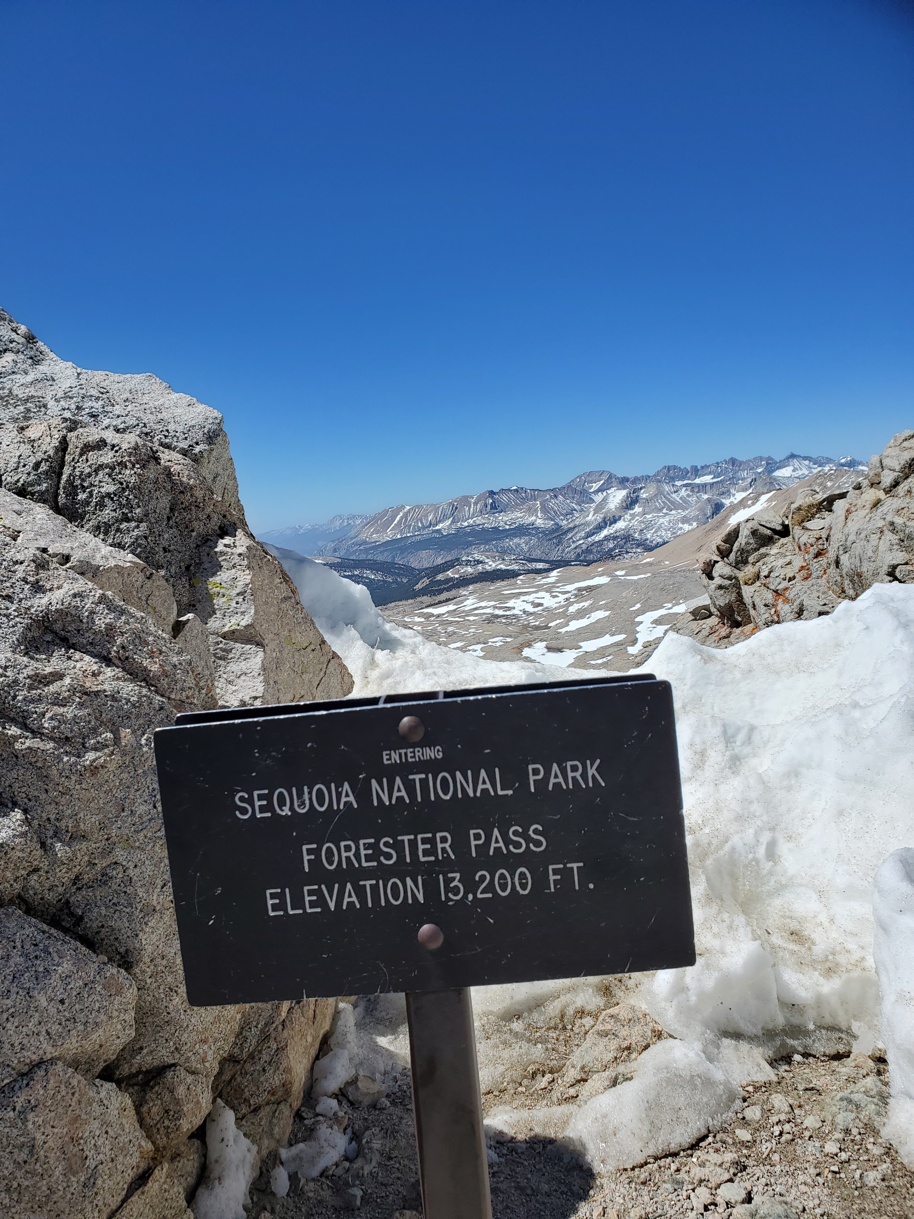
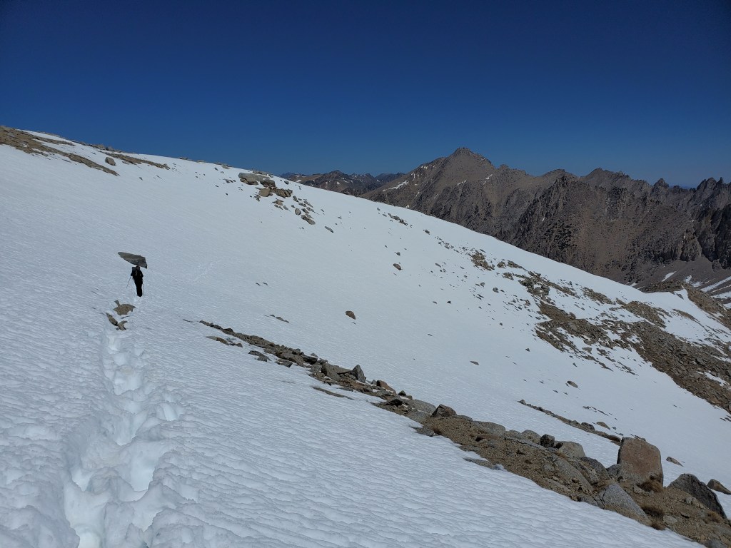
The headwall was short and steep, but a manageable final climb up the switchbacks. Cresting over the top, the official high point of the PCT, we finally got the view into the next valley which was absolutely stunning. We put on microspikes and rain gear then got the ice axes in hand to glissade down north side of the pass. The slope was reasonable with a safe runout, clearly many had gone for a ride before us.
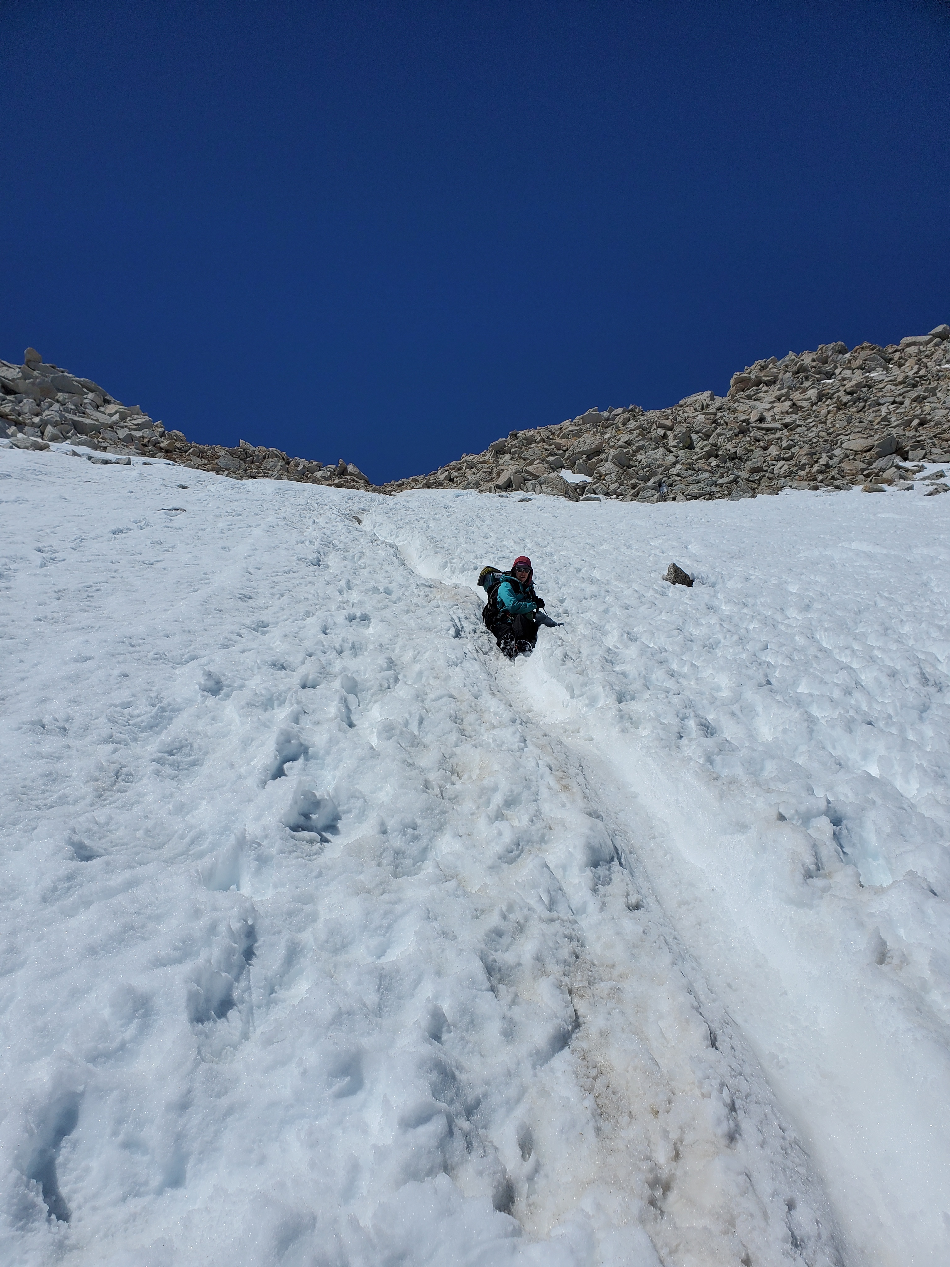
We slid down most of the way, with a couple postholes when walking. Our feet were wet again, but we had accepted it by now. We swapped the axes back for trekking poles and continued across the low angle snow.
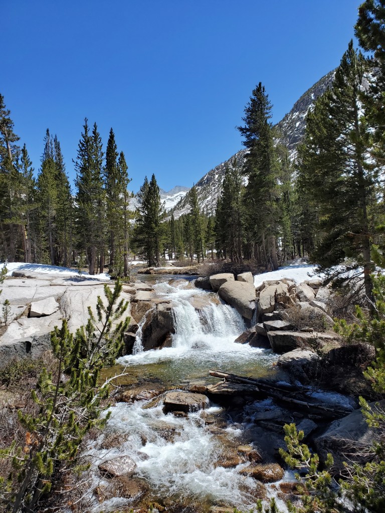
The trail weaved down the ridge to a grassy spot by the creek. We ate lunch with four other hikers, chatting about adventures in our previous lives. Down the valley, there was lots of snow to traverse. In the peak of the spring melt, there was no shortage of running water on the trail. I mean the trail was literally a creek for some stretches. This was supposed to be easy downhill miles, but the snow and water slowed our pace considerably. We finally got into the forest again where trail conditions improved, but it was still wet and snowy. We had no reason to complain though; gorgeous peaks, and a wonderful creek with waterfalls brightened our day.
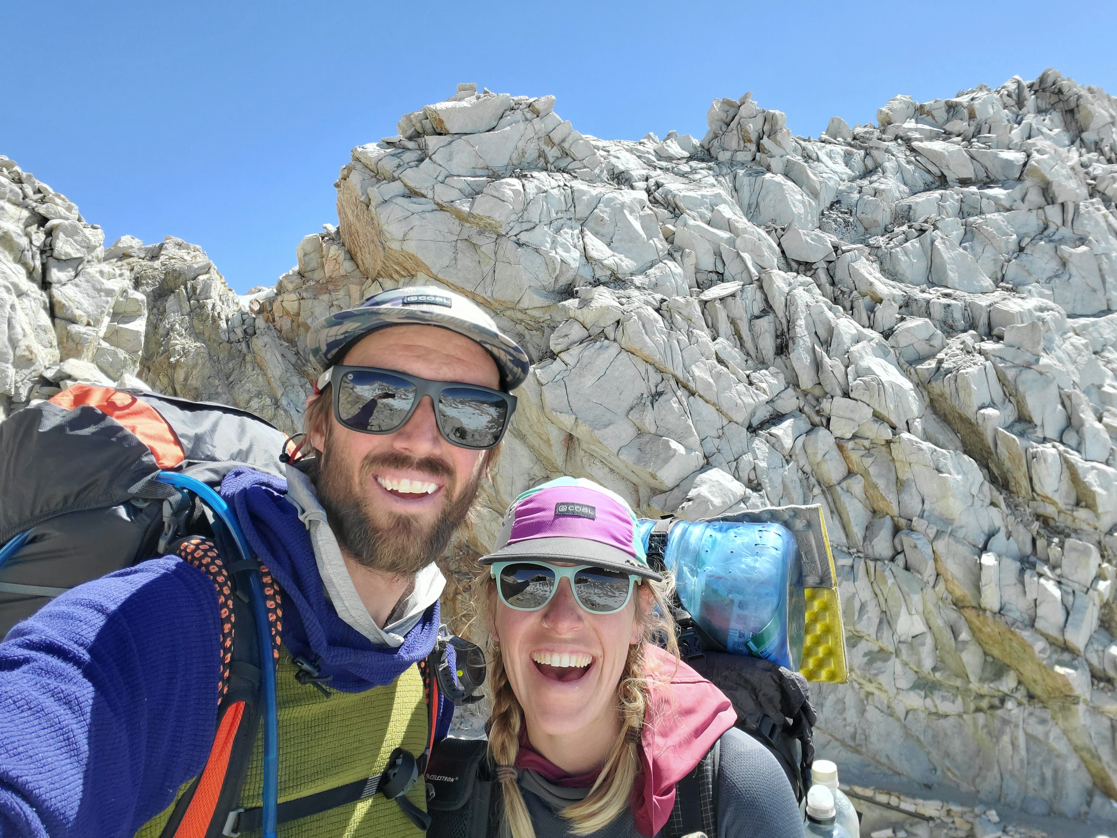
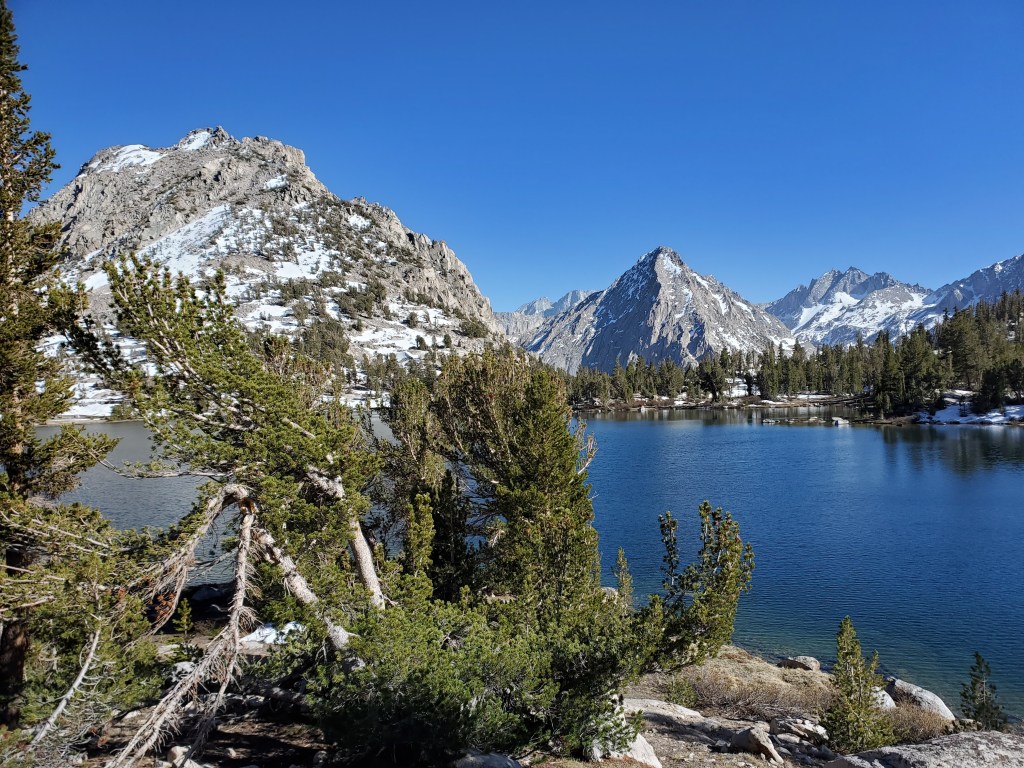
We took a snack break before the last climb of the day. We cruised up, passing several hikers. We saw a few more hikers looking beat, resting on the side of the trail. We knew what they had been through. We went a little ways up Kearsarge Pass trail to set us up for resupply. Amazingly, we were done hiking by 5pm. We sat and talked in the last few hours of sunlight, feeling both worn down and accomplished with our pace through the Sierras. We camped by Bullfrog Lake, feasting our eyes on the unreal scenery of high peaks and alpine lakes.
Day 56 – (+6) miles/788
Woke up to Bullfrog Lake, the water still as glass. We slept in and took it slow, feeling a little worn out from pushing hard the last 5 days.
We only had 6 miles to get over Kearsarge Pass and out to the trail head where we could get a ride to Lone Pine. We made a hot breakfast, oatmeal for Maggie and mashed potatoes for me. We got on trail at 8:30. A steady climb up to the top of the pass at 11,700′. We were rewarded with epic views of the High Sierra, looking upon the dominion of University Peak, a local 13er.
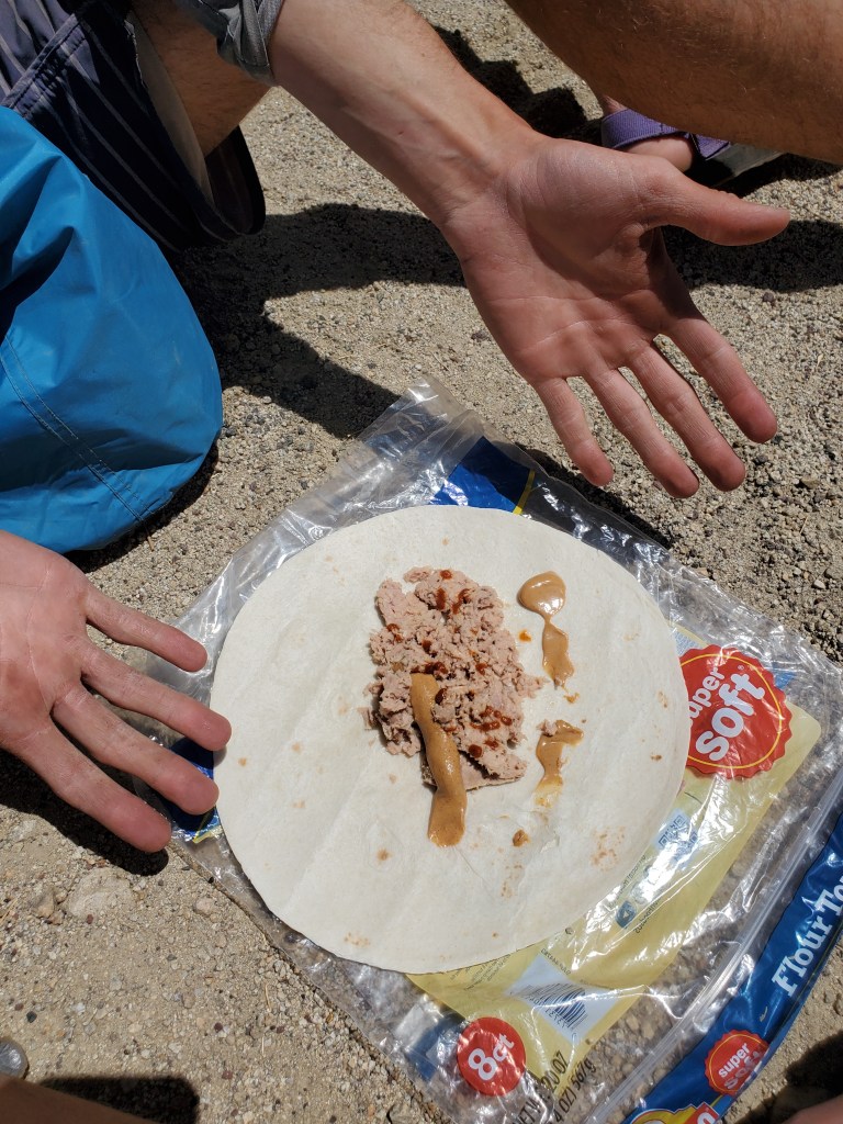
Down we went towards Owen’s Valley. The terrain was steep, but the switchbacks made for an easy descent. Maggie was flying down the trail, and I was struggling to keep up. I was certainly beat from our recent efforts. We finally made it to the parking lot at 9,200 feet around 11:30. Lots of hikers were milling around waiting for a ride. Most were headed to Bishop, while we were going the opposite direction to Lone Pine. We snacked on the last morsels of food while we waited- a crushed poptart, a tuna and peanut butter wrap, and the last of the nuts and jerky.
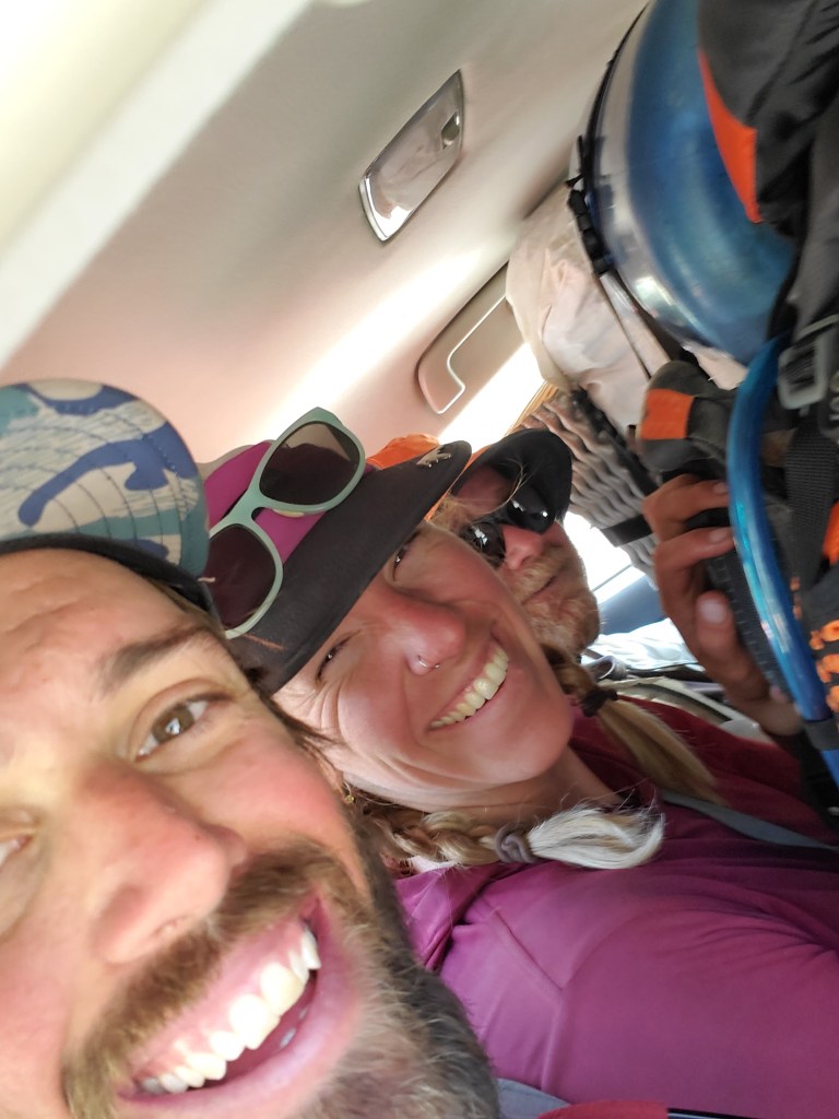
After an hour or so, word was spreading of the first guy offering a ride. We were 3rd in line, but the driver wasn’t going to Bishop. He pulled up and said, “I can take four to Independence.” We looked around eagerly seeing if anyone else was getting in. An older couple took the first two seats, but the Bishop bound folks passed on the offer, so Maggie and I got in. The silver prius was at max capacity with three of us in the back seat, our packs on our laps, and unable to see out front or the two faces up front.
Our driver, Coconut, was a PCT alum, and drove up from L.A. to provide some trail magic. We all enjoyed some casual conversation as we made our way down the windy road. The other couple got out in the town of Independence. “Lone Pine people, I can take you there. I’m on my way back home,” Coconut said. We reorganized with two fewer passengers and talked some more with Coconut. He dropped us off on the main drag. We started walking to the Mexican restaurant when three guys from the Wolf Pack emerged from the Mt. Whitney tavern, hootin’ and hollerin’ at us! We joined them inside the tavern and promptly ordered a beer. We got caught up on their hike since they were a little ways behind us. Turns out their pack of 4 had grown to 10. While it sounded fun, individually everyone we talked to expressed some disdain for the big group dynamic. We got burgers for lunch and saw all the familiar faces that had joined the Wolf Pack trickle in. It was great to see people. We said goodbyes as they headed back to the trail and we wandered over to the budget inn to check in to a room. We showered and went to the laundromat. We hung out in the room for a bit, then went and got that Mexican food we skipped earlier. Burrito for Maggie, fajitas for me. We picked up ice cream and pina coladas to go from the grocery store. Back in the room we indulged till our stomachs could handle no more.
