
Day 57 – <1(+7) miles/788
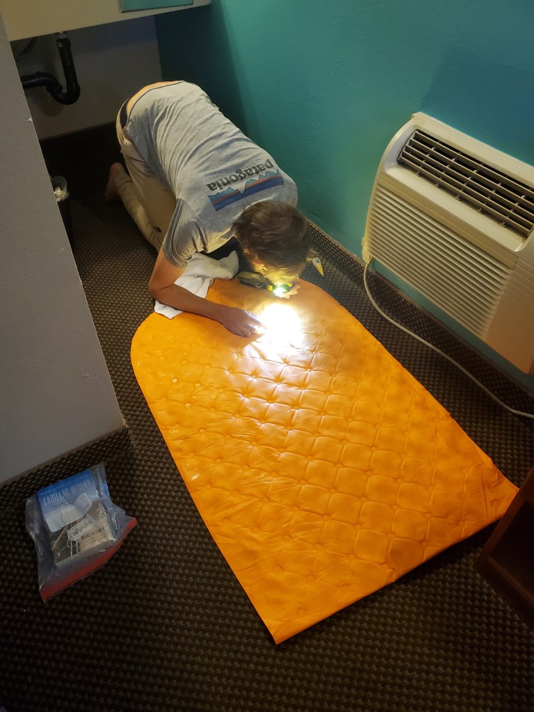
Maggie and I slept in till 7:30 and we ambled a few blocks to the Alabama Hills Cafe for breakfast. The reviews were overwhelming positive, and the food did not disappoint. Maggie got her classic veggie omelette, and I got a scramble with sausage and veggies. We ordered some extra French toast to make up for our calories lost on the trail last week. We felt tired and sluggish that morning, and I was seriously considering staying another night in town… Back at the hotel, we cleaned and organized gear. An hour before check out, I decided to investigate my leaky pad by filling up the tub and search for bubbles. I found two small holes and patched them up, buying some time until the next leak.
Maggie’s new pad she picked up in Tehachapi had already started leaking, less than two weeks after first using it. She decided to give up on the inflatable pad, so we went to the gear shop and she bought a new closed cell foam pad. Foam isn’t nearly as comfortable, but it will never fail you. We went to the post office next. Our first trail angel, Jane, from San Diego sent us some banana bread and brownies! We devoured them later on the trail and they were delicious.
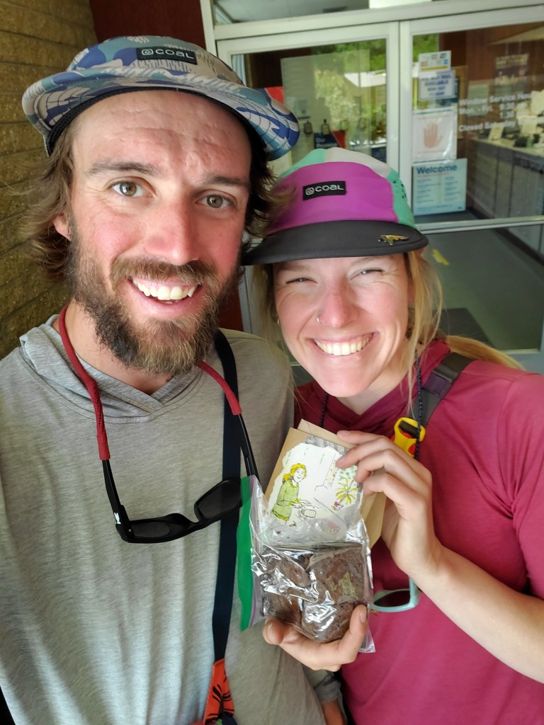
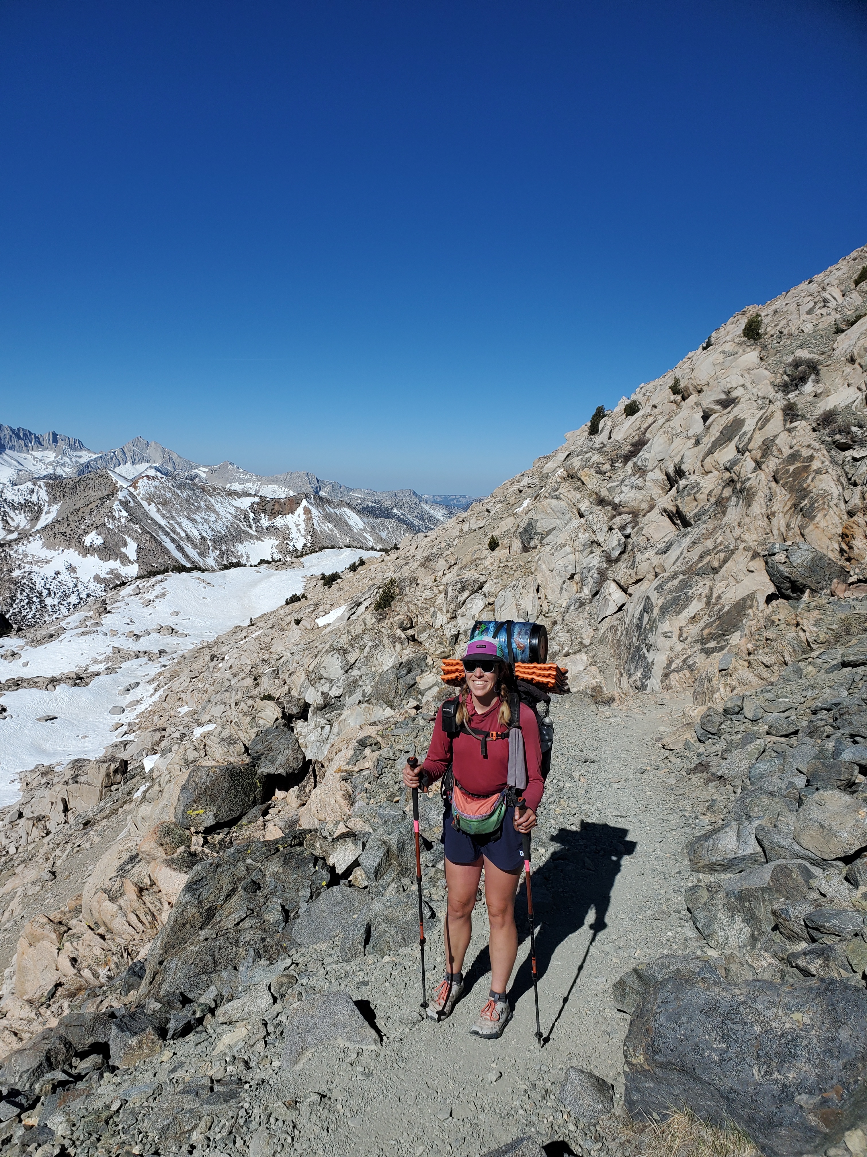
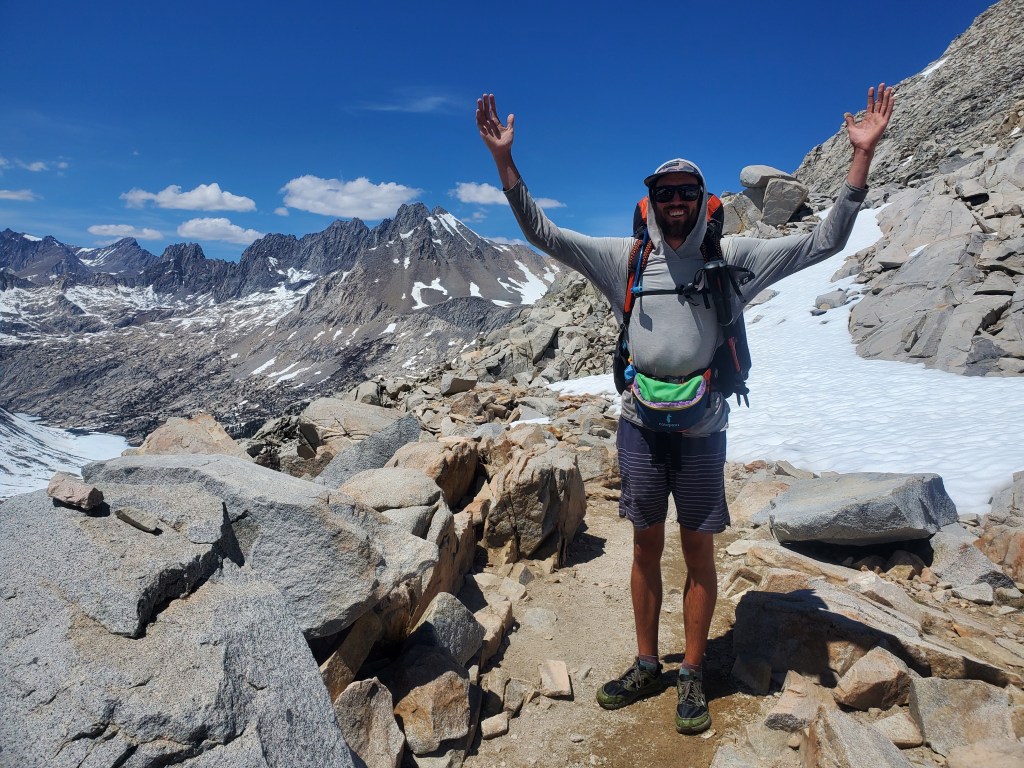
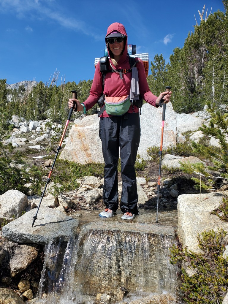
At last time for resupply, we wandered over to the grocery store. Thankfully everything in Lone Pine is within a 3 block radius, keeping our town miles to a minimum. As we worked our way through the 5 compact aisles in the market, a woman looked at us and asked, “Do you need a ride somewhere?” I suppose the giant backpacks are a dead giveaway, but still, an unprompted gesture of kindness like that is unbelievable. We explained we would need a ride in an hour or two and the woman, Sheena, agreed to take us back to the Kearsarge pass trail. We shoved as much food as we could into our bear canisters, picked up some sandwiches to go, and Sheena swooped us up for the 40 minute drive back to the trail. She was a peak bagger in town waiting to summit Mt. Whitney. With time to kill, she was happy to help out some fellow outdoor enthusiasts. We gave her some recommendations for Colorado 14ers and said farewell at the trailhead.
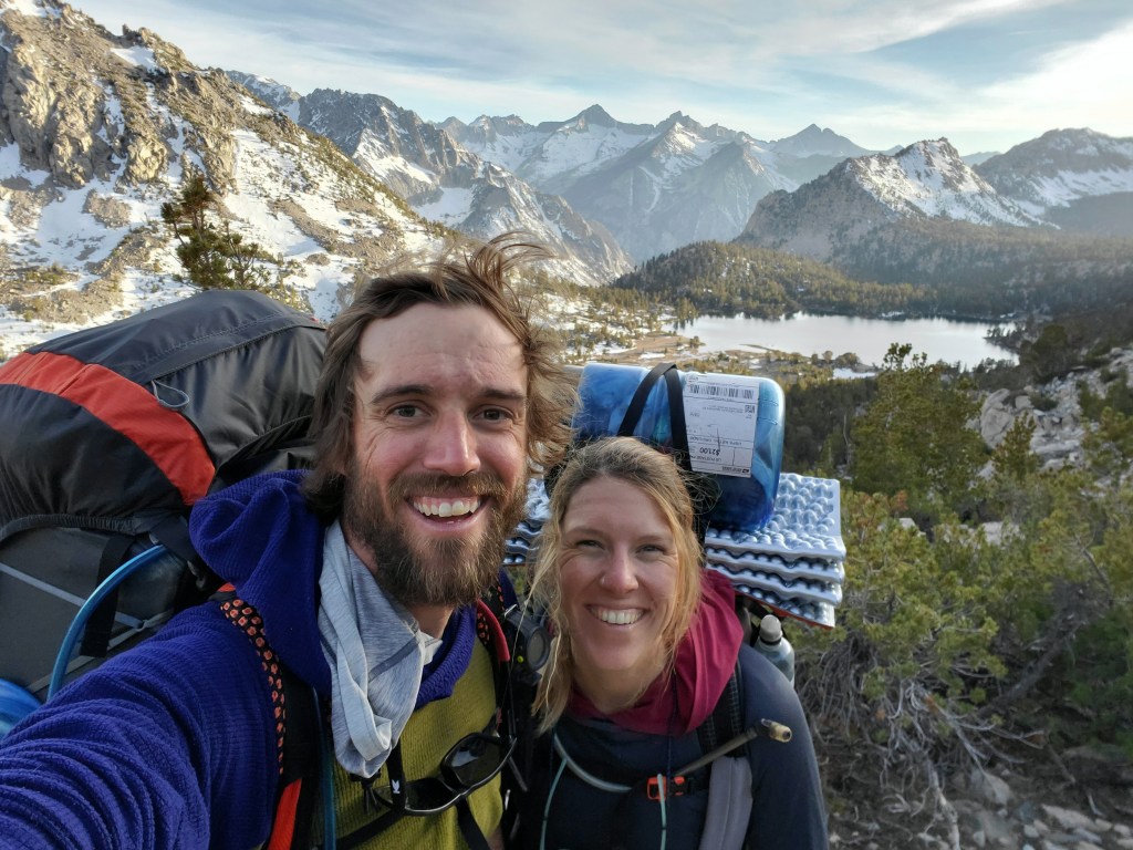
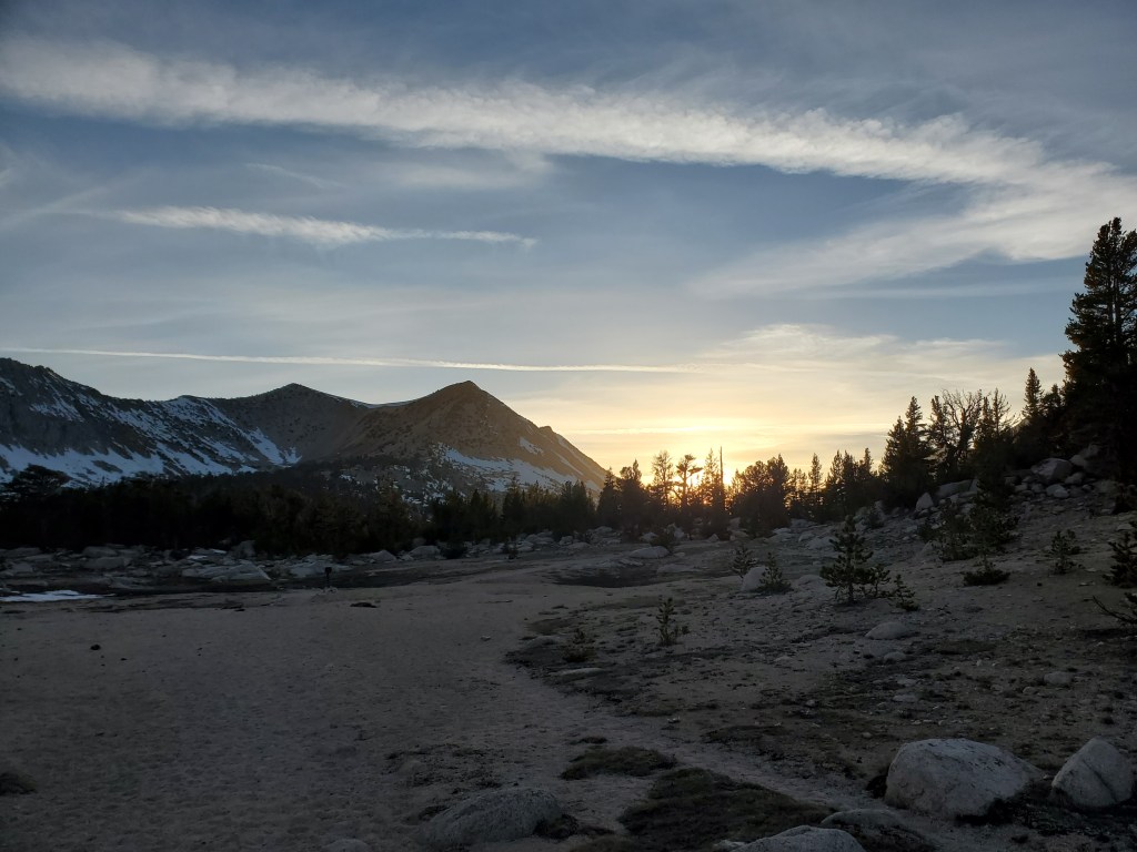
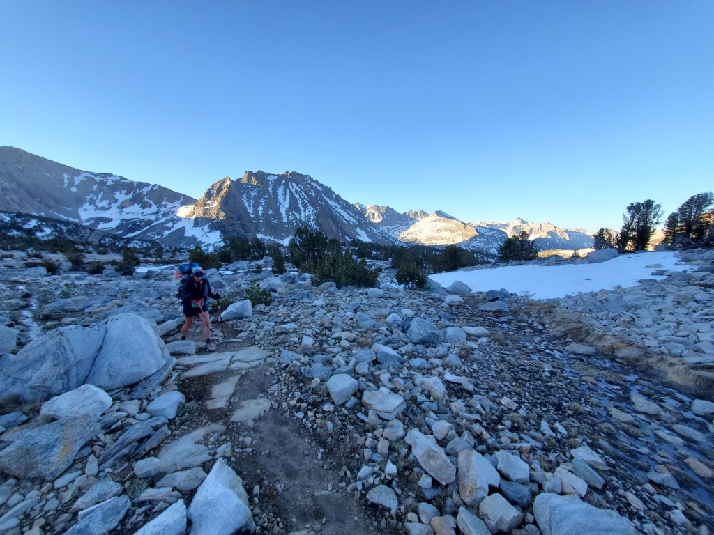
We were dreading the 2,600 foot climb back up with full packs. It was around 4pm when we got going, moving slow and steady. The nice thing about the Sierras is that we don’t have to carry much water, rarely more than one liter, which really helps keep the pack weight down. We actually felt great. We had gotten over the morning sluggishness and cruised up to the top of the pass just as fast as we hiked down the day before. At the top, we ran into Bennet and Burrito-with-a-J, the couple we got sushi with in Tehachapi! We shared war stories of our first week in the Sierras. Turns out they packed too little food as well and all had a good laugh about it. With the sun nearing the craggy horizon, we made our way back down to the PCT, where we camped near the junction. Maggie and I found ourselves alone on a sandy flat of open forest.
Day 58 – 16 miles/804
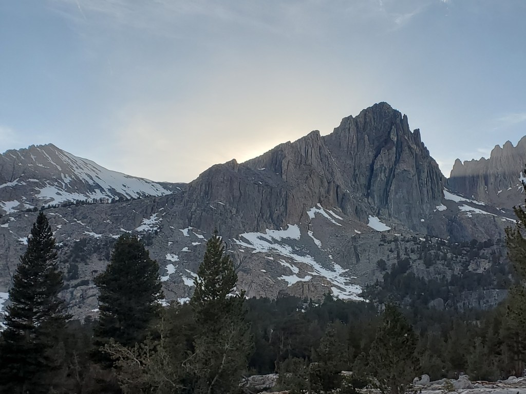
We woke up early, 4am, to tackle the next obstacle, Glen Pass. It was only three miles away, but it’s best to get up and over these high passes while the snow is firm in the morning. We were out of our frosty tent and on trail a little after 6am, headed up a narrow valley lined with towering cliffs. Somehow, someone decided to build the trail here with some of the tightest switchbacks I’ve ever seen. The south side of the pass was mostly snow free and we got to the top at 11,950′ a little before 8am.

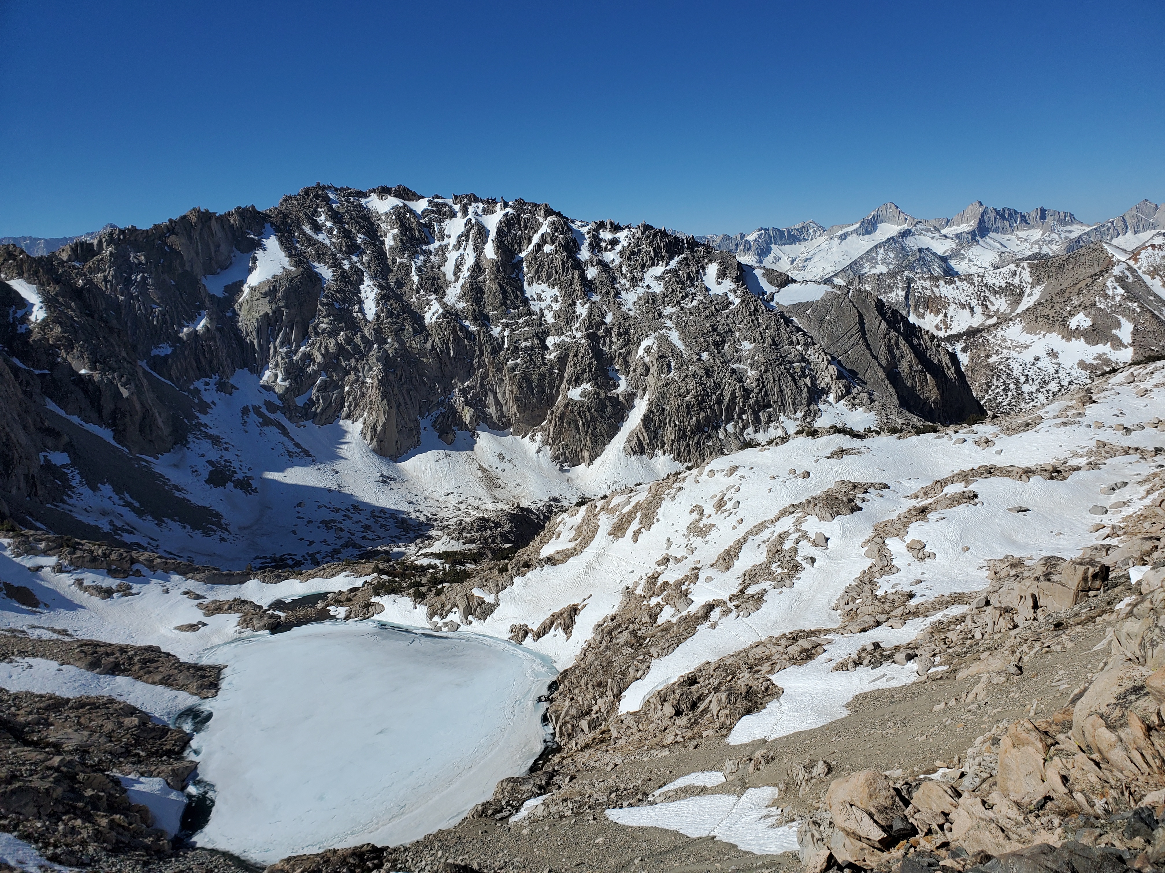
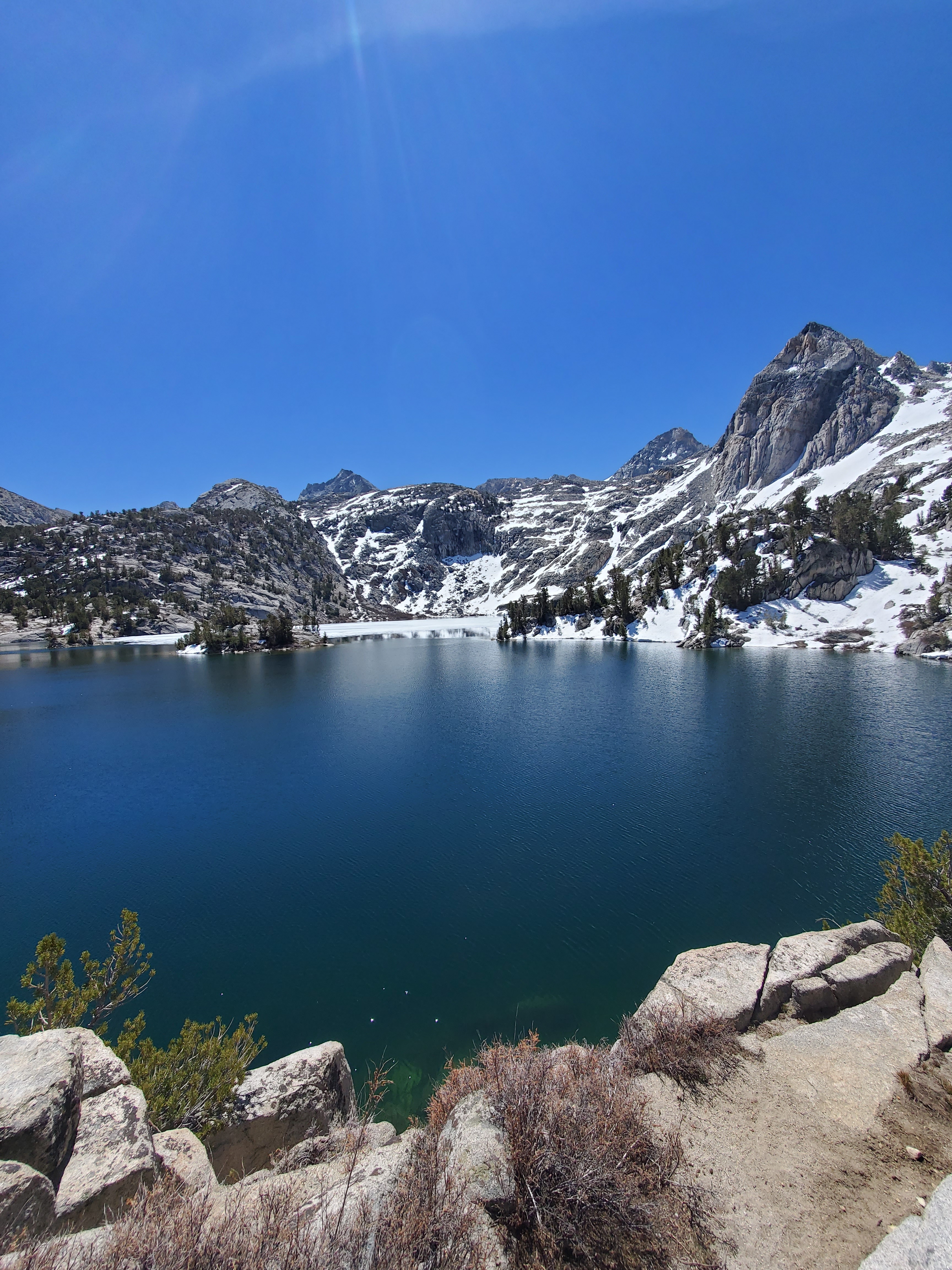
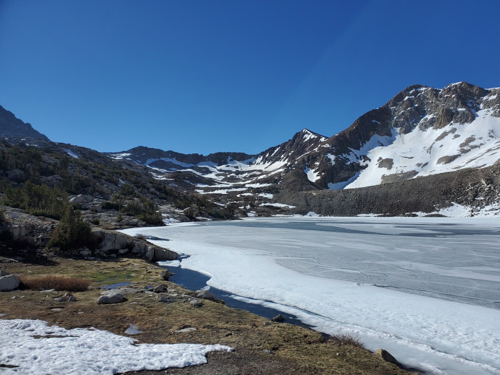
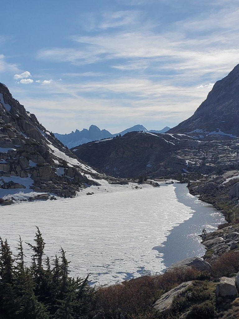
We donned our microspikes and got the ice axes in hand for the steep, snowy north side. A solid bootpack was set so we just had to follow in the footsteps of those who came before us. We didn’t need the axes for long and switched to trekking poles once the slope angle became less hazardous. We worked our way down to Rae Lakes, a pair of large alpine lakes with so many golden trout, you could probably grab one from the shoreline without too much effort. We took a lake break, taking in the view and a handful of snacks.
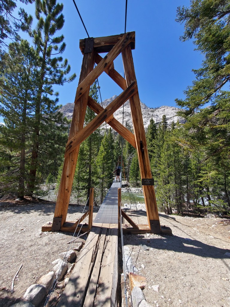
Down through a little more sun softened snow, we stopped a little later at Dollar Lake for lunch. Now I’m not sure if it was the snow travel that gave me some frustration, or if my lunch of canned herring upset my stomach, but I was not really feeling it as we descended further down the trail. Pinchot (PEEN-sho) pass lie 9 miles ahead of us, and the comments made it sound like the easiest pass yet, so we were aiming to get over Pinchot before sunset. By now, our feet were soaked from slush and stream crossings, which we’ve come to accept, but it is something that occupies my mind while I hike. We dropped back below treeline, enjoying the cool shade of lodge pole pines. I tried my best to keep up with Maggie on the downhill, but my malaise kept my pace rather slow. We reached the bottom between the passes at a suspension bridge over Woods Creek, a nice bit of infrastructure so we didn’t have to ford the raging creek, although it likely made no difference to our wet shoes in the long run.
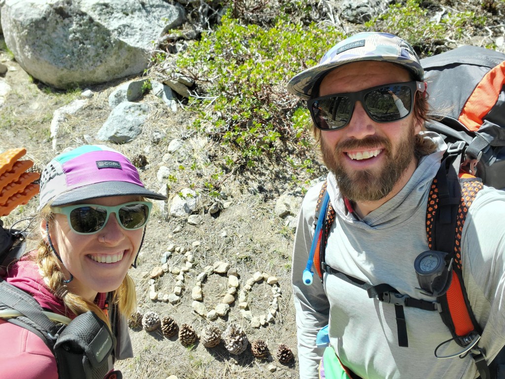
We got water and took a little break, discussing our plan for the day. With still some 7 miles and 3,500 feet of climbing, just to the top of Pinchot Pass, we felt we could do it, but it might be a late night of hiking. We started up the next valley and crossed the 800 mile mark. Maggie and I didn’t take much time to celebrate, the next pass weighing on our minds.
The funk I was feeling slowly stared to fade, and I got in the groove going uphill. The reverse happened to Maggie, her pack was feeling absurdly heavy, and her pace slowed a bit. We stopped for a quick break about 1/3 of the way up, looked at the hike ahead on our phones, and committed to getting over Pinchot. We would probably be hiking until 8pm, but we also needed to get in range of the next pass, Mather, which was reportedly quite spicy. Up and up, we got to a cute tent site next to a small stream 4 miles before Pinchot Pass. “Last chance..”, I said to Maggie. We had a good discussion about the safety of crossing the pass, potentially getting to camp after dark, and how we were feeling.
Ultimately, we decided to stop there around 6pm, which was definitely a good decision. We got to dry out our shoes a bit while we relaxed and soaked up the last hour of sunlight before being engulfed by the mountainous shadows. No one else came up behind us that evening, and we slept well through the quiet night.
Day 59 – 18 miles/822
We woke up at 4am, again. Some folks walked by our tent around 5 as we were packing up. I wonder when they woke up… Despite camping higher than the night before, the air was warmer. Certainly cold, but above freezing. We were moving at 6am and quickly found ourselves above treeline. It was an easy climb up towards Pinchot in the morning light, although the snow fields made route finding a bit of a task.
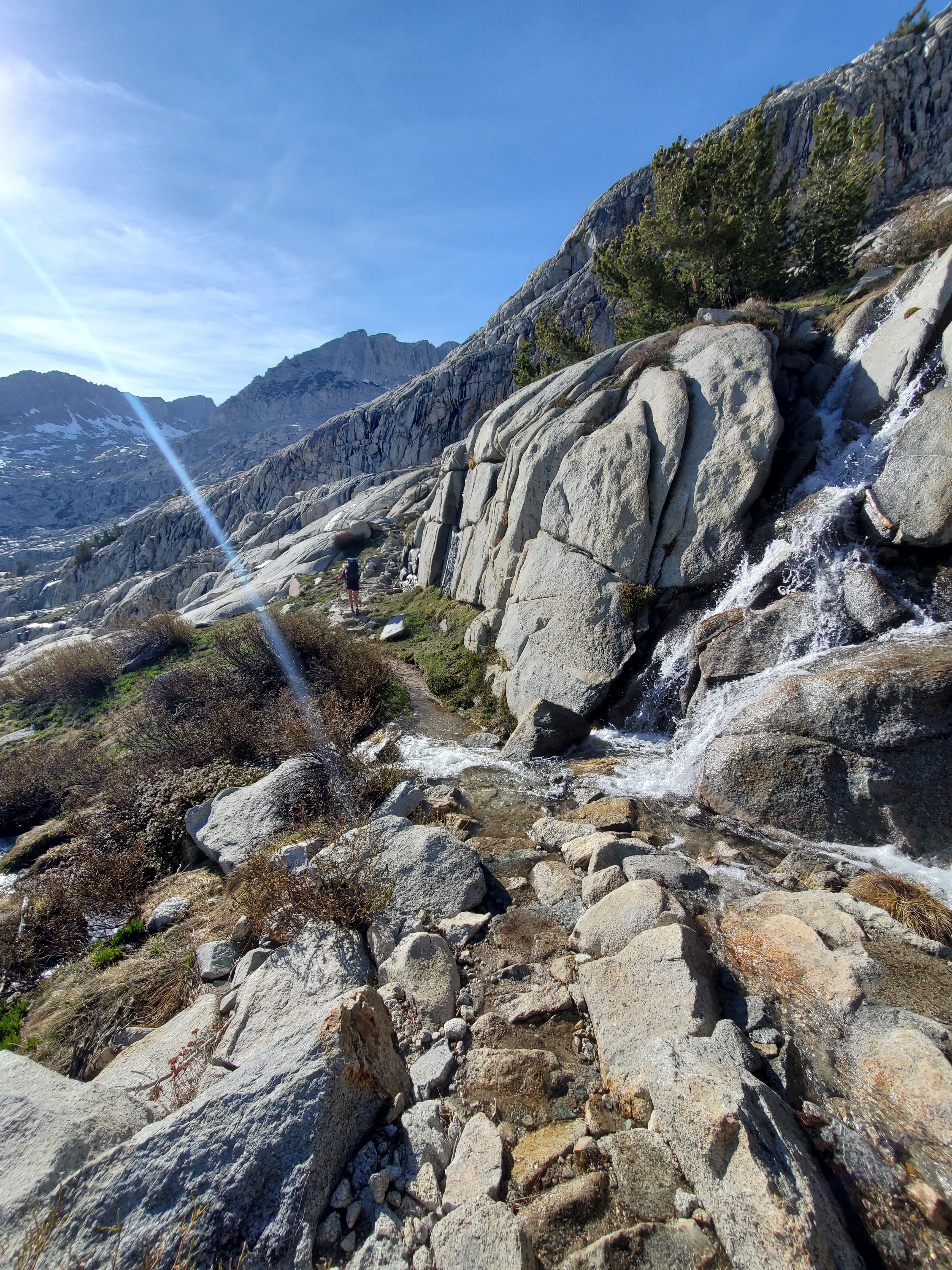
We put on microspikes for about a mile where the trail was on a side slope. The snow was firm and icy, so the spikes helped us move quickly through this stretch of snow. The dirt path became apparent again so we took the spikes off for the final climb. As advertised, Pinchot Pass wasn’t bad, and we were on top before 8am. The north side was relatively snow free and an easy slope, so we didn’t bother with the spikey gear. However, I did slip on some ice, initiating one of those weird slow motion falls, and nearly busted my face open on a rock. I caught myself at the last second, my wrist taking the brunt of the fall, but the pain didn’t linger for long. We took a morning snack break near the stream carrying water from the icy alpine lakes above. Much of the granite around us was polished to a nearly mirror finish, some parallel scratches all pointing downhill. This polish, in addition to the distinctive U-shaped valleys, is all that remains of a time when this land was buried by millions of tons of ice. Interesting to think about ice polishing granite.

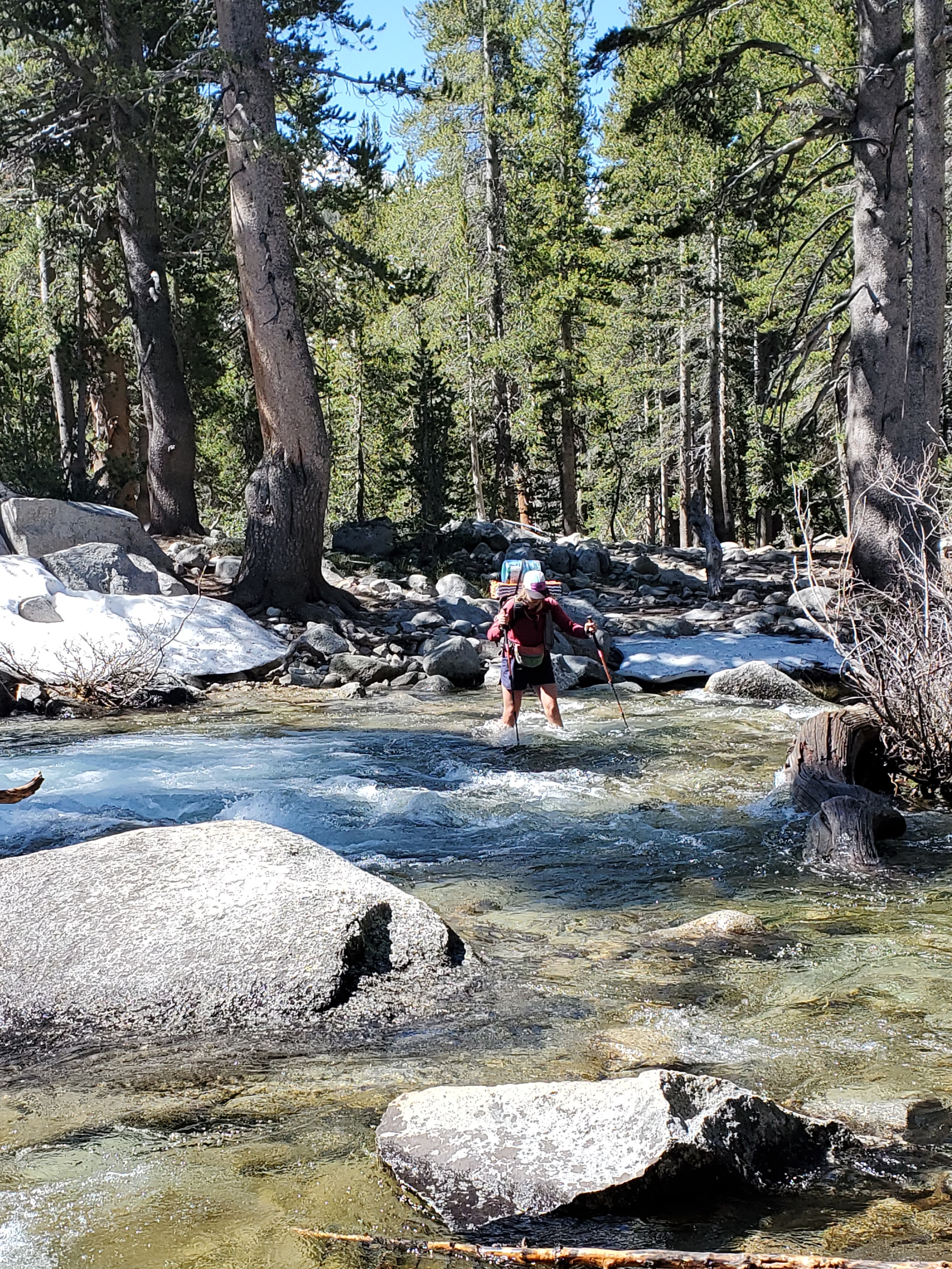
Onward down the valley again, there was about 9 miles between Pinchot and Mather Pass. We would’ve had to run to make it there while the snow was reasonably firm, but alas, we couldn’t run. We hiked down as fast as possible where we bottomed out on the South Fork of the Kings River. We had been warned about hairy river crossings in the Sierras, and this was our first test. The current was manageable, though the water did get above my knees at one point. We both got across with out issue.
We proceeded up the gentle climb towards Mather Pass, romping through every bit of flowing water we crossed, since it wasn’t worth our time to try avoiding wet shoes anymore. We stopped for lunch at 11am and dried out our pruney feet for a bit. Four more miles to Mather Pass over mud, rock, and some very soft, slushy snow. The state of the snow did not inspire confidence for the snow climb and descent that lie ahead of us. I’m sure anyone reading this with any mountaineering experience is shaking their head in horror.
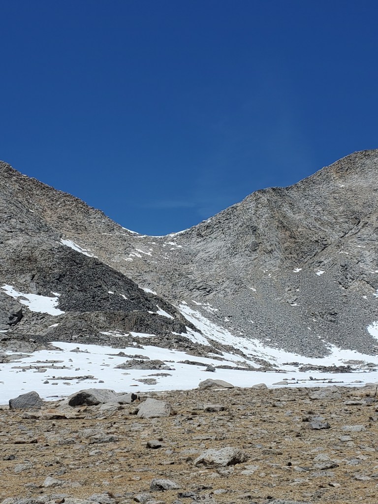
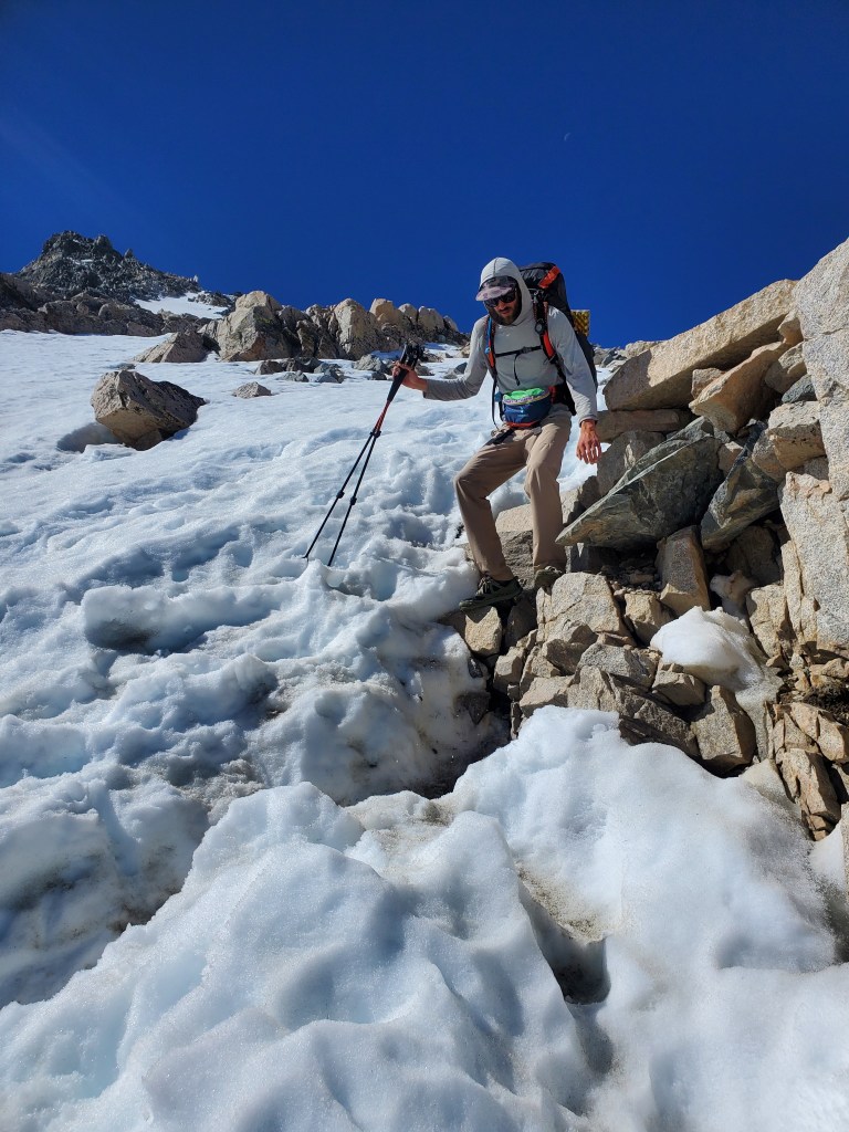
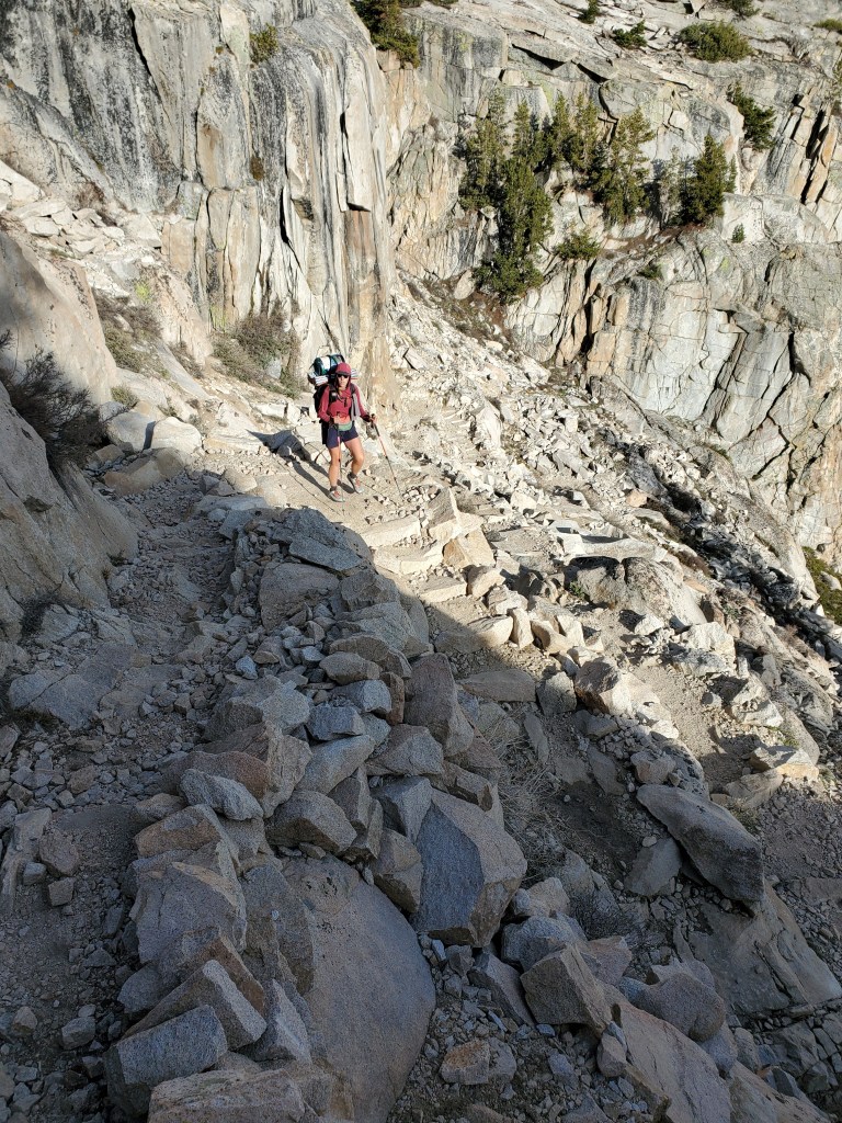
We got to the headwall of the pass. The trail was free of snow, except for the final half mile where is was supposed to switchback several times up a 30 degree slope. This section of trail was covered in snow, and the bootpack, which was set at a brisk angle up the hill, had melted through to the gravel below. We simply did not feel comfortable attempting to set a new bootpack in that soft snow on that steep slope. However, the snow-free area looked like we could scramble up the rock. We discussed our options – hike down and stay on the south side of the pass, or scramble up and get a look at what lies ahead. It was nearly 2pm, too early to quit, too late for snow travel, which was surely waiting for us on the north side of the pass. We finally decided to go up and get a look. The rock was solid, save a few small spots of gravel and scree. Maggie followed a safe distance behind in case of rock fall.
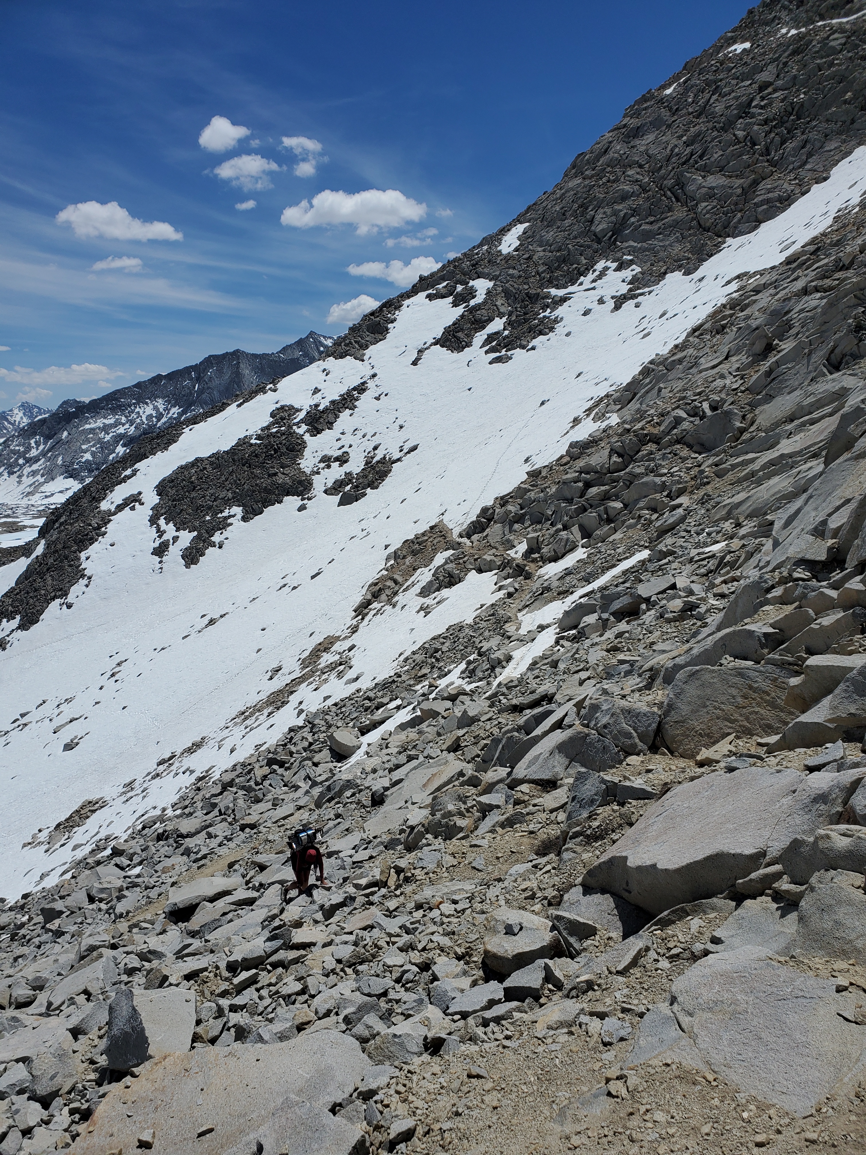
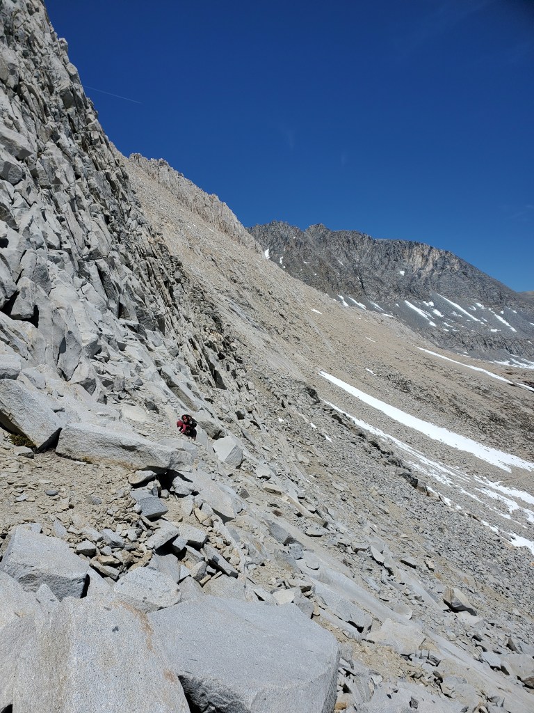

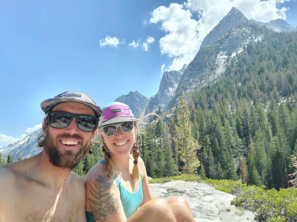
The scramble was solid Class 3, which we are both comfortable with, but the 25+ pound packs definitely added to the challenge. Even though I felt completely in control, my heart was racing, wondering if I would be rememered as that guy who tried to get over Mather Pass by scrambling off trail. One step at a time, testing the talus, and stepping up ledges, we made it to the top where we were greeted by what was perhaps the most epic view yet – the Palisades. Words cannot describe the natural beauty of the mountains and the valley ahead of us, but what was obvious was that we had a lot of snow to traverse.

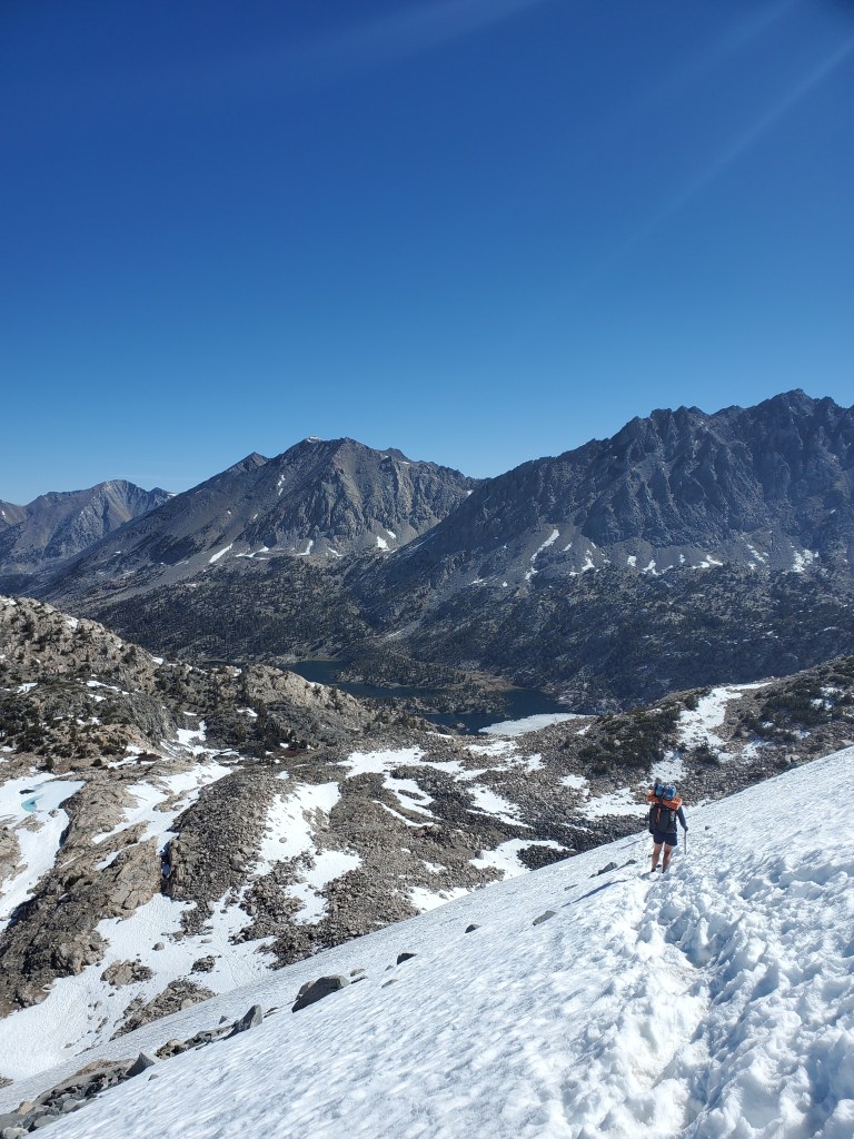
The slope down was steep. There was no wet slide activity visible from our vantage point, and at 12,000 feet, the softest snow on top barely went above our the soles of our shoes, meaning it was still stable. We decided to carry on, rain pants and spikes on, ice axes tightly gripped. The upper part of the pass going down was steep, and we both postholed up to our thighs soon after leaving the top of the pass. But, where the snow supported us, we were able to kick in solid steps to a safe spot to glissade. I went first, following the track of someone who likely descended only a few hours before us. This was the way to travel! Quick and painless, Maggie soon followed.
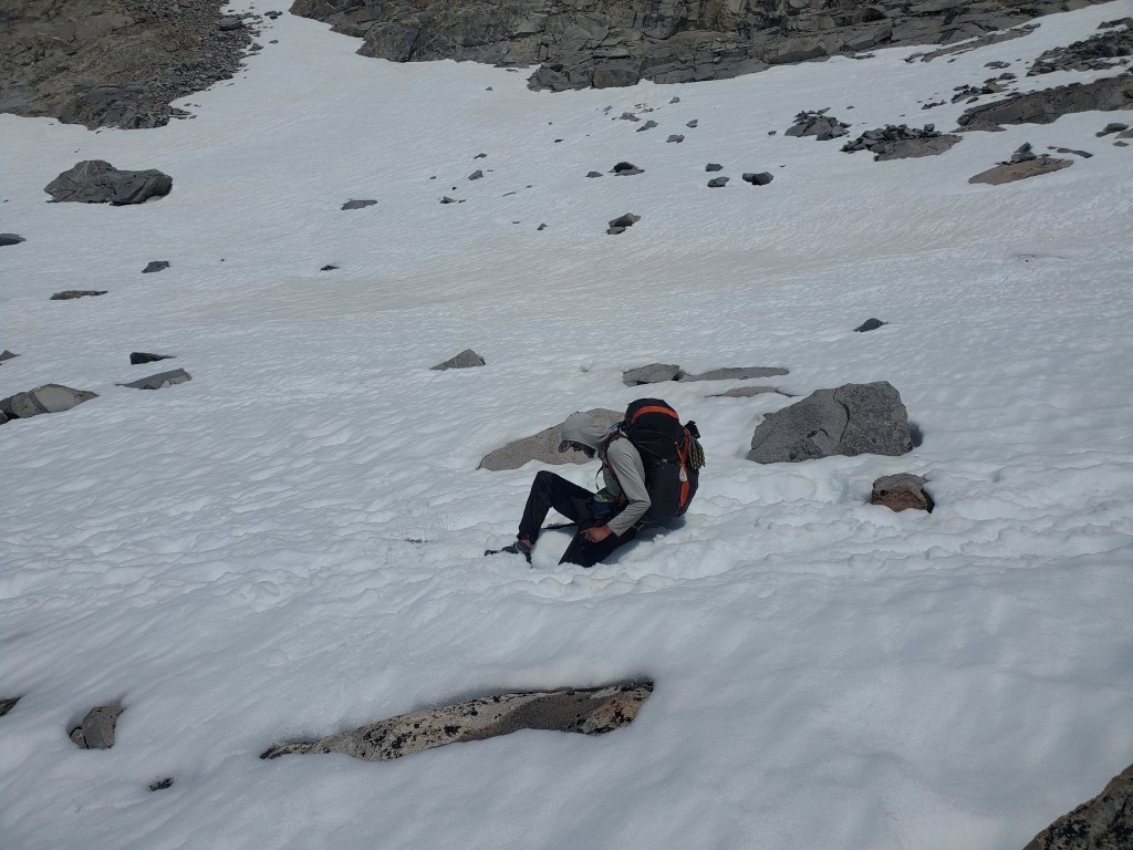
We were apmed up and felt great. We picked our way across to the next glissade, where Maggie went first, and me second. We were done with the steepest terrain. I looked back towards Mather and saw evidence of moderately sized wet avalanche less than a quarter mile west of the pass. I don’t think we were able to see it earlier from the top of Mather Pass, but it was a bit scary to know we were in and around avalanche terrain.
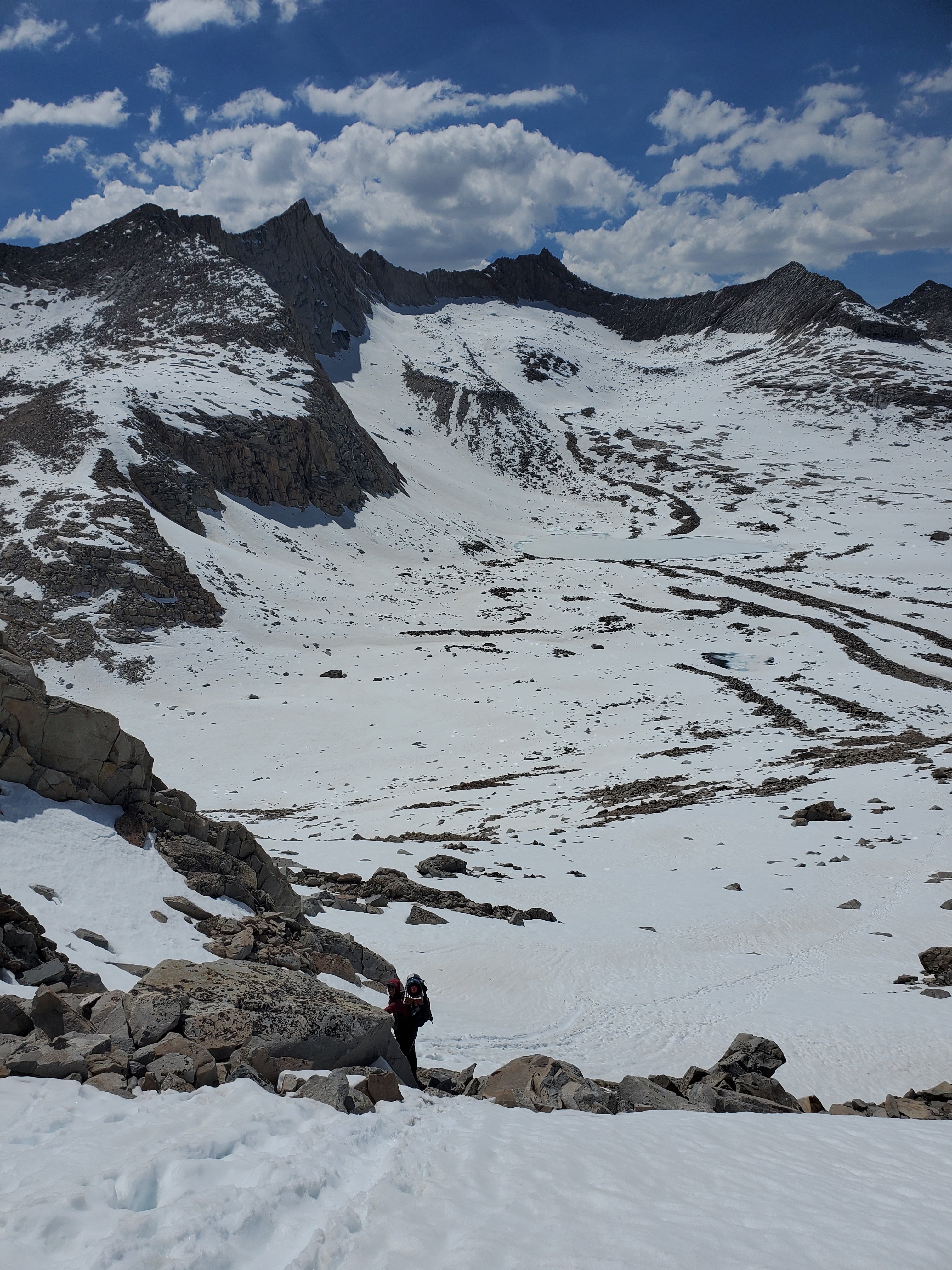
We started to boogey out of there, occasionally postholing, though far less often than we both expected. Evening fast approaching, our goal was to get out of the snow to a decent tentsite. We tried to walk on rock bands where we could to move faster, but it was overall slow going. We eventually found the PCT after following random tracks on the snow. In the transition between snow and rock, the trail was a creek, not that it mattered much since our feet were already cold and soaked through.
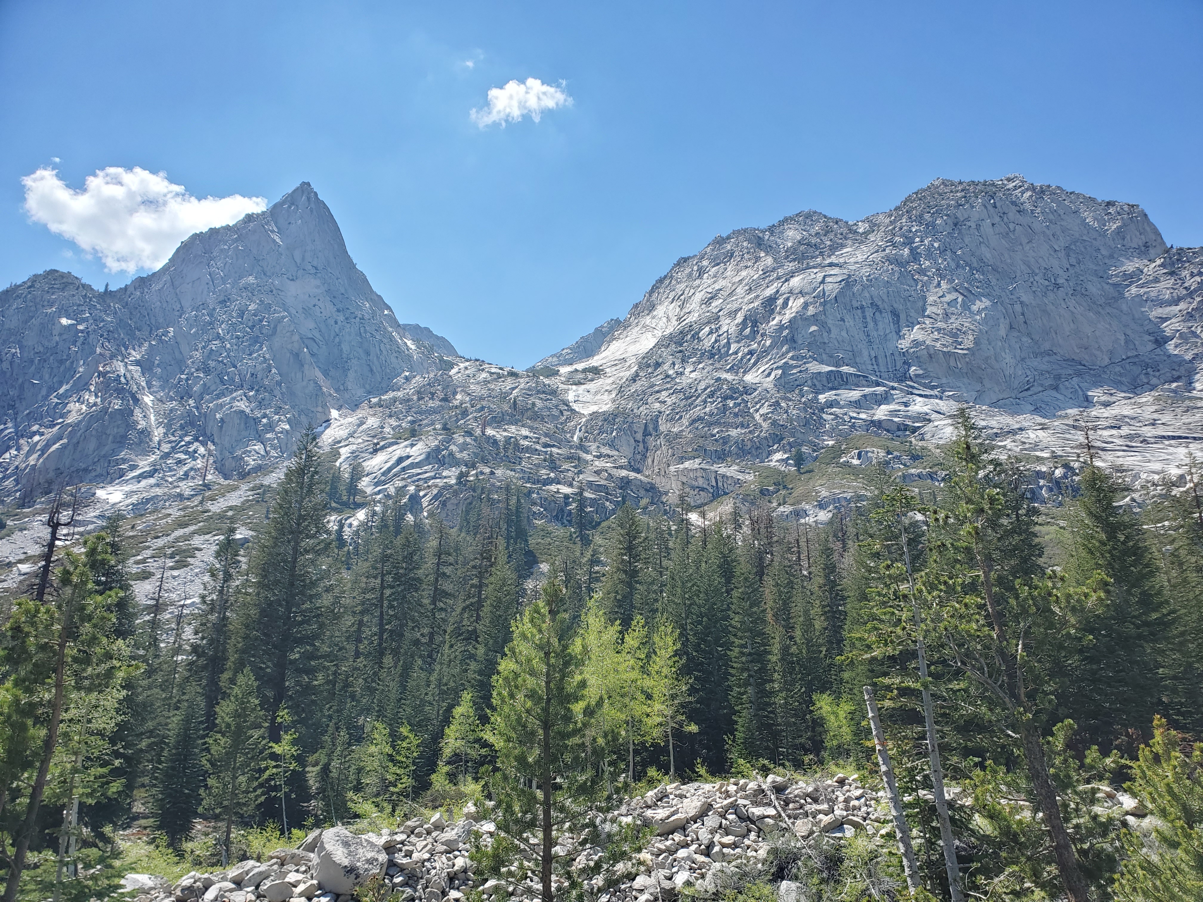
We descended towards Pallisade lake, where the steep cliffs and steady snowmelt produced countless waterfalls. It was absolutley gorgeous. North Pallisade Peak loomed overhead with its impenetrable fins and cliffs warning us to stay on the trail. Despite the mileage so far being well within our ability, we were fading fast, beat down by the vert and the snow. We eagerly looked for the first place we could pitch our tent.
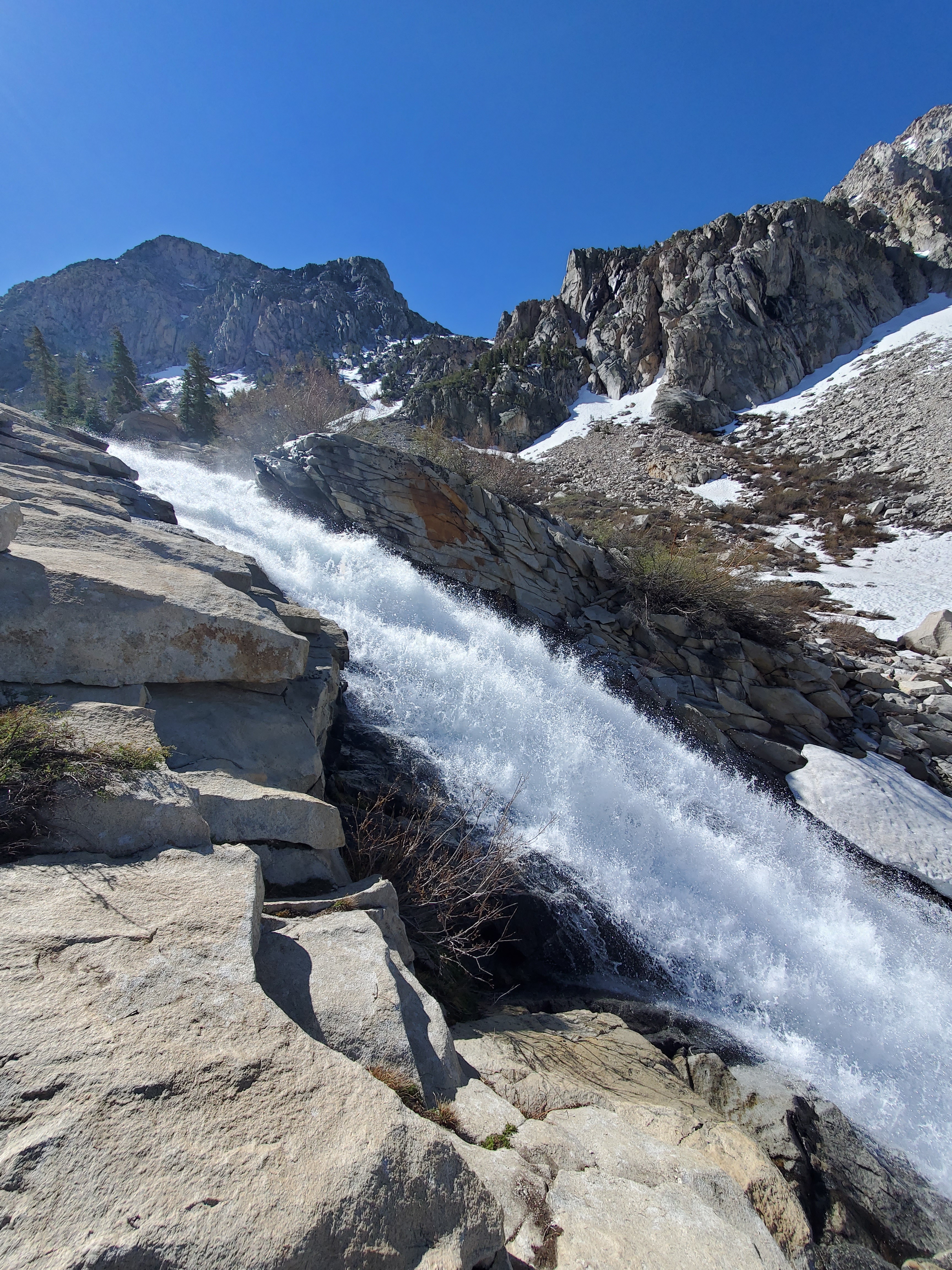
The first spot was too damp. Another half mile down tight switchbacks on a cliff and we found a site that was workable, and it had a spectacular view. Maggie grabbed water from Pallisade Creek (although ‘raging waterfall’ is probably more accurate than ‘creek’), and I pitched the tent. We were done at 6:30pm, over 12 hours after we set off, meaning we barely averaged 1.5 miles per hour. The Sierras are not to be taken lightly. Thankfully, we could take it easy the next day.
Day 60 – 12 miles/834
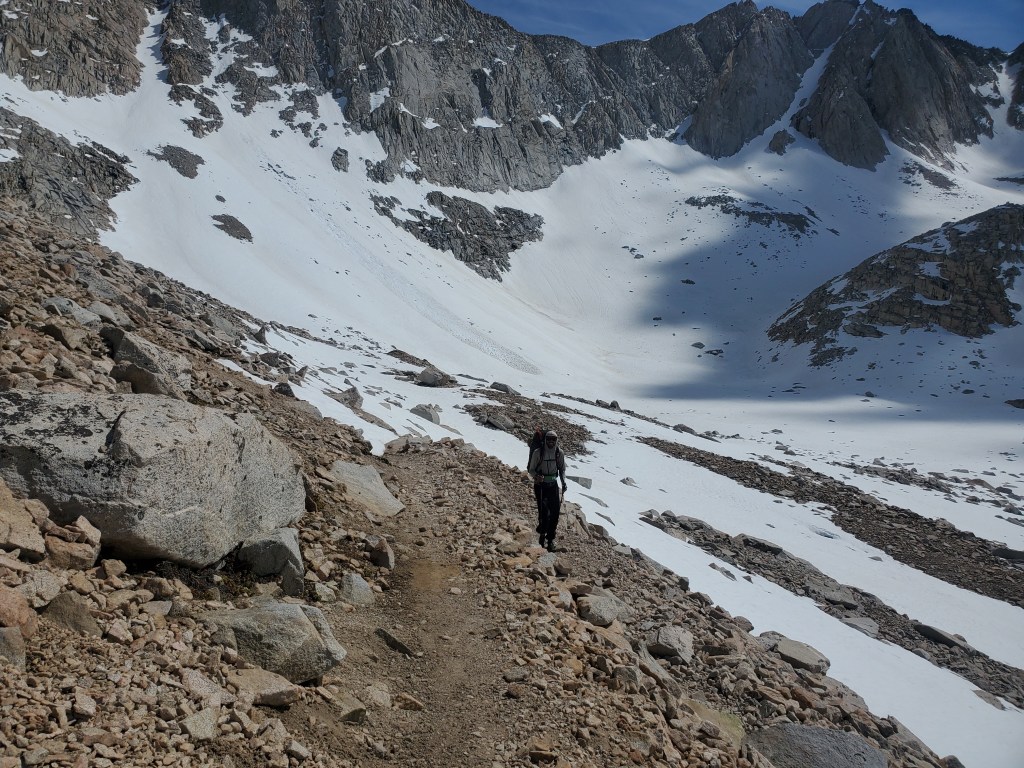
The next high pass, Muir Pass, lies 15 miles away. Even if we got an early start, we would be getting to the top of the pass by mid-afternoon, and Muir Pass reportedly had the longest snow fields. With this in mind, it was an easy decision to take an easy day and stop short of the pass. We slept in, recovering from the physically demanding day before. We got on trail at 9:45, cruising down the remainder of Pallisades Valley.
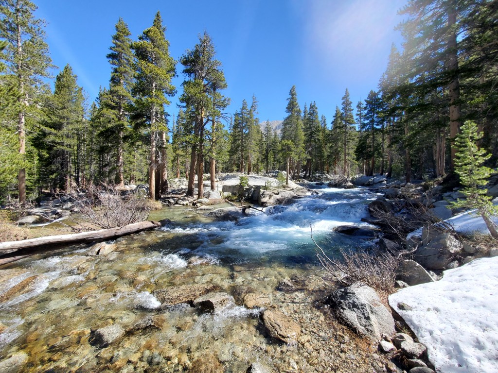
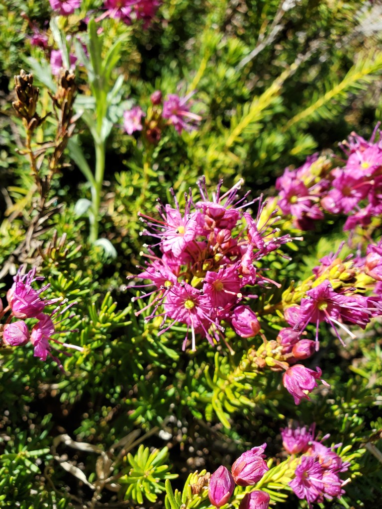
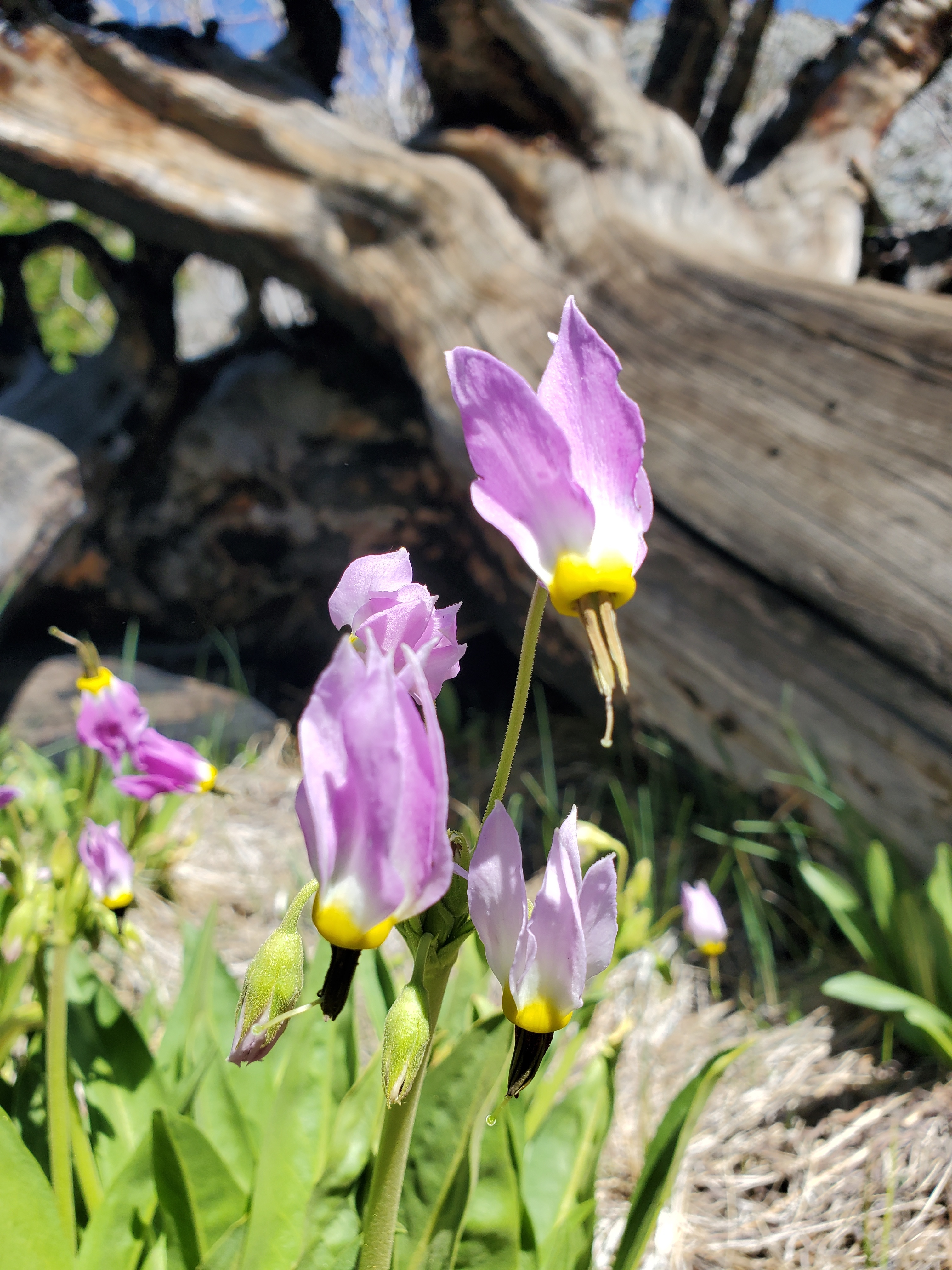
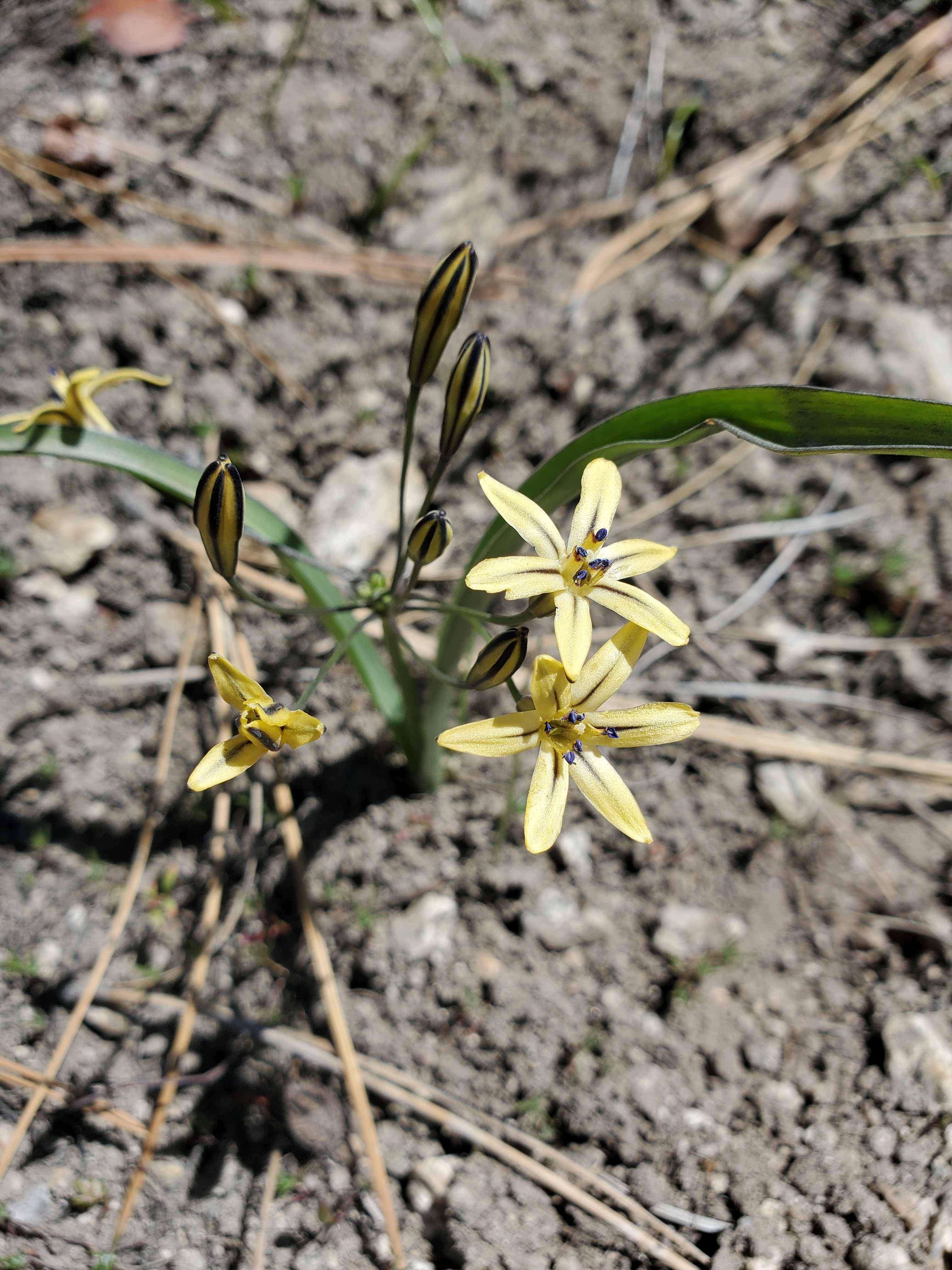
Not long after we started, Maggie got tripped up on some rocks and fell down, scraping her knee and earning a badass battle scar between her eyebrows. Thankfully, the damage was mostly superficial, and after a few minutes, we were moving again. We eased up on the pace, taking our time as we dropped below treeline. We took a long lunch at Palisades-Kings River confluence, shaded by large pines and firs. I took a quick dip in the Kings River to cool off, then sat in Pallisades Creek for a moment as well. The creek was colder. Down in the valleys, we saw the first signs that spring was coming to the mountains, shooting stars and small yellow lillies popping up where they could.
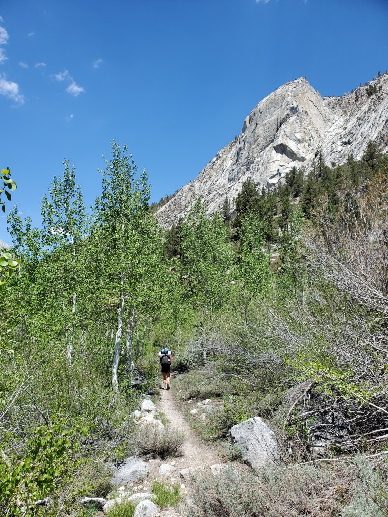
We continued up the Middle Fork of the Kings River valley. Towering granite domes and peaks rose 2,000 feet overhead. With time to kill, we couldn’t help but take a boulder break to take in the view, shirts off to soak up the sun. We admired the stark geological difference between the Sierra Nevada and the Rocky Mountains. Having grown up playing in the Rockies, I just thought mountains were.. rocky? That is to say the jumbled piles of talus that define the Rockies. The Sierras stand out with their solid granite blocks, sentinels standing watch after millenia of galciation.
Having gotten our fill of solar radiation and waterfall watching, we continued up, but not too far. We stopped short of our initial plan of ~15 miles. A nice tent site was beckoning, nestled between some pines and hemlocks, just a stones throw from the river. We took delight in ending our hike early, reading and writing as the evening light illuminated the valley. No one cared to join us at this wonderful spot, which we weren’t upset about.
