Day 73 – 19 miles/1016
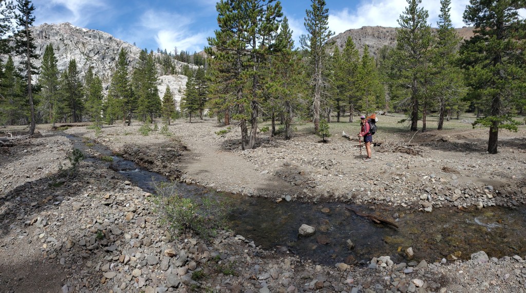
Our day started with an easy walk up Dorothy Lake Pass. Here we left Yosemite and entered Stanislaus National Forest. It was an easy walk down as well, minor snow, but a couple interesting little water crossings.

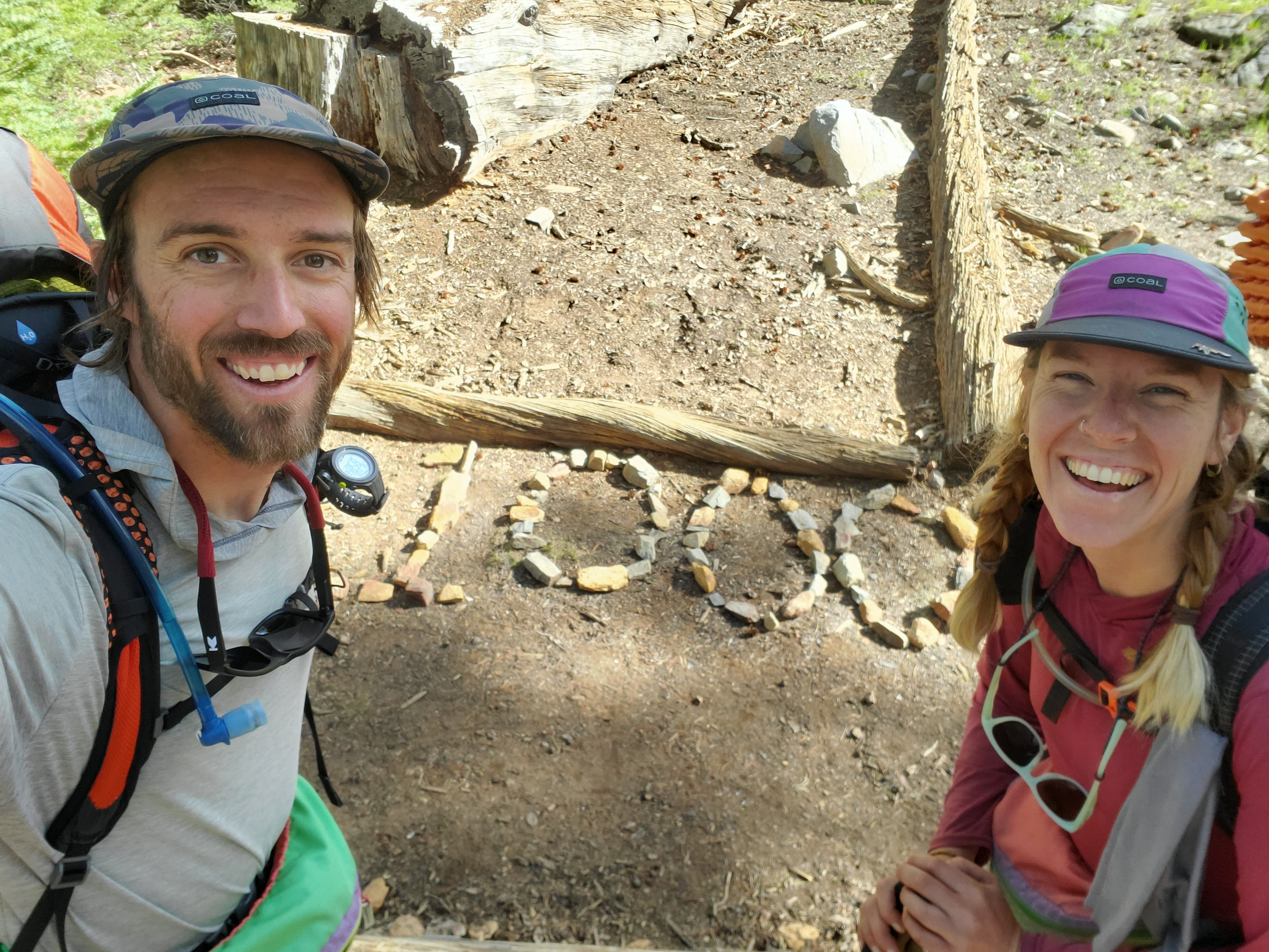
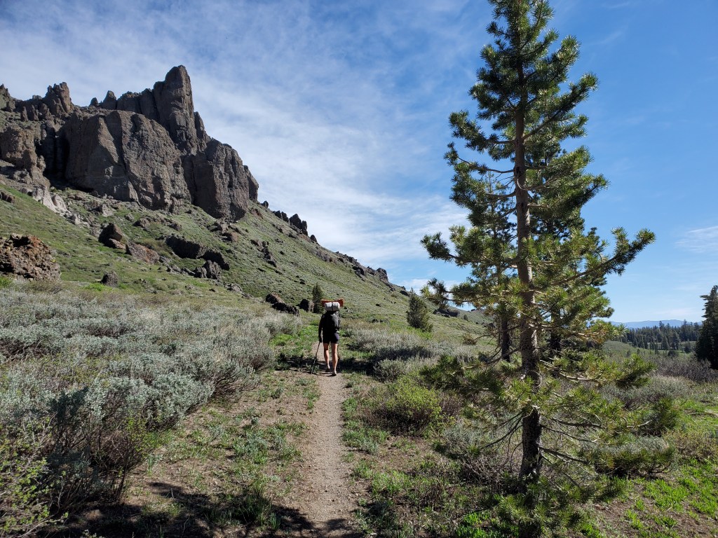
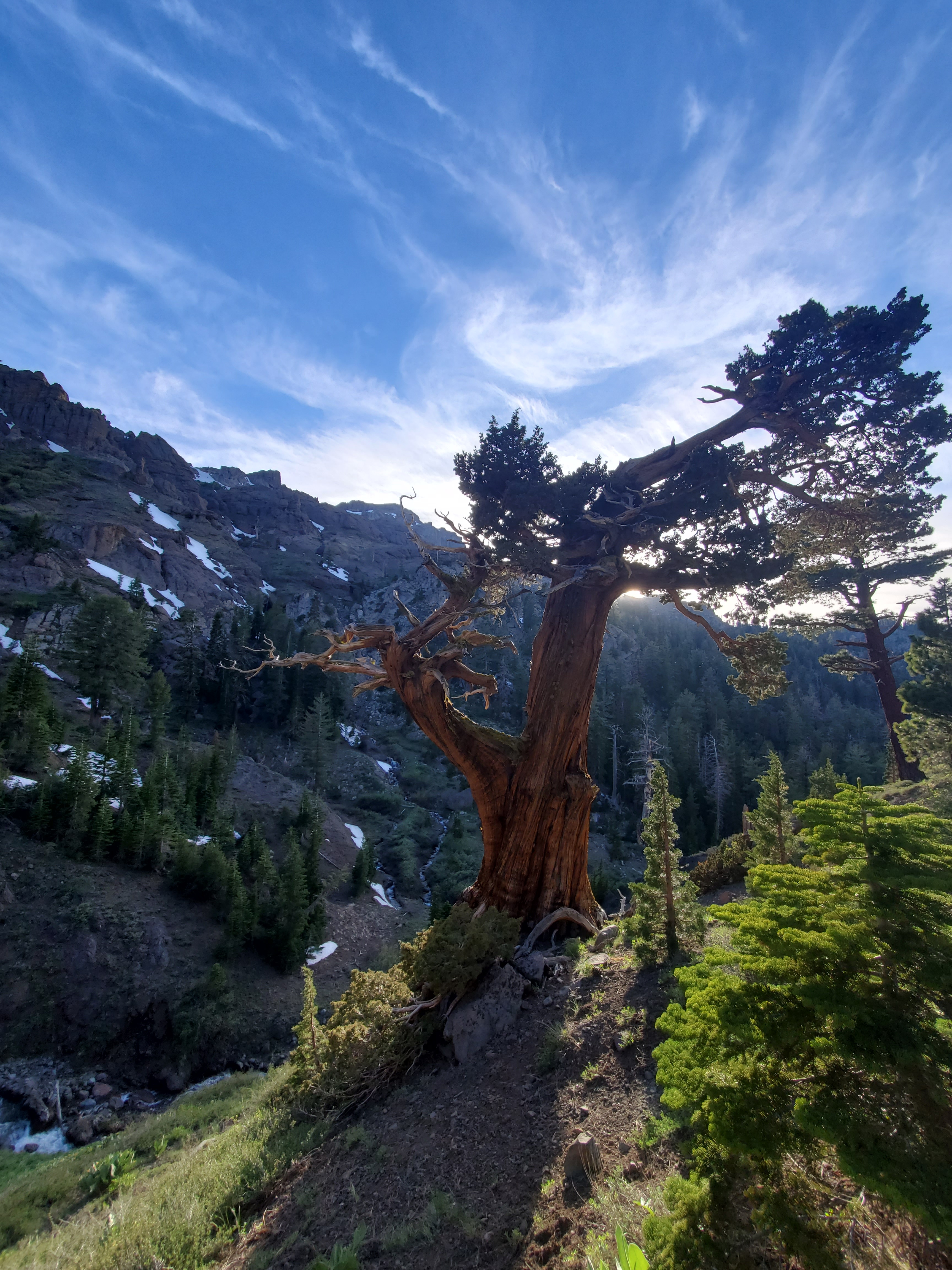
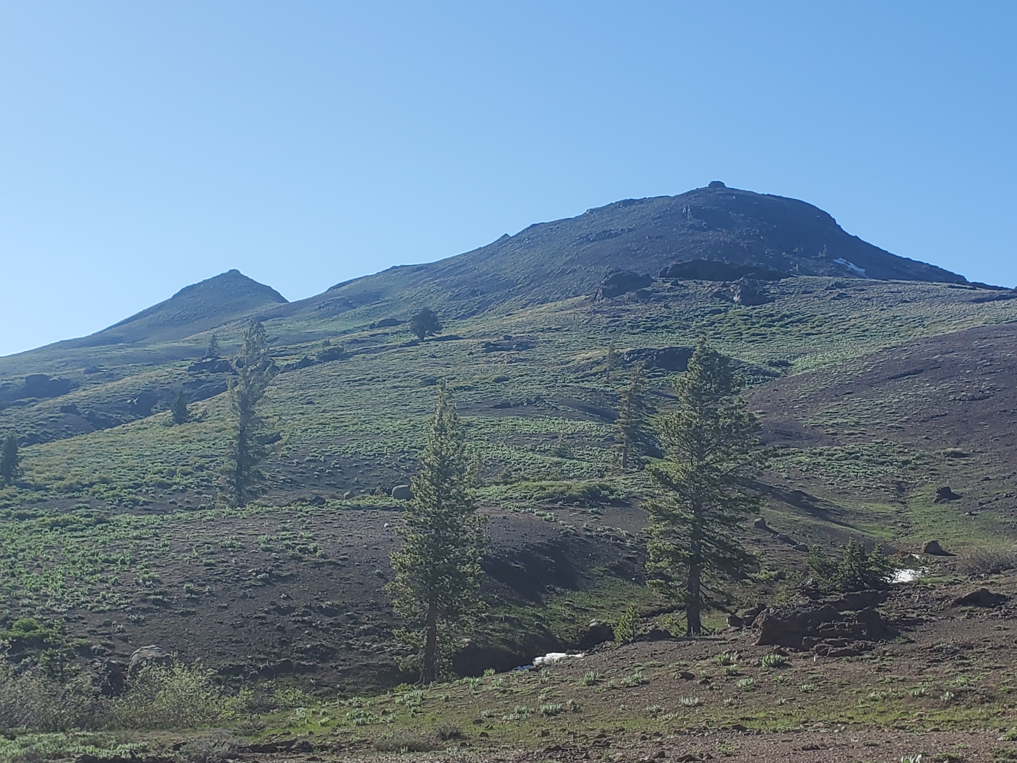
We wandered a couple miles through the forest where we finally stumbled upon the 1000 mile mark. This was momentous for sure. We took a snack break with some mosquitoes to celebrate. We continued on to see the granite give way to volcanic rock, andesite. It was a super interesting and noticeable geological shift.
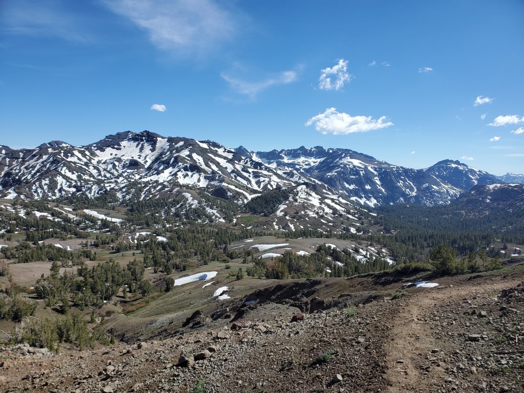
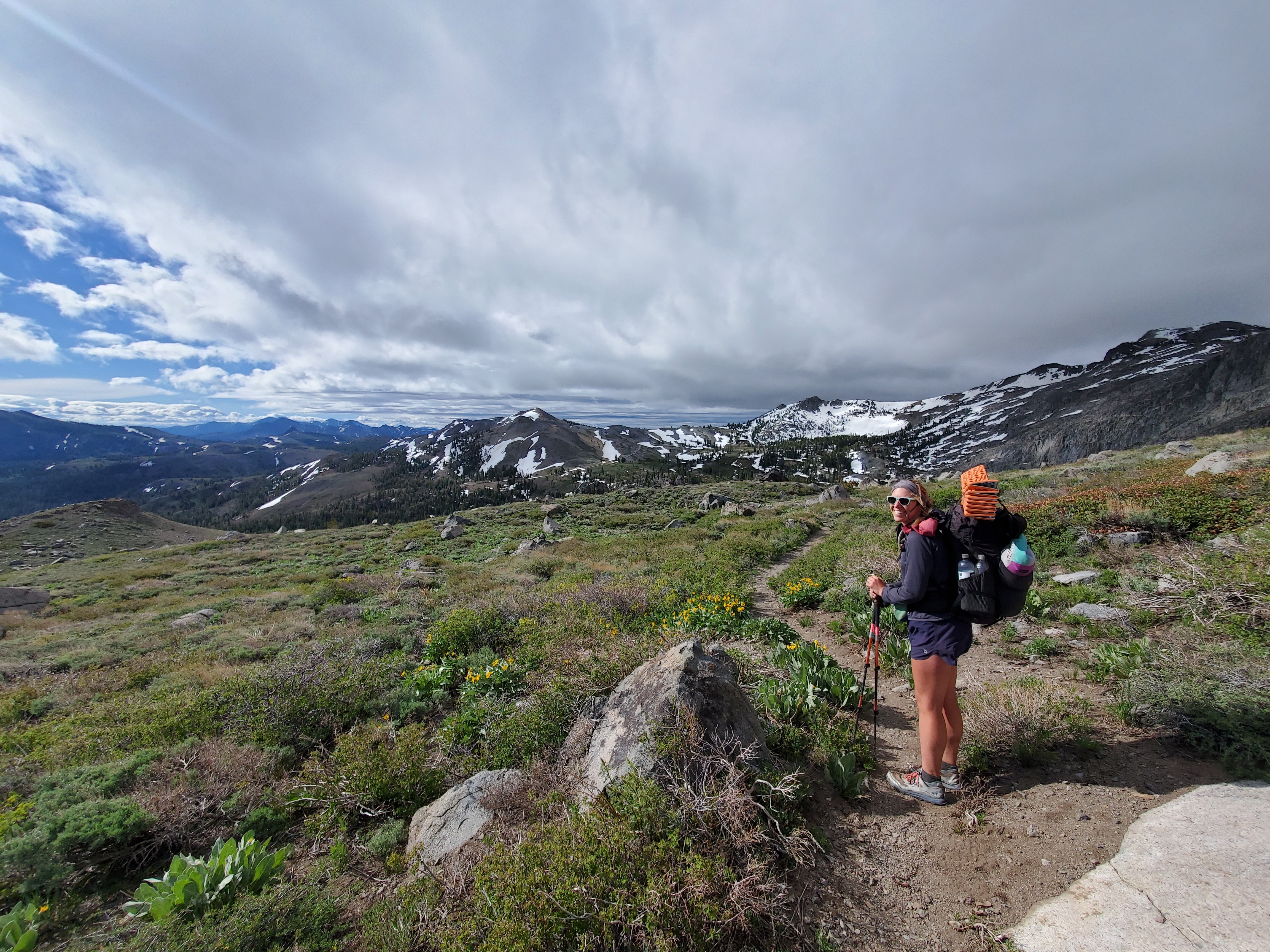
We started up the long climb to the volcanic ridge. In need of food and water, we stopped for lunch part way up, relaxing for an hour and a half. We made our way up top, traversing snow fields as we got higher. The view was awesome. We were high above any appreciable vegetation giving us the first wide open view in quite some time. We could see where we came from and where we were heading.
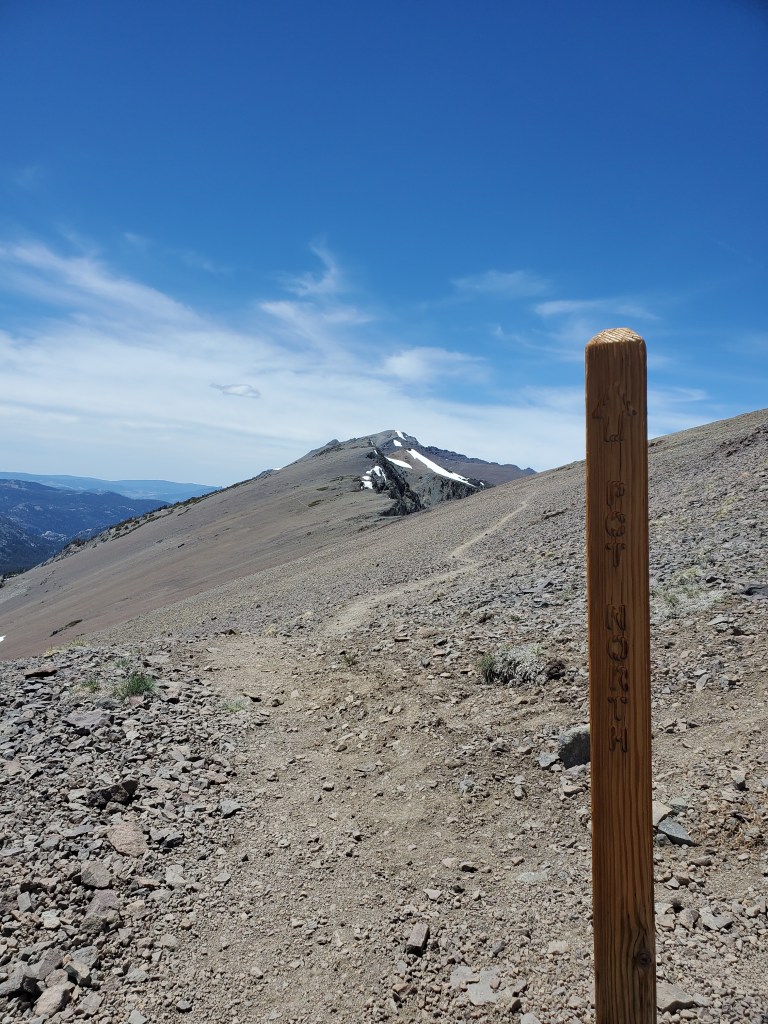
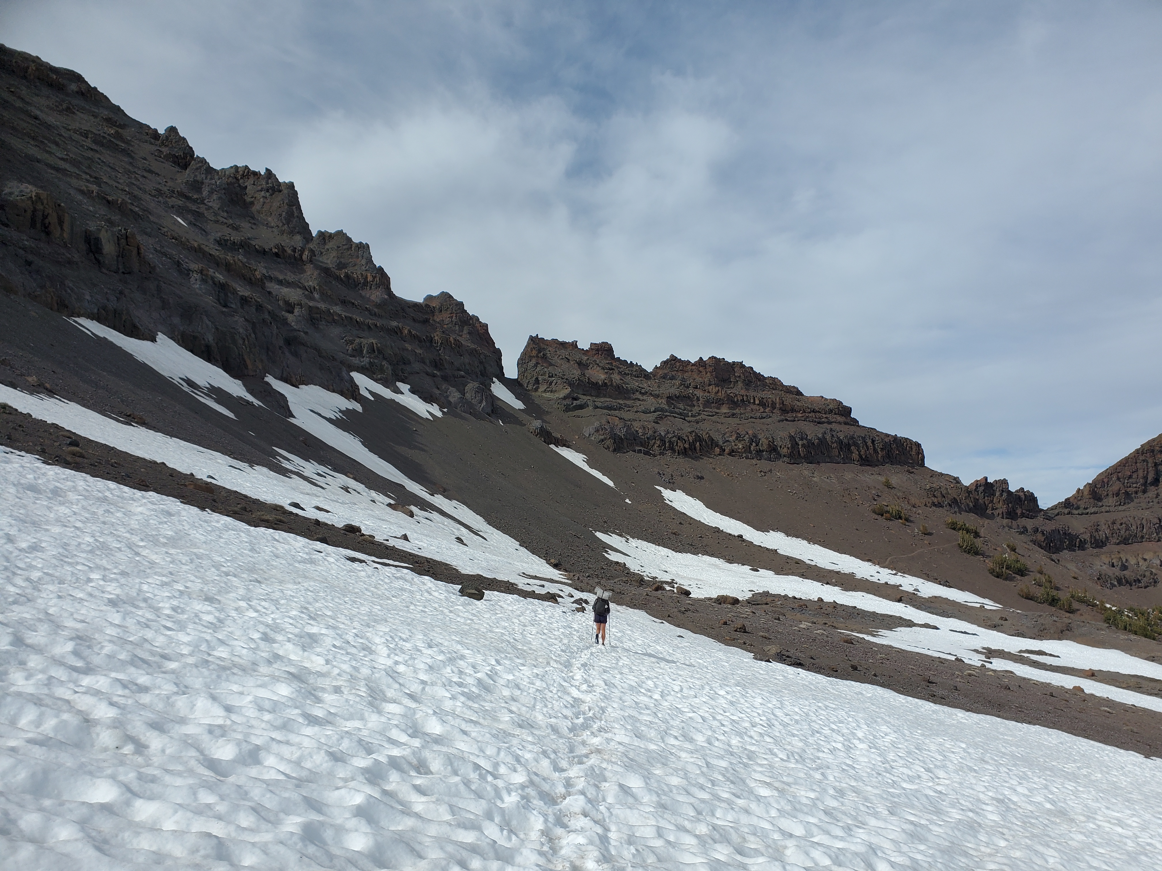
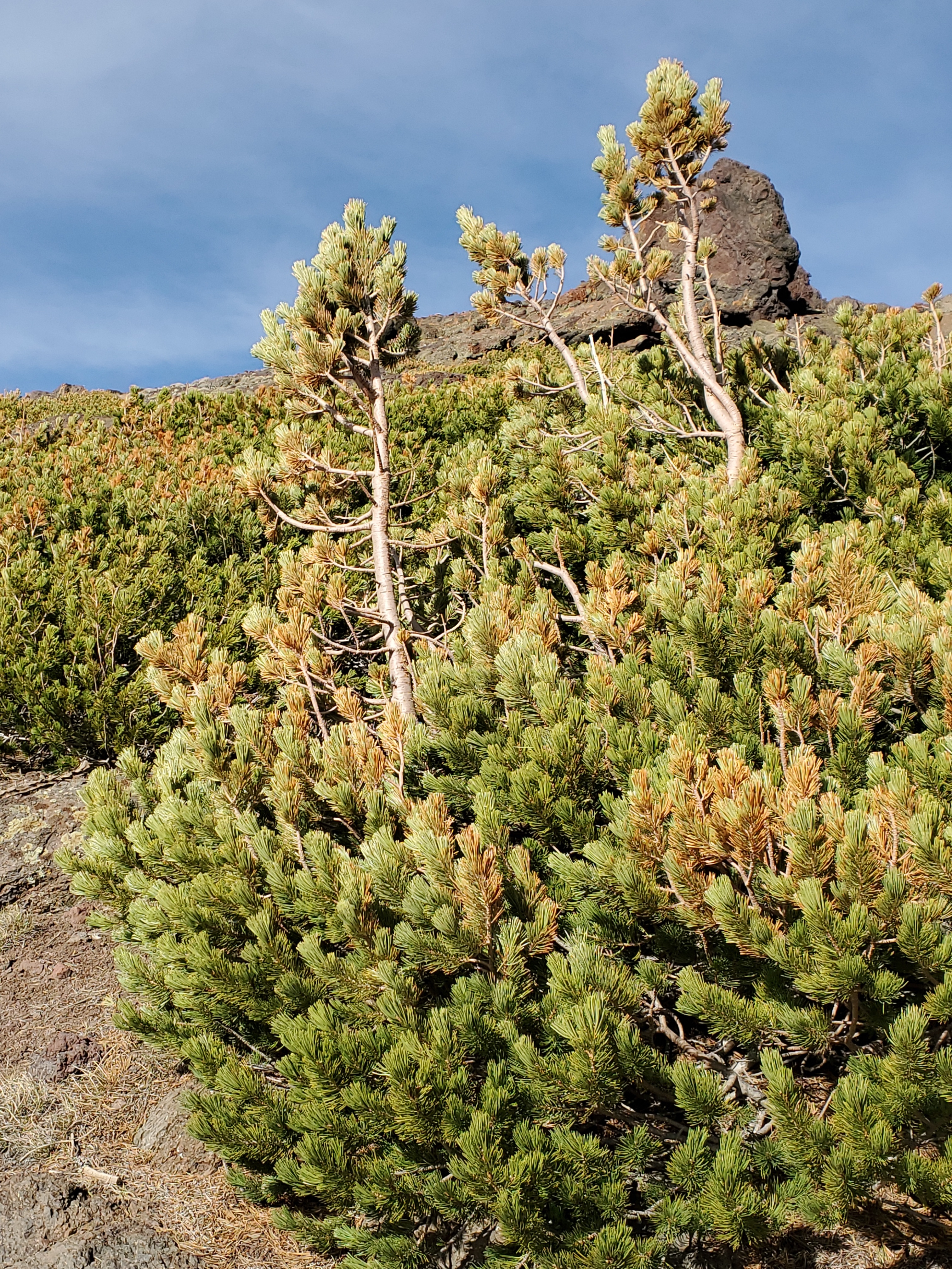
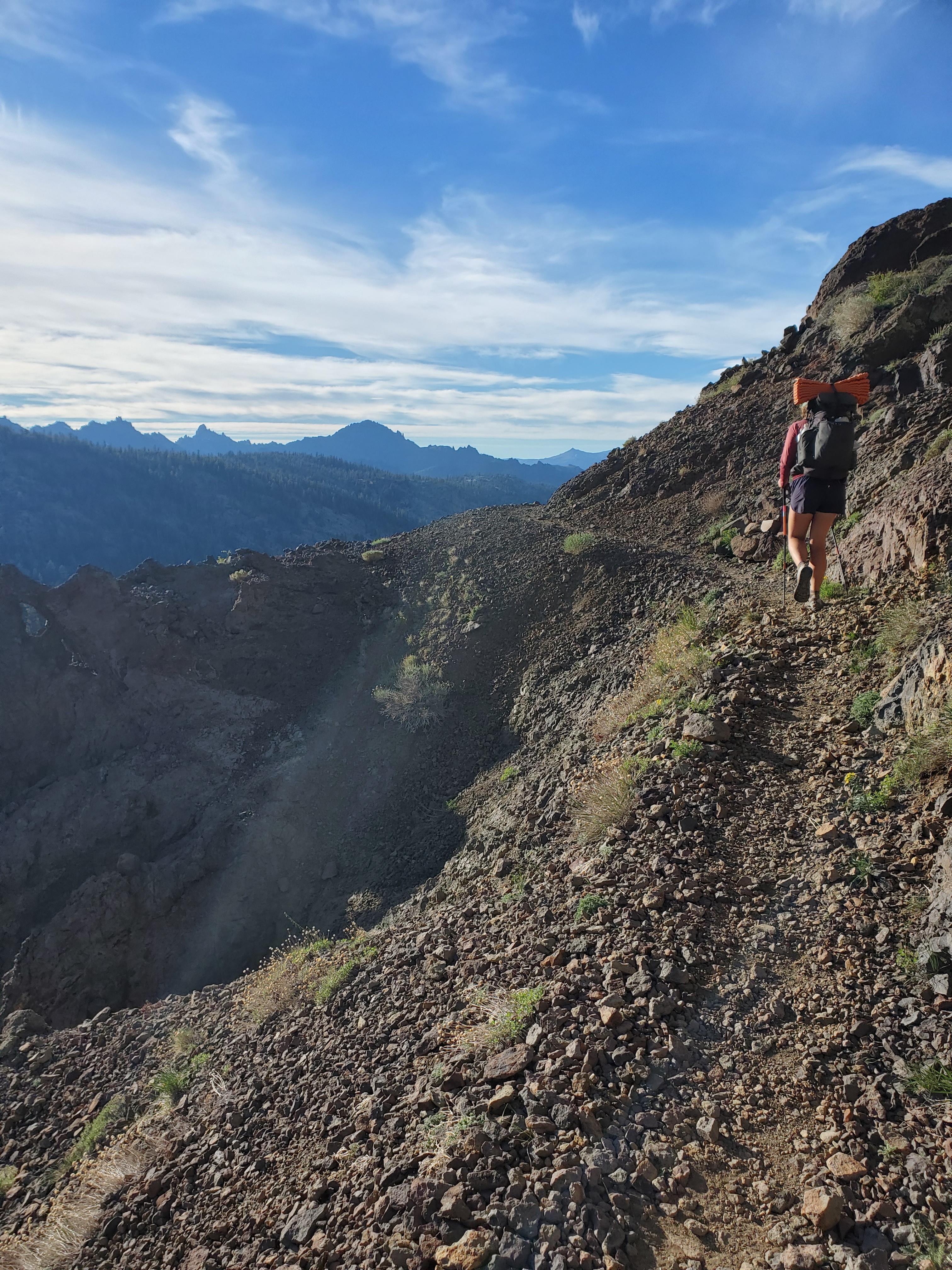
Much of the work done for the day, the trail took us across a few easy miles up high where we reveled in the jagged geology and distant horizon. Up near the ridgeline, bushy whitebark pines lined the trail, kept small by the wind. We took a snack break with cell service for an hour, something we had been largely deprived of in the Sierras. I got a text from my friend Sam, just a link to a song on Spotify – “Miss You” by Russ. Sam and I exchanged some bromantic texts and agreed to talk in the near future. Onward across more snow. A large snow field revealed itself behind a ridge, and while it was not ideal, it was no problem for us by now. On to the last descent. The trail took a couple switchbacks down and suddenly ended at a steep snow field, roughly 40 degrees, and rock solid. There was no bootpack, so clearly everyone else had gone around somehow. There were some foot steps leading down a rock band, so we followed the path, not feeling comfortable on the steep, firm snow. The rock band was more gravel and dirt, and not fun. It ended not far below us nearly vertical, so taking a fall would have had high consequences.
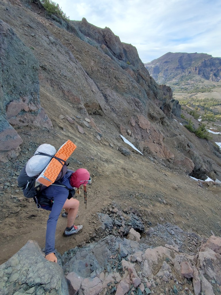

Maggie went first, slowly sliding down on her butt. She made it down to a safe spot to stand and I followed, clinging to the chossy rock. I pulled out a couple of rocks, which did not inspire confidence for continuing down this path. We got across a short, scary traverse back to the snow. We were giving each other very concerned looks. It was after 7pm, the sun was setting soon. We carefully put on microspikes on our small perch just before the snow. I stepped out first. The snow was barely soft enough to carve steps into. All those years of doing the hokey pokey trained me for shaking my feet. Jokes aside, we were not out of danger yet. The snow was steep and slick. We didn’t have our ice axes, and some nasty rocks were protruding through the snow below. It was slow going, one step every 8-10 seconds. Maggie took the lead halfway as my legs were getting tired from carving steps. We eventually made it across to lower angle snow where we could finally walk down comfortably. With little daylight remaining, we weighed our options. From our vantage point up high in this Y-shaped drainage, we could see the PCT straight down, but the trail actually crossed over and around the other side of the “Y” in a big, circuitous loop. We decided to bypass ~1 mile of trail by cruising straight down the closer branch of the drainage. It worked out well, and the shortcut saved a ton of time. We found a camp site half a mile from the road on Sonora Pass. In the dusky light, we got water, made dinner, and debriefed what just happened. I’m not sure how we could have done things differently, and we later heard from most hikers that this spot was the scariest yet on the trail. The adrenaline wore off from our ordeal and we crashed hard.
Day 74 – 7 miles/1023
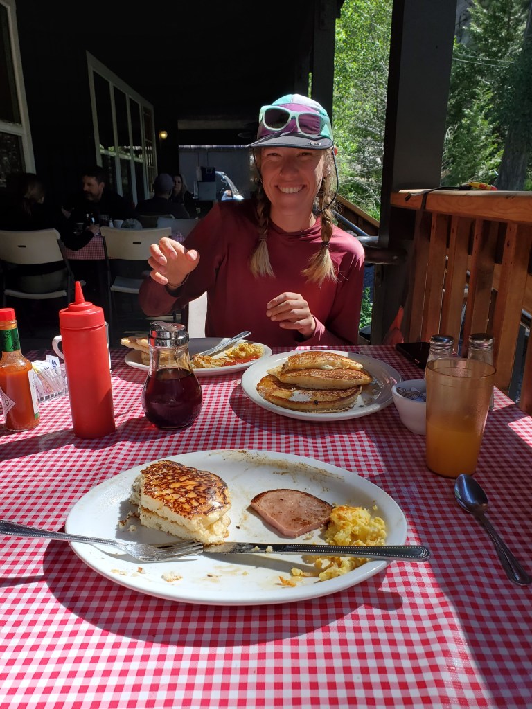
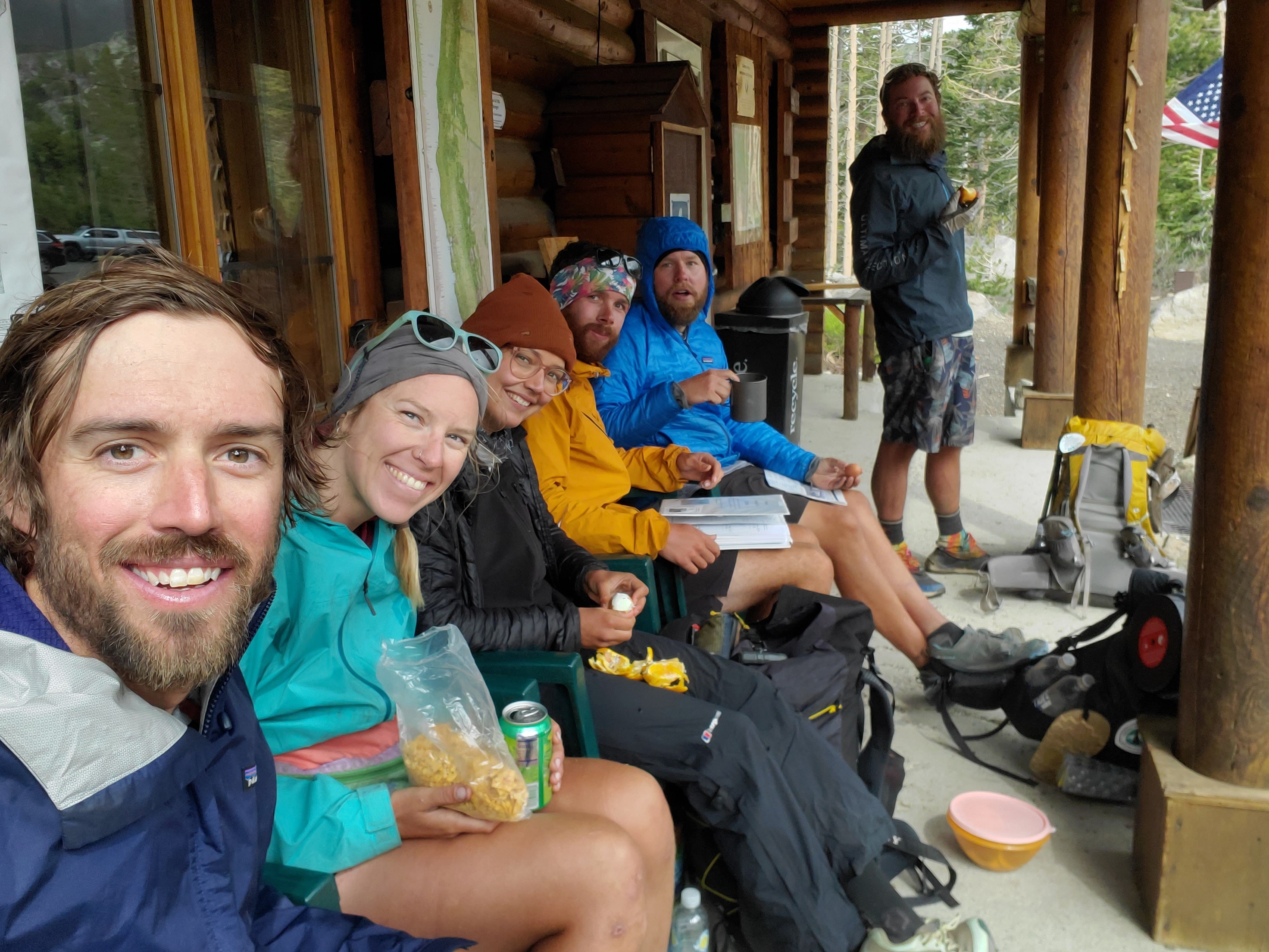
We slept in till 6:30. Our plan was to head into Kennedy Meadows (north), no affiliation with the first Kennedy Meadows, just coincidence. Maggie was ready before me and left first, while I took it slow and walked the half mile to Sonora Pass on Hwy 108. On the way down, I crossed paths with a pair of backcountry skiers who gave us some Bobo’s bites. They were on their way up to ski the gnarly slope we hiked down the day before. I wished them luck as we parted ways. At the road I found Maggie. We heard a motorcycle coming over the hill, and behind it a Volkswagen. Thumbs up and he stopped, first car! The driver was picking up his son who was section hiking the PCT, so he was happy to take us to Kennedy Meadows North. The driver, Bryan, had his small dog in the car, who wanted many pets. On the drive down, Bryan and his son Kias, were bantering about how his GPS device died out on the trail because Bryan’s mom was messaging Kias too much. It was quite comical, especially since we haven’t gotten any messages on our InReach yet. We unloaded at Kennedy Meadows North and immediately got seated for breakfast at the resort. Naturally, we ate way too much food.
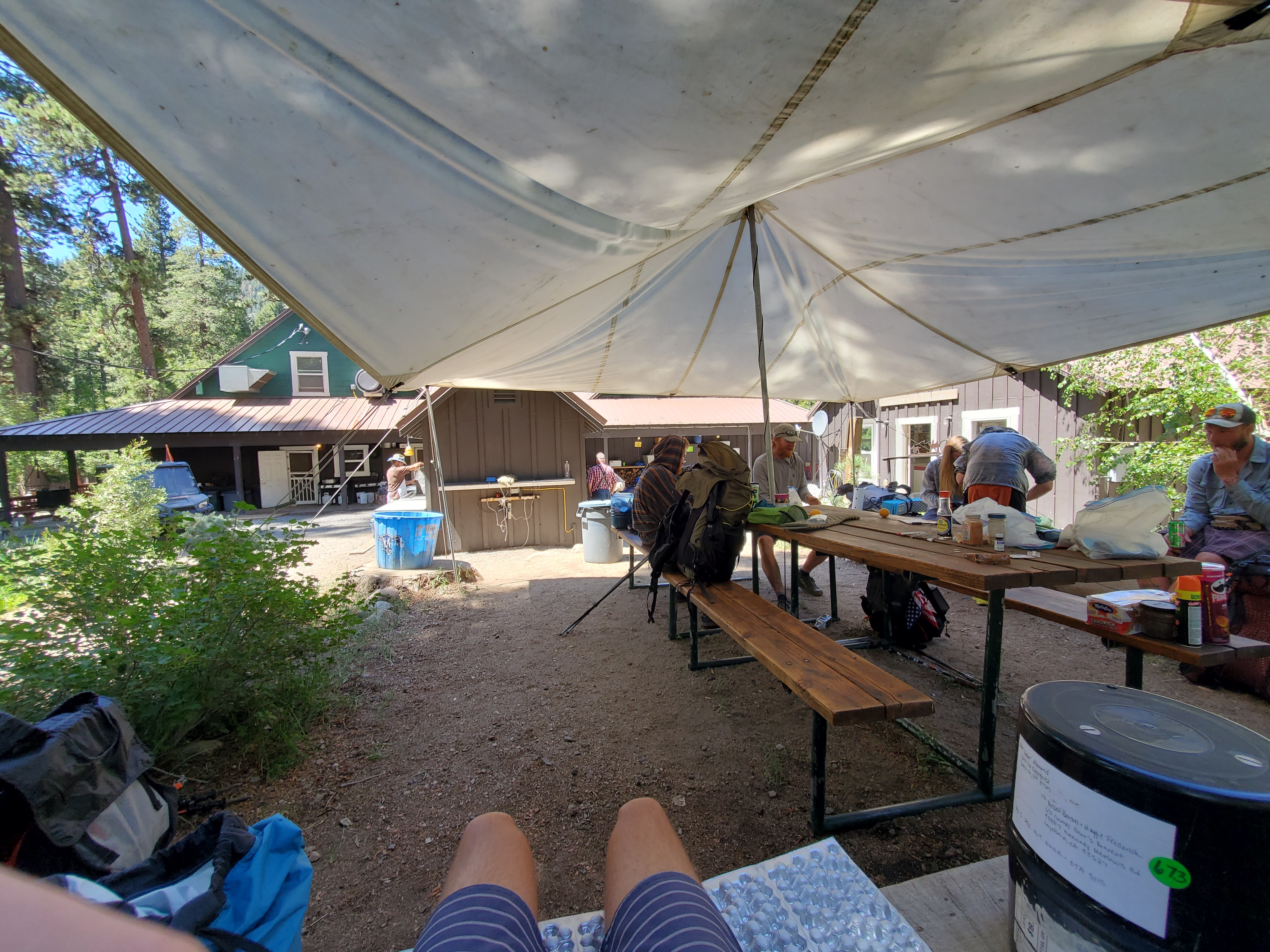
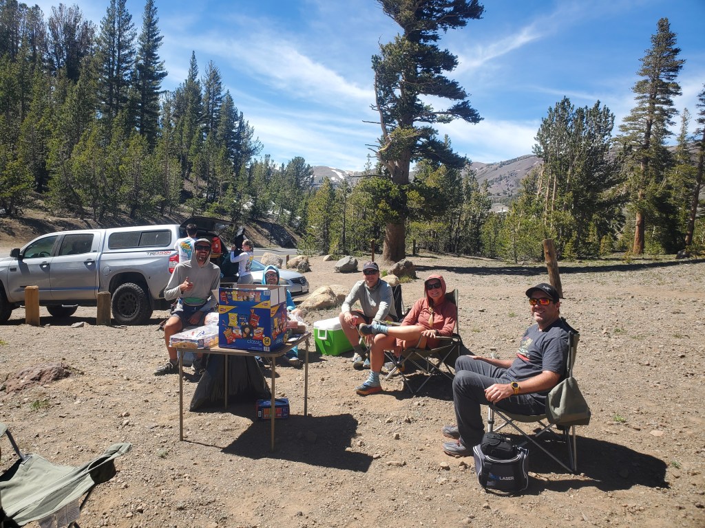
We chilled with other hikers under the PCT hiker tent back behind the lodge, out of sight from the paying guests who were there for scenery and fishing. We were able to get a 4 day resupply from the small store on site. We ordered some lunch to-go and packed up. The resort does run a shuttle for hikers, which was nice, so we piled into the big white van with 6 other hikers and a sweet yellow Labrador. Back at the top of Sonora Pass, someone was doing trail magic. We indulged in some chips and cold drinks, despite just having an easy day with good food so far. We chatted with the trail angel, Pogo, a PCT alum from 2019. He wanted to give back some generosity he has received on the trail a few years prior.
Full of food in our bellies and our packs, we set off to hike 6 miles around Sonora peak down to east fork of Carson River. It was a short climb that felt entirely too long. Down the north side, we were back into the old pattern of romping down soft snow, route finding through rocks, mud, and shrubs.
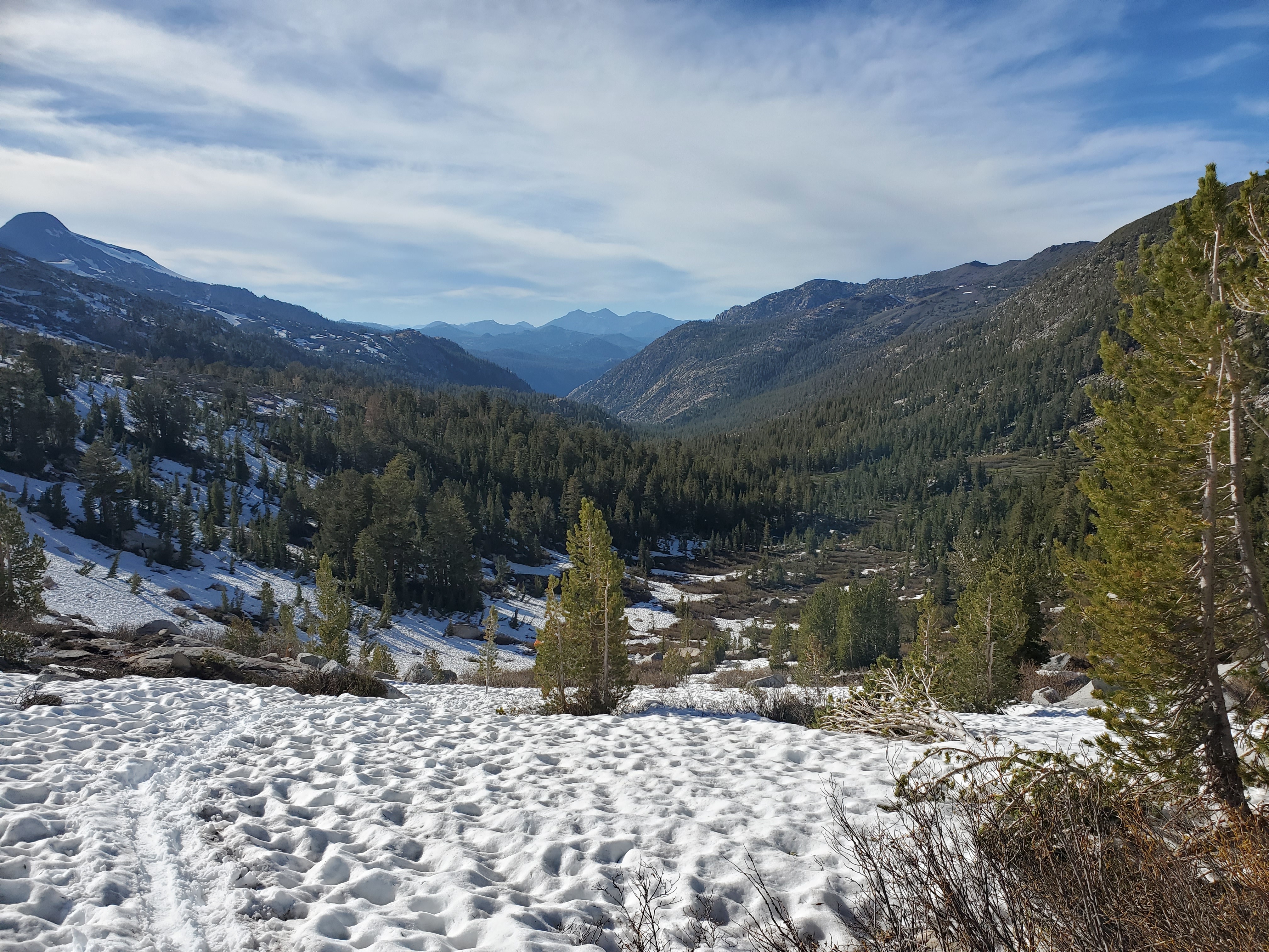
On the descent, we dropped below 10,000 feet for the last time on the PCT. I was optimistic this would mean we might be seeing less snow ahead. We found the trail again for a little ways to our campsite next to the river. It was a great nearo, but we were getting back to work the next day.
Day 75 – 24 miles/1047
Maggie and I had purchased four days of food, but we realized we could get to South Lake Tahoe in three days if we did a few more miles each day. We got going early and began our day by climbing out of the valley. We were back in between granite ridges rather than volcanic rock, hinting that the Sierras weren’t quite done yet.
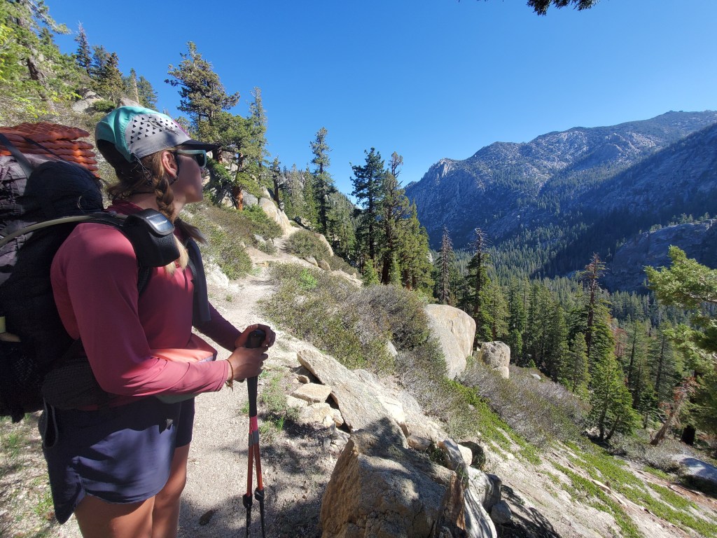
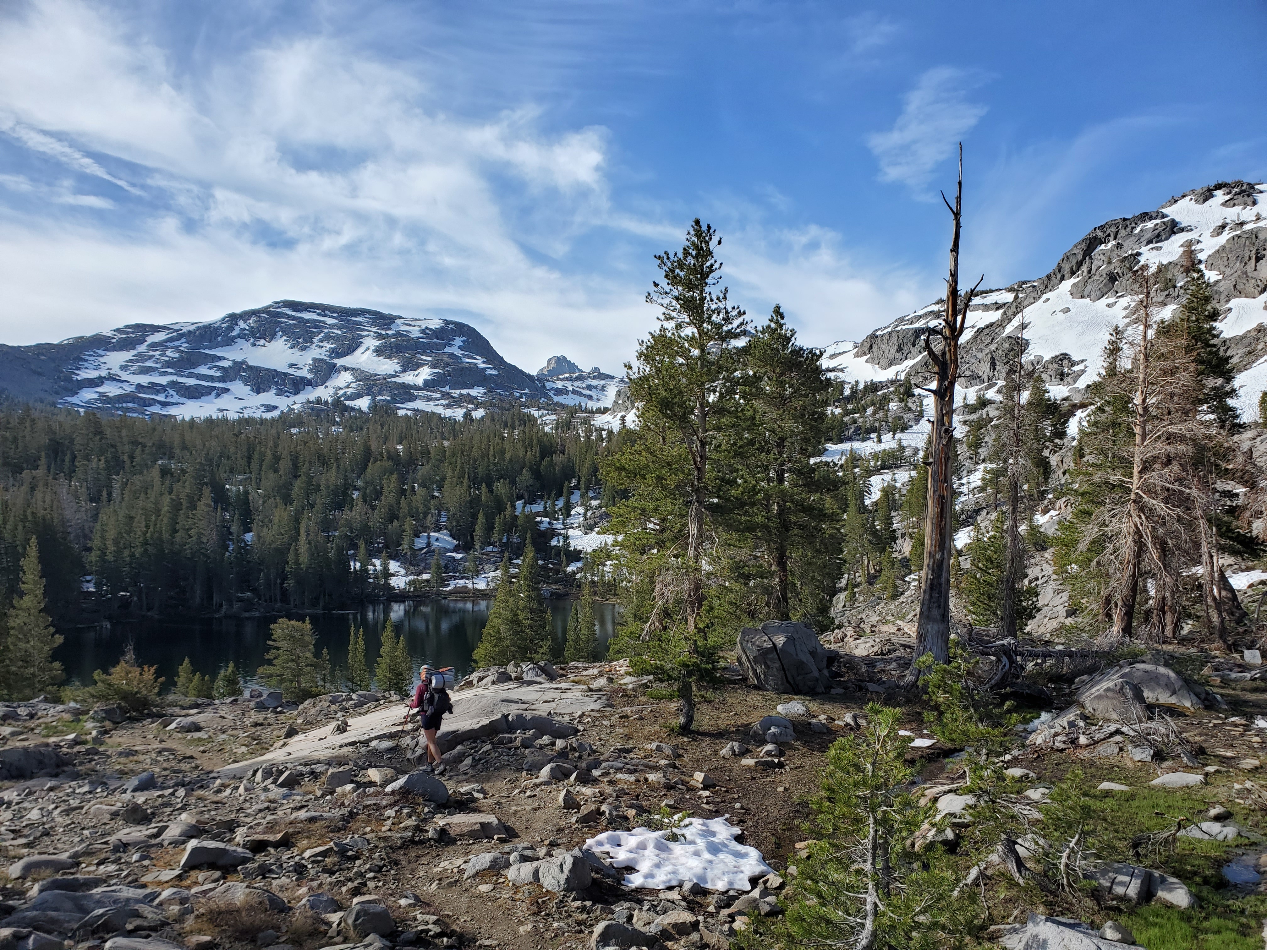
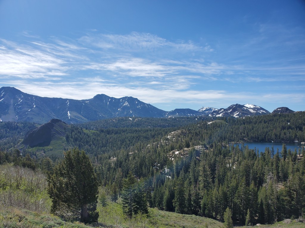
Overall, it was a bit of an odd day, at least for the first half. There was nothing too special, nothing to complain about. We hiked mostly in the forest. Around the next volcano, the trees opened up for a couple spots with good views. There was some snow to deal with, but very manageable compared to what we’ve seen to this point. We didn’t talk much with each other while we hiked, nor did we see too many hikers. We climbed up to a high saddle after doing 20 miles. We got a nice view of the next valley topped by an alpine lake.
Eager to get to camp, we booked it down from the saddle. The trail took us down below the lake to an interesting stream crossing in a steep walled drainage. We accepted wet feet near the end of the day so we could get to camp. The last two miles involved some unexpected climbing, which was tough so late in the day. We made it at last to a beautiful campsite at the end of a high ridge. There were a handful of other hikers set up already. We talked with Sugar Daddy, Runaway, Meth Trout, Crash, and Puff while we ate. The sun set as the conversation carried on, noticeably later as we approached the summer solstice.
Day 76 – 23 miles/1070
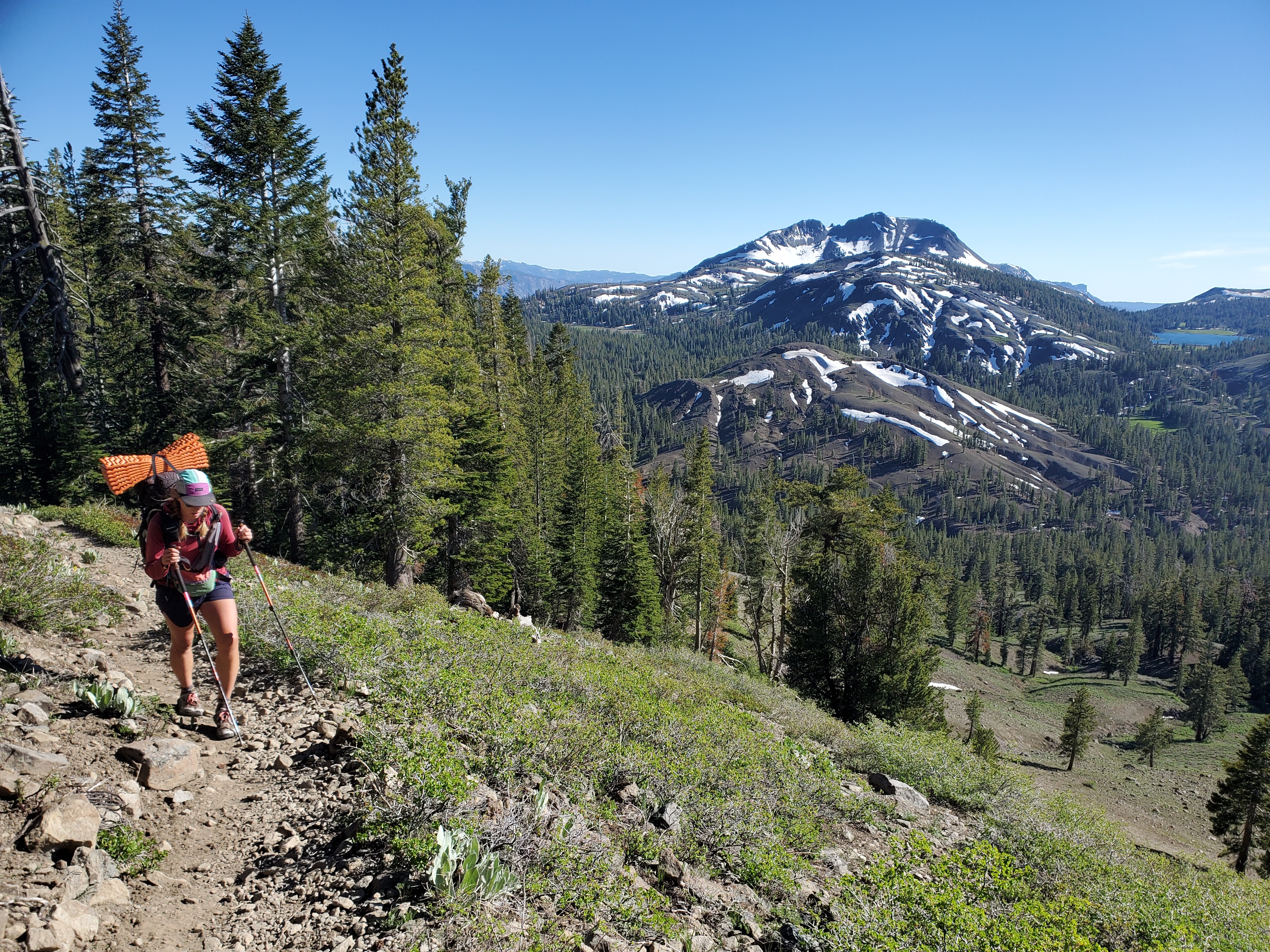
It was another dull day for most of the hike. We descended from our high perch through lots of pine and fir forest. Some more volcanoes were appearing between the granite. There were lots of day hikers out on this beautiful Saturday, although the wind was picking up throughout the day and I sensed a change in the weather was coming.
We stopped for lunch by a small creek. We took our sweaty shirts off and I asked Maggie if she could tell how much weight I had lost. It was apparent to her, and I was feeling down that I had lost a noteicable amount of weight not even half way through the trek. Motivation to eat more. We hiked on, and near the end of the day, we climbed up the side of The Nipple. We got nice view up here, and we were both feeling better at that point.

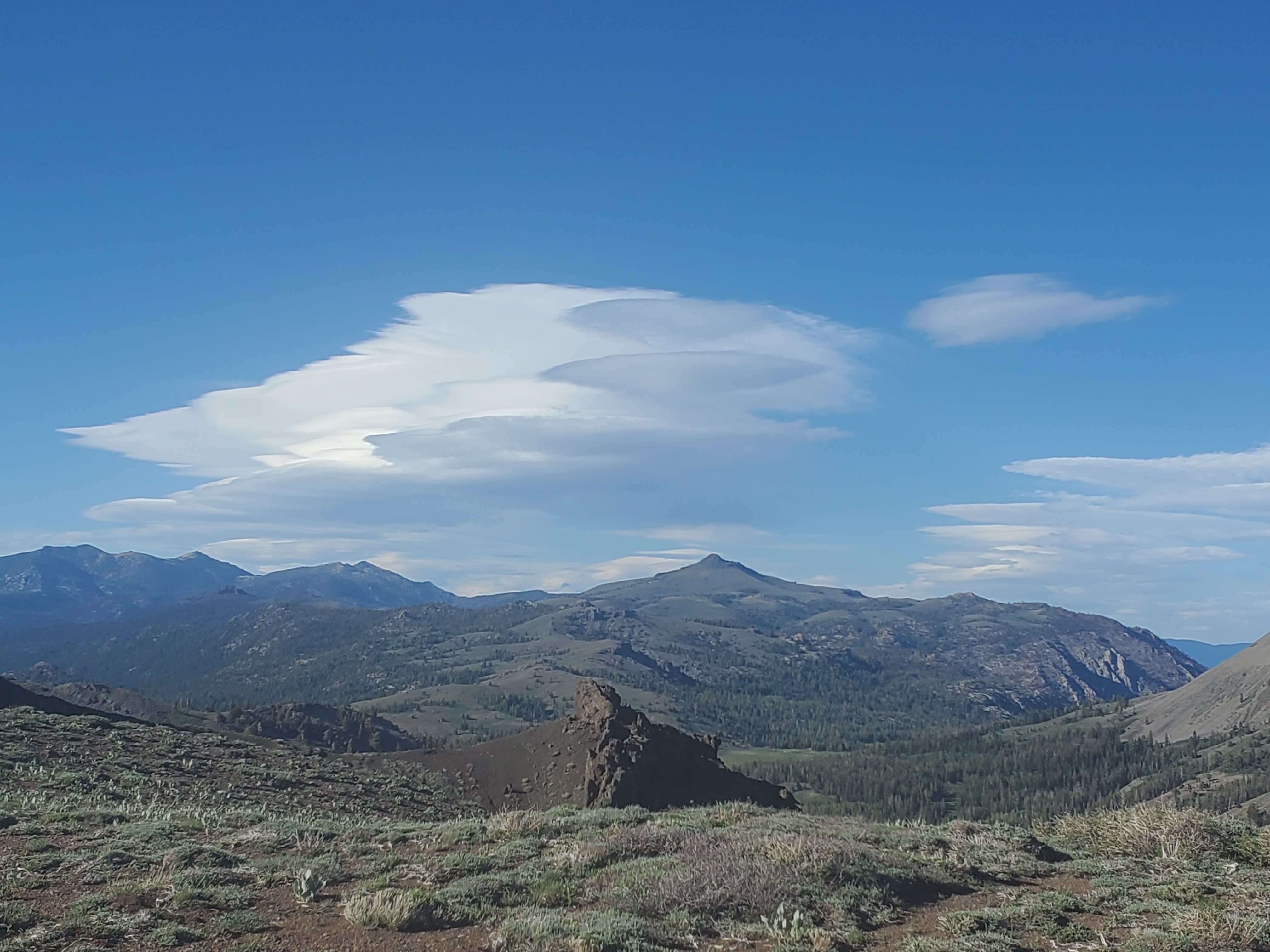
The wind had only increased and a large lenticular cloud appeared in the distance. We cruised on to get to camp. Down the north side of The Nipple, there were a couple snow fields to cross. On the last bit of snow, which was on a steep sidehill, Maggie said, “Do you see that chonky marmot down there?” I spotted the ball of fur and returned my focus to the snow travel. “Wait, that’s not a marmot…” Maggie said. We looked closer and sure enough a cat was staring back up at us.
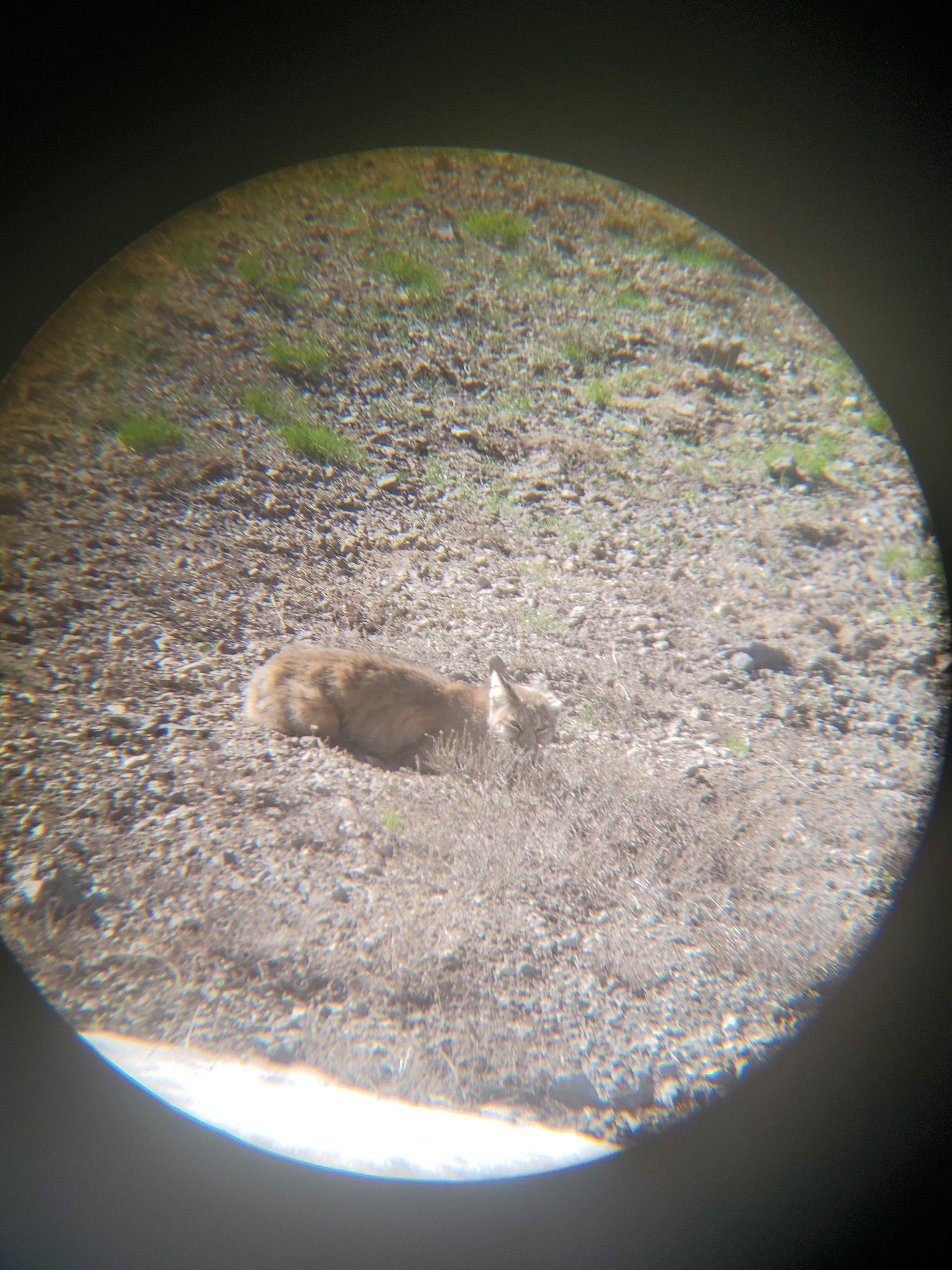
Mountain lion? No, too small. Bob cat? No pattern on the fur. We accidentally kicked some snow down and the cat scurried away into some trees. We saw its stubby tail and now believe it was in fact a lynx. Super cool to see! We pushed on for the last mile to camp by lost lake, a choir of frogs singing to us all night.
Day 77 – 21 miles/1091
We woke up at 5am, and got moving at 6:50. We wanted to get an early start with an incoming storm and just over 20 miles to cover to South Lake Tahoe. It would be ideal to get to Highway 50 before dark in order to hitch. Our first obstacle was a high ridge before Carson Pass. We hiked fast over rolling terrain and snow fields around Roundtop Mountain to get our day going.
It was rather windy. We climbed up this ridge, encountering some more “no fall zone” snow fields, but the boot pack was solid and we got across safely. On the descent, some light rain started. The storm was here. We saw a few day hikers heading up to where we just were and I suspected that the storm was going to ruin their hike. We stopped at Carson Pass visitor center where the nice ladies running it provided trail magic- oreos, apples, hard boiled eggs, and seltzer! We snacked with other hikers under the awning and watched the rain turn on and off.

We set off again into intermittent drizzle, which gradually picked up over the next hour into steady rain. We hiked mostly through open pines and exposed meadows, where we felt the full force of the wind and rain. We ate lunch under some hemlocks by Showers Lake, very apropos for the free showers that fell on us. Sitting down we got cold, so we took a short lunch break.
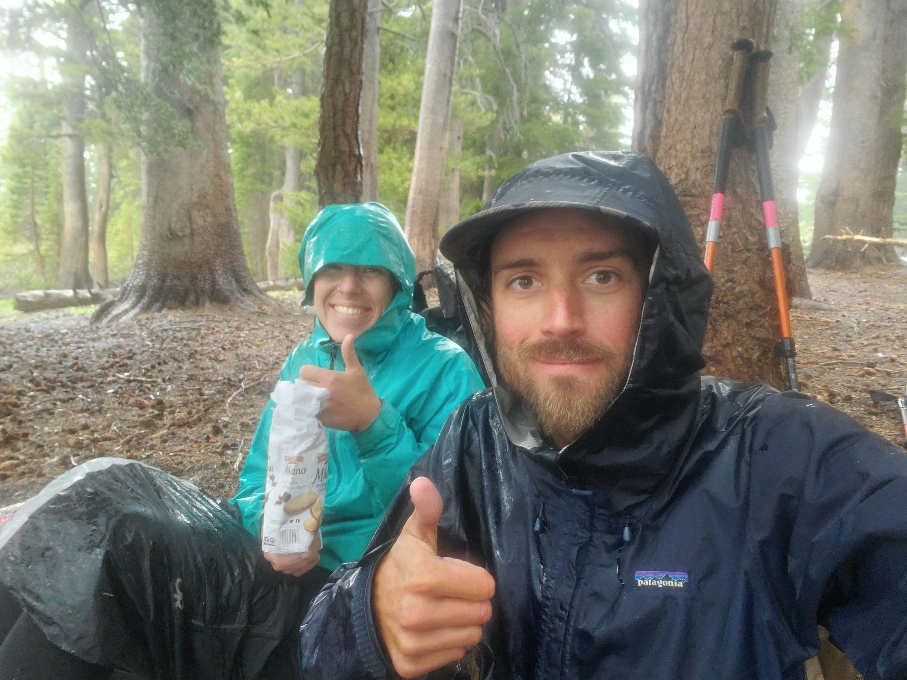
We kept moving and saw two guys hiking the other way, but no one else after that. Of course, there was some more snow, which was quite interesting to walk on after a few hours of rain. Between keeping our heads down and the intermittent fog, we didn’t see much scenery, just chugged through the miles to get to town. The rain was coming down in sheets, soaking the rain gear, but we generally stayed dry. At last, as we began the final descent, the rain let up. We could see the the granite cliffs and steps around Benwood Meadow. We made it out to Hwy 50 around 4pm, the fastest 21 miles we had hiked to date.
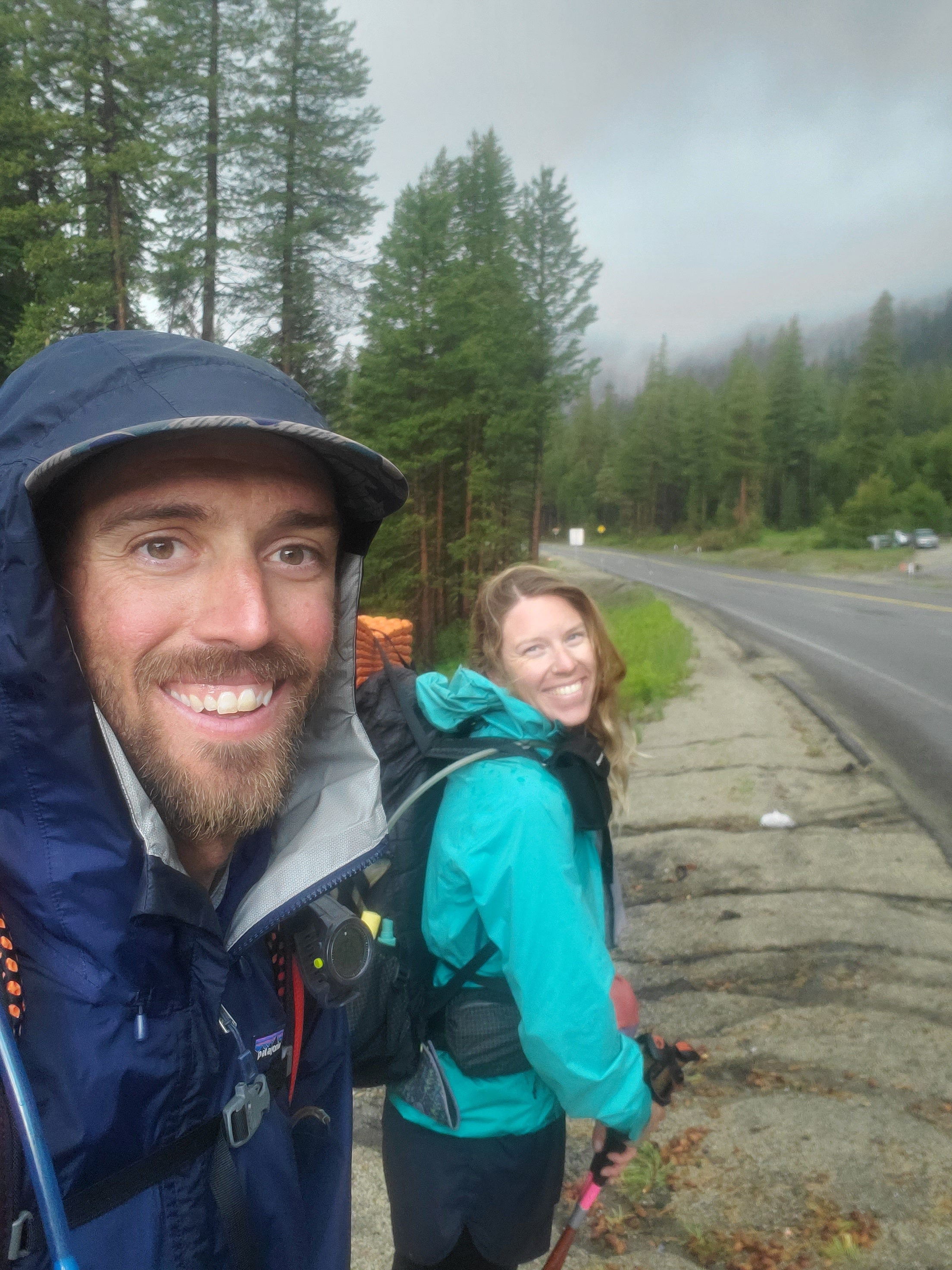
We posted up on the shoulder, believing someone would quickly take pity on some weary hikers standing in the drizzle. We were mistaken as a hundred cars whizzed by and no one stopped for half an hour. I was about to go look at a list of Tahoe trail angels when a gold Toyota Highlander came around from the other side of the highway. A young couple saw us and decided to turn around to pick us up! They were on the way home from a weekend trip, the back of their car was full of stuff on top of their in-car bed. We squeezed in the back and thanked them for picking us up. They dropped us off near a bus stop. We waited for 10-15 minutes and rode the rest of the way to our hotel.
A hot shower was heaven after trudging through the cold rain all day. Maggie got laundry going at the hotel while I went and picked up Chipotle burrito bowls and a pint of ice cream for dinner. We got our fill of food and passed out, happy to have a soft bed and solid roof overhead.
Day 78 – 0 miles/1091
Resupply day in South Lake Tahoe. Lots of wandering around. Breakfast. Gear store. Mailed our snow gear and bear canisters back to New Mexico. Lunch. Grocery shopping. Dinner. Nothing too interesting happened
