
It is true, we were still in California after more than 100 days of hiking. Geopolitical boundaries seem arbitrary to a dirt path, but walking to Oregon from the Mexican border felt like a major milestone, and it was finally within reach…
Day 108 – 22 miles/1624 (7/13/22)
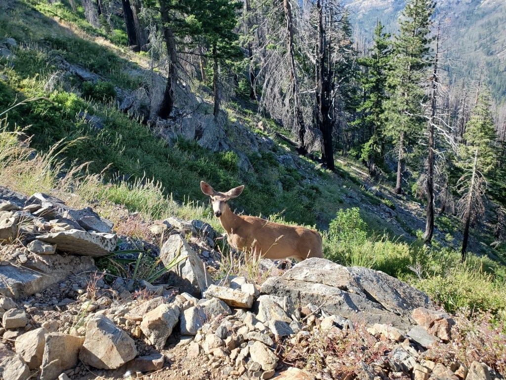
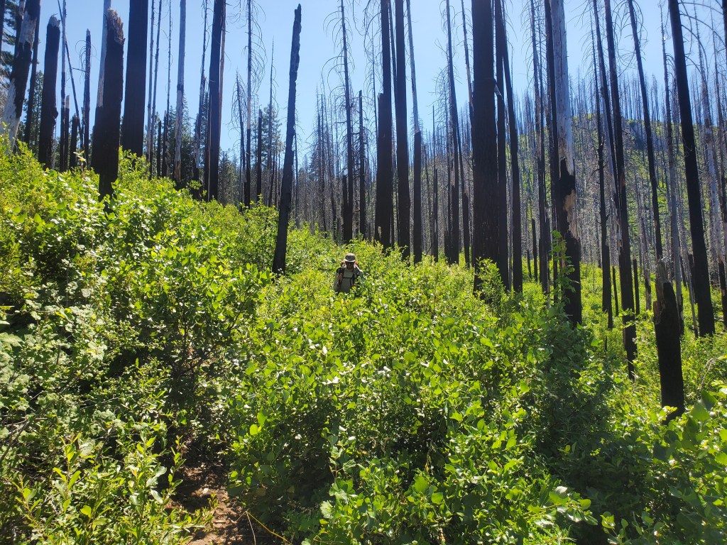
Our day started with passing through a burn scar, and an abundance of blowdown that typically comes with the burn. At our first water stop a few miles in, a curious, or rather, an intrusive deer paid us a visit. It loped around, slowly getting closer to us, pretending to not notice our presence. It came within 10 feet of us, clearly unafraid of humans. Honestly it seemed like the deer was looking for something from us. I tried my best to instill some fear in the deer, growling and throwing sticks to chase it off.
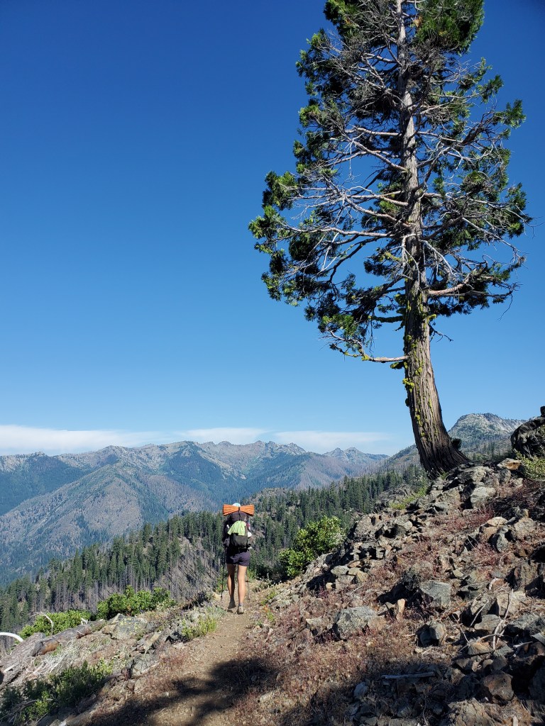
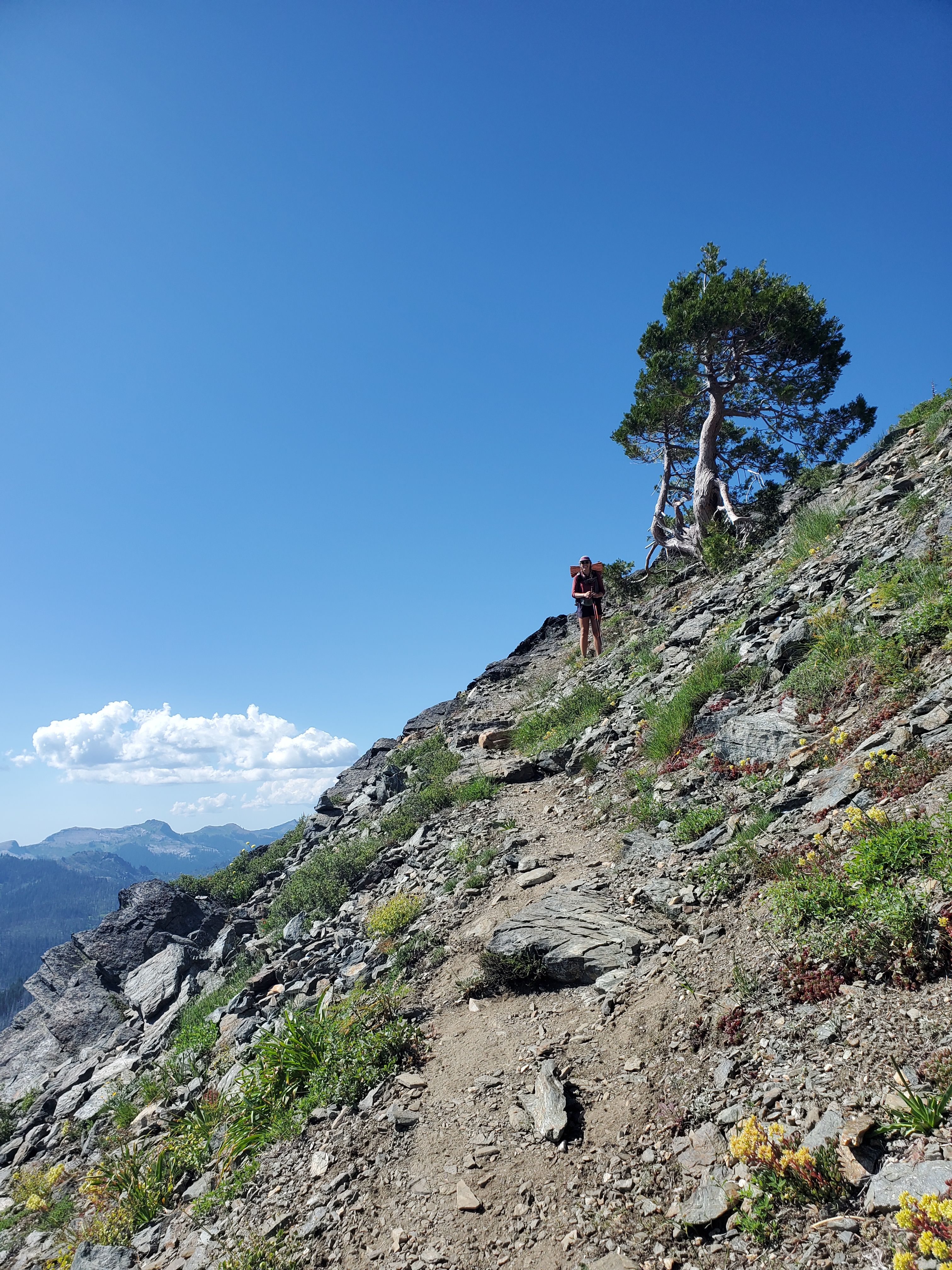
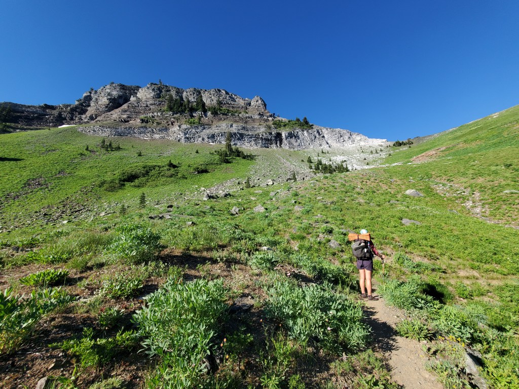
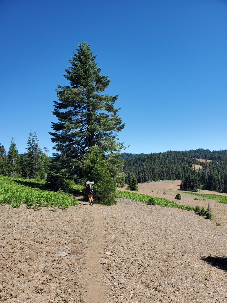
We hiked on, leaving behind the burn. We got cell service on an open ridge, where we booked a room in Medford. Between all the stops, and feeling a bit sluggish after our stay in Etna, we had only covered 8 miles before lunch. Fueled up, we were ready to push for Marble Mountain. The trail followed the ridge above 6,000 feet, where we got amazing view of the surrounding mountains. When the ridge became too technical, the trail dropped down, passing by beautiful lakes and ponds.
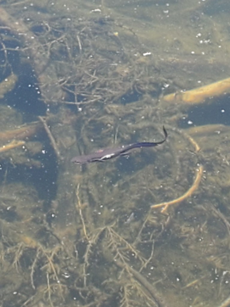
A few ponds had rough skinned newts, swimming around with long eel-like tails. North American newts are unique in that they are born in the water, live on land as juveniles, then return to the water as adults. How neat is that?! A little further on, we saw a large, fresh pile of bear scat on the trail. A strong odor filled the air, and we sensed the creature was nearby. Alas, we never saw the culprit who dropped the trail scat… A small climb back up over the ridge brought us above Man Eaten Lake – and wow – this was one of the prettiest spots yet in the Trinity Alps!
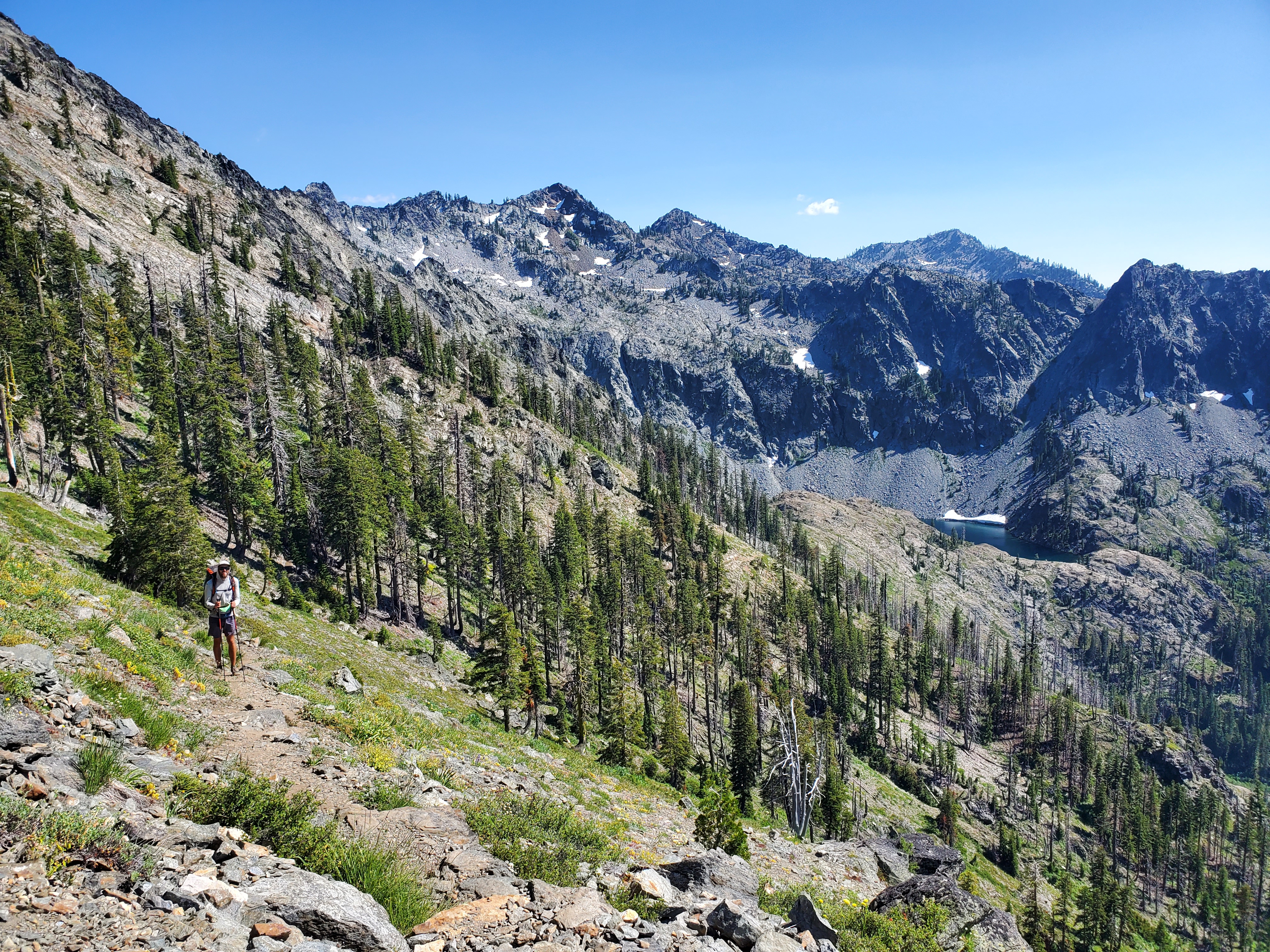
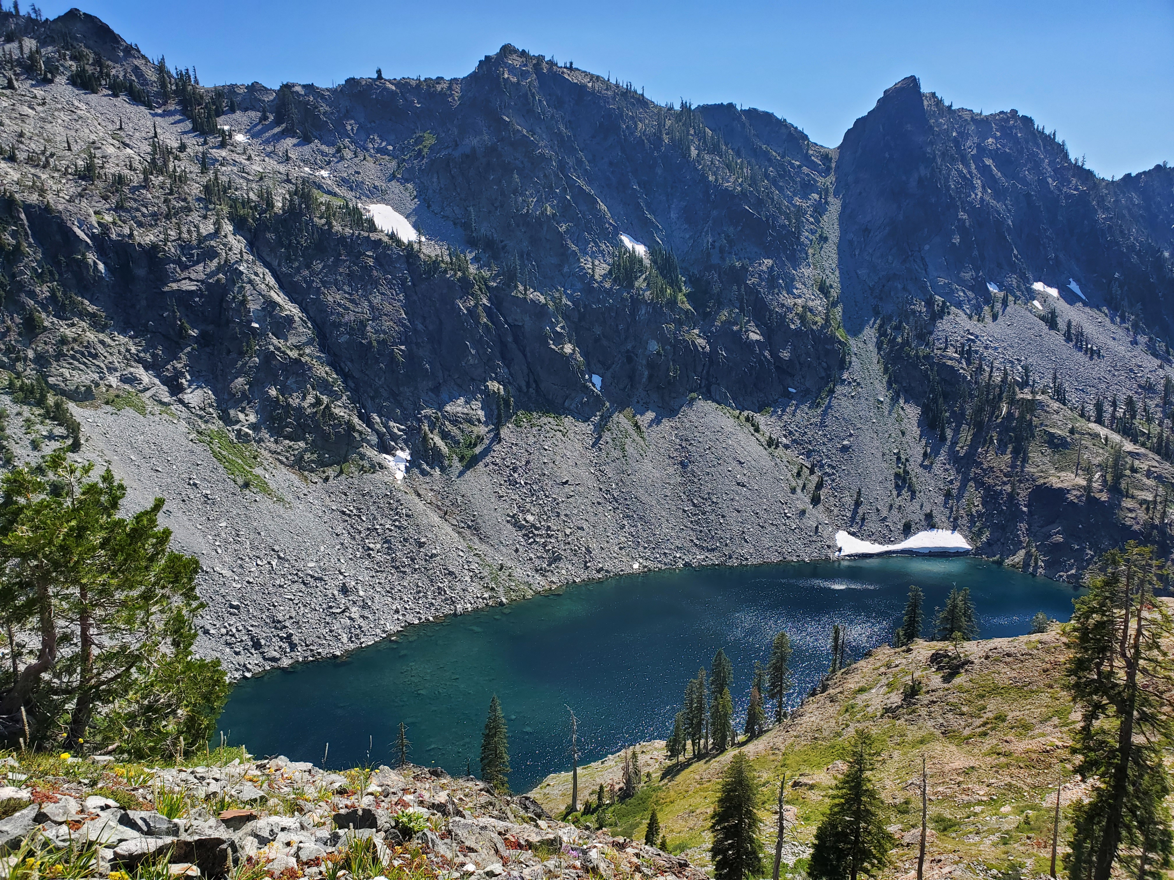
The deep aquamarine lake was so clear, we could see boulders beneath the surface from our high perch. Rugged peaks surrounded the basin, a smattering of snow holding on through the summer heat waves. We carried on along the ridge, then dropped down by Marble Mountain. Sadly, there I couldn’t find a good view of the shining white peak, but piles of marble lined the trail for the final mile.
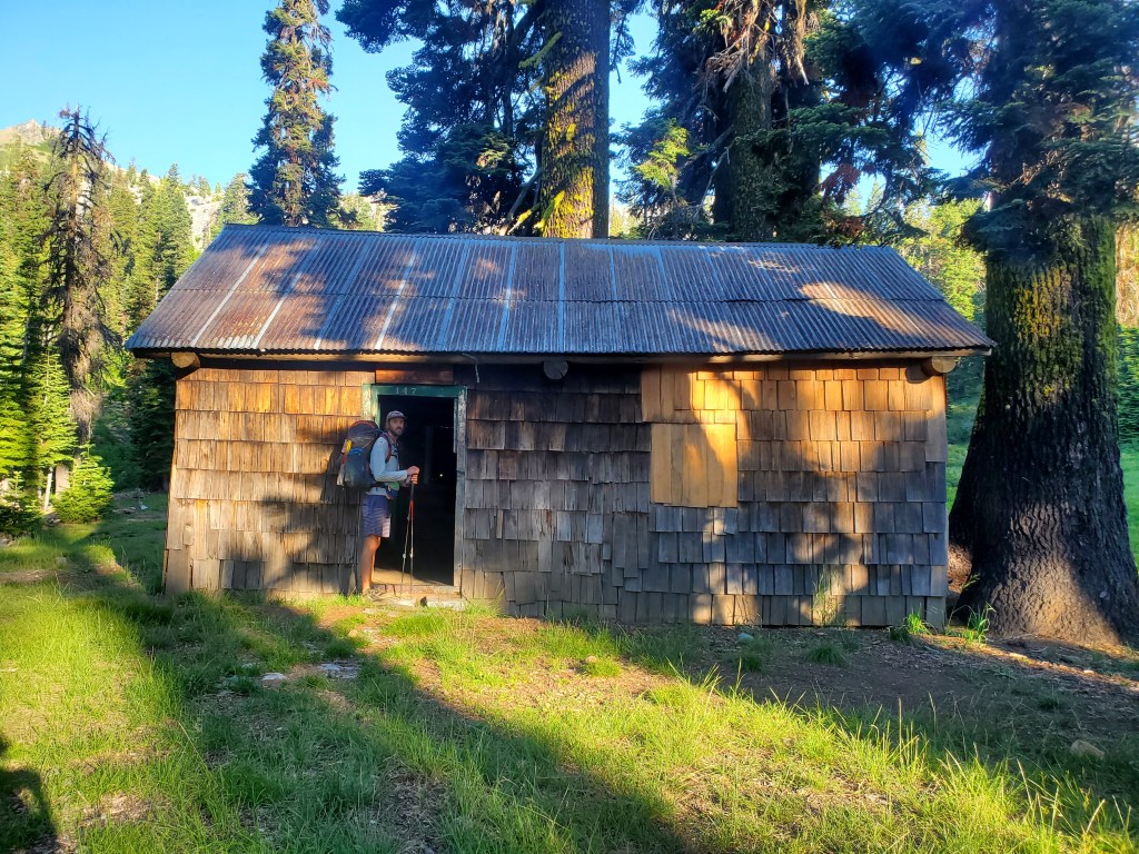
We ended the day at a nice campsite by an old Forest Service cabin. In the tent, prepping for dinner, we heard something tug at the guy lines. Poking our heads out, we were once again face to face with a pair of bold deer. I got into predator mode and tried to scare the deer off. They returned before long… It appears these deer were interested not in our food, but our urine, digging and licking up the salt we so graciously deliver to them. Overall, this was perhaps the hardest 22 mile day for us, but not for the terrain, we were both not really feeling it. On the bright side, we only saw 6 people all day, making it feel like a remote a wild hike again.
Day 109 – 26 miles/1650 (7/14/22)
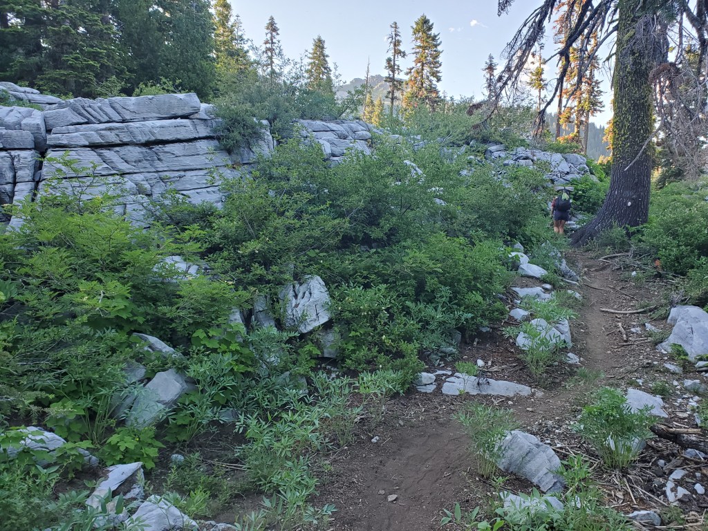
Maggie and I were up and moving at 7:30 am. We hiked over a few ups and downs around a couple ragged mountains, marble boulders still highlighting the way. It was back and forth between dense, humid vegetation and dusty burn scars with blowdown. We were moving a little slower than usual, but making progress.
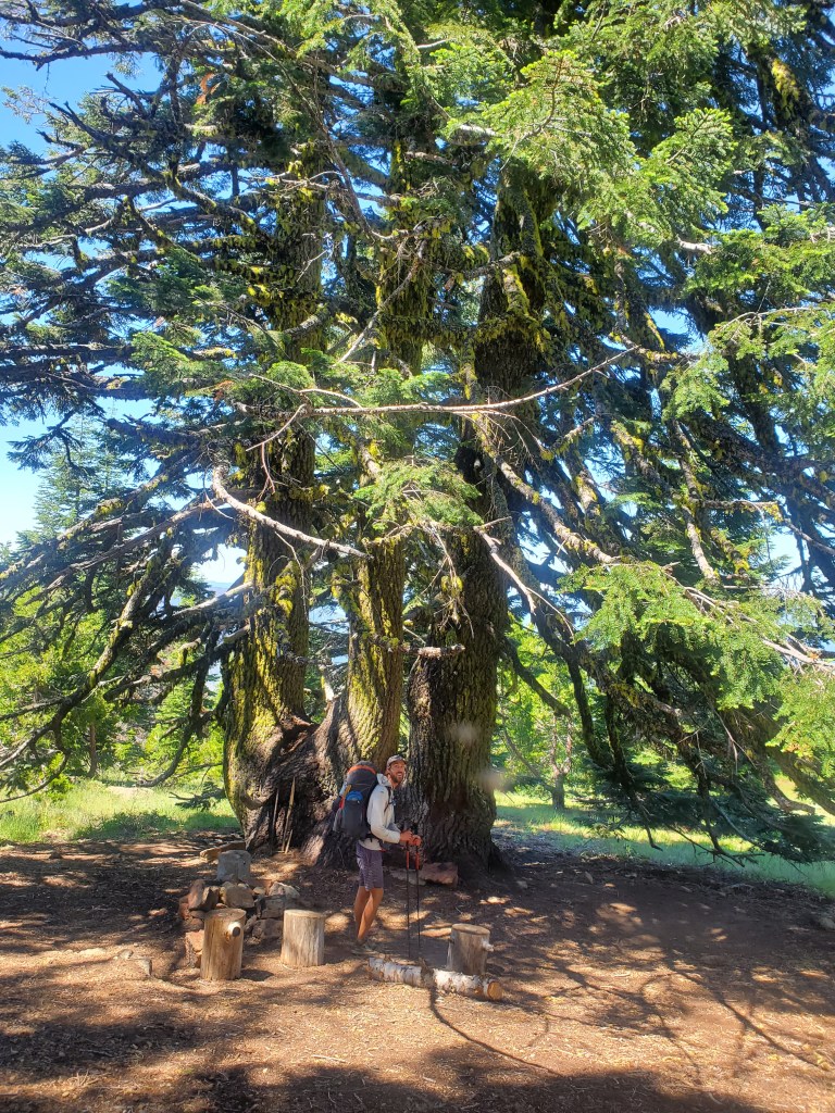
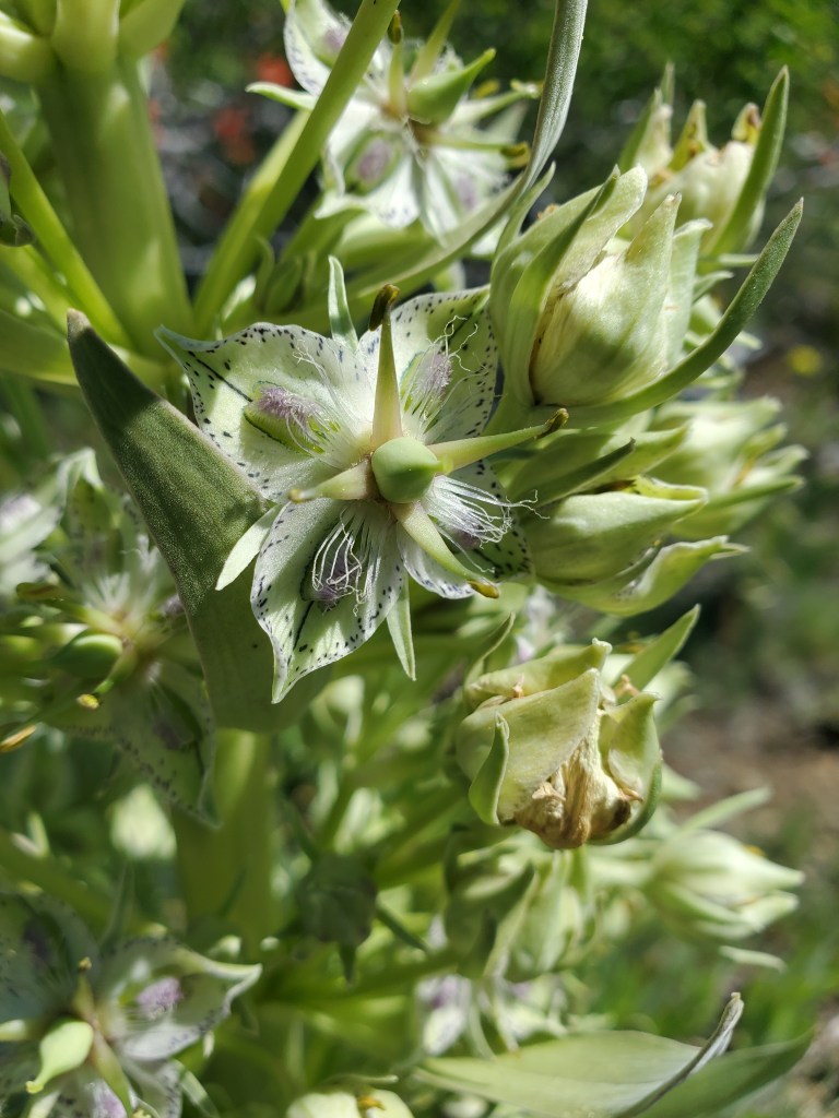
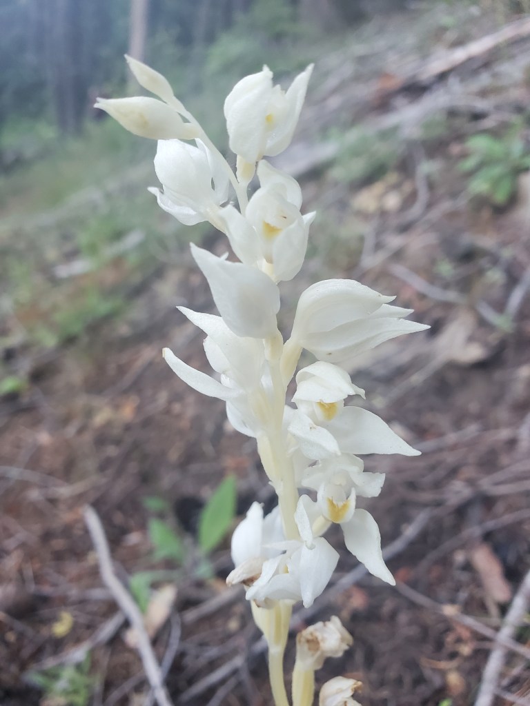
We stopped for lunch under a big triple fir tree up on the last ridge. We sat on large sawn logs while we ate, an uncommon luxury out here in the wilderness. Up in the high clearings, we saw Monument Plants/Elkweed (Frasera speciosa) in bloom. I love the unique morphology of these flowers! Lower down between the trees, I spotted a Phantom Orchid (Cephalanthera austiniae) starting to bloom. This orchid is fully parasitic and has lost all of its green chlorophyll, standing like a beautiful old bone planted in the earth. Super cool!
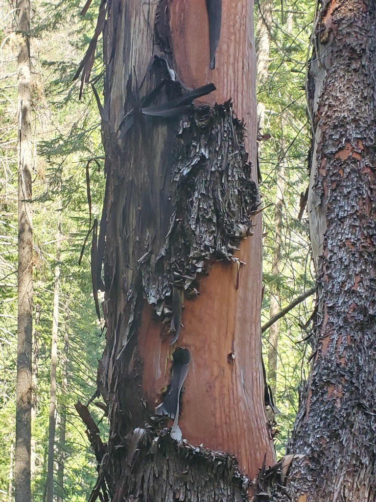
It was finally time to begin the big descent – 5,800′ down – to Grider creek. Parts of it included old burn scar which had thick, shrubby regrowth. It was bushwhacky with blowdown, an awesome combo, but it didn’t last too long. We were able to cruise relatively quickly down to the creek. The climate was clearly changing with altitude, notably Pacific Madrones (Arbutus menziesii) started to appear. These gorgeous evergreen trees in the blueberry family have waxy leaves and rough flaky bark that falls off to expose the smooth rusty-auburn inner bark.
We stopped for water 18 miles in, with 8 to go to our campsite. We were tired but pushed on. The gentle downhill slope made it easy, but Maggie’s lower shin and upper ankle were hurting. Her shoes didn’t have much life left in them after 750 miles of punishment… The day had been going by quickly to this point, but now it felt like a slow slog. We made it to the Grider Creek campground at 7:15 pm. We set up the tent, then cleansed ourselves of dirt and sweat in the creek. We made dinner and looked ahead to Oregon. Despite being low in a valley, we were graced by some lovely orange underglow as the sun set on some unseen horizon.

Day 110 – 13 miles/1663 (7/15/22)
We took it really easy in the morning. After feeling a little worked from the mileage the day before, and the fact that we only had 6 miles to get to Seiad Valley, we slept in and took our time packing up. Still, we managed to get going at 8:20 am, which took me back to the desert days when we struggled to get on trail by 8. It was an easy road walk with a gentle downhill grade, following Grider Creek to the Klamath River. At the larger river, we saw a flock of turkey vultures were catching the first thermals of the day, effortlessly circling upwards for a better view. Soon after, a flock of Canadian geese flew in from the northwest, honking all the way down on their descent. They circled around and landed in the river, following the flow downstream. It was some fun bird watching to start the day!
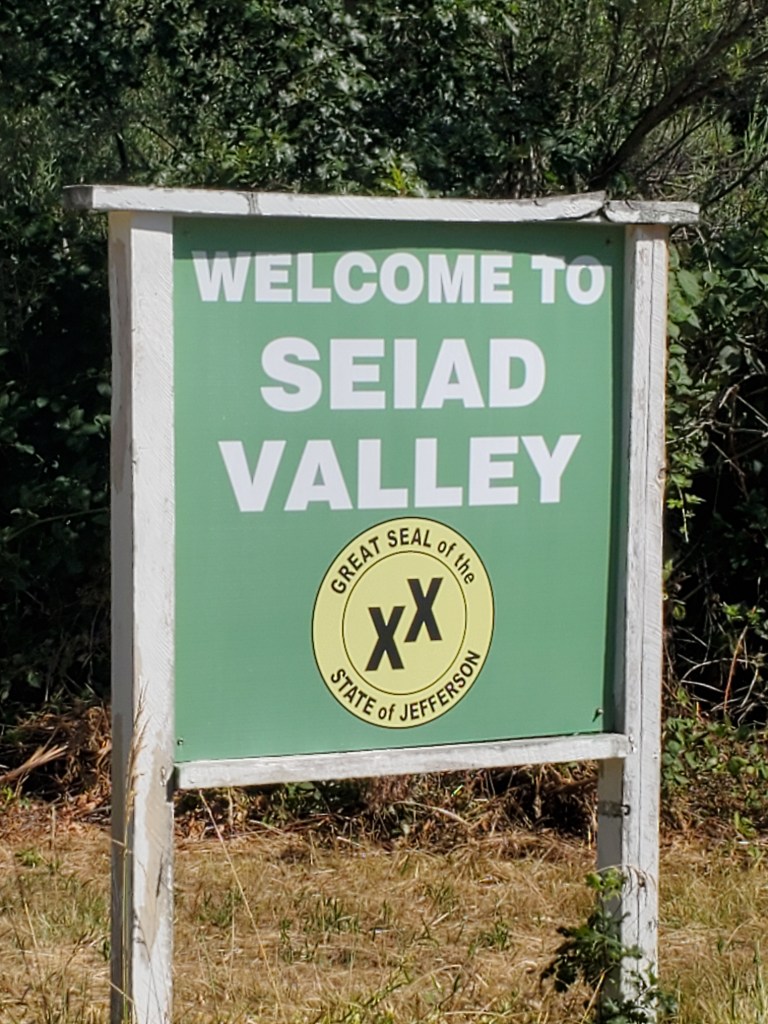
A couple more miles on the road and we made it to Seiad Valley. This town proudly displays the great seal of the State of Jefferson. For the uninitiated, Jefferson has been a proposed state since the 1940s. Rural communities in northern California and southern Oregon generally feel underrepresented in their respective state governments and, by extension, the federal government too. As such, they want to secede and rejoin the USA as the 51st state. Lawsuits have been filed as recently as 2016, however these efforts have been shut down, so for now, the state of Jefferson is still just an idea.
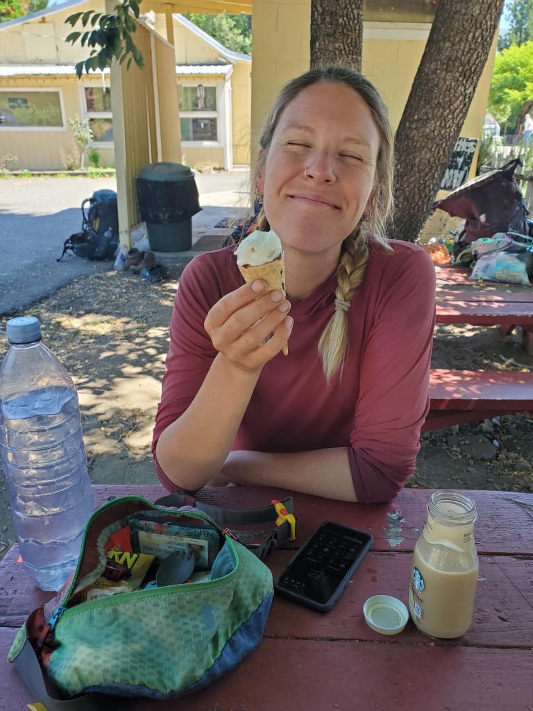
With the PCT routed right through town, it was only a 10 foot side trip into the café. We got second breakfast to really fill our bellies. There is a general store attached to the café, which we perused, but we had a resupply box waiting for us. With some leftovers from Etna, we only needed to buy a few things for the 65 mile stretch to Ashland/Medford. This was an easy resupply, so we were theoretical ready to get back to hiking just after noon. However, it was hot, well into the 90s. Like most towns, there was a monster climb right after, 4,500 feet over 9 miles. We took the opportunity to siesta while waited for the temperature to come down.
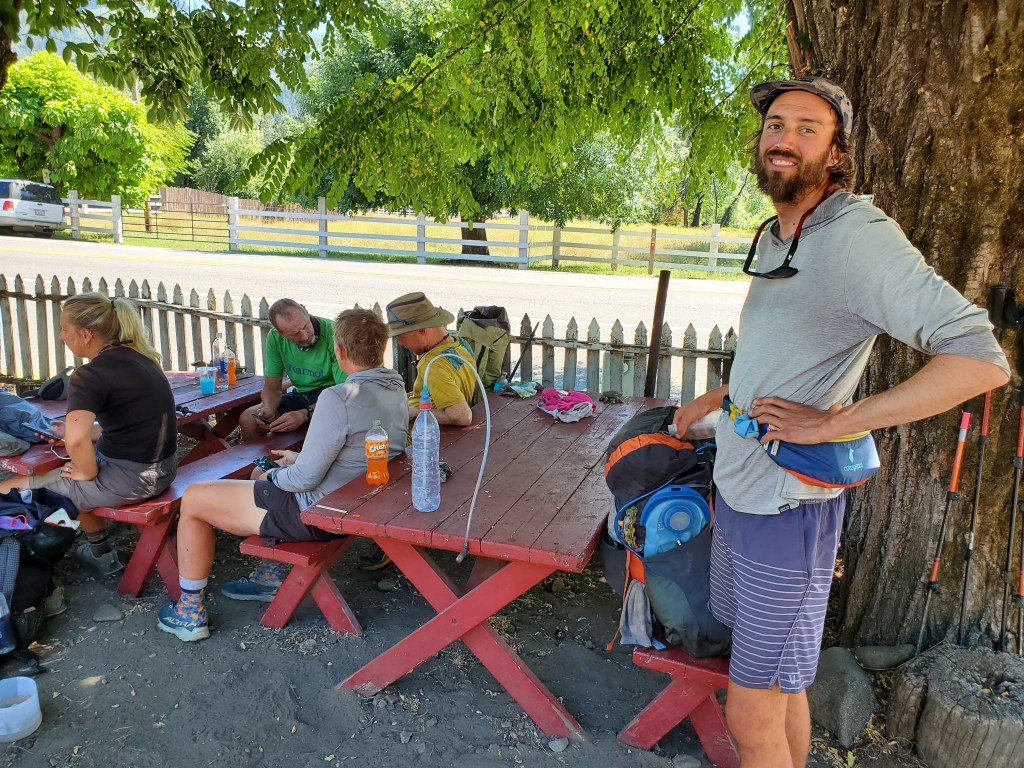
While we were sitting at some shady picnic tables, a local man drove up on a green John Deere Gator. He started talking to us and another couple of hikers. “Don’t take the trail out of town, take the road. That’s what I tell all the hikers. It’s shorter, has more shade, and it takes you right back to the PCT up on the ridge,” Gator-man said. We were vaguely aware of the road walk, but we didn’t realize it would be much, much easier than the trail proper. We contemplated our options for a few more hours, waffling back and forth between the PCT and the road. Another hiker was doing some clothing repair, and Maggie joined him to stitch up a hole in her sunshirt, killing a little more time. We finally packed up at 3:30 pm and started walking up the road, rather than the trail. There was no shade for the first mile. We were roasting, especially walking on pavement, and we were questioning our decision. Thankfully, we made it to the trees, and the road walk was well shaded as advertised.
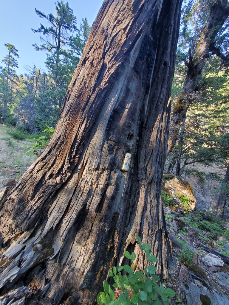
The easy climb continued, the pavement gave way to gravel, and we found a beer in a tree! Who knows how long it had been there, but it wasn’t expired yet, so we took the beer. We hiked 7 miles up to a bridge over Seiad Creek. It was 6 pm. The water was good. There was a big flat parking area to camp, so we called it a day. We chilled the tree beer in the creek, then sipped on it with dinner 🙂

Day 111 – 24(-2) miles/1687 (7/16/22)
We got moving up the road at 7:20 am, which was 2 miles shorter than the PCT proper. A couple of hikers passed by as we were packing up, taking advantage of the cool morning air on the big climb. The road was quite nice, well maintained and a steady slope up to a saddle near 5,000 feet. We took our time with plenty of nature breaks on the way up – waterfalls, flowers, and berries breaking up the monotony of road walking.
We were back on the PCT around 9:45, where there was thankfully a water source and shade. Nearby in a recently burned area, there was once a grove of Modoc Cypress, a rare Cypress that only grows in a handful of locations in NorCal and Southern Oregon. I ran about half a mile to some trees, but they were just Douglas-firs and incensce-cedars, a bit of a disappointment. I later learned there were in fact seedlings seen two years ago, and I was even more disappointed I didn’t see a cypress.
Anyways, we carried on through intermittent burn scars, which eventually gave way to stands of fir and hemlock. It was hot, and we were sweating heavy. We took a generous lunch break under some shade to cool off. The geology was mostly flakey schist, which in some spots, inhibited trees from growing. Only a few small plants could survive in these patches, making for nice views and meadow-like breaks in the forest.
In the distance, we could see the north side of Mt. Shasta now, though it was somewhat obscured by haze. We hiked until 7 pm and set up our tent on an old forest road. This was our last full day in California. What a journey it has been to this point, and we still have more than 900 miles remaining on the PCT. We felt excited to get into a new state the next day!
Day 112 – 23 miles/1710 (7/17/22)
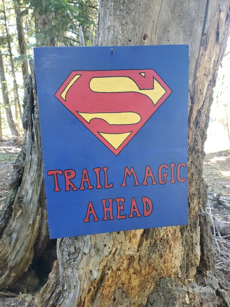
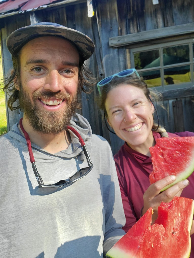
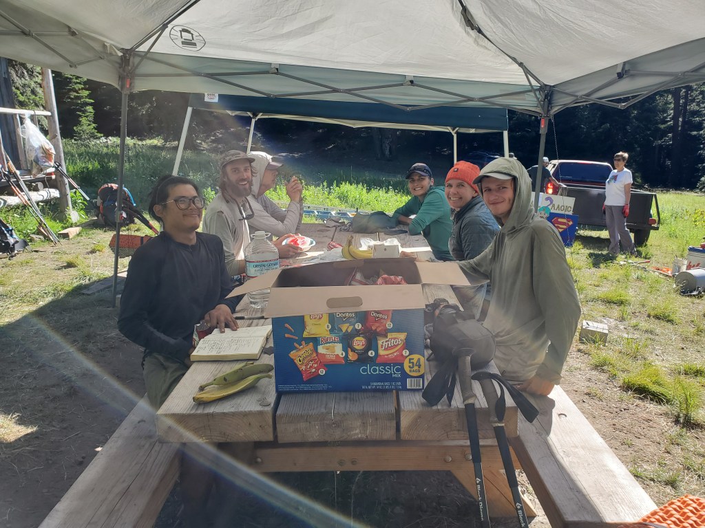
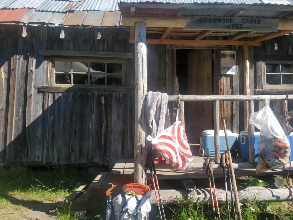
We packed up as usual for the final miles of California. As luck would have it, we happened upon trail magic just four miles after setting off! A group form Oregon was camped out for the weekend at Donomore Cabin, working to restore the old log hut. This cabin was built in the 1930s by Mr. Donomore, perhaps without permission from the US Forest Service, as a place to stay while his livestock grazed in the summer. The cabin was abandoned until recently when Mr. Donomore’s descendants started restoring it, making it more hospitable for PCT hikers and forest explores. Maggie and I got our fill of watermelon(!), chips, and banana bread while we talked with the trail angels and a few other hikers. It was wonderful, and we stayed for nearly an hour.
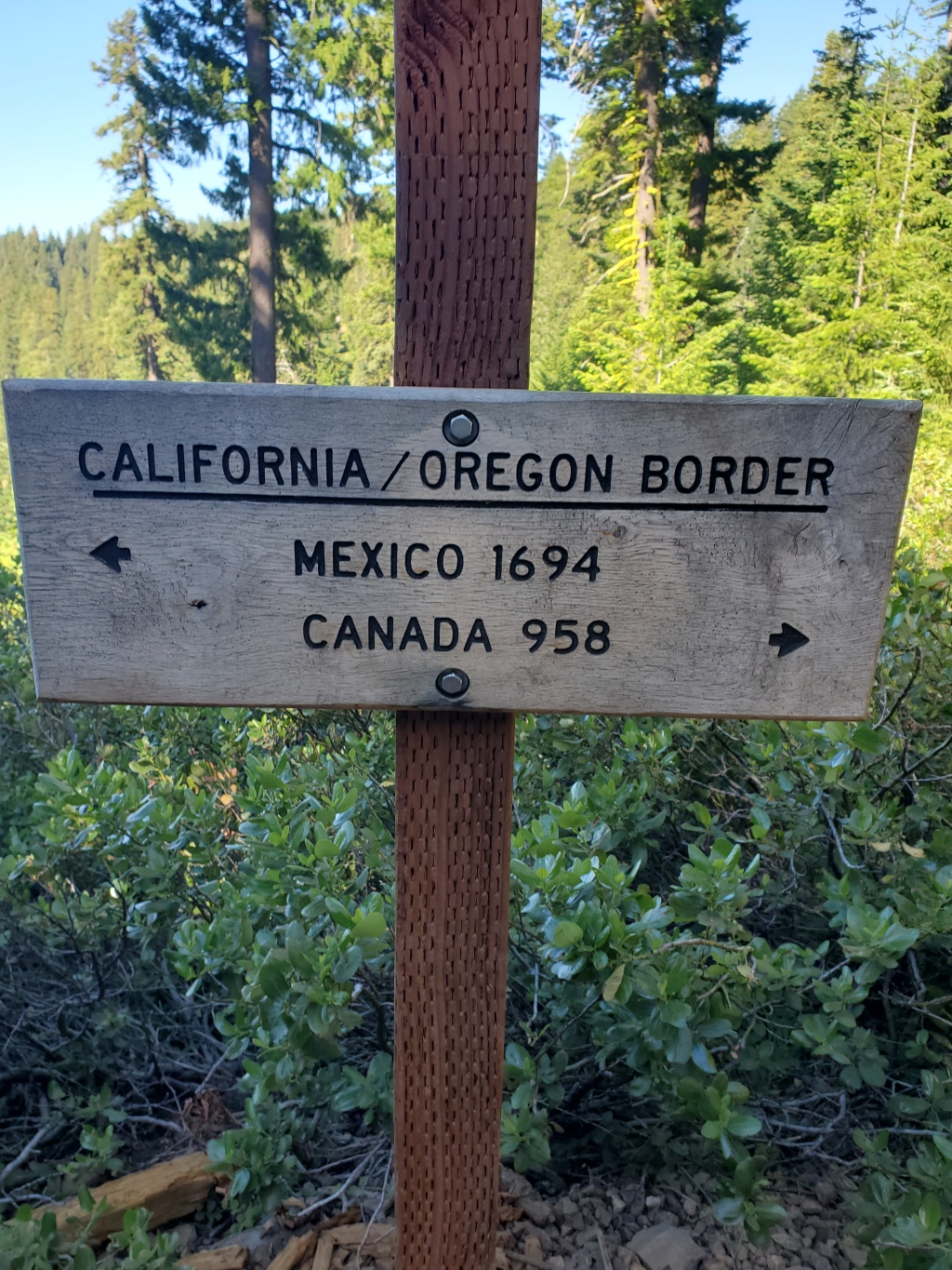
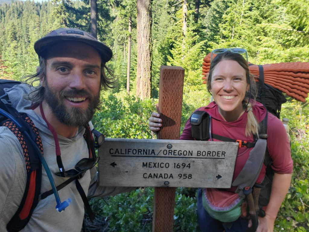
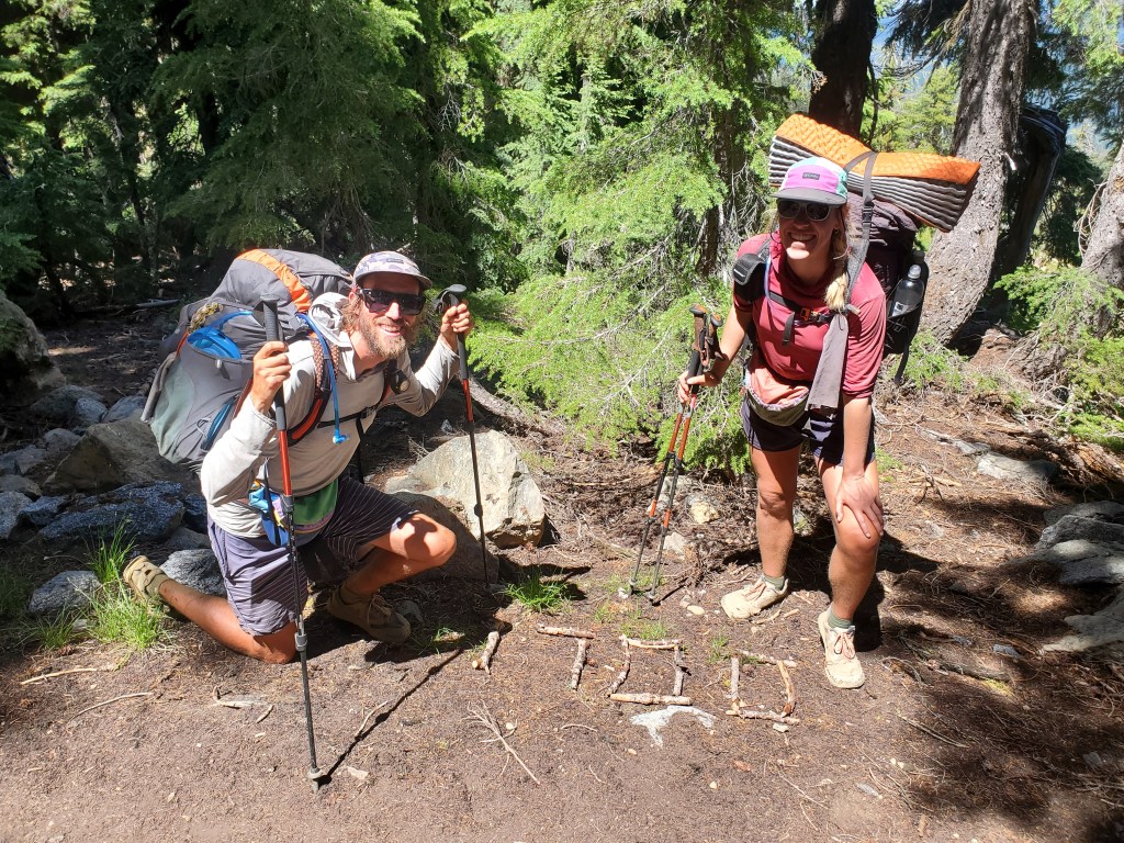
The trail beckoned, so we pushed for the Oregon border – 1,692 trail miles from the Mexican border. What a spectacular state California had been! Such a diversity of landscapes, towns, and people, yet it was such a relief to be done with this gargantuan state. We signed the trail register and did a little photo shoot to document our accomplishment.
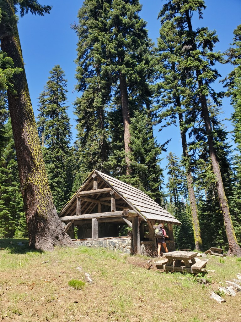
We hiked for a couple hours to reach a picnic shelter half a mile off trail, and would you believe it, there was a cooler with free beer! Not just some boring old American adjunct lagers, but tasty IPAs. There were only four remaining, so Maggie and I each took one, hoping the last two would bring joy to another pair of hikers.
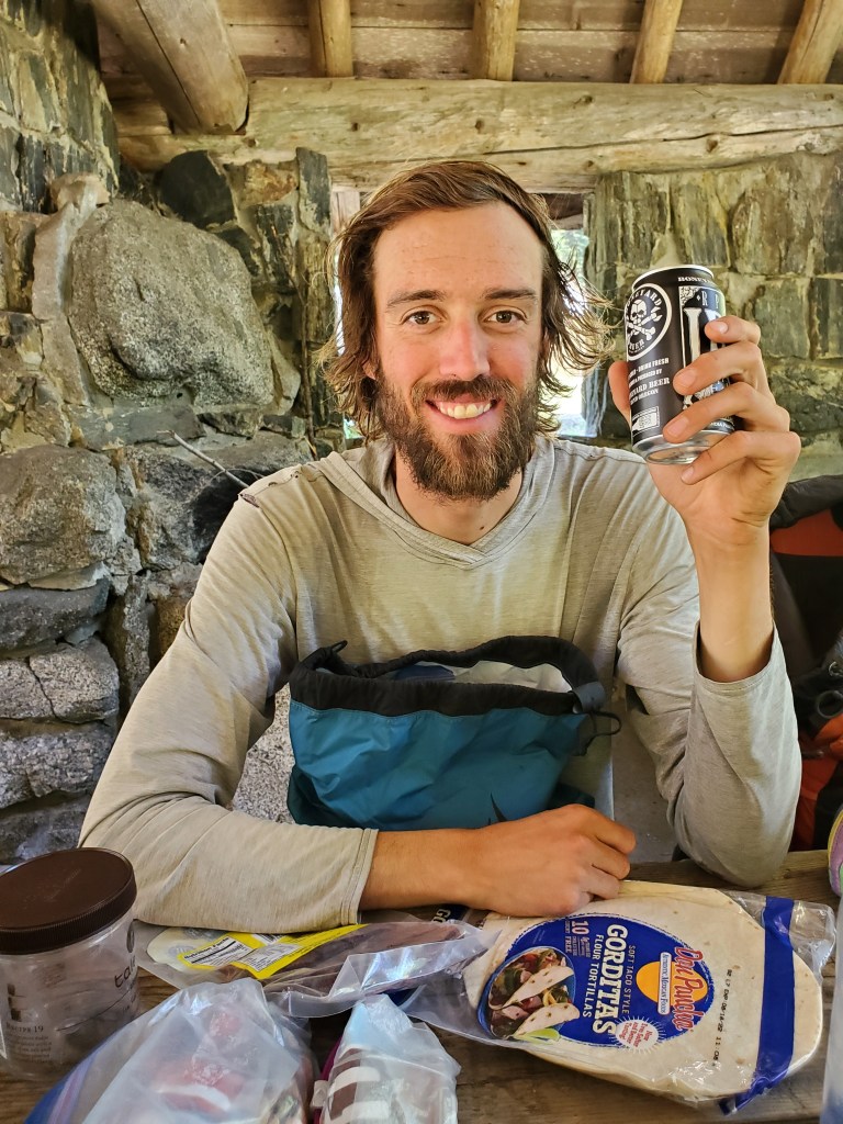
The scent of good beer must’ve been in the air, because it didn’t take long for two hikers to join us in the shelter. We ate and drank to celebrate our little walk to Oregon. We continued on, following an eastbound ridge towards Ashland. Soon after lunch, we crossed the 1,700 mile mark! What a day. A pair of day hikers took our photo, so no selfie for this one.
Our luck had not run out yet – we found sodas in a cooler and partook in some extra empty calories. Just a few more miles and we made it to a little campground by Mt. Ashland. The days aren’t always easy, but it’s days like this that are most rewarding, thanks in large part to the generosity of people.
Day 113 – 8 miles/1718 (7/18/22)
Maggie and I moseyed out of camp around 9 am. It was a short 8 mile hike down to I-5 near Callahan’s Lodge. We debated going to the lodge, but I stuck my thumb out for the first car approaching the on ramp and the driver stopped for us! The man driving this older, silver Prius got out to rearrange his stuff and make room for us.

We mostly talked about existential threats on the quick drive into Ashland. Our driver took us straight to our first stop – the post office. Maggie had a new backpack waiting for her since the aluminum rods in her current pack had broken through the fabric. It was stabbing her lower back, so a new pack was in order. I got a new sunshirt, since my first one had holes in both sounders, leaving me with a pair of lovely little sunburns. We both had new shoes to pick up as well, also much needed. We walked around downtown Ashland and got lunch.
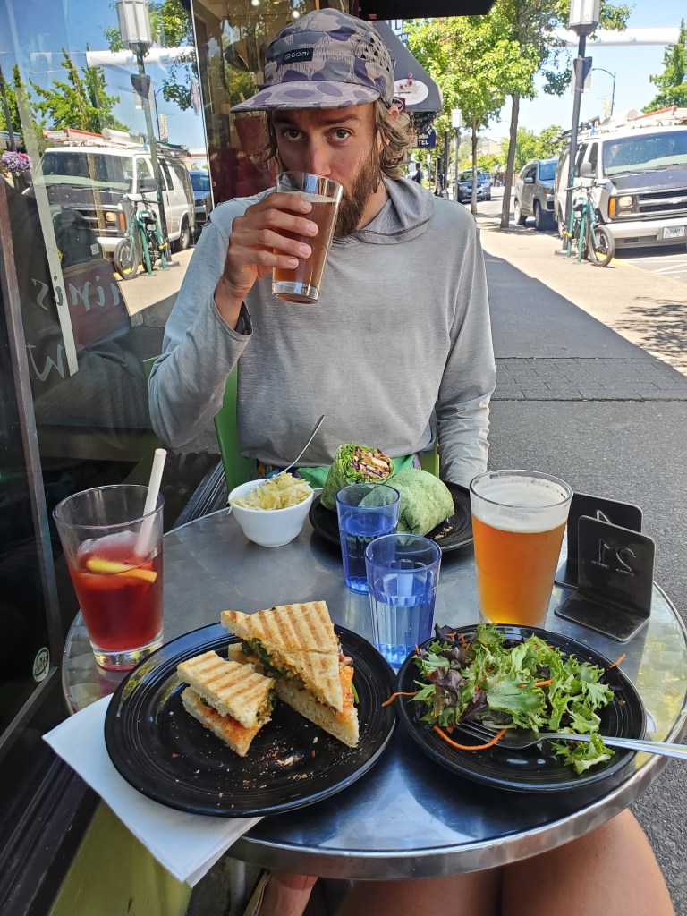
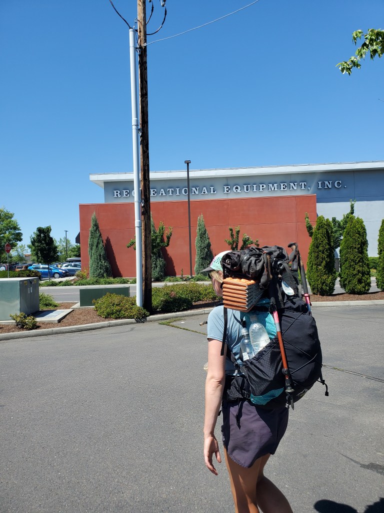
A hub of arts and culture, we found Ashland to be super cute! We really wanted to stay in Ashland, but everything in our price range was booked up. We took the bus to Medford for only two bucks. We walked a bonus mile by strip malls and parking lots to get some snacks and fuel at REI. Just around the corner was Trader Joe’s where we got more snacks!
Once again, without even trying, an old man offered to give us ride to our Airbnb. The backpacks are usually a dead giveaway, but it’s still surprising when strangers offer a ride unprompted. This old man, John, occasionally volunteered as a trail angel in Ashland, so he knew we needed help getting around. Finally at the bnb, we settled in and showered up. There was no time for laundry, so we went straight to dinner. We picked up a pint of ice cream on the walk back, and we demolished it back at the room.
