
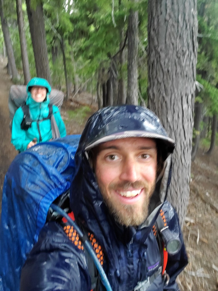
With ample time on our hands, we were able to enjoy some of the high points in the Oregon Casades. In the karmic tradition of the PCT, all that was good was balanced with a healthy dose of reality…
Day 120 – 0(+2) miles/1821 (7/25/22)
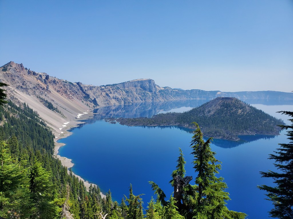
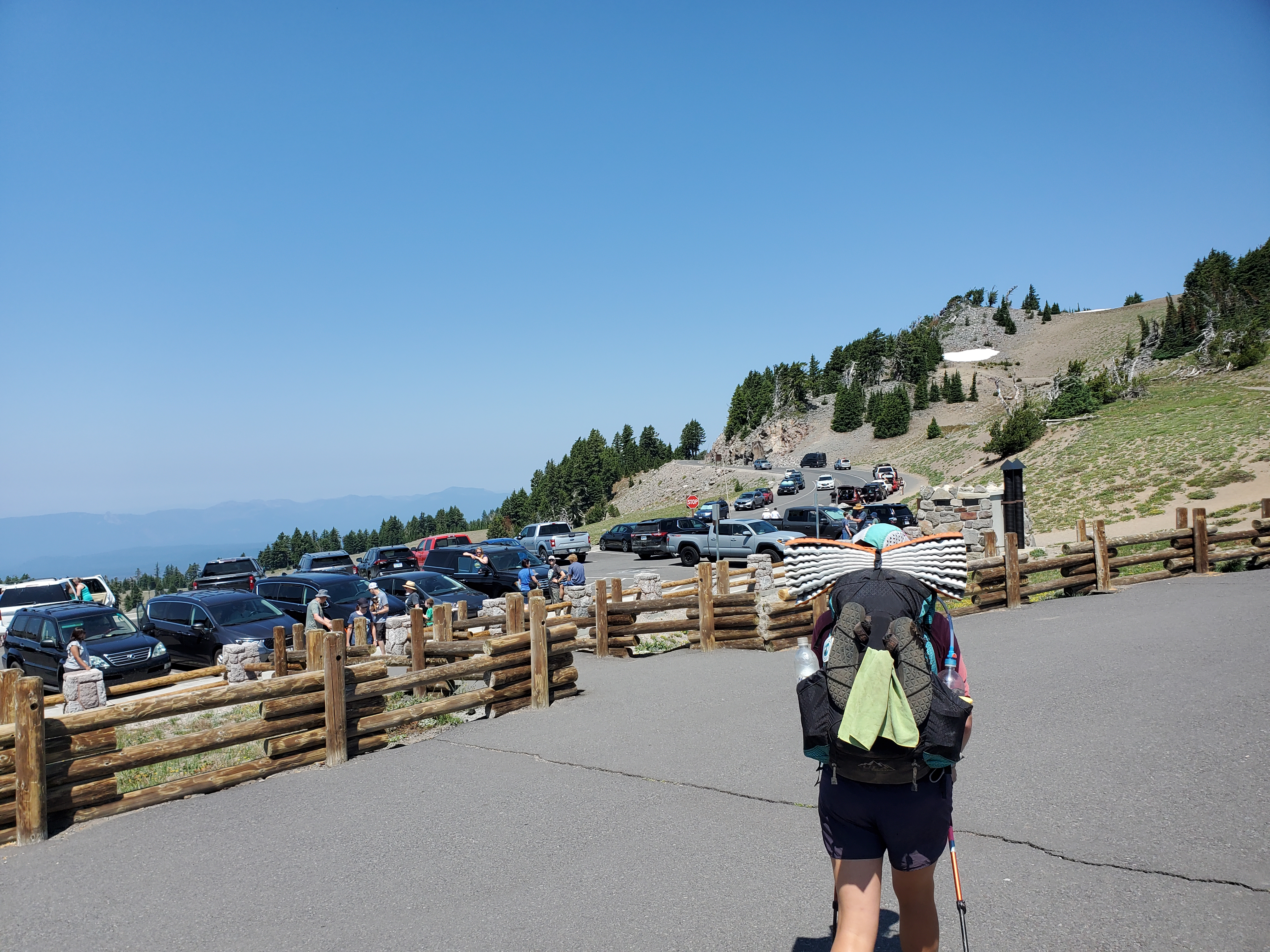
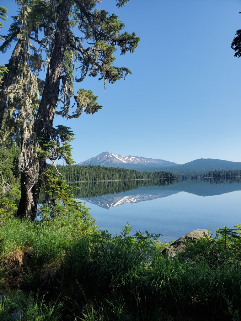
No alarms on this day. Maggie and I started stirring around 7:30 am and made breakfast. The PCT camp at Crater Lake had largely cleared out by the time we got out of the tent. Slowly packing up, we were planning to check out the Crater Lake visitor center and maybe hike 11 miles. We did some bathroom sink laundry, wringing out as much dirt and sweat as possible. I ran into Magic Mike, hiker turned trail angel from two days before, and he offered to drive us around if needed. We finally packed up around 10:30, we walked back to the store to charge electronics. We looked at the trail ahead – only 180 miles to Santiam Pass with 10 days to get there. I had arranged to meet up with my college roommates in Corvallis for a little 10 year reunion, and the dates were set in stone, so we needed to slow down. Between the store, free camping, and showers, it became apparent that we should kill some time here at Crater Lake. I went back into the campground and found Magic Mike asleep in his rental car, A/C blasting. He woke up before long and I let him know we wanted to take him up on a ride around the park. He was up for it and we met back by the store. The summer heat had been cooking us lately, so the obvious thing to do was swim in the icy blue waters of Crater Lake. We loaded up with Mike and he drove us up to the rim, where we finally got our first view of the lake. Wow… This is something you need to see with your own eyes to understand. Five miles across and 1,900 feet deep, Crater Lake is the deepest lake in North America. Fed only by precipitation, there is no silt to cloud the water, leaving an ultra-clear, blue bathtub for us to feast our eyes upon.
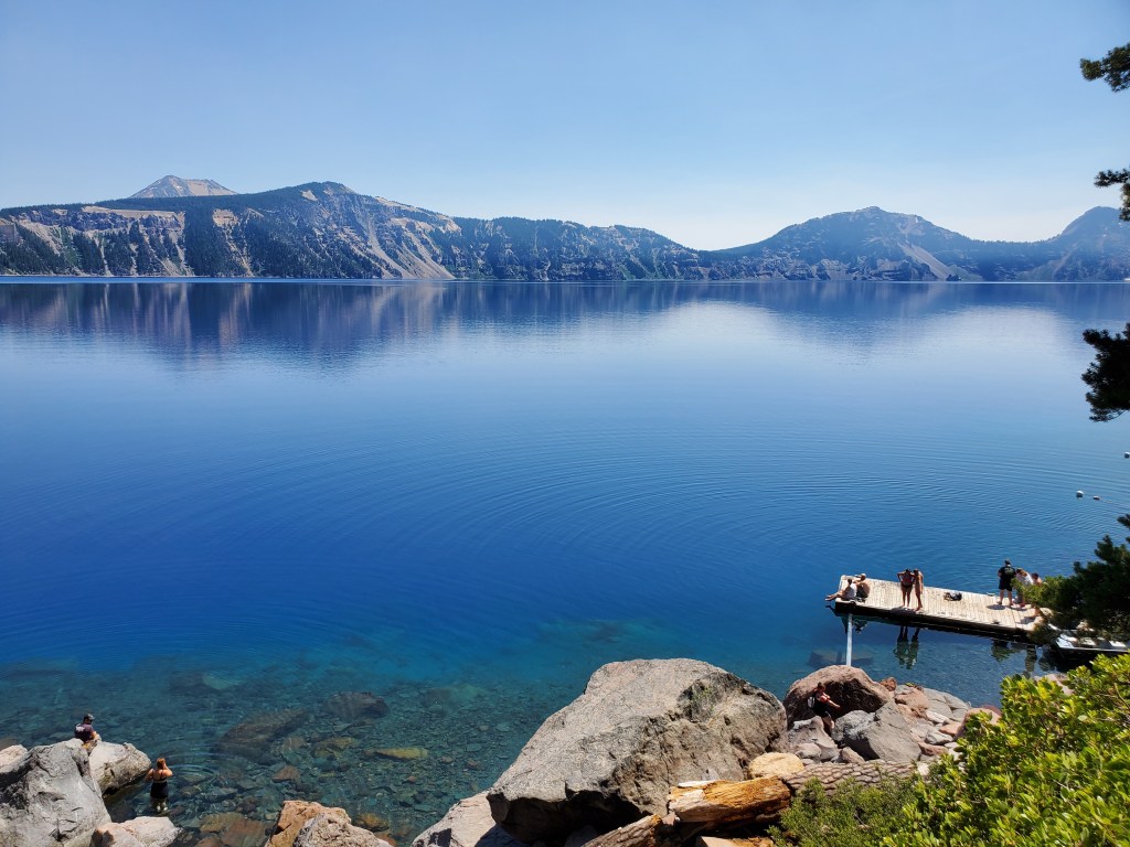
Magic Mike dropped us off at the Cleetwood Cove trail, where we walked down the mile long path to the only swimming spot in the park. We found a nice flat andesite boulder next to the water where we could lay out. We jumped in, and while the water was cold, it was definitely bearable, refreshingly cool. It’s no secret that Crater Lake is supremely clear, and that was obvious when we swam out and the lake bottom was still visible 60 feet below.
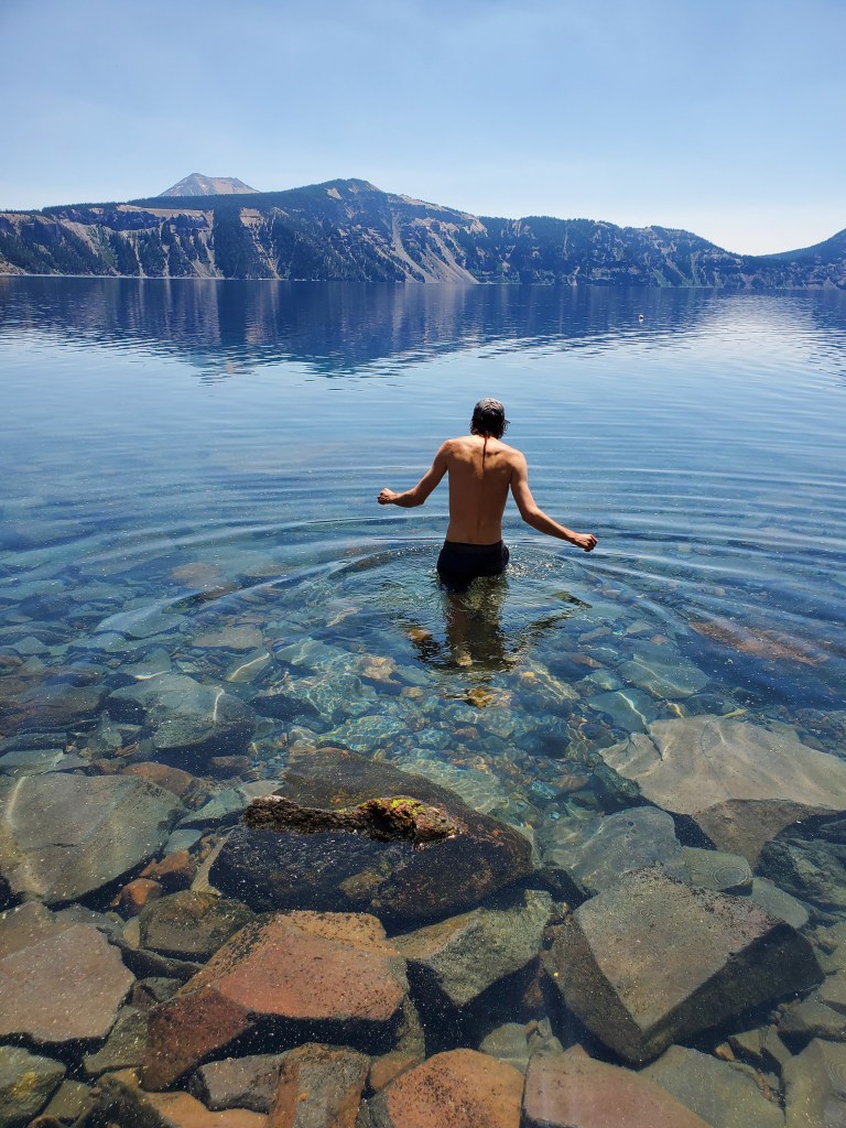
We ate lunch back on the boulder and warmed back up in the sun. Another couple rounds of swim and sun, and two hours had passed before we knew it. We hiked back up to the rim, our 1,800 mile legs allowing us to pass the tourists with ease. Magic Mike pulled up less than 10 minutes later with a fresh load of hikers. They had hiked some 30 miles and wanted to cool down. We traded spots with the other hikers and Magic Mike drove us back to the campground. We set up our tent in Magic Mike’s camp site. Later, he brought back all the hikers he was shuttling around, and the lot of us enjoyed dinner and drinks together at the picnic table. I felt at ease after a leisurely day, surrounded by happy hikers in a beautiful place.

Day 121 – 27(-4) miles/1848 (7/26/22)
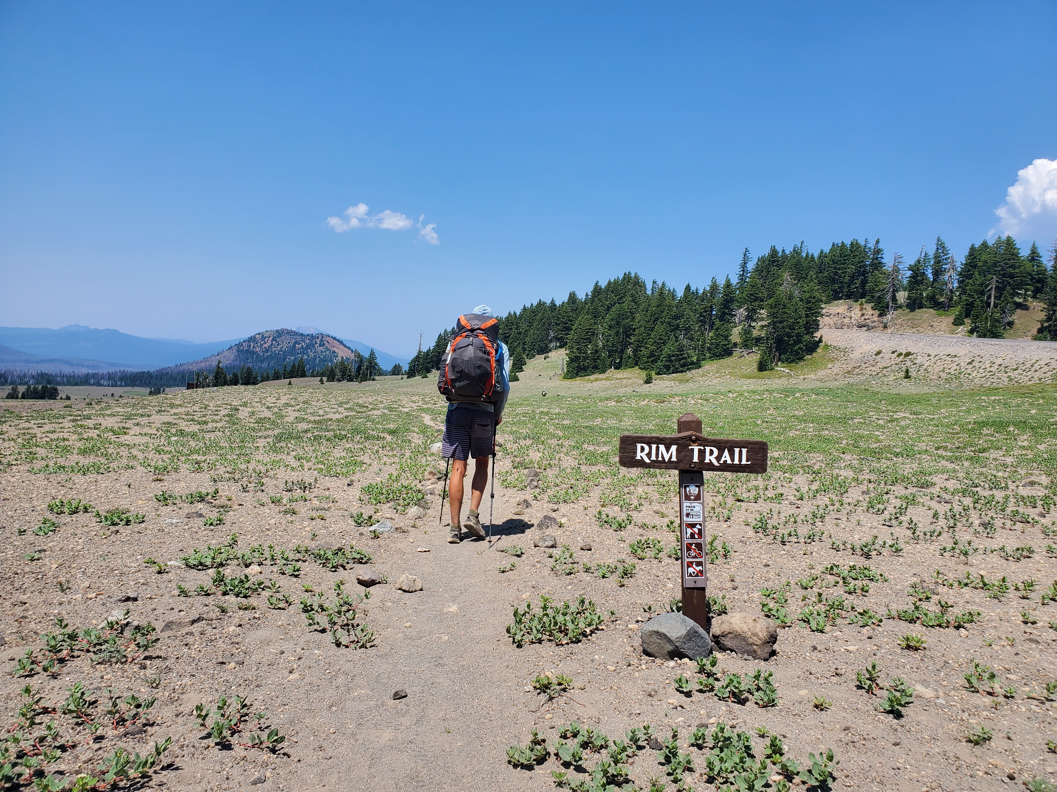
Time to get back on trail. Maggie and I opted to take the alternate – Crater Lake rim trail – rather than the PCT proper. We couldn’t pass up the views, and the rim trail shaves off four miles. Win-win! We made our way up to the lodge on the south rim, where we got second breakfast. The air was a bit hazy, smoke drifting in from distant fires. Thankfully, nothing was alight nearby. After a quick stop in the visitor center, and filling up water, we got moving around the west side of the crater.

Wizard Island and the enormous lake still compelled us to stop and take pictures. The day was wicked hot. The rim trail was more exposed than we expected, only passing through occasional stands of trees. The trail crossed a small snowfield, so we filled our hats with snow to cool down. Naturally, there were lots of tourists, crawling all around the parking area view points. Everyone has a right to explore their public lands, it’s just a bit jarring to be around so many people compared to the solitude of the trail.

As for hikers, there was a decent sized bubble, almost 20 hikers nearby. Some combination of our slower pace and wild fires in California allowed the PCT crowd to concentrate around us in southern Oregon. After 6 miles on the rim, we finally started dropping down off the north end of the caldera. We grabbed a little water from the Hwy 209 water cache and sat in the shade to cool off a little. For the rest of the day, we would be hiking through young lodgepole pine forest. Not much protection from the sun in this scant canopy. However, growing cumulus clouds eventually brought shade. Then they brought rain. At first, I was overjoyed by the rain, a cool shower after many blazing hot miles. We put on our pack covers in case the drizzle turned into a downpour. Thunder began, rolling across the Cascades, then hail. Nowhere to hide, so we kept on trucking.
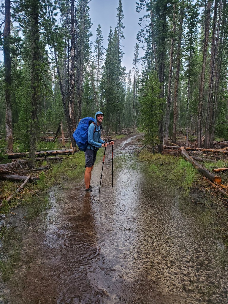
The soil parched from weeks of heat, it didn’t take long for the trail to turn into a flowing mess of chocolate milk and pine needles. We were walking through a miniature flash flood! The cool shower was now a freezing fire hose. I never thought this day would bring shivering and frozen hands, but here we were, prying our icy hands from our trekking pole handles to warm them up. The thunderstorm put a fire in our feet and the miles flew by. At last, the rain relented just as we were approaching Hwy 138. In a massive turn of events, there was trail magic waiting for us at the road! A friendly old couple came from nearby Roseburg to treat their nephew and fellow PCT hikers. They had cold Coors Banquet, fresh blueberries from their garden, and peaches – oh my the peaches!

Maggie and I sat and savored the generosity while talking with the hikers. We were happy we had booked it through the storm, since our trail angels packed up and left about 20 minutes after we arrived. We hiked another quarter mile and camped at small trailhead campground. Maggie and I tried to find some new friends from the trail magic, but we found another hiker sitting alone with his dog, so we joined him instead. His name was Smiles, for the unwavering smile that propped up his cheeks. It was nice to sit at a table and share some casual conversation before bed, a fitting end to a rollercoaster of a day.
Day 122 – 14(+2) miles/1862 (7/27/22)
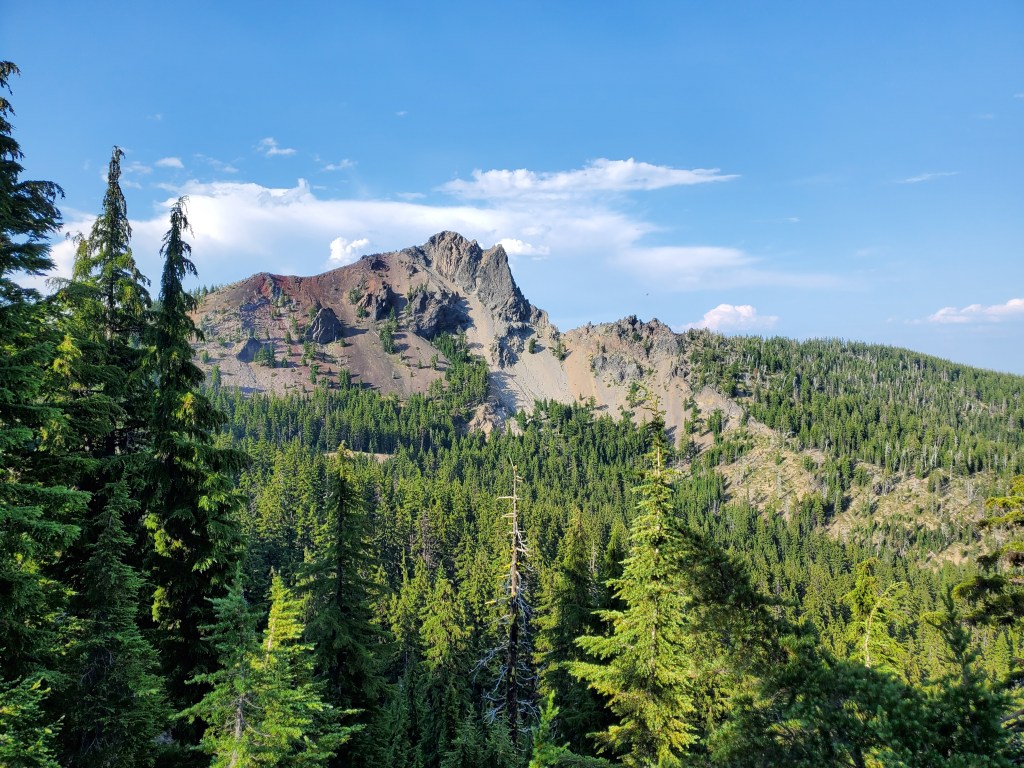
It was a very slow morning for us. Not sure why, we just didn’t want to get up. On trail at 8:30 am, we filled up a couple liters at another water cache. I thought Oregon would be flush with flowing water, but as usual, the PNW summer drought leaves some stretches of the PCT dry as a bone. It was an easy 5 miles to the Mt. Thielsen trail. Dubbed the “Lightning Rod of the Cascades”, Mt. Thielsen is a slim volcanic plug rising 2,000 feet above us with an epic spire for a summit.
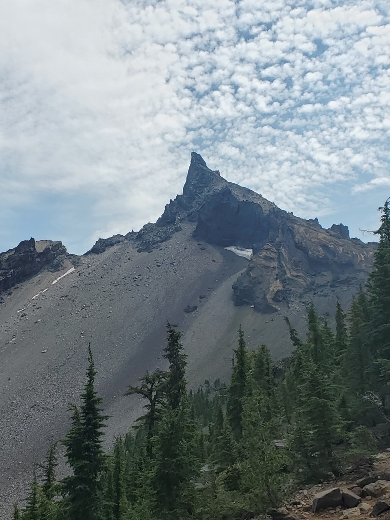
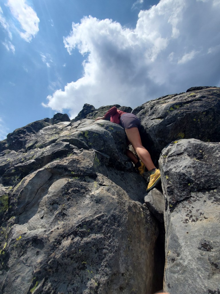
The PCT does not go to the summit of Thielsen, but we were feeling adventurous with extra time to spare. We ate lunch and stashed most of our gear, taking only food, water, and layers for the summit bid. We saw a few day hikers coming down and got some beta. There seemed to be a consensus that the summit spire would be exposed Class 4 climbing, but definitely doable with some rock climbing experience. And so we began our hike up Mt. Thielsen. Just under a mile with 1,800 feet of vert to the top.
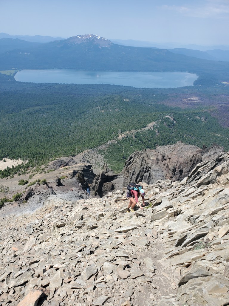
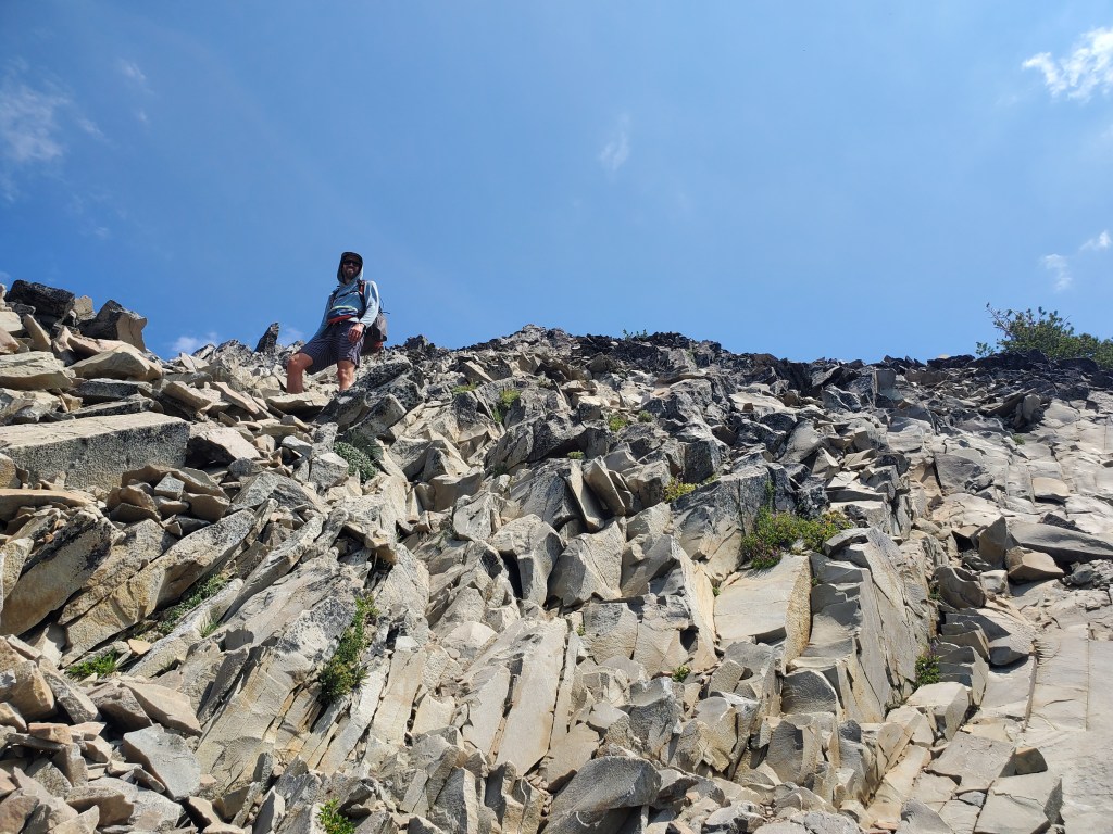
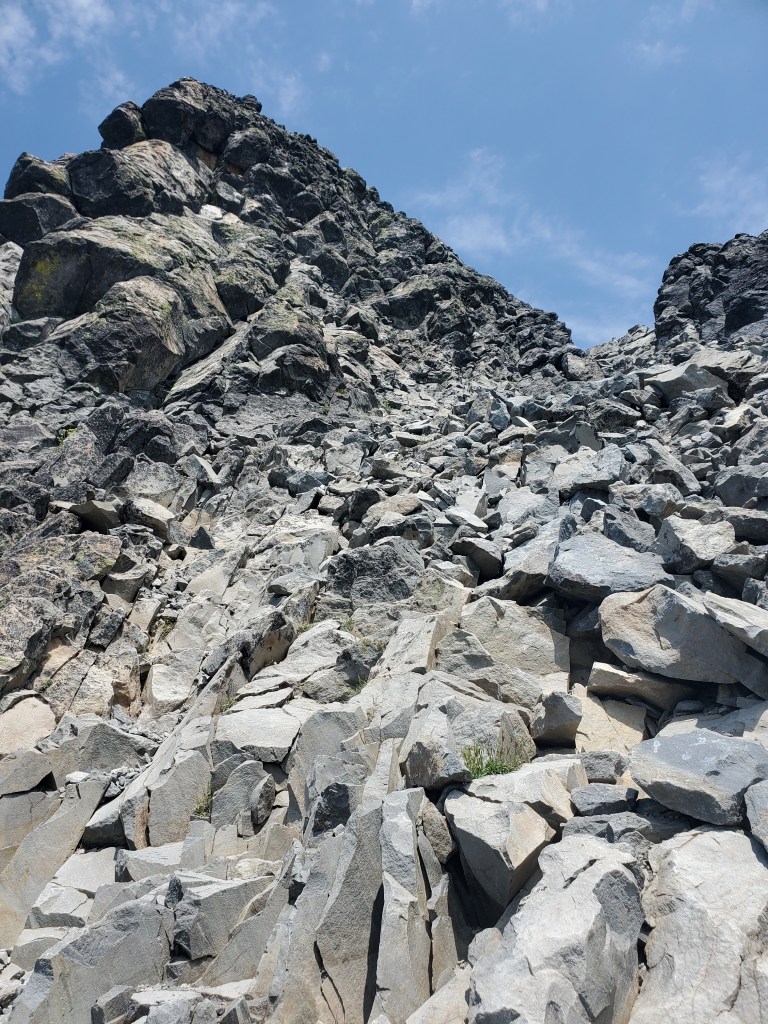
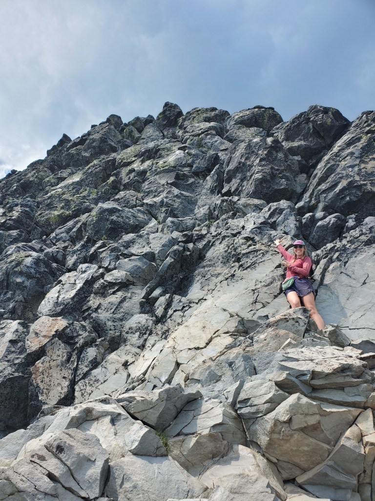
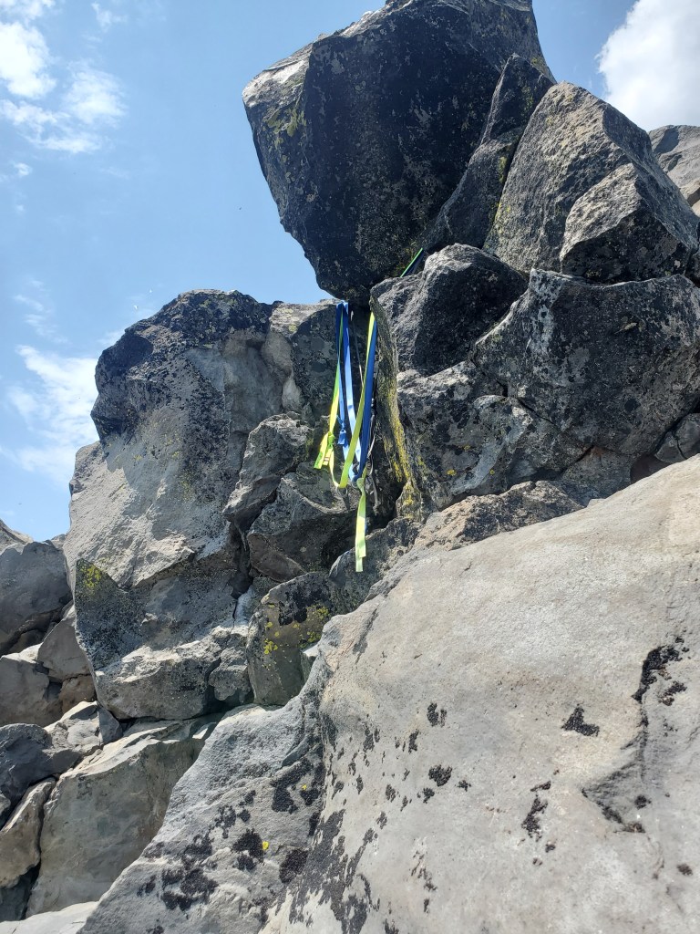
It was steep and loose scree at first, but we got on pretty solid rock closer to the top. It took the better part of an hour to reach the base of the summit block. We dropped our packs and scanned the headwall for a route. Maggie and I picked our way slowly through the Class 4 climb. The exposure was real, but we were able to stay on ledges and shimmy through cracks to the summit. It was somewhat unnerving to find a rappel station just short of the summit… I guess people do rope up for this, but based on the crampon scratches everywhere, I presume people rope up mainly for winter climbs.
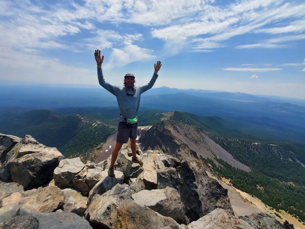
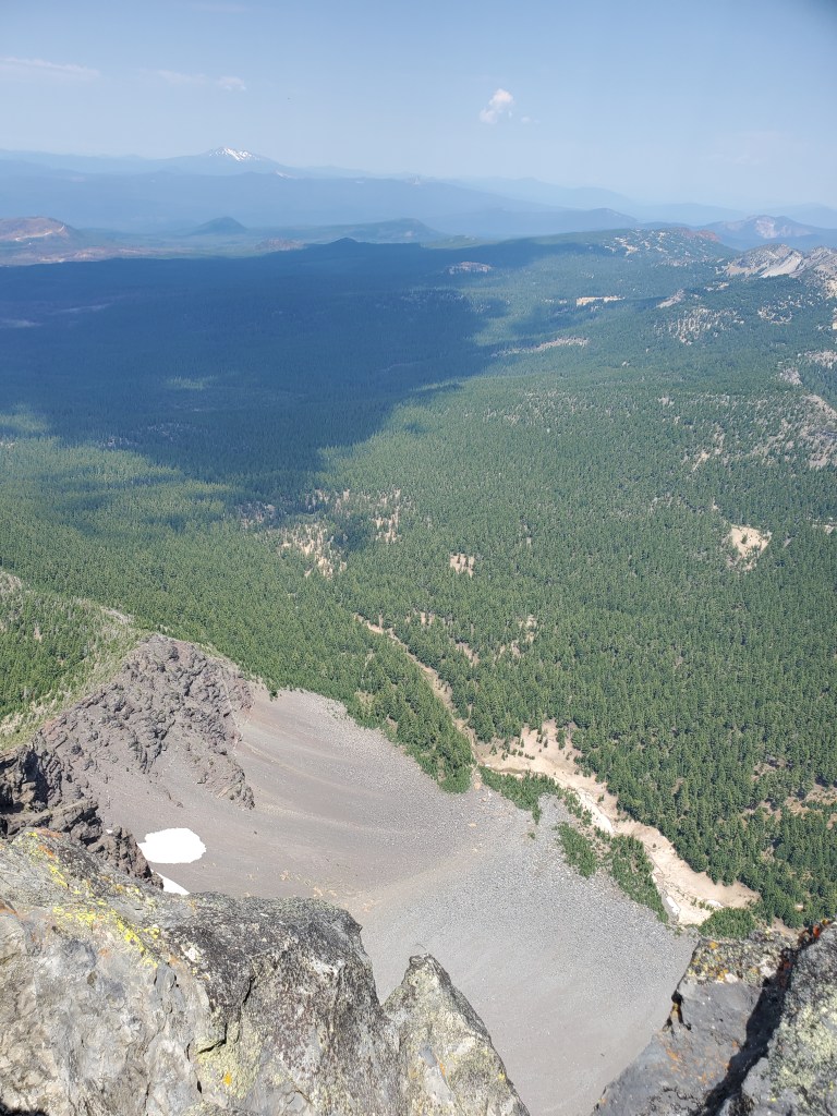
Our hearts pounding, we crested the final boulder and took in the 360° view! We had the top to ourselves, gazing upon Crater Lake behind us and the Three Sisters ahead to the north. Peering over the sheer north face of Thielsen was a sure fire way to induce vertigo!
A quick photo shoot, and we began the climb down. Down climbing is often more challenging because, a lot of the time, you can’t see where your feet are going. We took it slow and helped each other through tricky sections.

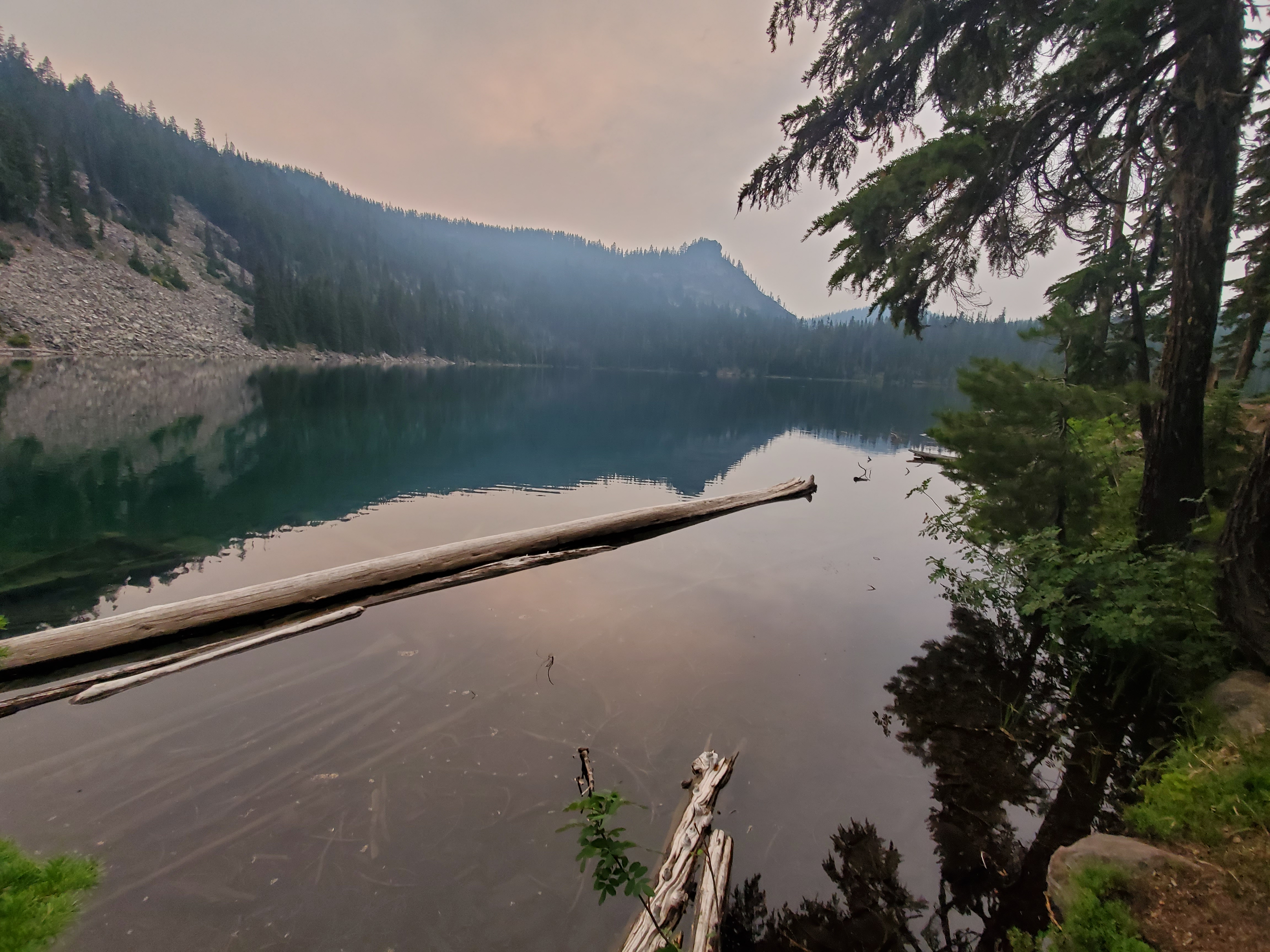
In our state of intense concentration, a big thunder cloud grew straight over head without us noticing. In the short time it took us to down climb, harmless puffy clouds had turned into a menacing shadow. Sheets of rain were falling a few miles to the west. Needless to say, we booked it down. Thunder began cracking as we approached tree line. We felt we were out of danger, but found ourselves hot and thirsty back at the gear stash. After a quick rest, we packed up and cruised 2 miles to get water at Thielsen Creek. Rain started while we were filtering, heavy infrequent drops at first, ramping up into a full on thunderstorm! The last time we really got rained on was hiking into Lake Tahoe, and here we got dumped on two days in a row! Maggie and I got moving quickly.
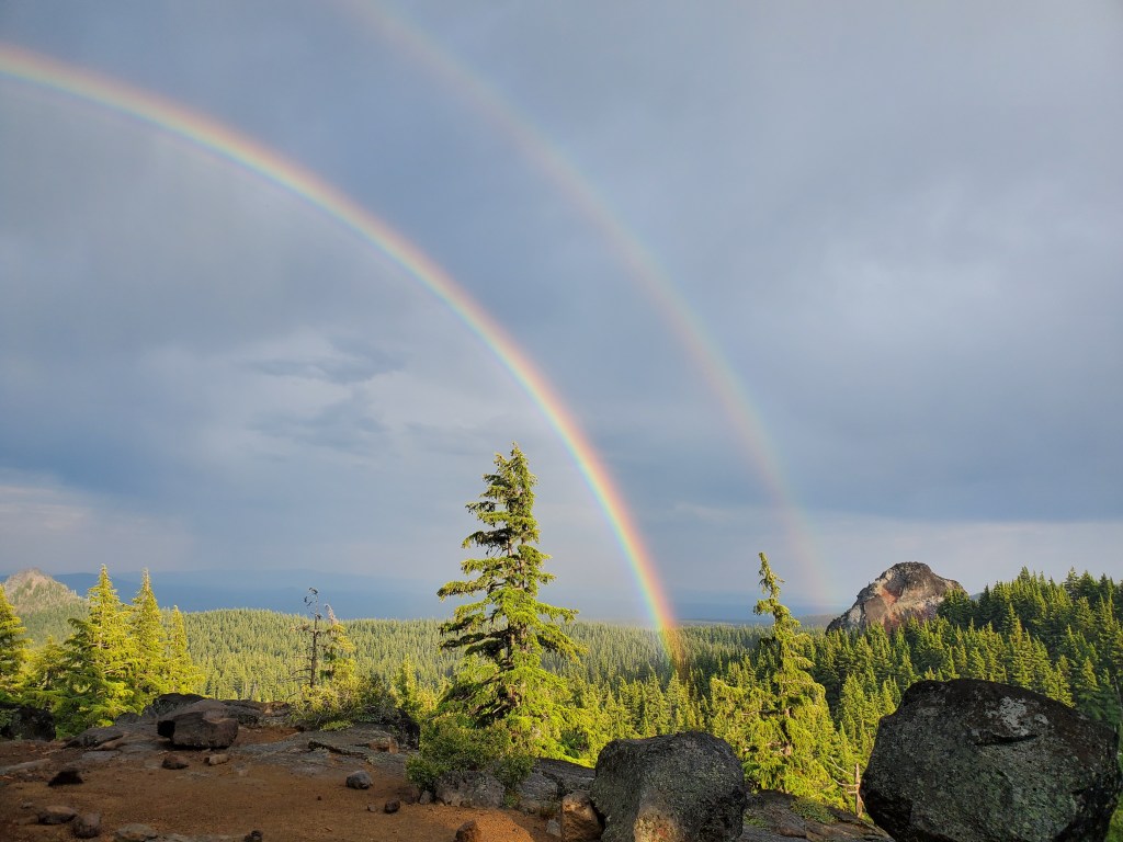
The rain and hail continued for 2 hours until we got to camp. The sun came out beneath the clouds, lighting up the eastern sky with an epic double rainbow! This was somewhat redeeming for the wet and the cold we had just endured. We enjoyed a chill evening in the tent as the rain let up. The mosquitoes were keen on interrupting our peace, sneaking in through our failing tent zipper…
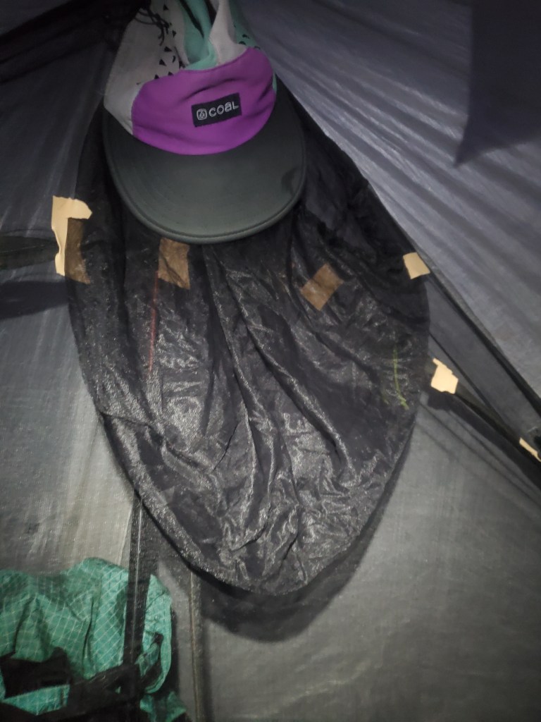
We tried our best to tape the zipper together, which certainly helped, but it wasn’t quite mosquito proof. Despite the rain and skeeters, we were still riding high on the stoke from summiting Mt. Thielsen.
Day 123 – 22 miles/1884 (7/28/22)
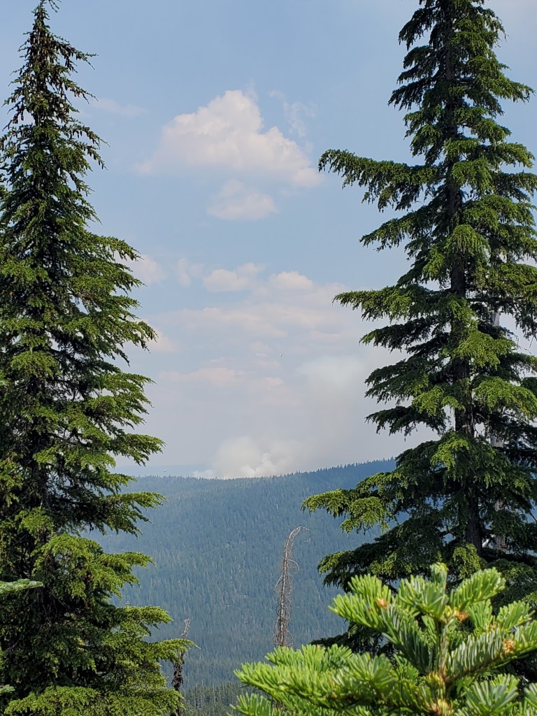
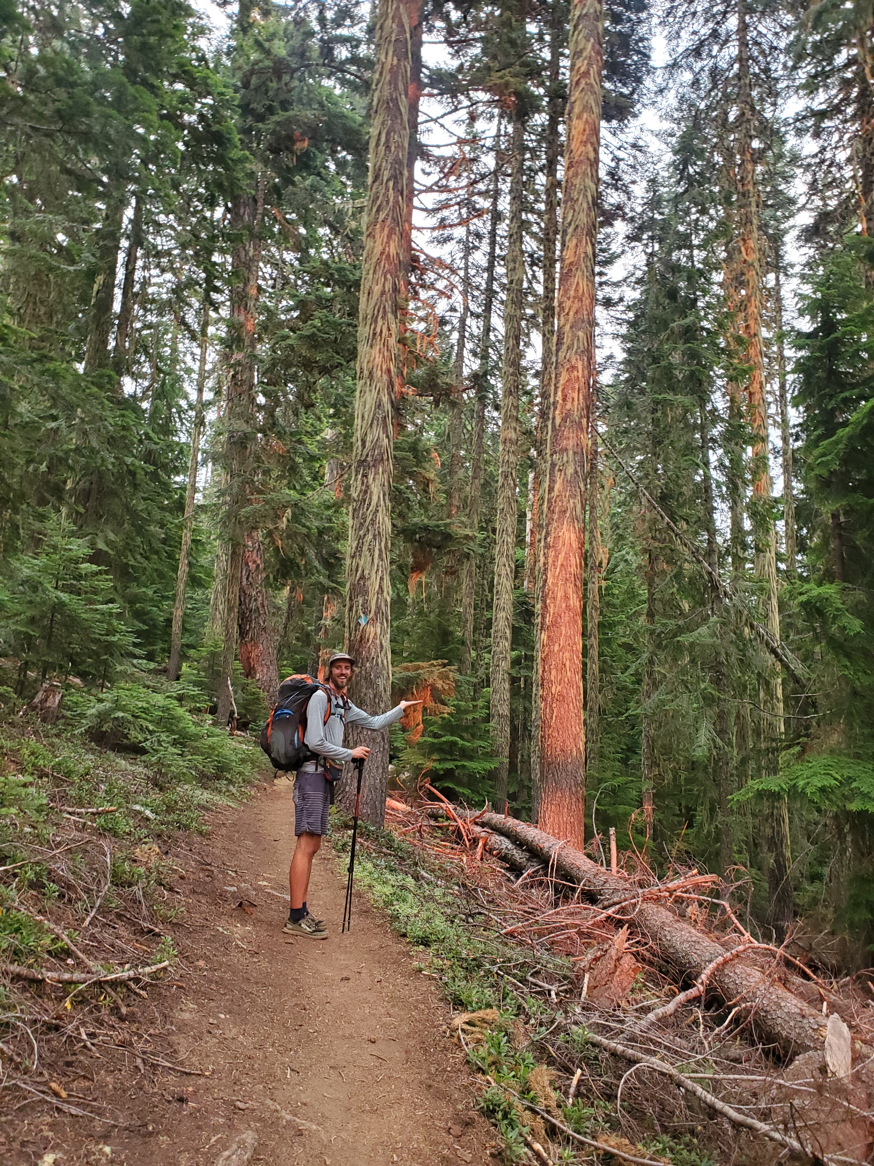
We were moving slow again, got going at 8 am. Back in the woods, we were mostly just wandering though hemlock forest all day. The heat was ungodly. Just before lunch, we could kind of smell smoke. Other hikers nearby confirmed that we weren’t imagining it. Shortly after lunch, we could see the column of smoke rising from a ridge only 3 miles away. Yikes!
Maggie and I had been fortunate thus far to be ahead of any wildfires, but it seems the fires finally caught up to us. It appears this fire may have been ignited by the thunderstorm the day before. There were loads of planes and a helicopter dumping water on it already. We hiked on for a bit and discussed our options, but my consternation was growing. We called the US Forest Service. They said that there were a lot of crews on the fire, it was only 8 acres at the time, and no trail closures had been announced yet. We got to yet another water cache at Windigo Pass and decided to hike onward up the PCT. We would be able to get about 10 miles from the blaze, which felt like a safe distance to us given the circumstances. We later learned that another fire would close Windigo Pass just two days after we hiked through…
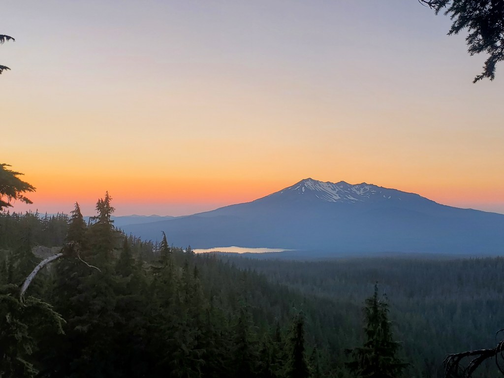
Hiking onward, we were both feeling itchy sweat salt – the accumulation of salt crystals in your pores from several sweaty days without bathing. The feeling is very hard to describe, but it is most akin to pins and needles when an extremity is regaining circulation after “falling asleep”, but I would say the sweat salt is more painful and it strikes randomly if you twist the wrong direction. Not fun! We finished the day climbing around cowhorn mountain, which came with some nice views. We found a tent site at 7 pm, right in the heart of mosquito hell. In the tent quickly, we watched the dragon flies pick off skeeters just before bed. A nice sunset over Crescent and Summit lakes brought the day to a close.
Day 124 – 22 miles/1906 (7/29/22)
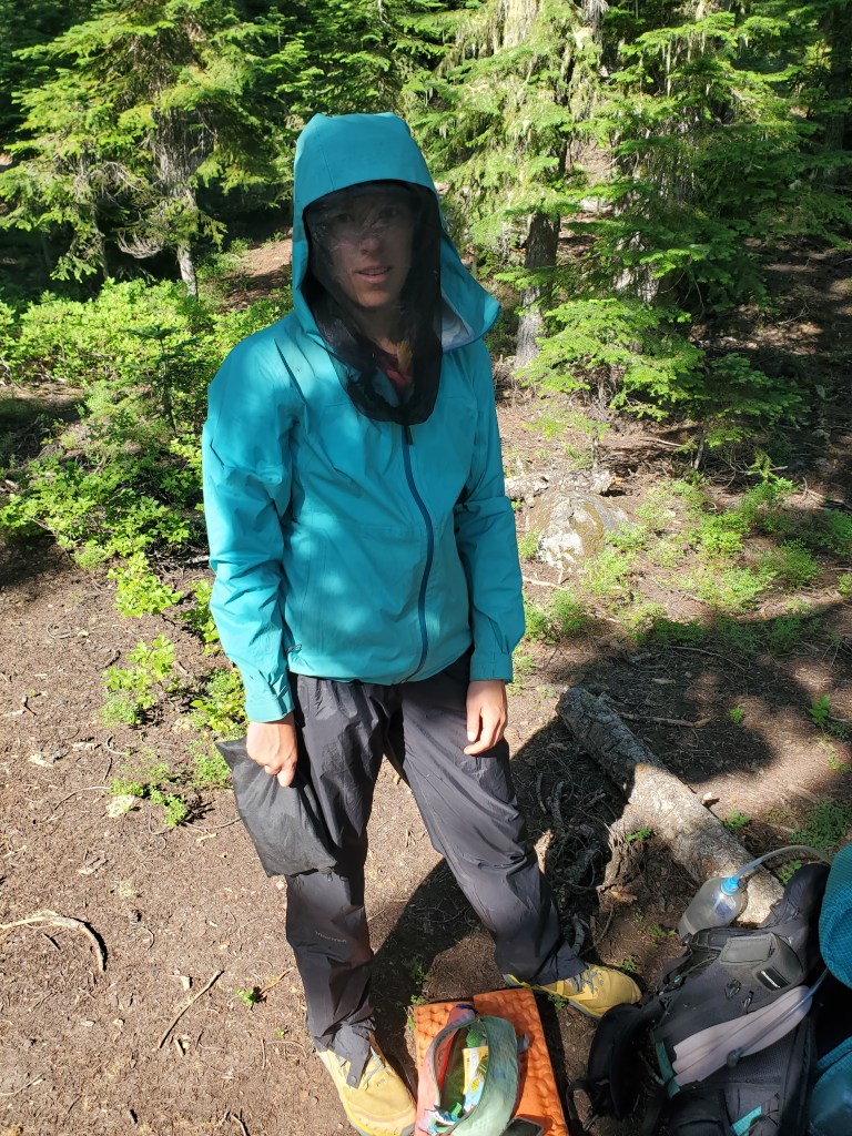
We awoke up to a nice sunrise, however I gazed upon it through a cloud of mosquitoes growing outside the tent. We did everything we could in the tent until the time came to pack up and go into the hoarde. Full PPE was necessary – rain gear and head nets – while we packed up. It was far too warm to keep the rain gear on, so a little bug spray on the legs and hands did the trick for hiking, but we kept the nets on for the first time. It was 7 miles of hell.
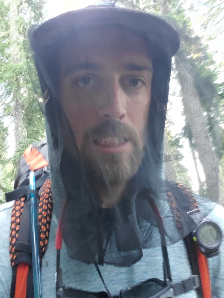
I don’t even remember what we hiked through because I was so preoccupied with swatting mosquitoes away. We grabbed water at Summit Lake, again donning rain gear while the water filtered. Safe to say we were not happy campers in this moment.
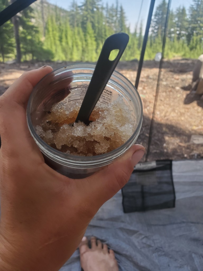
At last, a few miles past the lake, the bugs dissipated and we sat for a brief snack break. We enjoyed a couple more miles free from the skeeters as we rounded Diamond Peak. We stopped for lunch by a nice creek flowing with fresh snow melt, but alas the bugs like the water too. We found a shady spot and pitched the tent so we could eat in peace. Well worth the effort. Maggie grabbed some snow and added a lemon-ice tea flavor packet, making a wonderfully delicious backcountry slushie! We took a two hour break after rushing through 11 miles this morning.

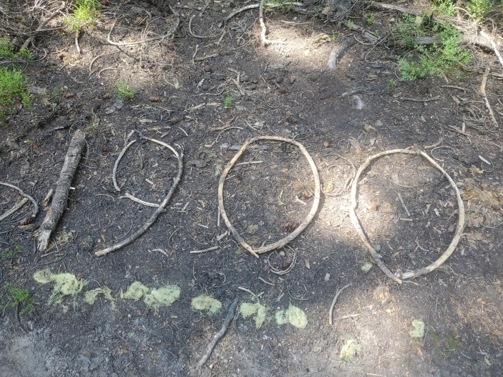
On the trail again, we meandered through more hemlock forest, the bugs off and on now, but nothing like the morning. We crossed the 1,900 mile mark on the north end of Diamond Peak – another hundred in the books!
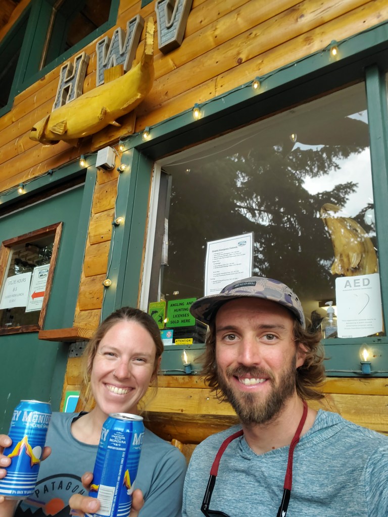
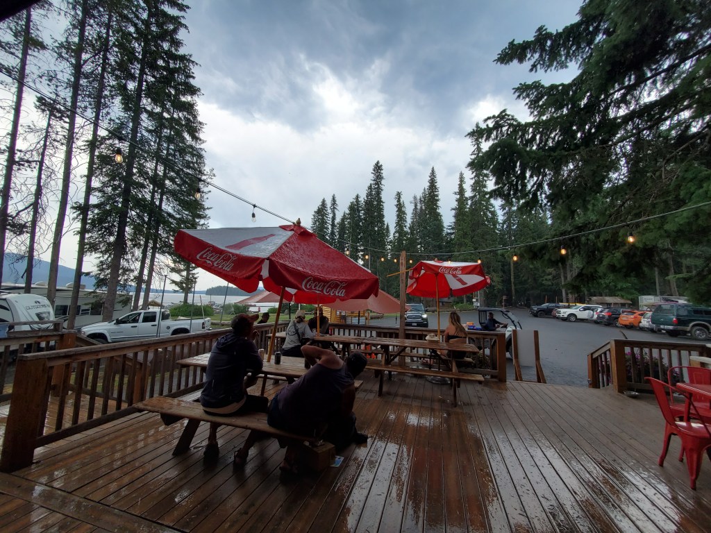
Maggie and I still hiked fast in an attempt to reach Shelter Cove Resort (Odell Lake) before the kitchen closed. We made it to the side road towards the resort, and when we joined up with the paved road, a nice man picked us up for the final mile. It was 5 pm already, and our driver informed us the kitchen had closed early. A bit of a bummer after working hard to get a decent meal. All good though. We found hiker friends, Sourpatch and Hotdish, and they graciously shared a beer with us. We milled around with the crowd of hikers, set up camp, and made dinner. A nice hot shower took care of our itchy salt, and we were early to bed.
Day 125 – 5 miles/1911 (7/30/22)
Maggie and I didn’t have any big plans, so we chilled at Shelter Cove for most of the day. We got out of camp and found a line of hikers at the storefront just before they opened at 8 am. We got some microwaveable breakfast and posted up under the PCT pavilion. We met a bunch of new hikers. Did laundry. We picked up our resupply boxes and reorganized. It rained yet again – who knew the Cascades get summer monsoonal thunderstorms? Not too eager to set off in the rain, we bought the last six pack of Montucky Cold Snacks to pass the time.
The rain let up around 4 pm, and loads of hikers packed up to hit the trail. We weren’t so sure, and sure enough, the rain started again. We finally left the resort at 6:20 pm when it seemed the rain was truly done. Smoke was in the air again. A weird pinkish light from the sun, smoke, and clouds beamed in through the trees for our little hike out. We camped by Lower Rosary Lake, feeling refreshed from a chill day at Shelter Cove.


2 responses to “Hail from the Heavens, Mosquitoes from Hell – Crater Lake to Shelter Cove”
What an amazing hike!!! You have gotten to see sooo much! Soooo cool!!!
LikeLiked by 1 person
I am so enjoying reading this!
LikeLiked by 1 person