
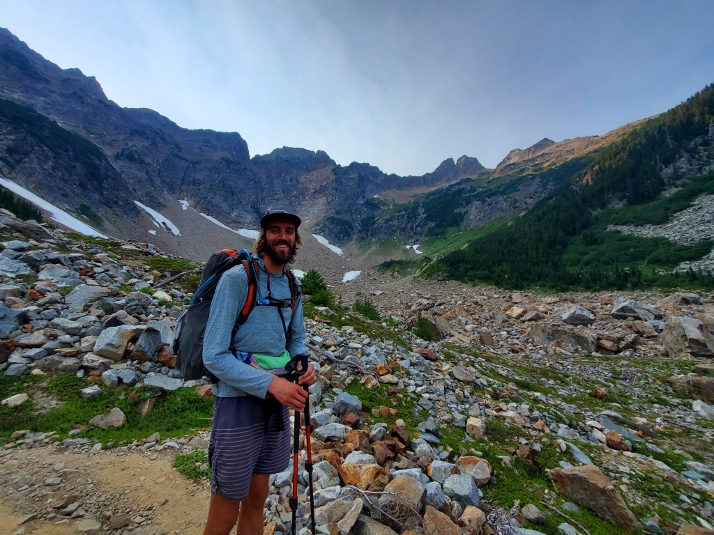
Maggie and I were headed into the insanely gorgeous Glacier Peak Wilderness. Canada was within reach, but we were seeing signs that we might not make it…
Day 154 – 6 miles/2471 (8/29/22)
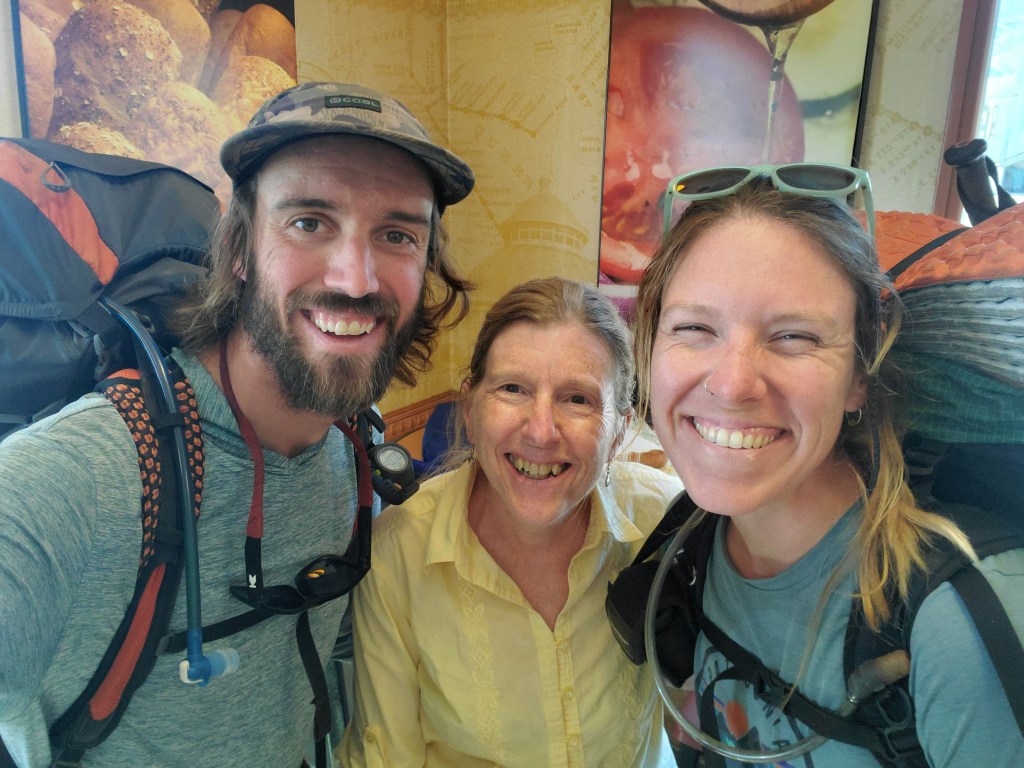
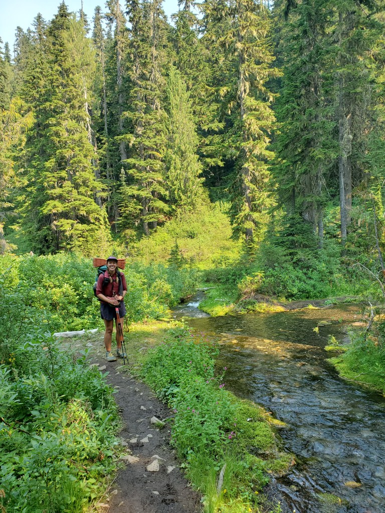
Maggie and I moseyed out of bed in the hotel and started getting our stuff together. Naturally, we were in the room up to the 10 am check out. We got breakfast at Louie’s, a cute little diner in Leavenworth. Next stop was the gear shop. My sleeping pad had been deflating since southern Oregon. I attempted to patch the pad, but still it leaked. Up until this point, I had accepted my fate, using a small slice of an old foam pad to cushion my bony hips at night. I opted to replace my pad with a luxurious self-inflating Thermarest, a bulky pad most thru hikers wouldn’t even consider. The end of the PCT was in sight, so a little extra weight and bulk would be fine for two weeks. We went to the Post Office to mail our books home, which would at least balance out the weight gain with the new pad. My mom’s friend, Wendy, was passing back through Leavenworth, so we met up with her and took her up on a ride back to the trail.
We grabbed a few treats from the bakery for the road. Walking through town, we ran into Sourpatch and Hotdish, and offered them a ride with Wendy. We got sandwiches to go, and the four of us loaded up in Wendy’s truck around 1 pm. Back at the top of Stevens Pass, we sat at the trail head with minimal motivation, eating lunch and taking care of a few things while we had cell service. Maggie and I got moving at 3:30 pm. Not too much to report on the 6 miles in.
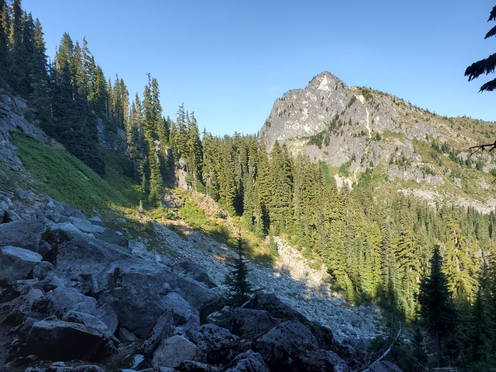
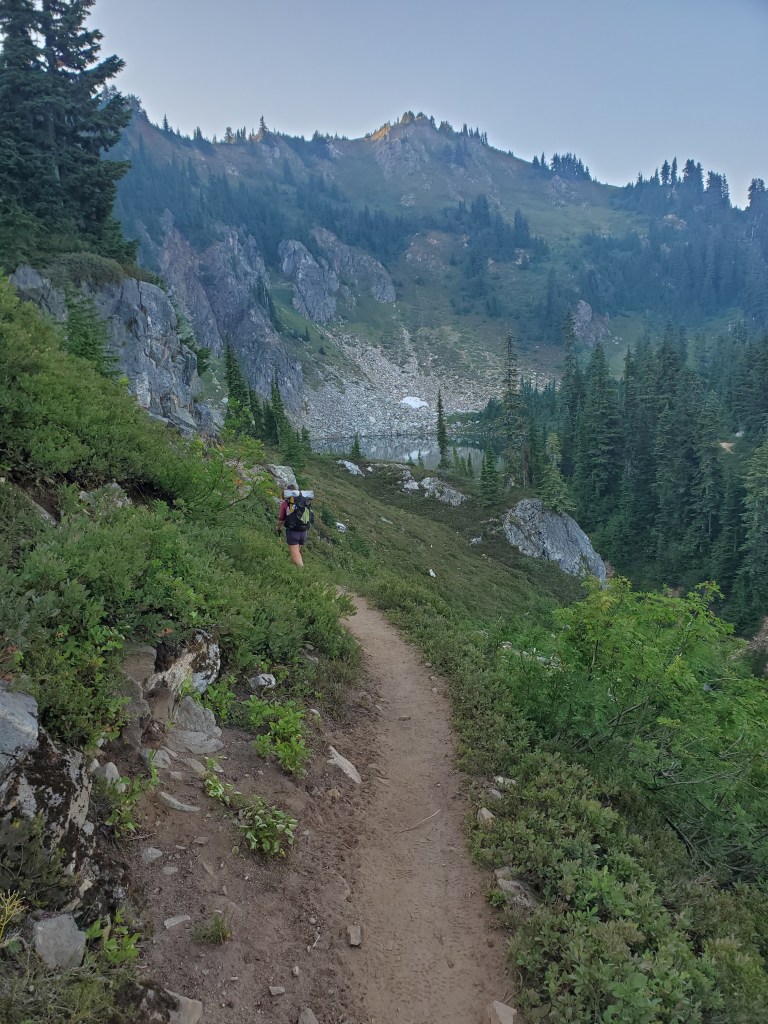
We got to Lake Valhalla at 5:30 and set up camp. Lichtenburg Mountain stood prominently next to the lake. The bubble was still noticeable, but we were able to camp at a roomy area by the lake with Sourpatch and Hotdish, as well as Bird, a former Dutch Rudder pirate. He explained how the massive tramily had gotten to be too much for him. We were all in bed around 8 pm, preparing to push hard into the Glacier Peak Wilderness.
Day 155 – 24 miles/2495 (8/30/22)
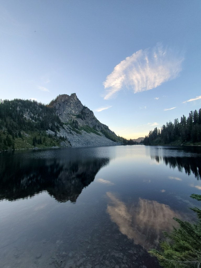
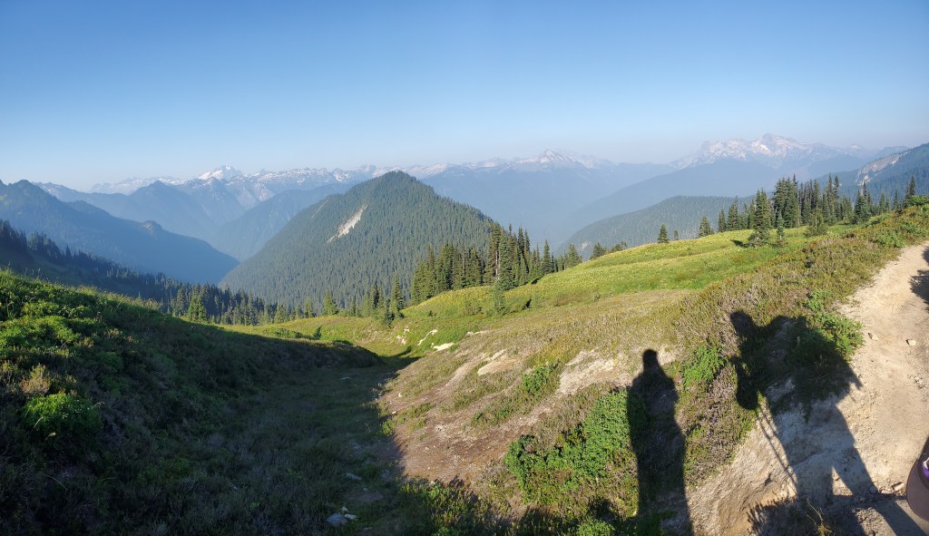
We were finally able to wake up early, 5 am, and get moving just before 7. The morning light was nice on Lake Valhalla, the reflection of an errant cloud adding a splash of color.
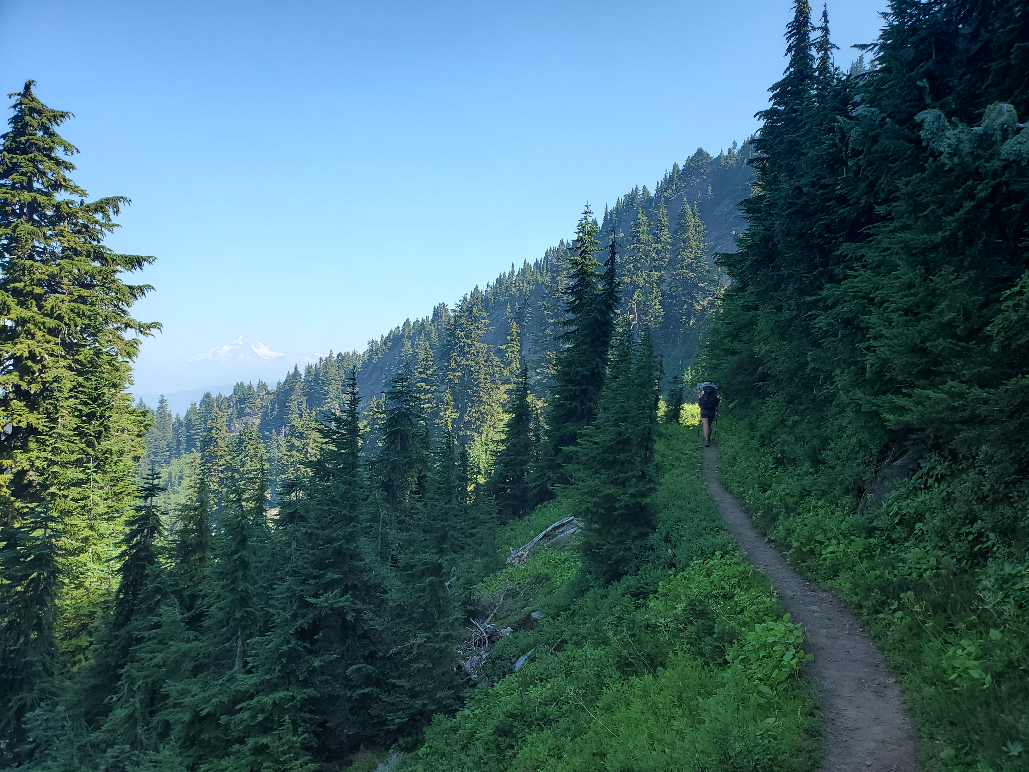
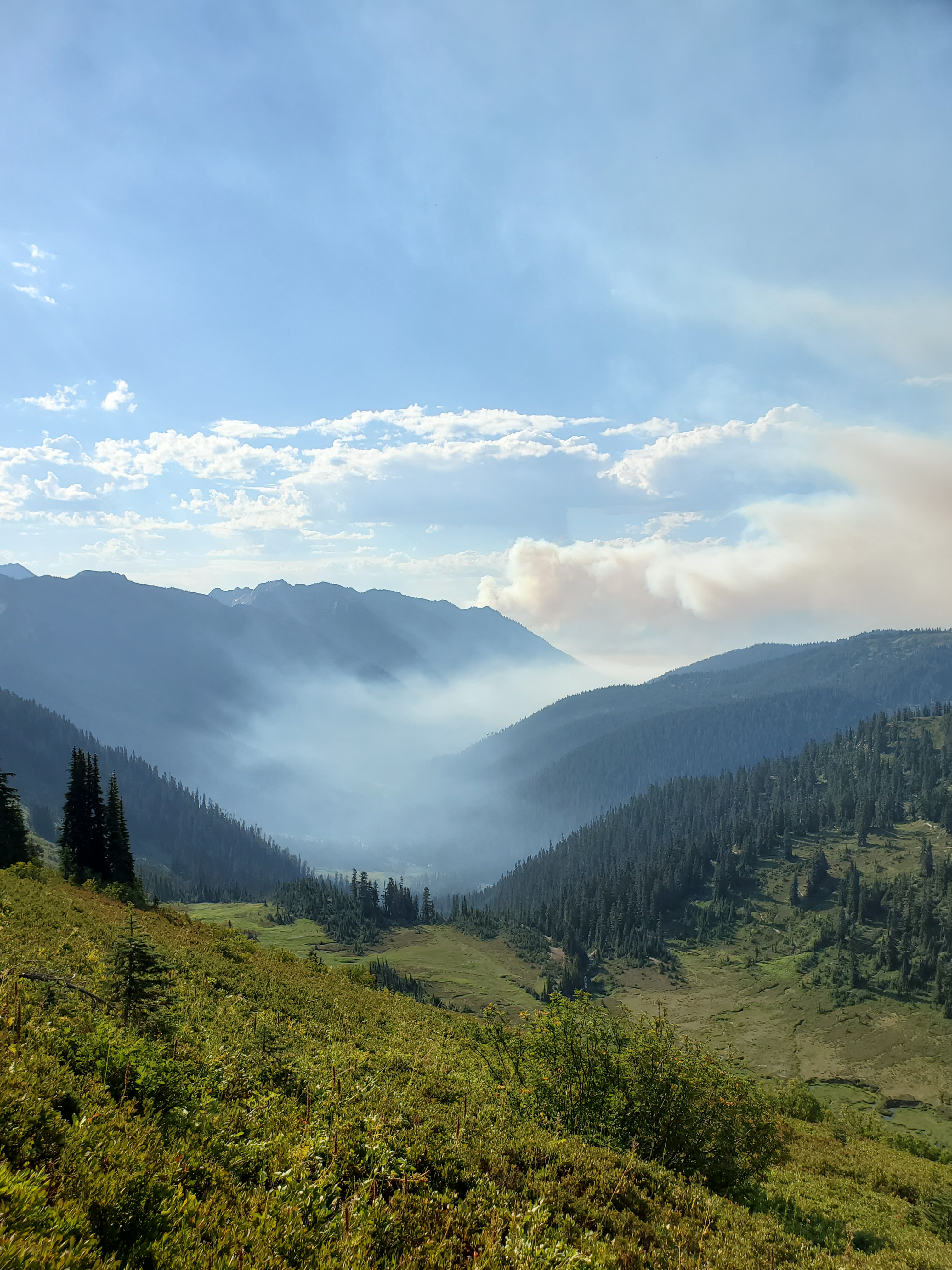
As we set off into the forest, the smell of smoke was in the air. We had checked on wild fire activity earlier, but the fires didn’t threaten the PCT on this stretch. Still, smelling smoke is a bit unnerving… We wandered around the ridge, down then up. When we got a view of the valleys below, we could see smoke pooling at lower elevations, and further on, more active billows of smoke from the hills beyond. It certainly put a bit of a damper on the day, since our lungs weren’t happy, and the views were mostly obscured.
We weren’t in the forest, but we weren’t in alpine meadows, rather a consistent mix of the two. Hundred yards of meadow, hundred yards of hemlocks. It was nice to not be trapped in the green tunnel, however by 11 am, the heat was cranking up. We really felt it in the exposed meadow sections.
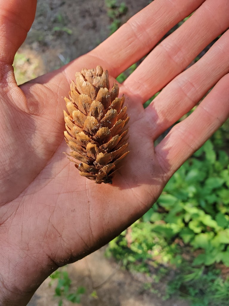
As a small consolation, the blueberries and huckleberries were bountiful. We started getting in the habit of grabbing berries while walking to avoid slowing down. We both probably ate over 100 berries each over the course of the day. After lunch, we dropped down to Pear Lake. A handful of hikers were already there, stripped down to their undies and swimming in the water. We eagerly dropped our packs and our shorts to join the fun.
It was so pleasantly cool and clear. I swam out and dove down for the coldest water to chill my core temperature. We were both shivering by the time we got out of the water, a sensation we weren’t expecting on this toasty day.
The trail took us over three more hills, making for another day with 6,000 feet of ascent. The smoke to the west was thick, so thick we couldn’t see through a valley near the horizon.
We got to Lake Sally Ann at 7 pm and took the first spot we found near the trail. It was a bit of an odd day, and the weariness of 5 months on trail was starting to weigh on me. There was nice scenery, but it was becoming hard to appreciate.
Day 156 – 21 miles/2516 (8/31/22)
We woke up feeling miserable. Not sick, we were just worn out from the day before. The heat and the smoke really got to us. A brief stint of rain drops fell on our tent, which finally got us to sit up after 50 minutes of snoozing the alarm. We took our time and got moving at 8 am. The smoke had cleared up by our camp, but we could see a dense plume rising to the east.
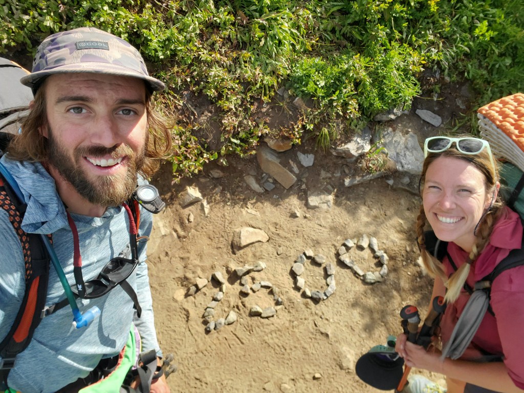
The trail took us along the ridgeline, where we were mostly passing through low lying ground cover. Within a couple hours of setting off, the sun was already burning through our sun shirts. The wind was picking up and the smoke was starting to follow us north. We crossed the 2,500 mile mark, an incomprehensible distance at this point.
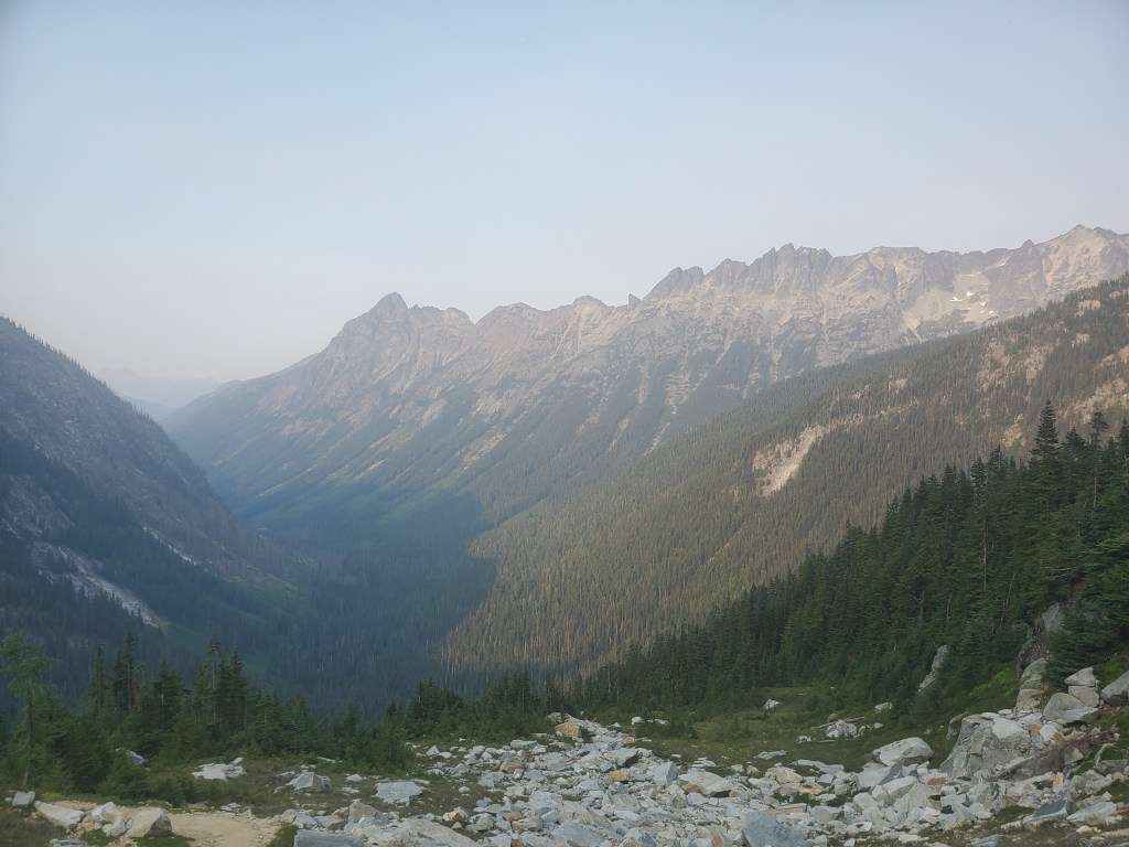
Soon after, we ate lunch on a sunny south facing slope, no shade in sight. We eagerly watched meager cumulus clouds roll in, hoping they would block the sun for a few moments. We still felt a bit off after lunch, but better than we had felt in the morning. Maggie and I hiked on, soon turning north around White Mountain towards Glacier Peak. We dropped down into a vast treeless valley, some small snow patches clinging on through the last few days of summer.
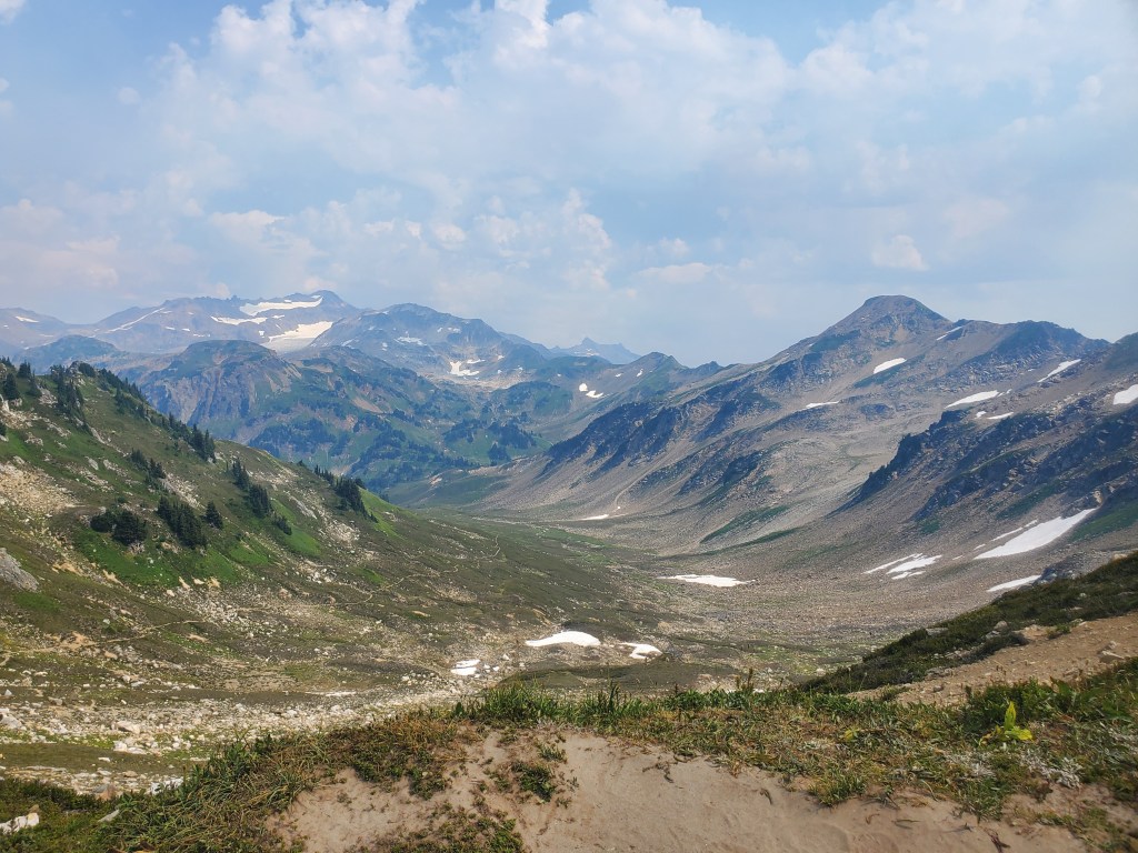
The view of Glacier Peak was accenuated by two formidable mountains in the foreground, and despite the smoke, it still filled our hearts with wonder. We continued down, at last returning the forest. A small clear creek ran through this narrow valley, and we stopped to splash ourselves with the cold water to combat the heat.
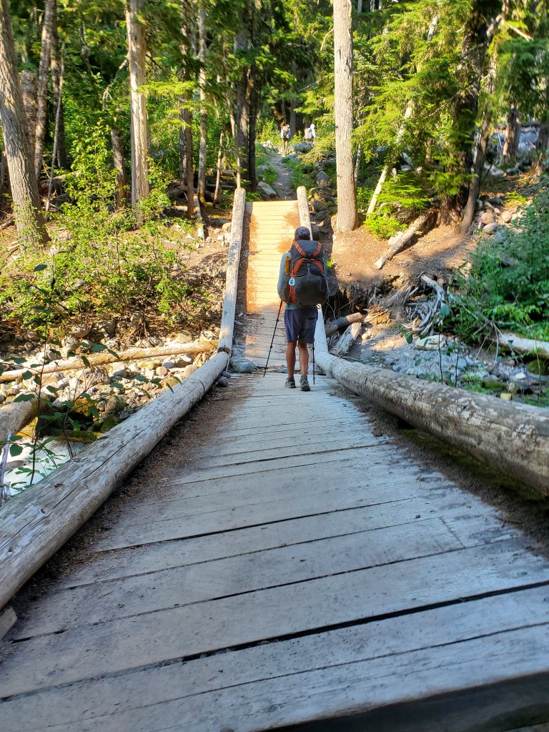
We were at least in the shade again, and we cruised on a few more miles for a water and snack break. A bridge, broken right in the middle, got us across the next creek.
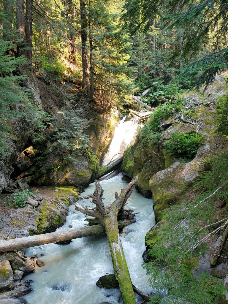
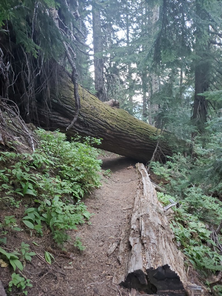
Further on, blowdown became more frequent, slowing our already slow progress. We finally made it to Kennedy Creek around 5 pm. “Creek” is a bit of an understatement – “raging torrent” is probably more accurate, its waters a milky gray with sediment.
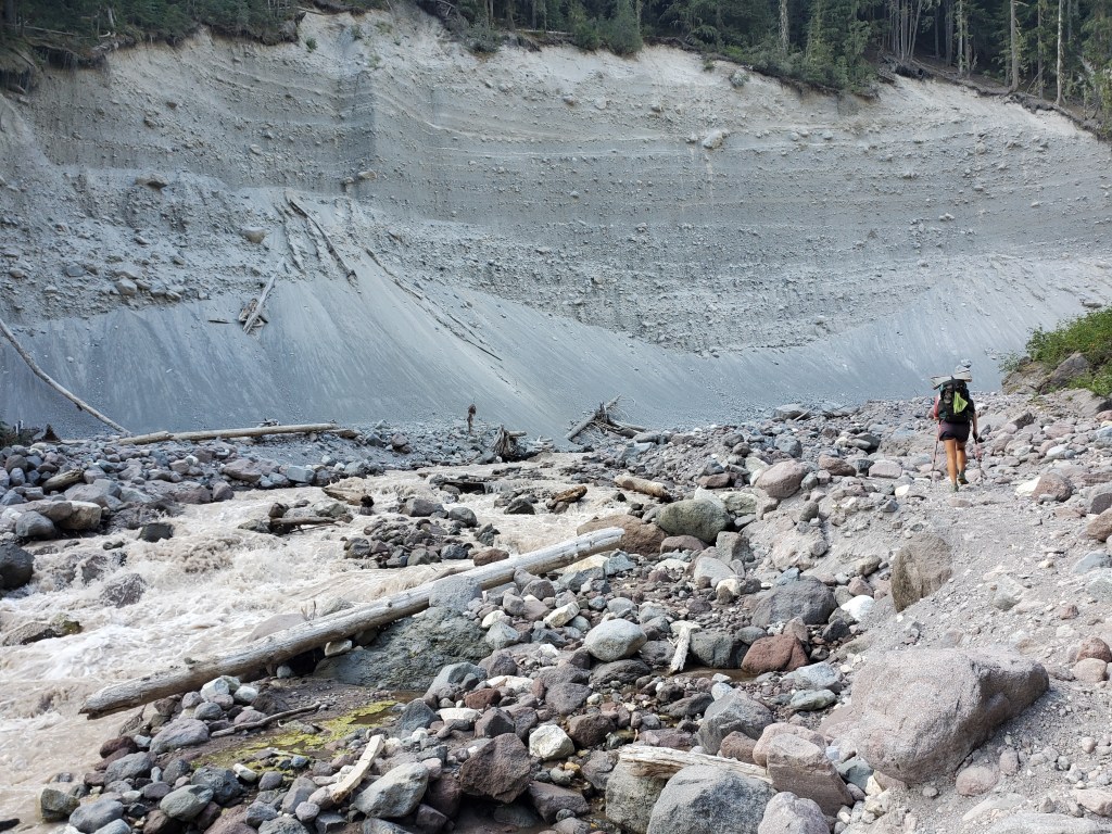
We inspected a sketchy log crossing, but decided against it. We opted to walk through the water where the flow was split by a rocky island in the middle. Our plan worked, and the water was never higher than our knees. A German hiker, Lion, followed close behind.

Safely on the other bank, we emptied silt and sand from our wet shoes for a good 20 minutes. It was nearly 6 pm now, we had only hiked 19 miles, and we were aiming to hike 2 more. We walked with some gusto up the last hill, and we found our campsite next to a small creek. Cool air started to pour down from Glacier Peak as the sun set and we curled up in our sleeping bags.
Day 157 – 20 miles/2536 (9/1/22)
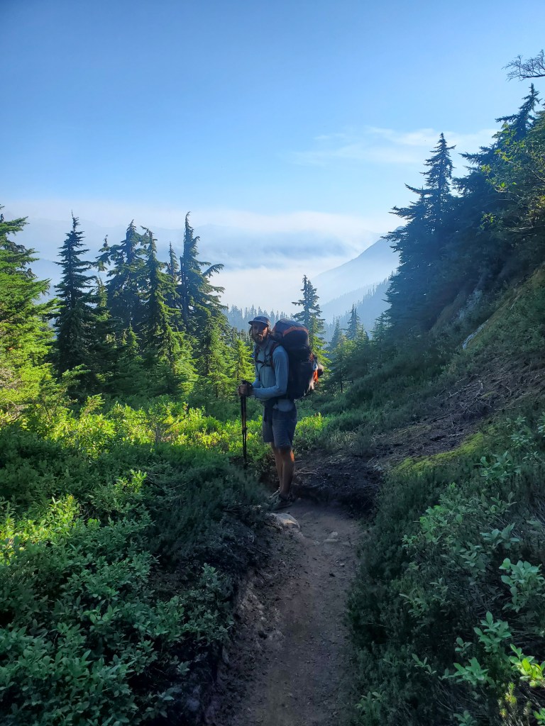
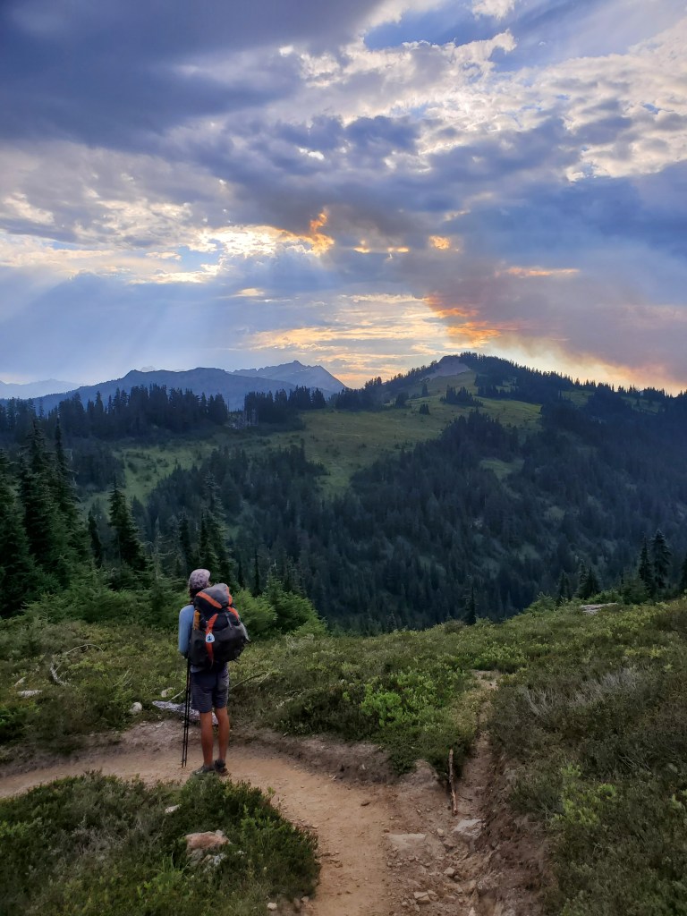
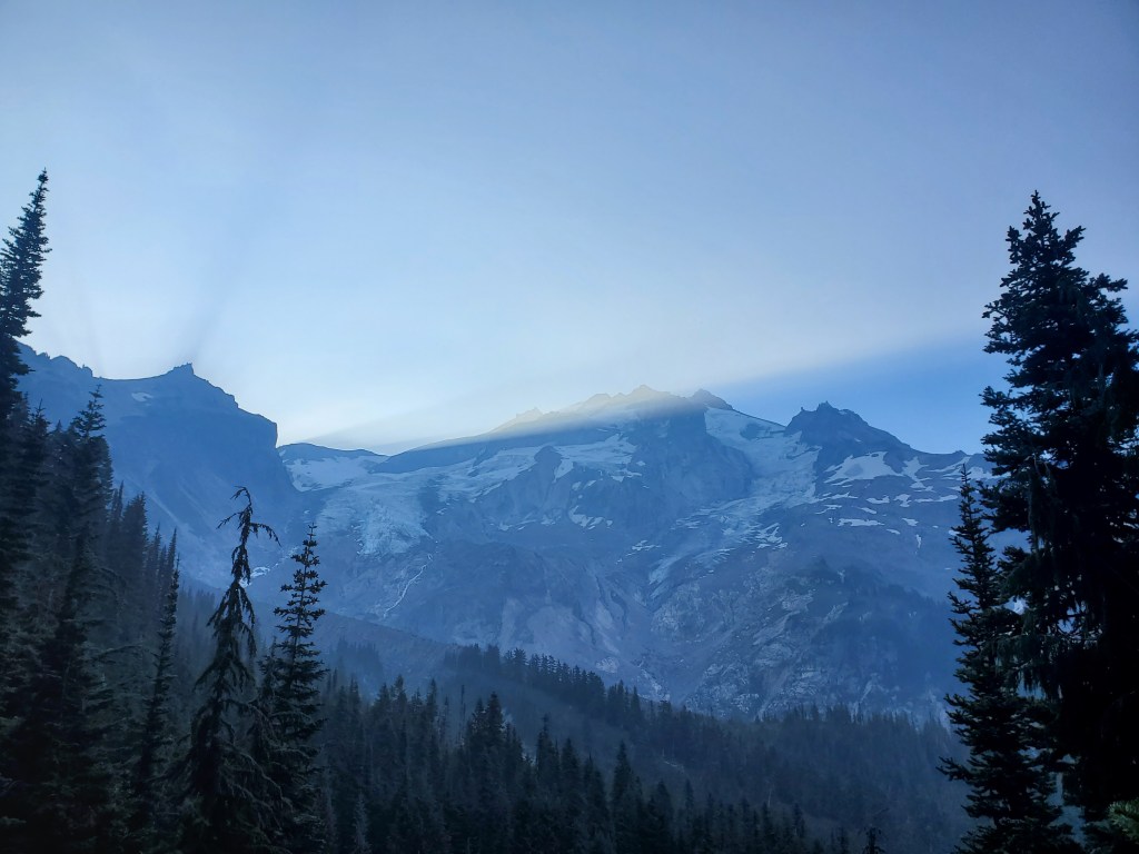
We woke up to a cool, damp morning. Breakfast was starting to require headlamps as the sunrise was coming later each day. We got on trail around 7:30 am and began our day by weaving around the flanks of Glacier Peak. The sun beams and shadows flying off the peak were visible through the smoke lingering in the air, making for some eye catching morning light.
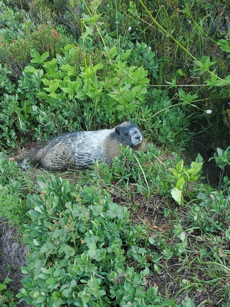
We enjoyed a few miles in the western shadow of the mountain, reveling in the cool air free from the sun’s rays. More blowdowns were littered across the trail. We climbed up and finally got a view to the north, where ragged, ice covered mountains were standing guard. What secrets were they protecting..? Perhaps the marmots will share their wisdom…
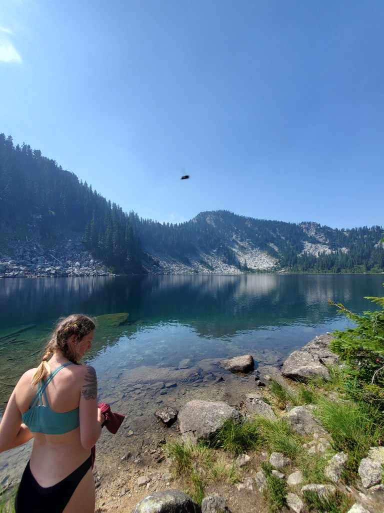
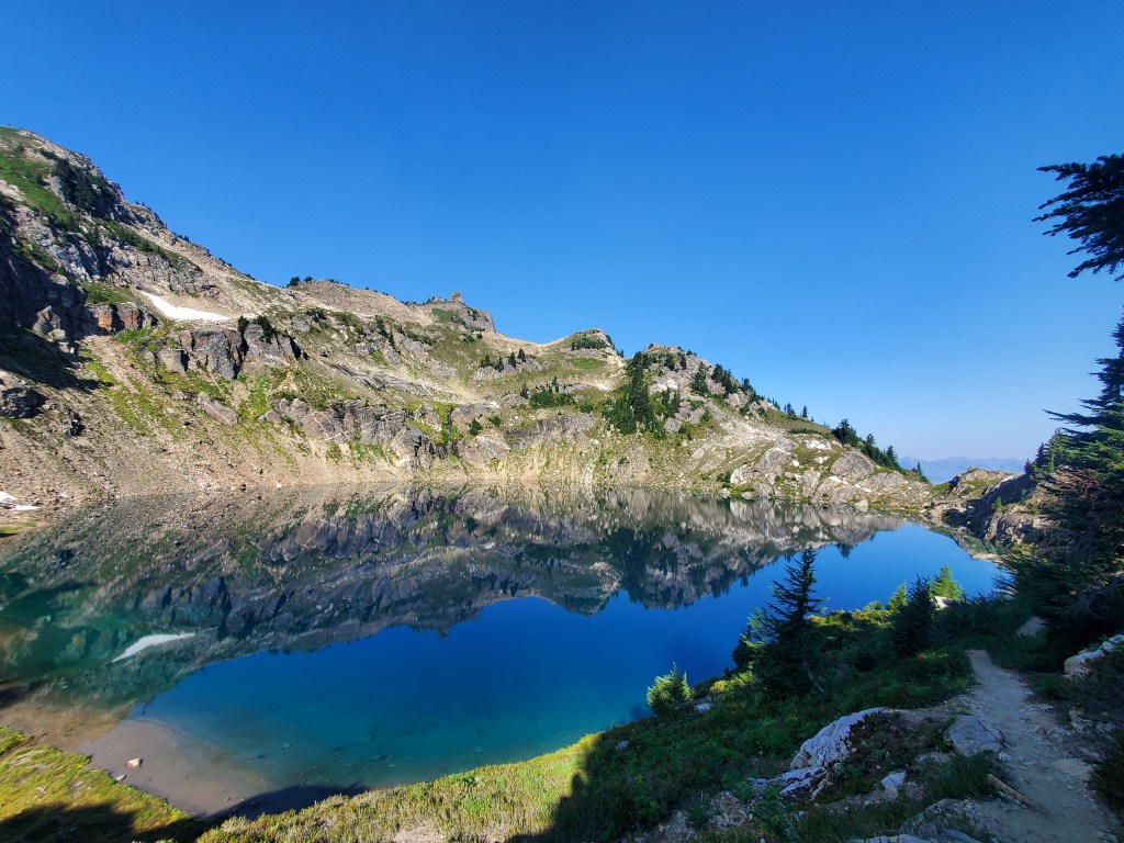
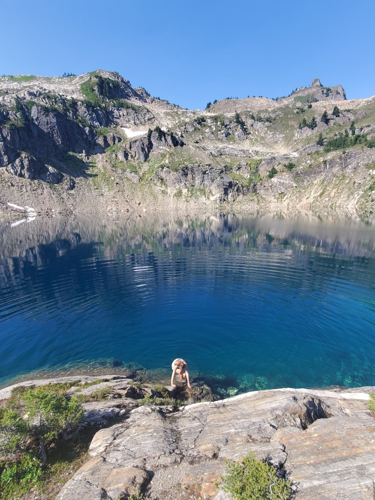
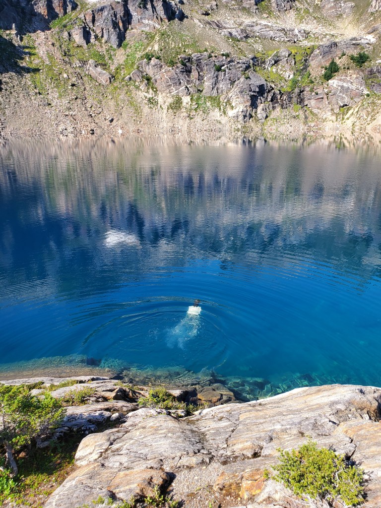
We descended down to Mica Lake, yet another icy blue, dead clear alpine lake. We could see fish from 100 feet away!
We sat in the sun, drying out gear and debating whether or not we should swim. It was only 10 am, but sitting in the sun, we knew it was going to get hot soon. Maggie took the plunge first, and quickly clambered out. I dove in next, and while I enjoy cold water more than Maggie, I too had to get back to shore within a few seconds. The cold was biting and invigorating, and we were happy we swam.
Onward down the hill, the trail turned back and forth with countless switchbacks, 3,000 feet all the way to the bottom. We crossed a bridge over Milk Creek, running white with silt. That “glacial flour” will ruin a filter, so we got water from a clear side stream and hiked up half a mile through overgrown brush to a shady flat spot on the trail for lunch. Lion caught up to us, and he sat with us for food and conversation. Somehow, it was 1 pm already, a very late lunch for us. Back up countless switchbacks, we climbed with podcasts to distract us from the strenuous hike. We got great views again up top, even though the smoke attenuated some of the grandeur.
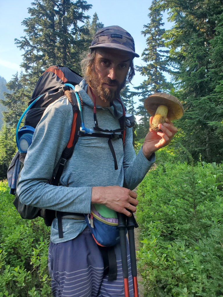
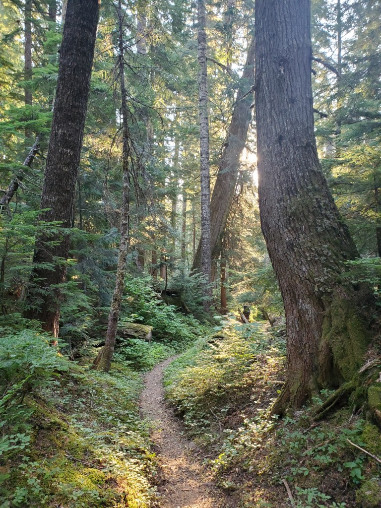
All that goes up must do down, so we went down the next hill. Fresh blueberries were back on the menu, they were almost hard to avoid at this point. The trail went back into the forest, now with many large conifers the PNW is famous for.

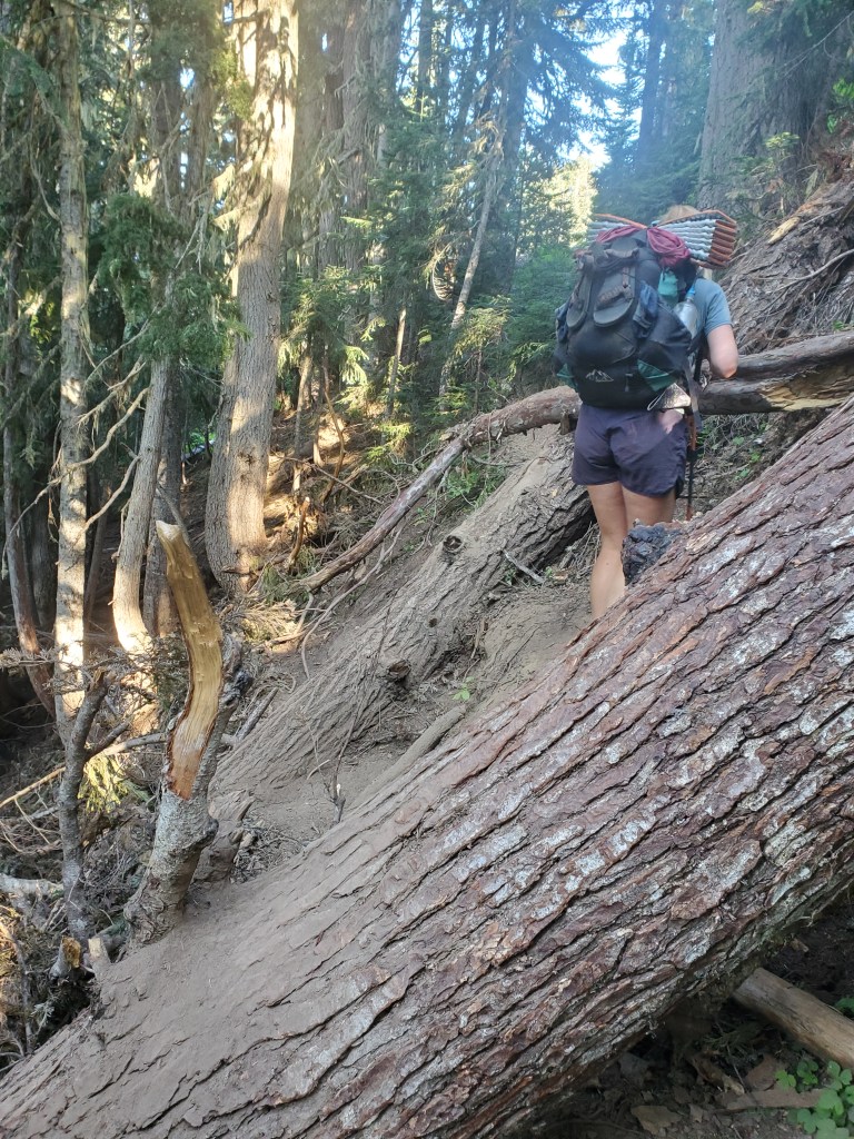
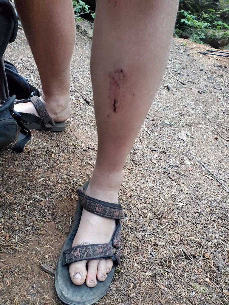
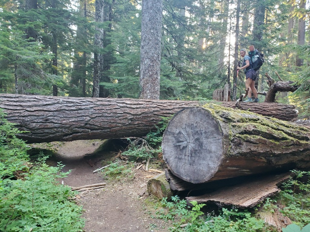
However, trees don’t live forever, and we encountered more blowdowns, some of them being massive old trees. One of these big trees had ripped its roots out from underneath the trail, leaving a soft and sketchy side hill to cross. Maggie slipped and banged her shin, tumbling down slope a few feet… It did not look good, but after a short break, she was able to keep moving.
We ended our day a little shorter than expected, worn out and beat down from challenging terrain. We camped by Vista Creek, another raging river fed by glacial melt water. The diffuse light on the forest floor dimmed as we prepared for bed.
Day 158 – 27 miles/2563 (9/2/22)
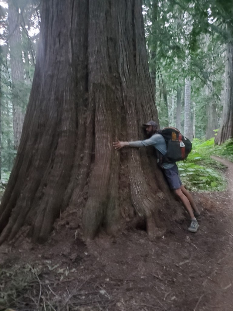
We were moving at 7:30 am. It was an easy morning as the trail descended gently along the Vista Creek. The old growth was becoming more frequent, especially near the Suiattle River. Western red-cedars and Douglas-firs stood 8 feet wide.
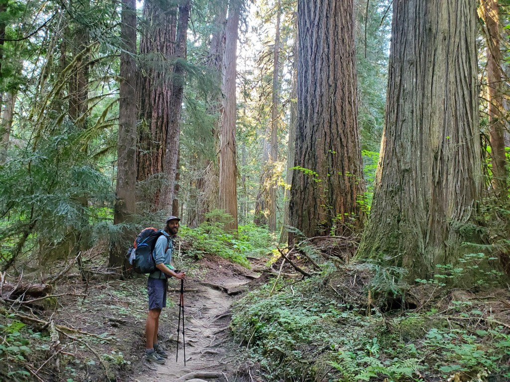

Whenever we thought we had seen the biggest tree, another challenger appeared around the next bend. With gigantic trees come gigantic blowdowns, making for interesting obstacles…
We crossed over the Suiattle River bridge, then pushed on up a 4,000 foot climb. Thankfully, the trail went up at a gentle grade and we had ample shade. Miles and miles through more forest, moss carpeting the space in between the trees.
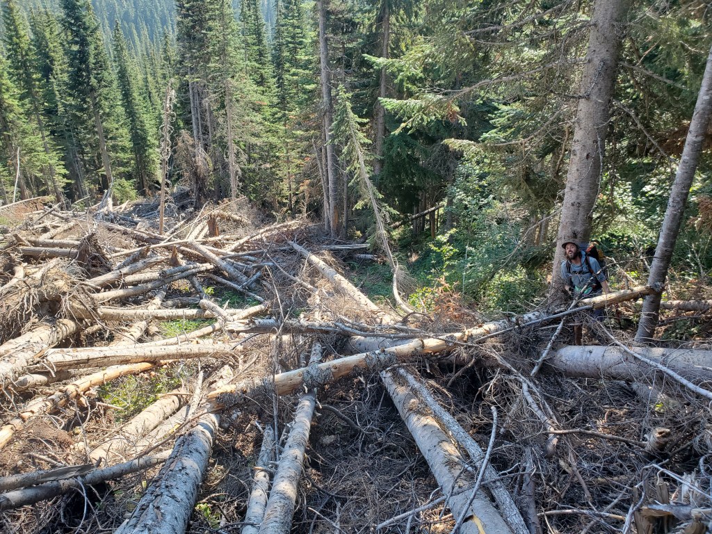
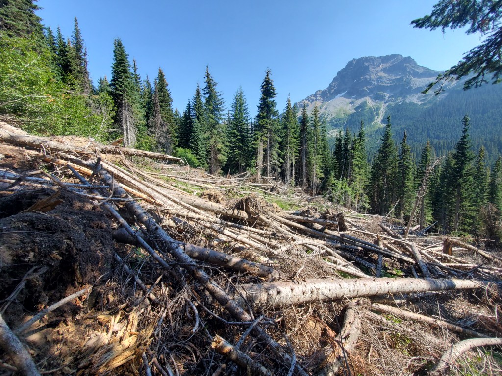
On the way up, we crossed an avalanche path – hundreds of trees strewn about, all pointing downhill, like some leviathan had been playing pick up sticks. It’s hard to imagine something as innocuous as snow causing all this destruction. This was one of the more challenging obstacles yet, since many of the logs were small and unstable. Falling into a hole between the logs would make for a bad day. Maggie and I inched our way across the clutter and found solid ground.
***NEW CONIFER ALERT***
Another classic of the PNW, Sitka Spruce (Picea sitchensis). I am used to seeing spruces cover mountain tops in the Rockies, filling in the highest and coldest altitudes below tree line. Sitka spruce is quite the opposite, clinging to low lands near the rain drenched pacific coast. The few that we saw here around Glacier Peak were surely on the edge of their range.

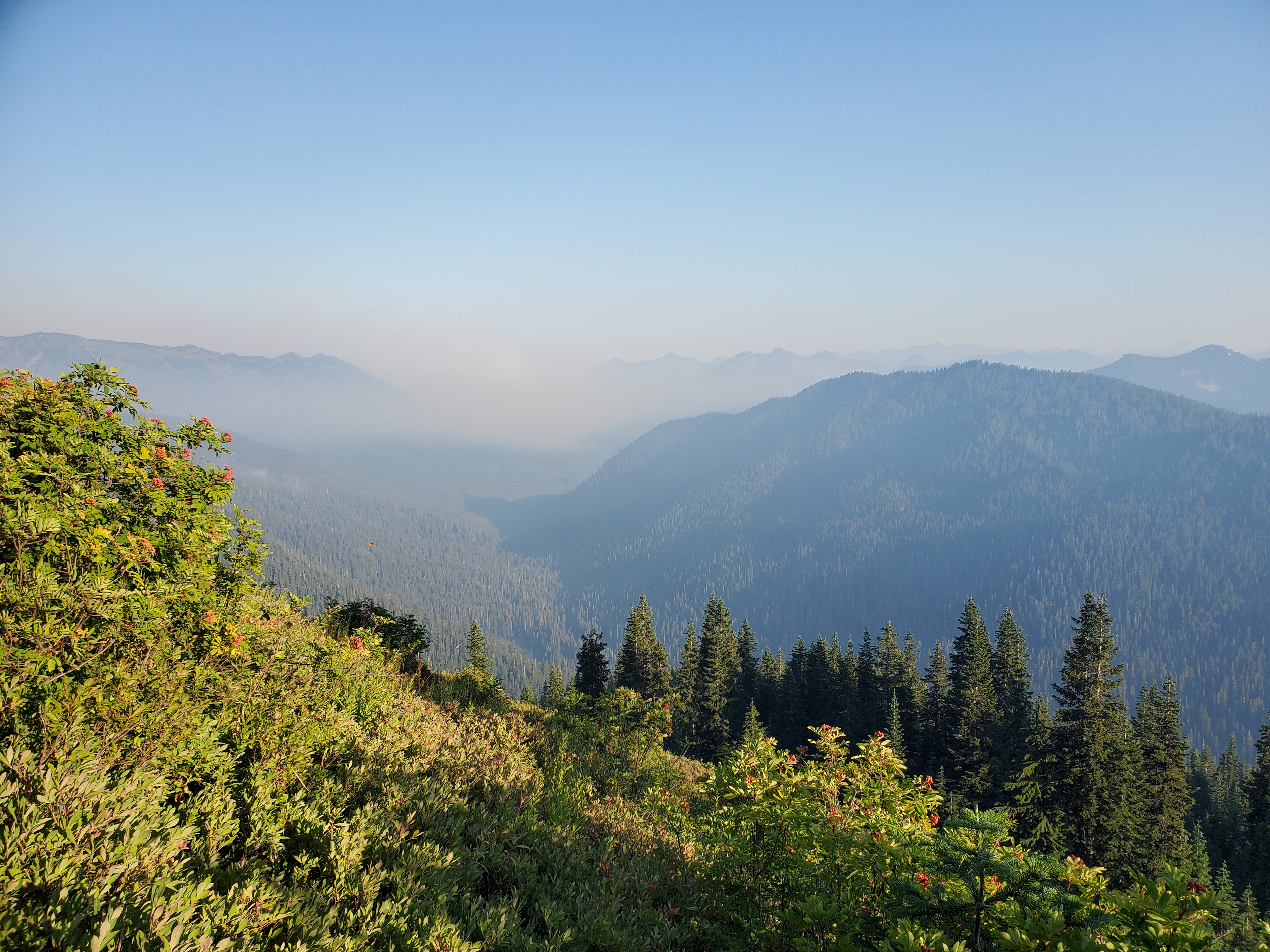
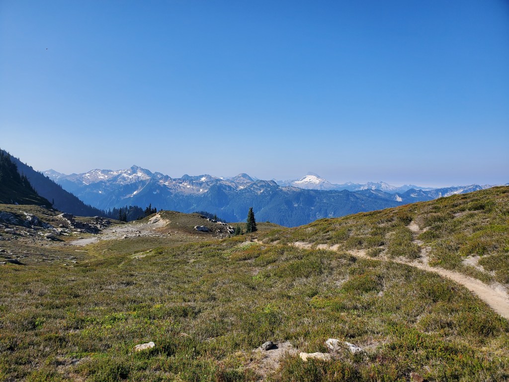
We got our last view of Glacier Peak and Fortress Mountain, some smoke obscuring the peaks. It’s always nice to look back at where we have come from on the PCT. We continued north and we were greeted with gorgeous views over the pass to Agnes Creek. A broad, glacially carved valley filled with dense coniferous forest crawling up the steep U-shaped walls, and capped by a striking sawtooth ridge.
I can’t really explain why I hiked 2,000+ miles, but small moments like cresting a pass with a brand new, awe-inspiring view make it feel worthwhile. We descended back down into the trees, save a few boulder fields. The views in the evening light continued to grab our attention.
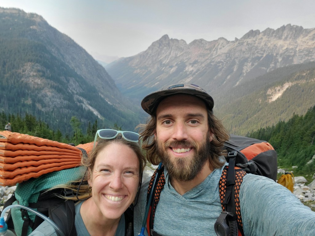
Maggie and I got within 100 miles of the Canadian border. There was a time when 100 miles felt wildly distant, but now it was just a few days away.
We descended further, moving at a steady clip, and we got to the first campsite on Agnes Creek. There was still some light and we were feeling great, so we decided to push 3 more miles for a total of 27 to get closer to the next town, Stehekin. The last few miles were easy, gently meandering downhill in the valley bottom. In the diminishing evening light, we stopped to admire more old growth Red-cedars.
Maggie and I made it to camp just before 8 pm. We found an open spot next to the creek, while everyone else camped up higher. We made and ate dinner as fast as possible, getting to bed at 9:30. We were feeling accomplished with our efforts, and overwhelmed by the beauty.
