
16 May 2023
Next up on my route south was Yellowstone National Park. My past experiences with Yellowstone left something to be desired… Given that I missed the eruption at Old Faithful some years ago, it is the parking lots, gift shops, and crowds that stand out in my memory. Another attempt to explore a back road into the park, Bechler Meadows, was met with the most heinous swarm of mosquitoes I have ever experienced. I have been looking to have a semi-enjoyable experience in Yellowstone for quite some time.
Wyoming had an exceptional snow year, so much of the park was still under feet of snow. Under the circumstances, a long hike seemed out of the question, so I decided I would drive through the park and make a quick stop or two along the way. Driving through the hilly caldera was pleasant, meadows and lodgepole pine forest. However, I was pretty surprised by the volume of car traffic here in shoulder season, but I guess that’s Yellowstone. The bison seemed to be unbothered.
I got to Canyon Village and decided it was time to stretch my legs. A quick glance at the park map and I picked “Brink of the Falls” trail. It was a steep, switchbacking path descending about 300 feet. Slowly, the sounds of rushing water grew louder as I got closer to the river. I had seen pictures of Yellowstone Falls, but I had zero expectations for what I was about to see.
I thought the trail might end at some viewing platform near the waterfall, but true to its name, the terminus was truly at the brink of the falls. You can stand and watch as flat water bends into a smooth curve and turns into an accelerating rush of white spray.
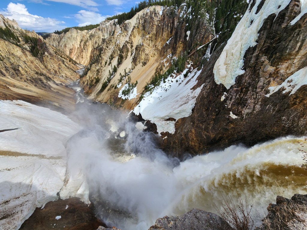
Of course, a small chain link fence guards people from becoming one with the waterfall, but the position is incredible. As your eyes follow the water down, then turn up with the mist, you begin to understand where you are. Downstream, an immense canyon carved into the park’s namesake rock forms a view as gorgeous as the falls are loud. I hung out at the brink of the falls for several minutes to take it all in.
Back on the road, I eventually came upon Lake Yellowstone, and I was shocked to see the water was still completely frozen over! I suppose it was only late spring, but the sheet of ice was a testament to the winter that had just passed.

I left Yellowstone on Hwy 14, which descends down a long, winding canyon along the North Fork of the Shoshone River. It was a lovely scenic drive before emerging on Wyomings vast plains.
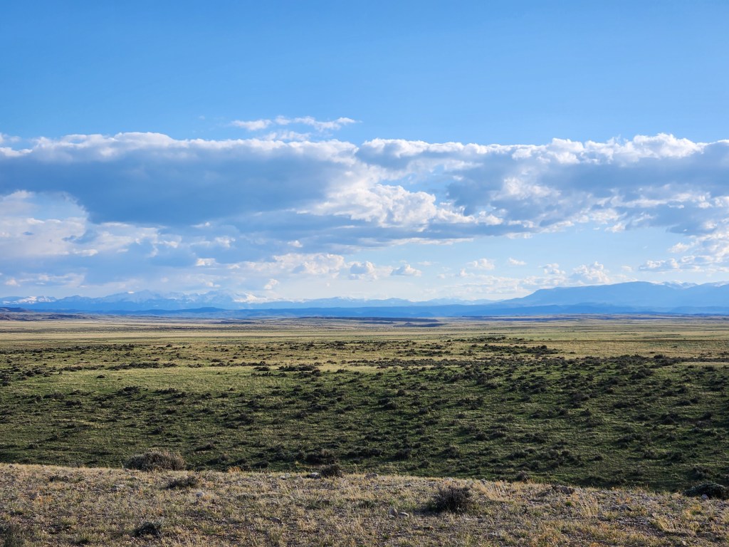
In the open space between Cody and Greybull, I found some BLM land on the map where I would camp for the night. Turning off Hwy 14 to a dirt road, an informational sign gave notice of wild horses. Horses are not native to the Americas, but were introduced by Spanish explores and colonists in the 1500s. Several thousand horses roam Wyoming today, but they are closely managed by the BLM. A couple of guys rode by on ATVs and asked, “You looking for horses?” They told me they had seen some less than a mile up the road. I didn’t see any horses close by my campsite, but it didn’t take long to spot a herd with my binoculars.

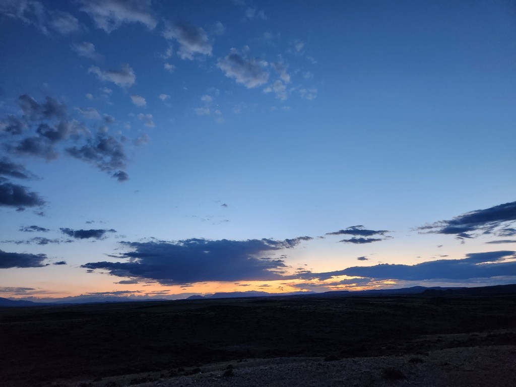
Wide open horizon offered up an epic sunset as I got ready for bed. It had been a nice day, and I was happy to be camping on the quiet expanse of Northern Wyoming.
The next day, I pushed west for Devil’s Tower. Along the way, the only thing worth noting is Ten Sleep Canyon. The towering limestone cliffs that line the canyon have made this a popular rock climbing destination. The town of Ten Sleep, at the bottom of the canyon, has a population of 300 people; it’s not uncommon for rock climbers to outnumber locals in the summer. I had hoped to climb here, but it was just a little too early in the season, and my forum post looking for partners hadn’t garnered any responses yet. I was nice to at least see it with my own eyes.
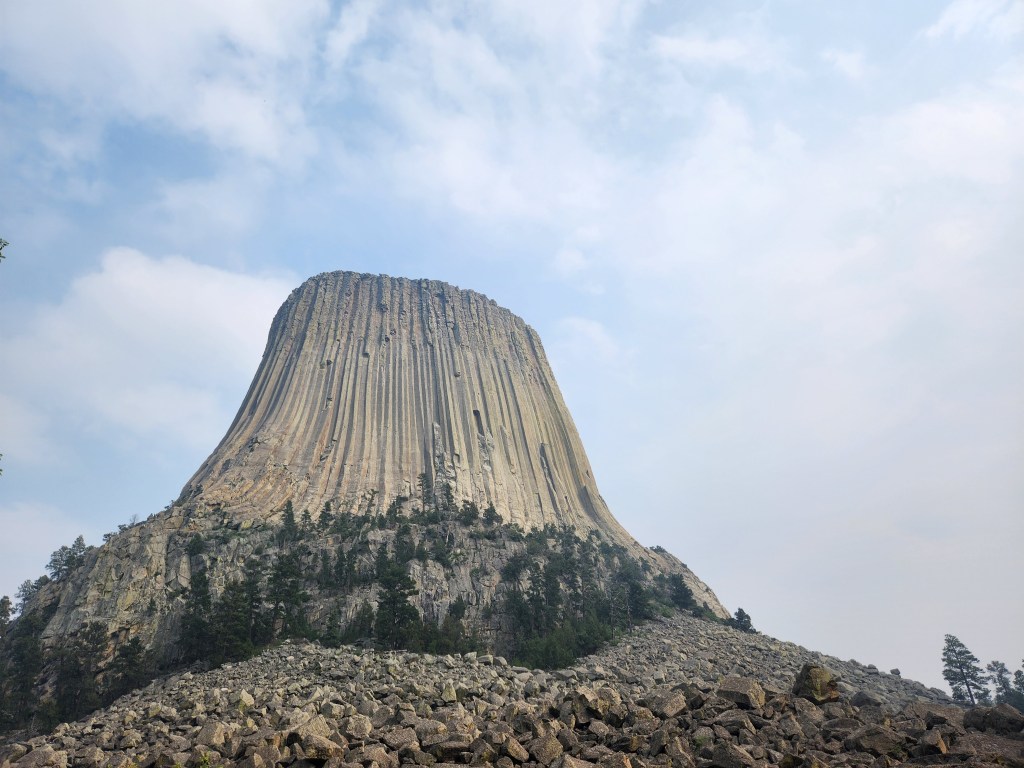
By mid-afternoon, I made it to Devil’s Tower National Monument. Wildfire smoke from Canada had also arrived, and while the smokey smell was pervasive, the views weren’t totally obscured. If anything, the smoke added a little mystique…
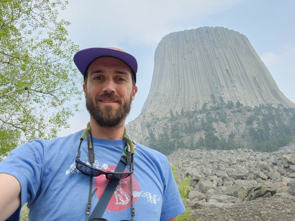
There is definitely a mythical aura around Devil’s Tower, or Bear Lodge as it is called amongst Native Americans. To paraphrase some oral histories, a girl or warrior was attempting to escape a large bear. The rock was lifted by the Great Spirit to save them, and as the bear tried to climb up and catch them, the bear clawed at the rock, leaving long, vertical scratches.

Modern geologists will tell you the formation is an igneous intrusion of columnar phonolite (yawn…). Personally, I like the oral history more. Of course, I can’t go without mentioning the pop culture phenomenon of “Close Encounters of the Third Kind,” which culminates with aliens visiting Earth at Devil’s Tower. The 1977 film made the monument a hot bed for UFO enthusiasts. Sadly, I didn’t have any close encounters on my visit.
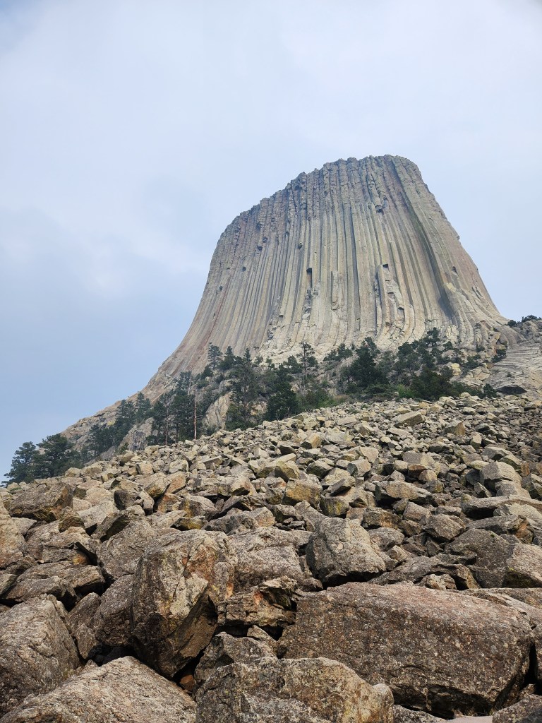
I wandered around the Tower Trail loop, slowly seeing all 360° of the tower through open stands of ponderosa pine. I quite enjoy the massive polygon shaped boulders scattered around the woods – they look entirely unnatural.

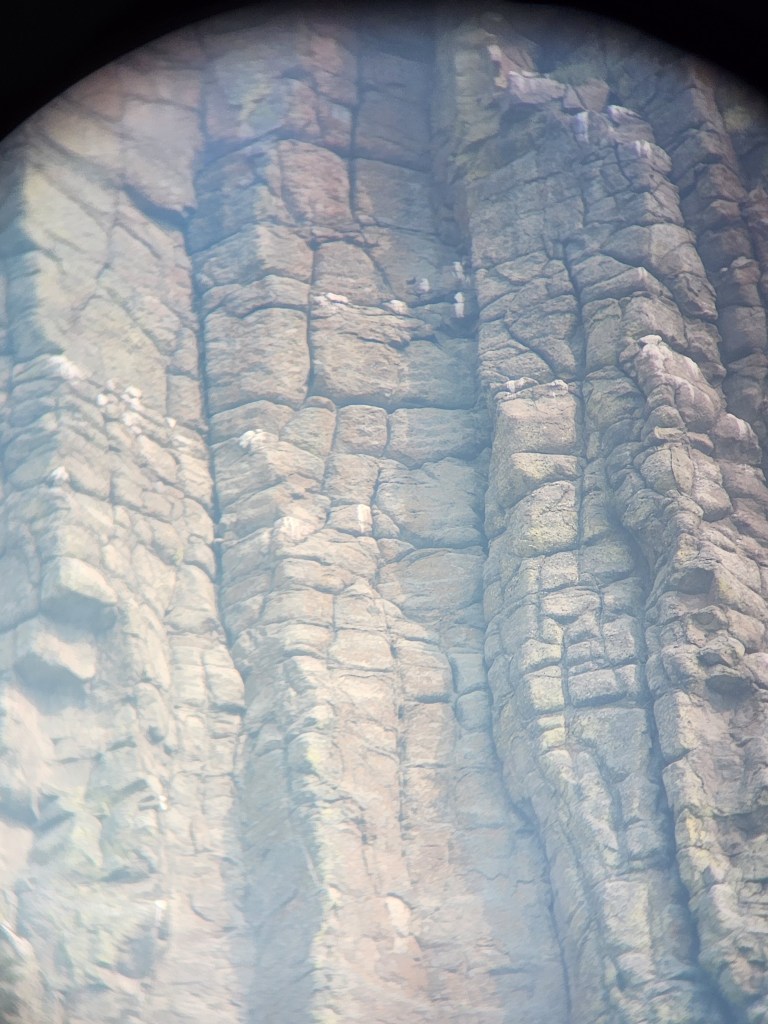
Some off color spots up high on the tower caught my attention, and with my binoculars I was able to see they were bird nests. Peregrin falcons and other raptors are known to nest high on Devil’s Tower, which have been known to attack rock climbers who venture too close to their nests. Naturally, seasonal climbing closures are in place to protect the nesting falcons.
I ended my day driving into Black Hills National Forest, where I found a spot to camp next to a forest road. I only saw a few cars drive by in the 12 hours I was there. The wildfire smoke was persistent, and a check of the forecast indicated it would be around for one more day. As darkness crept into the forest, I made a plan for the next leg of my trip into the Black Hills of South Dakota…

