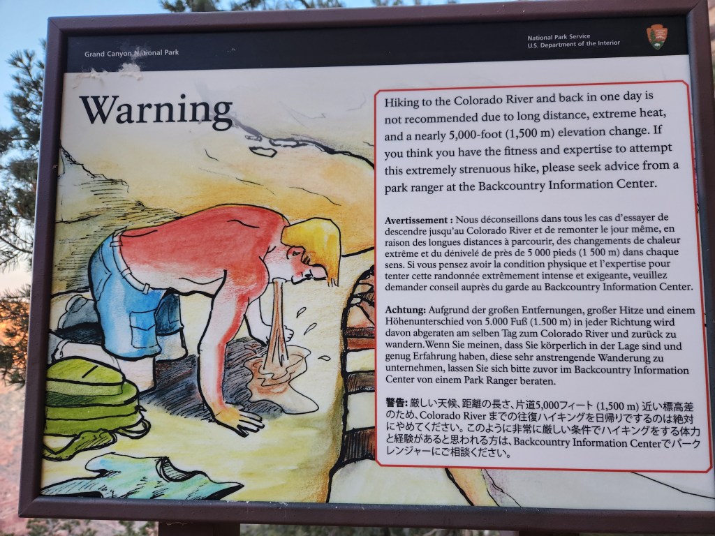
A seemingly insurmountable geographic barrier, The Grand Canyon is surrounded by as much lore as the canyon is deep. Traversing from rim to rim and back is a popular test piece for endurance athletes, especially now that the National Park Service has well maintained trails and water stations at several points along the way.
When our friend, Amber, sent out the invite to attempt R2R2R, Maggie and I had to accept. Hardcore ultrarunners usually do the 42 mile route in a day, but we felt more confident trying it as an overnight trip, or two days. Amber secured a camp site at the Cottonwood campground, about two thirds of the way across the canyon. Our plan was as follows:
- descend the South Kaibab Trail
- hike up the North Kaibab Trail
- drop some gear at Cottonwood camp
- tag the North Rim
- return to camp
- sleep
- hike back to the South Rim
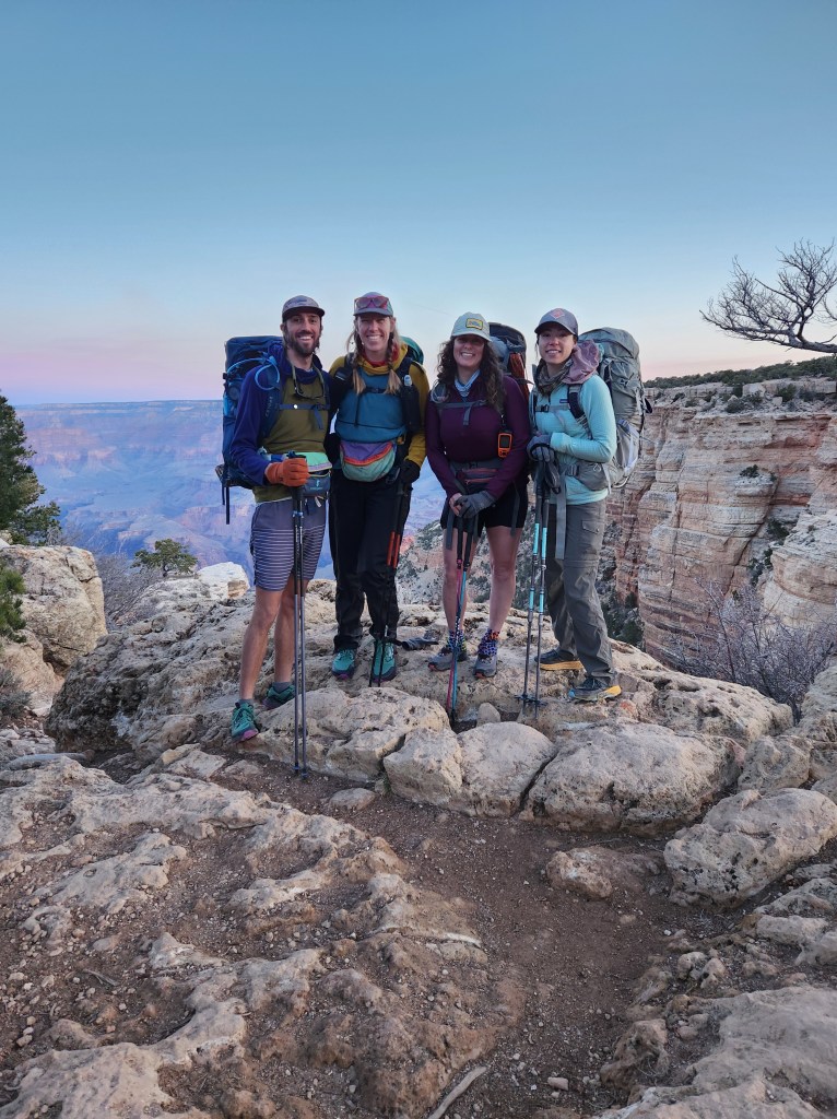
This would make the first day about 28 miles, and the second day 14 miles – challenging for sure, but we knew we could do it based on past experience. Amber’s friend, Jess, would be joining us as well, making a party of four.
22 March 2024
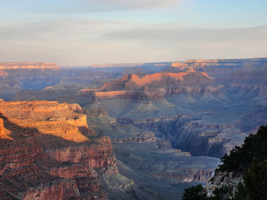
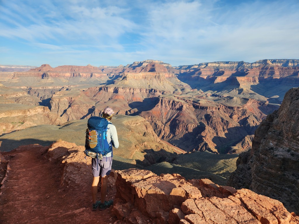
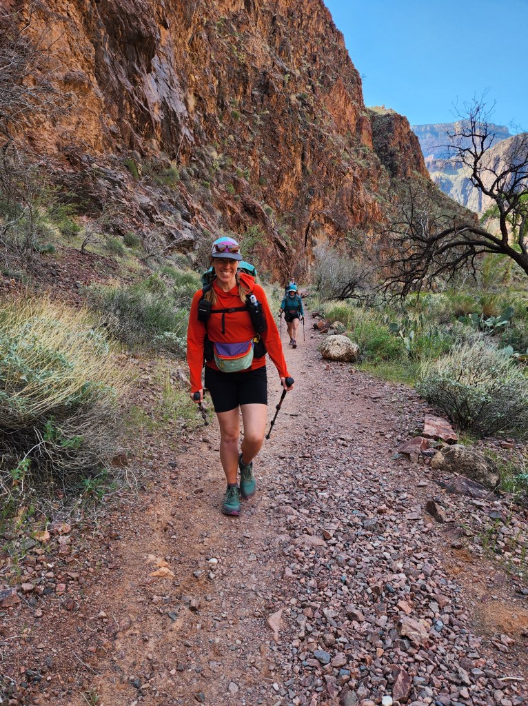
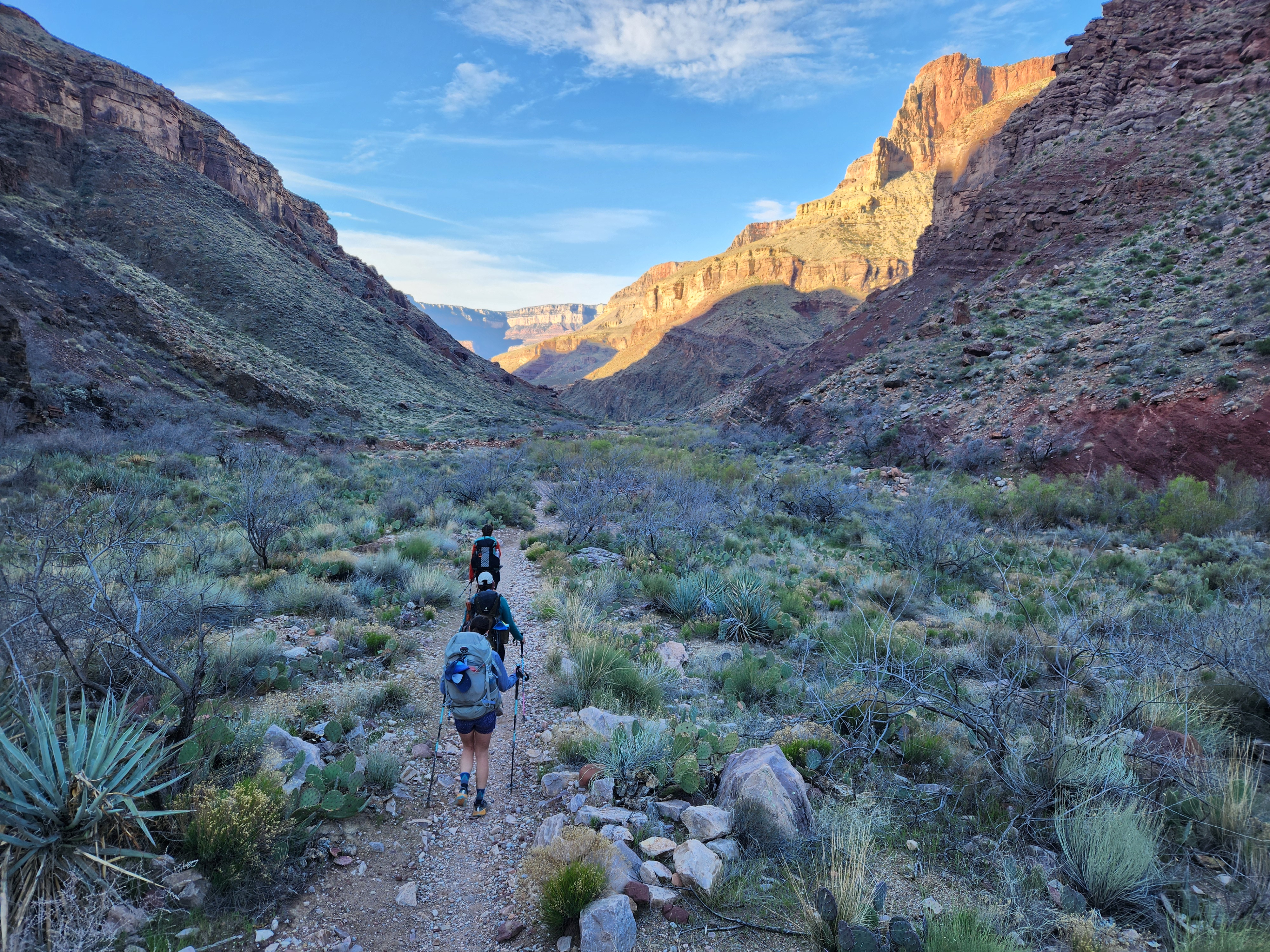
The four of us camped near the park Thursday night, waking up at 4 am to eat an energy bar breakfast in the frosty hours before dawn. We had to get to the South Rim visitor center before 6 to catch the first shuttle to the South Kaibab trailhead, which we accomplished with just enough spare time to use the nice bathrooms before hitting the trail. The shuttle bus was right on time, and by 6:30 we were standing on the precipice of the South Rim. The sun was starting to illuminate the upper reaches of the canyon’s east facing walls as we set off. Stoke was high, and I lead the pack at an unreasonable pace as we hiked down into the depths of the Grand Canyon.

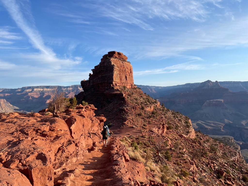
Down we go
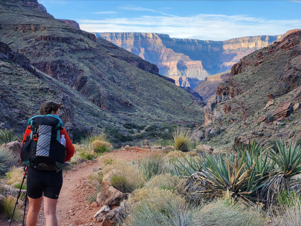
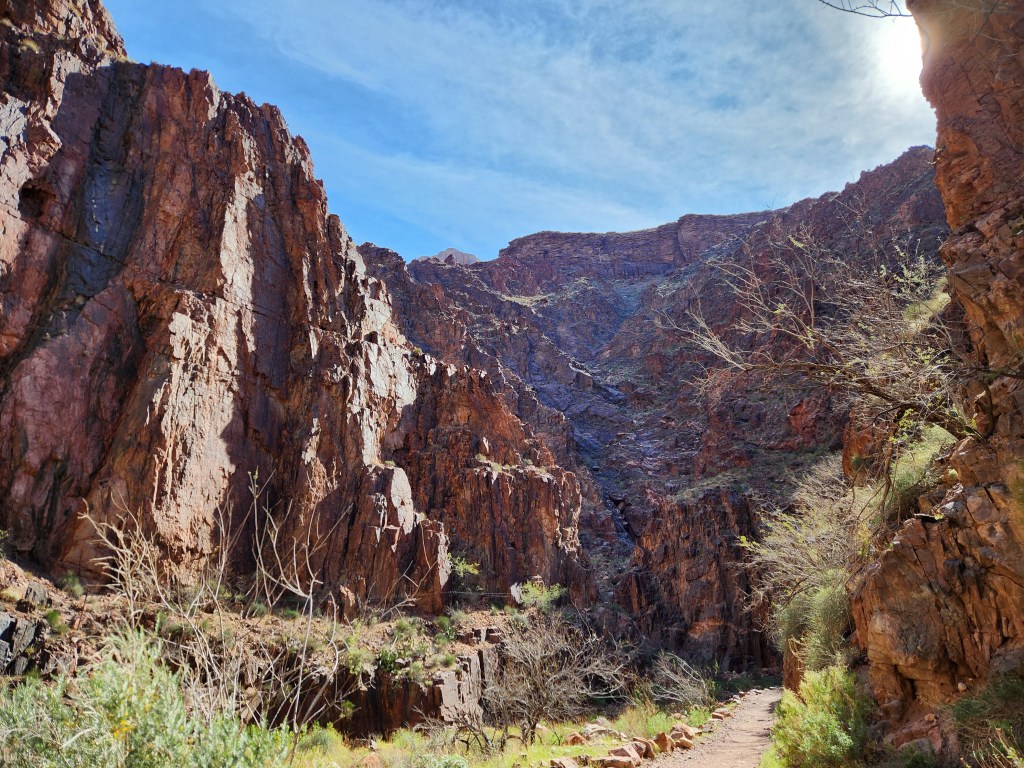
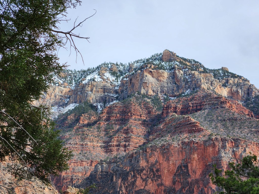
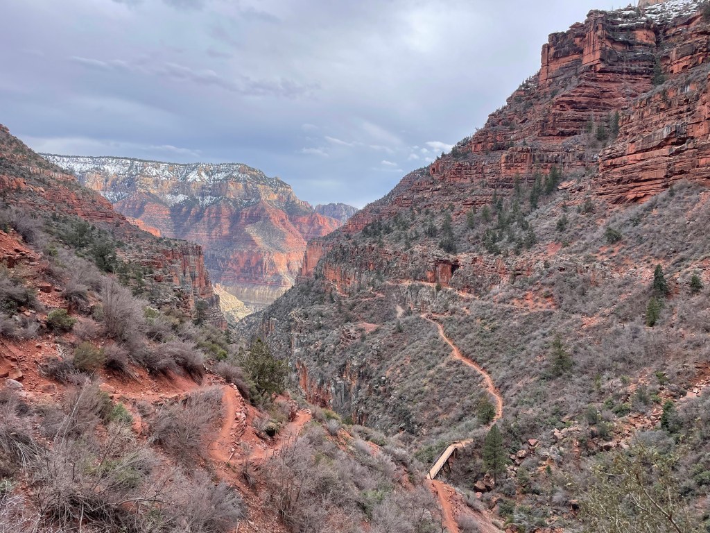
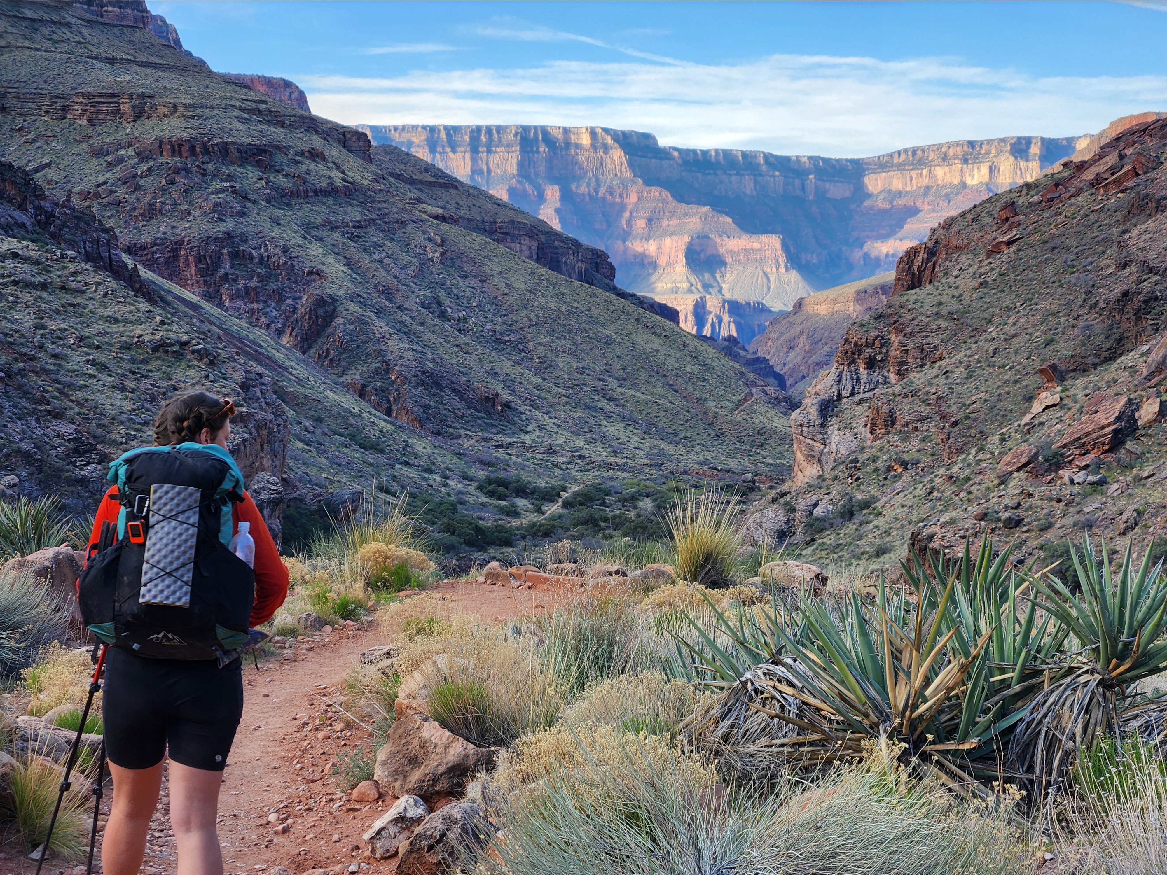
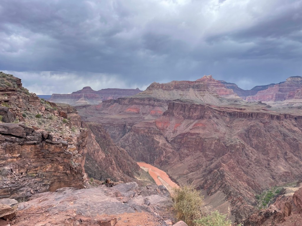
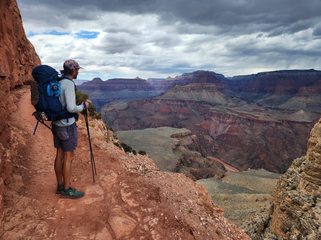
The South Kaibab trail roughly follows a ridge down into the Canyon, which is more exposed, but it offers fantastic views the whole way down. You get a sense of your descent in real time as either rim rises higher with each step, slowly being obscured by the textured topography. There are some drastic changes on the way down, dropping from 7,000′ to 2,000′ of elevation over 7 miles. Going from pinyon pine woodlands to proper desert is striking.
The temperature rises, more than can be accounted for with solar heating alone. The descent takes you deeper into the atmosphere where higher air pressure is necessarily hotter. The bare rock soaks up solar radiation like a sponge, only for the cool of night to wring the stored energy free as invisible infrared warmth. It’s not uncommon for the bottom of the canyon to reach 110°F in the summer, which is why we were here in early spring, taking advantage of milder temperatures.

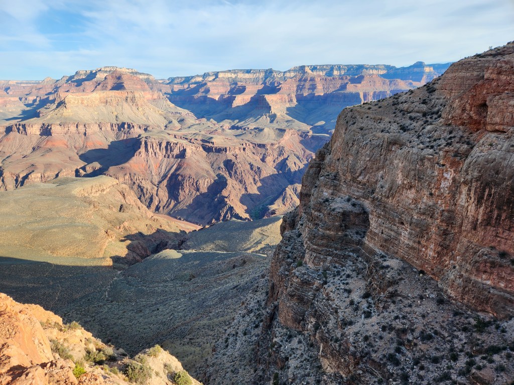

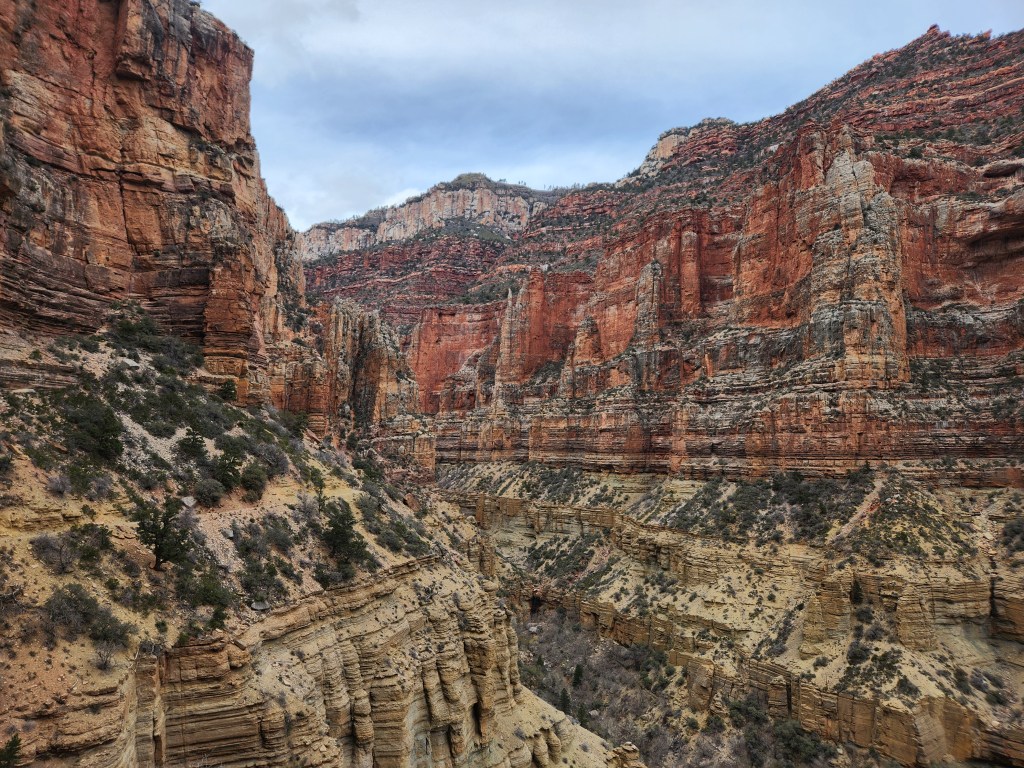
South Kaibab Scenery
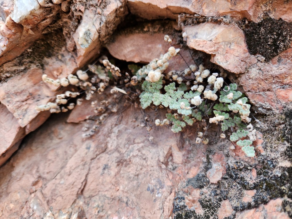
I was reading Gathering Moss by Robin Wall-Kimerer on the drive to Arizona, a book about moss and its literal and metaphorical connections it has to everyday life. I think most people associate moss with wet temperate environments where it carpets earth and trees with ease. Imagine my surprise when I noticed patches of bright green moss clinging to a north facing gully near the bottom of the South Kaibab trail, a place I knew to be hot and dry. Nearby, a small lip fern grew in a crevice. Good reminders to not judge a book by its cover, to challenge preconceptions about what’s “normal”. Or perhaps the reverse, that even in extreme climates, there exist microcosms comfortable enough for moss and ferns.
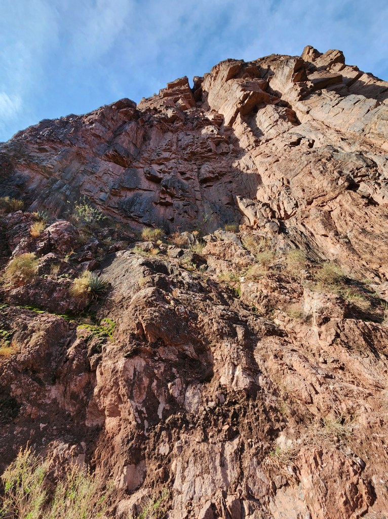
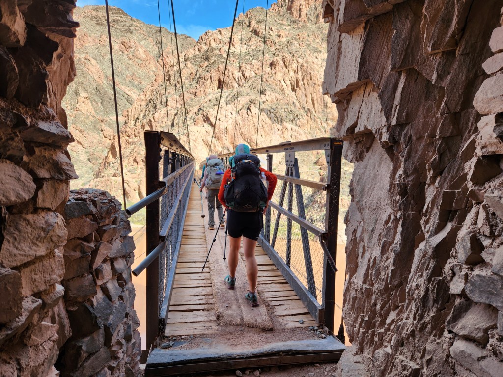
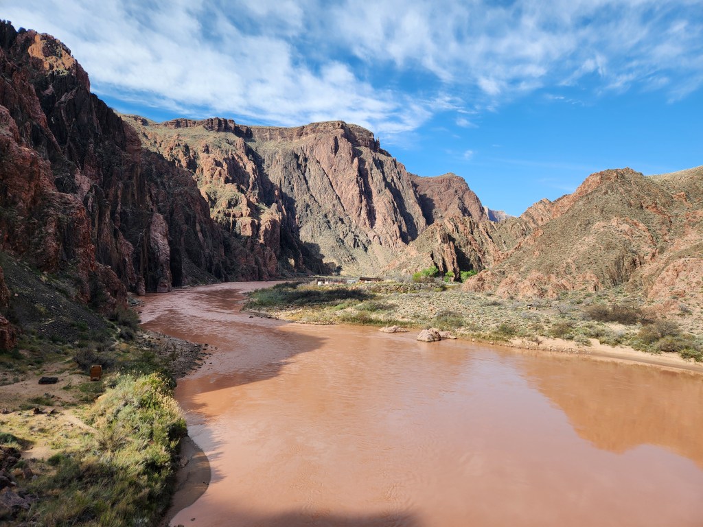
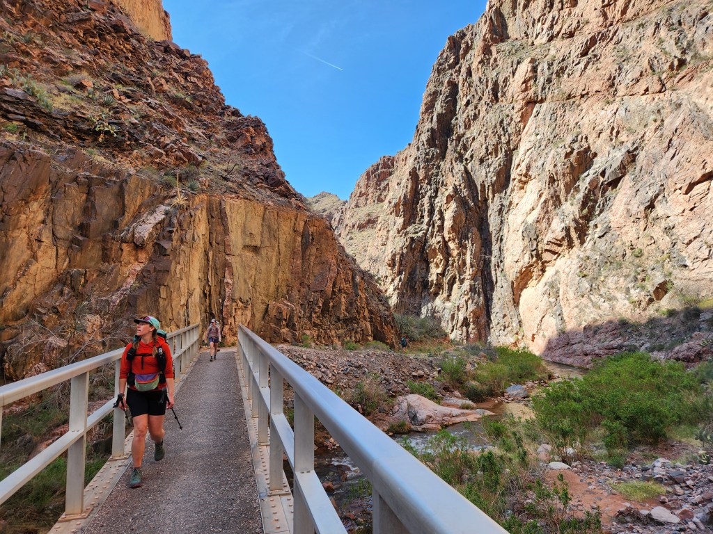
The South Kaibab trail terminates at a sheer rock face with a hole in it – a tunnel to the Colorado River. After about 10 steps in darkness, we came out the other side on a suspension bridge. The absurdity of the bridge is overtaken by the excitement of seeing such an impressive volume of flowing water in the middle of the desert. The rock at the bottom of the Grand Canyon is also markedly different than the layer cake of sedimentary stone above it. Ancient metamorphic schist carries the weight of the rest of the canyon. Contorted by over a billion years of geologic time, this is called the Vishnu Basement rock, which formed when life was barely getting a foothold on earth.

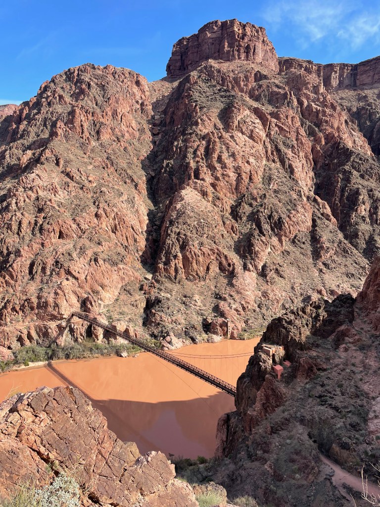
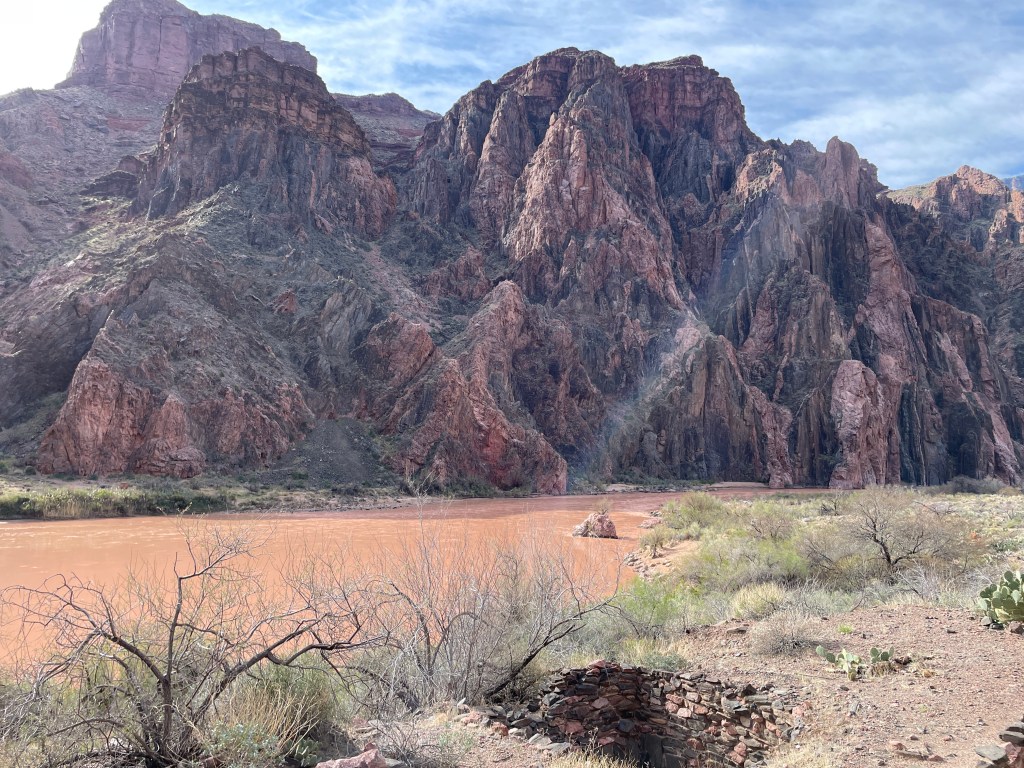
Down by the river
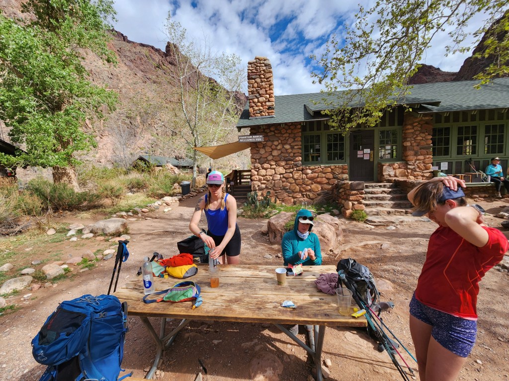
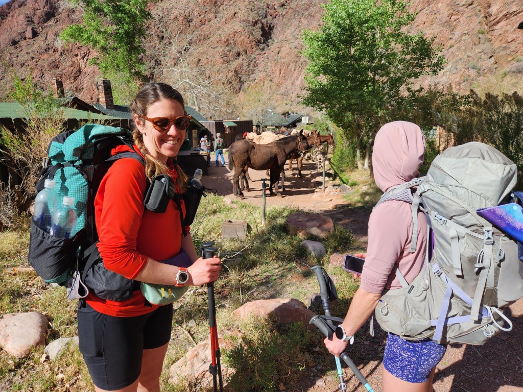
A little less than a mile later, we found ourselves ambling between the Fremont cottonwoods and Arizona sycamores of Phantom Ranch, the cabins, campground, and basic general store that sit in the heart of the canyon. All the supplies for Phantom Ranch are carried down on mule trains, and all the refuse is hauled back up. Maggie loves to pet the mules whenever she gets a chance (put a pin in that).
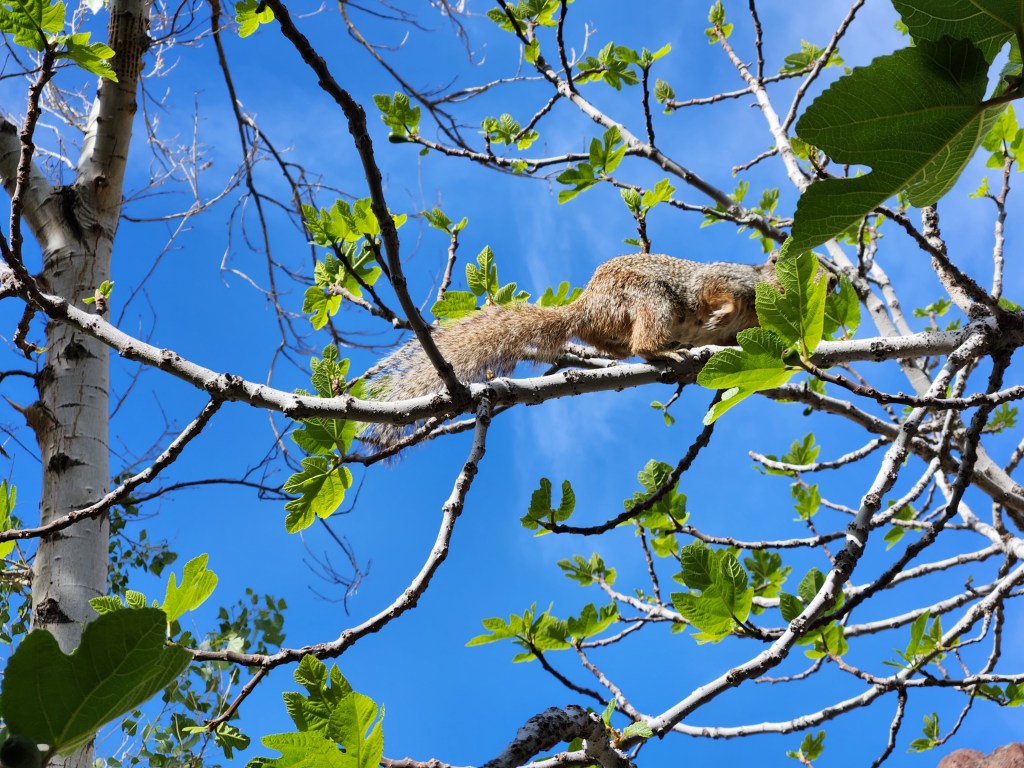
It was a balmy 80 degrees, welcome warmth after waking up in freezing temperatures a few hours earlier. We drank lemonade and had a snack, fending off fearless squirrels who also wanted a snack. As pleasant as it was, we couldn’t sit and sunbathe since we still had about 20 miles to hike!
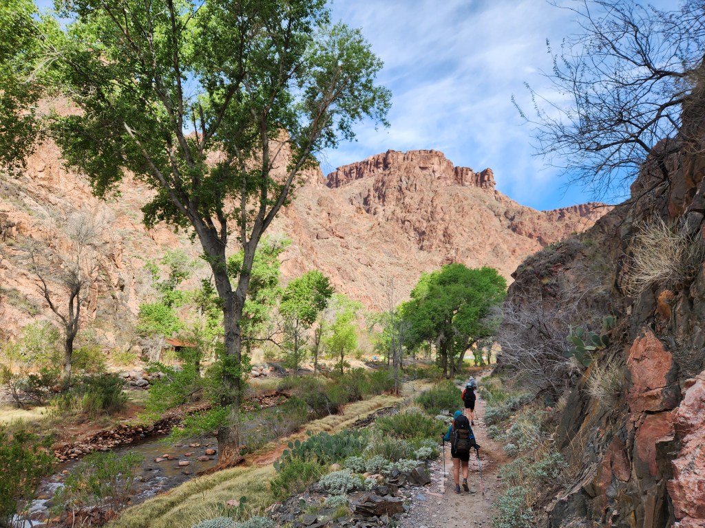
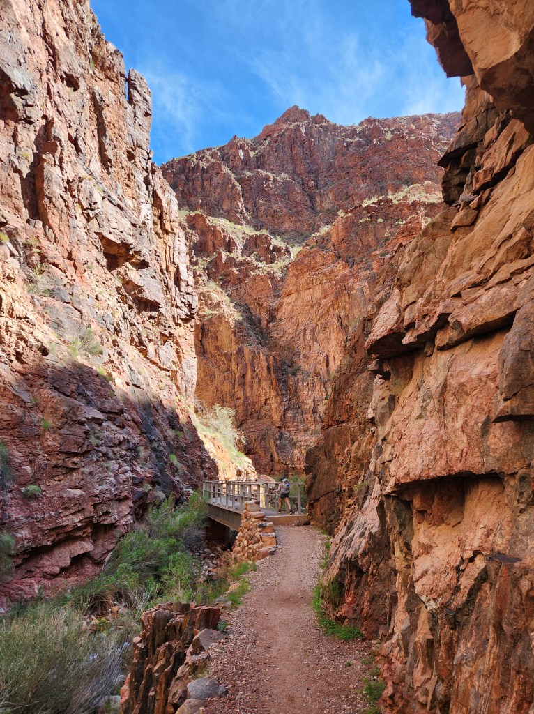
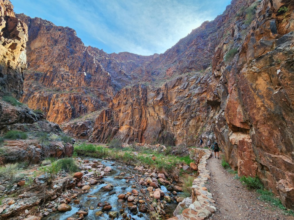
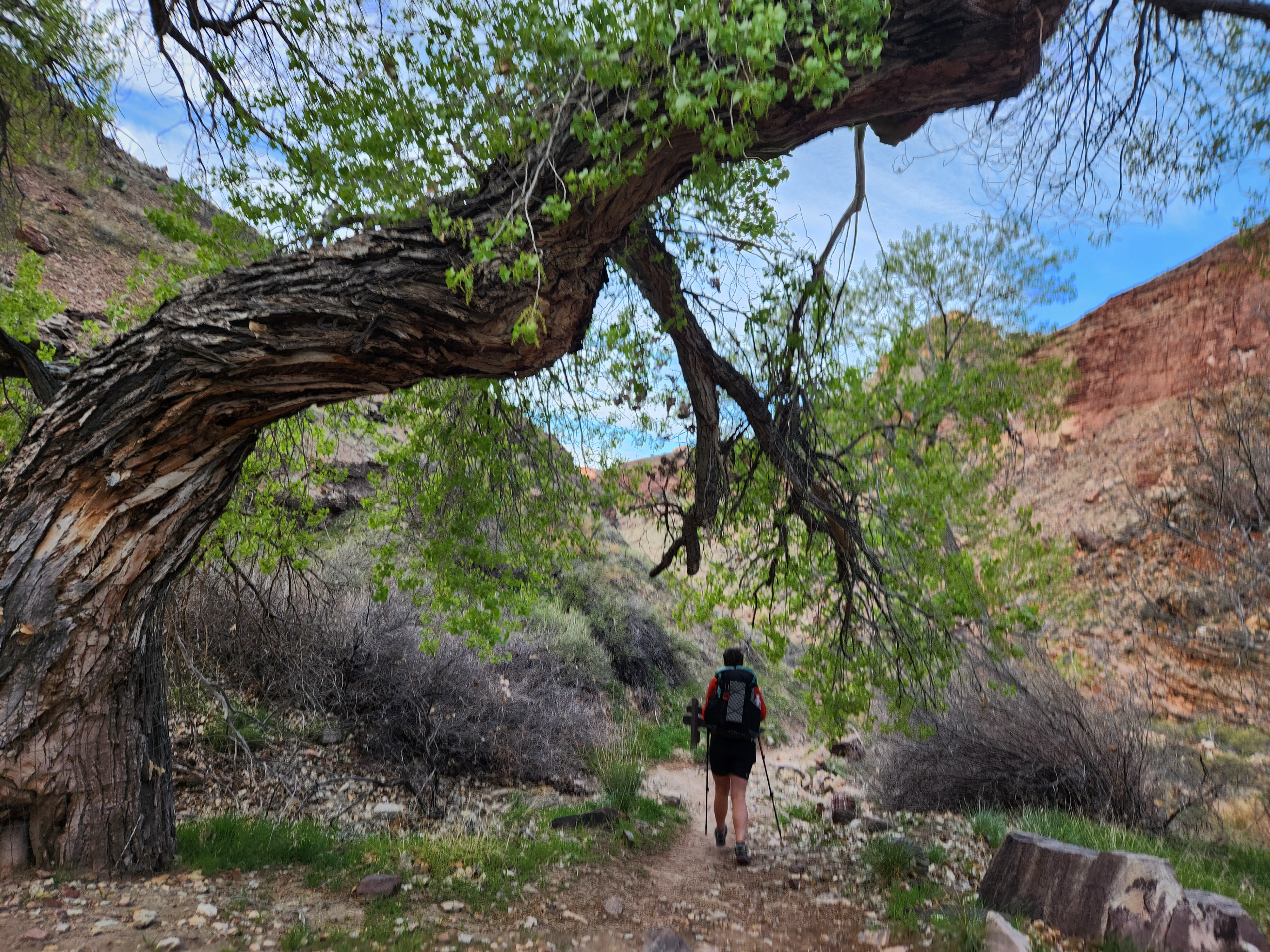
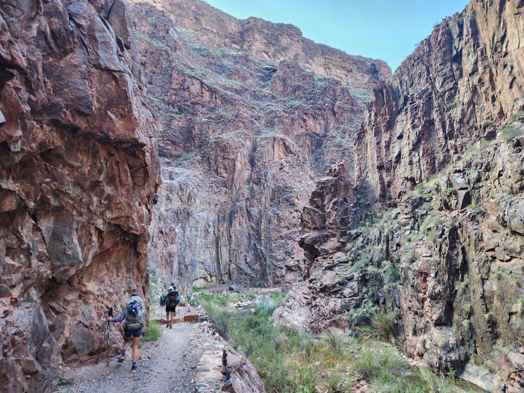
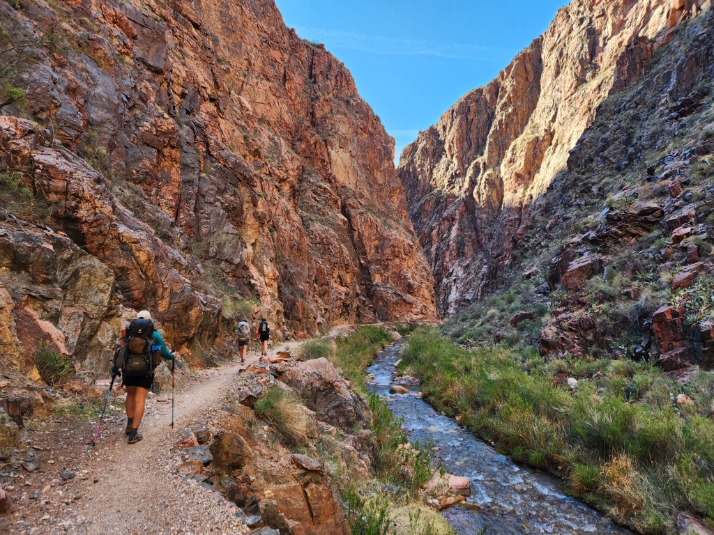
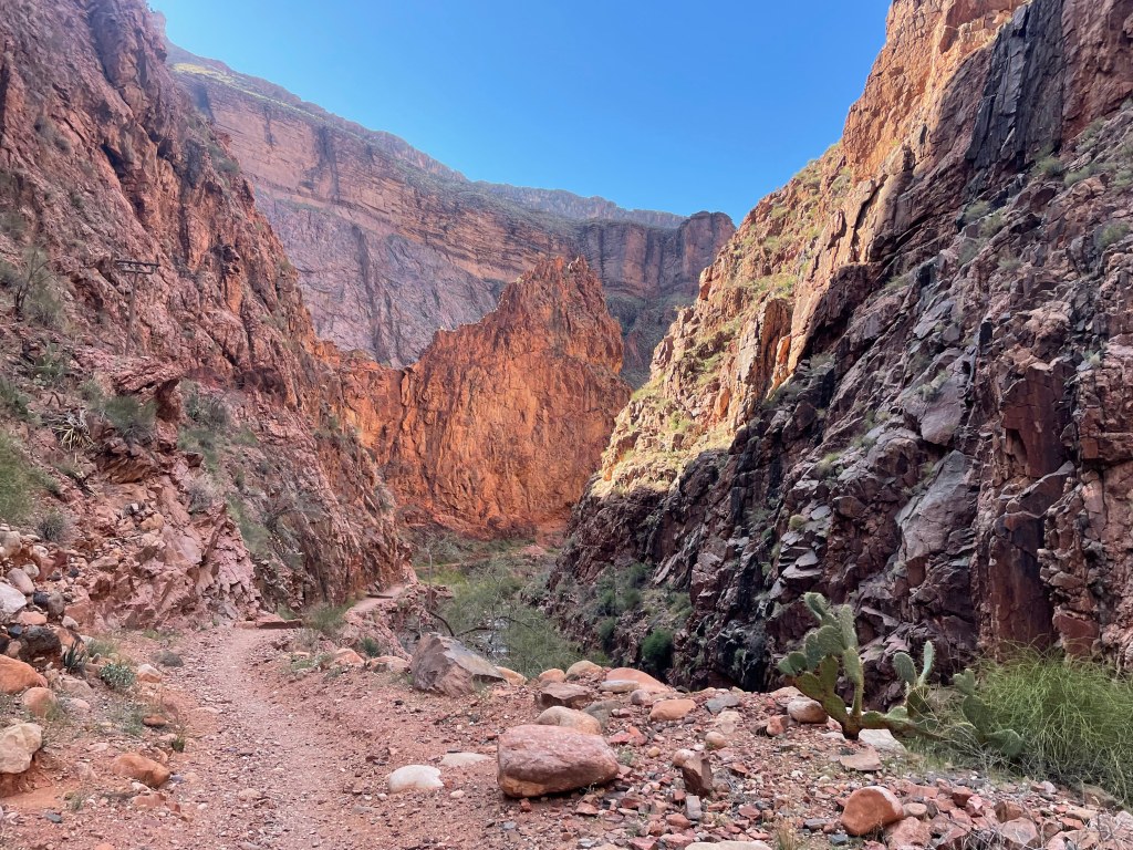
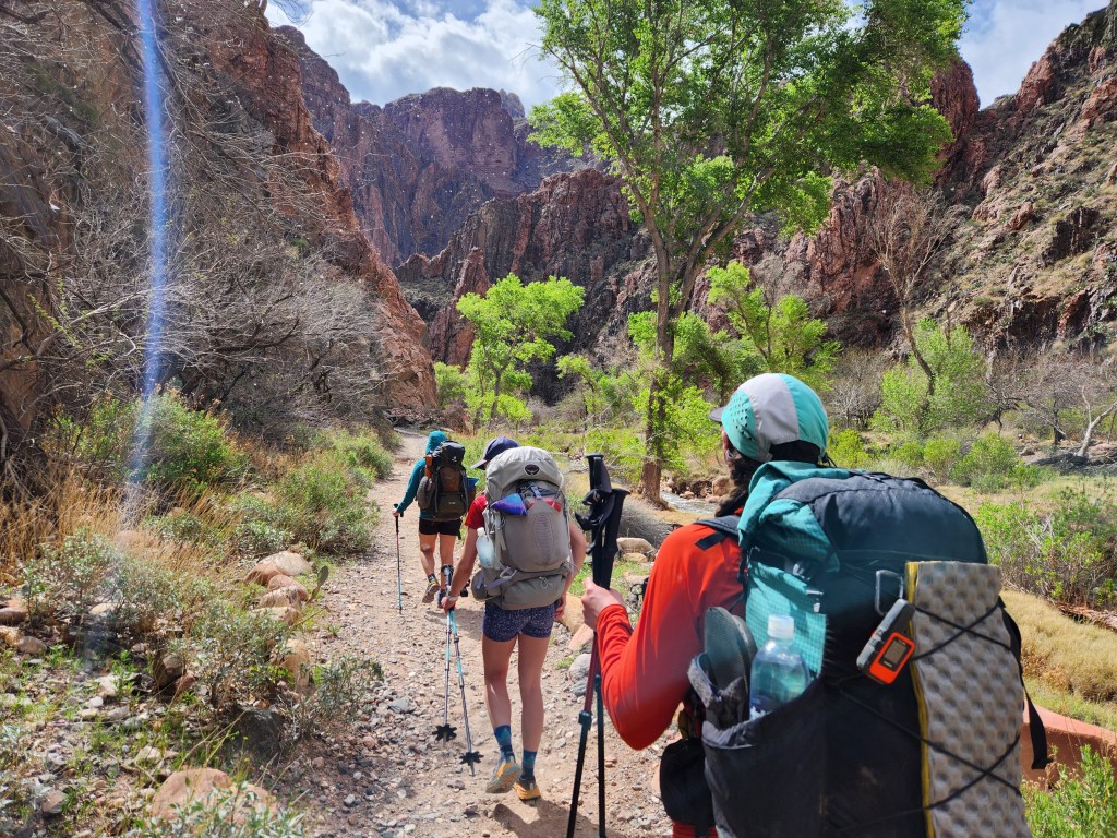
The North Kaibab trail leaves Phantom Ranch following Bright Angel Creek, which has cut a narrow slot into the tough basement rock. The close up, intimate walls forced me to refocus my eyes after gazing for miles across the gaping canyon above. My enthusiasm was reignited as we stepped into a new and interesting sliver of stone. I raced ahead on the gentle grade as we started pushing up towards the north rim.
The narrows of the basement rock opened up to exposed desert as we climbed back into the sedimentary layers. The heat of the day was picking up. Jess was starting to feel some discomfort from indigestion. A small tree and large boulder provided a bit of shade right when we needed to take a quick break. Jess was well enough to carry on. She had mainly lost her appetite, which might be a challenge under such high exertion.
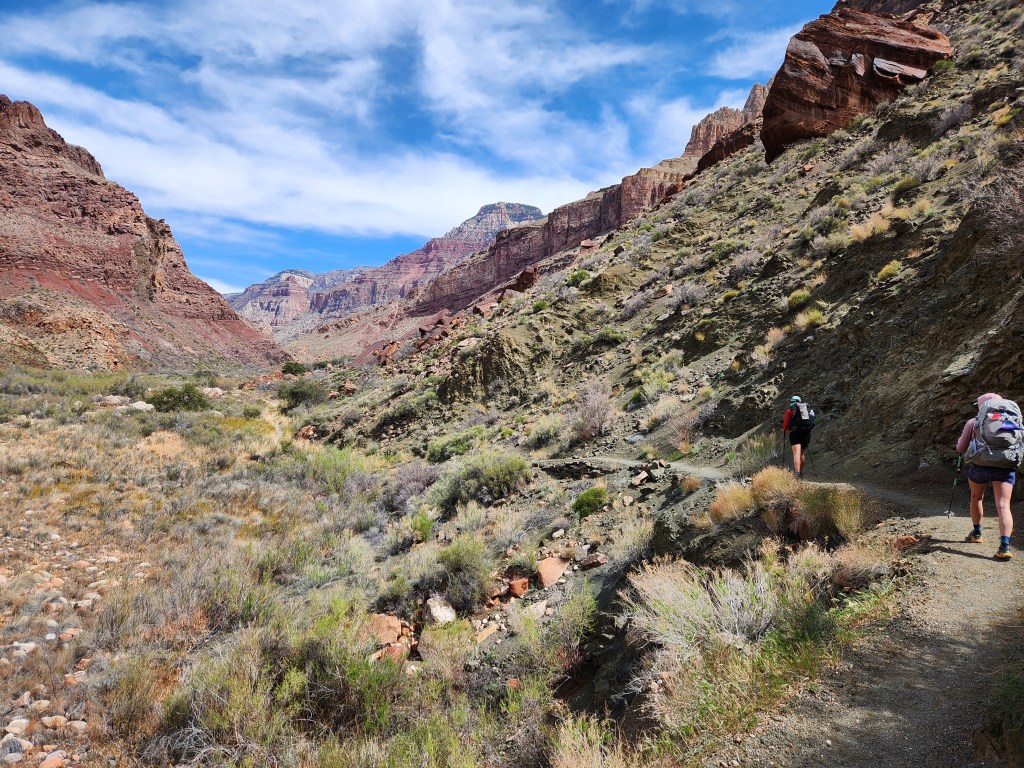
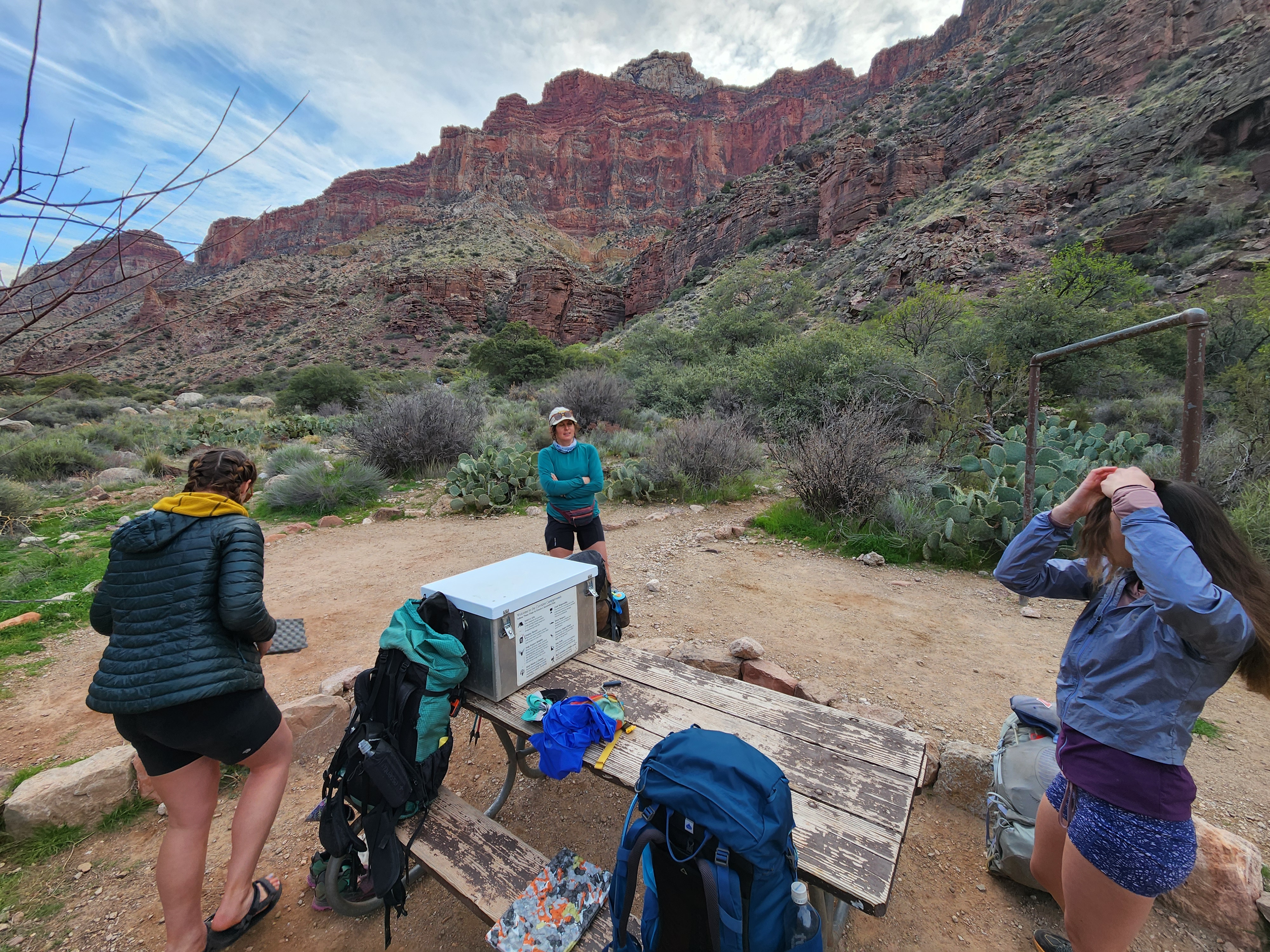
We pushed onwards to Cottonwood campground for an afternoon lunch in the shade. After 14 miles, it honestly felt a bit daunting to know we had covered half the distance for the day, and only a small portion of the uphill. The drive to accomplish a goal overcame the desire to sit and rest. We dropped all nonessential gear at our campsite. Maggie, Amber, and Jess opted to swap backpacks for running vests, going fast and light for the big climb up to the north rim. The safety conscious engineer, I couldn’t part with my full food bag, cook set, and clothes. Extra margin weighs extra, but it gives me peace of mind. Also, I forgot to bring a running vest…
We set off for the North Rim a little before 3 pm. Soon after, we crossed paths with a younger NPS Ranger, Nick, sporting a short blonde beard. He checked our camping permit and made sure we knew what we were in for, starting our second 14 mile hike of the day just a few hours before sundown. Our confidence convinced Ranger Nick that we were up for it, and he sent us on our way with a few words of encouragement.
We got to the Manzanita ranger station, where we filled up our water. Another group was there, running R2R2R in a day. They were on the way back to the south rim, hiding their pain behind laughter, resigned to the absurd situation the situation they had gotten themselves into. “You guys are smart for doing this in two days,” one of the guys said to us. We all wished each other luck as the lot of us went separate ways.
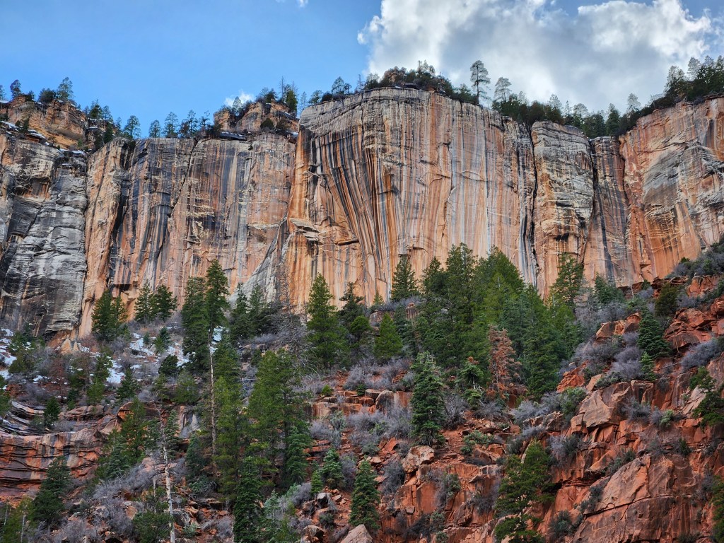
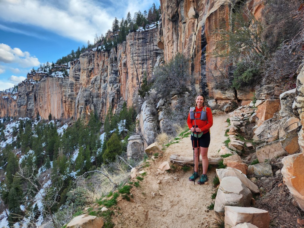
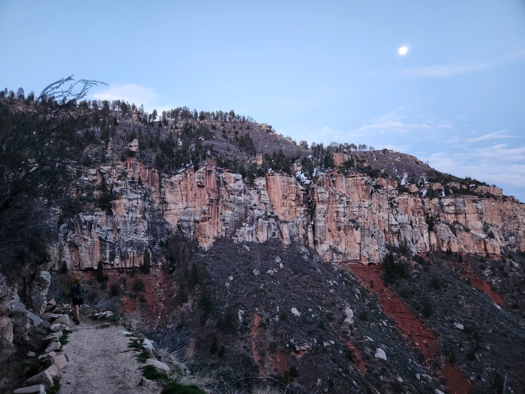
Bits of the north rim were coming into view, snow laden with tall conifers standing watch, though the trees looked like little more than fuzzy toothpicks from our vantage point. The vertical relief we had to climb was nothing to sneeze at. The trail ascended steeply into the narrowing gouges which would take us to our goal. Desert slopes gave way to sheer sandstone cliffs and spires. Snowmelt spilled over in a few spots, showering us on the slick rock trail before spilling down the cliffs below.


A number of parties were descending from the north rim late in the day. Most everyone had day packs, so I assumed they were staying at Cottonwood or Phantom Ranch. “Just a couple more switchbacks, right?” I asked half-jokingly. We were clearly getting closer to the rim, but one gentleman responded, “Ehh… you’ve still got a ways to go.”
Those switchbacks were starting to feel endless as fatigue and hunger slowly grew with each step forward in space and time. That said, Maggie and I were still feeling pretty good. Jess was still battling discomfort, and she hadn’t eaten much since Phantom Ranch. Even so, Jess wasn’t giving up, just moving a little slow. I can’t say I would’ve had the same drive to continue under those circumstances. Amber hiked with Jess, while Maggie and I cruised ahead, periodically stopping to regroup.
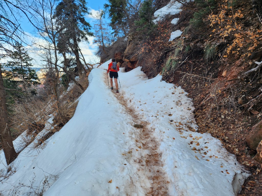
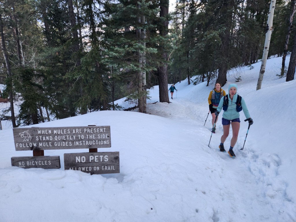
As challenging as the final miles to the north rim were, the scenery was impeccable. Surmounting the towering cliffs around us seemed impossible, but we trusted the trail and plodded on. We came upon the first patches of snow just under a mile from the top. Steady foot traffic left a solid boot pack, so we weren’t worried about slipping.
Maggie and I stopped at the Coconino Overlook where we could see clear back to the South Rim and Humphrey’s Peak beyond. Wild that we had started our day back over yonder. The air was quiet as the sun lit up west facing walls. In fact, it was a little too quiet… We must have crossed paths with the last party going down about half an hour before we got here, which meant we were the last party still going up. I always ask myself, “Why am I the only person here?” when this occurs. Of the billions of people on earth, we were the only four who decided to be at Coconino overlook at 5:45pm on March 22nd. Foolhardy? Perhaps. Adventurous? Most certainly.

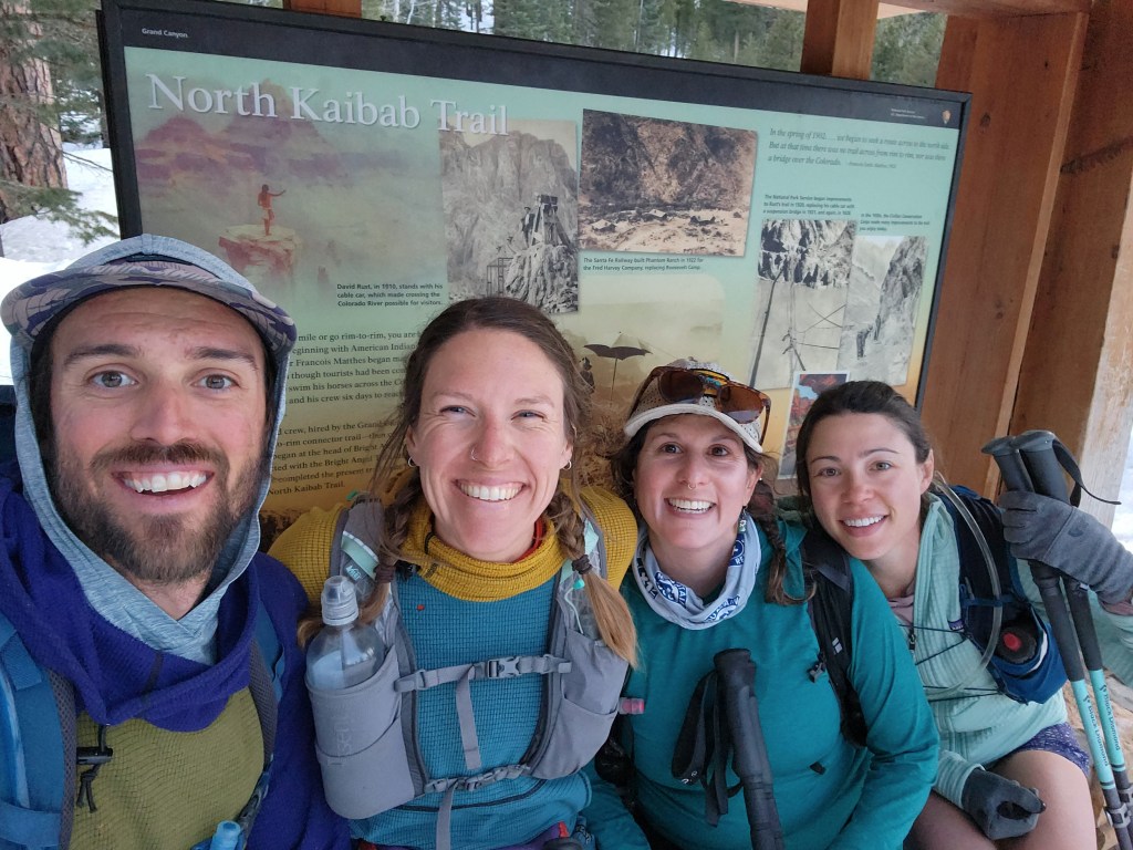
Amber and Jess caught up to Maggie and I at the overlook, and the four of us hiked up to the north rim together. The final stretch was marked by aspens, firs, and Douglas-firs, more montane than I expected. The trail signs were about knee height as we crested the north rim on 2-3 foot deep snow. We sat at the North Kaibab Trail informational sign, scarfing down snacks in lieu of a proper dinner. Stoke and satisfaction was high, having crossed the Grand Canyon, 22 miles in about 12 hours.
However, the seven mile descent back to camp was looming ahead. The nearly-full moon was already high in the sky as we set off, back down the canyon. Jess was able to move much quicker on the downhill, so the four of us stuck together as night descended upon the canyon. Headlamps on by dusk, our world slowly shrunk to four bobbing cones of light. The spookiest part of our night hike was a section of trail with a sheer drop off the side. It was unsettling to turn my headlamp a little to the left and see only black below…
Otherwise, there isn’t much to report on the descent back to Cottonwood Camp. I hardly remember talking much over the two hours. We were back at our campsite around 9 pm. Hunger took precedent over exhaustion, so I shoveled some ramen down before bed, then we slept like the dead…
23 March 2024
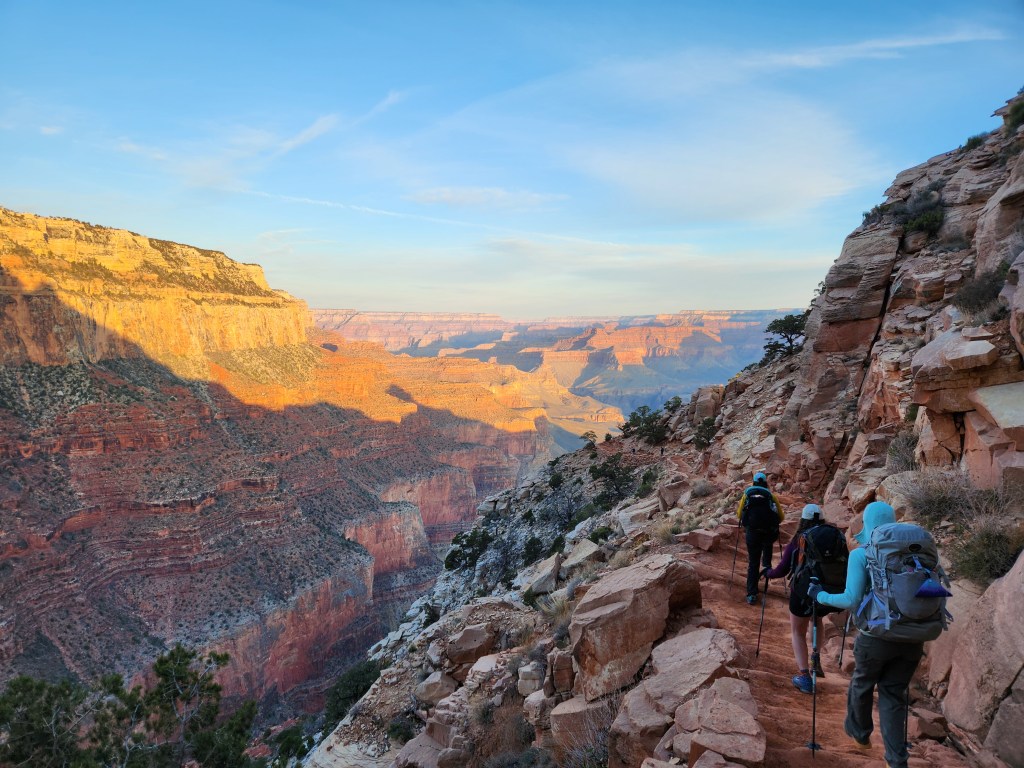
As much as we would have liked to sleep in, day two was no walk in the park. We were back on the trail by 7:30 am, cruising through cool morning air back down to Phantom Ranch. Once again, the morning light was spectacular; shadows for contrast and colors popping on sunlit walls. The fatigue from the day before faded, and now awe was in the forefront of my mind. A clear view back to the south rim was both inspiring and intimidating. Best not to think of the whole effort ahead, just keep enjoying the gentle downhill.
Leaving Cottonwood Camp
Of course we were retracing our steps, so nothing was new per se, but I was still enamored by the narrows through the basement rock. The lower angle morning light was quite nice. For one, we were hiking in the shade, and two, the light seemed to bounce back and forth between the walls with colors shared in all directions.

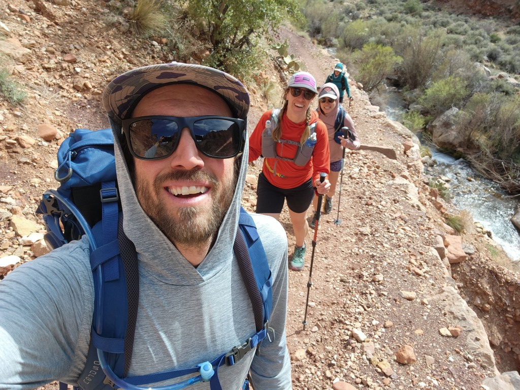
We were back at Phantom Ranch a little before 10 am, where we ate some snacks and indulged in more ice cold lemonade from the concession stand. While this hike is physically demanding, it is in some ways a pleasure cruise. We made sure to stop and thank the mules while we were there.
It was time to start going back up. We hiked though the cotton woods, their fluffy seeds floating in the wind, and got to the Colorado River. It was already starting to warm up, so I couldn’t resists a quick dip in the water.
Thanks to the Glen Canyon Dam and Lake Powell, the Colorado River consistently stays around 50°F year round in the Grand Canyon, rather than fluctuating with the seasons. This is probably warmer than it used to be in March, but 50° still makes for a toe numbing cold plunge! I dove in, but only for a few seconds. I sat on the beach and let the warmth wash over me, while Amber stood in the water, delaying the misery. I went back for round two, and Amber and Maggie finally took the plunge as well. Very refreshing!
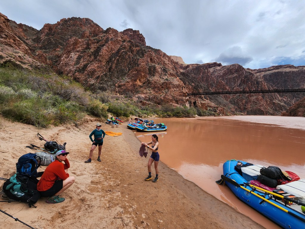
Back across the bridge, we were definitely going up now. Up. Up. Up. Just a 5,000 foot stair stepper lay ahead. We were seeing lots of folks heading down into the canyon, out for a not-so-casual Saturday stroll. Cool and cloudy weather was rolling in, which was perfect for the un-shaded climb up the South Kaibab Trail.
Jess was once again feeling quite a bit of discomfort as we climbed. We had a moment when Amber, Maggie, and I had stopped for lunch. Jess caught up, and knowing she couldn’t stomach any food, she carried on to get ahead. There weren’t any other choices really – just get out of the canyon. She was still moving, so a rescue wasn’t necessary, but we shared some of the pain knowing that our friend was struggling.
After a leisurely lunch break, I put the pedal to metal to catch up to Jess as soon as possible. She was further ahead than we expected, sitting on a rock bench with somewhat of a smile on her face. She was hurting, but her spirits were still high. Having eaten through most of my food, I had some space to spare in my pack, so I offered to take some of Jess’ gear. I’m not sure if it helped, but I figured it was the least I could do.
We plodded onward and upward, dodging day hikers left and right. Maggie and I got ahead again, so we stopped at Cedar Point for a break. The clouds were a menacing dark purple with rain chutes falling here and there. The wind gusts were fierce, sending dust and sand into our eyes. Maggie and I huddled up by a boulder, silently scolding some people nearby feeding the ground squirrels.
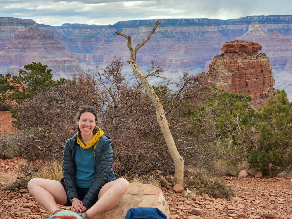
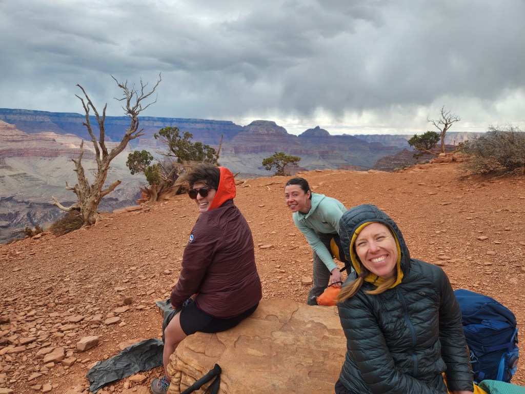
We regrouped and decided to hike together for the last mile and a half to the South Rim. The crowds grew more dense as we hiked, but we shared pleasant small talk with some folks and got occasional words of encouragement on the home stretch. The four of us crested the south rim, grinning ear to ear! We made sure to get a picture in the same spot when we set off about 35 hours earlier.

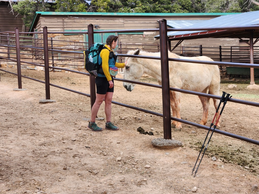
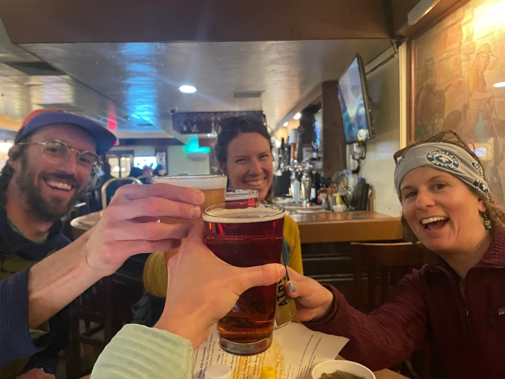
Maggie made sure to pet some mules before we caught the bus back to Grand Canyon Village. We went straight to the tavern in the Bright Angel Lodge for a proper meal. We reflected on best, worst, and first experiences on R2R2R over cold beers. Amber thought ahead and booked a hotel room in the village, so we enjoyed a chill evening before heading home the next day.
What a beautiful 42 miles! I am so glad to have this experienced this classic hike in the Grand Canyon. Personally, I liked doing it as an overnight – it kept the pressure low to maintain an aggressive pace and spared us from many hours of night hiking. I now know more about the route and services offered by the national park along the way. While I’m not chomping at the bit to give R2R2R a shot in one go, I think it is definitely doable in less than 24 hours with a little bit of training ahead of time. Honestly, even doing it in two days felt like a fever dream. It ended too soon. This trip got reignited the fire in me to get outside and go for big adventures. While Maggie and I may be back to the weekend warrior life style, R2R2R showed me what’s possible in a weekend. It’s wonderful to think about how much an enormous geologic anomaly in the earth can teach you about yourself and inspire you to do more…
