I’m not going to lie, Maggie’s knee injury was a major bummer. More so for her than me, but it put a damper on all the things we love doing together outside. I had big dreams for summer 2024, which largely disintegrated along with Maggie’s ACL. I stayed by Maggie’s side as much as possible, but when the invites came my way, she gave me the green light to get out on some adventures with my buddies.
26 July 2024
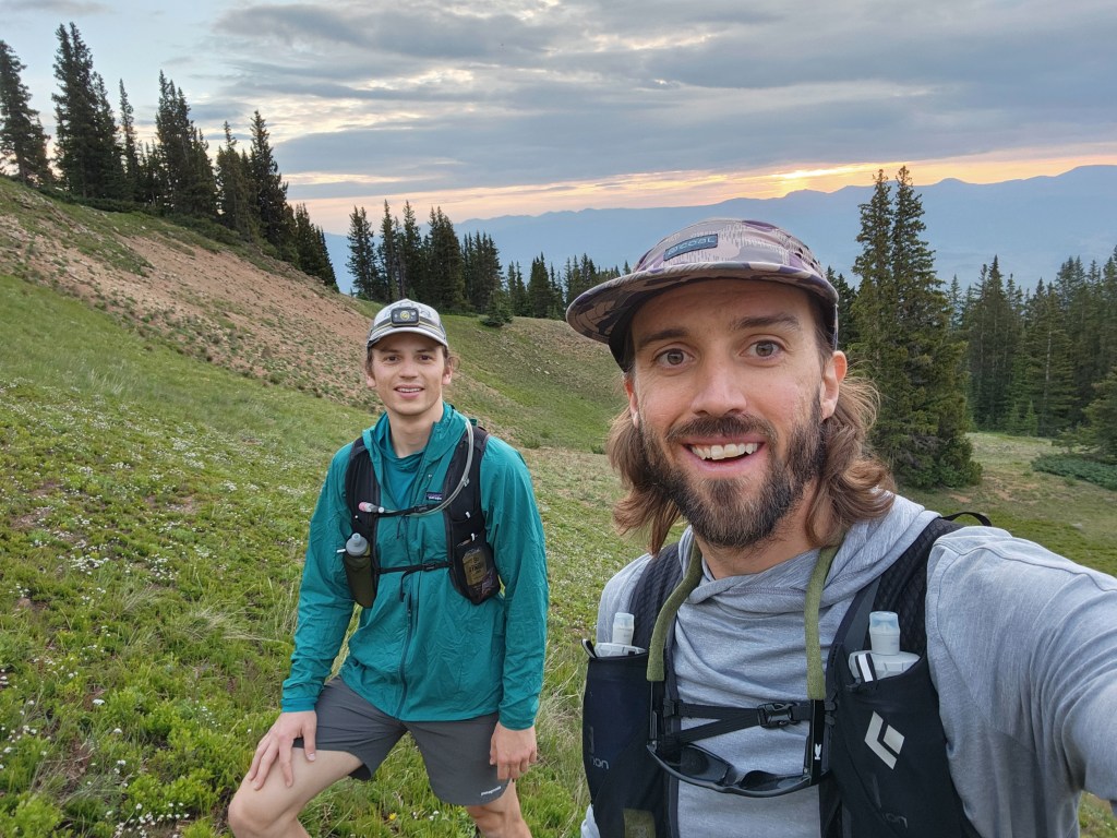
My friend Ryan’s asked me to join him on a hike as part of his whole hearted goal to summit all of Colorado’s 14ers. I agreed so I could continue on my half-assed quest to do the same. The objective was Mount Massive, Colorado’s second highest 14er. With five unranked sub-peaks over 14,000 ft, Mt. Massive has the largest area over 14k in the lower 48. We were hoping to tag all of the Massives on a long ridge romp, avoiding any crowds on the standard route.
Ryan and I drove up to Half Moon Creek road Thursday night, finding a marginal camp spot next to the road. After setting up my tent and brushing my teeth, I locked Ryan’s car to keep bears from getting to our food. I took two steps and realized… I had locked the keys in the car… I was fully prepared to break a window and repay Ryan for my idiotic mistake. He crawled out of his tent, seemingly undisturbed and asked, “Hmm.. ok. Are you sure all the doors are locked?” I yanked on door 1 – locked.. door 2 – locked.. door 3 – OPEN! Thankfully, one of the power locks was broken, which saved us from catastrophe! That was a fast and bumpy roller coaster to start our adventure.
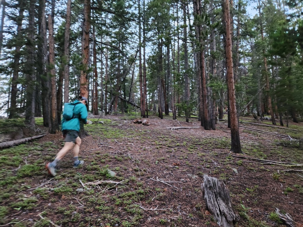
I was awake at 3:45 am, forcing down a cold breakfast bar with hot tea. We were hiking up the Colorado Trail by 5:20 after a very civilized campground bathroom pit stop. It had been a while since I had started hiking before sunrise. Despite the darkness, it was invigorating to be setting off for a big day, especially at the brisk pace Ryan set. About a mile in, we turned off the Colorado Trail to start the off trail quest up Mt. Massive’s east ridge. The lodgepole pine forest was open and easily navigable.
The sun rose, but not in any spectacular fashion. It was quite cloudy (rain was in the forecast later) so the dark only lifted to a dull gray with a brief orange glow behind us to the east. A moody Mt. Elbert provided some of the first views through the trees as we climbed.
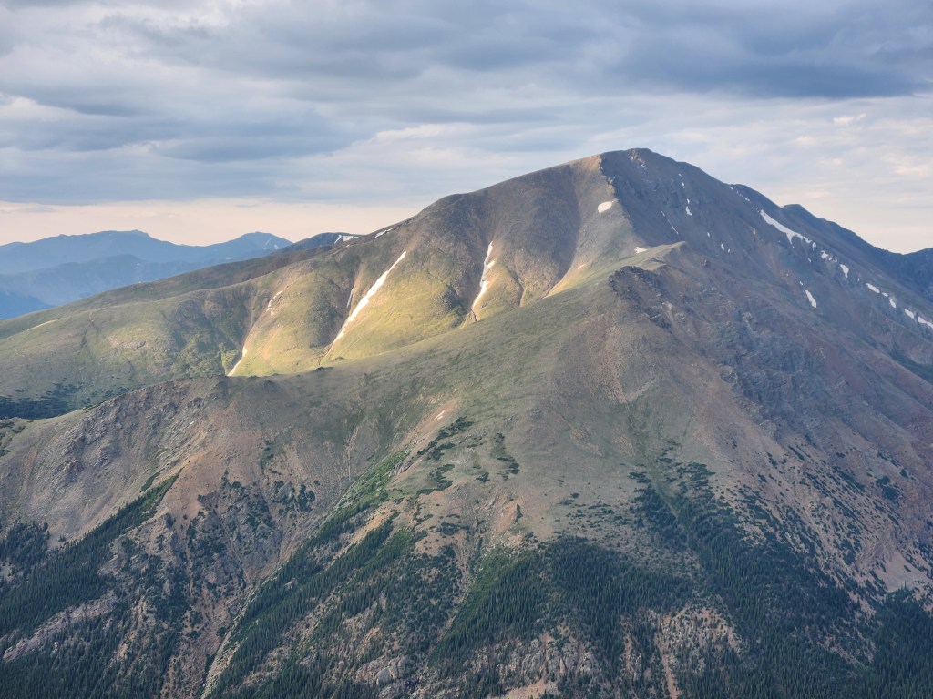
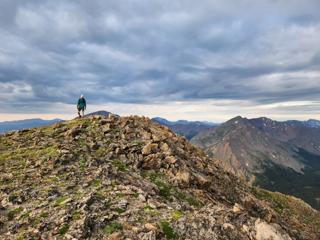
Ryan and I reached treeline an hour after setting off, then tackled the first steep climb up South Massive to 13,600′. A few sunbeams and swirling purple clouds made for some epic scenery. The stoke completely overwhelmed any fatigue. However, I hadn’t been spending much time at altitude this summer. I was feeling surprisingly gassed, especially when we tried to jog across the flatter saddles.
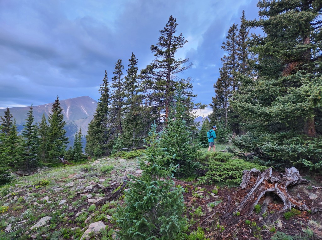
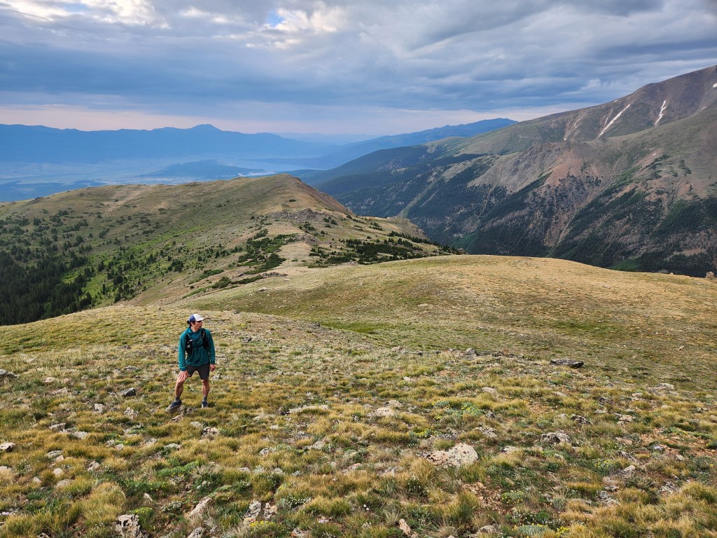
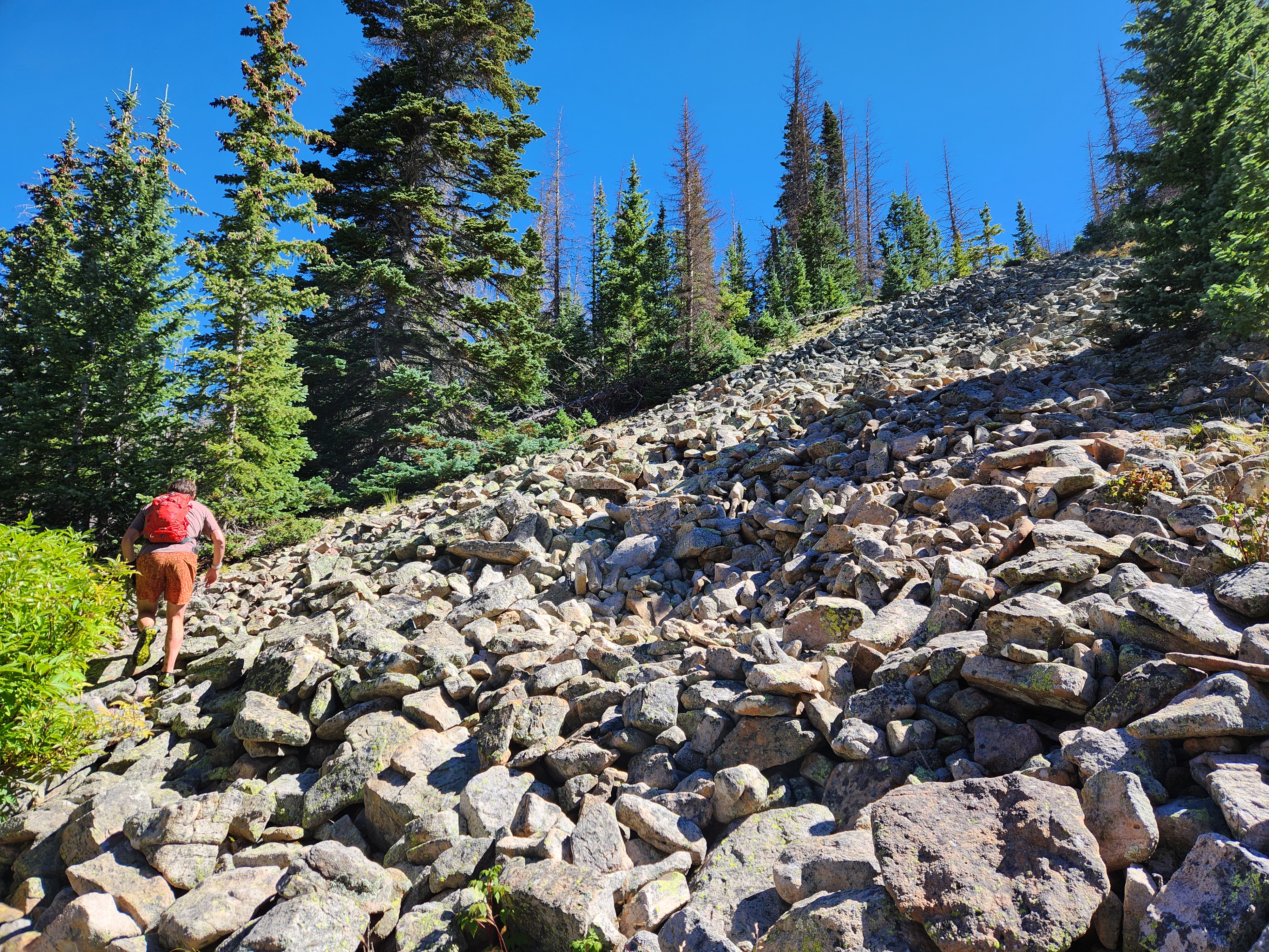
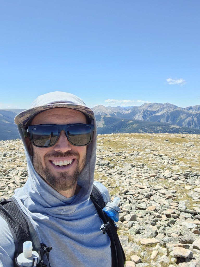
Grassy tundra gave way to exposed rock and talus, which made for some fun easy scrambling as we climbed higher. We finally hit 14,000 on Massive South-East, a rocky block with a clear view to our main objective. A chilly, damp wind necessitated donning a fleece layer to stay warm.
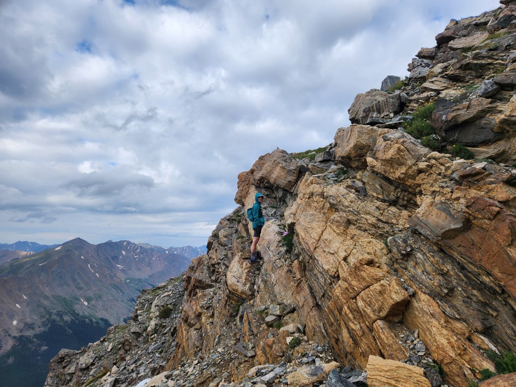
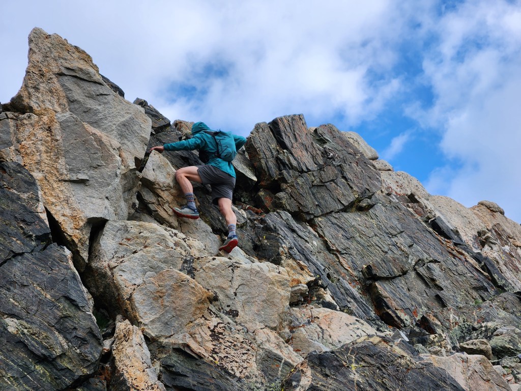
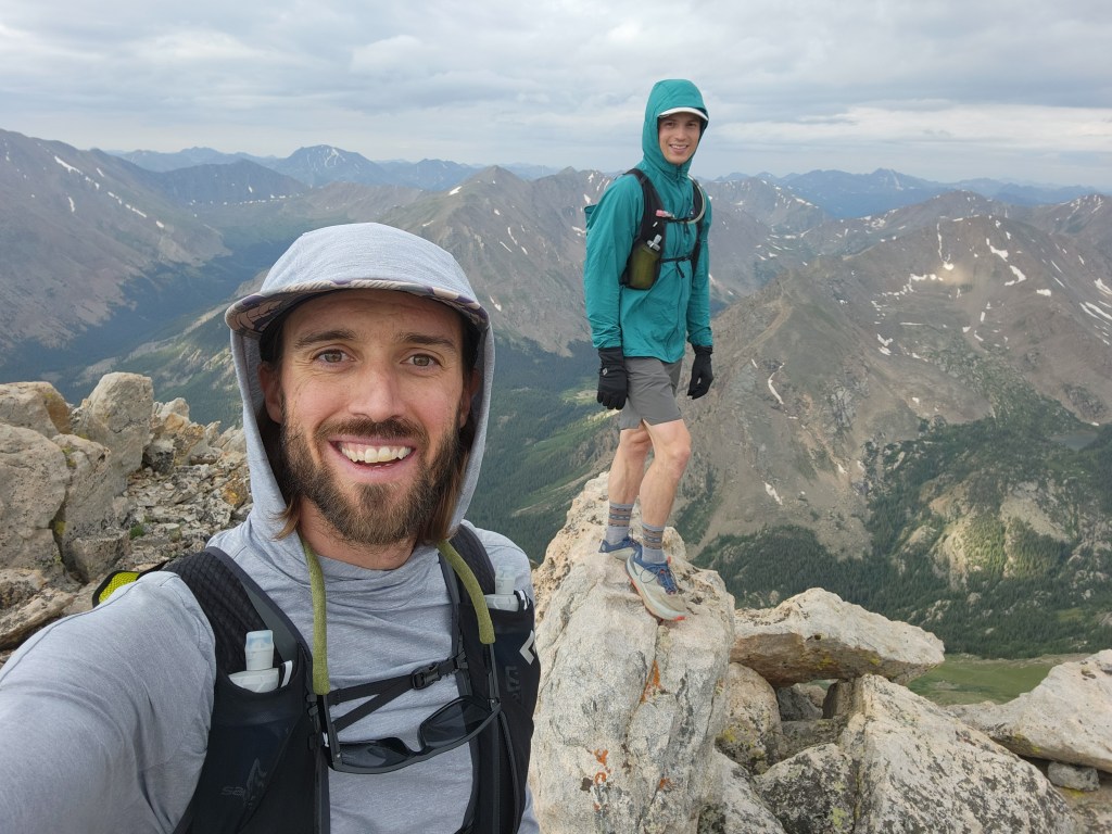
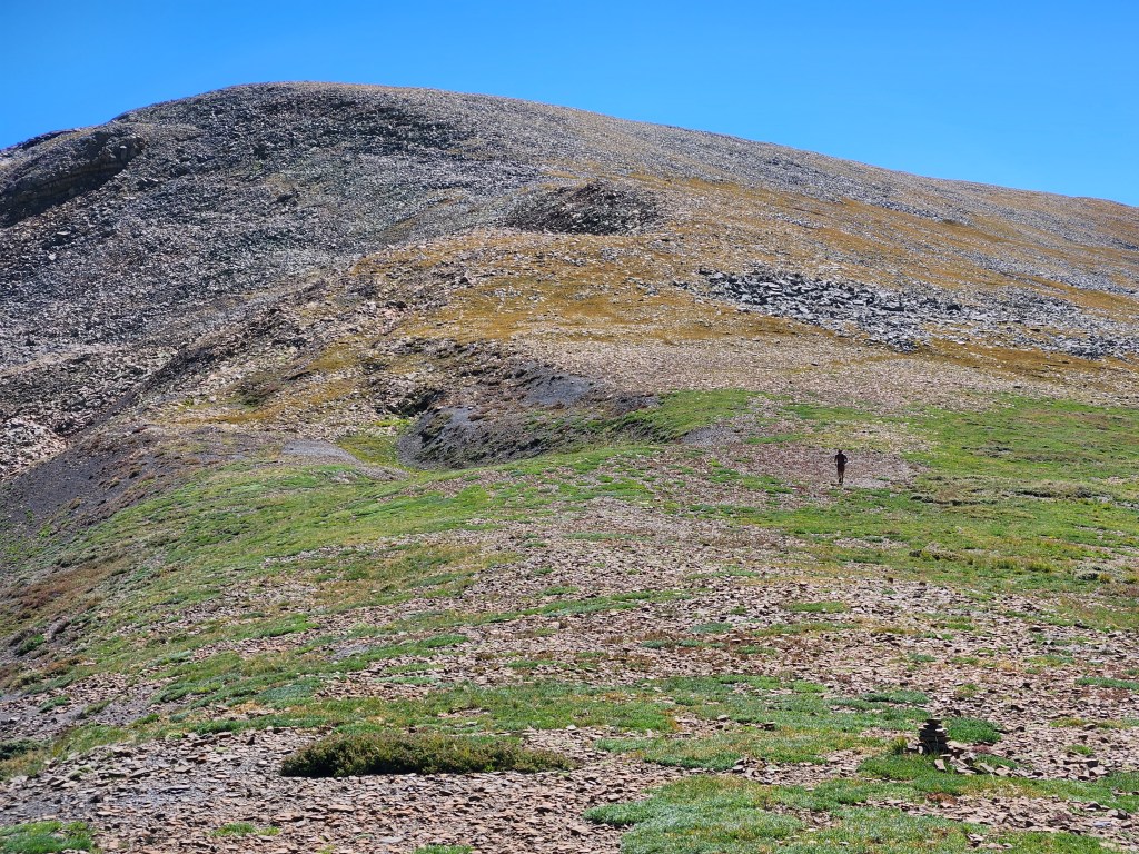
We joined the main trail for the final push to the summit, along with a handful of other hikers. With the bulk of the climbing done, it was a gentle cruise through the talus up to 14,400′. Another one in the bag!
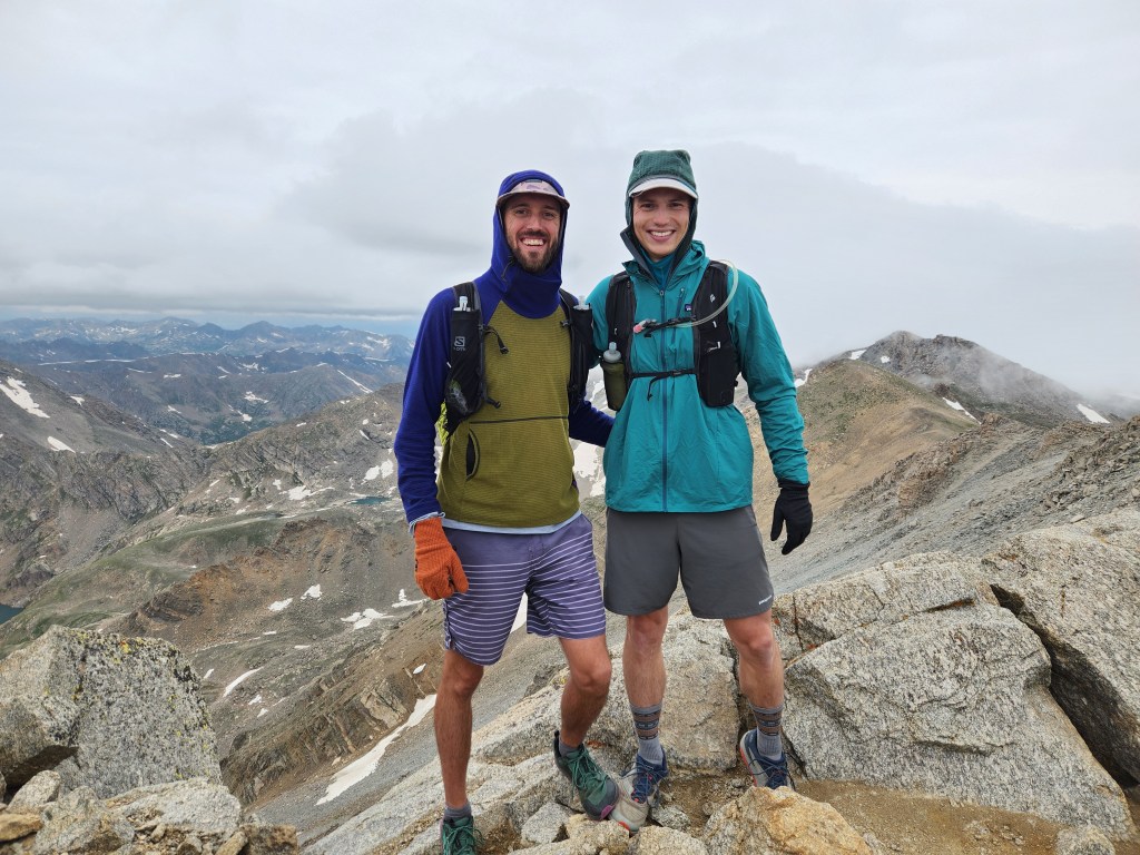
Ryan and I had planned on continuing north west over Mt. Massive’s ridge line, but the clouds looked rather threatening. Our planned descent would be off trail down steep slopes, so the last thing we wanted was to be stuck in a white out and rain while route finding down the mountain. Feeling successful with tagging the true summit, we retreated down the standard south slopes trail.
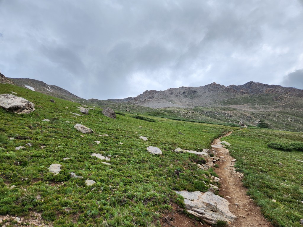
Other than missing the south slopes trail turn off and cutting across said slopes to get back on track, the descent was uneventful, though very pretty. It felt like we were in the heart of the Sawatch Mountains. Lower down, the wildflowers were popping off. A vigorous population of monkshood had taken over a stretch of the creek side, along with many other botanical friends.


Ryan and I jogged back to the car on the final miles of dirt road. Our Massive ridge romp was 12 miles with 5,000 feet of elevation gain, not super long by most standards but the vert made this one a solid outing. The views and solitude along the east ridge were just incredible! As is turns out, this would be my only 14er for summer 2024. I always wish I could do more, but this one was quite satisfying.
2 September 2024
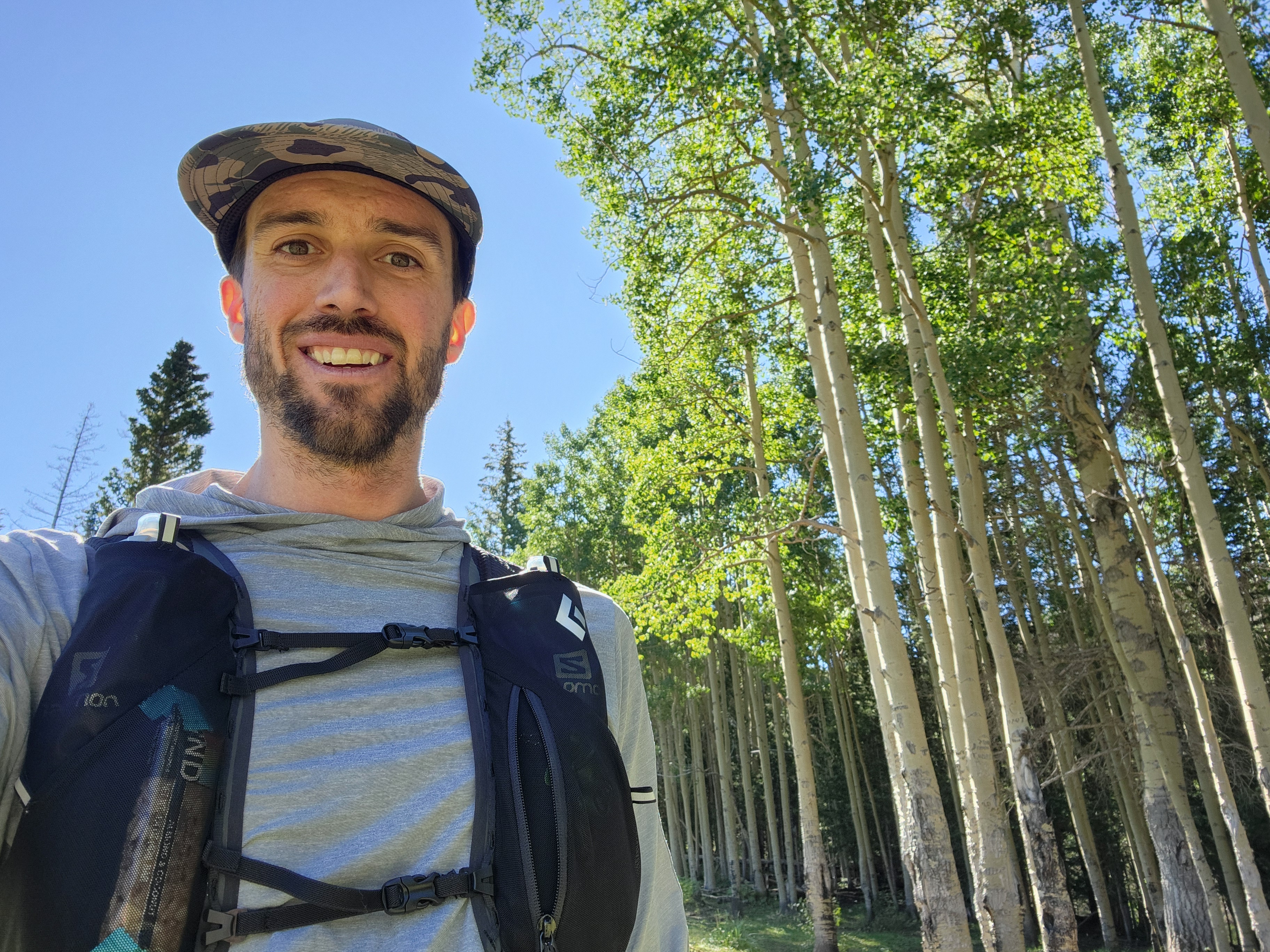
My buddy Matt reached out to me the evening of September 1st for a last minute invite to hike and run up Jicarita Peak. It was a bit of a surprise, but I was up for it! Matt is primarily a mountain biker, but a wrist injury had relegated him to “hands free” adventures. He thought I was the right person to join him for a big trail run, and right he was!
The summer sun was already relenting to the return of autumn. We set off around 8 am in the shade laden valley that follows Santa Barbara creek. Gloves and a wind breaker were essential for the first few miles. Matt set a humane pace of 12 minutes per mile, a nice steady jog up the gentle slope to get our day started.
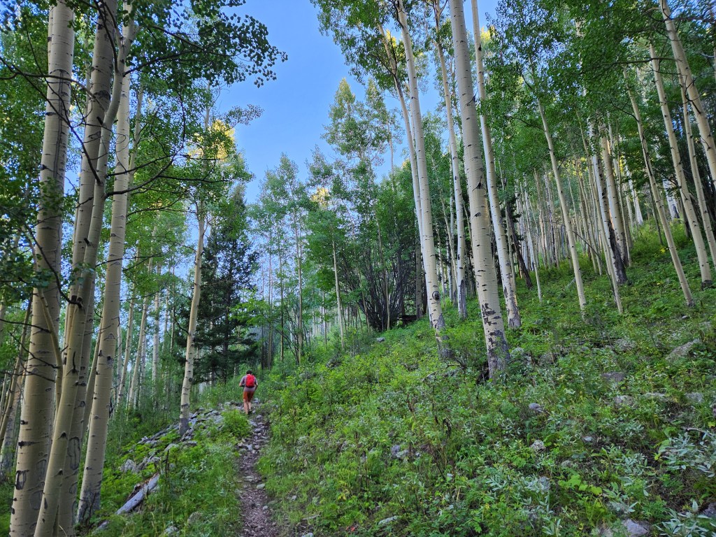
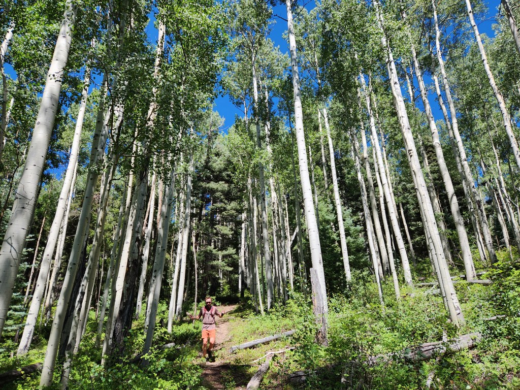
After a few miles, we started climbing in earnest out of the Santa Barbara valley, switch backing through quaking aspens and cow patties. Matt and I had to herd a heifer and three calves for a few minutes, which was annoying but Matt’s colorful commentary made it entertaining for me.
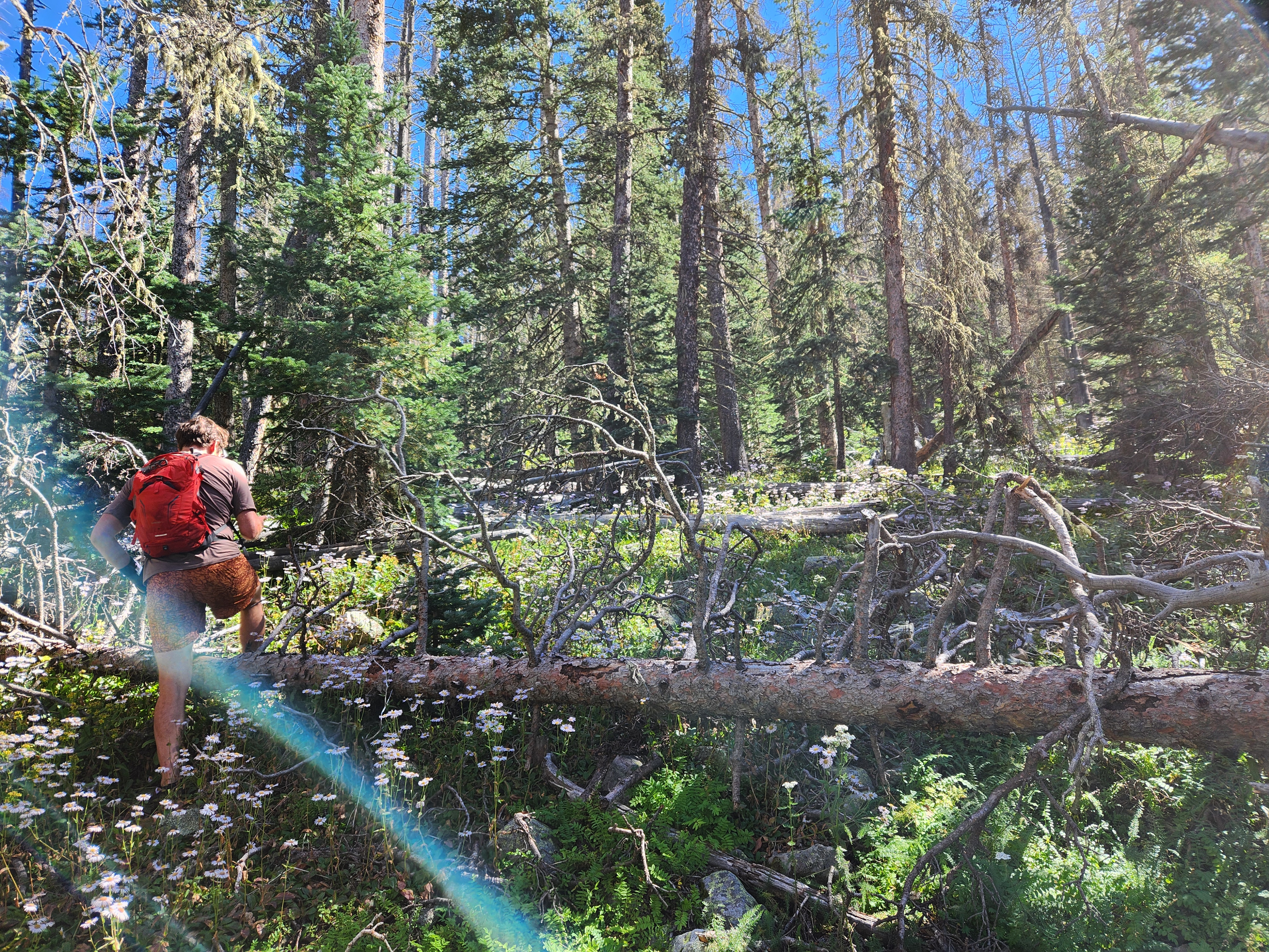
The trees opened up and the trail faded into and alpine meadow. Back in the spruce forest, we could follow a faint trail here and there, but it was littered with beetle kill blow down. Only the most popular trails in New Mexico stay somewhat maintained. I came in expecting this to some degree. The nice thing about the Rocky Mountains is that the bushwhacking is never that bad. Meandering up our own trail, the path of least resistance, Matt and I made it to tree line without too much trouble.

At the first saddle, I made sure to get a view to the east. The Hermit’s Peak-Calf Canyon fire had rolled through two years prior. It was one of the biggest fires in New Mexico history, started as a prescribed burn that got out of control. I was a little surprised to see handfuls of live trees amongst the charred bones of a former forest. Life finds a way.

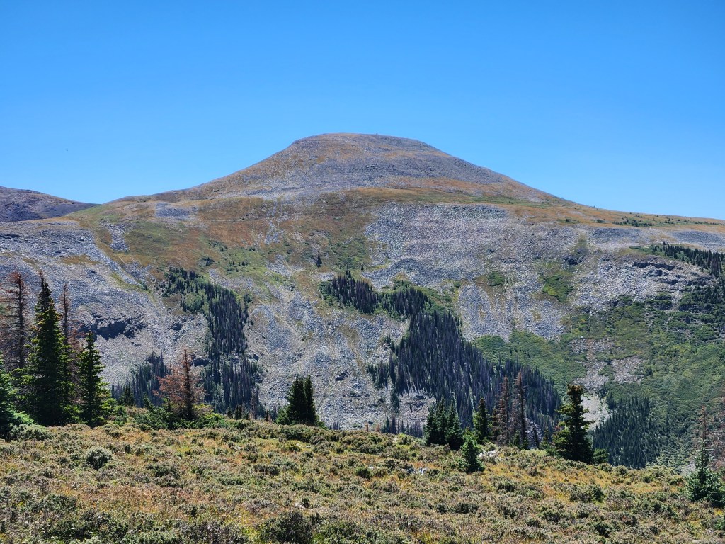
Matt and I went for the summit push. The weather was just wonderful. Crisp blue sky and a steady breeze to wick away the sweat. The broad flat top of Jicarita Peak makes you feel like you’re standing on some alpine dinner table fit for a giant.
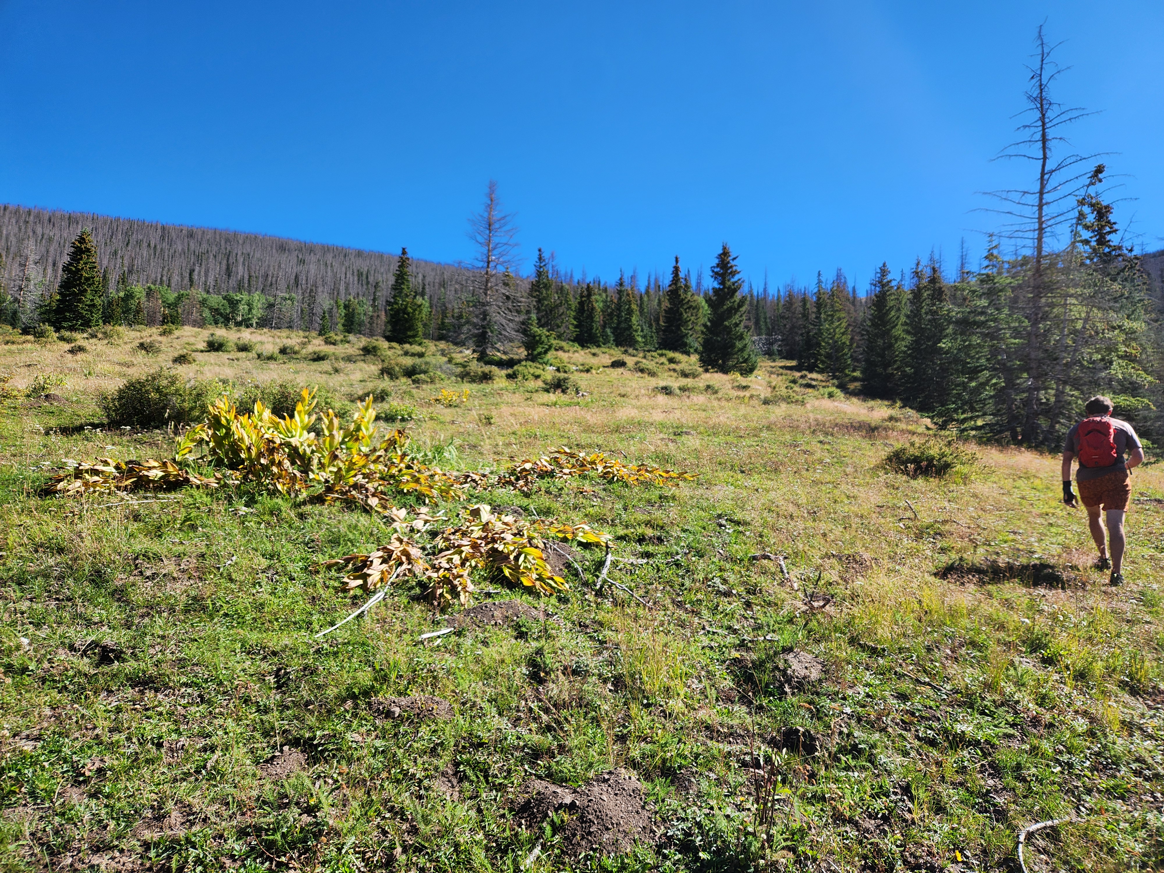
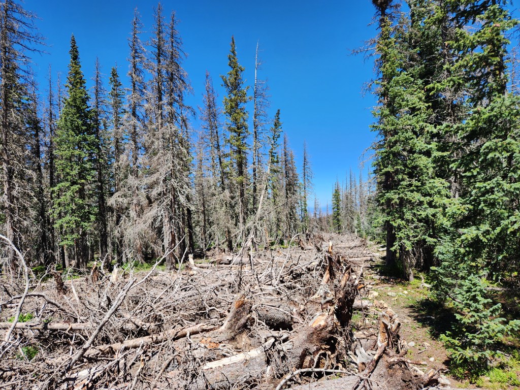
After a quick break we were heading down the north side of the mountain. I was back in familiar terrain and knew precisely where to go and what to expect. A long ridge traverse took us back to the woods where we found something I did not expect. A pile of dead trees stretching ahead of us like some sick unfinished highway. We deduced that it must have been a fire break for the HPCC fire. The fire never made it up this ridge so we were left with this eye sore.
We found our turn back towards Santa Barbara. Most of the descent would be in the next 2 miles. We tried our best to keep up a steady jog, but our legs were screaming after all the distance and vert up to this point. Matt and I walked and talked for the final bit back to the car. It was an epic 17.8 mile day with 4,400 feet of vert.
21 September 2024
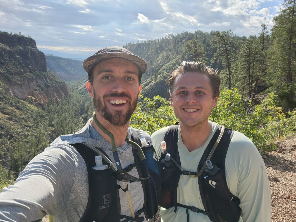
My friend, Tony, was training for the Canyon de Chelly 55k, a small but coveted trail race which participants are selected only by lottery. Tony’s race was only a few weeks away and he was sticking to his training plan well. He was running about 20-25 miles mid week and going for a 20 mile run on the weekend.
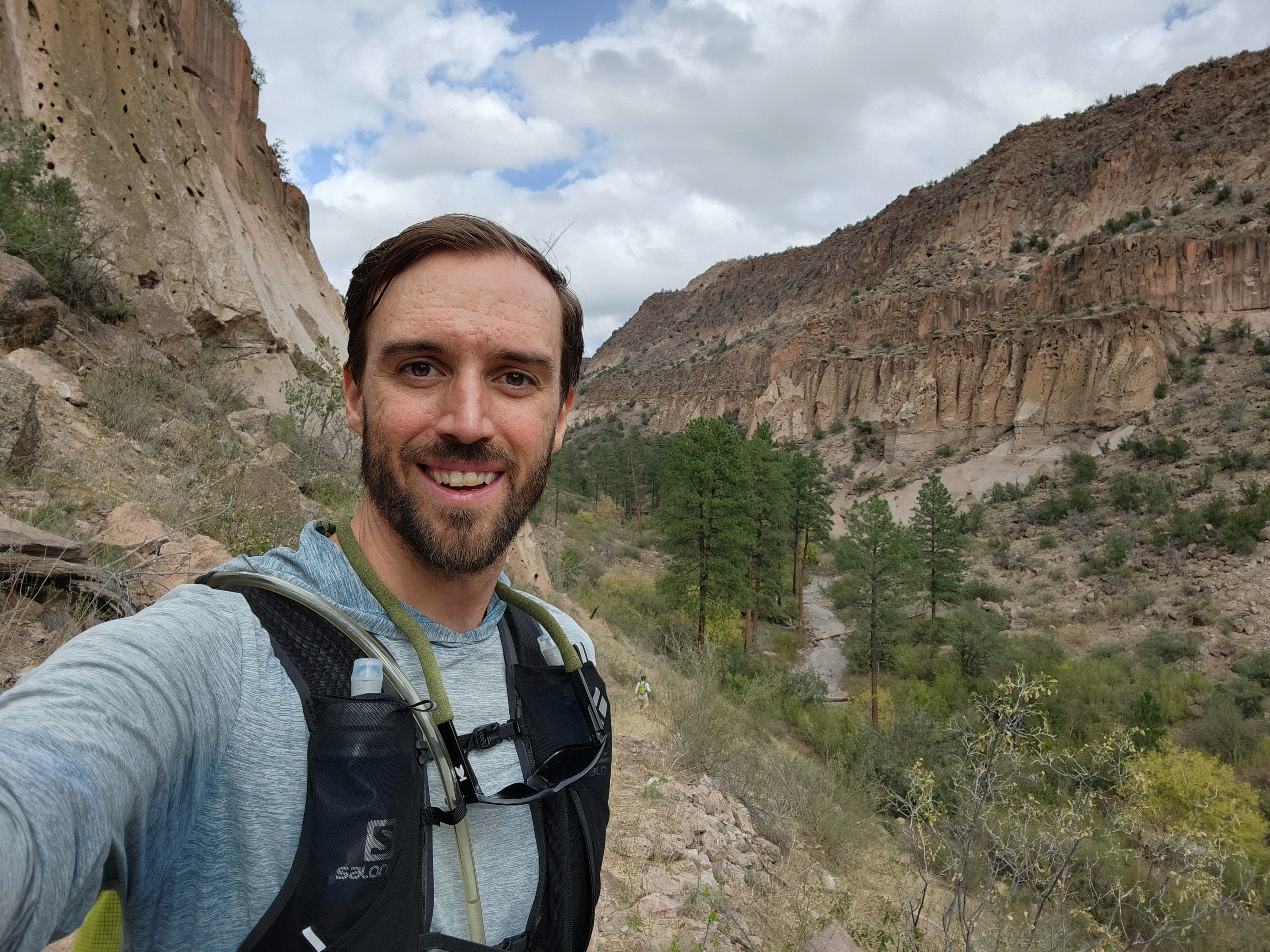
Maggie was recovering from her ACL surgery six weeks earlier. She was finally able to walk around a bit without crutches. After being mostly couch bound since the surgery, Maggie’s cabin fever was running quite high, so we decided to get out for a weekend of car camping at Bandelier National Monument. When we talked with Tony, he and I made a plan to go for a long trail run.
It’s great having such a beautiful National Monument in our back yard. Less than an hour from home, camping in Baneldier feels like a wilderness escape, but if anything goes awry, it’s comforting to know civilization is nearby. This was perfect under the circumstances with Maggie’s knee.
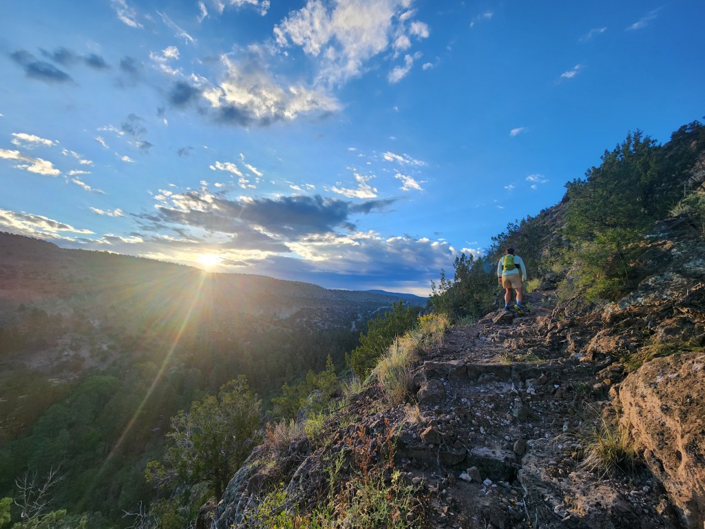
It was a cool first night of autumn, but not cold. Tony and I were up around 6 am for breakfast, tea, and coffee. The lack of summer light was becoming noticeable as we got ready by head lamp. We set off just after 7 as the sun was finally starting to peek over a cloud bank above the Sangre de Cristos.
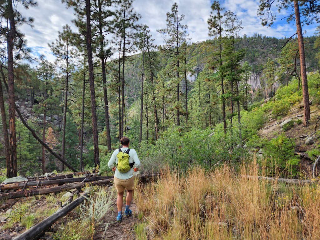
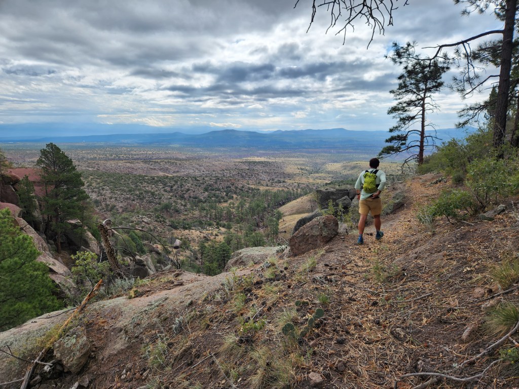
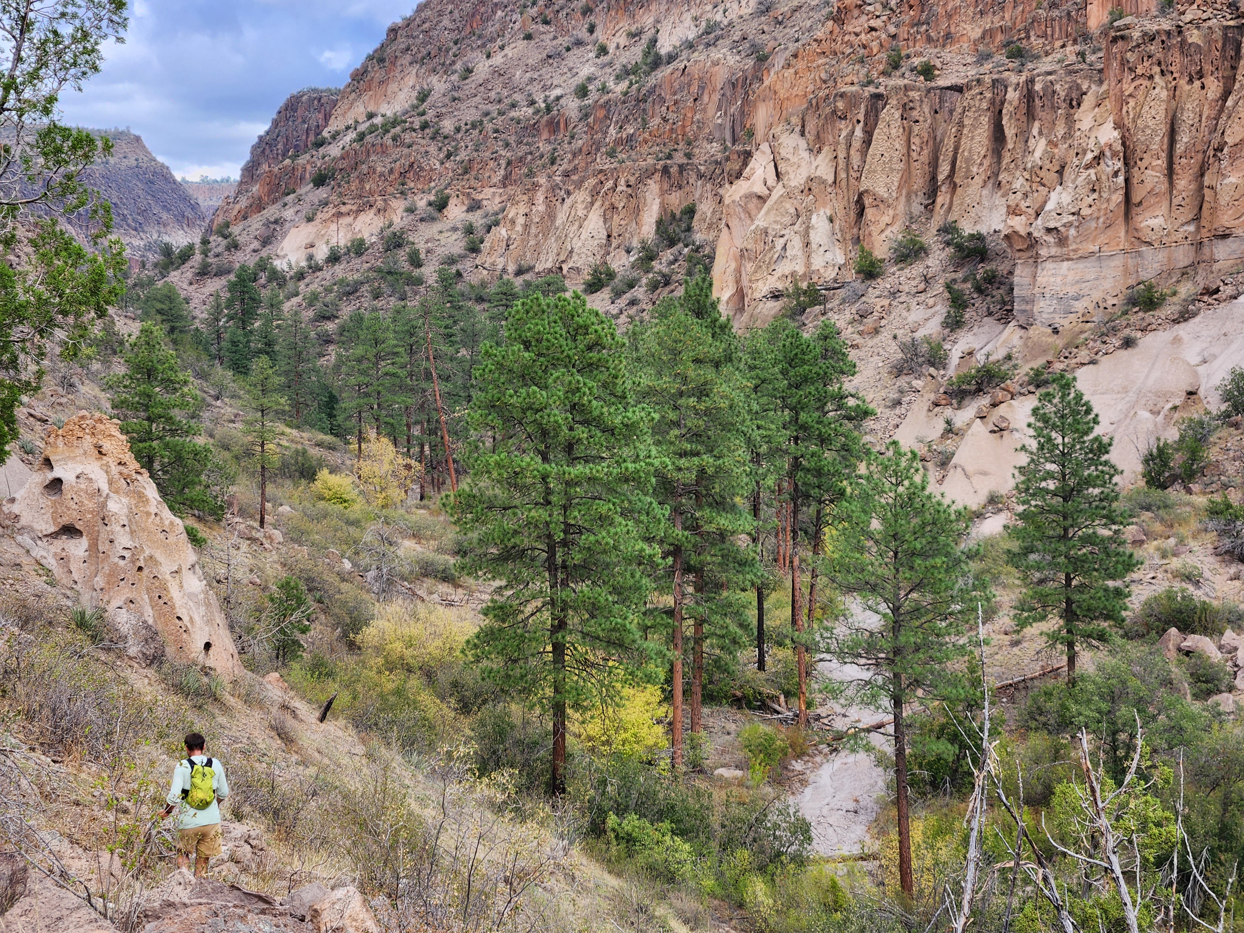
We were on the flanks of the Jemez Mountains, which were formed by multiple eruptions from a super volcano. Pyroclastic flows blanketed the land in hundreds of feet volcanic ash, which settled and solidified into the Bandelier tuff about 1.5 million years ago. After this cataclysm, water eroded a series of canyons leading towards the Rio Grande. Despite its name, this tuff is quite soft. The first humans here carved cliff dwellings into the walls of the canyons, in addition to constructing a large pueblo and numerous other structures. Here we were, slowly running up the side of Frijoles Canyon, a population center for many peoples spanning over 1,000 years.
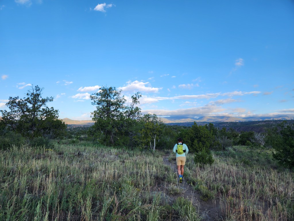
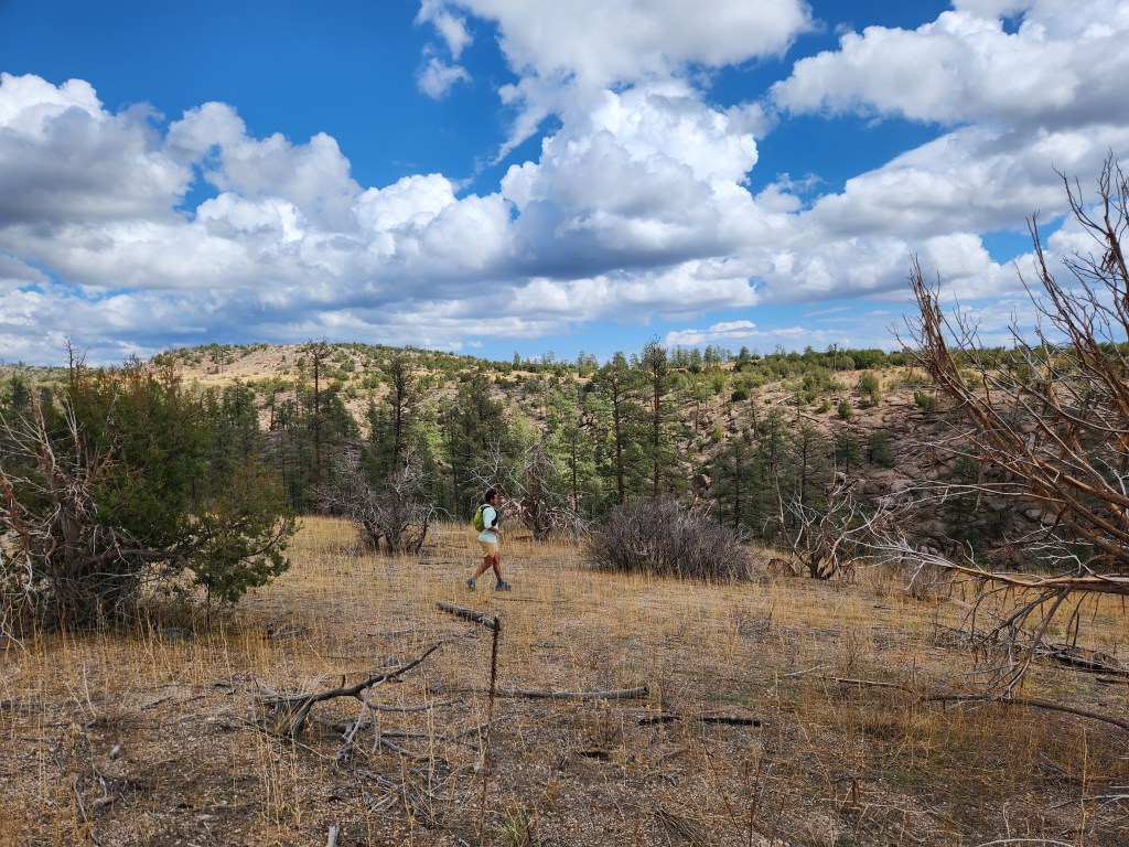
Meandering through the juniper woodlands, Tony and I maintained a steady 12 min/mile pace. Across the first mesa, we descended into the upper section of Alamo Canyon. Summer of 2024 had been a great monsoon season. While it certainly seemed like flash floods had created some disturbance in the canyon, the plant life was otherwise thriving. It’s always a treat to find such lush and vibrant microcosms in the desert. Life, uh, finds a way.
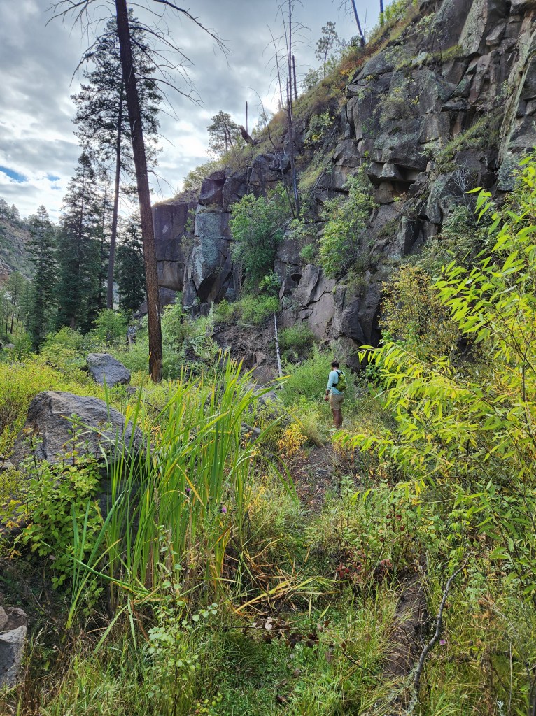
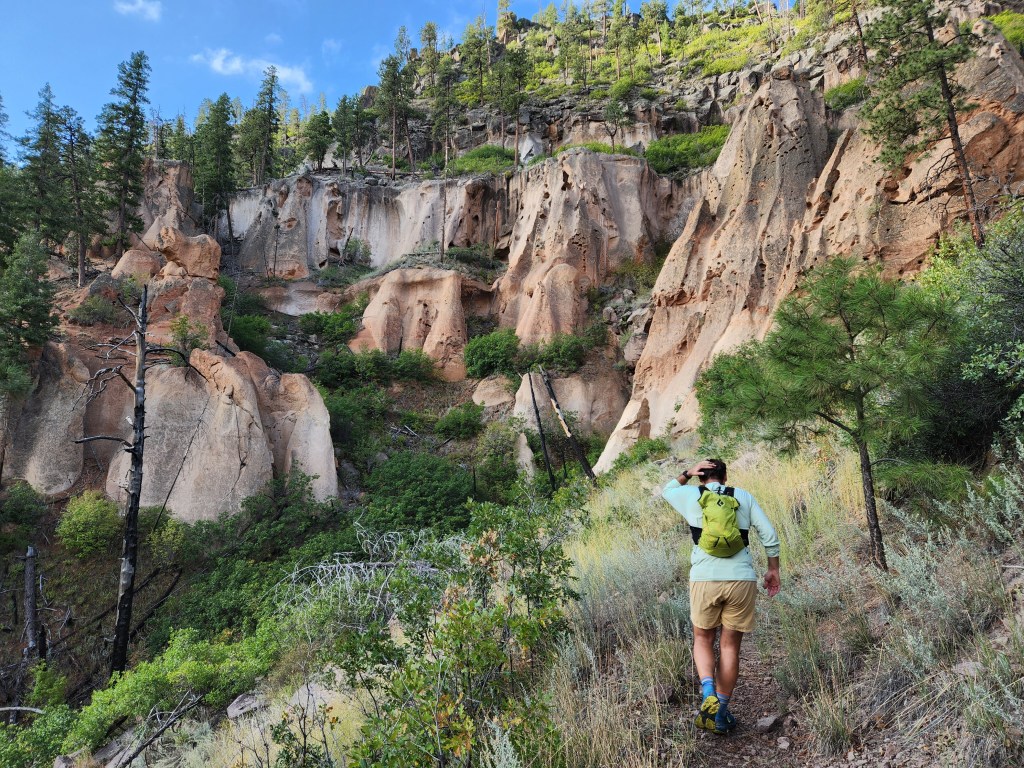
Tony and I climbed up the other side of Alamo Canyon, passing by some small tent rocks, a formation somewhat unique to the Jemez Mountains. Before long we were back to the juniper and ponderosa on the next mesa.
On a run this long, nutrition becomes an important factor for maintaining a decent pace. I was eating some small bars and apple sauce. Tony had a ziploc bag full of grits. I questioned his methods, but time would tell which nutrition plan was superior.
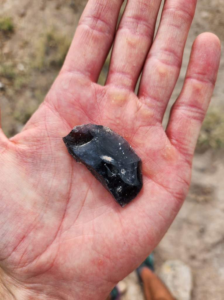
The view opened up to the west as we crested the end of a small ridge before arcing back towards Alamo Canyon. By mile 12 or so, I was still feeling pretty good. Tony and I tried to find a trail following the rim of Alamo Canyon, but alas it was yet another abandoned footpath in the New Mexico back country. In search for the trail, all I found was an obsidian scraper/blade. We turned back to continue on a well worn trail back towards the car.
The middle Alamo Canyon crossing is one of my favorite places in Northern New Mexico. The steep 300 foot walls make it seem like an impasse, yet a route exists down to the bottom and back up the other side. In the canyon, I had to stop for a quick snack break. Here was the difference between a race and a fun run. I ate what I could in a few minutes, but Tony wanted to keep moving.
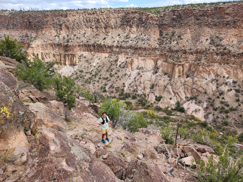
In this section of Alamo Canyon, the impact of flash floods was quite visible. Log jams and upturned boulders made the trail impossible to follow. I had been here a year earlier and knew things had changed quite a bit. We picked our way through the chaos and found the exit.
After climbing out of Alamo Canyon, it was mostly flat back to the car, cruising across the mesa. I was trying to coordinate meeting Maggie and some friends at the cliff dwellings in Frijoles Canyon. At mile 16, Tony and I got back to the intersection which would take us back to the car. It was about noon and my lunch hunger was starting to hit. Turns out my nutrition plan wasn’t adequate.
“Tony, I’m gonna call it good here, I should go meet Maggie and our friends down in the Canyon,” is what I said, but in reality I was starting to bonk.
“Alright, I’m gonna keep going to get 20,” Tony said.
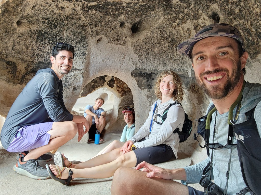
We split up. Tony continued on the mesa top and I went back down into the canyon. Grimy, sweaty, and wearing unusual clothing, I walked between crowds of tourists also here to visit the cliff dwellings. I claimed a picnic table and before long Maggie, and our friends, Will and Mackenzie, showed up with a cooler full of food and drinks. My saviors!
As we were wrapping up lunch, the clouds rapidly grew from harmless marshmallows into menacing purple thunder heads. We threw everything in the car and took refuge in the visitor center. I got a message from Tony that he got to his car just as the thunderstorms hit, so we need not worry about him.
After reading every informational sign in the visitor center, we looked out and saw the sun shining bright. Tony met up with us and we all walked towards the Tyuonyi Pueblo and cliff dwellings. This was somehow my first time actually walking through the pueblo.
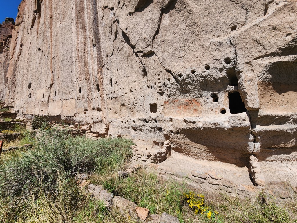
The size is on par with those at Chaco Canyon, and the cliff dwellings carved into the canyon walls add an extra dimension. The Park Service has a couple ladders to let guests sit inside the cliff dwellings. Being 6’2″, it’s hard to imagine living in a space where I can barely crouch to get from one side to the other.
Once we had finished the loop, Maggie and I said good bye to our friends. We returned to our camp site for a relaxing evening in the desert. What an incredible day!
While there is always a desire to do more, when I reflect on these adventures it fills me with joy. Getting out for big days with my friends on (and off) the trail is a sure fire way to get stoked on life. Maggie is well on the road to recovery and we will be getting out on some adventures together again soon!
