When I had a conference to attend in South Lake Tahoe, I made sure to book my flight so I could stay through the weekend and romp around the Sierra Nevada. In addition to business clothes in my suitcase, I packed a 70L duffel bag full of camping and adventure gear (I’ll let you guess which bag was more important to me). Maggie booked a flight so we could get out together for a quick and dirty quest through the Desolation Wilderness.
The obvious thing to do was to reconnect with the PCT in some fashion. A combination of Instagram inspiration and recollecting of the awesome peaks above Lake Aloha set us on a path to do the Crystal Range Traverse. The PCT goes to some incredible view points, but avoids most mountain summits. We were excited to come back, tag some peaks, scramble, and swim along this 17 mile route.
1 August 2025
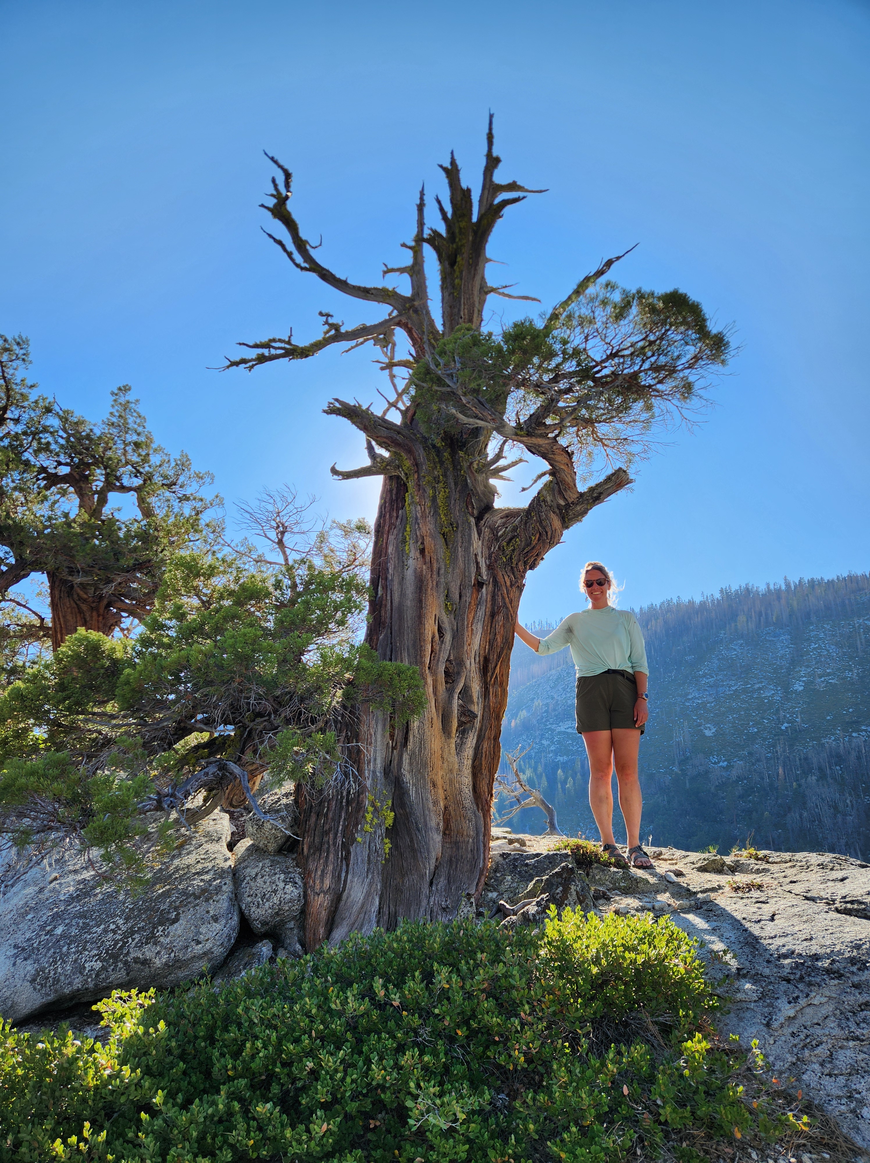
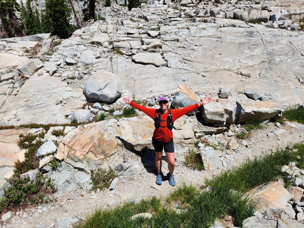
Maggie and I camped at Lovers Leap, a popular climbing area just outside South Lake Tahoe. We hiked up the Hogsback to take in the view. There were a number of cool trees, natural bonsai, up on this barren spine of rock. We were both happy to be back in the Sierra and taking in the unique scenery.
2 August 2025
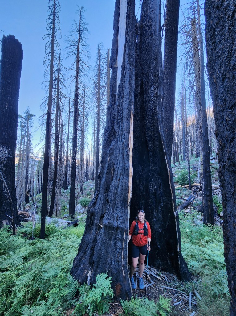
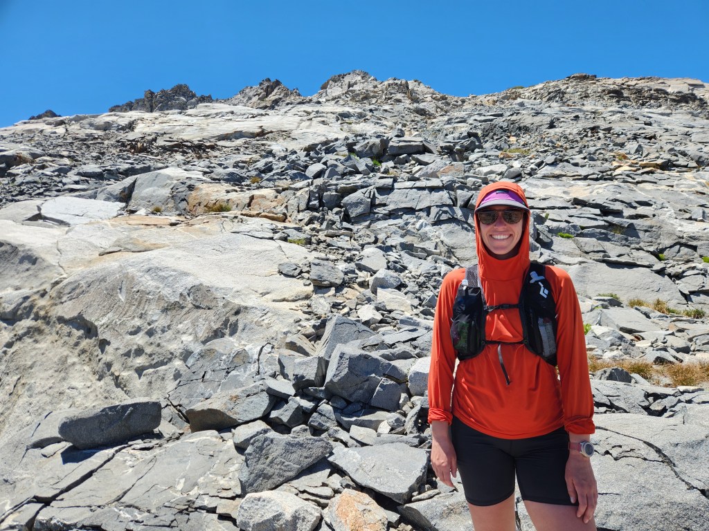
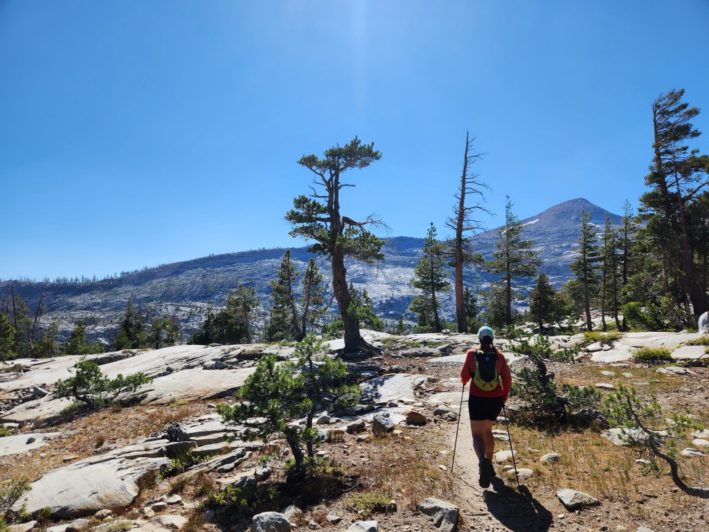
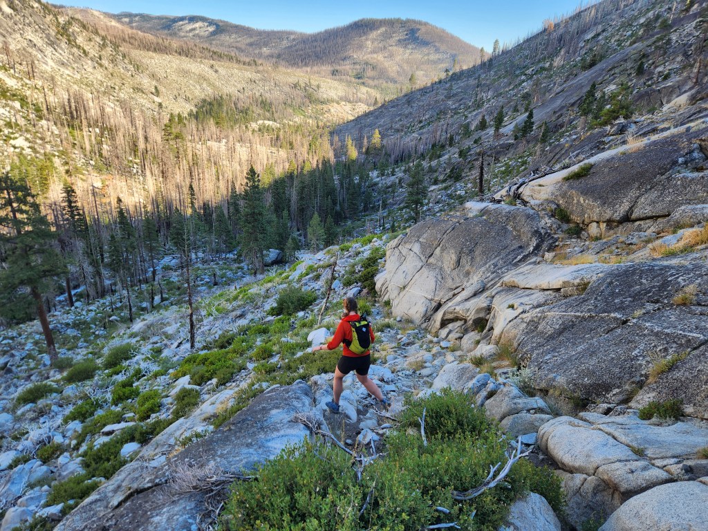
Maggie and I awoke at 5 am, shoveled some oatmeal down, packed up, and drove a short distance to the Pyramid Peak trail. We were moving at 6:30, that tender hour where dawn creeps in between the mountains with diffuse light. This area was affected by the 2020 Caldor Fire. Trees as wide as I am tall went up in smoke, a thousand years of growth undone in the blink of an eye. I have to remind myself that wild fire is a natural part of the ecosystem. Sprouts and saplings dotted the landscape – death becomes life again.
The trail is steep, ascending nearly 4,000 feet in 3 miles. Maggie and I thought we were maintaining a decent pace until some ultrarunner guy passed us. This is an uncommon occurrence for us, but I know we’re no elite athletes.
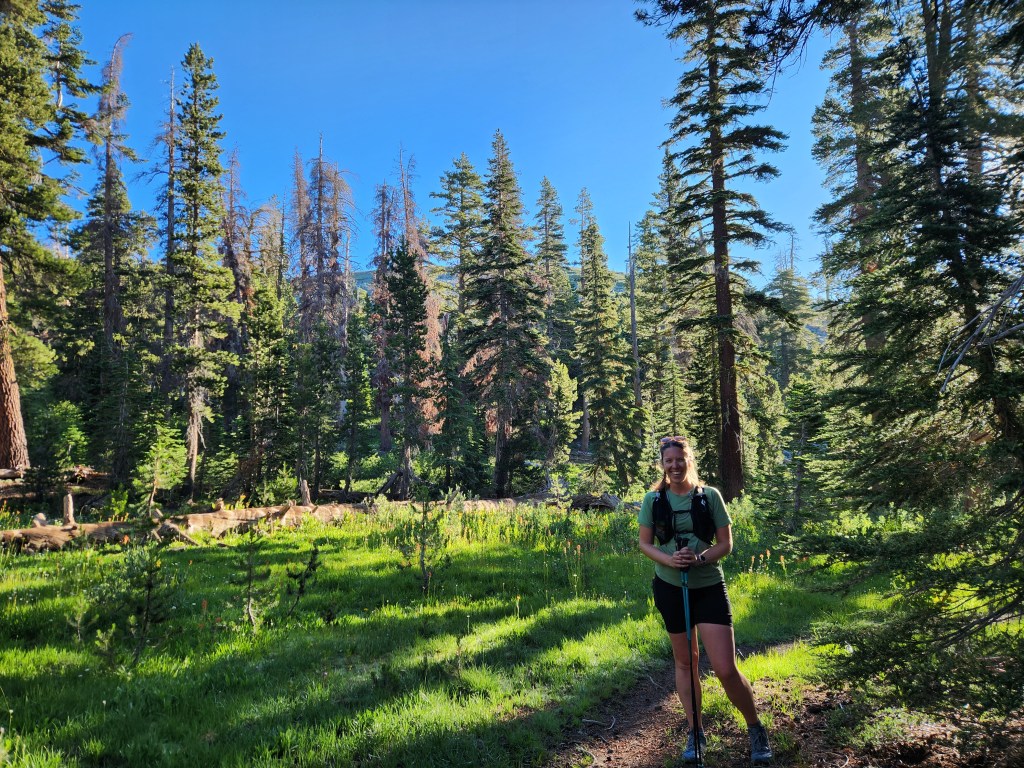
Returning to healthy forest was a treat. Damp and green, I was pleased to see my old coniferous friends from the PCT, like incense cedar, mountain hemlocks, and some honking sugar pines.
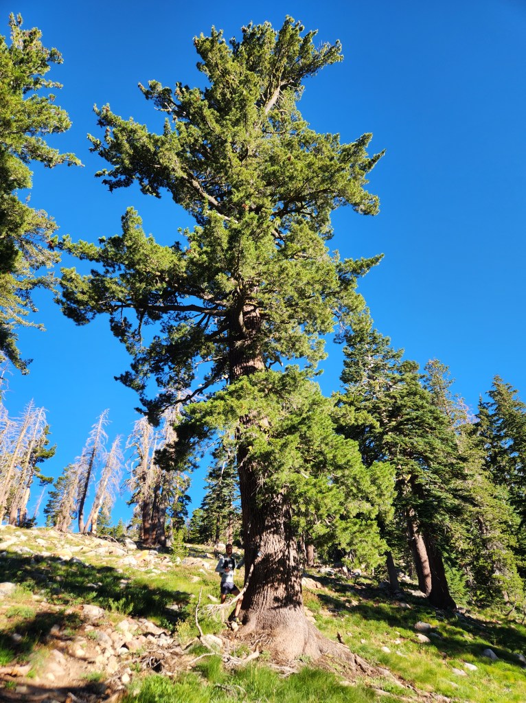
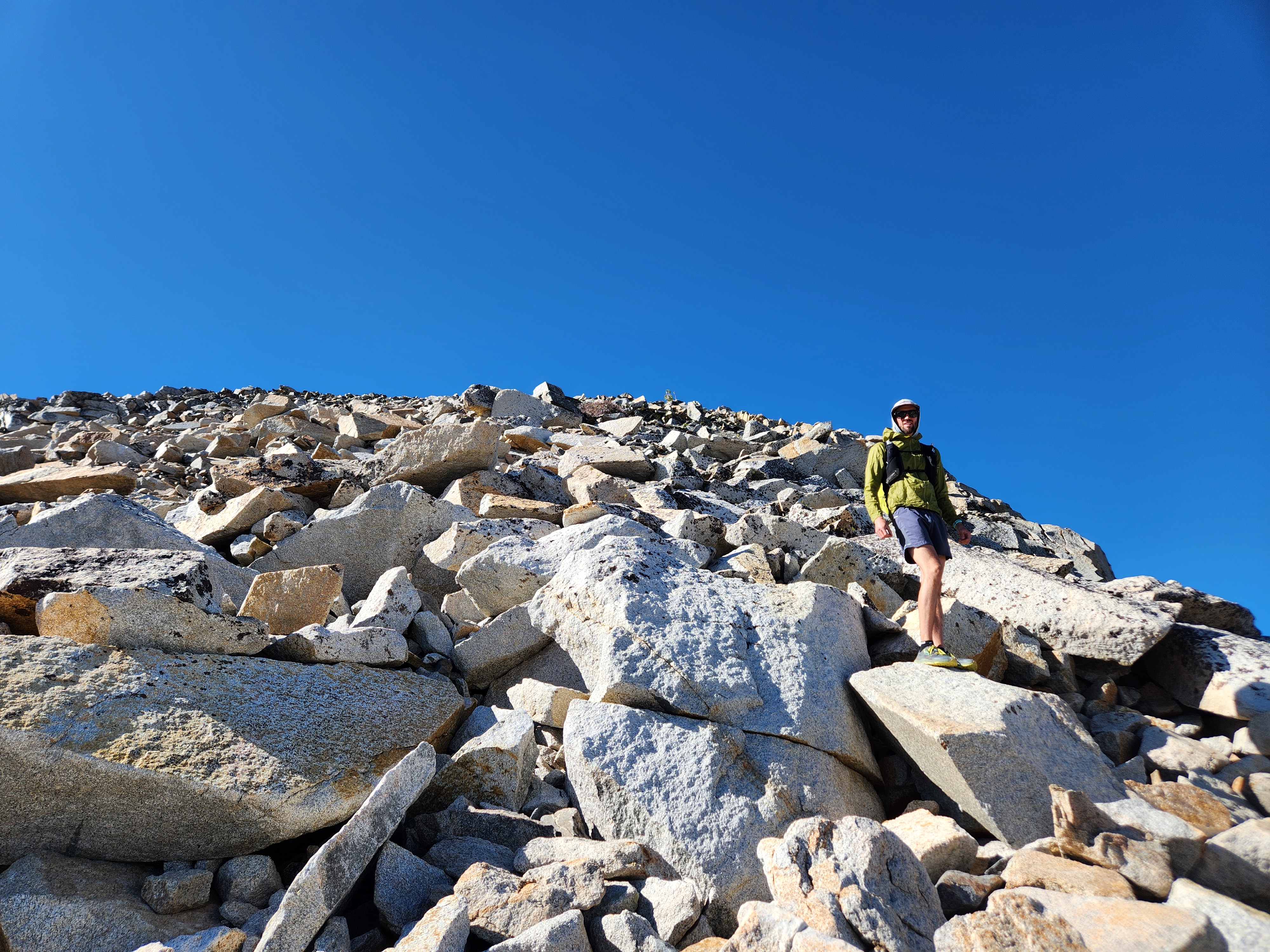
The forest didn’t last long though, thinning out as we climbed higher on to talus. We saw the ultra runner was heading down near treeline, saying he didn’t feel comfortable rock hopping and scrambling. I took solace in the fact that, while he may have been faster, we were more adventurous. This was just our warm up.
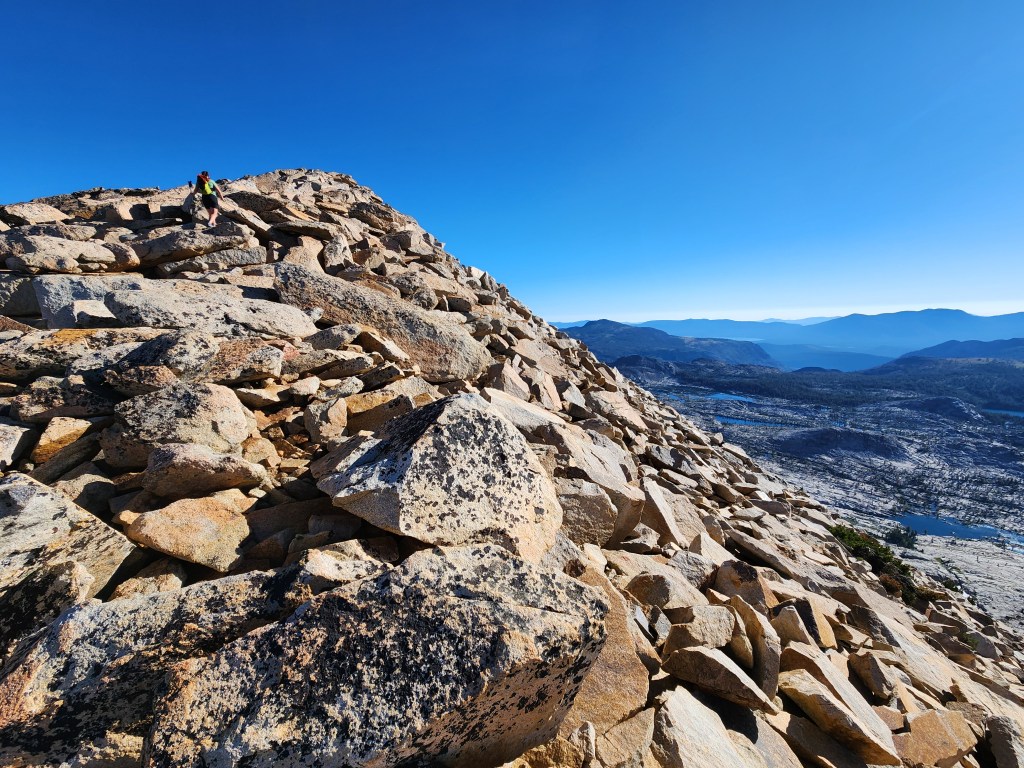
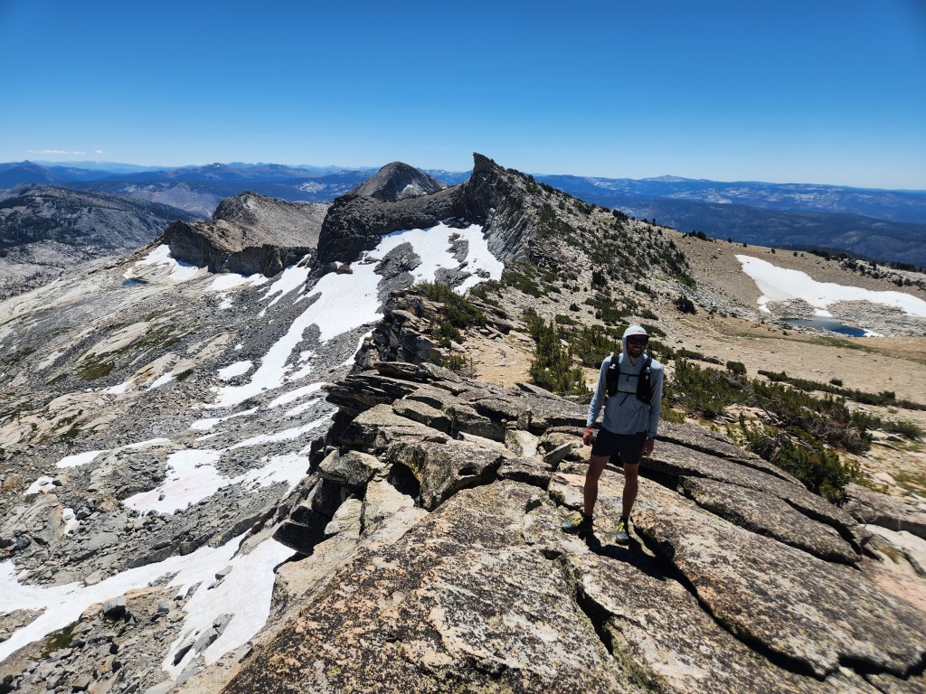
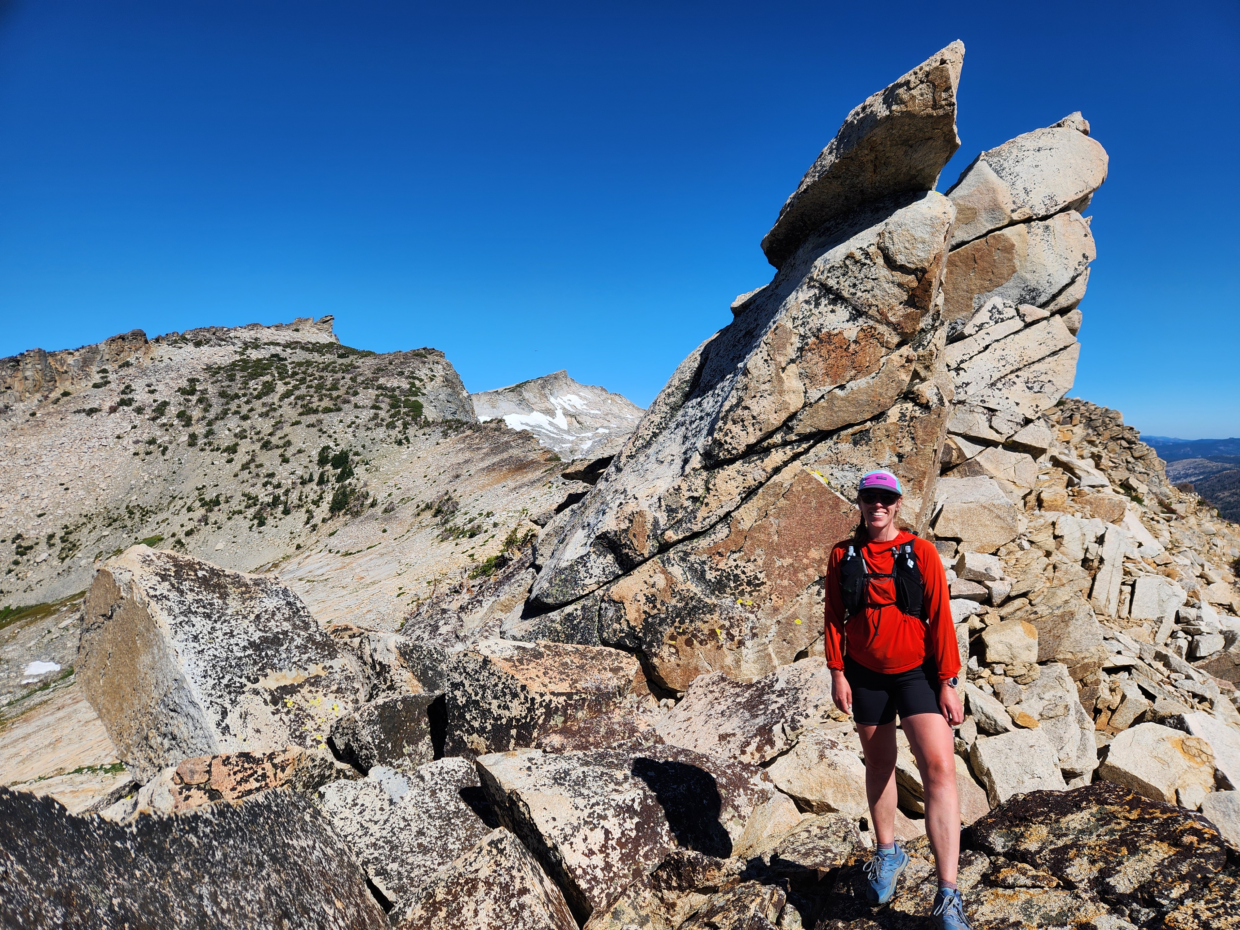
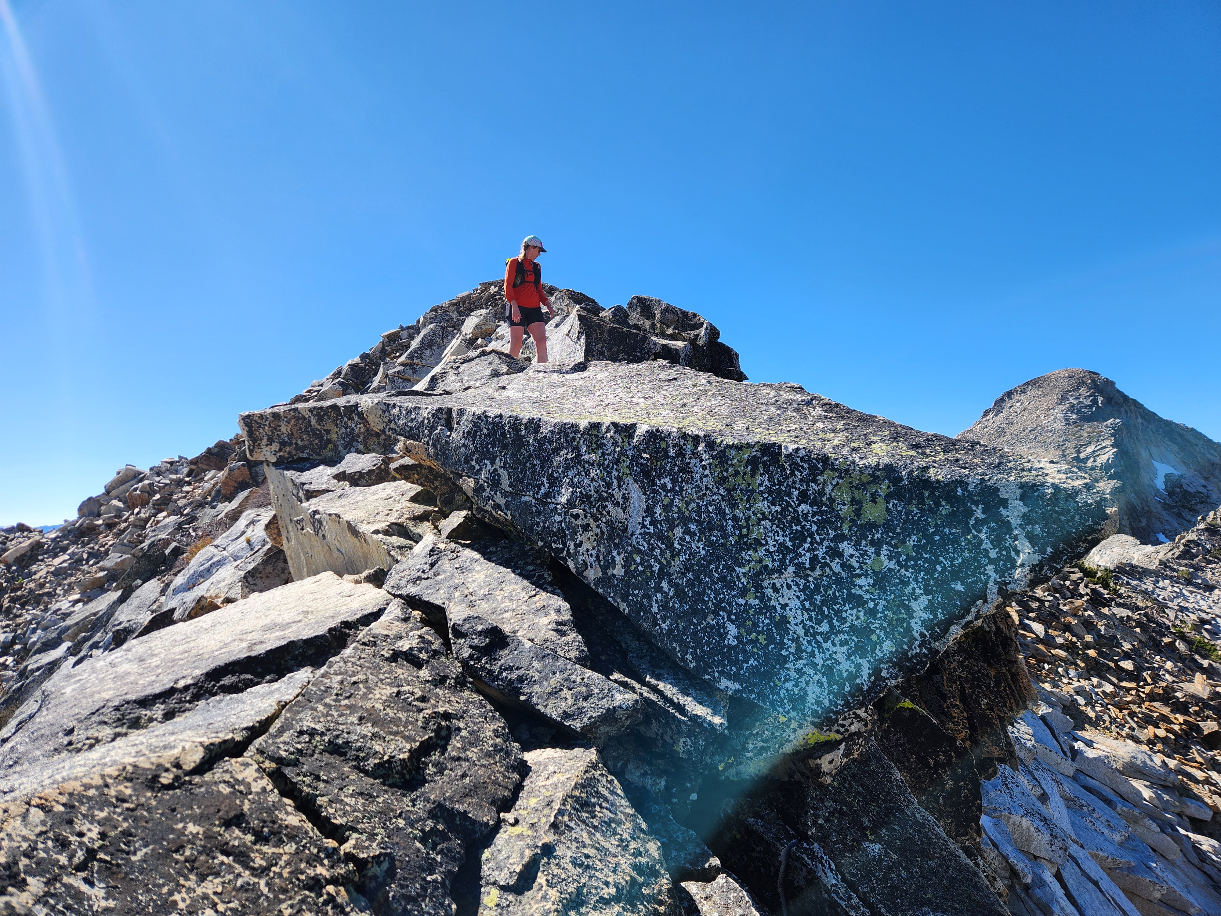
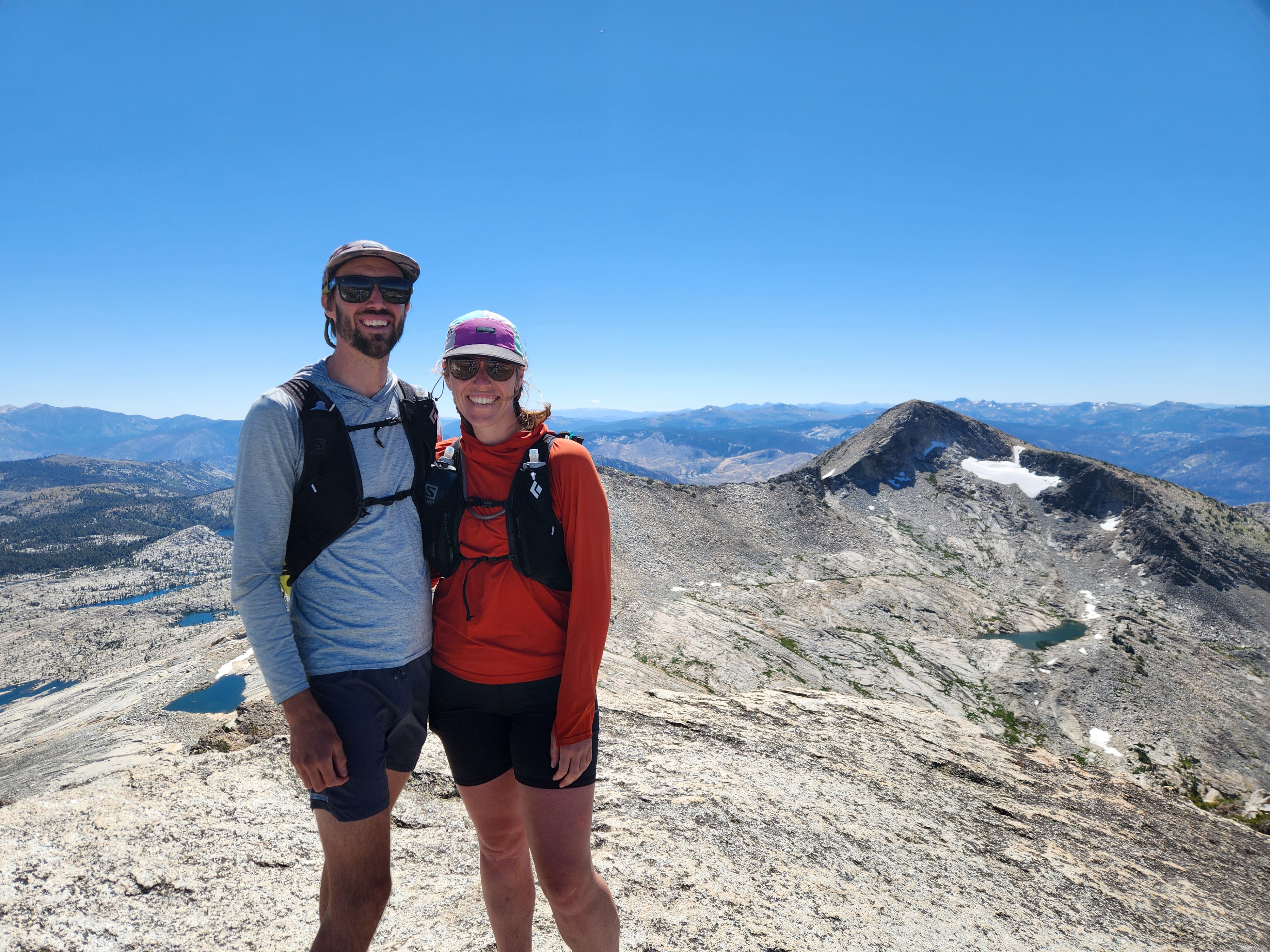
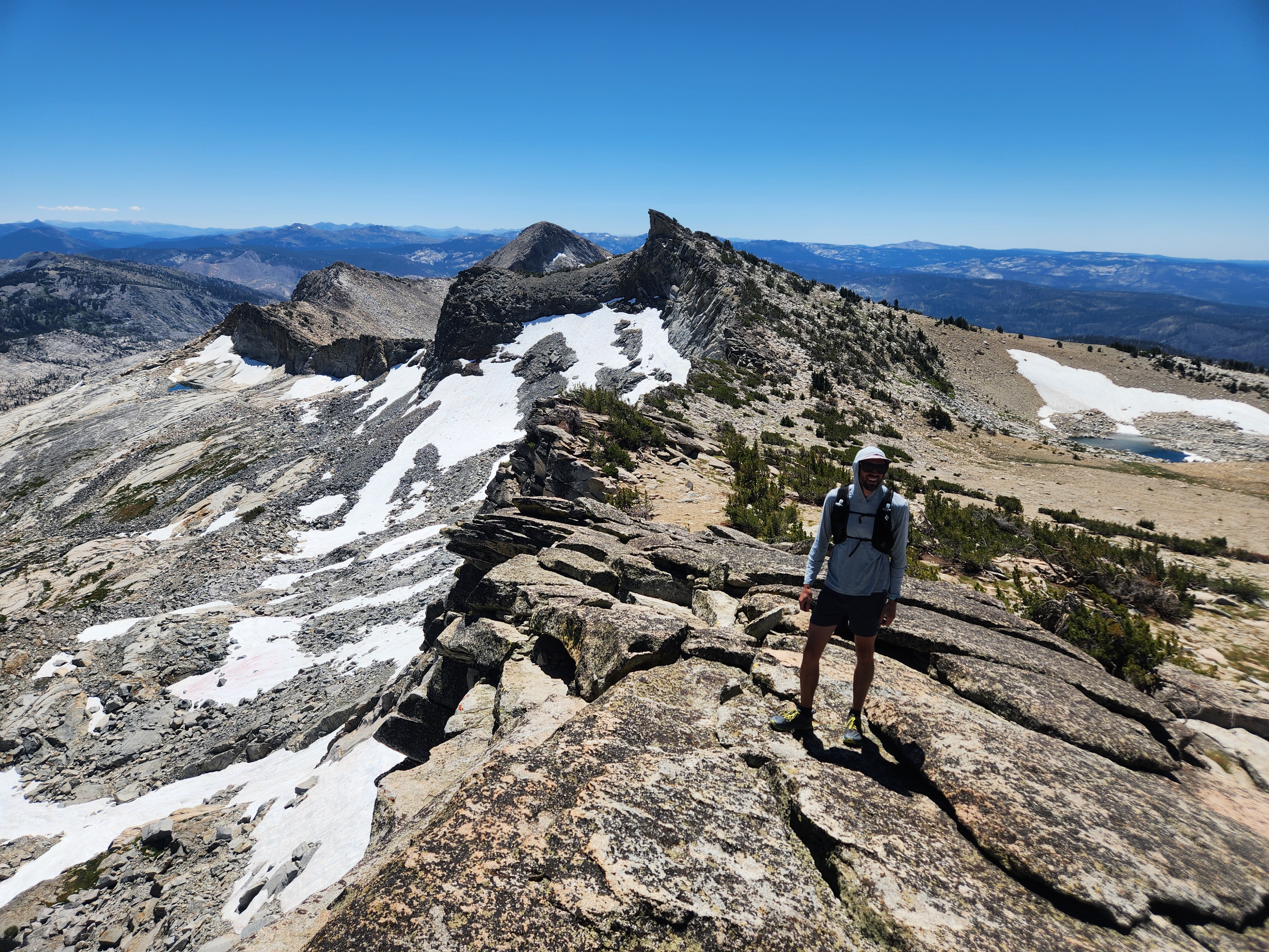
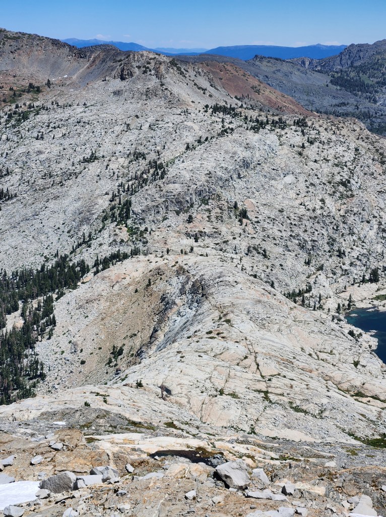
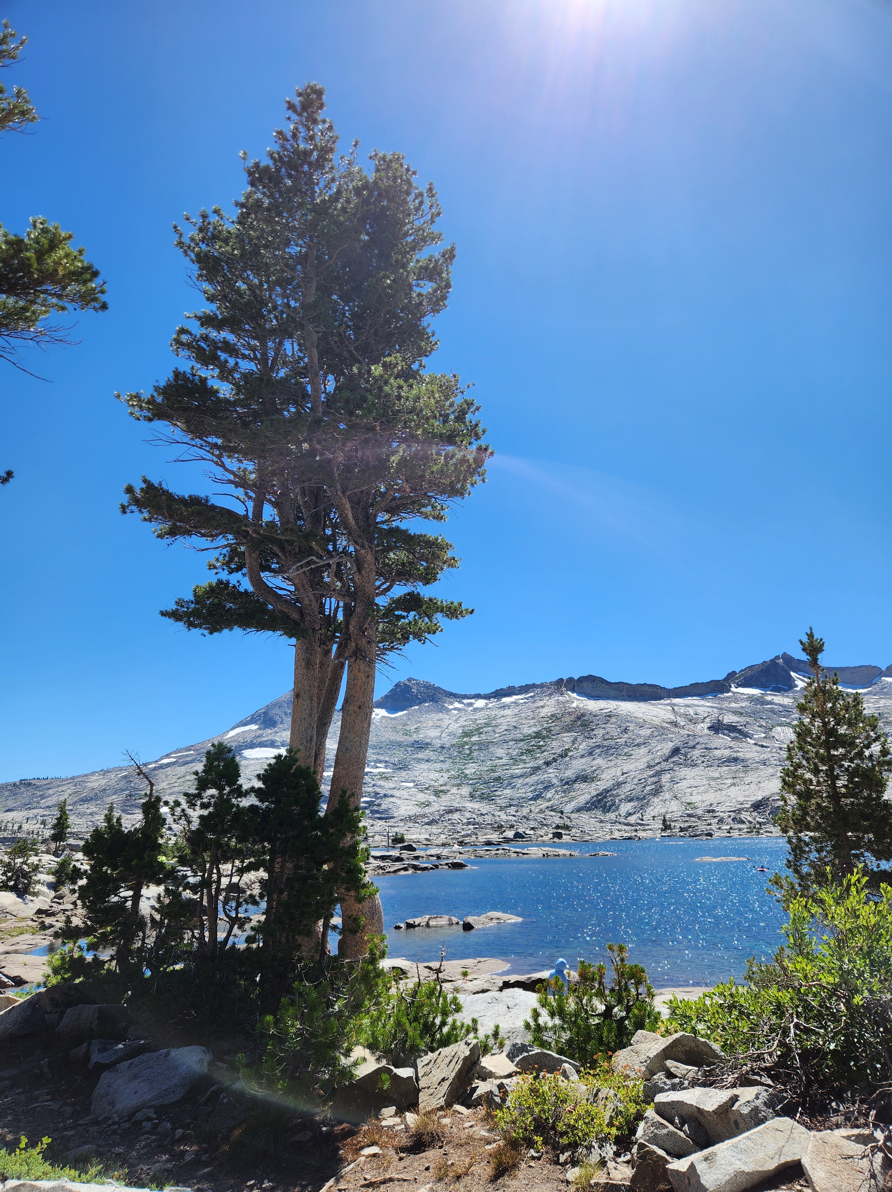
Talus hopping up Pyramid Peak was a fun introduction. The views got better with every foot of elevation gained. Lovers Leap, a 700 foot cliff, looked absolutely miniscule from up here. We got our first views of Lake Aloha, the basin we were circumnavigating. And of course, we could see the ridge line that defined our route. Being able to see the full loop was a bit daunting. We were in for a big day.
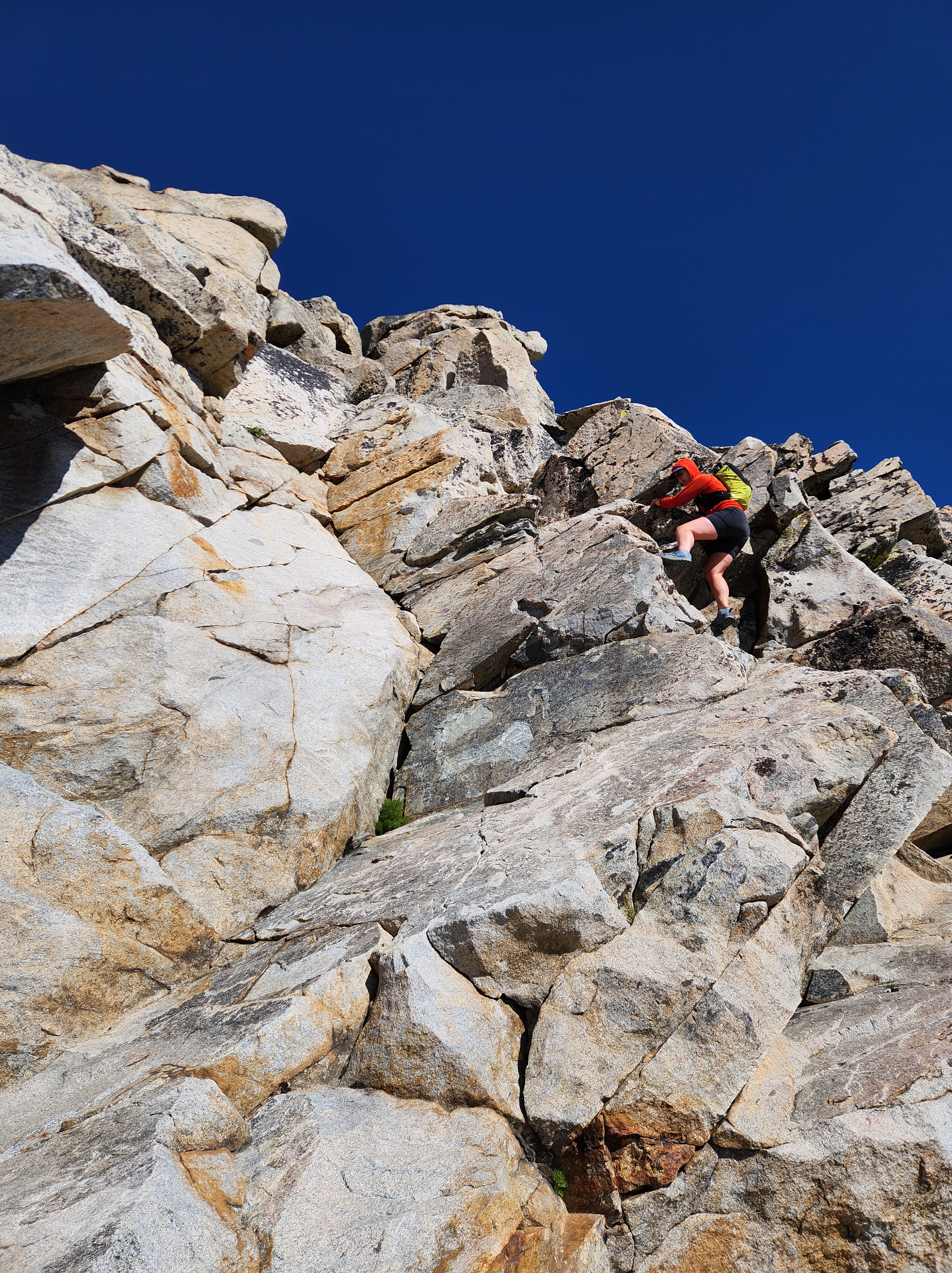
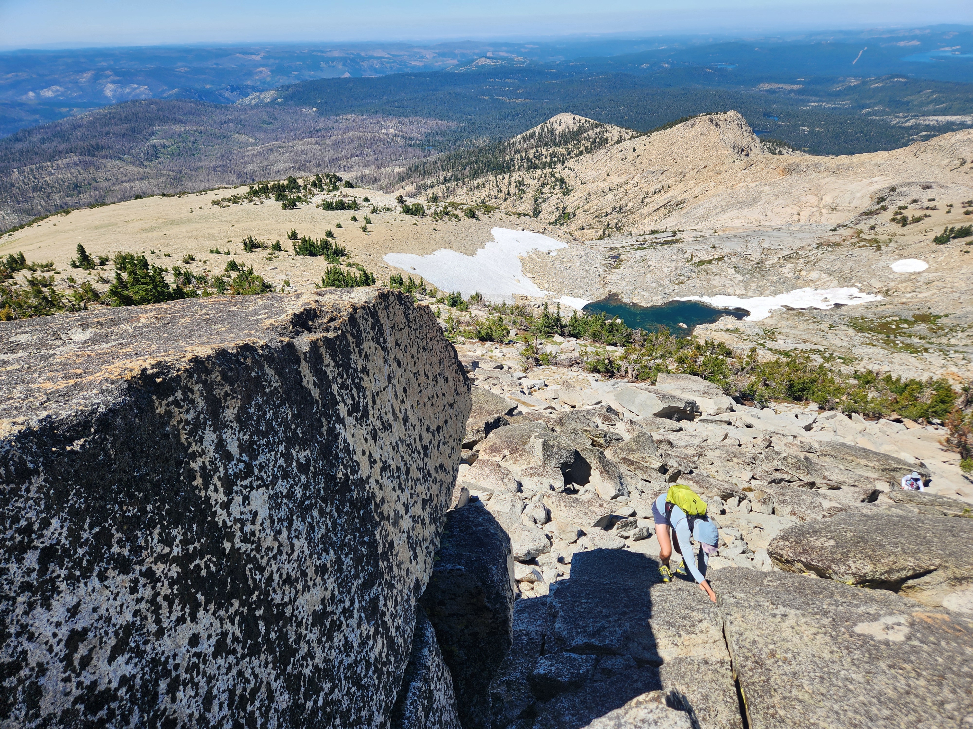
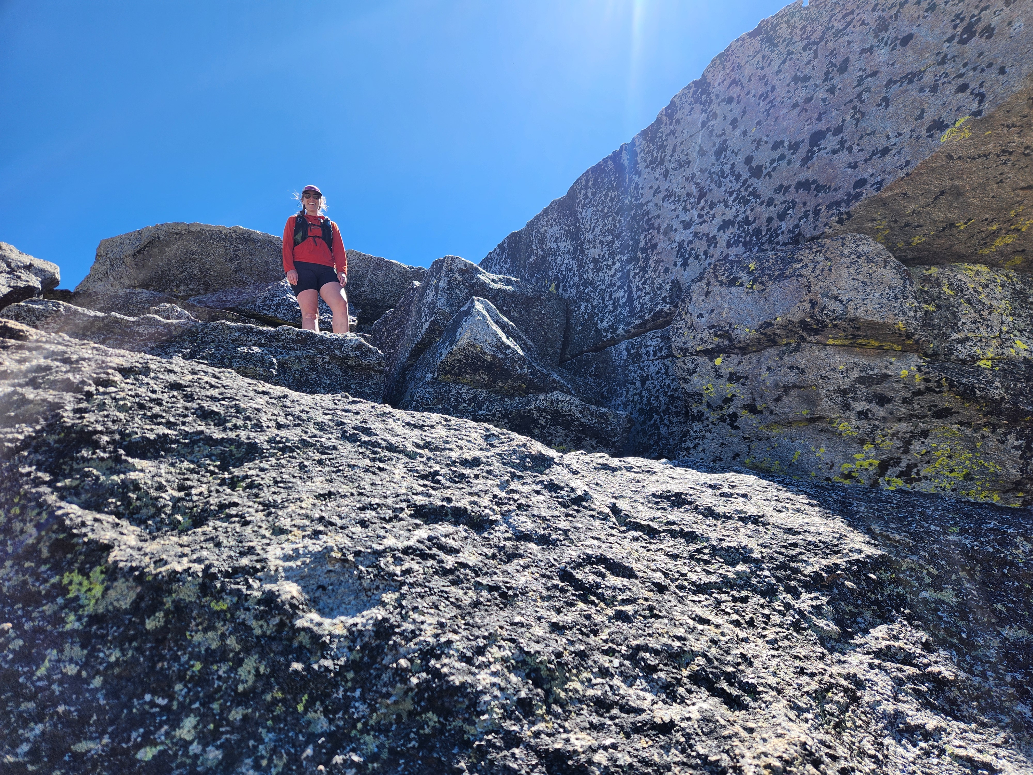
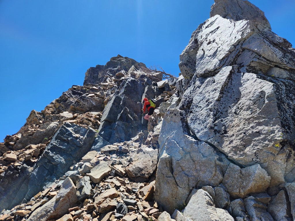
Descending the north side of Pyramid was a bit steep but a very doable talus hop. At the saddle, we had our first crux ahead of us, a blocky cliff band guarding the ridge above. We picked our way through 40-50 feet of class 3/4 scrambling, nothing too crazy, but it was probably the biggest mandatory crux of the day. From there, we had miles of ridge ahead of us. Despite the fact that our route was off trail rock hopping, my ankles didn’t ache covering the uneven terrain. Our spirits were high as we pressed on. How could we feel otherwise with such beautiful views?

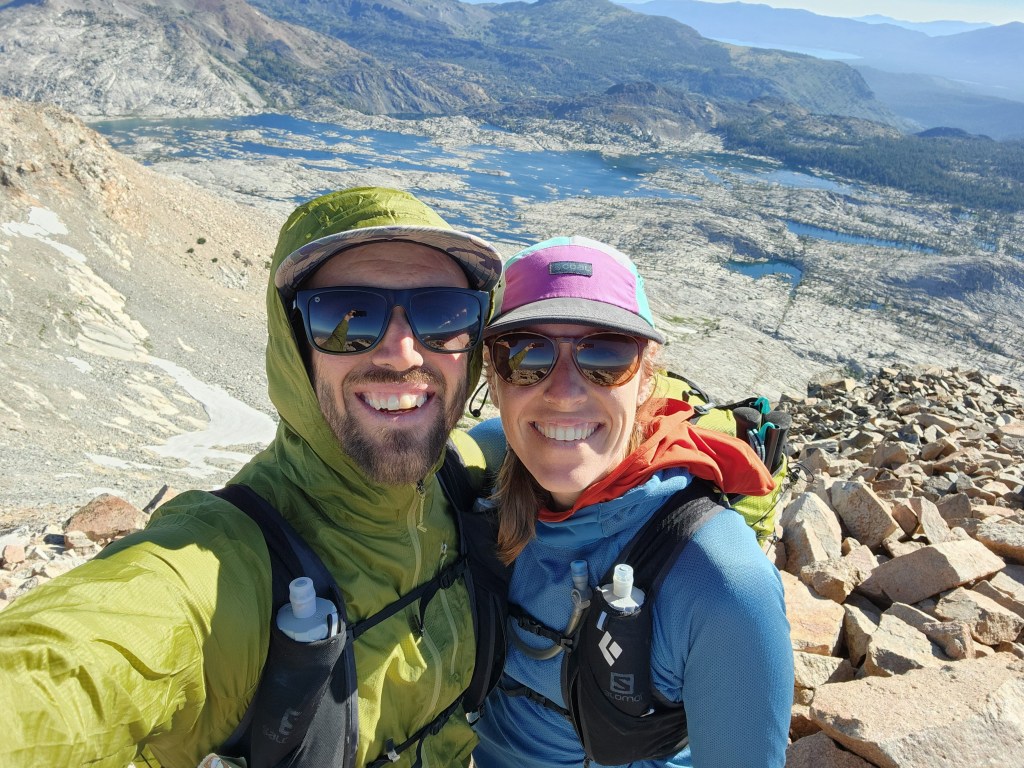
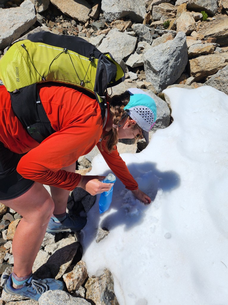
As we ascended the next hump towards Mount Aggasiz, we could hear voices. Maggie and I expected be be alone up here, but we eventually crossed paths with another couple sitting near the ridge top, melting snow for water. They had slept on the summit of Pyramid the night before, choosing to do this route over a couple days. We exchanged pleasantries and continued upwards. Seeing them melt snow tipped us off to do the same. Maggie and I put a few scoops of snow in our water bottles just below Aggasiz.
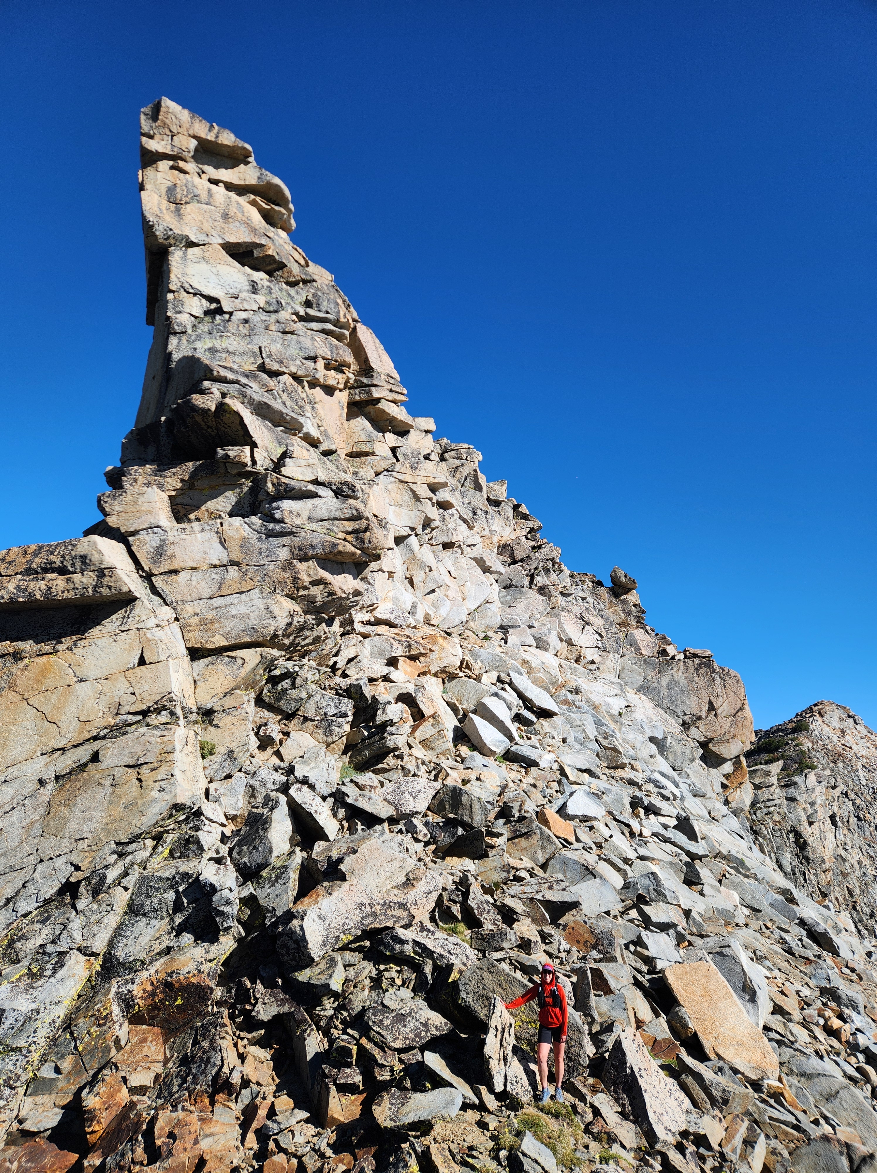
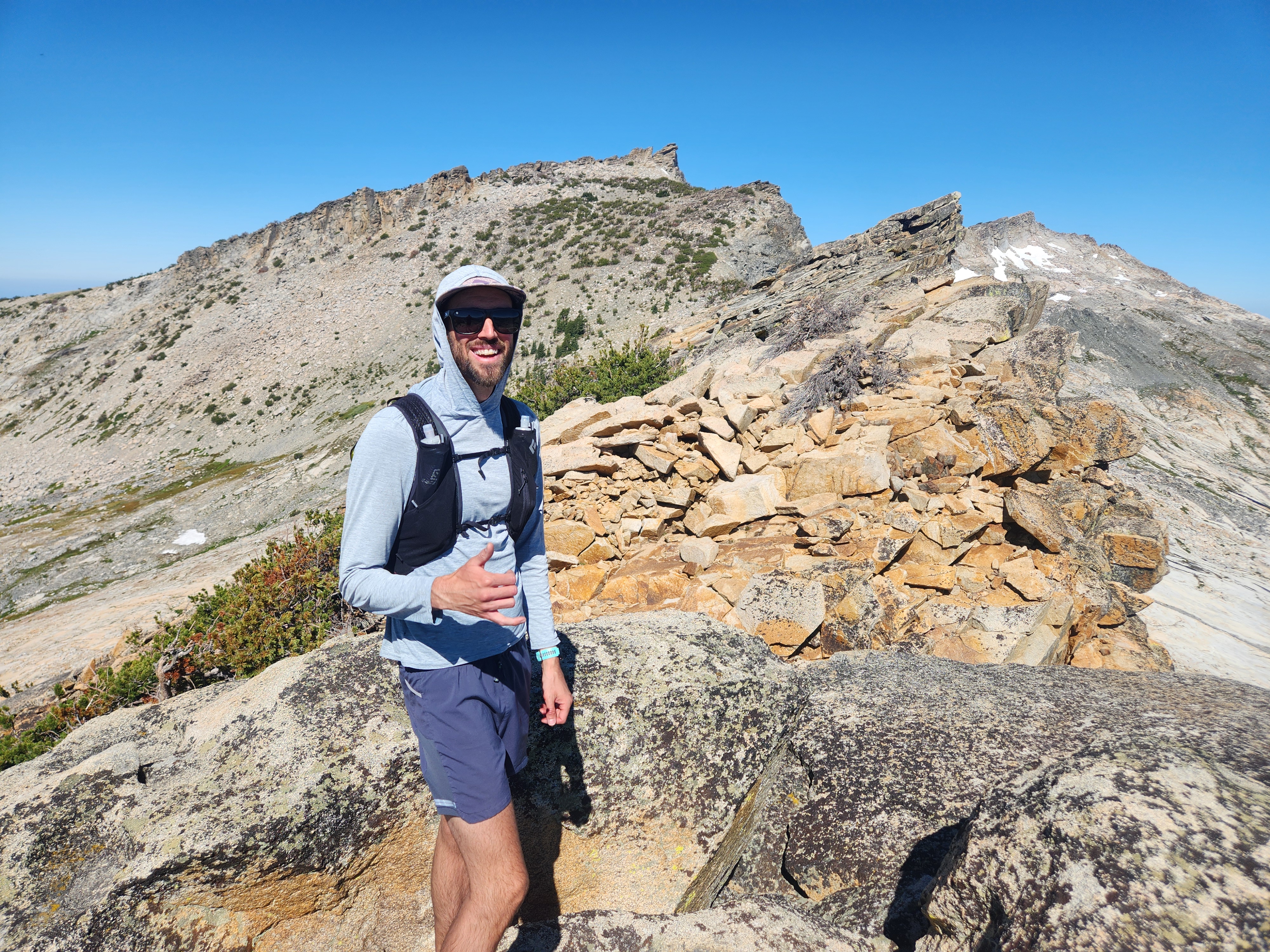
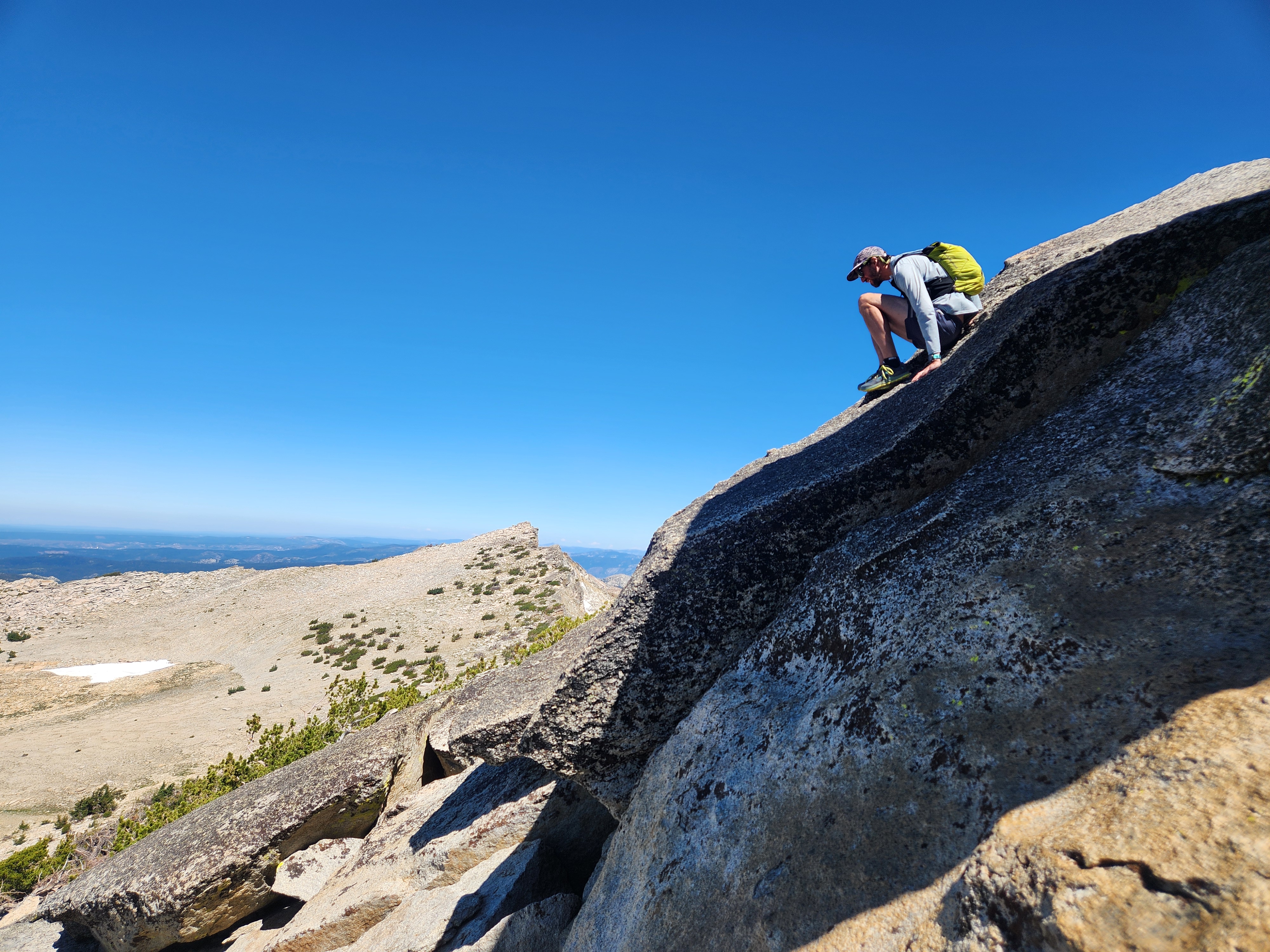
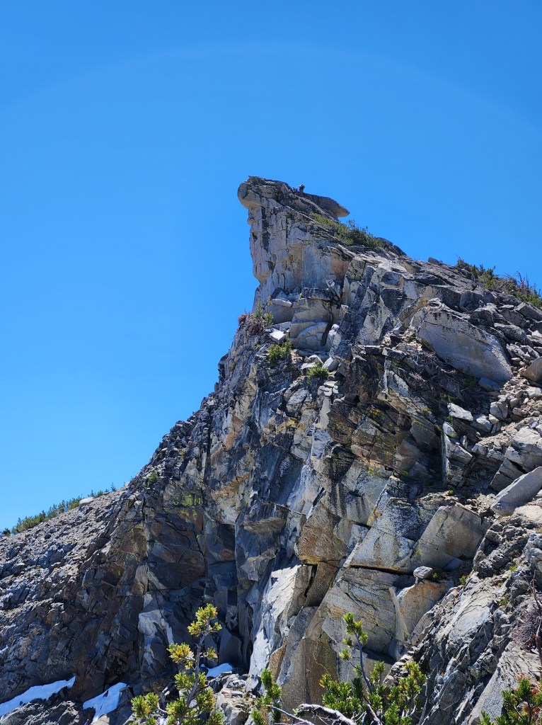
The summit of Aggasiz is a proud granite spike. We couldn’t pass up the opportunity to scramble to the top. Slab, cracks, and boulders took us to the summit. We were once again surprised to have company as a man grunted his way up to join us. He had come from the other direction. Outwardly, he didn’t look like someone who would be scrambling up something like Aggasiz – a big sun hat, chunky boots, large pack and trekking poles – but after talking for a few minutes, we gathered that he was an experienced Sierra explorer. He gave us some good advice for descending Mount Price, the next peak ahead.
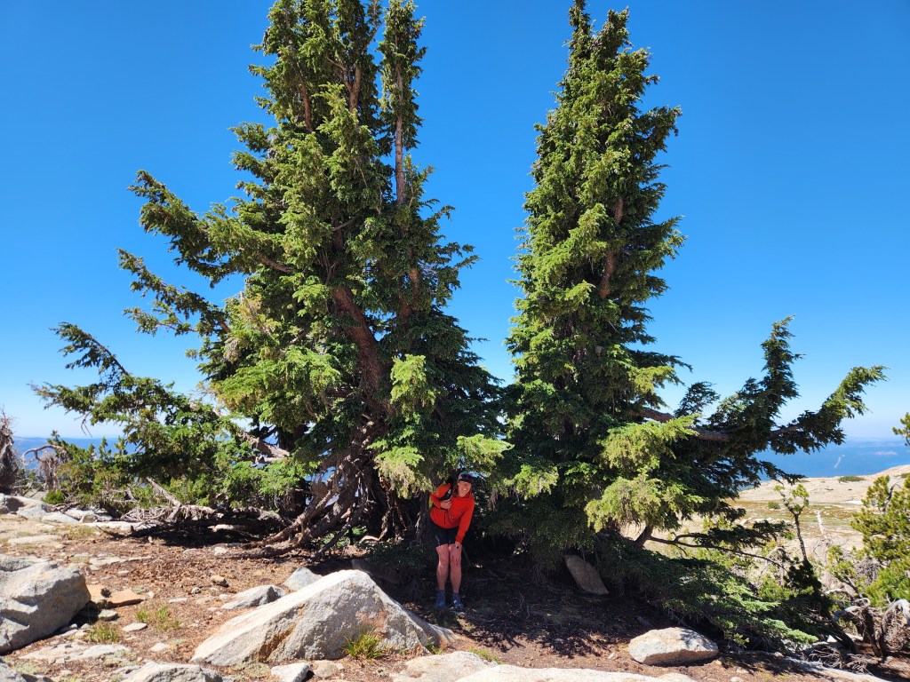
Hunger struck as we continued traversing. We sat in the shade under one of the larger hemlocks, a real treat on this barren ridgeline.
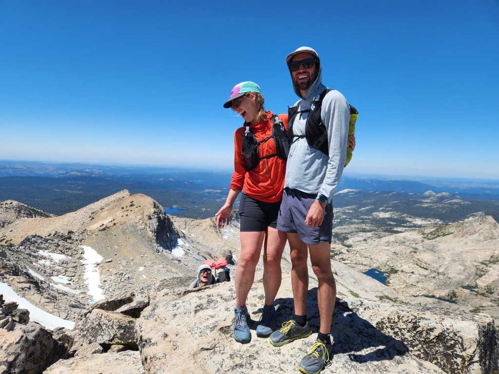
The overnighters passed by as we ate, then we caught up to them on the summit of Price. We talked a bit more on this blocky summit. They had found the route on All Trails (a site which I make a point to avoid). They were a little surprised by the amount of exposure and scrambling involved, but they were rolling with it.
Descending Price was another small crux, a little class 3/4 downclimb. It felt like a piece of cake compared to what we had done on Capitol the week before. Maggie and I were dialed in, helping each other with route finding.

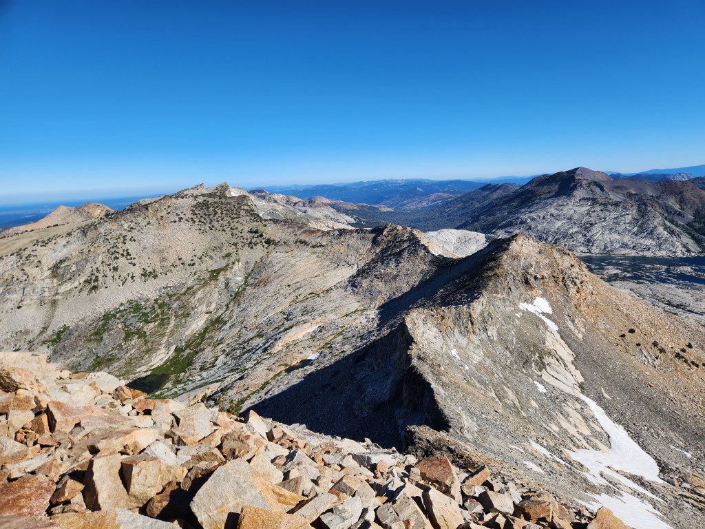
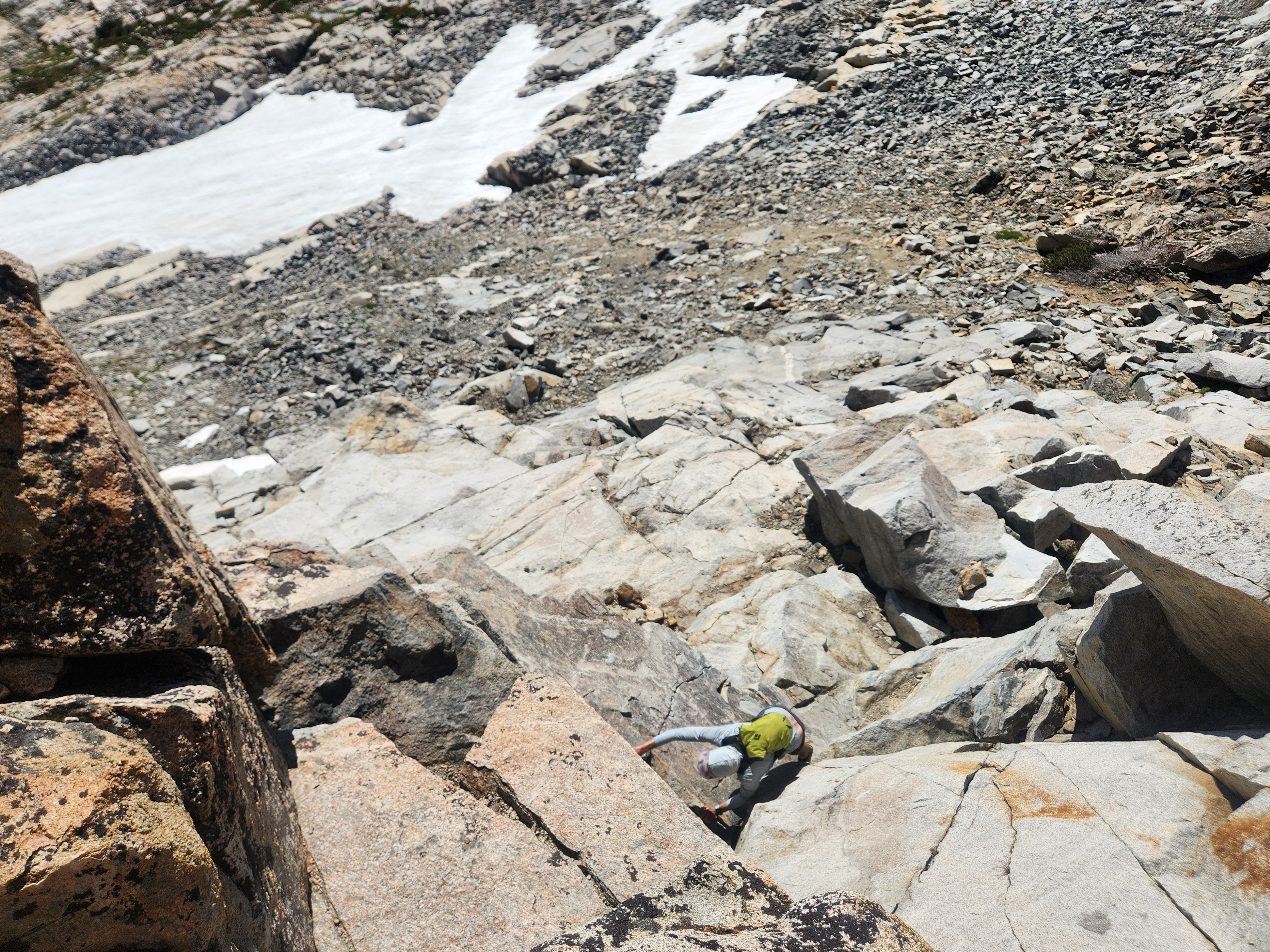
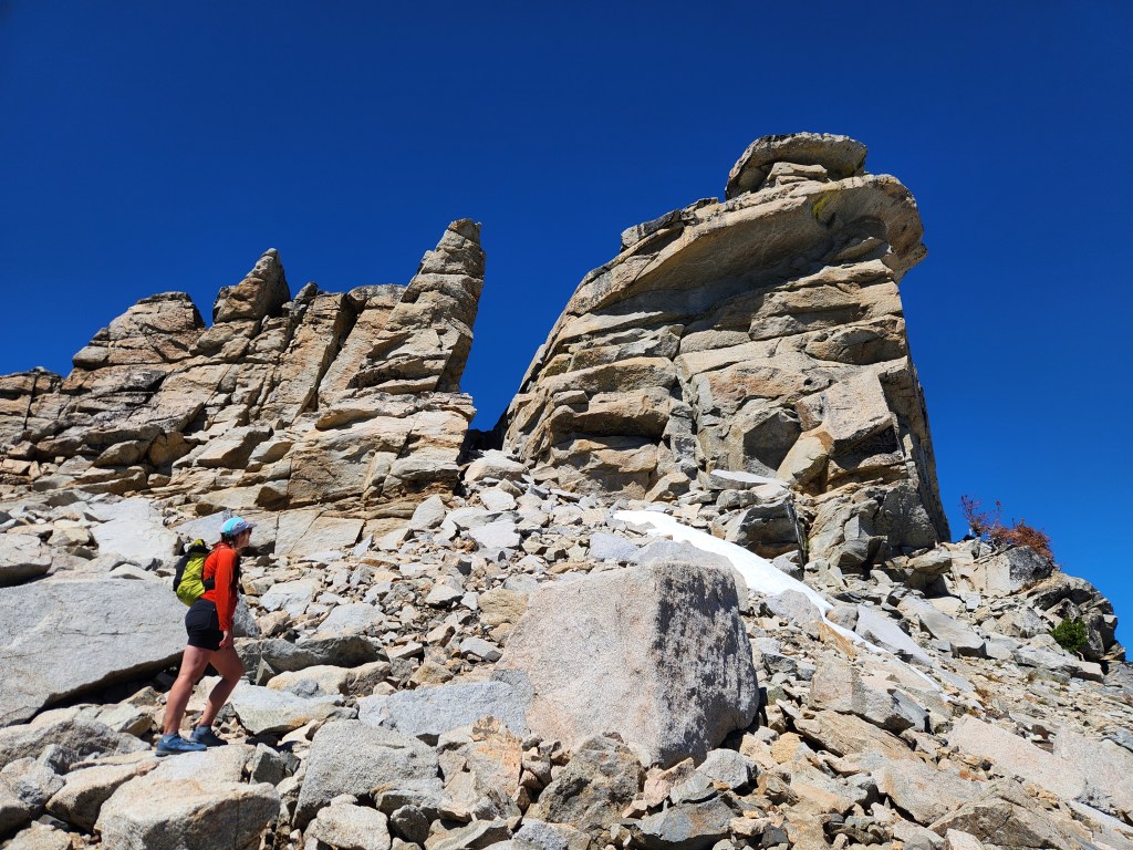
There was scree, talus, and a few cliff bands to navigate on the east slopes or Price. We just had the “insanity slabs” ahead. At first, we were having fun on the slabs. It was kind of nice to walk on solid rock rather than talus. However, most of the slabs were only 20-30 yards long, ending in a short steep face that required traversing around. Instead of a nice straight path, we were forced to zig and zag around every little impasse. About half way down I was starting to feel the insanity creep in. The slabs truly ended at the Mosquito Pass saddle, where we met up with a real trail again. The hard part was done, now we just had miles of easy hiking.

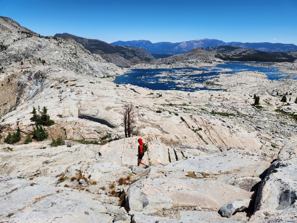

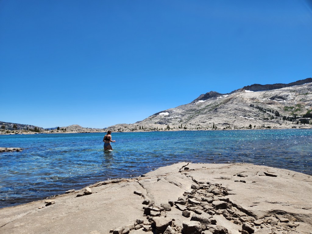
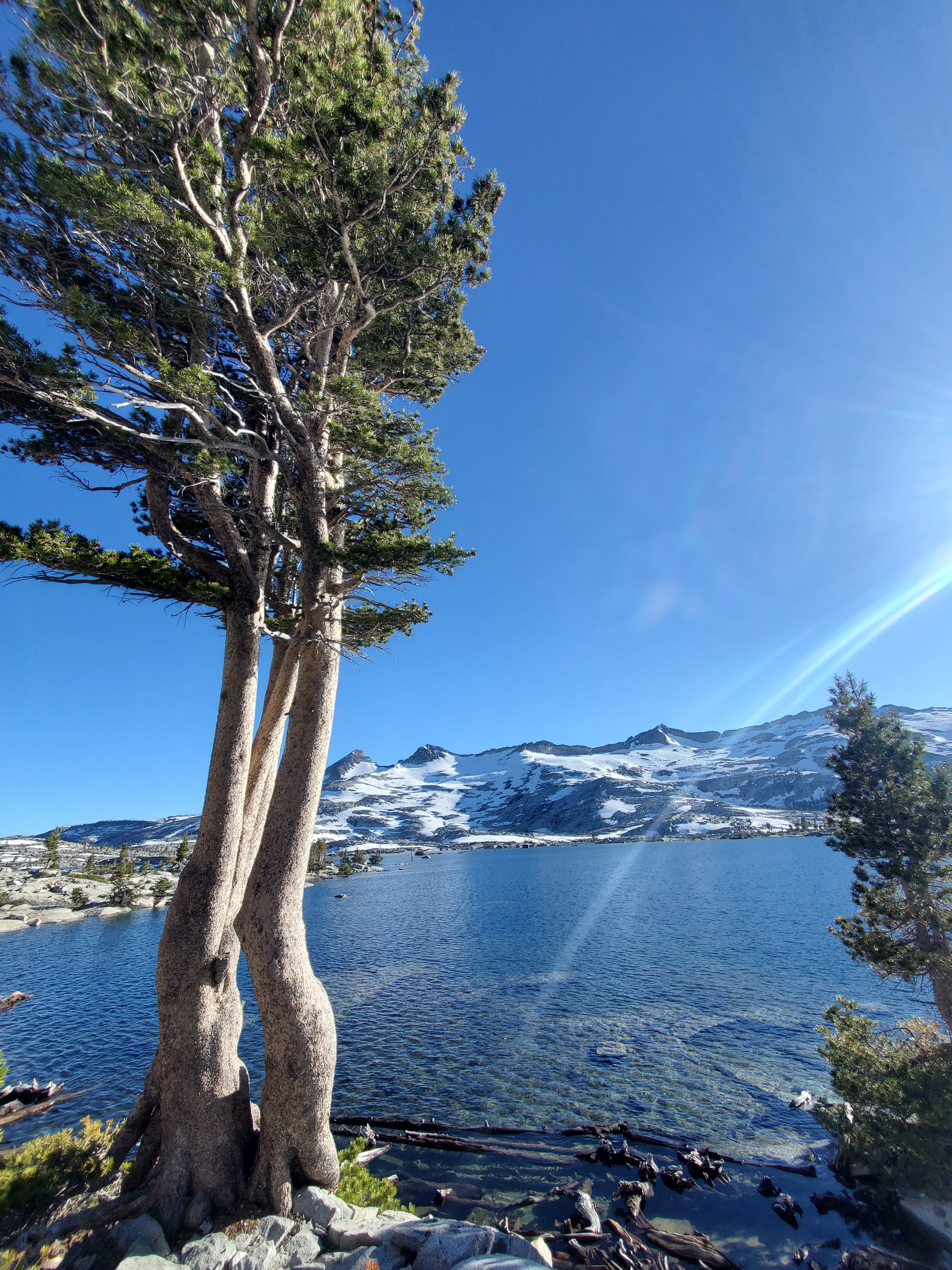
Maggie and I cruised down to Lake Aloha. We were starting to feel the miles, the water looked inviting, plus we needed to top off our water bottles. Time for a lake break, as if we needed an excuse. The water was shallow and warmer than expected, but refreshing nonetheless. Looking around, you might have thought we were at some alpine beach party. The shore was dotted with large tents, camp chairs, and people floating on inner tubes. Who could blame them, it’s hard to imagine a more picturesque place to swim.
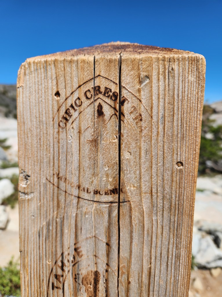
Clothes back on, we were back on trail. It was a short distance to connect with the PCT. It felt like returning to our second home. Having been here before made this brief section of trail feel special. Small details were reigniting distant memories from that day in 2022. The people we saw. The puddles. The frogs. The small ups and downs.
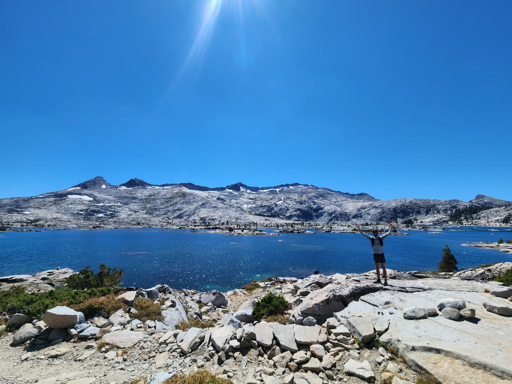
I was looking across Lake Aloha, hoping to recreate one of my favorite pictures from the PCT. I didn’t want to disturb some people hanging out on the lake shore, but I found the spot. A small group of lodgepole pines standing watch. Some saplings had sprouted in the last three years.
Our time on the PCT was over too soon. We turned off towards lake of the woods. I was starting to feel tired and uninterested in hiking. Partly because we were just in the woods again, somewhat tame views compared to the epic scenery we had earlier. More so, I felt like I’m getting soft, too comfortable in my day to day life working and relaxing at home. My appetite for all day adventures has been replaced with longing for lounging on the couch, at least for half the day. I wish I could channel that hardened thru hiker from three years ago who proudly proclaimed to be comfortable with discomfort…
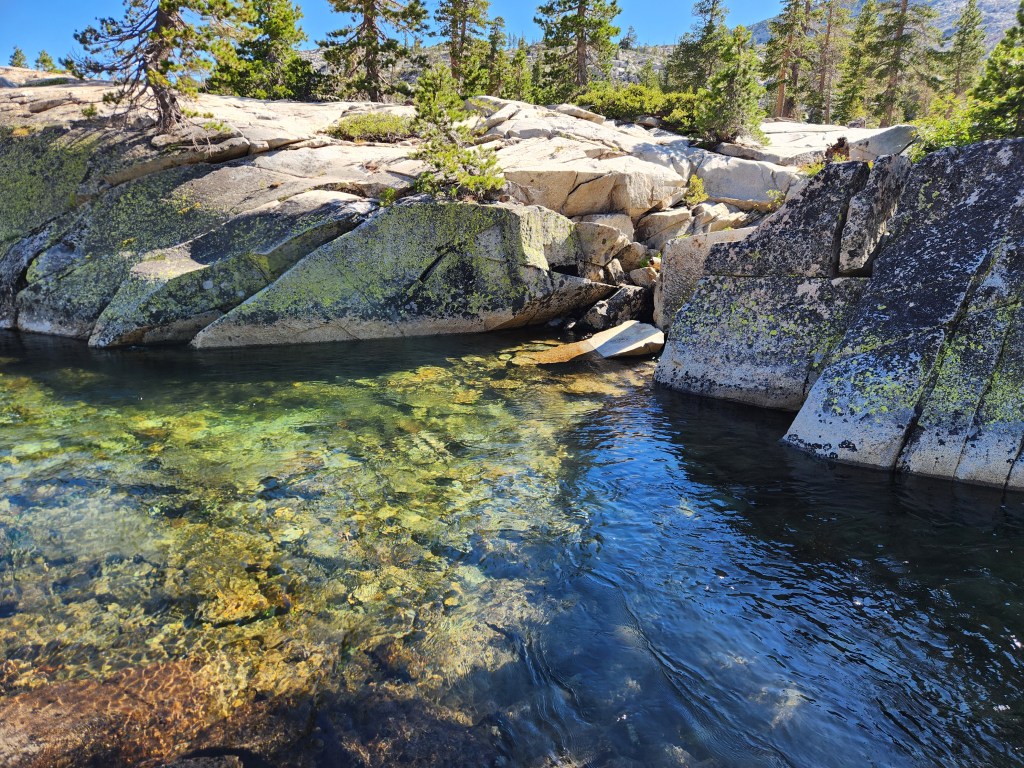
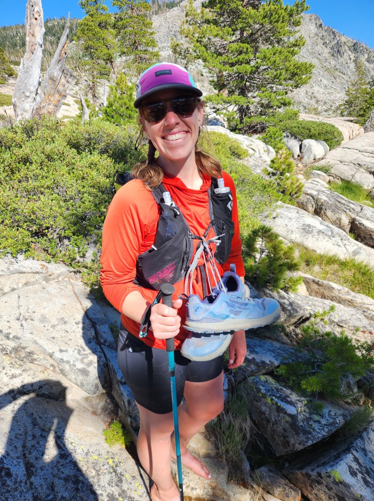
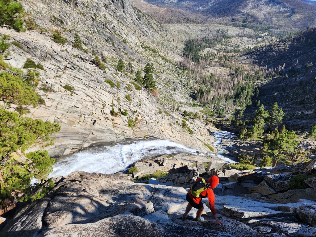
Maggie and I rounded Lake of the Woods and passed through some more scant forest the Desolation Wilderness is known for. At Pyramid Creek, we found our last crux of the day – a significant water crossing. Wanting to avoid wet shoes in our luggage the next day, we chose to take our shoes off. Maggie thankfully brought trekking poles and she graciously shared one with me. There was a stiff but stable current up to our thighs. We both made it across without a problem, but this was a classic Sierra water crossing with little room for error.
The final stretch of trail down to HWY 50 was a primitive trail. We had some trouble route finding and ended up scampering down some ledges and boulders next to Horsetail Falls. At one point Maggie was crossing a blank slab with a steep drop below. It looked to me like she could fall into the massive waterfall below. I kind of freaked out and asked her to come back.
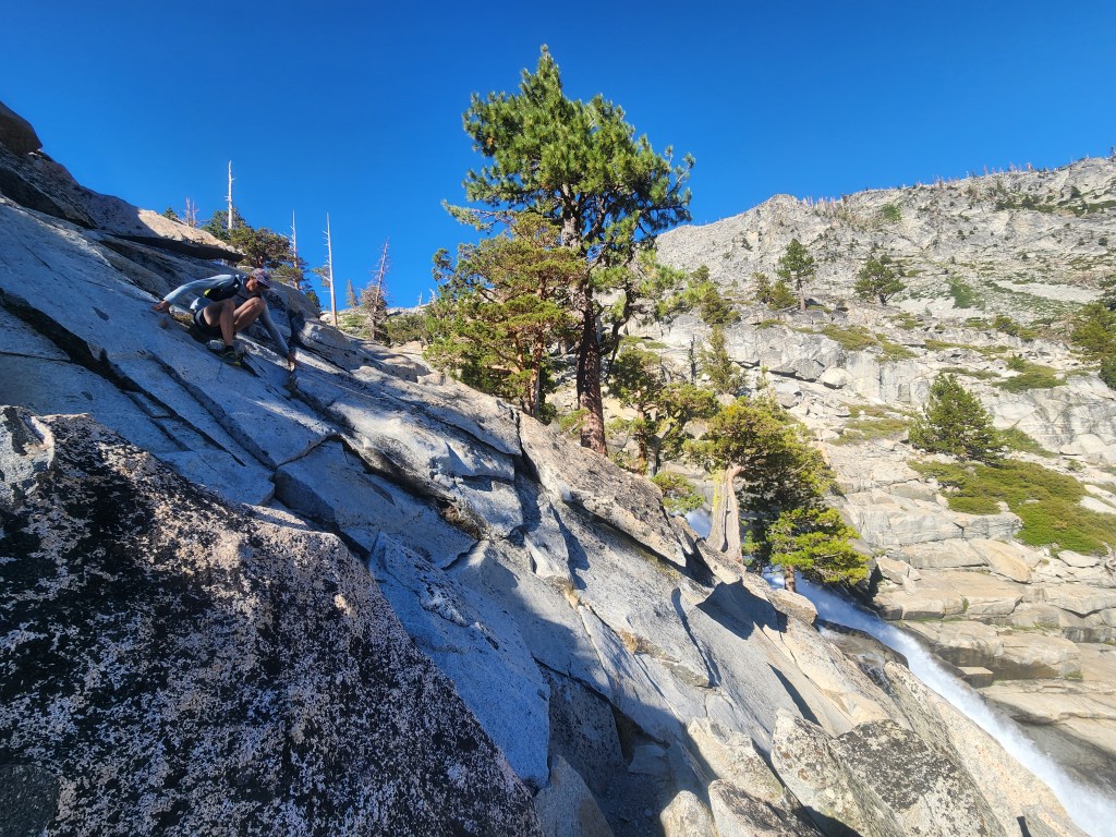
This was definitely not the right way to go. We backtracked a little, scrambling up towards where the trail ought to be. Back on more level-ish ground, it was smooth sailing from there. At least until we got to the highway…
Our car was 3/4ths of a mile down US50. Maggie and I thought through our options for a minute – try to hitch or walk down the side of the somewhat-busy highway. Walking seemed simpler, but little did we know what we were in for.
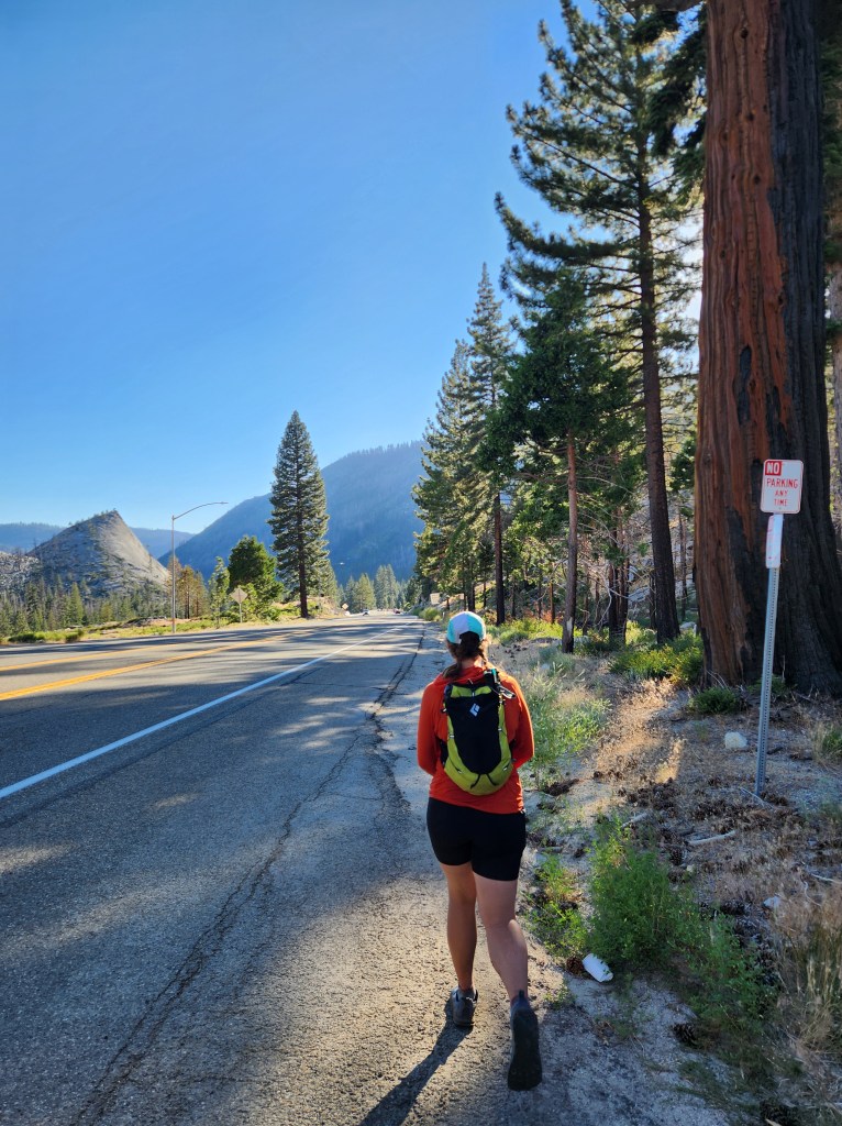
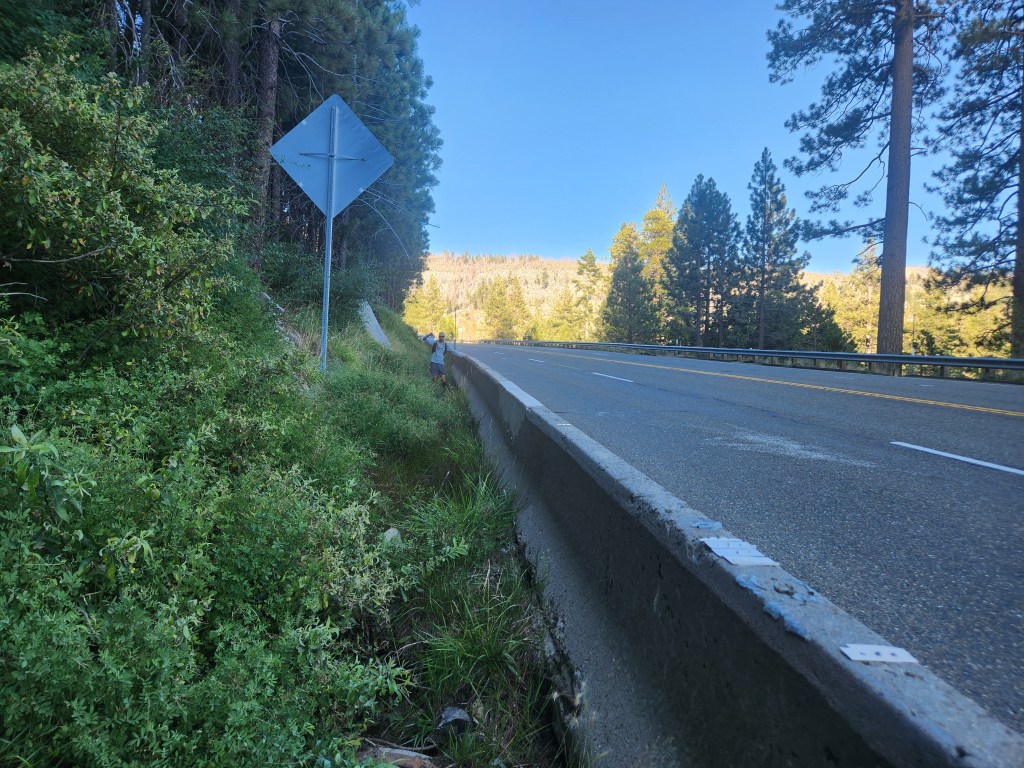
There was a nice wide shoulder to start, although that didn’t last long. We were confined to a narrow path between the concrete barrier and the hill side. We were happy to have a little protection from the speeding traffic until we were trapped. The ditch next to the road filled in with mucky run off. We tried our best to keep our feet dry with limited success. Twelve hours after setting off, this was truly an awful way to end the day. As we got close to the car, we scurried across the highway through a gap in the traffic to finally escape the nasty culvert. We hardly had time to rest back at the car. We had to drive to Reno and catch early flights the next morning, which made the day feel especially mega…
Maggie and I were stoked we made the Crystal Range Traverse happen, even though we were both pretty worn out after this adventure. When we hiked the PCT, there were so many side quests we were inspired to do, so it felt really cool to come back and experience this one. The scrambling, ridge romping, and overwhelming beauty of this route make it well worth doing, just avoid the road walk…
