
Day 93 – 9 miles/1340
In order to avoid any potential issues with stealth camping in the Chester City Park, we packed up just before 7 am. Most restaurants in town were closed Mon/Tue so we went to the Kopper Kettle, open 7 days a week for breakfast, lunch, and dinner. The food was decent, anything cooked by someone else is pretty much guaranteed to taste good to a hiker. We walked to the coffee shop so Maggie could get good coffee, and I worked on the blog for a couple hours. We wandered back to the grocery store for resupply shopping. Maggie and I ate lunch at a picnic table next to an RV Park. A man saw us and offered a rotisserie chicken, which was tempting, but I respectfully declined. Back on the main drag, we hitched out of town with only a few minutes of holding our thumbs out. Mike the bike guy from Bend, OR has a cabin in the area and is always happy to help out hikers. Back at the trailhead, Drive Thru (our driver into town) was giving out cold drinks. She gave us each a beer to go, a lovely little send off from a lovely little town.
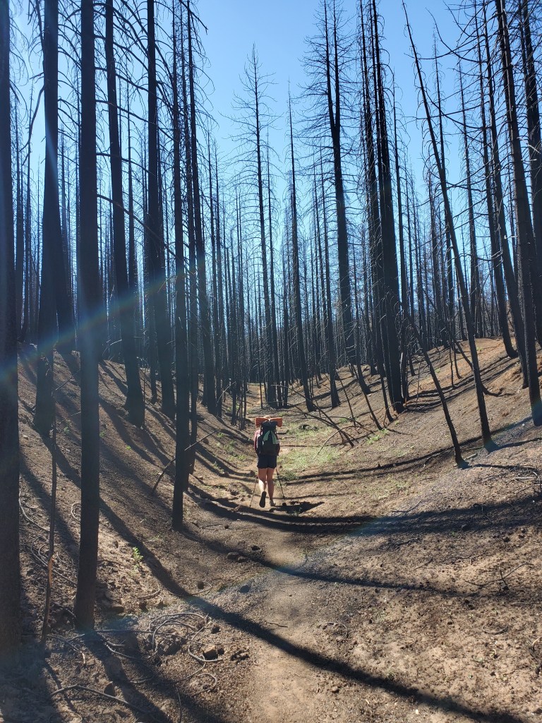
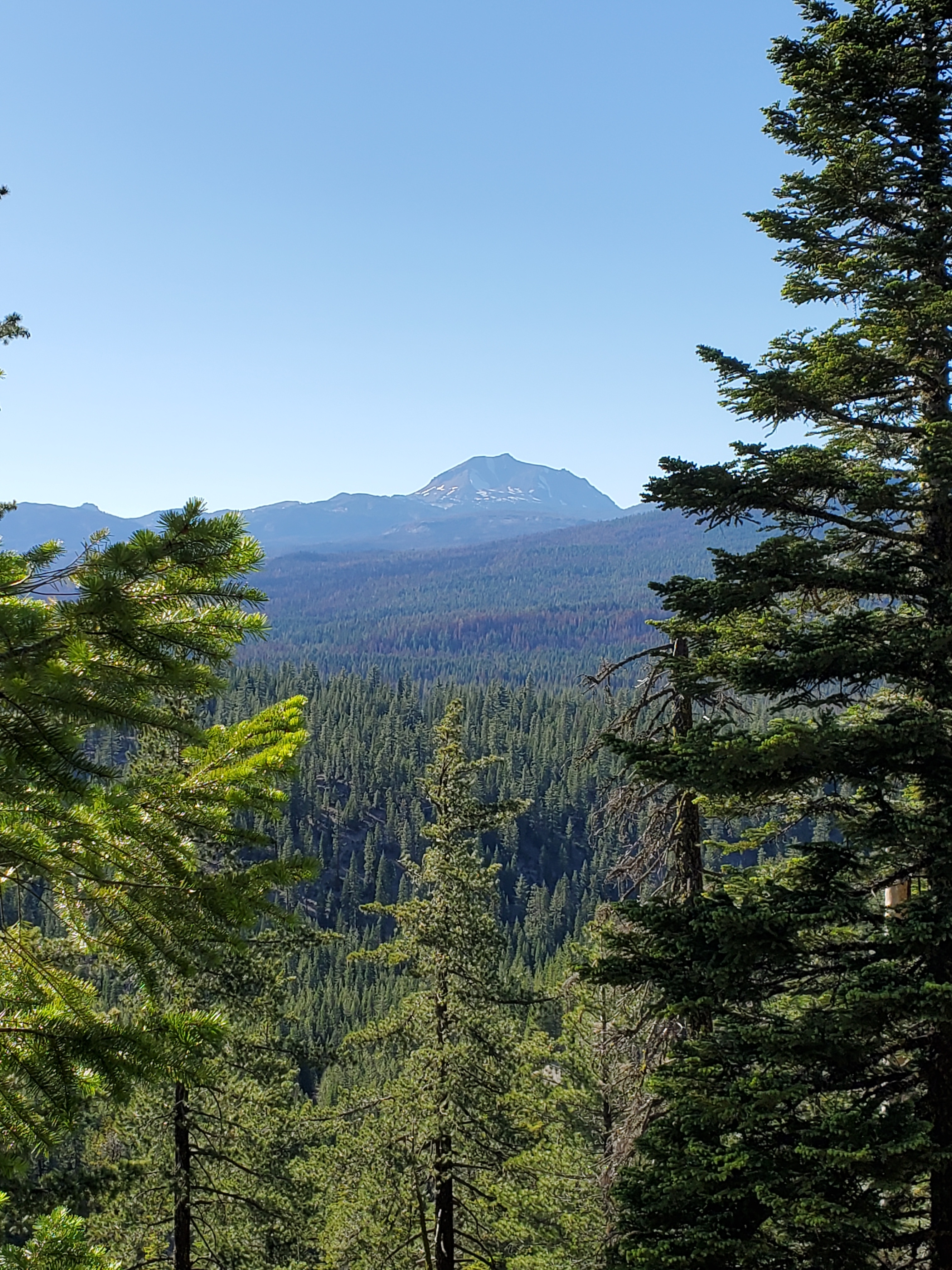
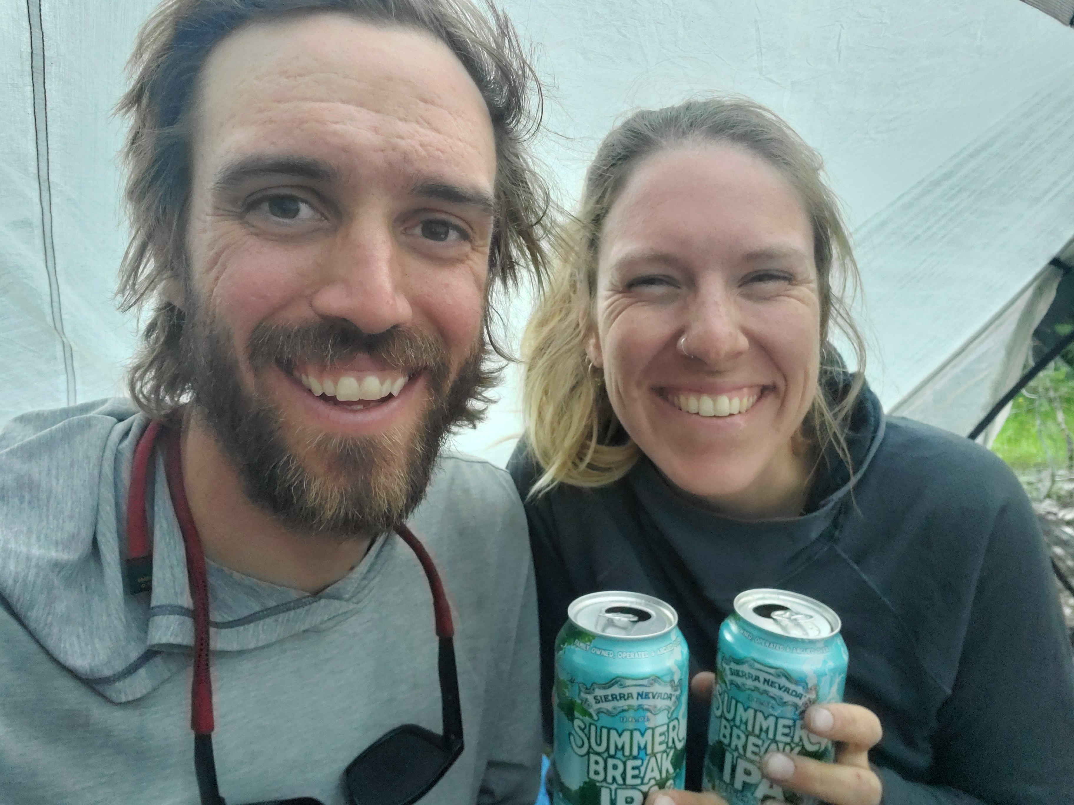
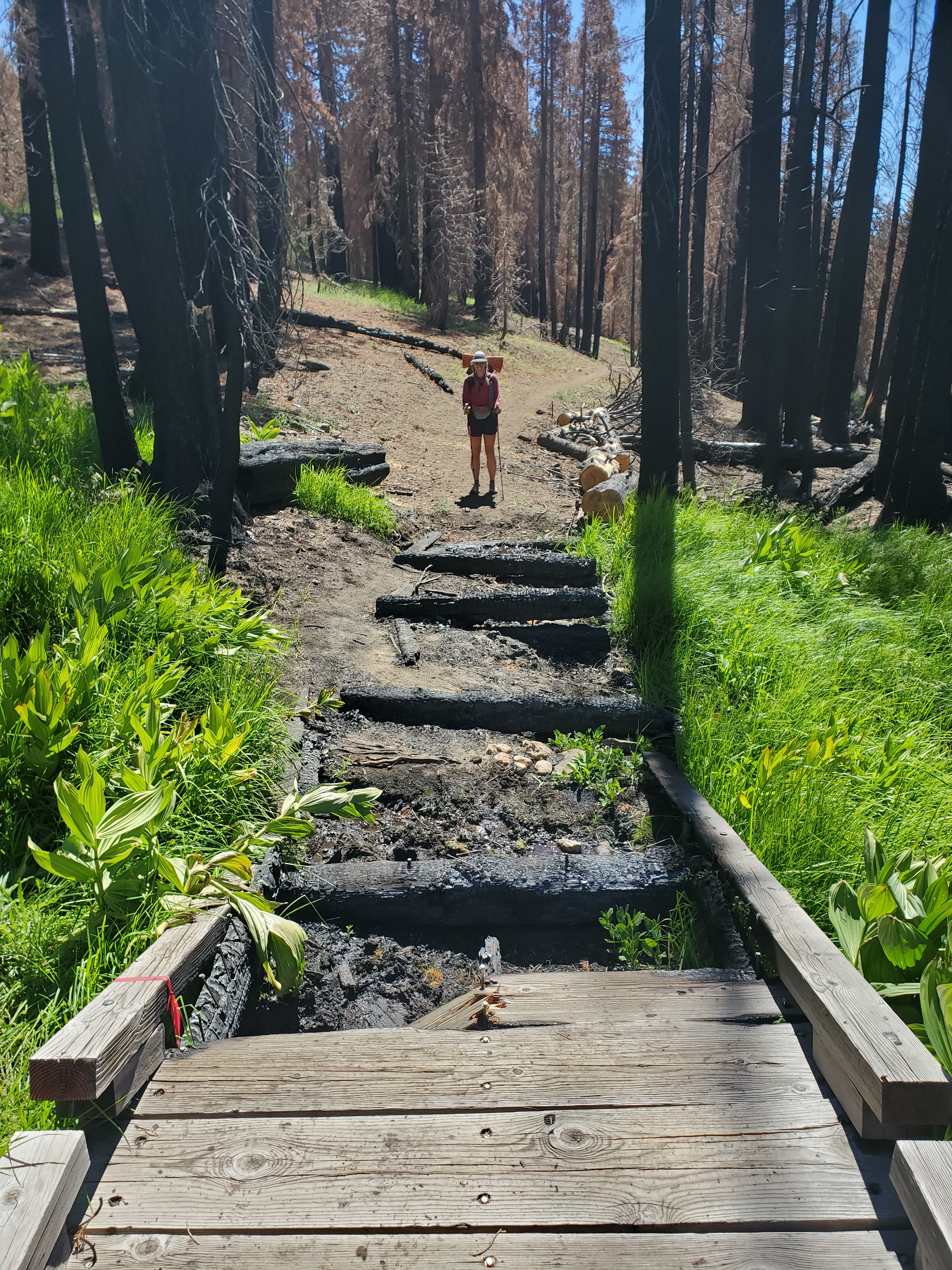
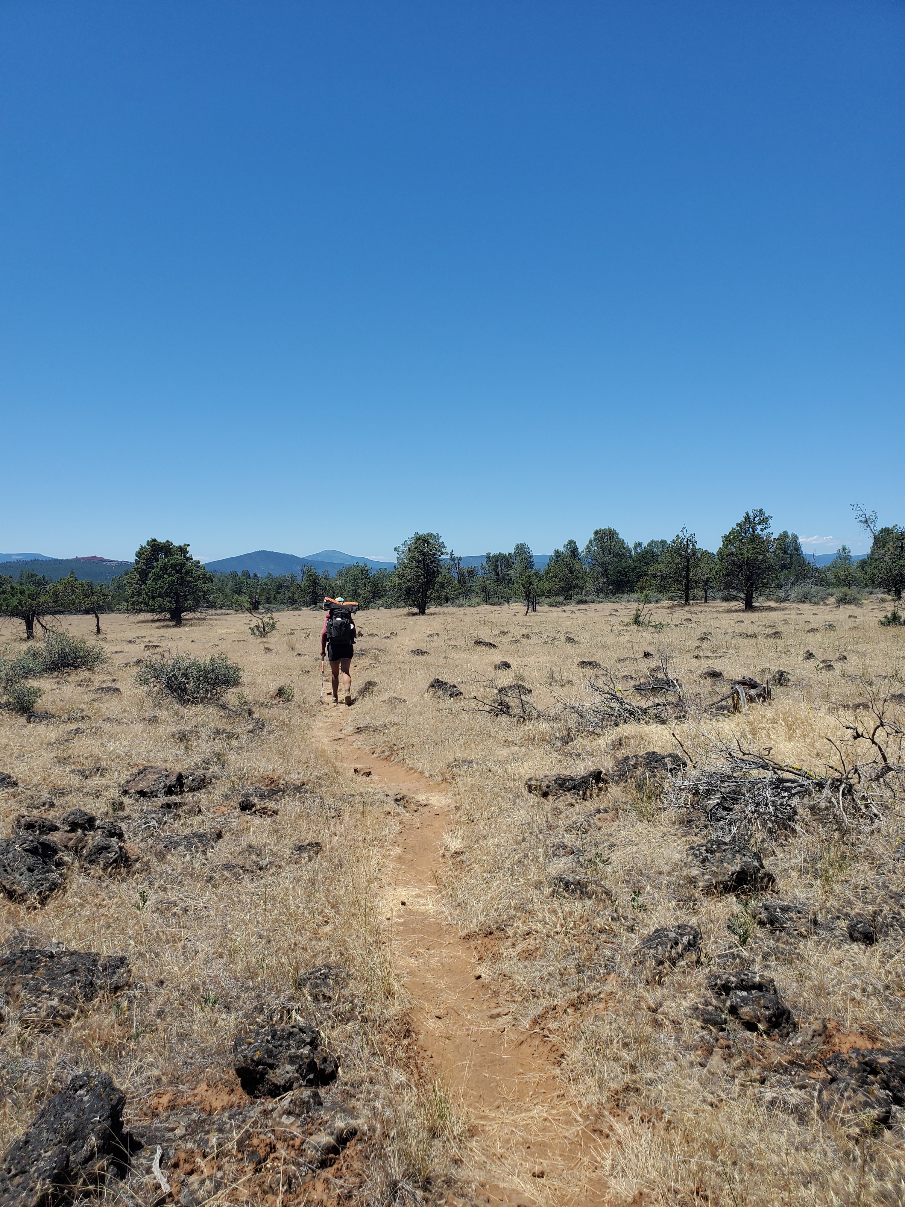
We hiked five miles through burn, collecting a fresh layer of soot and dust on our clean legs. The burn temporarily ended and we passed through four miles in the living forest, a pleasant reprieve from the bleak burn. There were a few nice views of Lassen Peak between the trees. We camped by the N Fork of the Feather River, the same water we relaxed in when we were in Belden. I threw our beers in my bug net and chilled them in the water while we set up camp. We sipped our beverages in happiness, trying to avoid negative thoughts of the day that lay ahead

Day 94 – 28 miles/1368
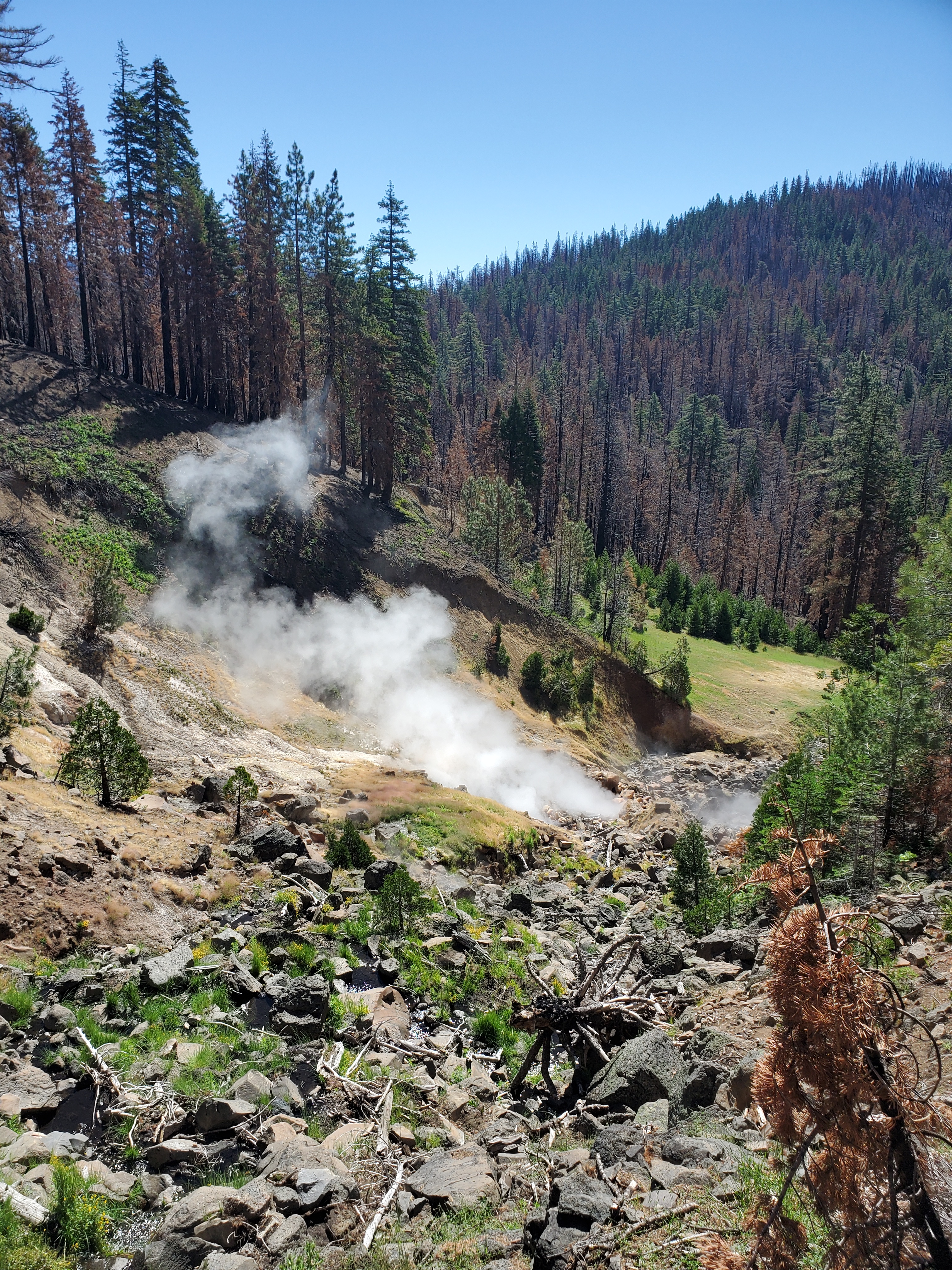
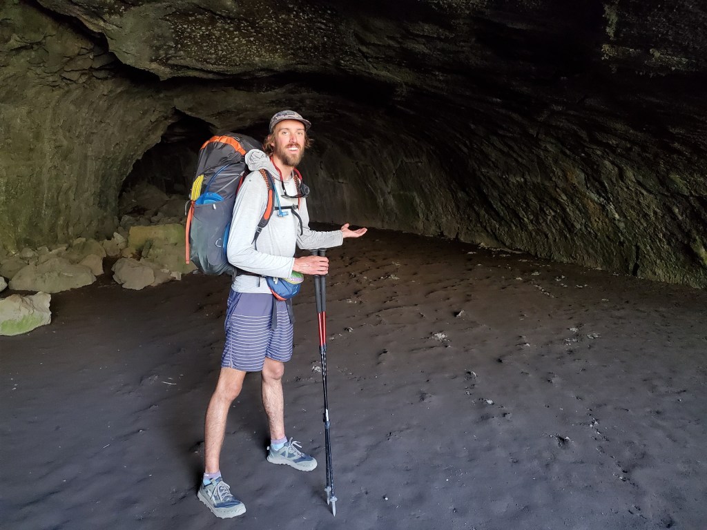
It was a cold morning down by the river. We had to put on warm layers we hadn’t worn in weeks. Maggie and I got moving at 6:50. We quickly returned to burn scar, and that was pretty much the story all day. We entered Lassen National Park, which was almost entire burned in a recent wildfire. We did a short side trail to a “geyser”. This thermal vent boiling water made for a neat little nature break, watching the hot vapor roil in spiraling clouds up through the air.

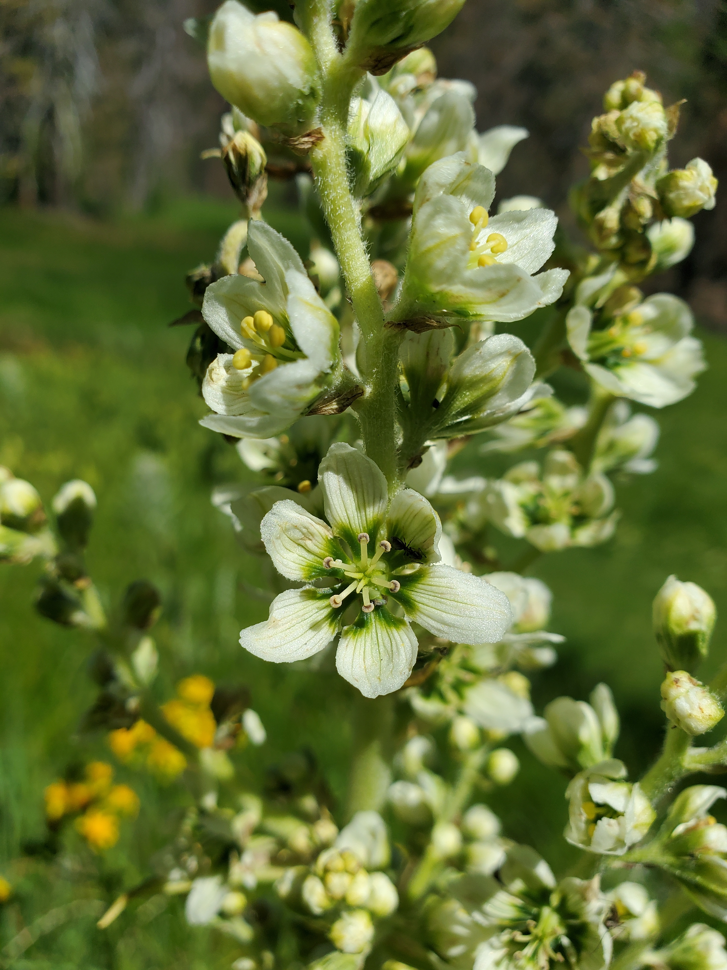
Back on the trail, we walked through very drab charred standing logs, save a few wet meadows in the low drainages. We saw Corn Lily (Veratrum Califorincum) blooming in these wet meadows, a plant common throughout the Rockies as well. I was puzzled for a long time by corn lily – it looks like good eating for herbiverous critters, but I’ve never seen any nibbles on the lucious green leaves. Perhaps it doesn’t come as a surprise that corn lily is toxic, deterring herbivory. Corn lily contains a compound called cyclopamine, which disrupts symmetric growth in embryos. If a pregnant mammal ingests corn lily, it will give birth to a cyclops, which rarely live longer than a few minutes after being born. If you want some nightmare fuel, go ahead and do some further internet searching, but otherwise, I would recommend just enjoying the pretty flowers.
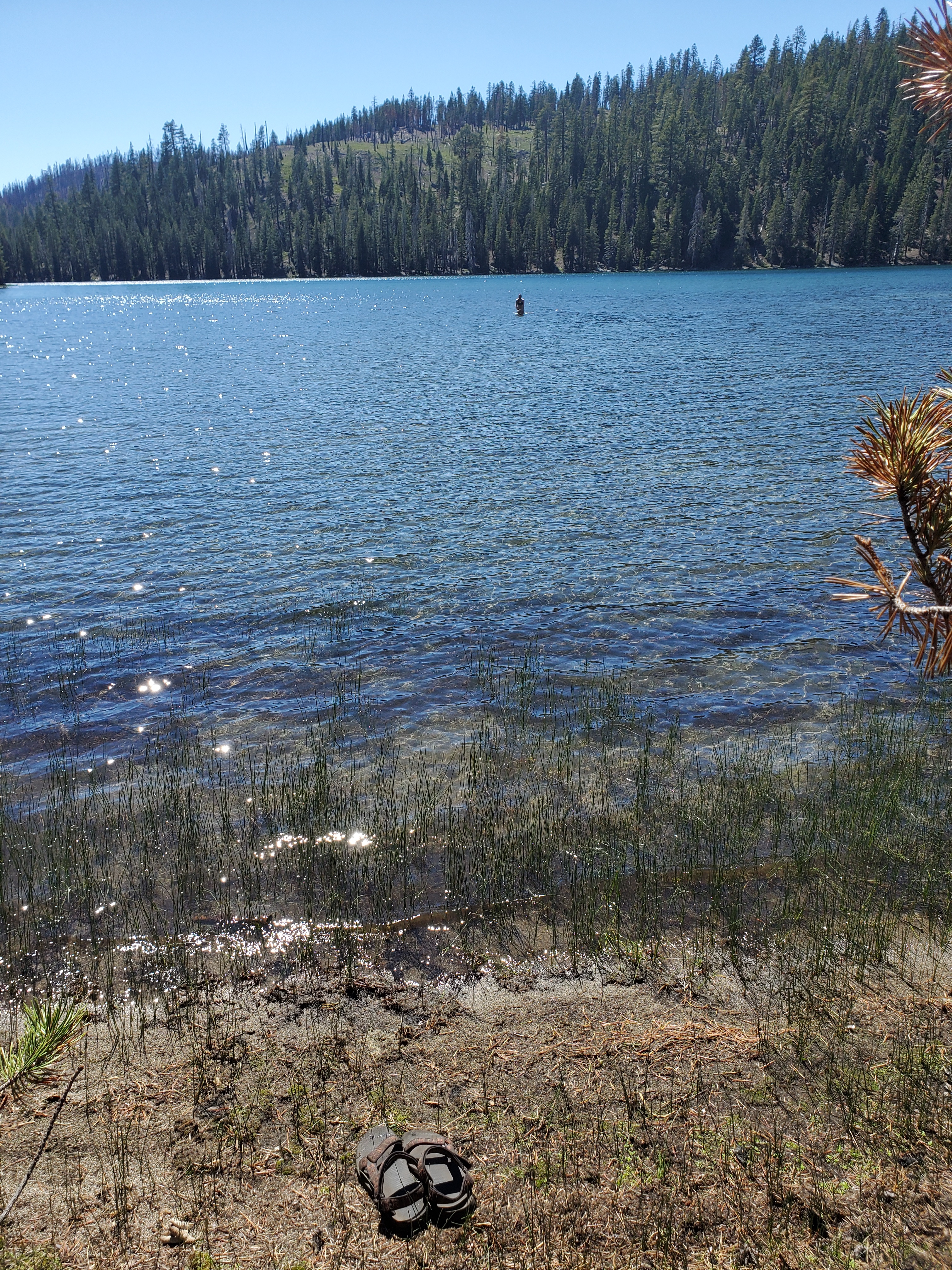
We stopped for lunch at a campground picnic table, where we met Hustle. We compared food, as hikers do. While our lunches don’t vary too much, Hustle does themes throughout the week – one day is sausage and cheese, trail mix the next. Curious strategy from our perspective. We continued on through more burn. Many miles of burn. The monotonous, dismal scenery was a test for sure. Our situation was exacerbated by scorching sunshine landing freely on our backs between the burnt trees. We came upon lower Twin Lake, and we couldn’t resist the water. A small spot in the shade of a handful of live lodgepole pines was our oasis for an hour. We collected some water, and Maggie and I both jumped in the lake. This was a small redeeming moment for the day, wading out through the warm shallows to the cool deeper water 100 yards from the shore.
We begrudgingly packed up and hiked through more burn. The hours dragged on. Aside from wanting to get out of the burn scar, we had to get through Lassen NP where bear canisters are required. We made it to the park boundary after hiking 25 miles.
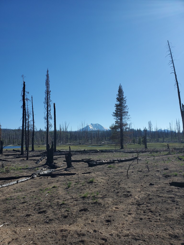
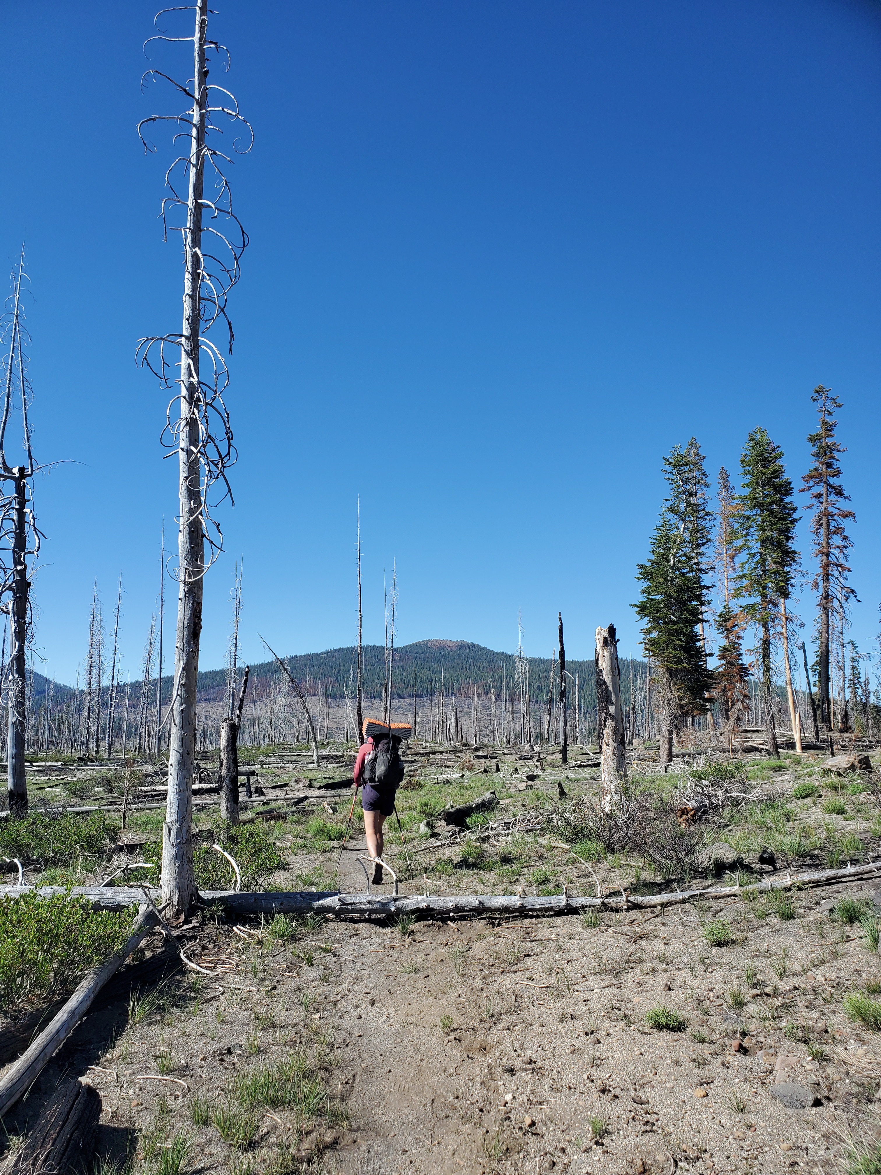
The hour was getting late, but we needed to carry on 3 more miles to access water. We hiked till sunset, leaving the burn scar behind us and found rolling hills of manzanita. The trees returned for the final mile, and we set up camp in a pine plantation near Hat Creek. This was perhaps one of my least favorite days so far. We got to bed late, spent from a long day in the heat.
Day 95 – 25 miles/1393
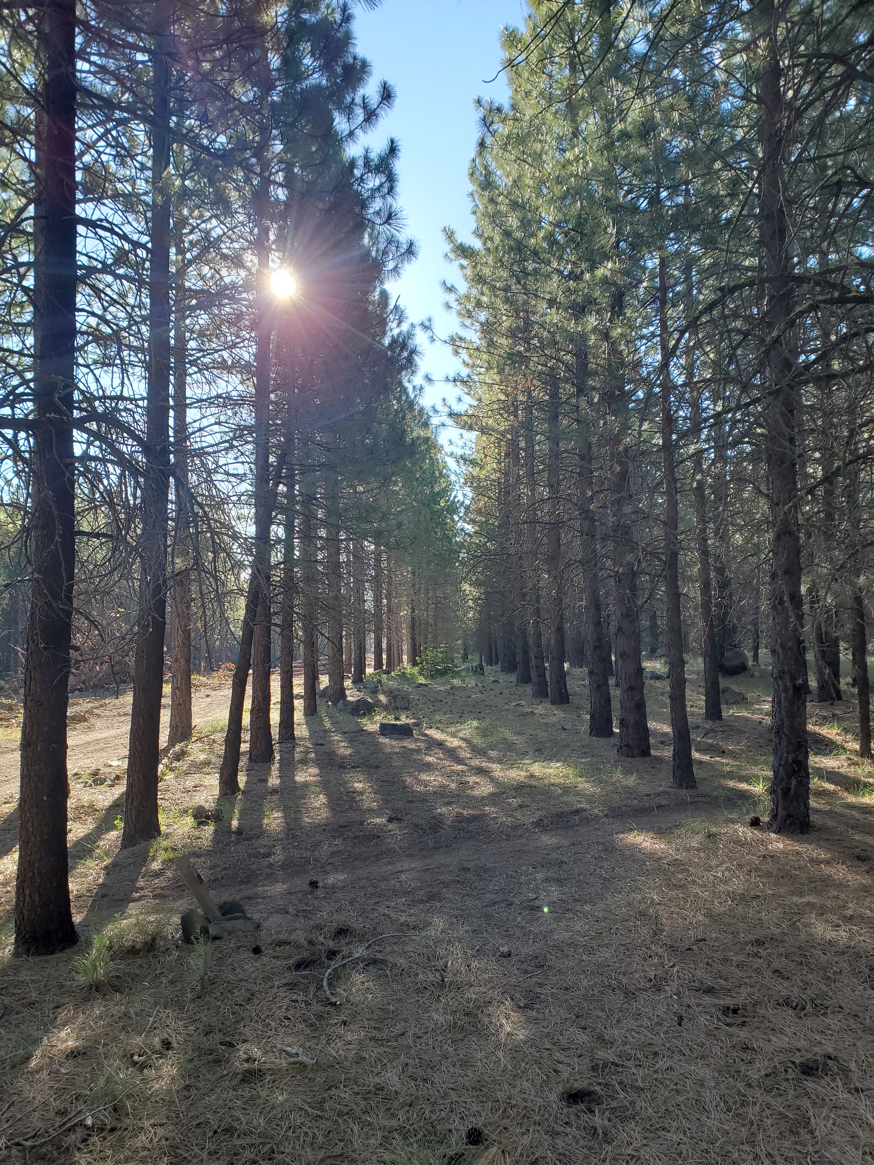
Maggie and I slept in a little bit, and got moving at 8am. It was 8.5 easy miles to Old Station. The trail roughly followed Hat Creek through pines, firs, and incensce-cedars with dry understory of sage brush and some wild flowers. We hiked fast and got to the gas station in ~2.5 hours.
We bought some food to supplement lunch – potato salad, pickles, fruit, smoothie, and soda. Eating lunch out back, we chatted with Dine n’ Dash. He had hiked 44 miles the day before. Also completed the CDT, so I picked his brain on that trail. I booked a hotel room in Burney, our next town stop. We sat in the shade for nearly 3 hours and finally decided to get moving again. It was less than a mile to Subway Caves. Just before the caves, we found a cooler stocked with fruit and cold drinks, trail magic from the parents of our friend Hundee!

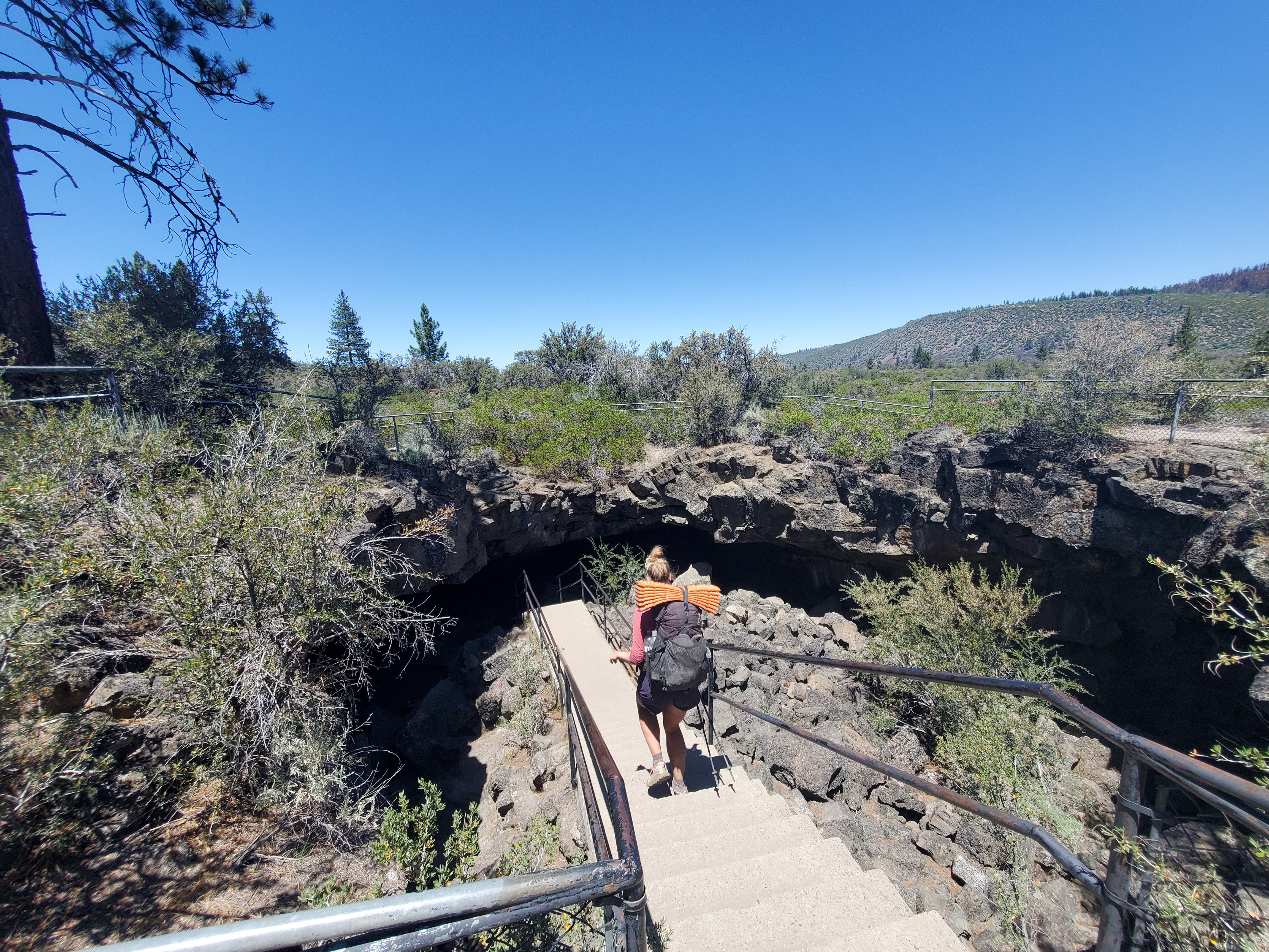
We descended down into the tubes… This was a very cool lava tube, quite literally – the temperature stays a constant 60°F. We put on our headlamps and explored the caverns for a little while. Dine n’ Dash showed up behind us, playing his ukulele in the echoing basalt chambers. We were back in trail at 2pm, hiking up to Hat Creek Rim in the heat of the day. Thankfully, our next stop was only 2.5 miles away, the Trail Angel Café.
This guy has posted up in his RV to provide water, snacks, and a chairs for hikers before setting off on the exposed rim hike. The trail magic was quite nice and low pressure. We talked about New Mexico, where our trail angel had hunkered down for the pandemic.

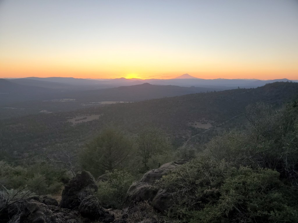
Feeling the need to get some miles behind us, we set off again around 4pm. We wanted to push another 13 miles, and so we pushed. We hiked as fast as possible across the rim. It was warm, but cooling off and breezy. We took a break under some tall pines around 6:30, satiating some pre-dinner hunger. We hiked into an epic Mt. Shasta sunset, which was pretty enough for us to stop and take pictures.
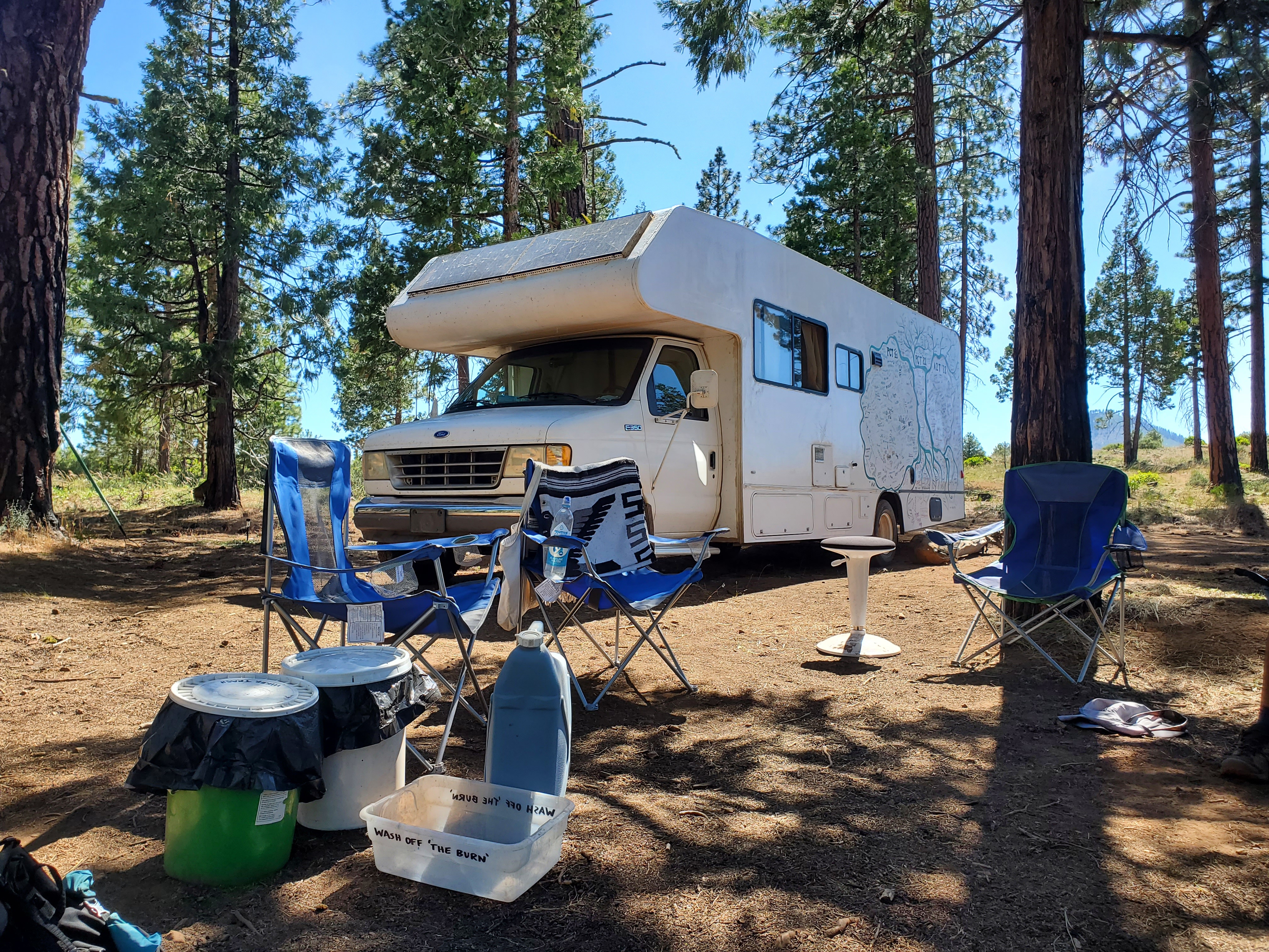
We ended the day around 9pm at Cache 22 (a water cache on forest road 22). There were loads of tents, and we struggled to find a decent spot. After set up, getting water, and eating dinner, we were falling asleep at 10:30. Another late night, but we were set up for success to get to Burney the next day.
Day 96 – 18 miles/1411
With the late bed time, we slept in till 6:30, and got moving at 8:30. We were last to leave camp. The trail continued on Hat Creek Rim for a few miles.
During our morning break, I checked my phone and found I had several text and voice messages from the hotel in Burney. They were expecting us to check in the day before, but we were obviously out on the trail. Apparently, I fat fingered the dates in the online reservation. I was charged for the night, $128, got no refund, and they had no vacancy for the night we wanted. I was devastated. After 5 days of hard hiking, through exposed burn scars and blazing sun, I was dreaming of lounging comfortably in a dark, air conditioned hotel room. Perhaps unsurprisingly, this put me in a sour mood. We set off again and I was quite literally rage hiking. As the sun climbed higher, the sparse shade from the trees grew small and we took the brunt of the sun. We descended off of Hat Creek Rim and crossed the 1,400 mile mark. We missed the 1,400 marker, and the low morale meant there was no celebration. We carried on through flat, open forest with some desert plant understory. We were crossing the volcanic legacy of Northern California, which was feeling very similar to the desert of Southern California.
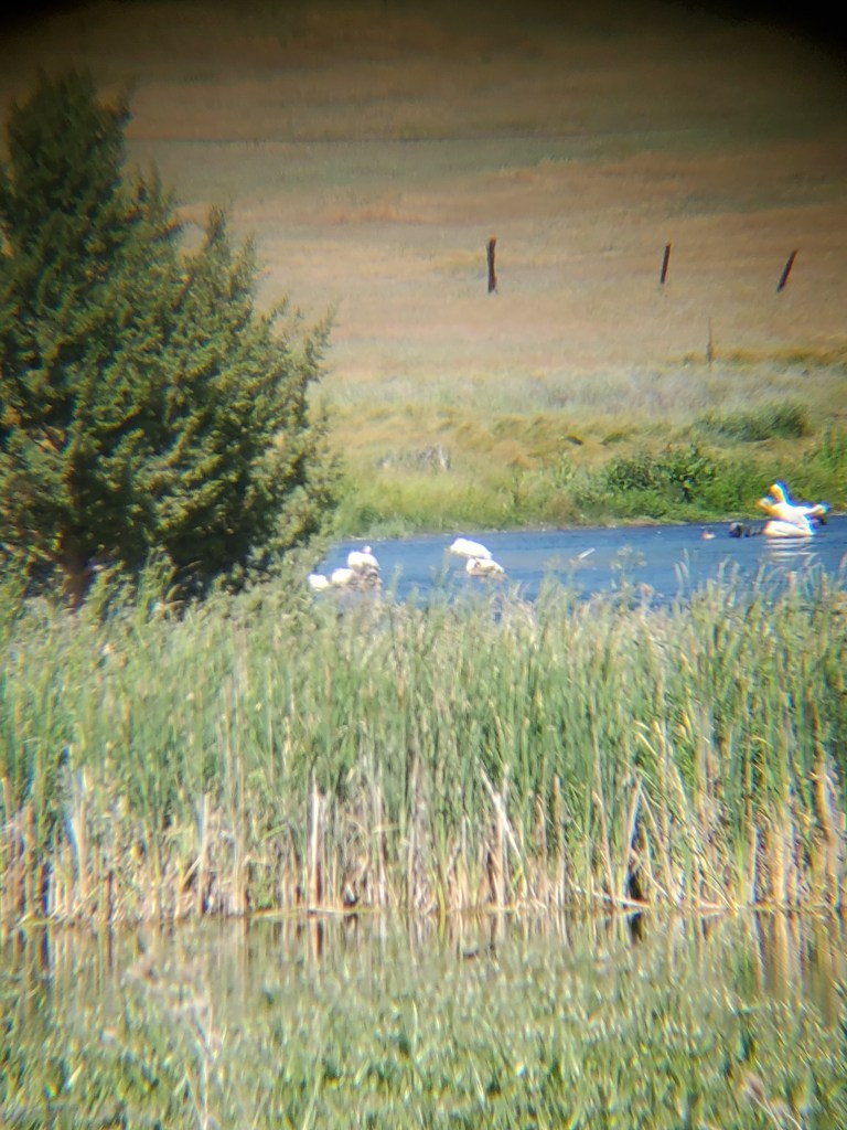
We ate lunch under the shade of a large juniper. A few hikers passed by, hastened by the prospect of fresh food in town. I calmed down a bit and we kept moving. We finally made it to the first natural water source in 40 miles. Just before was a pipe with cold flowing water, which made for a nice bench to chill our butts for a minute. Shortly after, there was a small reservoir, I spotted some large white birds soaring overhead. Maggie used her bird ID app to guess that we probably saw pelicans. Sure enough when we got a good view of the lake, a small flock of pelicans were hanging out. What a sight to behold in this arid clime. We stopped a couple more time to watch the birds do bird things in the water.
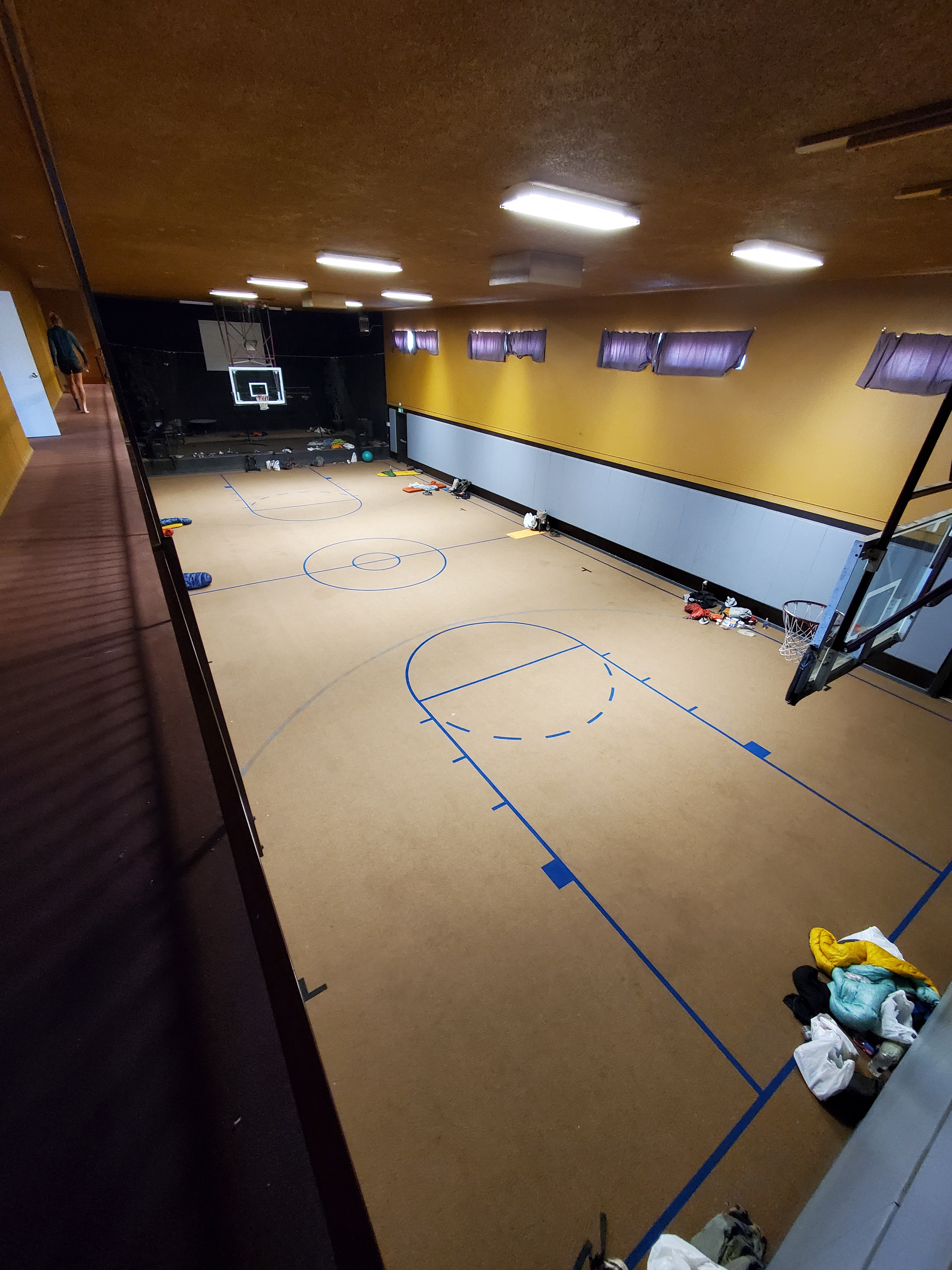
It was a few more easy miles to Hwy 299 where we were done hiking for the day. Thumbs up, a handful of cars passed as we tried to hitch, and after 10 minutes a white 4Runner pulled over for us. Tim, a Burney native, regularly gives rides to PCT hikers. He dropped us off at the Word of Life Church, which hosts PCT hikers for free. The church has a carpeted gym floor and a few community room where hikers can “set up camp.” We showered and took care of our dirty laundry. Maggie went to the grocery store to get breakfast makings. I picked up chinese food on the walk back to the church, where we ate outside on the stoop. While it wasn’t the hotel of my dreams, it was a nice vibe at the church. We were in bed by 10, feeling at ease after a couple tough days.
Day 97 – 8 miles/1419
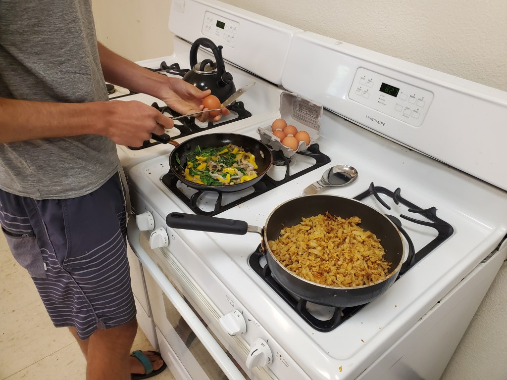
Once again, we took the opportunity to sleep in a little, rolling out of bed at 7am. We cooked breakfast in the church kitchen. Maggie had been wanting to cook a proper meal for quite a while, and we finally got to scratch the itch with a healthy helping of eggs, hashbrowns and veggies. It was wonderful and much lower stress than going out for breakfast.
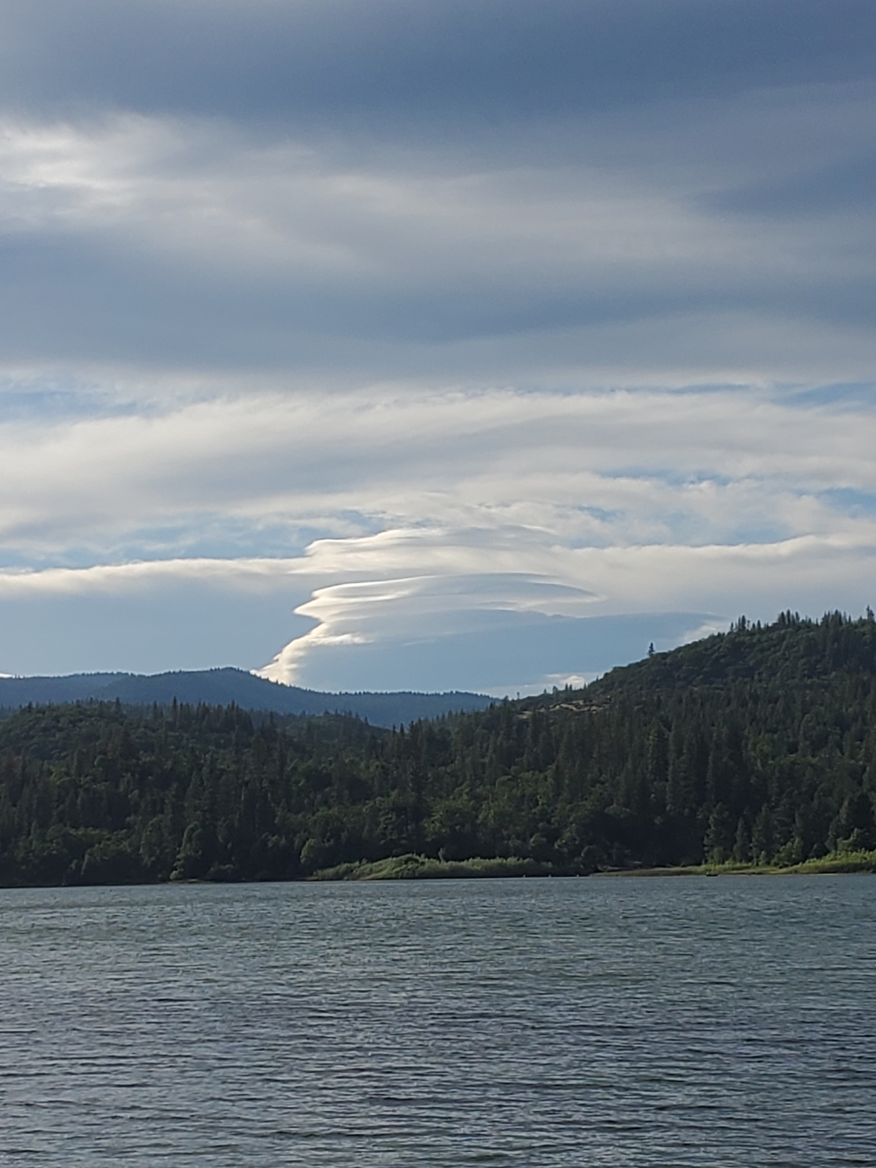
We went grocery shopping and packed up back at the church. A quick drug store stop for candy and sunscreen and we were ready to get out of town. The second car stopped for us. Ina, a nice old lady in a silver Ford Taurus drove us the five miles back to the PCT. We ate sandwiches back at the trail and got moving around 2pm. We heard from other hikers a wild fire started south of Burney, the first sign the fire season was upon us. We hiked to Burney Falls State Park. There were tons of people out for Independence Day weekend. We checked in with some rangers and got a walk in tent site for hikers and bikers. The ranger informed us that the wild fire had already been contained, and we were happy to hear that. We wandered through the bustling campground and set up the tent, which was thankfully far enough from the crowds that they didn’t bother us. With some time to kill before dinner, we walked down to a small cemetery, then the reservoir at the end of the path. We saw and heard bald eagles, screeching in the evening light. The lenticular clouds over Mt. Shasta were putting on a show for us, the creamy texture illuminated by the low angle sun.

We walked back up and made dinner. A few other hikers had set up near by. We talked with Andi, who had just got back on trail after norovirus, injury, and her daughter getting covid. She thought she left her wallet with her partner who just drove off, but found it buried in her pack. I suggested the trail name “Rollercoaster” since it sounded like she had gone through so many ups and downs on the PCT so far. We got to bed around 9, feeling satisfied with an easy resupply day.

2 responses to “Burn, Baby, Burn – Chester to Burney”
Just checking in on you.. I was thinking about you today. I hope that you both are doing well and staying healthy
LikeLike
Yes sir! We are doing well, trucking through Oregon currently, but working around the wild fires. I appreciate the check in!
LikeLike