
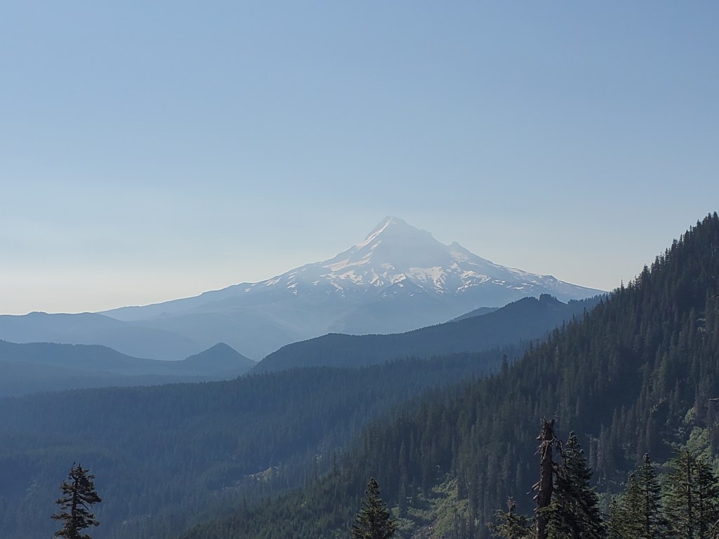
Mount Hood – Oregon’s conspicuous crown jewel. Another lonely Cascade volcano standing 11,240 feet above sea level, Mt. Hood holds glaciers and snow fields year round. The PCT would take us around the flanks of this massive mountain, showing us the magic of what happens when high altitude meets temperate rain forest.
Day 135 – 3(+4)(bypass-138) miles/2101 (8/9/2022)
To say we were wrecked from five days of partying would be an understatement. We weren’t even back on the PCT yet, but the trail beckoned. Maggie and I slept in till 8:30 am, a vague attempt to recover and catch up on lost sleep. Motivation was at an all time low, so we lounged around the campground till 10, and finally left at noon. As if to punish us for our prolonged betrayal to hiking, the trail gods unleahed a small thunderstorm just as we were setting off. You can’t help but laugh a little when it feels like everything is going against you.
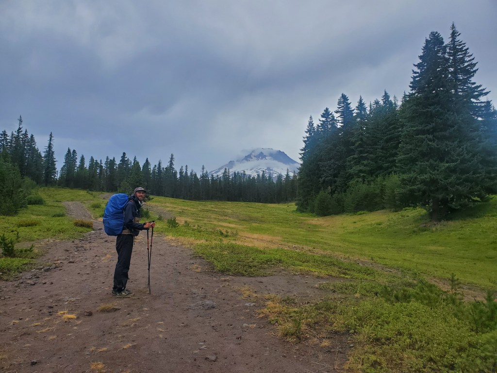
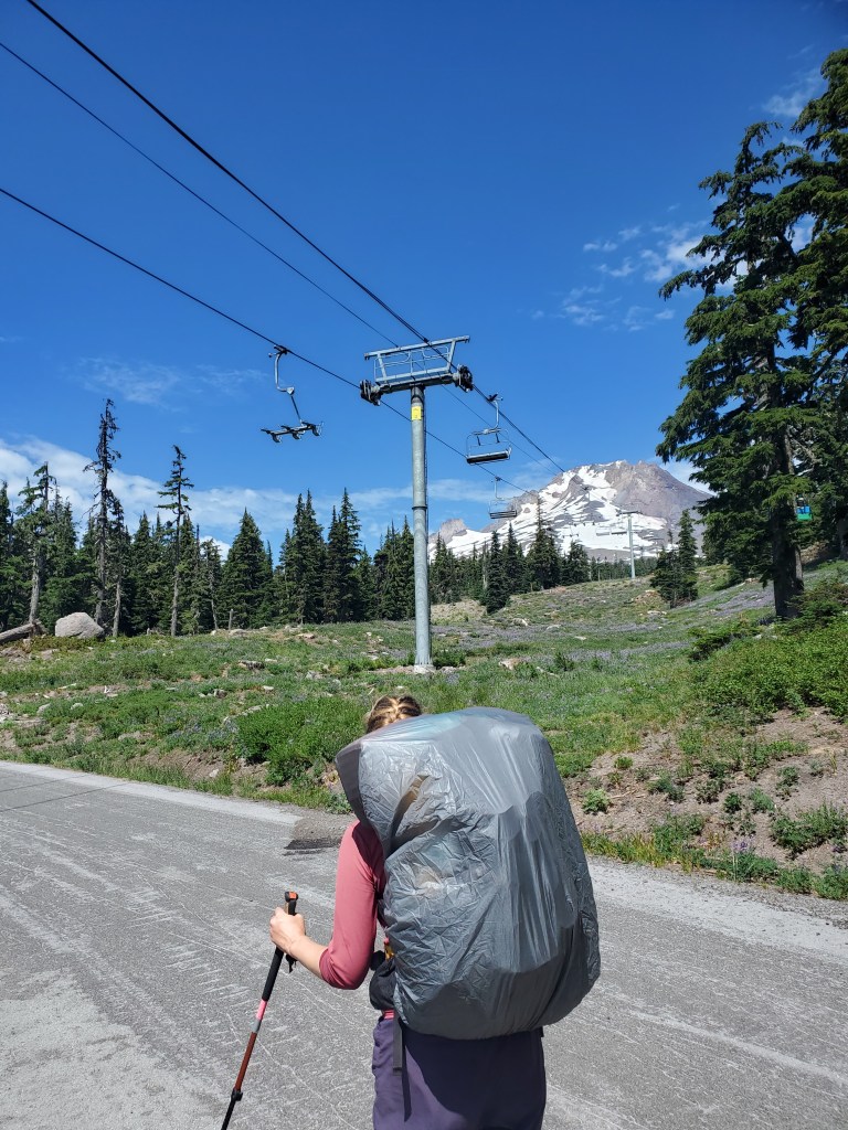
Rather than hitching to the PCT from Government Camp, we chose to hike up through the lower ski slopes and the old road to Timberline Lodge. Maggie and I picked up our resupply box at the newer ski lodge. This box of food was largely unnecessary given that we had bought four days of supplies in Corvallis but ended up bypassing many more miles than expected. We ate lunch in the ski lodge, gleefully watching the next thunderstorm roll though from the safety of the indoors. Maggie and I sifted through our extra provisions, packed up, and donated our leftovers to some hikers sitting outside.
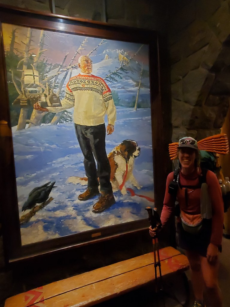
We checked out the Timberline Lodge for a few minutes. Aside from the grandiose architecture, Timberline’s claim to fame is that Stephen King’s “The Shining” was filmed there.
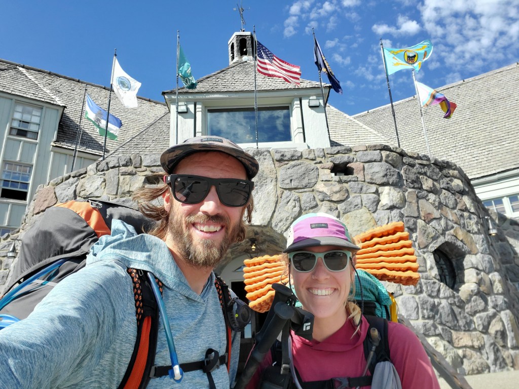

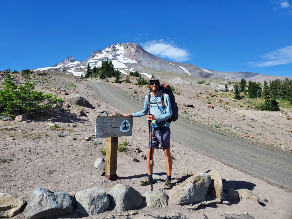
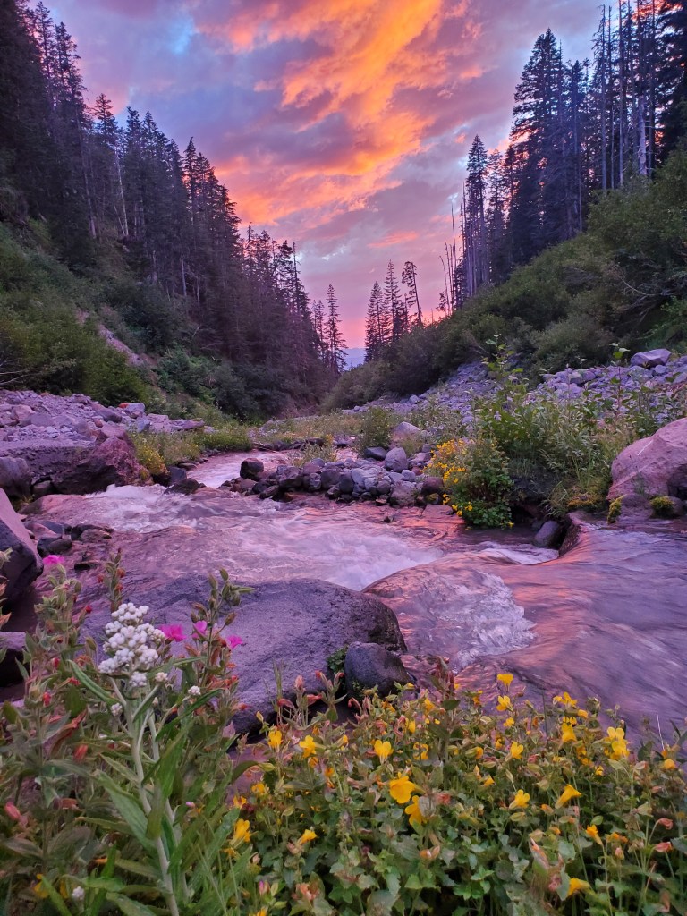
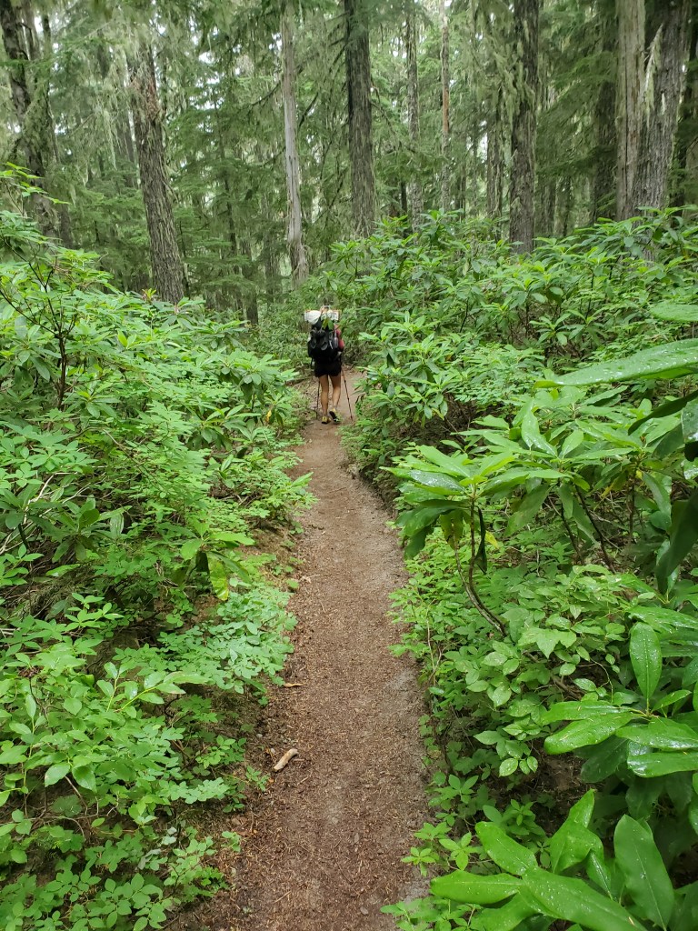
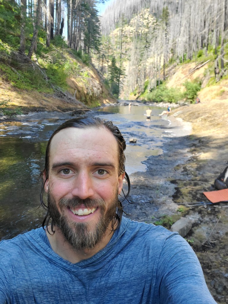
After a few pics, we finally got back on the PCT proper. It was like returning home after a long vacation, the familiar rounded triangle welcoming us back to the 2 foot wide line of dirt. I think we both felt a sense of relief to be back on the path to Canada. The storm had passed, the sun was shining on Mt. Hood, and we could see Mt. Jefferson to the south as well. We hiked a couple easy miles, then dropped down to the Zigzag River.
Another rain cloud was approaching so we ended the day early at 6:30 pm. Frankly, we were kind of beat after just 7 miles of hiking. Where did those trail legs go? A little drizzle passed through, but nothing too bad. We watched in awe as an orange juice sunset lit up the misty clouds before bed.
Day 136 – 19 miles/2120 (8/10/2022)
Still recovering, we took it slow again in the morning, and got moving on trail at 8 am. We woke up in dense fog. The trail took us up and out of the Zigzag River drainage pretty quickly, and we found ourselves above the fog for a while. A view to the west showed us that the fog was pervasive. Up at 5,400 feet, that was the last we saw the sun on this day.
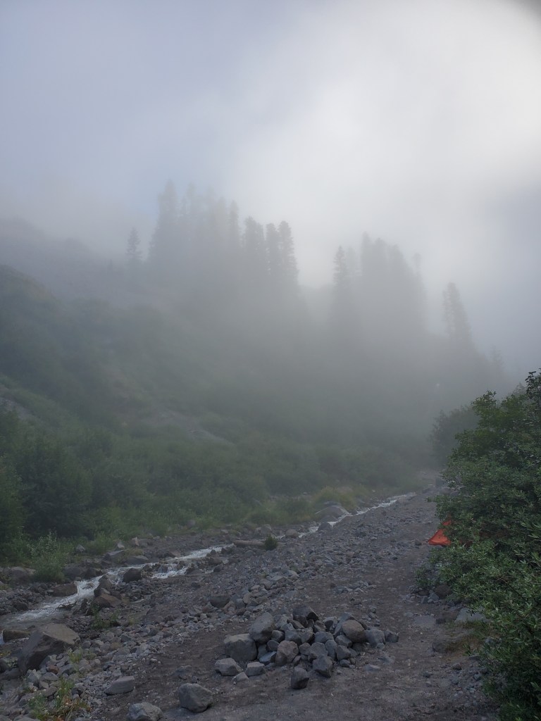
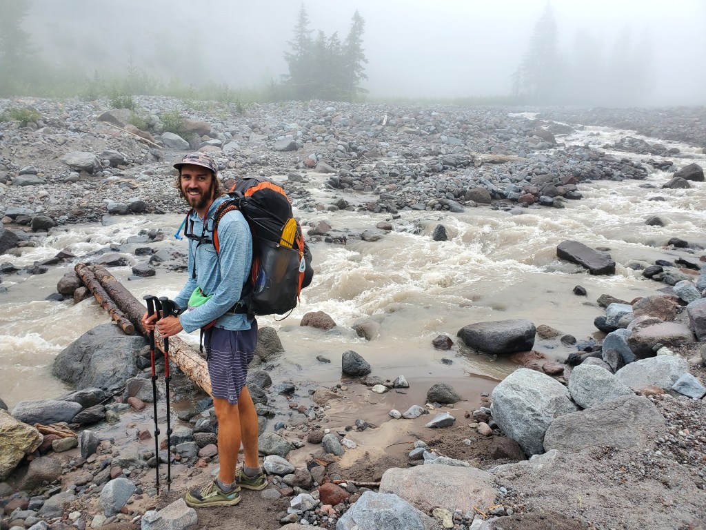
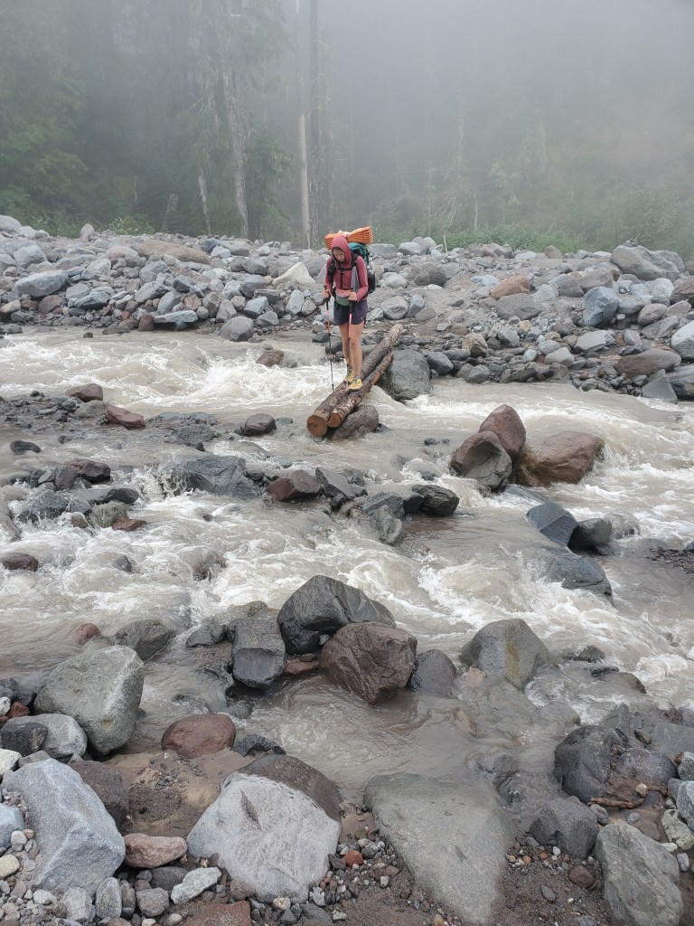
We descended back down to the Sandy River, diving back into the fog. It felt like the Oregon I knew from my 4 years of fall and winter at OSU: lush, green growth all around, a dim overcast sky above, and the feeling of cool, humid air on your skin. The Sandy River provided a somewhat spicy crossing, but logs and rocks allowed us to keep our feet dry.
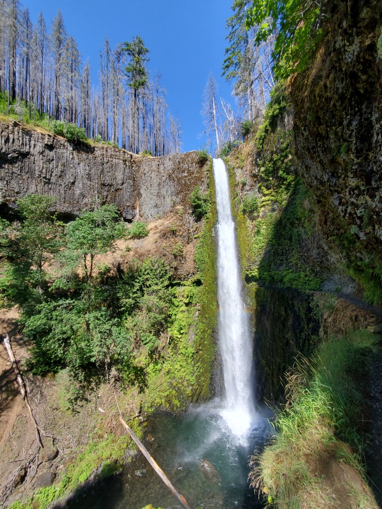
From there, we chose to take an alternate trail to Ramona Falls where we could stop for lunch. On the way, Maggie rolled her ankle pretty bad… Through watering eyes and grimacing lips, she insisted that we just get to the waterfall for a break. Not too far after we made it Ramona falls, a gorgeous 70 foot cascade over black basalt. We sat and ate lunch, and we talked with our friend, Smiles.
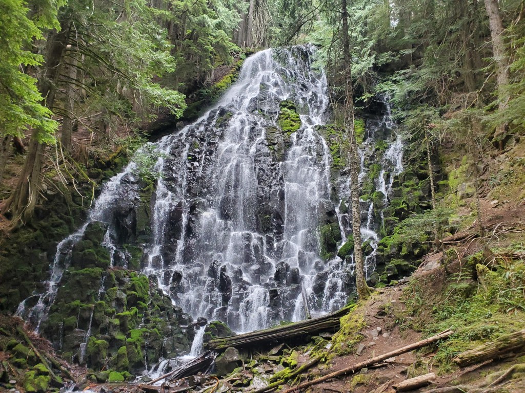
A dozen or so day hikers rolled in and out. While this was definitely one of the better waterfalls on the PCT so far, it felt kinda funny that this was a special trip for day hikers, but it was just Wednesday for us. We truly were spoiled after hiking for so long. We carried on through the mist, plunging further into the temperate rain forest. Maggie’s ankle was sore, but she has a stubborn will power to keep hiking.
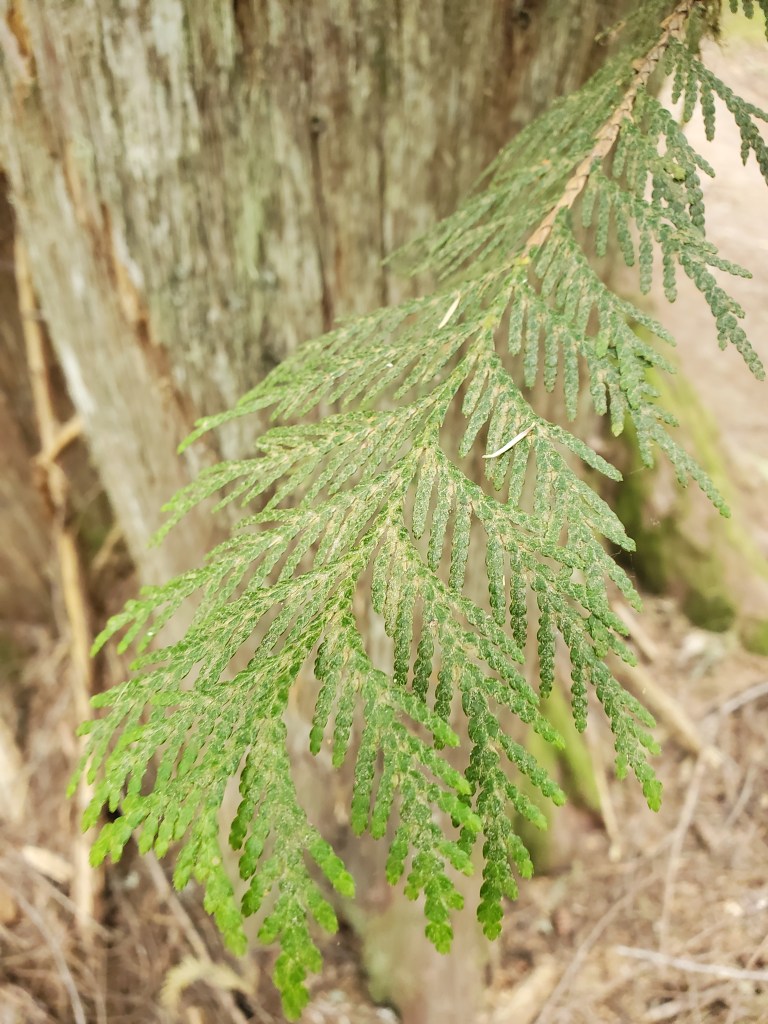
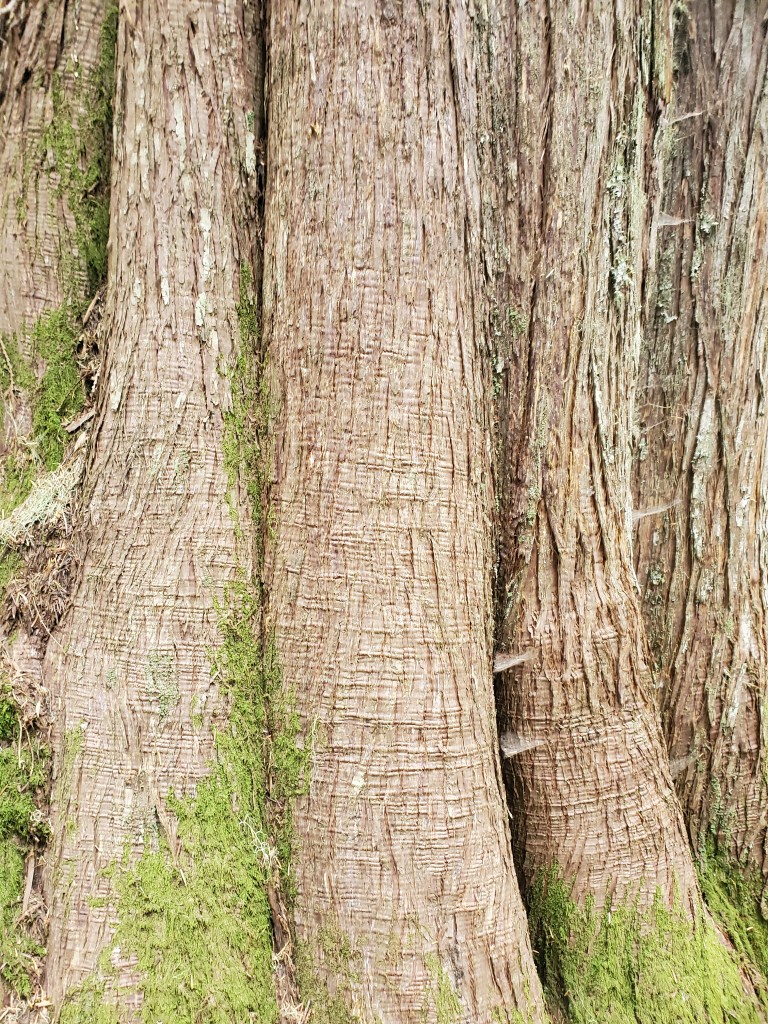
**NEW CONIFER ALERT**
Western red-cedar (Thuja plicata) started appearing at lower elevations. Along side Douglas-fir, western red-cedar is one of the quintessential conifers of the Pacific Northwest. Simple, yet stately, the red-cedar’s stringy gray bark stands out amongst its coniferous peers in this neck of the woods.
We climbed back up 1,500 feet out of another ravine, a real kick in the pants. As luck would have it, we were rewarded soon after with some trail magic! Beer-town-Bill was set up with potato salad, chips, pickles, hot dogs, soda and beer.
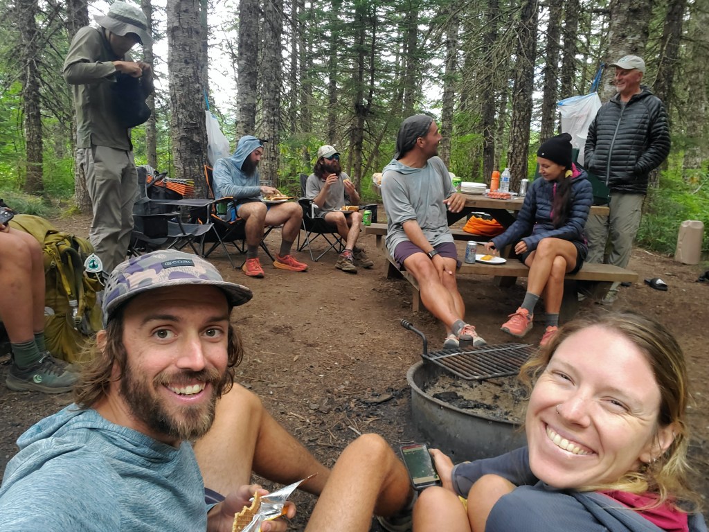
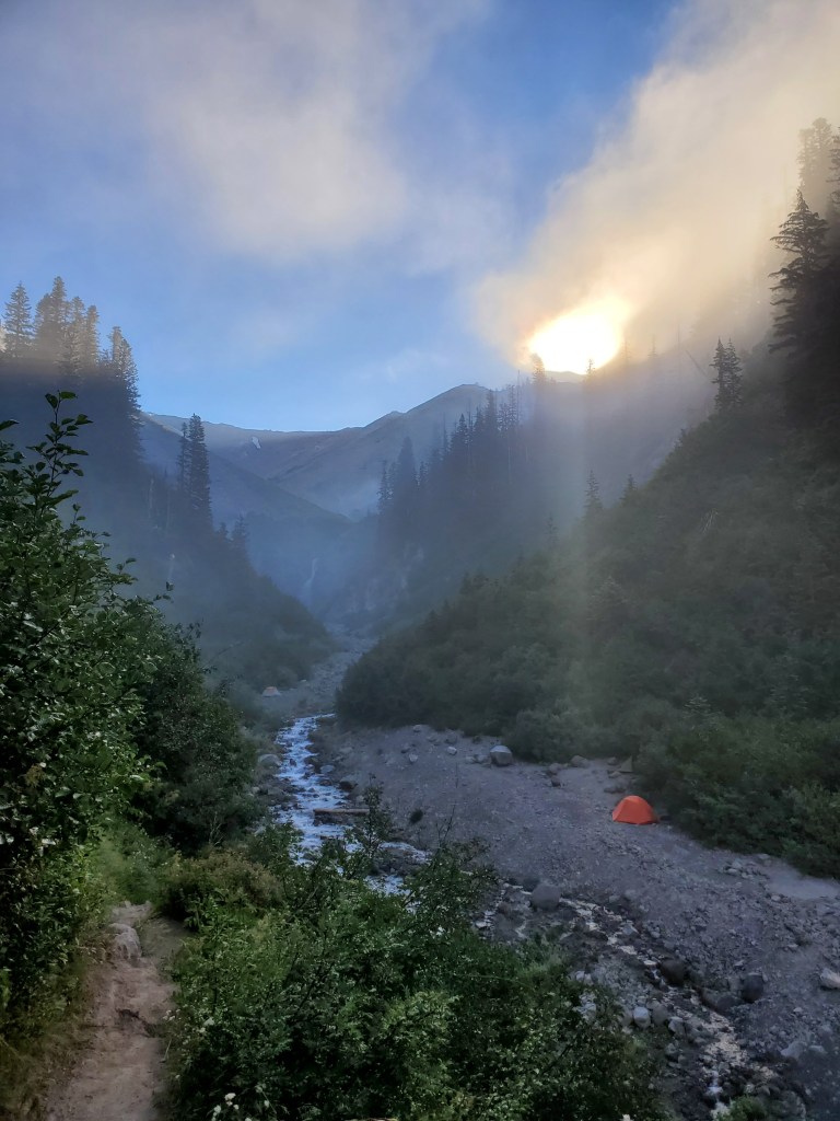
We indulged in a little bit of everything, except for the beer as we were still getting over the 5 day party hangover. Bill was also an OSU alumnus (Go Beavs!), and he had completed several thru hikes and a coast to coast bike ride, so he knew how to talk the hiker talk. We sat and shared good conversation with 6 other hikers for a solid hour. We were getting cold sitting around in a cloud, so we got moving again, but only for 4.5 more miles. We were done hiking at 6:15 pm. No one else joined us.
Day 137 – 28(-7) miles/2148 (8/11/2022)
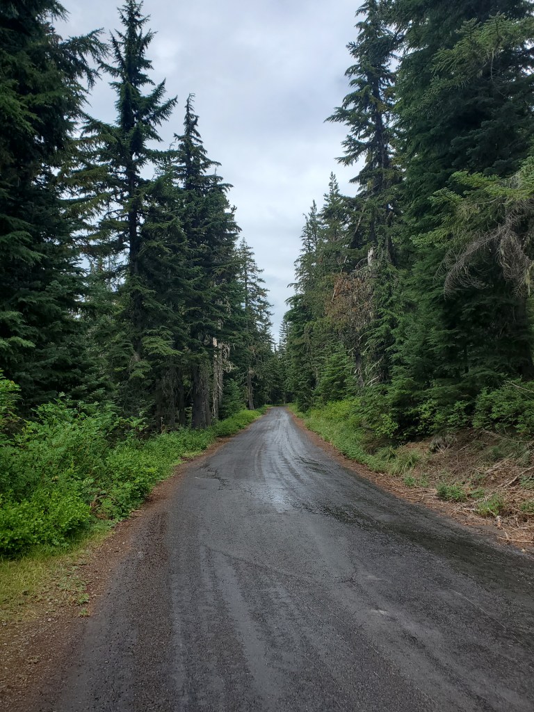
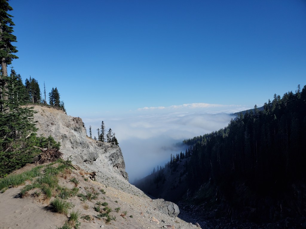
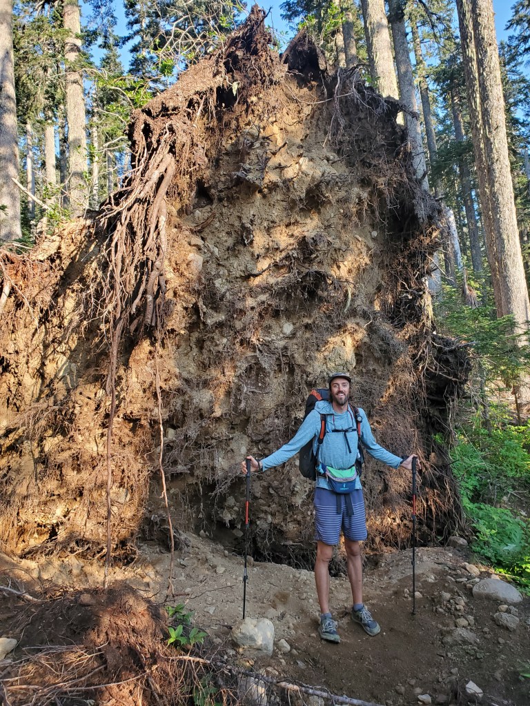
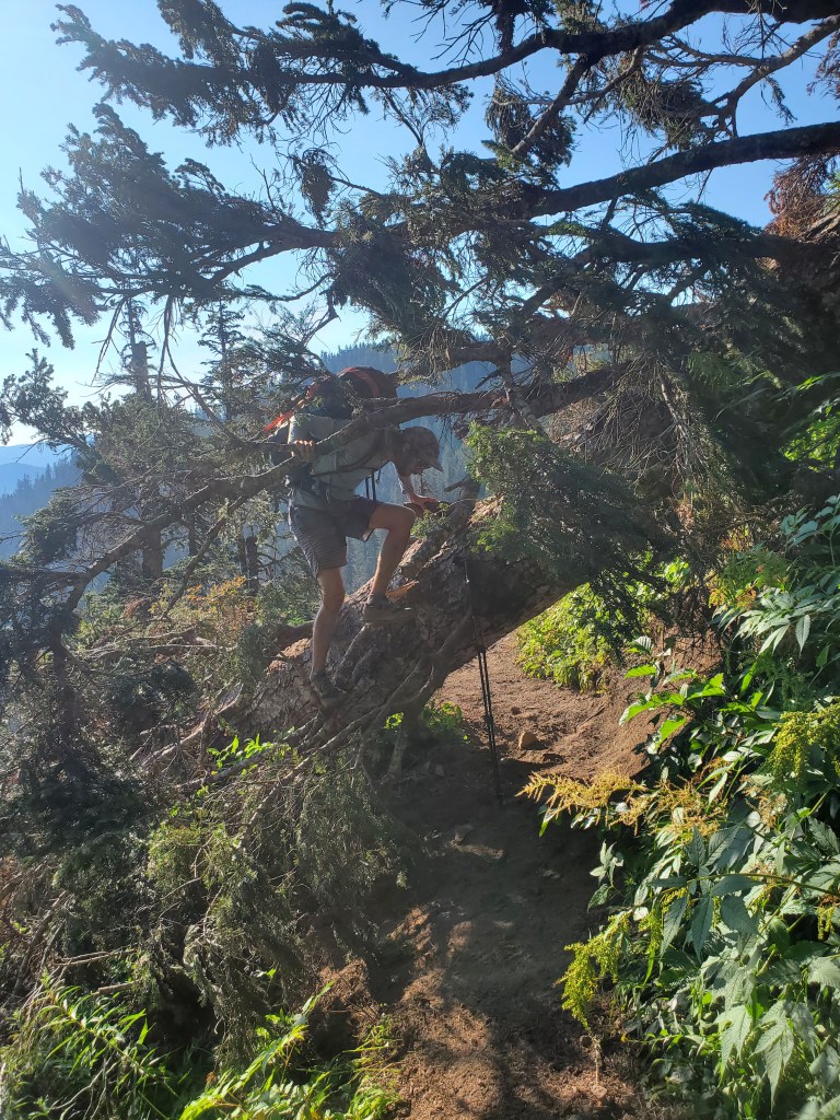
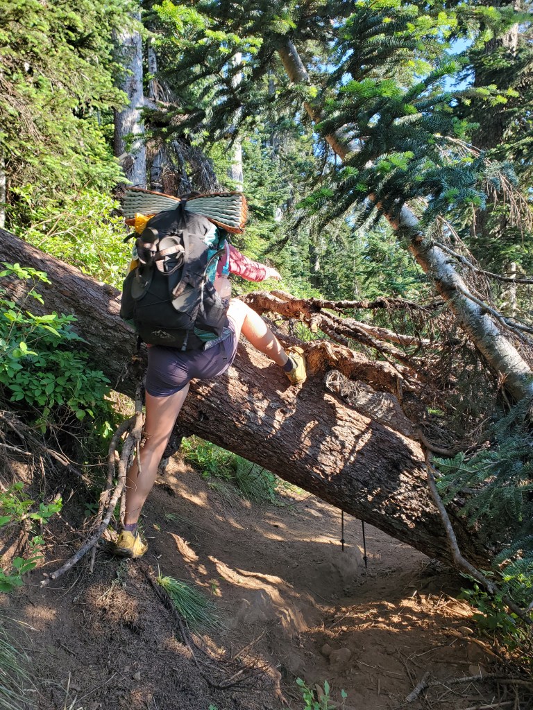
We woke up to a clear, cool morning. We were expecting to meet my friend’s parents, David and Kathleen, in Cascade Locks for dinner, so we got moving at 7:15 am. We were intent on moving quickly, so we cruised along the ridge, headed north and down to the Columbia River. We were quickly stopped in our tracks by frequent blowdowns… Some tricky to climb over, others with sketchy footing, barely clinging to the slope. This was not part of the plan, but by now we have learned that the PCT rarely let’s you stick to a plan.
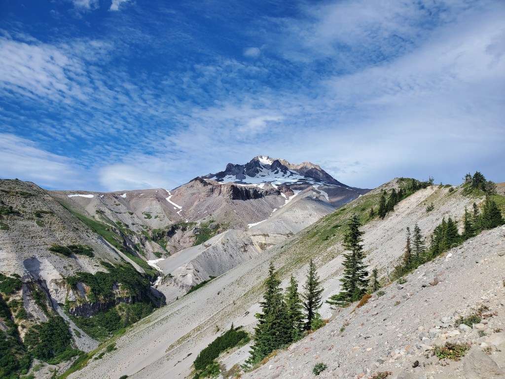
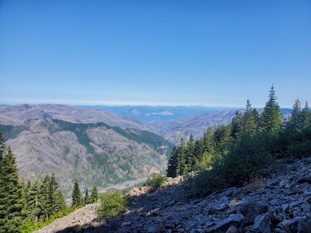
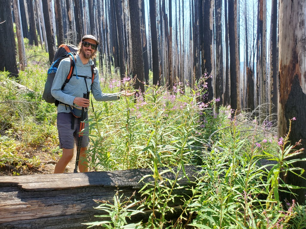
When the trees gave way to volcanic talus, we got nice views of Mt. Hood, Mt. St. Helens, Mt. Adams, and Mt. Ranier, the big four of Northern Cascades. We could also see the remains of the 2017 Eagle Creek fire, which was started when a kid carelessly threw some fireworks into the woods. The fire nearly burned down the town of Cascade Locks, and the blaze even jumped across the mighty Columbia River. It seems almost inconceivable that fire could fly over half a mile across one of the biggest rivers in North America.

Aside from this ashen blemish on the earth, there were some lovely wild flower, blueberries, and common juniper in the alpine meadows. We stopped for lunch at Indian Springs and found Smiles again. We shared candy with each other like school children. Smiles asked for a new trail name, sarcastically imitating everyone he’s met, “iS iT bEcAuSe YoU sMiLe A lOt?!?!”

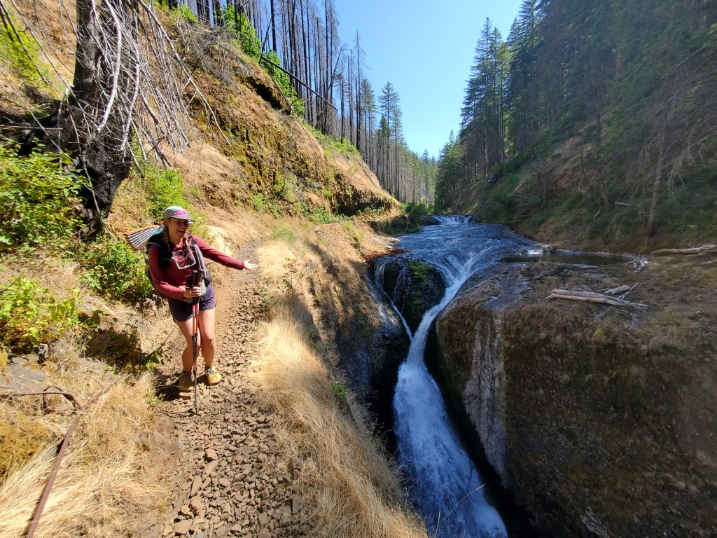
Once again, Maggie and I opted to take an alternate trail. This would be 7 miles shorter than the PCT, and it would take us through the famously beautiful Eagle Creek canyon. We began the 4,000 foot descent, which was steep and dusty at first. We soon found ourselves in the 2017 burn scar, the blazing August sunshine beating down on us. The fire weed grew was dense and monstrous.
After a few miles of meandering through burnt trees, we were finally following Eagle Creek. The temperature was noticeably higher down at this elevation, so we jumped in the creek for our afternoon break. The water was cool and refreshing, and a couple of hikers joined us in the swimming holes.
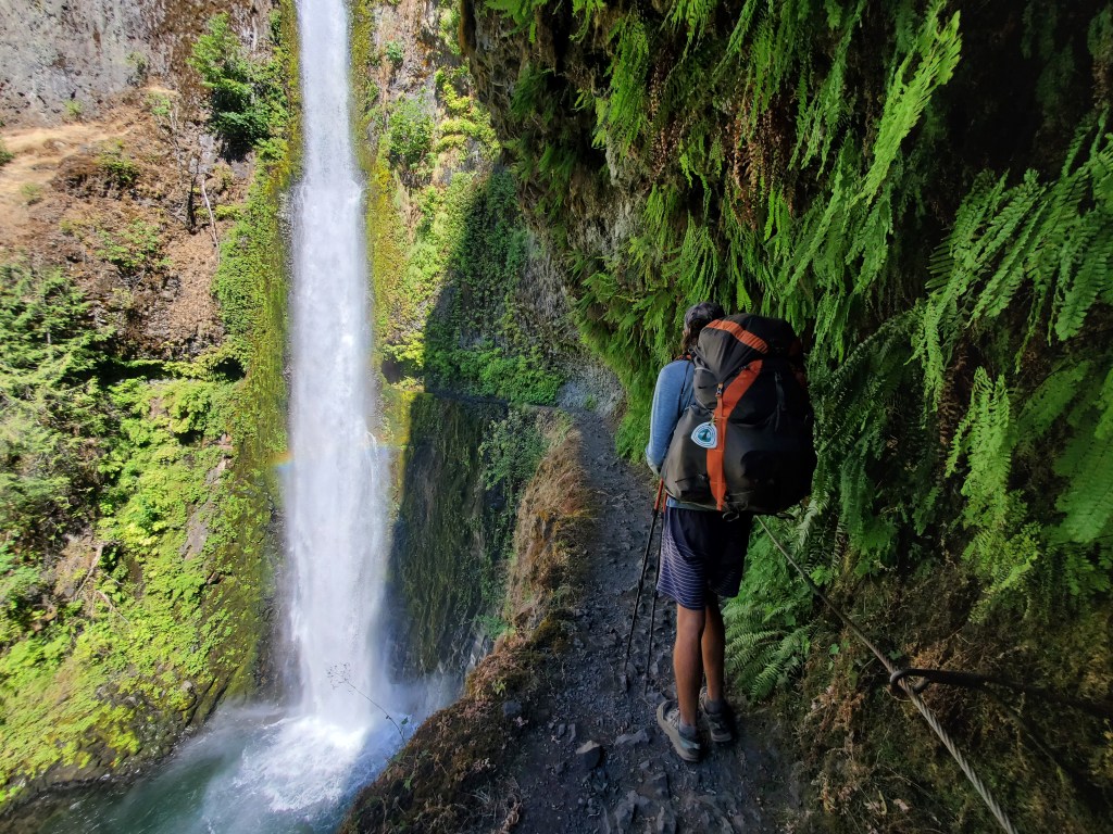
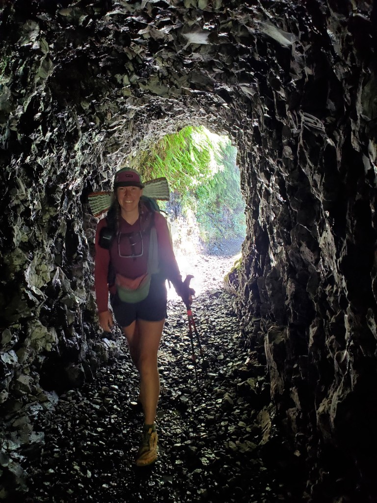
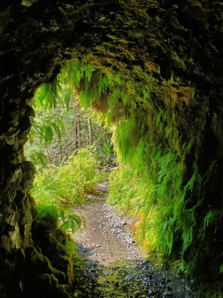
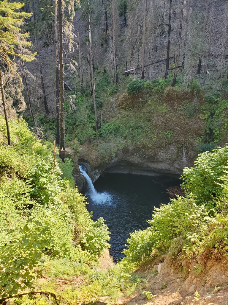
We continued down, down, down. At last we came upon Tunnel Falls, revealed in an instant by rounding a sharp right hand curve in the trail. Cascading down 165 feet, the power of this small tributary was palpable. The trail, a shelf carved out of the basalt cliffs, became a tunnel behind the falls, hence the name. The mist and spray feeds a vertical carpet of ferns from top to bottom, making the cliffs feel alive. We couldn’t help but grin as we passed through the tunnel, ducking under the draping ferns.
Several more waterfalls on the main stem of Eagle Creek made our jaws drop, and we were happy we took this alternate. After that, it was just hot, rocky miles of trail. The creek was inaccessible, so we couldn’t cool down in the water anymore.

Day hikers started filing in on this popular trail. Some dogs had given up walking in the heat, and I wanted to stop and rest with them. Maggie and I finished hiking just after 5 pm. David and Kathleen found us at the trail head and they graciously took us to dinner in Cascade Locks. We shared all the details of hiking life to satisfy their curiosity. David and Kathleen dropped us off with a grocery bag full of fruit, nuts, and snacks! We thanked them and hugged each other good bye. Maggie and I made our way to the campground in town. A Subaru passed by us in town, the blonde girl waving excitedly from the driver seat – it was Camel – our Bend-Corvallis driver! What a fun coincidence! At the campground, we found loads of hikers, including (most of) the Dutch Rudder, Smiles, and Miss Pixar, a guy we had met waaay back in the desert. We sat in a large social circle on the grass, chatting till dark.


One response to “It’s All Good in Mt. Hood – Government Camp to Cascade Locks”
Yes, Go Beavs!
LikeLiked by 1 person