In order to avoid a few ferry crossings on Chile’s Carretera Austral, Maggie and I chose to drive through Bariloche, El Bolson, and Alerces National Park in Argentina. Customs, cash, and camping all presented new challenges, but we were excited to carry on with our south bound road trip…
15 January 2023
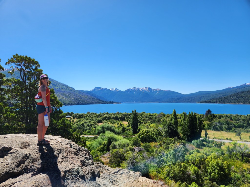
After a scrambled egg breakfast, cooked up on our new frying pan, Maggie and I were off to Argentina. We got some brief views of Volcan Puyehue through the trees and the clouds as we ascended the winding road to the border with Argentina. We tried to look up information on crossing the Chile/Argentina border, but nothing online seemed super helpful. We rolled up to the first booth on the Chilean side and we were given a basic ticket. A guard directed us to a small parking area, where we saw others getting out of their cars and walking into a building, which was not obviously marked. Step one – emigrate from Chile. This was the passport check, and the customs officer punched our info into the computer. Not too bad. Step two – I’m still not really sure what this is, but I think it’s for verifying vehicle paperwork. A few more minutes here, a few stamps there, and we were free to go. We returned to our car, handed over the initial ticket, and crossed into Argentina. A new country, wow! The customs protocol on the Argentinian side was fairly similar to what we just went through leaving Chile, and it was fairly painless too. Although, from start to finish, it took close to an hour from the fist gate in Chile to driving away in Argentina. All good when you don’t have much of an itinerary. The road weaved down the mountains through southern beech forest. The peaks were gorgeous, so it should come as no surprise that we drove by numerous people bike touring through the area. We dropped down to Lago Nahuel Huapi, an expansive deep blue alpine lake surrounded by mountains.
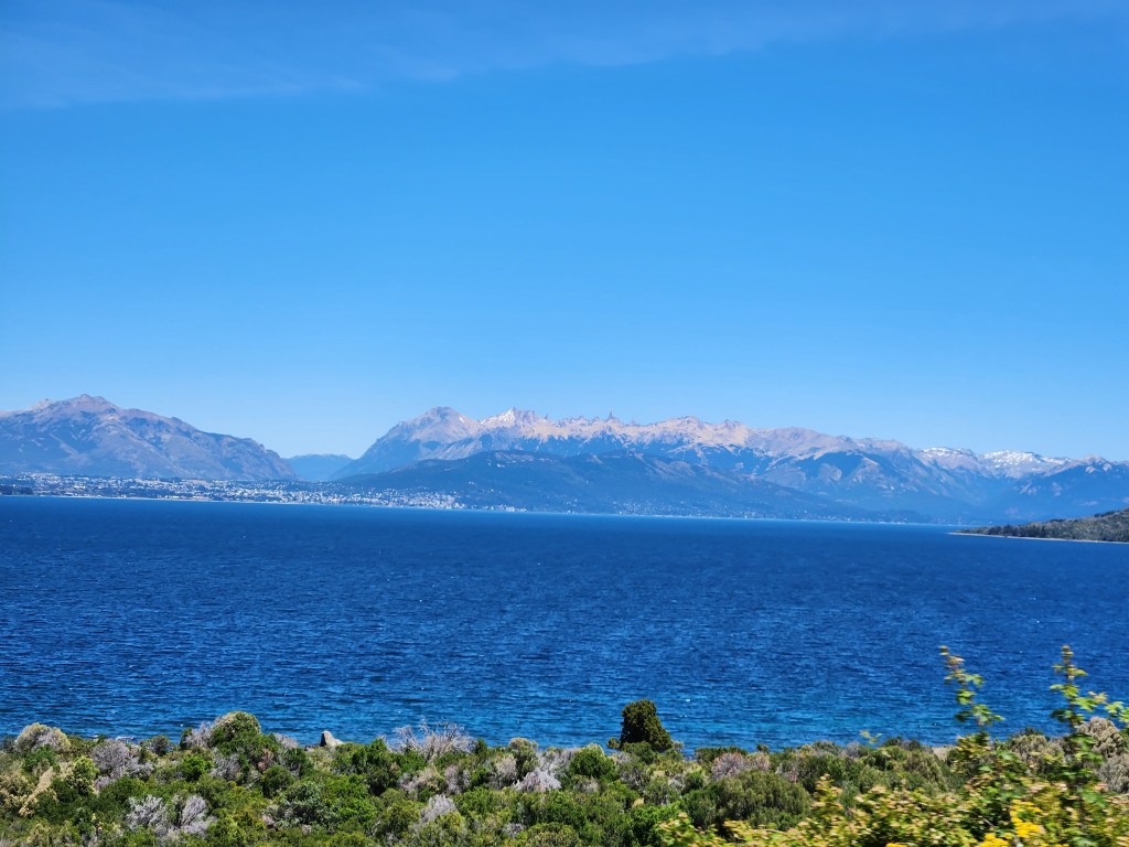
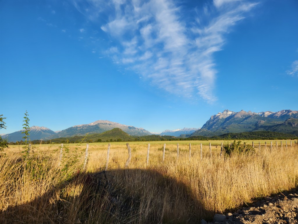
The closest comparison that comes to mine is Lake Tahoe, however the mountains here were much more rugged and needley. Further from the mountains, we were greeted by the Patagonian steppe – parched lands east of the mountains, wind swept and, by all accounts, a tough environment to eek out a living. It instantly reminded us of the desert in New Mexico.
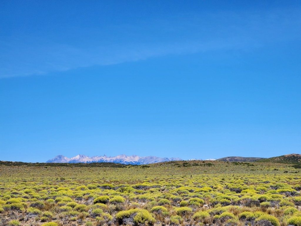
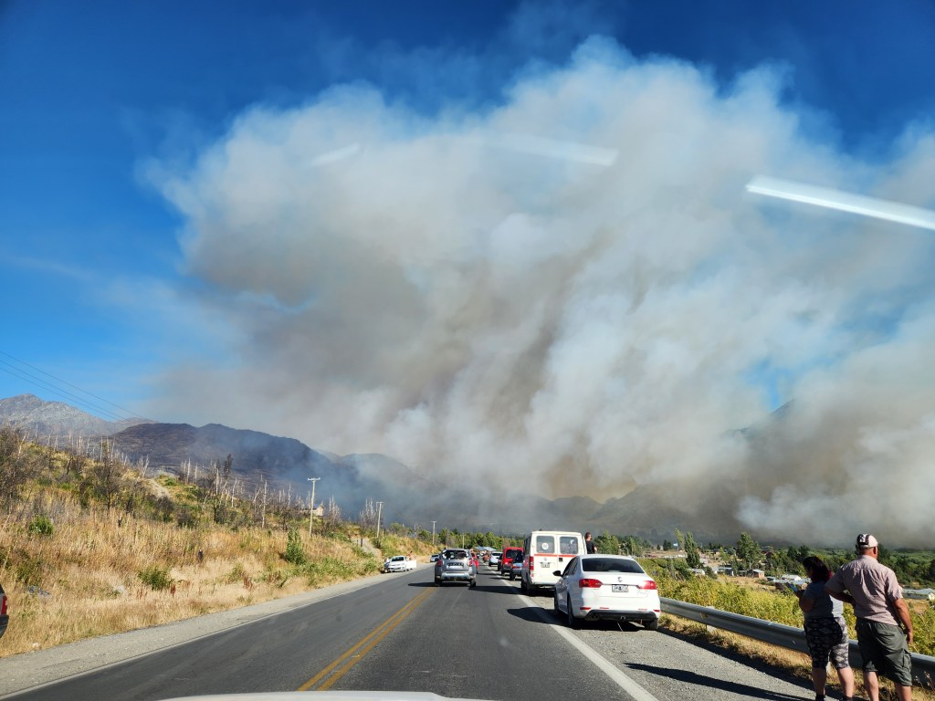
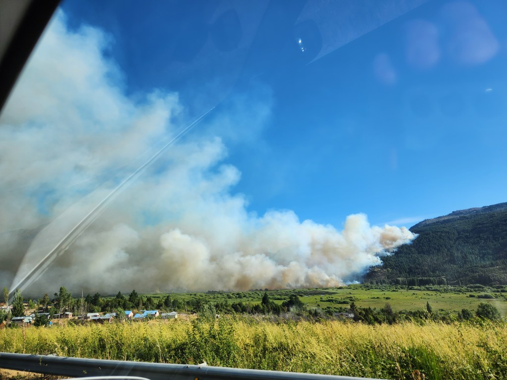
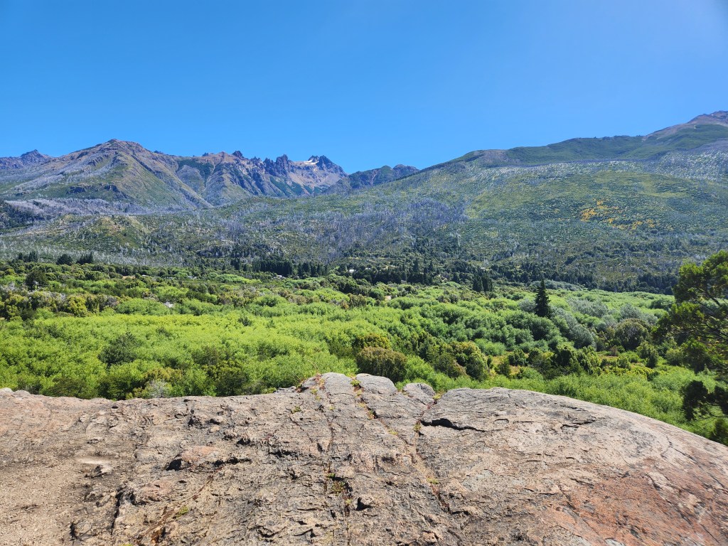
The road took us all the way around the northern shore of Lago Nahuel Huapi and around the east end to San Carlos de Bariloche. We found a little vegetarian restaurant, which served ready made dishes by the kilo. We walked around Bariloche a little bit. Maggie was in need of some hiking pants, and she found some that fit, but the price tag was about $200 USD – yeah, no thanks. The cashier said they were marked up for being imported, and that even he couldn’t afford them. We got back in the car and started making our way south on RT40. It finally felt like we were on our way to the fabled Patagonia, a stretch of rugged peaks and windswept grassland at the southern end of the continent. Our goal was still far, far away, and the roads would prove to be rough. Ruta 40 was narrow, windy, and full of potholes, or baches. We still don’t really understand south American speed limits, since the signs seems especially slow, like 30 mph on a two lane highway. Drivers seem to just drive whatever is comfortable. Naturally, there were a few back ups behind slow cars on curvy sections, and even we drove too slow for most locals. It was, however, quite pretty, at least until we drove past an active wildfire less than a mile off the road south of El Bolson. Loads of people were pulled over, watching the blaze crawl up the hills. Authorities detoured traffic through another small town, so it didn’t turn out to be too much of an inconvenience for us, but we felt bad for the residents dealing with catastrophe.
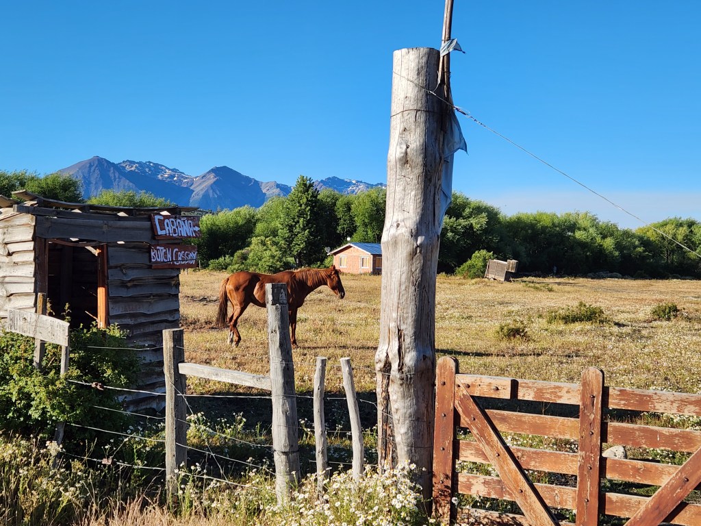
We drove onwards, eventually diverting off RT40 to Road 71. Before long, the pavement gave way to dirt and gravel. We stopped by the supposed cabin where Butch Cassidy and The Sundance Kid hid out after they became the most wanted men in America. We may never know if this is the true spot that they went to, but it was a pretty locale and I thought it could be decent spot to live out your life.
Not too much further down, we turned on to a side road to inspect a potential campsite. We found it with the iOverlander app, which is a crowd sourced map of camp sites geared towards people living the vanlife and boondockers. This app has been immensely useful to us on our road trips ever since a friend turned us on to it, so we were stoked to see a bunch of spots in South America. The side roads ended at a gravelly open area next to a small river just across from Villa Rural Rio Blanco. Good enough for us!
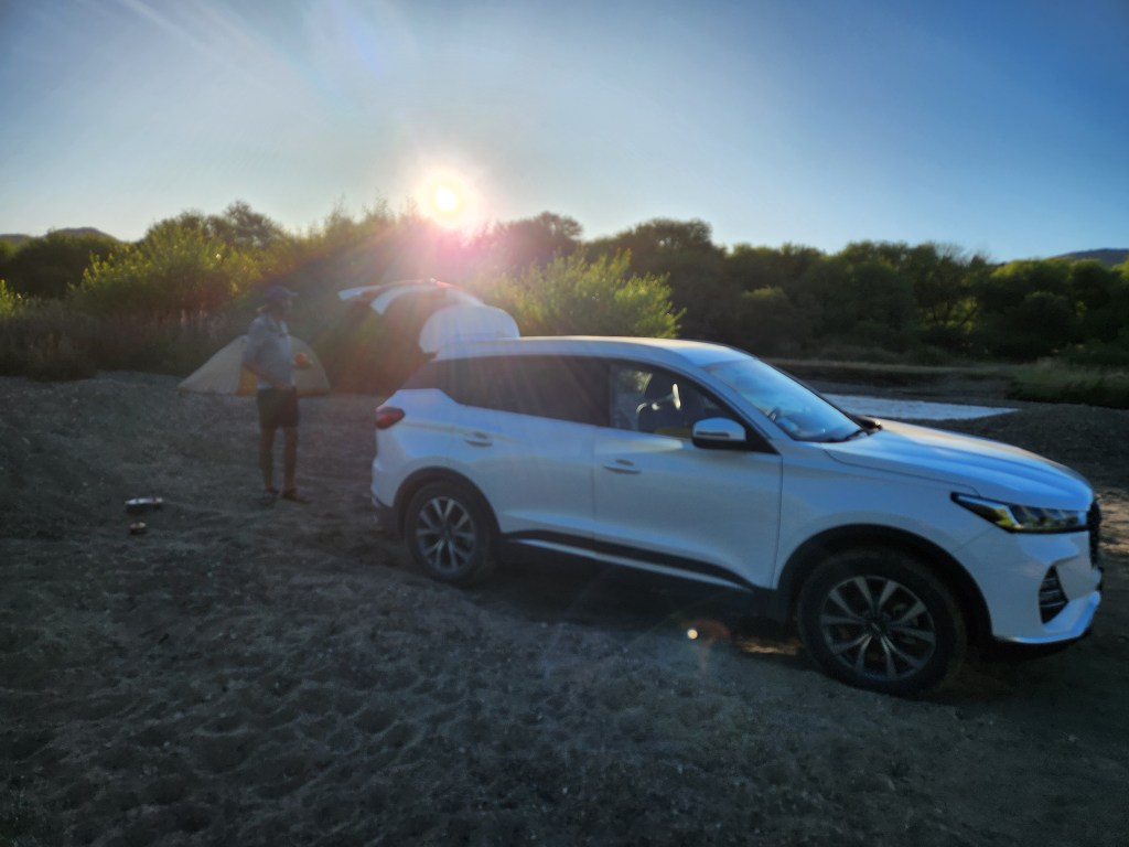
We were however a little on edge, for fear that we might get kicked out. We pitched the tent and made dinner, only seeing a few cars and cyclists on the opposite side of the river. No one bothered us before dark, so we slowly relaxed and went to sleep… In the middle of the night, sounds of a growling engine grew louder, and headlights poured in to the tent. We were both awakened by the commotion, and we lie still as our hearts were pounding. The truck revved up, accompanied by a splash of water. The engine faded into the night, and we looked at each other, confused. Clearly, whoever drove by wasn’t interested in us, but it scared the crap out us!
16 January 2023
It was a quiet, clear morning on the river bank. We cooked breakfast in the gravel clearing, and no one bothered us, except for a young man who came walking out of the bushes. He waved, seemingly unperturbed by out presence, then continued walking out of sight We didn’t waste much time packing up, since we still felt on edge about potentially trespassing.


On the road again, we continued south towards Alerces National Park. Alerce is Spanish for ‘larch’, the common name for Patagonian Redwood (Fitzroya cupressoides), which is definitely not a larch, but in the redwood-cypress-juinper family. I was keen on finding more rare, and hopefully huge, conifers.
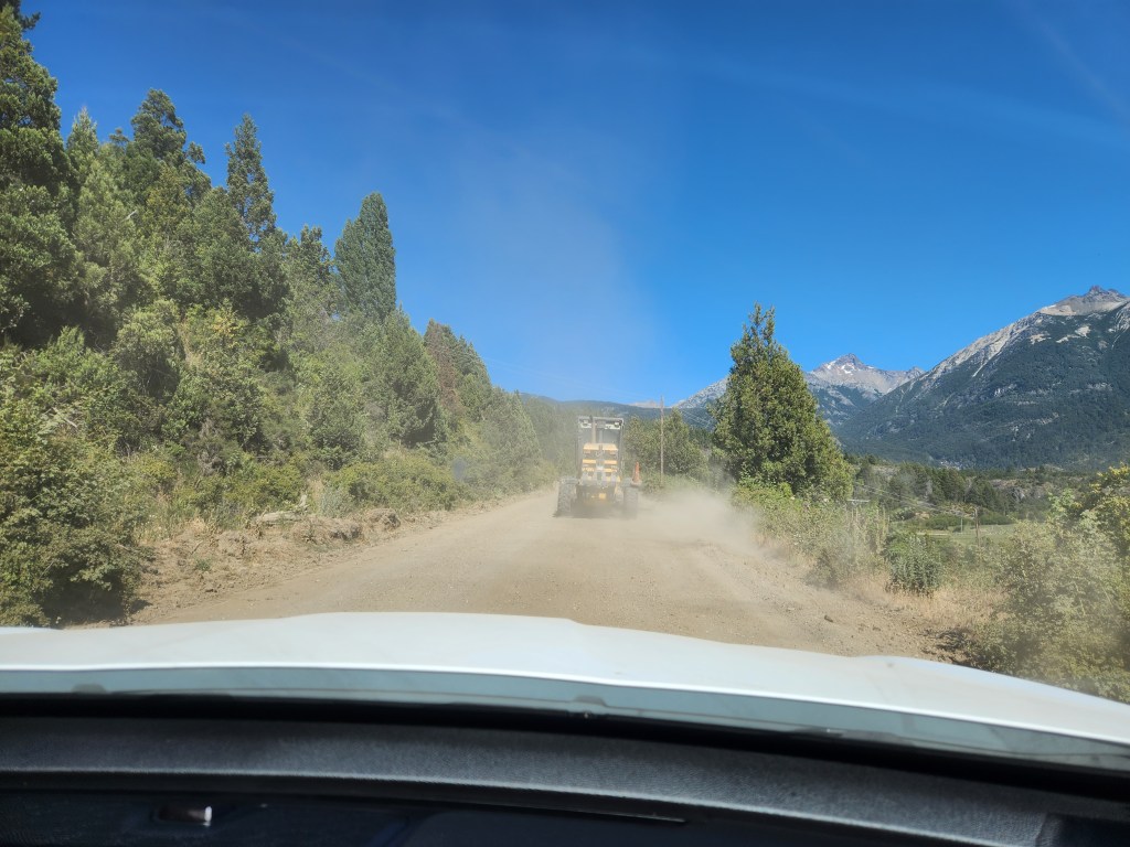
The road surface was still dirt and gravel, and pretty rough at that. Sure enough, we crossed paths with the grader working to level out the road, leaving a one foot tall berm of fresh gravel in the middle of the road. Now I wasn’t upset about the guy doing his job, but the berm would slowly drift from the center until there wasn’t enough space to the edge of the road. This necessitated driving on the left (i.e. wrong) side of the road for some stretches, which was a bit unnerving on this narrow, winding road. At least other cars were visible from a distance with the large clouds of dust following them…
After about an hour of driving, we made it to the national park entrance station. I went inside to pay the entrance fee. A couple of things are worth noting: 1) We arrived in Argentina on a Sunday afternoon, and despite our best efforts, we could not find a currency exchange in Bariloche that was open, and 2) Argentina has two exchange rates – the white rate set by the government at ~180 Argentine Pesos (ARP) per USD, and the “unofficial,” but widely used, Blue Dollar rate at ~330 ARP per USD. The fee to get into the park was 3,500 ARP per person, so ~$11 blue, or ~$19 white. I explained that I didn’t have any Argentine cash, but I could pay with card or Chilean cash. Sadly, the folks at the front desk wouldn’t accept either… They suggested that we drive back to the town of Cholila and withdraw cash from the ATM. I wasn’t even sure if that was possible. My disappointment was bountiful. Maggie and I tried to put on our best puppy dog faces for the staff as we got back in the car, but they didn’t seem to have any sympathy for us.
Twenty minutes back up the dirt road, avoiding the grader and the gravel berm again. In Cholila, we found the small local bank. I spoke with a banker to see if my debit card would work with their ATM, and he seemed confident that it would. He helped with with the ATM, and I was able to withdraw 10,000 ARP. A step in the right direction, although, I wasn’t sure if this was at the white rate, or the blue rate. I wouldn’t know until I checked my bank statement later that it was at the blue rate, thank goodness. Twenty minutes back down dirt road to Alerces National Park, we paid and drove into the park. Maggie and I had hoped to go for a 9 mile hike up a mountain, but that trail was in fact closed. We had burned so much time getting money that the hike was out of the question anyways. Adding insult to injury, the condition of the road only seemed to deteriorate the further we pressed on into the park – the washboarding and rocks were non-stop.
Maggie and I pulled off at a small trailhead parking area. I was still fuming over the money ordeal and the fact that the trail we wanted was closed. Nonetheless, we embarked into the woods along side Rio Arrayanes.
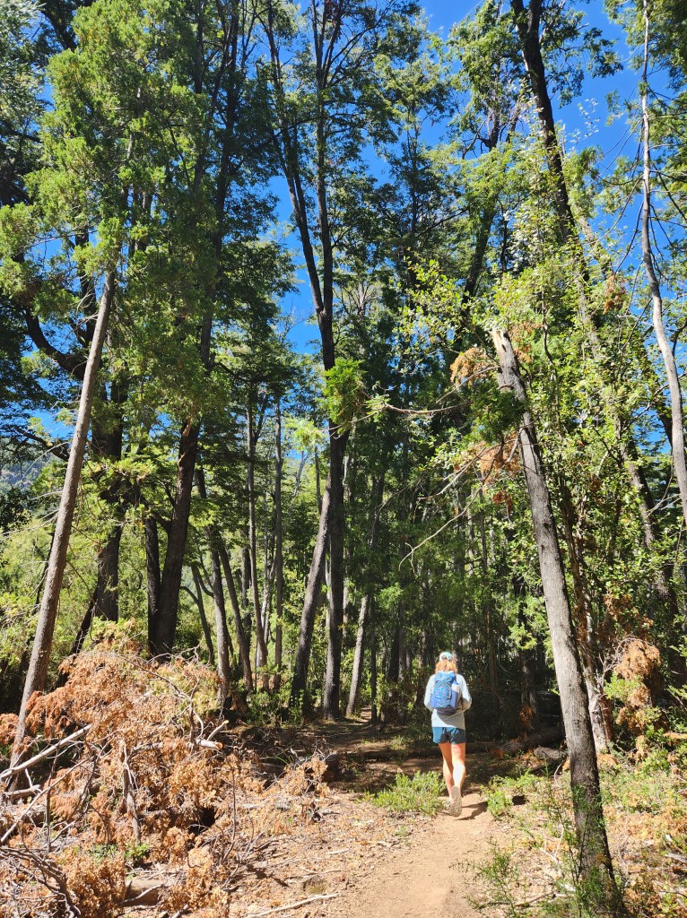
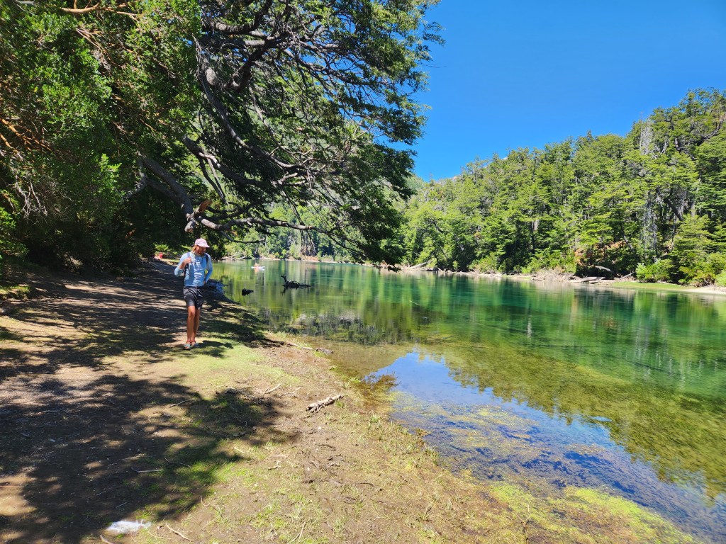
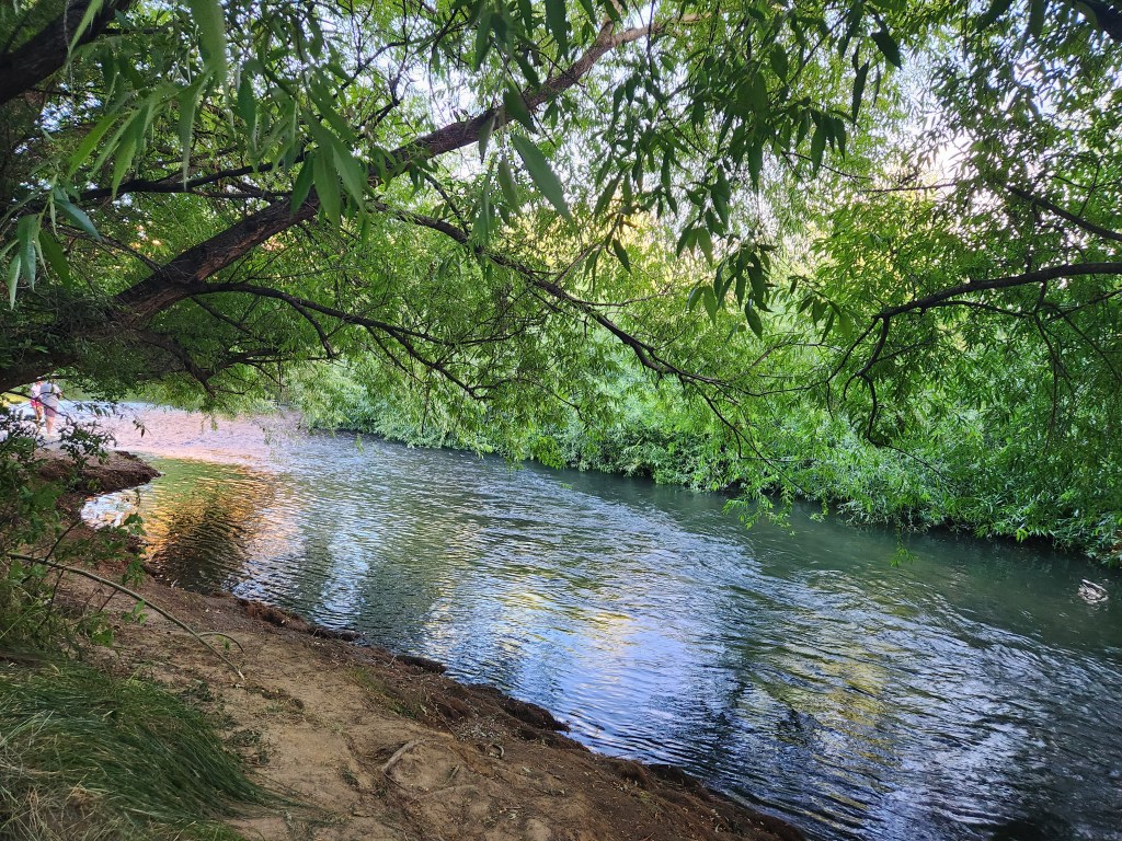
We crossed paths with an Americano, a man from Montana. It is quite funny, because the default greeting is “Hola,” then there’s this awkward pause where we both recognize a bit of an American accent in a fellow gringo, followed by speaking in English. Our friend from Montana informed us that Rio Arrayanes a premier fly fishing river. Once we saw the river, we understood why – it was crystal clear with a calm current. Maggie and I took a seat on the river bank and ate lunch in the serenity.

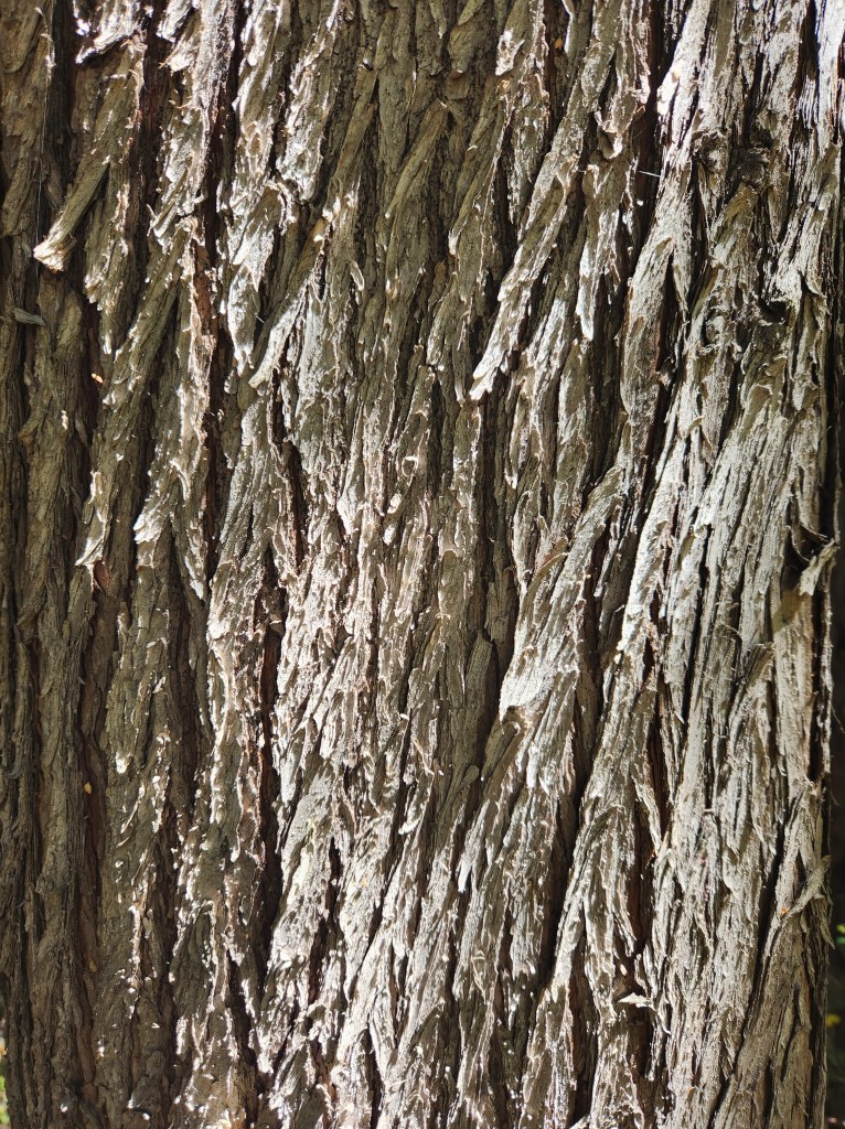
The forest was mostly southern beech, but there were some conifers in the mix, although they didn’t not appear to be the prized alerces. After some research, I determined we were looking at Austocedrus chilensis, cordilleran cypress, a new conifer for me!

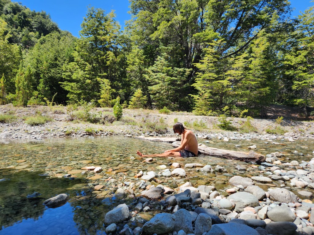
We packed up on the river bank and returned to the car. Continuing through the park, we saw a hitchhiker. Having received so many rides on the PCT, Maggie and I agreed to pull over and pick him up. Devolver el favor. He was a young man from Argentina, exploring his home country with a backpack. We didn’t take him too much further though, as we were stopping for another short hike. He thanked us, and Maggie and I started up the trail. It was a short, steep kilometer to a waterfall view point. The water fall wasn’t particularly close, but it was a nice view. On the way back down, we diverted off the trail to cool off in a creek for a few minutes. Whatever anger I felt earlier was washing away.

Maggie and I went for one more little hike to see some prehistoric rock art, and get a view of Lago Futalaufquen. Despite our technical difficulties earlier in the day, I would say we had a nice time in Alerces National Park.

Back on the road, we drove to Trevelin. Hunger was gnawing at us, so we parked the car and wandered around searching for a restaurant. The places we initially wanted to go were all closed, so we settled for an Italian joint on the town plaza. The server spoke good English, and he had a hint of sassy charisma. Before going to South America, we were warned that Chilean Spanish can be difficult and confusing, however, we were finding Argentine Spanish to be even worse. When I asked about the Milanese sandwich being served with “jam”, the server confidently said, “Yes, jam”, with a hard J sound. So here I am thinking my chicken sandwich is coming with raspberry jam on it, when in fact it came with jamón, or sliced ham. The portions were unbelievably enormous, especially for the price!
After dinner, the last thing we needed to do was find a place to sleep. To save some cash, we opted for iOverlander wild camping again. The first spot just out side of Trevelin was mildly sketchy. Broken bottles, unkept fire pits… A handful of people were already milling around there, so we declined to stay there, and drove a few more minutes towards Aldea Escolar. We found a sheltered little spot next to a bridge over Rio Percey. A family was hanging out and fishing on the river bank. We waved at each other, and their kids ran around our tent for a minute, but they packed up and left before dark. All alone, this was the perfect spot, except for the mosquitoes… No problemo in the tent.
17 January 2023
We were headed back to Chile, so with another border crossing on deck, we were up and out of camp early. Also, we couldn’t bear to make breakfast in the cloud of mosquitoes, so we threw everything in the car and got moving. A ringed kingfisher bid us farewell from Rio Percey.

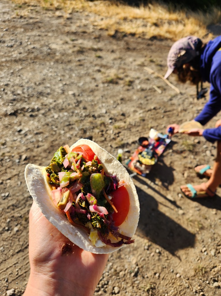
We did stop to make breakfast before the border crossing, since fresh produce and eggs are strictly prohibited from entering Chile. We disposed of our delicous contraband in the form of breakfast tacos while we admired the mountains all around.
At the customs office, we got some new stamps in our passports, and we were on our way to Futaleufú, Chile. This was one of THE cutest mountain towns we visited on the entire trip. White water rafting is the big draw to Futaleufú, so the town definitely had an outdoor tourism vibe. It reminded me a bit of Salida, CO. Having eaten most of our food, Maggie and I restocked our supplies for the road south – literally named the “Carretera Austral” – Chile’s Ruta 7.
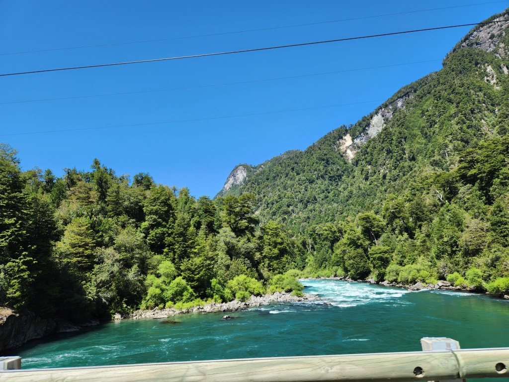

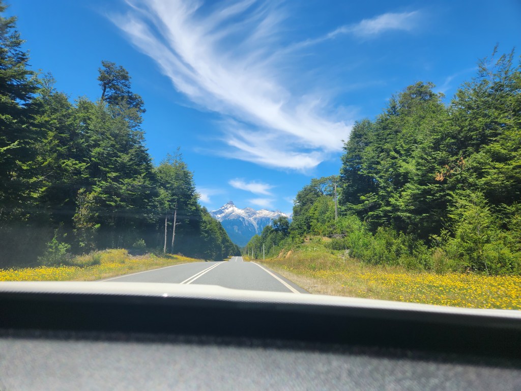
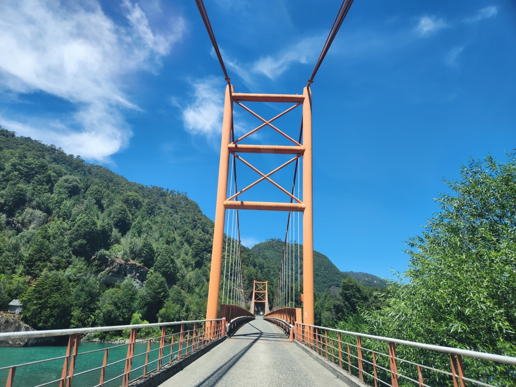
We were back into the mountains, feeling like we had found what we were looking for. We drove over many more miles of rough, dirt road, stopping at Lago Yelcho for lunch with a view. Finally we made it to the Carretera Austral, where we found immaculate pavement leading us south bound. To call this a simply a “scenic drive” would be a disservice to the true nature of the Carretera Austral. From Puerto Montt to Villa O’Higgins, you can drive 770 miles through the Andes. Building the highway was a major undertaking for Chile, having only opened in 1988, and much of it is still unpaved. Nonetheless, the vision and execution of this highway is nothing short of extraordinary.
Maggie and I made a pit stop in La Junta. Pulling out of the gas station, we saw a few hitch hikers, and after waffling back and forth, we decided to pick up a pair of them. Bike touring and hitch hiking are both popular ways to experience the Carretera. Our passengers were Artur, from France, and Victoria, from Canada. As we got to talking, it didn’t take long to find out that Victoria had hiked the PCT in 2019! They’re everywhere, I tell ya. We enjoyed an hour of conversation with our fellow travelers, asking for recommendations elsewhere in South America. They both spoke highly of Peru, touting its unrivaled natural beauty.
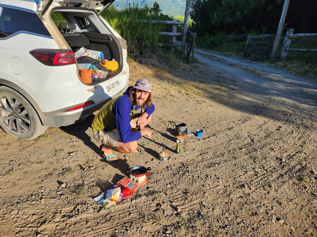
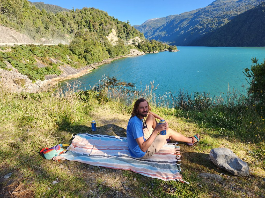
We stopped for the day at a spot informally called “dolphin rocks,” another free campsite, just past Queulat National Park. It was only 4 pm, but we had had enough driving for the day. Artur and Victoria thanked us and quickly got back on the side of the road to continue hitching. Maggie and I went for a run along the highway to get some physical activity in for the day. On the way back, half a mile short of the car, we decided to jump in the nearby fjord from a small dock. The water was heavenly. Nice and cool, but not too cold. We were in the Pacific Ocean, but the water was not particularly salty. We surmised that the salt must be diluted by the glacial run off just up the hill. On the last bit back to the car, Maggie and I spotted a nice creek flowing off the steep hill side next to the road. We were a bit low on water, so we returned with our jugs and water filters to fill up on fresh Andean creek water. A couple more people pulled over to camp with us at Dolphin Rocks. We made dinner, sipped on some giant beers, and watched the sun set as the day turned to night.

One response to “To Argentina and Back Again – Entre Lagos to the Carretera Austral”
Great adventure story! Loved reading about the border crossing experience and the scenic road trips. The photos really bring the journey to life.
LikeLiked by 1 person